- North Fork, California
-
For the community in Humboldt County formerly with this name, see Korbel, Humboldt County, California. For the community in Plumas County formerly with this name, see Seneca, California.
North Fork — Unincorporated community — Location in California
 North Fork
Coordinates: 37°13′47″N 119°30′34″W / 37.22972°N 119.50944°WCoordinates: 37°13′47″N 119°30′34″W / 37.22972°N 119.50944°W Country United States State California County Madera County Elevation[1] 2,638 ft (804 m) North Fork (formerly, Brown's and Northfork) is an unincorporated community in Madera County, California.[1] It is located 22 miles (35 km) east of Raymond,[2] at an elevation of 2638 feet (804 m).[1]It is 9.89 miles (15.92 km) miles south east of Bass Lake and 14 miles (23 km) from Oakhurst. North Fork is also home of the Mono Indian Museum and the starting point of the Sierra scenic byway. The town boasts one grocery store, three restaurants (one of which is part of the town's bar) and two gas stations. The best seasons to visit weatherwise are late summer, early fall and spring.
North Fork is at the foothills of the Sierra Nevada near Yosemite National Park. According to the 2000 U.S. Census the population of the 93643 zip code area was 3,360 with a median age of 44.8 years. The community is inside area code 559. It is part of the Madera–Chowchilla Metropolitan Statistical Area.
The town's original inhabitants were members of the Mono tribe, who still comprise a significant portion of the population (9.4% according to the 2000 Census). Milton Brown was the first white settler at the place and its original name was Brown's.[2] The name North Fork came from the North Fork Lumber Company.[2] The North Fork post office opened in 1888.[2]
North Fork's economy was based in the timber industry until the local lumber mill closed in 1996.
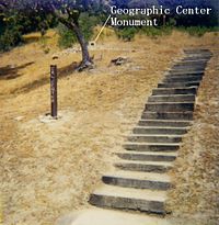
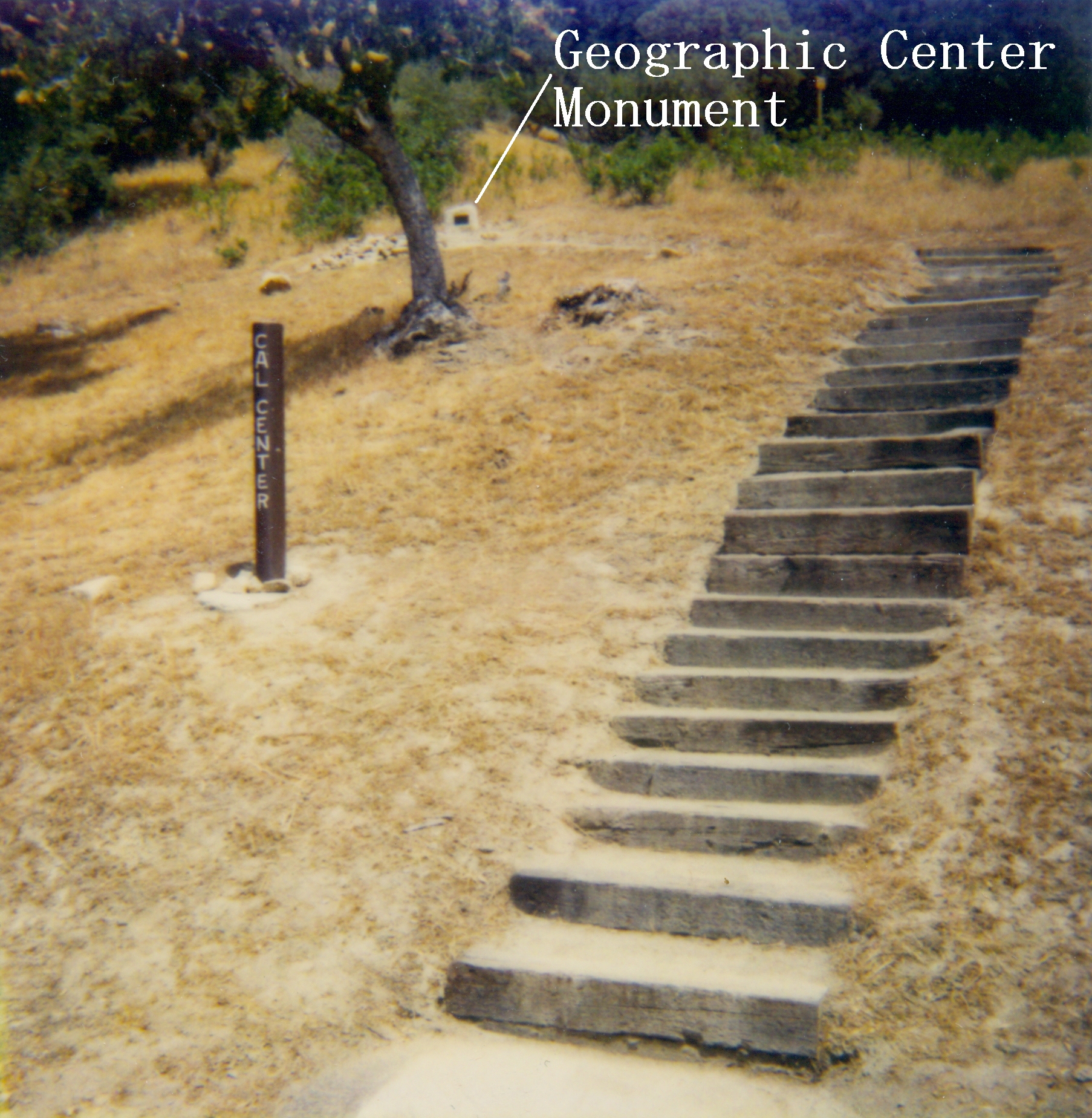
The geographic center of the state of California is located between North Fork and Italian Bar. The point is about 7.1 miles (11.4 km) driving distance from the United States Forest Service office in North Fork. The location is marked by a sign and a survey marker. NAD83 coordinates for the exact center of California are 37°09′58″N 119°26′58″W / 37.16611°N 119.44944°W The Fresno County line is less than one mile (1.6 km), (straight-line distance), from the site's survey marker. The site is also marked on the United States Forest Service road map of Sierra National Forest, which can be purchased at the North Fork USFS office. The actual site has wooden stairs leading up the hillside about 50 feet from the road. The marker is not wheelchair accessible.
Italian Bar Rd., the road to the geographic center marker, is paved with a smooth surface and is usable by ordinary passenger cars. The road is narrow and meeting a large truck, such as Forest Service Fire Engine or logging truck, may require maneuvering to allow passage.
North Fork is the birthplace of Jeff King, four-time champion of the Iditarod Trail Sled Dog Race.
The Northfork Rancheria of Mono Indians of California maintains their tribal headquarters in North Fork. The Sierra Mono Museum is also located here.[3]
References
- ^ a b c U.S. Geological Survey Geographic Names Information System: North Fork, California
- ^ a b c d Durham, David L. (1998). California's Geographic Names: A Gazetteer of Historic and Modern Names of the State. Quill Driver Books. p. 810. ISBN 9781884995149.
- ^ Sierra Mono Museum. (retrieved 24 July 2009)
- "Center Of California" #608, California's Gold, Huell Howser Productions, 1995.
External links
- North Fork Chamber of Commerce
- Mono Indian museum in North Fork
- North Fork Community Development Council
Municipalities and communities of Madera County, California County seat: Madera Cities 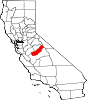
CDPs Ahwahnee | Bass Lake | Bonadelle Ranchos-Madera Ranchos | Coarsegold | Fairmead | La Vina | Madera Acres | Nipinnawasee | Oakhurst | Parksdale | Parkwood | Rolling Hills | Yosemite Lakes
Unincorporated
communitiesAhwahnee Estates | Bass Lake Annex | Berenda | Bonadelle Ranchos | Bonadelle Ranchos Five | Bonadelle Ranchos Nine | Bonita | Borden | Cascadel Woods | Central Camp | Dairyland | Daulton | Fine Gold | Fresno Crossing | Gregg | Hildreth | Indian Lakes Estates | Indian Springs | Irrigosa | Italian Swiss Colony | Kismet | Knowles | Knowles Junction | Lake Madera Country Estates | Madera Country Club Estates | Madera Highlands | Madera Ranchos | Minturn | North Fork | Notarb | Old Corral | O'Neals | Raymond | Ripperdan | River Road Estates | San Joaquin River Estates | Sharon | Sierra Vista | South Fork | Storey | Sugar Pine | Sumner Hill | The Pines | Trigo | Valley Lake Ranchos | Whisky Falls | Yosemite Forks | Yosemite Lakes Park
Indian
reservationsGhost towns Ash | Bailey Flats | Bethel | Birch | Buchanan | Califa | Cascadel | Femmon | Fort Miller | Gertrude | Gold | Grub Gulch | Herbert | Hillside | Jesbel | Lankershim | Lincoln | Magnet | Medano | Miami | Millerton | Minarets | Narbo | Oak | Ovejo | Plains | Rallsville | Starville | Talbot | Tharsa | Tillman | Tyler | Watt | Willow Glen | Wishon
Categories:- Populated places in Madera County, California
- Unincorporated communities in California


Wikimedia Foundation. 2010.