- North Fork Road
-
North Fork Road

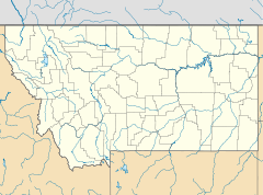

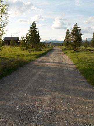
Location: North Fork drainage, Fish Creek to Kintla Lake, Glacier NP, West Glacier, Montana Coordinates: 48°32′53″N 113°59′11″W / 48.54806°N 113.98639°WCoordinates: 48°32′53″N 113°59′11″W / 48.54806°N 113.98639°W Architect: NPS Landscape Division Architectural style: No Style Listed Governing body: National Park Service MPS: Glacier National Park MPS NRHP Reference#: 95001572 Added to NRHP: January 19, 1996[1] The North Fork Road in Glacier National Park was built in 1901. The Butte Oil Company constructed a rough wagon road from Lake McDonald to its oil well at Kintla Lake, encouraging the development of the North Fork region. From 1935-1945, the National Park Service developed the road adding culverts and drains. The unpaved road extends nearly forty miles, almost to the Canadian border.[2]
In 1933 a proposal was advanced to extend the road to Canada to connect with a proposed road on the Canadian side of the border that would create a loop around Glacier and Waterton Lakes National Park. No further action was taken, and by the 1950s the plan had been abandoned.[3]
References
- ^ "National Register Information System". National Register of Historic Places. National Park Service. 2008-04-15. http://nrhp.focus.nps.gov/natreg/docs/All_Data.html.
- ^ "North Fork Truck Trail". List of Classified Structures. National Park Service. 2008-11-14. http://www.hscl.cr.nps.gov/insidenps/report.asp?STATE=MT&PARK=GLAC&STRUCTURE=&SORT=&RECORDNO=357.
- ^ Ann Hubber (June 1995). National Register of Historic Places Inventory-Nomination: North Fork RoadPDF (643 KB). National Park Service
Going-to-the-Sun Road Big Drift · Bird Woman Falls · Garden Wall · Going to the Sun Mountain · Heavens Peak · Highline Trail · Jackson Glacier · Lake McDonald · Lake McDonald Lodge · Logan Pass · Rising Sun · Saint Mary Lake · Trail of the Cedars · Weeping WallMany Glacier Two Medicine Waterton-Glacier International Peace Park National Register of Historic Places in Glacier National Park National Historic Landmarks National Historic Landmark District Other historic districts Belly River Ranger Station Historic District | Cut Bank Ranger Station Historic District | East Glacier Ranger Station Historic District | Glacier National Park Tourist Trails--Inside Trail, South Circle, North Circle | Headquarters Historic District | Howes' Lake McDonald Cottage Sites Historic District | Kelly's Camp Historic District | Kintla Lake Ranger Station | Kishenehn Ranger Station Historic District | Logging Creek Ranger Station Historic District | Many Glacier Hotel Historic District | Nyack Ranger Station Historic District | Polebridge Ranger Station Historic District | Rising Sun Auto Camp | St. Mary Utility Area Historic District | Sherburne Ranger Station Historic District | Stillwater Ranger Station Historic District | Swiftcurrent Ranger Station Historic District | Upper Lake McDonald Ranger Station Historic District | Walton Ranger Station Historic District
Other properties Apgar Fire Lookout | Alice Beck Cabin | Bowman Lake Patrol Cabin | Bowman Lake Road | Cattle Queen Snowshoe Cabin | Chief Mountain Border Station and Quarters | Coal Creek Patrol Cabin | Fielding Snowshoe Patrol Cabin | Fish Creek Bay Boathouse | Ford Creek Patrol Cabin | Goathaunt Bunkhouse | Granite Park Chalet | Greve's Tourist Cabins | Gunsight Pass Shelter | Harrison Lake Patrol Cabin | Heaven's Peak Fire Lookout | Huckleberry Fire Outlook | Kootenai Creek Snowshoe Cabin | Lake McDonald Lodge Coffee Shop | Lee Creek Snowshoe Cabin | Lincoln Creek Snowshoe Cabin | Logan Creek Patrol Cabin | Logan Pass Visitor Center | Loneman Fire Lookout | Lower Logging Lake Snowshoe Cabin and Boathouse | Lower Nyack Snowshoe Cabin | Lower Park Creek Patrol Cabin | Margaret McCarthy Homestead | McCarthy Homestead Cabin | Many Glacier Barn and Bunkhouse | Many Glacier Campground Camptender's Cabin Mount Brown Fire Lookout | North Fork Road | Numa Ridge Fire Lookout | Pass Creek Snowshoe Cabin | Polebridge to Numa Ridge Phoneline | Ptarmigan Tunnel | Quartz Lake Patrol Cabin | William Raftery Homestead | Roes Creek Campground Camptender's Cabin | Saint Mary Ranger Station | Saint Mary Visitor Center, Entrance Station and Checking Stations | Scalplock Mountain Fire Lookout | Anton Schoenberger Homestead | Charlie Schoenberger Homestead | Sherwood Lodge | Skyland Camp-Bowman Lake Ranger Station | Slide Lake-Otatso Creek Patrol Cabin and Woodshed | Sperry Chalet | Sun Camp Fireguard Cabin | Swanson Boathouse | Swiftcurrent Auto Camp Historic District | Swiftcurrent Fire Lookout | Two Medicine Campground Camptender's Cabin | Two Medicine General Store | Upper Kintla Lake Patrol Cabin | Upper Logging Lake Snowshoe Cabin | Upper Nyack Snowshoe Cabin | Upper Park Creek Patrol Cabin | Johnnie Walsh's Guest Lodge | Johnnie Walsh Homestead | West Entrance Station
U.S. National Register of Historic Places Topics Lists by states Alabama • Alaska • Arizona • Arkansas • California • Colorado • Connecticut • Delaware • Florida • Georgia • Hawaii • Idaho • Illinois • Indiana • Iowa • Kansas • Kentucky • Louisiana • Maine • Maryland • Massachusetts • Michigan • Minnesota • Mississippi • Missouri • Montana • Nebraska • Nevada • New Hampshire • New Jersey • New Mexico • New York • North Carolina • North Dakota • Ohio • Oklahoma • Oregon • Pennsylvania • Rhode Island • South Carolina • South Dakota • Tennessee • Texas • Utah • Vermont • Virginia • Washington • West Virginia • Wisconsin • WyomingLists by territories Lists by associated states Other Categories:- National Register of Historic Places in Montana
- Transportation in Flathead County, Montana
- Glacier National Park (U.S.)
- Montana Registered Historic Place stubs

Wikimedia Foundation. 2010.