- National Register of Historic Places listings in Iowa
-
 Iowa counties (clickable)
This is a list of properties and historic districts in Iowa that are listed on the National Register of Historic Places. There are listings in all of Iowa's 99 counties, adding up to more than 2,100 total.
-
- This National Park Service list is complete through NPS recent listings posted November 10, 2011.[1]
Current listings by county
The following are approximate tallies of current listings by county. These counts are based on entries in the National Register Information Database as of April 24, 2008[2] and new weekly listings posted since then on the National Register of Historic Places web site.[3] There are frequent additions to the listings and occasional delistings and the counts here are approximate and not official. New entries are added to the official Register on a weekly basis.[4] Also, the counts in this table exclude boundary increase and decrease listings which modify the area covered by an existing property or district and which carry a separate National Register reference number. The numbers of NRHP listings in each county are documented by tables in each of the individual county list-articles.
 Phil Hoffman House, in Mahaska County
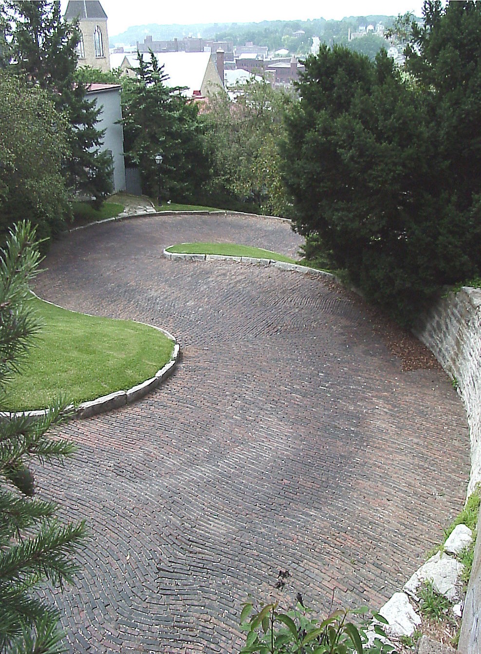
 Snake Alley, in Des Moines County
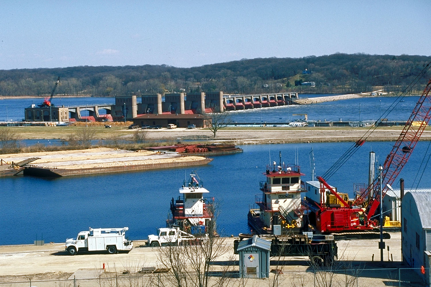
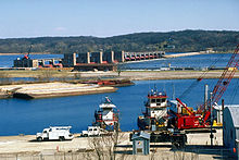 Lock and Dam No. 14 Historic District, in Scott County
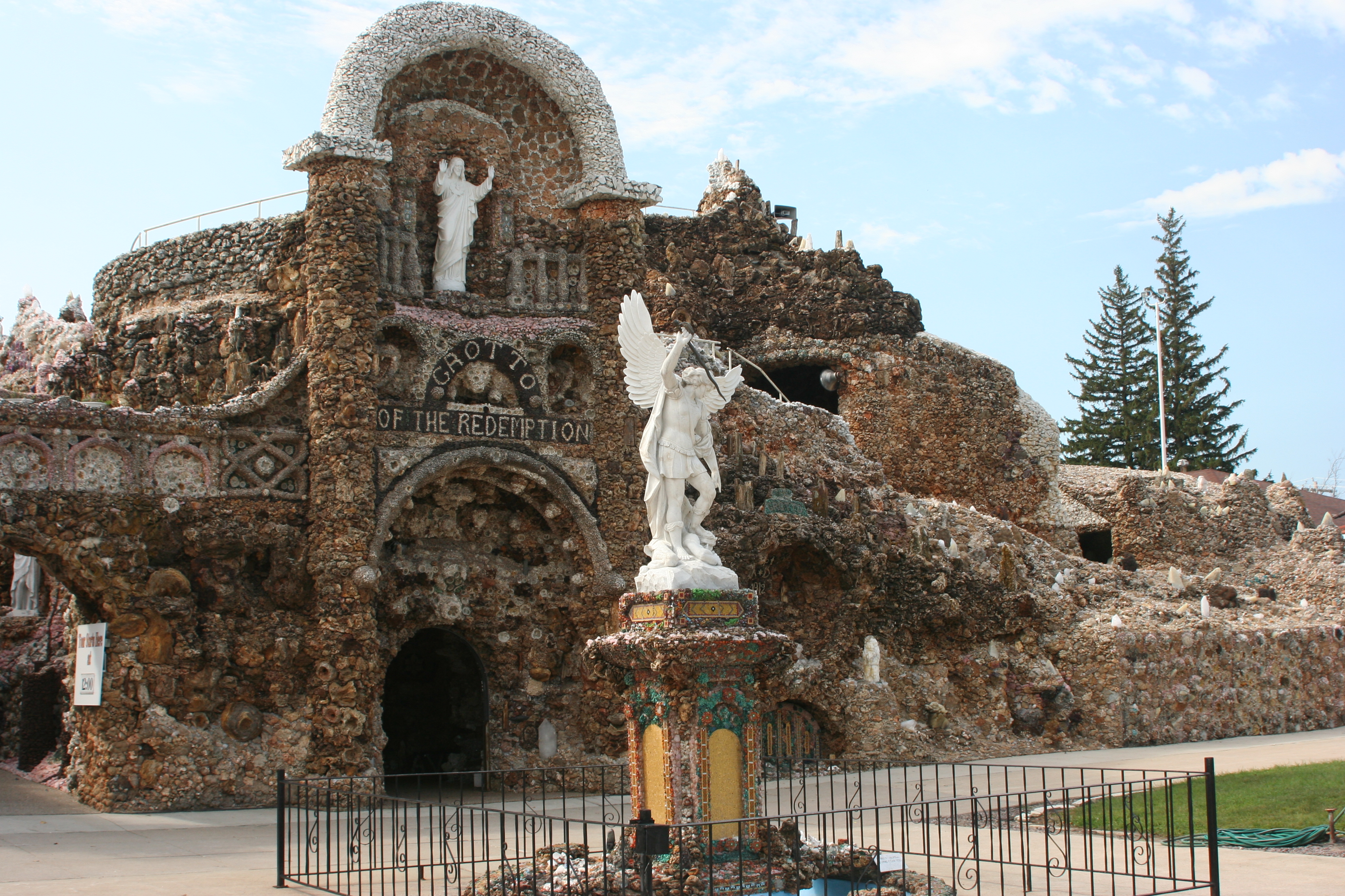
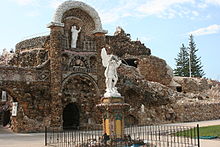 Grotto of the Redemption, in Palo Alto County
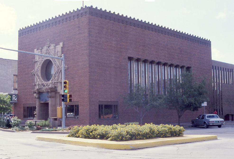
 Merchants' National Bank in Poweshiek County, designed by Louis Sullivan
 Howes Building, in Clinton County
 Fourth Street Historic District, in Woodbury County
County # of Sites 1 Adair 7 2 Adams 4 3 Allamakee 19 4 Appanoose 13 5 Audubon 13 6 Benton 12 7 Black Hawk 40 8 Boone 18 9 Bremer 6 10 Buchanan 19 11 Buena Vista 7 12 Butler 6 13 Calhoun 12 14 Carroll 12 15 Cass 10 16 Cedar 16 17 Cerro Gordo 40 18 Cherokee 9 19 Chickasaw 4 20 Clarke 7 21 Clay 8 22 Clayton 52 23 Clinton 26 24 Crawford 14 25 Dallas 14 26 Davis 11 27 Decatur 7 28 Delaware 15 29 Des Moines 27 30 Dickinson 12 31 Dubuque 72 32 Emmet 3 33 Fayette 27 34 Floyd 18 35 Franklin 11 36 Fremont 9 37 Greene 16 38 Grundy 2 39 Guthrie 6 40 Hamilton 8 41 Hancock 9 42 Hardin 31 43 Harrison 9 44 Henry 45 45 Howard 8 46 Humboldt 7 47 Ida 5 48 Iowa 10 49 Jackson 75 50 Jasper 12 51 Jefferson 28 52 Johnson 80 53 Jones 23 54 Keokuk 10 55 Kossuth 4 56 Lee 42 57 Linn 76 58 Louisa 8 59 Lucas 15 60 Lyon 10 61 Madison 47 62 Mahaska 46 63 Marion 24 64 Marshall 15 65 Mills 4 66 Mitchell 10 67 Monona 9 68 Monroe 11 69 Montgomery 15 70 Muscatine 26 71 O'Brien 3 72 Osceola 1 73 Page 8 74 Palo Alto 4 75 Plymouth 10 76 Pocahontas 3 77 Polk 165 78 Pottawattamie 34 79 Poweshiek 22 80 Ringgold 6 81 Sac 8 82.1 Scott: Davenport: Downtown 59 82.2 Scott: Davenport: East 86 82.3 Scott: Davenport: West 109 82.4 Scott: Davenport: Duplicates (1)[5] 82.5 Scott: Other 31 82.6 Scott: Total 284 83 Shelby 11 84 Sioux 4 85 Story 32 86 Tama 12 87 Taylor 7 88 Union 5 89 Van Buren 21 90 Wapello 27 91 Warren 12 92 Washington 15 93 Wayne 3 94 Webster 12 95 Winnebago 4 96 Winneshiek 30 97 Woodbury 53 98 Worth 6 99 Wright 9 (duplicates) (3)[6] Total: 2,154 Adair County
Landmark name Image Date listed Location City or Town Summary 1 Adair County Courthouse July 2, 1981 Iowa Ave. and 1st St.
41°18′17″N 94°27′35″W / 41.30472°N 94.45972°WGreenfield 2 Adair County Democrat-Adair County Free Press Building February 7, 2011 108 E. Iowa St.
41°18′18″N 94°27′38″W / 41.305°N 94.46056°WGreenfield 3 Adair Viaduct June 25, 1998 Business Route 80 over the Iowa Interstate Railroad tracks
41°29′56″N 94°38′23″W / 41.49889°N 94.63972°WAdair 4 Catalpa November 13, 1974 Southeast of Greenfield
41°13′55″N 94°21′37″W / 41.23194°N 94.36028°WGreenfield 5 Chicago, Rock Island and Pacific Railroad: Stuart Passenger Station February 19, 1980 Front St.
41°30′10″N 94°18′56″W / 41.50278°N 94.31556°WStuart 6 Loucks Grove Church November 22, 1995 7 miles north of the junction of Iowa Highways 25 and 92, then 3 miles east and 1.5 miles north on an unnamed county road
41°25′30″N 94°23′40″W / 41.425°N 94.39444°WGreenfield 7 Warren Opera House Block and Hetherington Block October 18, 1979 156 Public Sq.
41°18′17″N 94°27′26″W / 41.30472°N 94.45722°WGreenfield Adams County
Landmark name Image Date listed Location City or Town Summary 1 Adams County Jail February 28, 1991 1000 Benton Ave.
40°59′32″N 94°44′4″W / 40.99222°N 94.73444°WCorning 2 Corning Opera House September 21, 1993 800 Davis Ave.
40°59′25″N 94°44′1″W / 40.99028°N 94.73361°WCorning 3 Noah Odell House November 30, 2000 1245 240th St.
40°57′35″N 94°50′45″W / 40.95972°N 94.84583°WNodaway 4 Snider Bridge June 25, 1998 220th St. over an unnamed stream
40°59′28″N 94°36′38″W / 40.99111°N 94.61056°WCorning Allamakee County
Appanoose County
Audubon County
Benton County
Black Hawk County
Boone County
Bremer County
Landmark name Image Date listed Location City or Town Summary 1 Bank of Sumner August 25, 2004 118 W. 1st St.
42°50′58″N 92°5′55″W / 42.84944°N 92.09861°WSumner 2 Bremer County Court House August 28, 2003 415 E. Bremer Ave.
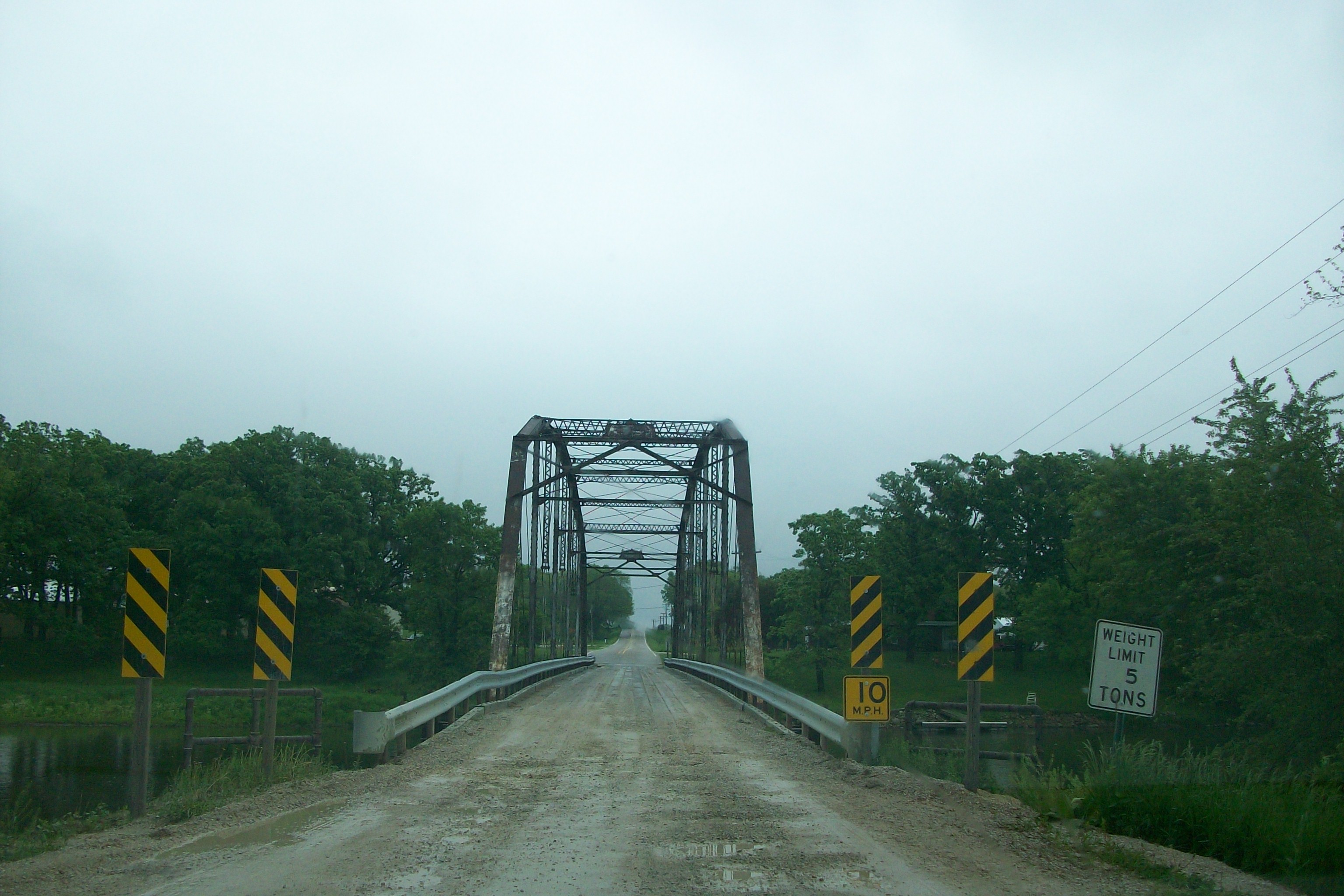
42°43′34″N 92°27′54″W / 42.72611°N 92.465°WWaverly 3 Green Mill Ford Bridge June 25, 1998 County road over the Cedar River
42°40′20″N 92°25′44″W / 42.67222°N 92.42889°WJanesville 4 Sumner High School June 16, 2004 300 W. 4th
42°51′3″N 92°6′4″W / 42.85083°N 92.10111°WSumner 5 Wartburg Teachers' Seminary January 20, 1978 Wartburg College campus
42°43′46″N 92°28′54″W / 42.72944°N 92.48167°WWaverly 6 Waverly House December 12, 1976 402 W. Bremer Ave.
42°43′33″N 92°28′33″W / 42.72583°N 92.47583°WWaverly Buchanan County
Buena Vista County
Landmark name Image Date listed Location City or Town Summary 1 Jesse J. and Mary F. Allee House March 26, 1992 20006 640th St.
42°35′22″N 95°0′33″W / 42.58944°N 95.00917°WNewell 2 Brooke Creek Bridge June 25, 1998 470th St. over Brooke Creek
42°50′11″N 95°17′8″W / 42.83639°N 95.28556°WSioux Rapids 3 Chan-Ya-Ta Site November 21, 1978 Address Restricted Linn Grove 4 Chicago, Milwaukee and Pacific Railroad-Albert City Station October 22, 1976 212 N. 2nd St.
42°46′53″N 94°56′54″W / 42.78139°N 94.94833°WAlbert City 5 Harker House 
December 6, 1990 328 Lake Ave.
42°38′27″N 95°12′4″W / 42.64083°N 95.20111°WStorm Lake Demolished in 2010 6 Illinois Central Passenger Depot-Storm Lake September 6, 1990 S. of W. Railroad St., between Lake and Michigan Aves.
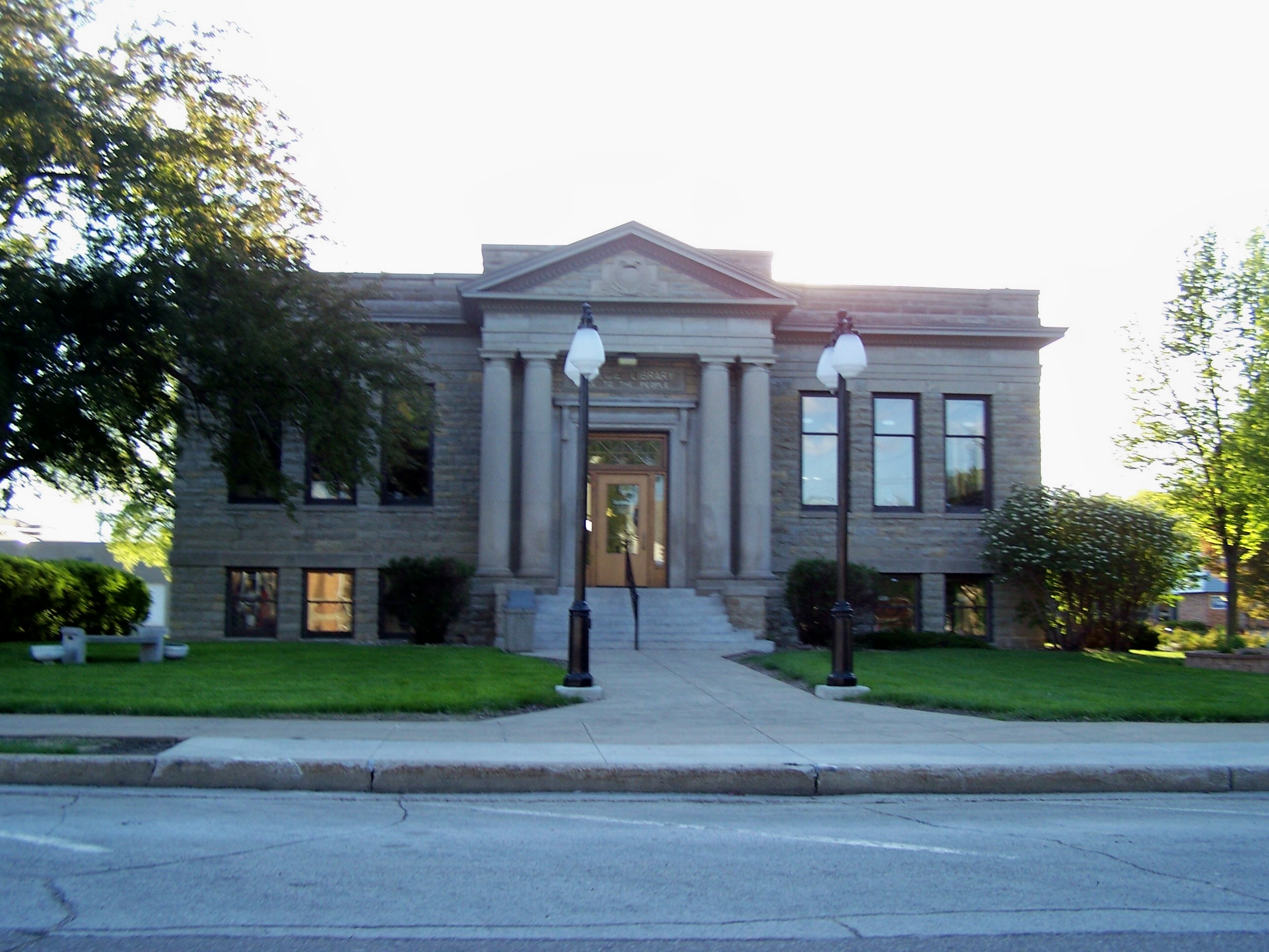
42°38′35″N 95°12′6″W / 42.64306°N 95.20167°WStorm Lake 7 Storm Lake Public Library May 23, 1983 E. 5th and Erie Sts.
42°37′35″N 95°15′30″W / 42.62639°N 95.25833°WStorm Lake Butler County
Landmark name Image Date listed Location City or Town Summary 1 Cherry Street Bridge June 25, 1998 Cherry St. over a tributary of the Shell Rock River
42°42′28″N 92°35′8″W / 42.70778°N 92.58556°WShell Rock 2 Coldwater Church of the Brethren July 13, 1979 100 block of N. High St.
42°53′31″N 92°48′32″W / 42.89194°N 92.80889°WGreene 3 Charles H. & Theresa H. McBride Bungalow February 7, 2011 127 E. Adair St.
42°53′31″N 92°48′32″W / 42.89194°N 92.80889°WShell Rock 4 Netcott-Pfeiffer House April 24, 2007 206 Buswell St.
42°34′43″N 92°47′28″W / 42.57861°N 92.79111°WParkersburg 5 Shell Rock Bridge March 12, 1999 Cherry St. over the Shell Rock River
42°42′40″N 92°34′53″W / 42.71111°N 92.58139°WShell Rock 6 Charles Wolf House October 1, 1979 401 5th St.
42°34′32″N 92°47′17″W / 42.57556°N 92.78806°WParkersburg Calhoun County
Carroll County
Cass County
Cedar County
Cerro Gordo County
Cherokee County
Landmark name Image Date listed Location City or Town Summary 1 Bastian Site July 19, 1976 Address Restricted Cherokee 2 Brewster Site March 21, 1979 Address Restricted Cherokee 3 Cherokee Commercial Historic District August 24, 2005 Parts of Main, Maple, and Willow between 1st and 6th Sts.
42°45′5″N 95°33′10″W / 42.75139°N 95.55278°WCherokee 4 Cherokee Public Library April 9, 1985 215 S. 2nd St.
42°44′55″N 95°33′4″W / 42.74861°N 95.55111°WCherokee 5 Cherokee Sewer Site December 24, 1974 Address Restricted Cherokee 6 Illinois Central Railroad Yard-Cherokee September 6, 1990 Roughly bounded by S. 4th, 5th, W. Maple, and W. Beech Sts.
42°44′45″N 95°33′21″W / 42.74583°N 95.55583°WCherokee 7 Lewis Hotel September 15, 1997 231 W. Main St.
42°44′58″N 95°33′9″W / 42.74944°N 95.5525°WCherokee 8 Mill Creek Bridge June 25, 1998 Old Iowa Highway 21 over Mill Creek
42°46′38″N 95°31′47″W / 42.77722°N 95.52972°WCherokee 9 Phipps Site October 15, 1966 Address Restricted Cherokee Chickasaw County
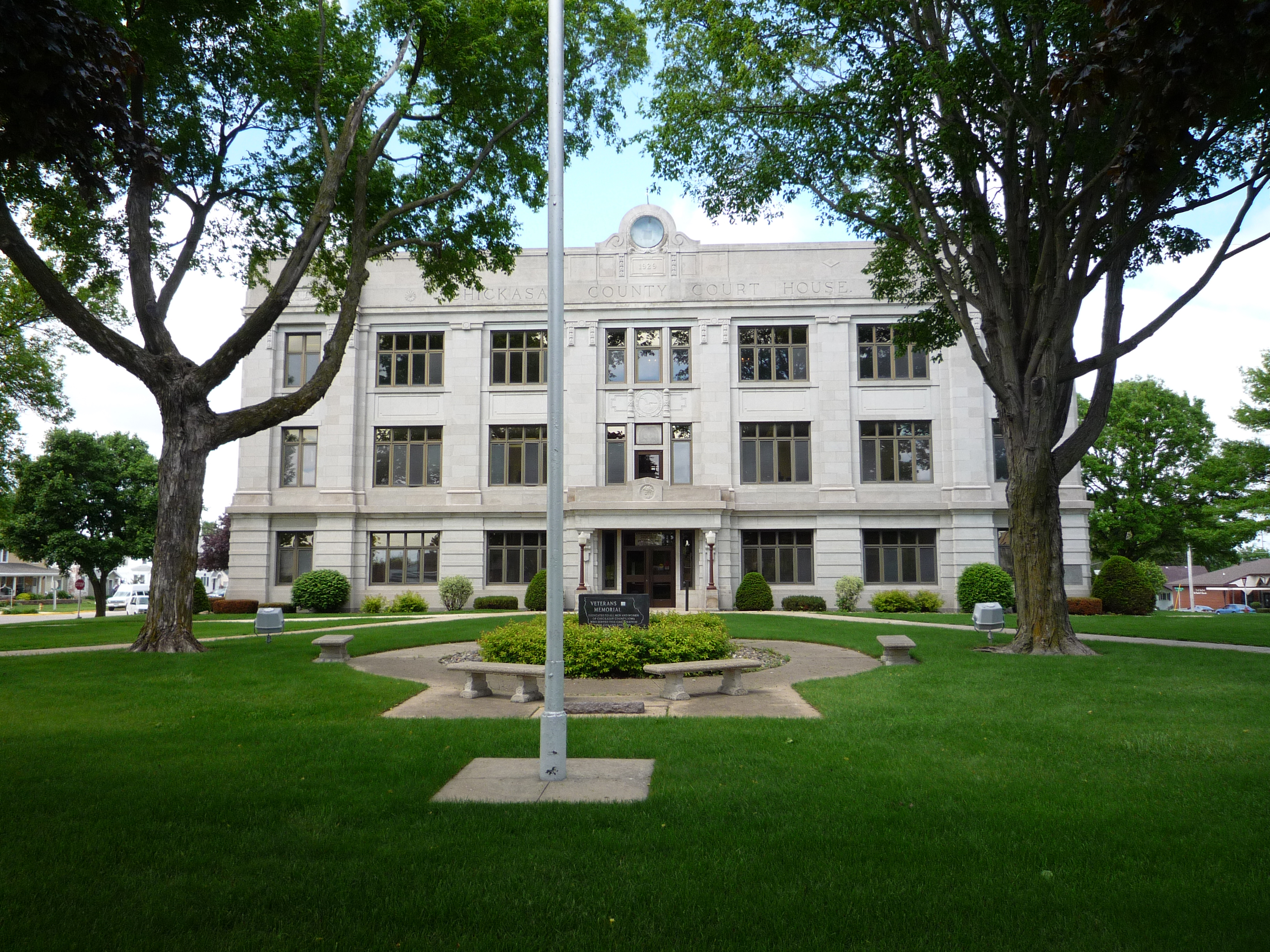
Landmark name Image Date listed Location City or Town Summary 1 Chickasaw County Courthouse 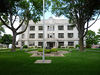
July 2, 1981 Prospect St. at Locust Ave.
43°9′36″N 92°18′49″W / 43.16°N 92.31361°WNew Hampton 2 Chickasaw Octagon House July 17, 1979 Court St.
43°2′11″N 92°29′58″W / 43.03639°N 92.49944°WChickasaw Township 3 George Darrow Round Barn June 30, 1986 County Road T76
43°9′52″N 92°29′46″W / 43.16444°N 92.49611°WAlta Vista 4 John Foley House April 16, 1979 511 N. Locust St.
43°3′52″N 92°18′49″W / 43.06444°N 92.31361°WNew Hampton Clarke County
Current listings
Landmark name Image Date listed Location City or Town Summary 1 J.V. Banta House July 14, 1983 222 McLane St.
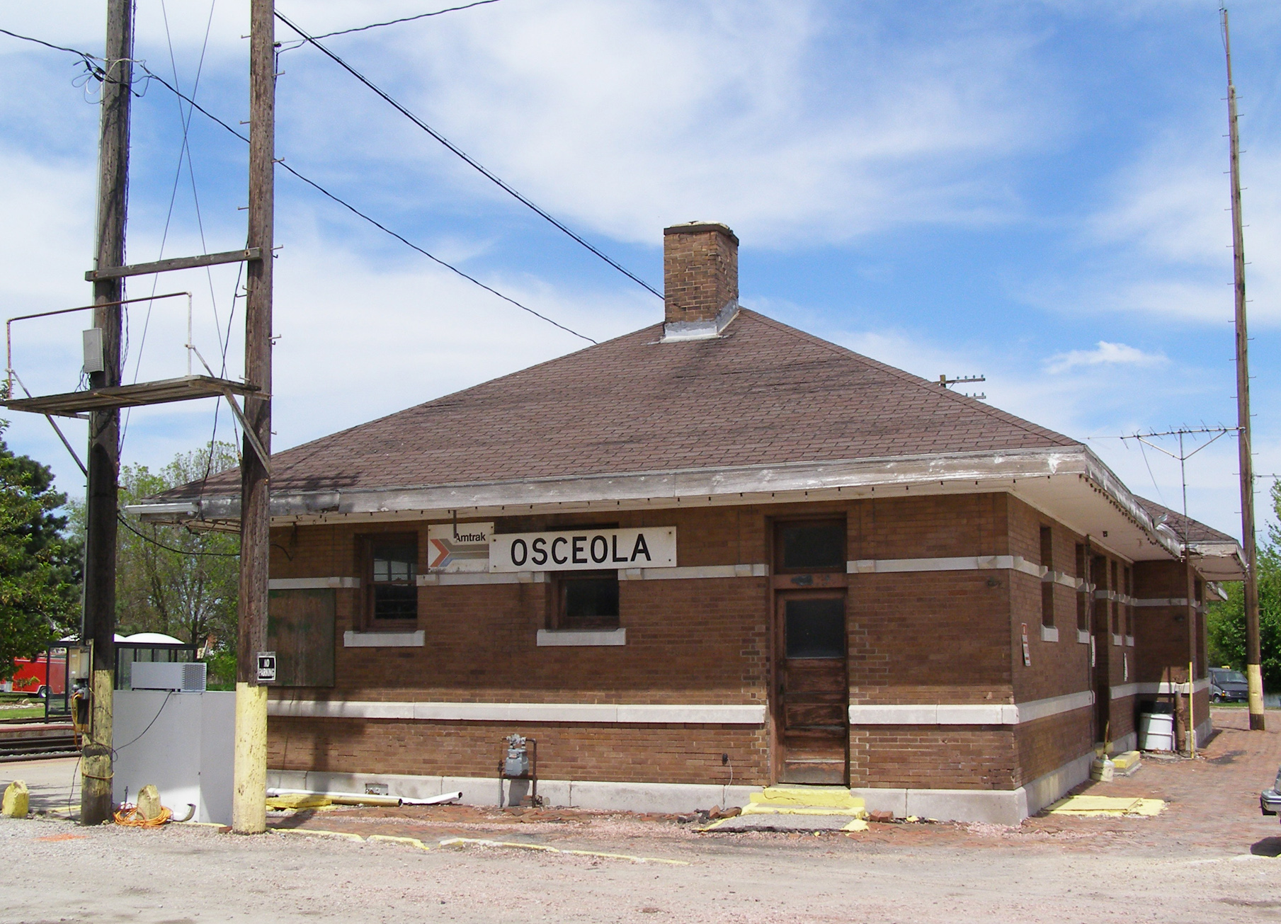
41°0′41″N 93°48′1″W / 41.01139°N 93.80028°WOsceola 2 Chicago, Burlington and Quincy Depot 
January 8, 2009 215 N. Main St.
41°2′11.868″N 93°45′56.376″W / 41.03663°N 93.76566°WOsceola Part of the Advent & Development of Railroads in Iowa Multiple Property Submission 3 George H. and Alice Spaulding Cowles House December 20, 2006 229 W. Cass St.
41°2′3″N 93°46′9″W / 41.03417°N 93.76917°WOsceola 4 John and Mary Jane Kyte Farmstead District September 14, 2000 2875 Mormon Trail Rd.
40°56′9″N 93°39′22″W / 40.93583°N 93.65611°WWeldon 5 Osceola Masonic Block July 6, 2010 101-103 South Main St.
41°2′5″N 93°45′55″W / 41.03472°N 93.76528°WOsceola 6 Marcellus Luther and Julia Protzman Temple House April 4, 1996 502 S. Main St.
41°1′46″N 93°45′57″W / 41.02944°N 93.76583°WOsceola 7 Dickinson Webster House July 20, 1977 609 W. Jefferson St.
41°2′12″N 93°46′2″W / 41.03667°N 93.76722°WOsceola Former listing
Landmark name Image Date listed Location City or Town Summary 1 Brady-Bolibaugh House January 3, 1985 217 W. Washington
41°2′12″N 93°45′45″W / 41.03667°N 93.7625°WOsceola Removed from NRHP May 12, 2009[7] Clay County
Landmark name Image Date listed Location City or Town Summary 1 Adams-Higgins House September 27, 1984 1215 N. Grand Ave.
43°9′1″N 95°8′43″W / 43.15028°N 95.14528°WSpencer 2 Clay County Courthouse July 2, 1981 W. 4th St. and 3rd Ave., W.
43°8′31″N 95°8′52″W / 43.14194°N 95.14778°WSpencer 3 Grand Avenue Historic Commercial District December 6, 2004 301-605 Grand Ave., 12-18, 21 W. 5th St., and 10, 13, and 15-19 W. 4th St.
43°8′39″N 95°8′42″W / 43.14417°N 95.145°WSpencer 4 Philip and Anna Parrish Kirchner Log House September 2, 1993 4969 120th Ave.
42°55′42″N 95°20′48″W / 42.92833°N 95.34667°WPeterson 5 Little Sioux River Bridge June 25, 1998 210th Ave. over the Little Sioux River
43°9′47″N 95°10′12″W / 43.16306°N 95.17°WSpencer 6 Logan Center School No.5 January 16, 2001 Junction of 420th St. and 310th Ave.
43°2′22″N 94°58′23″W / 43.03944°N 94.97306°WDickens 7 Spencer High School and Auditorium February 12, 2010 104 E. 4th St.
43°8′29.02″N 95°8′35.24″W / 43.1413944°N 95.1431222°WSpencer 8 Wanata State Park Picnic Shelter November 15, 1990 South of the junction of County Road M27 and Iowa Highway 10
42°54′39″N 95°20′17″W / 42.91083°N 95.33806°WPeterson Clayton County
Clinton County
Crawford County
Dallas County
Davis County
Decatur County
Landmark name Image Date listed Location City or Town Summary 1 Decatur County Courthouse July 2, 1981 9th St.
40°44′26″N 93°44′46″W / 40.74056°N 93.74611°WLeon 2 Grand River Bridge 
June 25, 1998 County road over the Grand River
40°43′18″N 93°52′33″W / 40.72167°N 93.87583°WLeon 3 Liberty Hall September 29, 1983 Main St.
40°37′30″N 93°57′7″W / 40.625°N 93.95194°WLamoni 4 J.J. McClung House December 6, 1990 Junction of Main and Vine Sts.
40°49′38″N 93°36′36″W / 40.82722°N 93.61°WGarden Grove 5 Missouri, Iowa & Nebraska Railway Co. Depot-Weldon December 13, 1991 N. Main St. at the Decatur County line
40°53′57″N 93°44′1″W / 40.89917°N 93.73361°WWeldon 6 C.S. Stearns House November 28, 1978 Main St.
40°49′36″N 93°36′10″W / 40.82667°N 93.60278°WGarden Grove 7 Union Church December 12, 1976 Clark at Sycamore St.
40°38′21″N 93°48′23″W / 40.63917°N 93.80639°WDavis City Delaware County
Des Moines County
Dickinson County
Dubuque County
Emmet County
Landmark name Image Date listed Location City or Town Summary 1 Brugjeld-Peterson Family Farmstead District 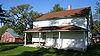
April 6, 2000 2349 450th Ave.
43°18′17″N 94°42′2″W / 43.30472°N 94.70056°WWallingford 2 Ellsworth Ranch Bridge 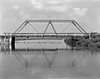
July 15, 1998 130th St. over the East Fork of the Des Moines River
43°27′36″N 94°34′49″W / 43.46°N 94.58028°WArmstrong 3 Thomsen Round Barn June 30, 1986 Off Iowa Highway 15
43°20′46″N 94°29′52″W / 43.34611°N 94.49778°WArmstrong Fayette County
Floyd County
Franklin County
Fremont County
Landmark name Image Date listed Location City or Town Summary 1 Chautauqua Pavilion October 22, 1976 Iowa Highway 42
40°41′39″N 95°34′27″W / 40.69417°N 95.57417°WRiverton 2 Fremont County Courthouse July 2, 1981 Clay St.
40°44′45″N 95°38′37″W / 40.74583°N 95.64361°WSidney 3 Hamburg Public Library May 23, 1983 1301 Main St.
40°36′22″N 95°39′26″W / 40.60611°N 95.65722°WHamburg 4 Hunter School January 9, 2007 Junction of U.S. Route 275 and 120th St.
40°52′24″N 95°40′16″W / 40.87333°N 95.67111°WTabor 5 Jason and Elizabeth Baylor Rector House February 4, 2002 2174 Bluff Rd.
40°43′58″N 95°42′35″W / 40.73278°N 95.70972°WThurman 6 St. Patrick Church July 7, 1983 3rd St.
40°52′51″N 95°25′32″W / 40.88083°N 95.42556°WImogene 7 Tabor Antislavery Historic District October 31, 2007 Park, Center, Orange, and Elm Sts.
40°53′57″N 95°40′29″W / 40.89917°N 95.67472°WTabor 8 Tabor Congregational Church October 6, 2011 403 Elm St.
40°54′1″N 95°40′25″W / 40.90028°N 95.67361°WTabor 9 Todd House August 15, 1975 Park St.
40°53′58″N 95°40′35″W / 40.89944°N 95.67639°WTabor Greene County
Grundy County
Landmark name Image Date listed Location City or Town Summary 1 Grundy County Courthouse July 2, 1981 Grundy Ave.
42°21′31″N 92°46′18″W / 42.35861°N 92.77167°WGrundy Center 2 Chris Neessen House January 12, 1984 601 E. 4th
42°26′4″N 92°55′29″W / 42.43444°N 92.92472°WWellsburg Guthrie County
Landmark name Image Date listed Location City or Town Summary 1 All Saints Catholic Church December 7, 2000 420 N. Fremont
41°30′25″N 94°19′2″W / 41.50694°N 94.31722°WStuart 2 John Cretsinger House October 7, 1998 1363 Burl Ln.
41°48′46″N 94°42′52″W / 41.81278°N 94.71444°WCoon Rapids 3 Roswell and Elizabeth Garst Farmstead Historic District August 12, 2009 1390 Iowa Highway 141
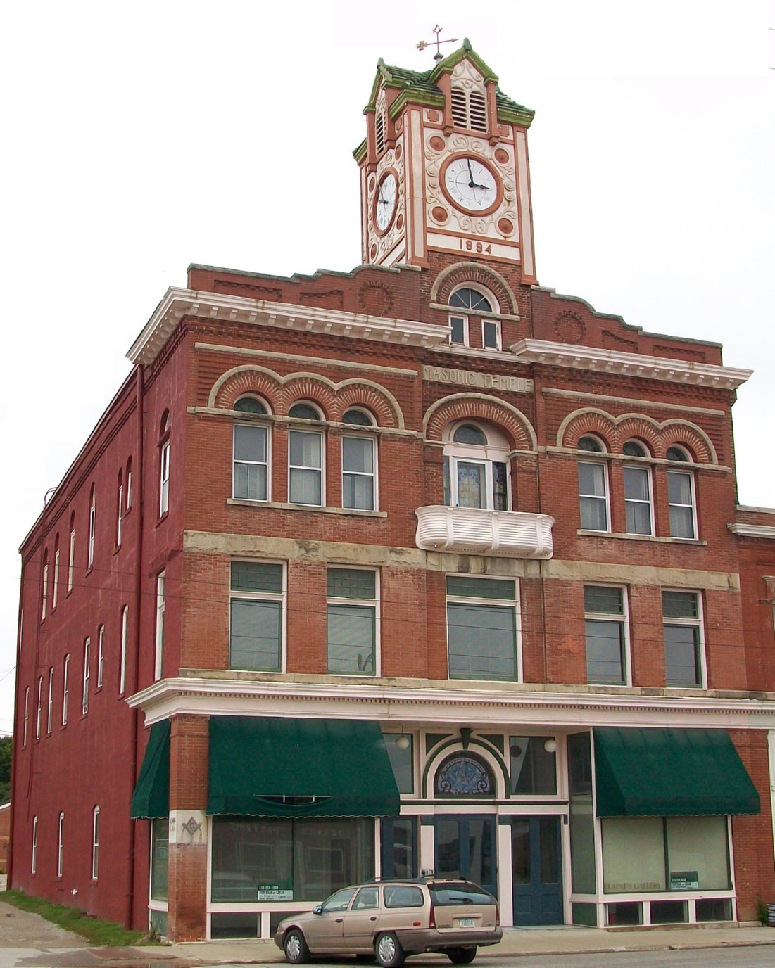
41°50′54.76″N 94°38′42.54″W / 41.8485444°N 94.64515°WCoon Rapids 4 Masonic Temple Building 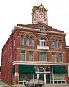
April 12, 1996 1311 N. 2nd St.
41°30′18″N 94°19′7″W / 41.505°N 94.31861°WStuart 5 Octagon Barn, Richland Township June 30, 1986 Off Iowa Highway 141
41°49′24″N 94°20′10″W / 41.82333°N 94.33611°WRichland Township 6 Springbrook State Park, Civilian Conservation Corps Area November 15, 1990 Junction of Iowa Highway 384 and County Highway F25
41°46′38″N 94°27′54″W / 41.77722°N 94.465°WGuthrie Center Hamilton County
Landmark name Image Date listed Location City or Town Summary 1 Albright Bridge June 25, 1998 130th St. at 510th Ave. over the Boone River
42°24′20″N 93°48′36″W / 42.40556°N 93.81°WWebster City 2 Kendall Young Public Library 
May 23, 1983 1201 Willson Ave.
42°27′30″N 93°50′12″W / 42.45833°N 93.83667°WWebster City 3 William Oakland Round Barn June 30, 1986 Off U.S. Route 69
42°29′11″N 93°38′0″W / 42.48639°N 93.633333°WBlairsburg 4 Schultz Brothers Drug Store May 16, 1996 116 Main St.
42°29′19″N 93°32′38″W / 42.48861°N 93.54389°WWilliams 5 State Bank of Stratford July 7, 1983 801 Shakespeare St.
42°16′14″N 93°55′1″W / 42.27056°N 93.91694°WStratford 6 Tremaine Bridge May 15, 1998 280th St. over the Boone River
42°23′12″N 93°48′31″W / 42.38667°N 93.80861°WWebster City 7 Webster City Post Office July 6, 1982 801 Willson Ave.
42°28′6″N 93°49′9″W / 42.46833°N 93.81917°WWebster City 8 William J. and Hattie J. Zitterell House February 16, 1996 821 Division St.
42°28′4″N 93°49′28″W / 42.46778°N 93.82444°WWebster City Hancock County
Landmark name Image Date listed Location City or Town Summary 1 The Avery Theater November 12, 2008 495 State St.
43°6′2.088″N 93°36′7.596″W / 43.10058°N 93.60211°WGarner 2 Hancock County Courthouse July 2, 1981 State St.
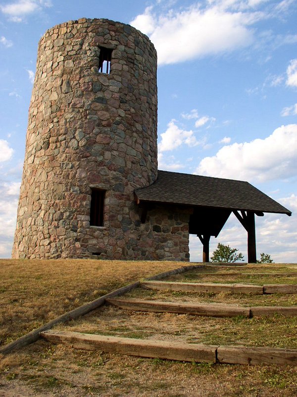
43°5′47″N 93°36′4″W / 43.09639°N 93.60111°WGarner 3 Pilot Knob State Park, Observation Tower (Area 2) 
November 15, 1990 South of the junction of Iowa Highways 9 and 332
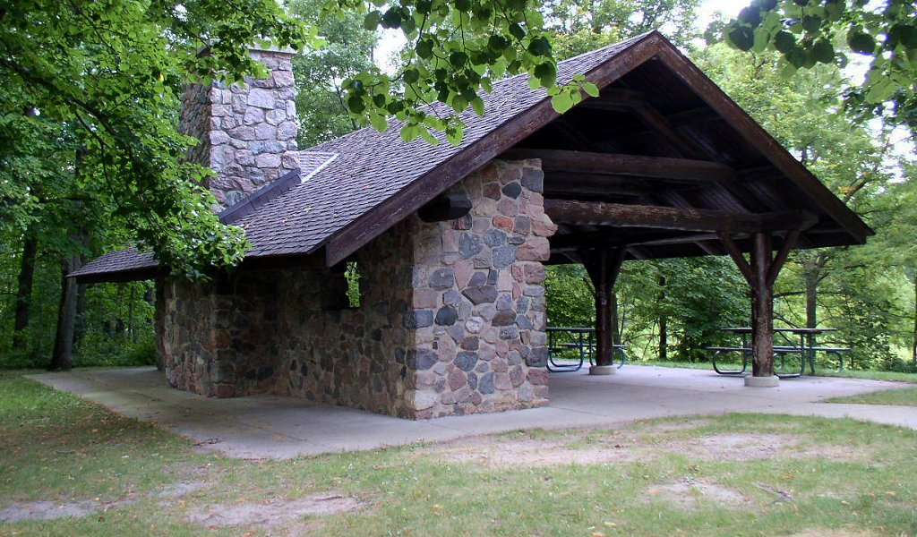
43°15′9″N 93°33′9″W / 43.2525°N 93.5525°WForest City 4 Pilot Knob State Park, Picnic Shelter (Area 3) 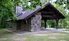
November 15, 1990 South of the junction of Iowa Highways 9 and 332
43°14′54″N 93°34′1″W / 43.24833°N 93.56694°WForest City 5 Pilot Knob State Park, Amphitheater (Area 4) November 15, 1990 South of the junction of Iowa Highways 9 and 332
43°15′12″N 93°32′39″W / 43.25333°N 93.54417°WForest City 6 Pilot Knob State Park, Portals (Area 5a) November 15, 1990 South of the junction of Iowa Highways 9 and 332
43°15′18″N 93°34′2″W / 43.255°N 93.56722°WForest City 7 Pilot Knob State Park: Portals in Area 5b April 17, 1995 Off Iowa Highway 9 southeast of Forest City in Pilot Knob State Park
43°15′20″N 93°32′46″W / 43.25556°N 93.54611°WForest City 8 Pilot Knob State Park, Trail Area (Area 6a-6c) November 15, 1990 South of the junction of Iowa Highways 9 and 332
43°14′55″N 93°33′26″W / 43.24861°N 93.55722°WForest City 9 George E. Stubbins House April 15, 1999 248 1st Ave., SW.
43°5′41″N 93°48′11″W / 43.09472°N 93.80306°WBritt Hardin County
Harrison County
Landmark name Image Date listed Location City or Town Summary 1 William Haner Polygonal Barn June 30, 1986 County Road L16
41°49′14″N 95°49′25″W / 41.82056°N 95.82361°WPisgah 2 Harrison County Courthouse July 2, 1981 7th St.
41°38′37″N 95°47′23″W / 41.64361°N 95.78972°WLogan 3 I.O.O.F. Hall June 23, 2011 613-615 Iowa Ave. Dunlap 4 Murray General Merchandise Store July 31, 1998 Junction of Mulberry and 2nd Sts.
41°48′33″N 96°1′27″W / 41.80917°N 96.02417°WLittle Sioux 5 Old Harrison County Courthouse February 24, 1983 401 Locust
41°41′38″N 95°52′18″W / 41.69389°N 95.87167°WMagnolia 6 State Savings Bank April 18, 1985 312 E. 7th St.
41°38′38″N 95°47′13″W / 41.64389°N 95.78694°WLogan 7 John R. Wheeler Jr. House November 4, 1986 407 S. 3rd St.
41°51′3″N 95°36′33″W / 41.85083°N 95.60917°WDunlap 8 Woodbine Normal and Grade School November 18, 2002 5th and Weare
41°44′15″N 95°42′24″W / 41.7375°N 95.70667°WWoodbine 9 Woodbine Public Library May 23, 1997 58 5th St.
41°44′13″N 95°42′12″W / 41.73694°N 95.70333°WWoodbine Henry County
Howard County
Landmark name Image Date listed Location City or Town Summary 1 Bohemian Savings Bank September 13, 1990 Main St.
43°13′5″N 92°5′26″W / 43.21806°N 92.09056°WProtivin 2 Cresco Opera House August 27, 1981 115 W. 2nd Ave.
43°21′12″N 92°8′4″W / 43.35333°N 92.13444°WCresco 3 James C. Fellows House June 21, 1982 Main St.
43°22′2″N 92°33′5″W / 43.36722°N 92.55139°WRiceville 4 Howard County Courthouse 
July 2, 1981 Elm St.
43°22′26″N 92°7′3″W / 43.37389°N 92.1175°WCresco 5 Kellow House November 22, 1977 324 4th Ave., W.
43°22′33″N 92°7′16″W / 43.37583°N 92.12111°WCresco 6 Lime Springs Mill Complex 
April 11, 1977 Former Iowa Highway 157
43°27′54″N 92°16′45″W / 43.465°N 92.27917°WLime Springs 7 Polygonal Barn, New Oregon Township June 30, 1986 Off Iowa Highway 39
43°13′32″N 92°7′38″W / 43.22556°N 92.12722°WNew Oregon Township 8 South Ward School November 10, 1982 500 S. Elm St.
43°22′3″N 92°7′2″W / 43.3675°N 92.11722°WCresco Humboldt County
Landmark name Image Date listed Location City or Town Summary 1 Berkhimer Bridge 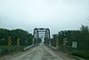
May 15, 1998 245th St. over the Des Moines River
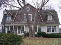
42°44′21″N 94°15′11″W / 42.73917°N 94.25306°WHumboldt 2 Corydon Brown House 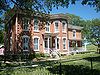
November 14, 1978 East of Dakota City off Iowa Highway 3
42°43′28″N 94°11′27″W / 42.72444°N 94.19083°WDakota City 3 Des Moines River Bridge May 15, 1998 Iowa Highway 3 over the West Fork of the Des Moines River
42°43′55″N 94°15′30″W / 42.73194°N 94.25833°WHumboldt 4 Humboldt County Court House 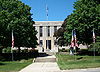
August 28, 2003 203 Main St.
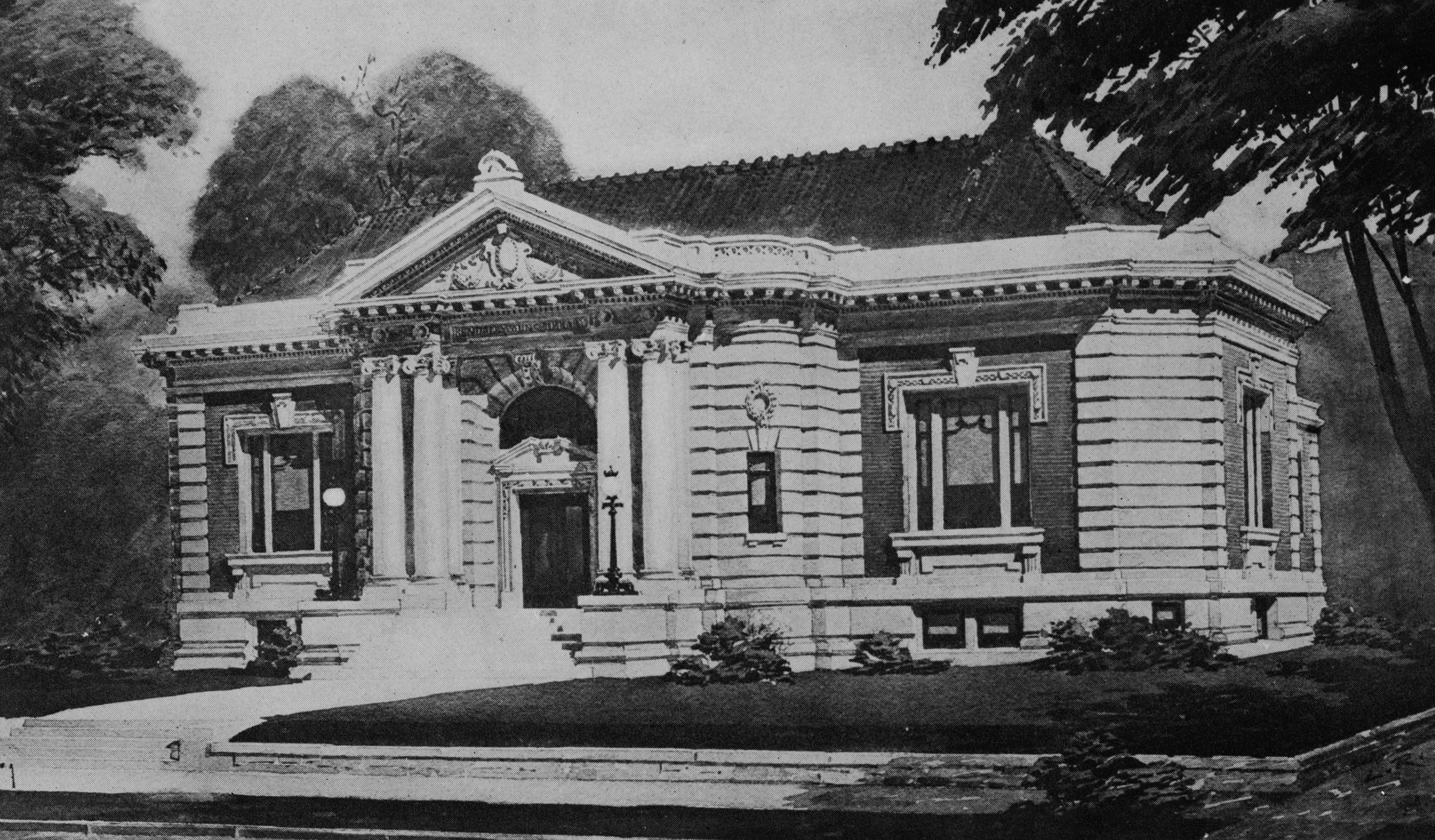
42°43′21″N 94°12′58″W / 42.7225°N 94.21611°WDakota City 5 Humboldt Free Public Library 
May 23, 1983 30 6th St., N.
42°43′16″N 94°13′10″W / 42.72111°N 94.21944°WHumboldt 6 Renwick Generating Plant 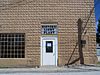
February 17, 1995 103 N. Field St.
42°49′43″N 93°58′42″W / 42.82861°N 93.97833°WRenwick 7 Stephen Harris Taft House 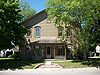
December 27, 2002 809 1st Ave., N.
42°43′20″N 94°13′11″W / 42.72222°N 94.21972°WHumboldt Ida County
Landmark name Image Date listed Location City or Town Summary 1 Alvin Bushnell Bell House January 27, 1983 310 Quimby St.
42°21′8″N 95°28′23″W / 42.35222°N 95.47306°WIda Grove Designed by architect George Franklin Barber 2 Ida County Courthouse March 15, 1974 401 Moorehead St.
42°20′31″N 95°28′2″W / 42.34194°N 95.46722°WIda Grove 3 Moorehead Stagecoach Inn August 27, 1974 Off U.S. Route 59
42°21′15″N 95°28′44″W / 42.35417°N 95.47889°WIda Grove 4 Dr. Francis B. Warnock House October 13, 1988 201 Maple St.
42°18′56″N 95°36′1″W / 42.31556°N 95.60028°WBattle Creek Designed by architect George Franklin Barber 5 Waveland Round Barn June 30, 1986 Off U.S. Route 20
42°29′46″N 95°42′9″W / 42.49611°N 95.7025°WCushing Iowa County
Jackson County
Jasper County
Jefferson County
Johnson County
Jones County
Keokuk County
Kossuth County
Landmark name Image Date listed Location City or Town Summary 1 William C. and Hertha Dau House July 29, 1993 315 S. Dodge St.
43°3′58″N 94°14′10″W / 43.06611°N 94.23611°WAlgona 2 Des Moines River Bridge May 15, 1998 County Road P14 over the East Fork of the Des Moines River
43°20′42″N 94°26′33″W / 43.345°N 94.4425°WSwea City 3 Land and Loan Office Building 
March 19, 1998 123 E. State St.
43°4′8″N 94°14′8″W / 43.06889°N 94.23556°WAlgona Also known as the Henry Adams Building 4 Lu Verne City Jail 
December 18, 1992 307 3rd St.
42°54′39″N 94°5′0″W / 42.91083°N 94.083333°WLu Verne Lee County
Linn County
Louisa County
Landmark name Image Date listed Location City or Town Summary 1 Bethel Church February 22, 1979 Northeast of Morning Sun, off U.S. Route 61
41°6′36″N 91°11′15″W / 41.11°N 91.1875°WMorning Sun 2 Columbus Junction School 1882-1920 August 14, 1973 122 E. Maple St.
41°16′36″N 91°21′37″W / 41.27667°N 91.36028°WColumbus Junction 3 Commercial Hotel August 30, 2001 227 N. Main St.
41°10′51″N 91°11′12″W / 41.18083°N 91.18667°WWapello 4 County Line Bridge May 15, 1998 140th block of County Line Rd. over Long Creek
41°16′51″N 91°29′6″W / 41.28083°N 91.485°WColumbus Junction Extends into Washington County 5 Florence-Council On The Iowa Site December 27, 1978 Address Restricted Oakville 6 Gipple's Quarry Bridge May 15, 1998 100 block of V Ave. over Buffington Creek
41°12′17″N 91°24′31″W / 41.20472°N 91.40861°WColumbus Junction 7 Louisa County Courthouse July 2, 1981 Main St.
41°10′43″N 91°11′9″W / 41.17861°N 91.18583°WWapello 8 Toolesboro Mound Group 
October 15, 1966 6568 Toolesboro Rd.[8] Toolesboro Lucas County
Lyon County
Madison County
Mahaska County
Marion County
Marshall County
Mills County
Landmark name Image Date listed Location City or Town Summary 1 Nishnabotna River Bridge May 15, 1998 County Road M16 over the Nishnabotna River north of Henderson
41°5′21″N 95°28′49″W / 41.08917°N 95.48028°WAnderson Township 2 Plattsmouth Bridge 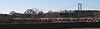
April 15, 1993 U.S. Route 34 over the Missouri River southwest of Pacific Junction
41°0′2″N 95°51′58″W / 41.00056°N 95.86611°WPlattville Township Extends into Cass County, Nebraska 3 Pony Creek Park July 30, 1971 Northwest of Glenwood
41°4′16″N 95°47′12″W / 41.07111°N 95.78667°WOak Township 4 West Oak Forest Earthlodge Site June 11, 2010 Rural (Address Restricted) Glenwood vicinity Mitchell County
Monona County
Landmark name Image Date listed Location City or Town Summary 1 Garretson Outlet Bridge March 12, 1999 County Road K64 over Garretson Outlet Ditch
42°12′16″N 96°6′24″W / 42.20444°N 96.10667°WWhiting 2 Jones Creek Watershed Historic District December 23, 1991 Between the Little Sioux and Soldier Rivers, southwest of Moorhead
41°53′12″N 95°55′49″W / 41.88667°N 95.93028°WMoorhead 3 Mann School No. 2 January 16, 2001 Oak Ave, 3.5 miles northwest of the entrance to Preparation Canyon State Park
41°55′47″N 95°57′11″W / 41.92972°N 95.95306°WMoorhead 4 Monona County Courthouse July 2, 1981 Iowa Ave.
42°1′37″N 96°5′31″W / 42.02694°N 96.09194°WOnawa 5 Onawa IOOF Opera House August 3, 1990 1023 10th Ave.
42°1′32″N 96°5′47″W / 42.02556°N 96.09639°WOnawa 6 Onawa Public Library October 1, 1979 Iowa Ave. and 7th St.
42°1′34″N 96°5′35″W / 42.02611°N 96.09306°WOnawa 7 Round Barn, Cooper Township June 30, 1986 Iowa Highway 141
42°7′59″N 95°44′14″W / 42.13306°N 95.73722°WCooper Township 8 Trinity Memorial Episcopal Church August 10, 1990 302 S. 7th St.
42°9′47″N 95°47′18″W / 42.16306°N 95.78833°WMapleton 9 Newell A. Whiting House August 10, 1990 1106 Iowa Ave.
42°1′37″N 96°5′56″W / 42.02694°N 96.09889°WOnawa Monroe County
Montgomery County
Muscatine County
O'Brien County
Landmark name Image Date listed Location City or Town Summary 1 Carnegie Library April 11, 1977 321 10th St.
43°10′47″N 95°51′14″W / 43.17972°N 95.85389°WSheldon 2 Indian Village Site 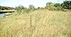
October 15, 1966 Address Restricted Sutherland 3 O'Brien County Courthouse July 2, 1981 Fir Ave.
43°5′12″N 95°37′38″W / 43.08667°N 95.62722°WPrimghar Osceola County
Landmark name Image Date listed Location City or Town Summary 1 Osceola County Courthouse July 2, 1981 3rd Ave. and 8th St.
43°24′7″N 95°44′51″W / 43.40194°N 95.7475°WSibley Page County
Landmark name Image Date listed Location City or Town Summary 1 Goldenrod Schoolhouse September 23, 1994 1600 S. 16th St.
40°43′21″N 95°2′14″W / 40.7225°N 95.03722°WClarinda 2 Col. William Peters Hepburn House June 4, 1973 321 W. Lincoln St.
40°44′28″N 95°2′31″W / 40.74111°N 95.04194°WClarinda 3 Iowan's Hotel January 29, 2009 508 E. Railroad St.
40°51′55″N 94°59′9″W / 40.86528°N 94.98583°WEssex 4 McCoy Polygonal Barn June 30, 1986 Off U.S. Route 71
40°51′55″N 94°59′9″W / 40.86528°N 94.98583°WHepburn 5 Page County Courthouse 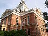
July 2, 1981 Main St.
40°44′12″N 95°2′13″W / 40.73667°N 95.03694°WClarinda 6 Wabash Combination Depot-Shenandoah September 6, 1990 Junction of Ferguson Rd. and Burlington Northern tracks
40°46′20″N 95°22′13″W / 40.77222°N 95.37028°WShenandoah 7 W.T.S. White House and Carriage House January 21, 1994 400 N. 16th St.
40°44′29″N 95°2′17″W / 40.74139°N 95.03806°WClarinda 8 Women's Christian Temperance Union Public Fountain September 27, 1984 Clarinda and Sheridan Sts.
40°45′57″N 95°22′19″W / 40.76583°N 95.37194°WShenandoah Palo Alto County
Landmark name Image Date listed Location City or Town Summary 1 Emmetsburg Public Library May 23, 1983 10th St. on Courthouse Sq.
43°5′19″N 94°41′52″W / 43.08861°N 94.69778°WEmmetsburg 2 First Presbyterian Church May 24, 2010 101 1st Ave. SW
42°57′34.86″N 94°26′47.1″W / 42.9596833°N 94.446417°WWest Bend 3 Grotto of the Redemption 
February 23, 2001 300 N. Broadway
42°57′50″N 94°26′44″W / 42.96389°N 94.44556°WWest Bend 4 Ormsby-Kelly House July 29, 1977 2403 W. 7th St.
43°6′46″N 94°41′2″W / 43.11278°N 94.68389°WEmmetsburg Plymouth County
Landmark name Image Date listed Location City or Town Summary 1 Foster Park Historic District April 25, 2008 500-900 blocks of Central Ave., S. and blocks around Foster Park
42°47′1.32″N 96°9′59.112″W / 42.7837°N 96.16642°WLe Mars 2 Kimball Village June 11, 2010 Rural (Address Restricted) Westfield vicinity Archaeological Resources of Initial Variant of the Middle Missouri Tradition in Iowa MPS 3 Le Mars Central High School May 14, 1999 335 1st Ave., SW.
42°47′19″N 96°10′5″W / 42.78861°N 96.16806°WLe Mars 4 Le Mars Municipal Park and Golf Course Historic District August 8, 2001 Between 4th Ave., NE. and Iowa Highway 3
42°48′10″N 96°9′3″W / 42.80278°N 96.15083°WLe Mars 5 Le Mars Public Library March 26, 1979 200 Central
42°47′25″N 96°9′56″W / 42.79028°N 96.16556°WLe Mars 6 Plymouth County Courthouse July 2, 1981 E. 3rd Ave.
42°47′23″N 96°9′40″W / 42.78972°N 96.16111°WLe Mars 7 Reeves Farmstead Historic District January 26, 2001 15991 Iowa Highway 60
42°49′22″N 96°9′44″W / 42.82278°N 96.16222°WLe Mars 8 Sacred Heart Hospital February 3, 2010 4110 6th Ave., NE.
42°47′40.14″N 96°9′27.34″W / 42.7944833°N 96.1575944°WLe Mars 9 St. George's Episcopal Church November 21, 1976 400 1st Ave., SE.
42°47′16″N 96°9′52″W / 42.78778°N 96.16444°WLe Mars 10 Tonsfeldt Round Barn November 19, 1986 Plymouth County Fairgrounds
42°47′46″N 96°11′11″W / 42.79611°N 96.18639°WLe Mars Pocahontas County
Landmark name Image Date listed Location City or Town Summary 1 Laurens Carnegie Free Library November 5, 1974 263 N. 3rd St.
42°50′54″N 94°50′56″W / 42.84833°N 94.84889°WLaurens 2 Pocahontas County Courthouse July 2, 1981 Court Sq.
42°44′14″N 94°40′7″W / 42.73722°N 94.66861°WPocahontas 3 Saints Peter and Paul Catholic Church March 1, 1994 16 2nd Ave., NW.
42°44′5″N 94°40′15″W / 42.73472°N 94.67083°WPocahontas Polk County
Pottawattamie County
Poweshiek County
Ringgold County
Landmark name Image Date listed Location City or Town Summary 1 Beaconsfield Supply Store May 24, 2007 1621 Main St.
40°48′35″N 94°3′2″W / 40.80972°N 94.05056°WBeaconsfield 2 W.J. Buck Polygonal Barn June 30, 1986 Off U.S. Route 169
40°46′57″N 94°15′25″W / 40.7825°N 94.25694°WDiagonal 3 Middlefork Methodist Episcopal Church November 29, 1990 South of U.S. Route 169 on the eastern side of the Middle Fork Grand River
40°35′47″N 94°19′3″W / 40.59639°N 94.3175°WRedding 4 Ringgold County Courthouse July 2, 1981 Madison St.
40°42′46″N 94°14′26″W / 40.71278°N 94.24056°WMount Ayr 5 Ringgold County Jail June 19, 1979 201 E. Monroe St.
40°42′43″N 94°14′9″W / 40.71194°N 94.23583°WMount Ayr 6 Lee Shay Farmhouse November 6, 1986 Off County Road P27
40°41′13″N 94°22′57″W / 40.68694°N 94.3825°WMaloy Sac County
Landmark name Image Date listed Location City or Town Summary 1 Blackhawk State Park, Wildlife Preserve Area (Area A) November 15, 1990 South of the junction of U.S. Route 71 and County Highway M68
41°59′50″N 95°2′21″W / 41.99722°N 95.03917°WLake View 2 Blackhawk State Park, Black Hawk Preserve (Area B) November 15, 1990 South of the junction of U.S. Route 71 and County Highway M68
42°3′13″N 95°0′58″W / 42.05361°N 95.01611°WLake View 3 Blackhawk State Park, Denison Beach Area (Area C) November 15, 1990 South of the junction of U.S. Route 71 and County Highway M68
42°18′7″N 95°2′6″W / 42.30194°N 95.035°WLake View 4 Chicago and North Western Passenger Depot May 9, 2003 3727 Perkins Ave.
42°16′13″N 95°5′23″W / 42.27028°N 95.08972°WWall Lake 5 Chief Black Hawk Statue May 26, 2000 Crescent Park Dr.
42°18′31″N 95°2′33″W / 42.30861°N 95.0425°WLake View 6 Lakeside Park Historic District December 23, 1991 3rd St. from Lake to Park St.
42°18′23″N 95°2′46″W / 42.30639°N 95.04611°WLake View 7 Sac County Courthouse July 2, 1981 Main St.
42°25′21″N 94°59′19″W / 42.4225°N 94.98861°WSac City 8 Sac City March 7, 1996 707 Audubon St.
42°25′16″N 94°59′33″W / 42.42111°N 94.9925°WSac City Scott County
Shelby County
Sioux County
Landmark name Image Date listed Location City or Town Summary 1 Charles M. and Emma M. Fischer Fleshman House January 7, 1993 919 9th St.
42°59′45″N 96°28′51″W / 42.99583°N 96.48083°WHawarden 2 Hawarden City Hall, Fire Station and Auditorium March 10, 2009 715 Central Ave.
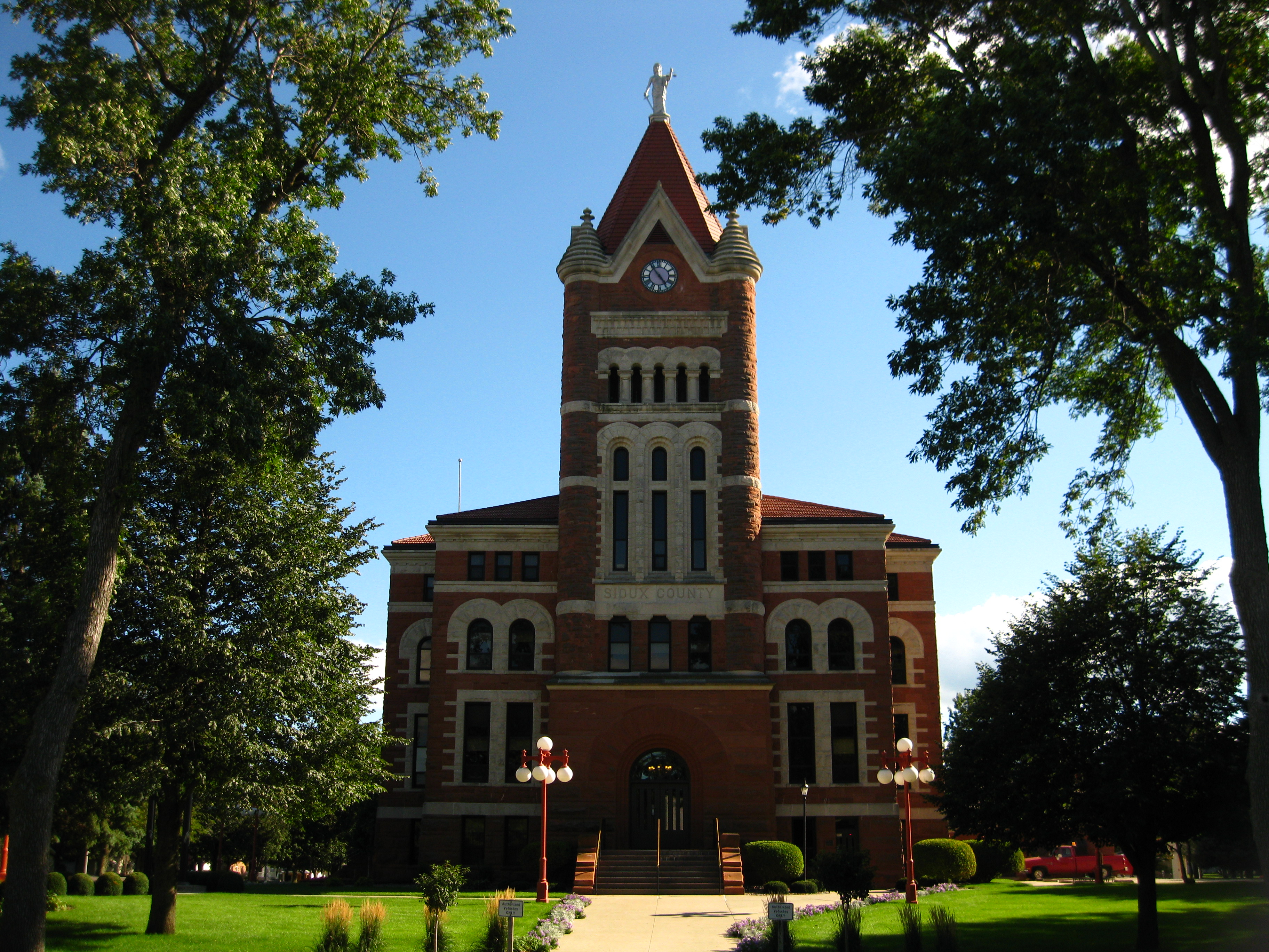
42°59′37.068″N 96°29′6.684″W / 42.99363°N 96.48519°WHawarden 3 Sioux County Courthouse 
April 11, 1977 Off Iowa Highway 10
43°0′16″N 96°3′30″W / 43.00444°N 96.05833°WOrange City 4 Zwemer Hall, Northwestern College 
May 28, 1975 101 7th St., SW.
42°59′58″N 96°3′28″W / 42.99944°N 96.05778°WOrange City Story County
Tama County
Taylor County
Landmark name Image Date listed Location City or Town Summary 1 Bedford Commercial Historic District September 12, 2002 200-500 blocks of Main St., the 500 and 600 blocks of Court, and the 500 block of Central
40°40′1″N 94°43′7″W / 40.66694°N 94.71861°WBedford 2 Bedford House June 14, 1977 306 Main St.
40°40′4″N 94°43′13″W / 40.66778°N 94.72028°WBedford 3 Bedford Oil Company Station July 15, 1999 601 Madison
40°40′2″N 94°43′15″W / 40.66722°N 94.72083°WBedford 4 Bedford Public Library May 23, 1983 Jefferson St.
40°36′29″N 94°44′53″W / 40.60806°N 94.74806°WBedford 5 Lenox Hotel December 20, 2002 114 S. Main St.
40°52′52″N 94°33′33″W / 40.88111°N 94.55917°WLenox 6 Lenox Round Barn May 5, 1999 1001 Pollock Boulevard
40°40′39″N 94°43′45″W / 40.6775°N 94.72917°WBedford 7 Taylor County Courthouse July 2, 1981 Court Ave.
40°40′1″N 94°43′8″W / 40.66694°N 94.71889°WBedford Union County
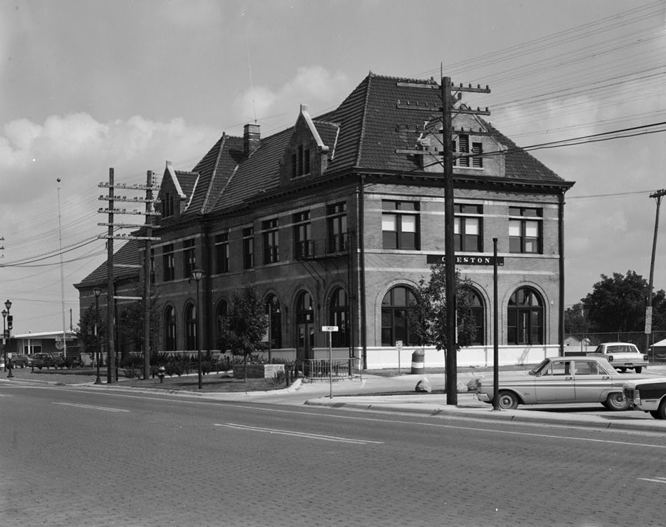
Landmark name Image Date listed Location City or Town Summary 1 Chicago, Burlington and Quincy Railroad-Creston Station 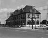
August 15, 1973 200 W. Adams St.
41°2′21″N 94°20′34″W / 41.03917°N 94.34278°WCreston 2 Grand River Bridge May 15, 1998 230th St. over the Grand River
40°57′48″N 94°2′20″W / 40.96333°N 94.03889°WArispe 3 Iowana Hotel May 12, 2009 203 W. Montgomery St.
41°3′30.98″N 94°21′45.9″W / 41.0586056°N 94.36275°WCreston 4 Jefferson Elementary School October 24, 2002 501 North Cherry
41°3′44″N 94°21′22″W / 41.06222°N 94.35611°WCreston 5 U.S. Post Office December 8, 1978 Maple St.
41°3′33″N 94°21′58″W / 41.05917°N 94.36611°WCreston Van Buren County
Wapello County
Warren County
Washington County
Wayne County
Landmark name Image Date listed Location City or Town Summary 1 Nelson Round Barn November 19, 1986 County Road J46
40°42′24″N 93°20′44″W / 40.70667°N 93.34556°WAllerton 2 Pleasant Hill School May 28, 1975 3 miles north of Lineville on U.S. Route 65
40°37′26″N 93°29′48″W / 40.62389°N 93.49667°WLineville 3 W.H. Tedford House March 26, 1979 312 S. West St.
40°45′25″N 93°19′24″W / 40.75694°N 93.32333°WCorydon Webster County
Winnebago County
Landmark name Image Date listed Location City or Town Summary 1 Forest City Public Library April 5, 1984 E. I St. and Clark
43°15′56″N 93°38′15″W / 43.26556°N 93.6375°WForest City 2 Round Barn, Norway Township February 27, 1987 Off County Road R60
43°29′22″N 93°35′51″W / 43.48944°N 93.5975°WNorway Township 3 Charles J. Thompson House November 30, 1978 336 N. Clark St.
43°15′58″N 93°38′18″W / 43.26611°N 93.63833°WForest City 4 Winnebago County Courthouse July 2, 1981 J St.
43°15′47″N 93°38′19″W / 43.26306°N 93.63861°WForest City Winneshiek County
Woodbury County
Worth County
Landmark name Image Date listed Location City or Town Summary 1 Chicago, Milwaukee, and St. Paul Railroad-Grafton Station June 23, 1976 Iowa Highway 337
43°19′33″N 93°4′13″W / 43.32583°N 93.07028°WGrafton 2 First Methodist Episcopal Church August 16, 2000 401 2nd. St.
43°21′7″N 93°12′40″W / 43.35194°N 93.21111°WKensett 3 Northwood Central Avenue Historic District 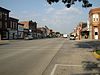
September 19, 2006 Roughly Central Ave., W. near 5th St. to 9th St. on the east
43°26′46″N 93°13′22″W / 43.44611°N 93.22278°WNorthwood 4 Old Worth County Courthouse July 2, 1981 921 Central Ave.
43°26′38″N 93°13′7″W / 43.44389°N 93.21861°WNorthwood 5 Rhodes Mill November 24, 1978 Main St.
43°15′50″N 93°25′16″W / 43.26389°N 93.42111°WFertile 6 Worth County Courthouse 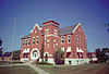
July 2, 1981 Central Ave. between 10th and 11th Sts.
43°26′40″N 93°13′3″W / 43.44444°N 93.2175°WNorthwood Wright County
Landmark name Image Date listed Location City or Town Summary 1 Boone River Bridge May 15, 1998 Buchanan Ave. over the Boone River
42°51′26″N 93°56′46″W / 42.85722°N 93.94611°WGoldfield 2 Burlington, Cedar Rapids & Northern Passenger Depot-Dows 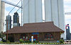
January 7, 1993 200 Railroad St.
42°39′28″N 93°29′59″W / 42.65778°N 93.49972°WDows 3 Burlington, Cedar Rapids and Northern Railroad Passenger Station June 23, 1988 302 S. Main
42°43′48″N 93°43′59″W / 42.73°N 93.73306°WClarion 4 Cornelia Lake Bridge May 15, 1998 Over an inlet of Cornelia Lake
42°47′31″N 93°41′38″W / 42.79194°N 93.69389°WClarion 5 Eagle Grove Public Library November 22, 1977 401 W. Broadway
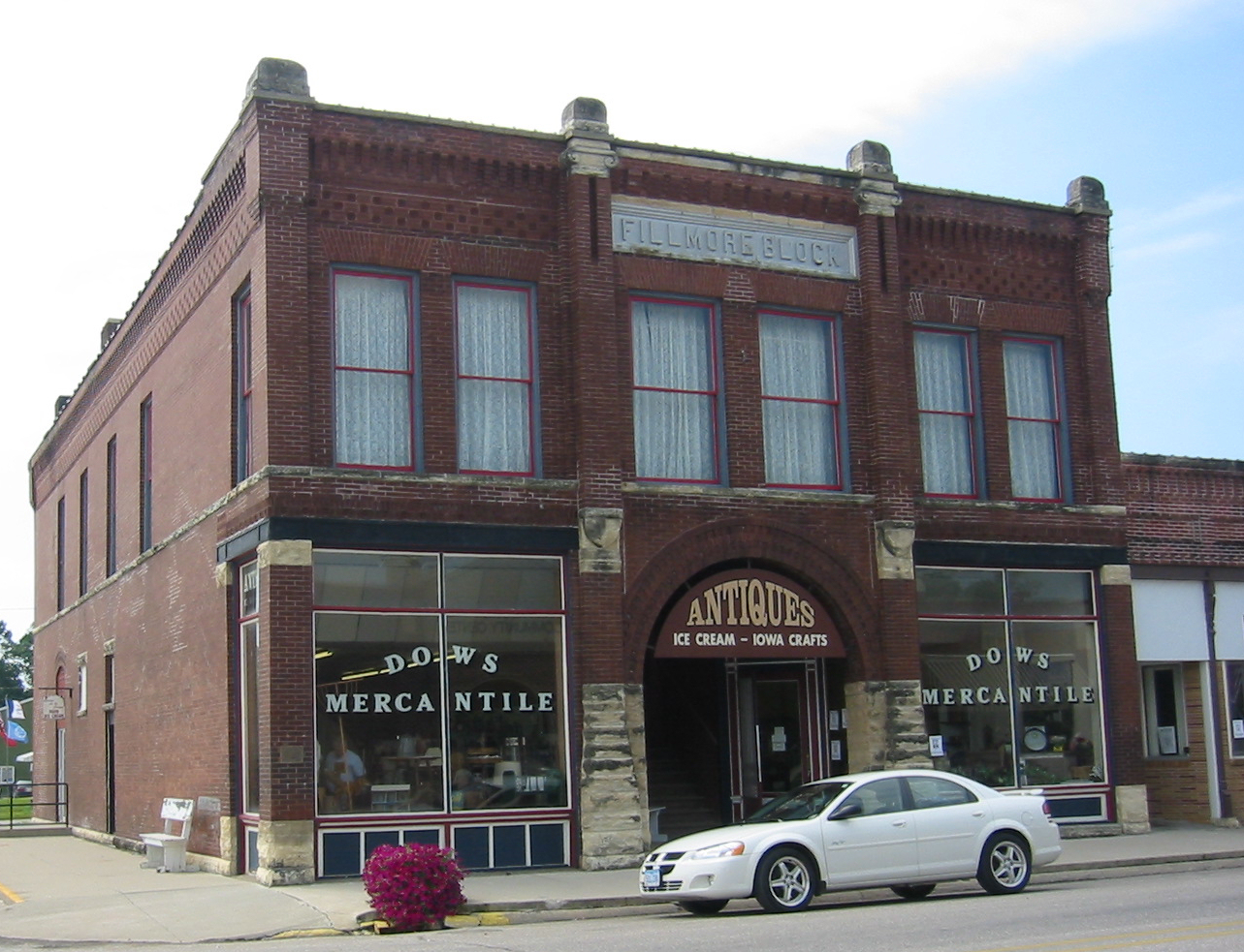
42°39′51″N 93°54′24″W / 42.66417°N 93.90667°WEagle Grove 6 Fillmore Block 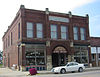
November 20, 1998 Junction of Ellsworth and Garfield
42°39′23″N 93°29′59″W / 42.65639°N 93.49972°WDows 7 Goldfield Bridge May 15, 1998 Oak St. over the Boone River
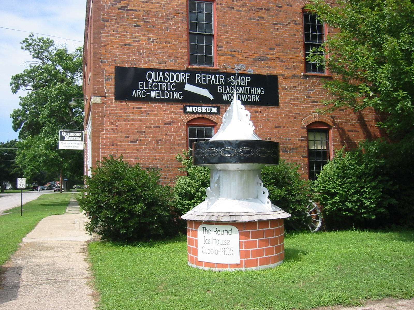
42°44′14″N 93°55′29″W / 42.73722°N 93.92472°WGoldfield 8 Quasdorf Blacksmith and Wagon Shop 
January 21, 1994 Junction of Train and W. Railroad Sts.
42°39′25″N 93°29′57″W / 42.65694°N 93.49917°WDows 9 Wright County Courthouse July 2, 1981 Central Ave.
42°43′56″N 93°43′55″W / 42.73222°N 93.73194°WClarion See also
References
- ^ "National Register of Historic Places: Weekly List Actions". National Park Service, United States Department of the Interior. Retrieved on November 10, 2011.
- ^ "National Register Information System". National Register of Historic Places. National Park Service. 2008-04-24. http://nrhp.focus.nps.gov/natreg/docs/All_Data.html.
- ^ "National Register of Historic Places: Weekly List Actions". National Park Service. http://www.cr.nps.gov/nr/nrlist.htm. Retrieved January 2, 2009.
- ^ Weekly List Actions, National Register of Historic Places website
- ^ The Vander Veer Park Historic District is split between east and west Davenport.
- ^ Effigy Mounds National Monument is split between Allamakee and Clayton counties; Le Grand Bridge (1896) is split between Marshall and Tama counties; County Line Bridge is split between Louisa and Washington counties
- ^ "Weekly List". National Park Service. May 22, 2009. http://www.nps.gov/history/nr/listings/20090522.HTM. Retrieved May 24, 2009.
- ^ Address derived from this Louisa County Conservation Board page; the NRIS lists the site as "Address Restricted".
U.S. National Register of Historic Places Topics Lists by states Alabama • Alaska • Arizona • Arkansas • California • Colorado • Connecticut • Delaware • Florida • Georgia • Hawaii • Idaho • Illinois • Indiana • Iowa • Kansas • Kentucky • Louisiana • Maine • Maryland • Massachusetts • Michigan • Minnesota • Mississippi • Missouri • Montana • Nebraska • Nevada • New Hampshire • New Jersey • New Mexico • New York • North Carolina • North Dakota • Ohio • Oklahoma • Oregon • Pennsylvania • Rhode Island • South Carolina • South Dakota • Tennessee • Texas • Utah • Vermont • Virginia • Washington • West Virginia • Wisconsin • WyomingLists by territories Lists by associated states Other Categories:- National Register of Historic Places in Iowa
- National Register of Historic Places lists by state
- Iowa-related lists
-


Wikimedia Foundation. 2010.