- National Register of Historic Places listings in Jackson County, Iowa
-
 Location of Jackson County in Iowa
This is a list of the National Register of Historic Places listings in Jackson County, Iowa.
This is intended to be a complete list of the properties and districts on the National Register of Historic Places in Jackson County, Iowa, United States. Latitude and longitude coordinates are provided for many National Register properties and districts; these locations may be seen together in a Google map.[1]
There are 75 properties and districts listed on the National Register in the county.
-
- This National Park Service list is complete through NPS recent listings posted November 10, 2011.[2]
[3] Landmark name [4] Image Date listed Location City or town Summary 1 D.H. Anderson Building April 10, 1986 129 S. Main St.
42°04′06″N 90°39′54″W / 42.068333°N 90.665°WMaquoketa 2 D.H. Anderson House 
August 9, 1991 315 E. Locust
42°03′51″N 90°39′41″W / 42.064167°N 90.661389°WMaquoketa 3 Bassnett-Nickerson House July 24, 1992 116 S. Vermont
42°04′04″N 90°40′24″W / 42.067778°N 90.673333°WMaquoketa 4 Bellevue Herald Building August 30, 1991 130 S. Riverview St.
42°15′28″N 90°25′22″W / 42.257778°N 90.422778°WBellevue 5 Big Mill Homestead August 30, 1991 Paradise Valley Rd. west of Bellevue
42°16′14″N 90°31′03″W / 42.270556°N 90.5175°WBellevue 6 Building at 101 North Riverview Street August 30, 1991 101 N. Riverview St.
42°15′32″N 90°25′22″W / 42.258889°N 90.422778°WBellevue 7 Building at 126 South Riverview Street August 30, 1991 126 S. Riverview St.
42°15′28″N 90°25′22″W / 42.257778°N 90.422778°WBellevue 8 Building at 130-132 North Riverview Street August 30, 1991 130-132 N. Riverview St.
42°15′33″N 90°25′24″W / 42.259167°N 90.423333°WBellevue 9 Building at 306 South Second Street August 30, 1991 306 S. 2nd St.
42°15′21″N 90°25′24″W / 42.255833°N 90.423333°WBellevue 10 Nathaniel Butterworth House July 24, 1992 Eastern side of Iowa Highway 62 north of Andrew
42°09′46″N 90°35′52″W / 42.162778°N 90.597778°WAndrew 11 Canton School July 24, 1979 South St.
42°09′47″N 90°53′46″W / 42.163056°N 90.896111°WCanton 12 Central School July 24, 1992 Junction of Bellevue-Canton and Dubuque-Canton Rds.
42°10′24″N 90°51′15″W / 42.173333°N 90.854167°WCanton 13 Chicago, Milwaukee & St. Paul Narrow Gauge Depot-LaMotte February 17, 1995 Market St.
42°17′32″N 90°37′22″W / 42.292222°N 90.622778°WLa Motte 14 George Cooper House August 9, 1991 413 W. Platt St.
42°04′07″N 90°40′11″W / 42.068611°N 90.669722°WMaquoketa 15 Cundill Block August 9, 1991 202 S. Main
42°04′03″N 90°39′57″W / 42.0675°N 90.665833°WMaquoketa 16 Decker House Hotel December 29, 1978 128 N. Main St.
42°04′13″N 90°40′04″W / 42.070278°N 90.667778°WMaquoketa 17 DeFries House, Barn and Carpenter Shop July 24, 1992 Eastern side of 232rd Ave. west of its junction with Iowa Highway 62
42°11′17″N 90°37′20″W / 42.188056°N 90.622222°WAndrew 18 John S. Dominy House July 24, 1992 605 Pearl St.
42°04′11″N 90°09′36″W / 42.069722°N 90.16°WSabula 19 Dyas Hexagonal Barn June 30, 1986 U.S. Route 52
42°13′57″N 90°24′20″W / 42.2325°N 90.405556°WBellevue 20 George Dyas House August 30, 1991 County Road Z-15 southwest of its junction with U.S. Route 52
42°14′30″N 90°25′20″W / 42.241667°N 90.422222°WBellevue 21 William Dyas Barn August 30, 1991 County Road Z-15 southwest of its junction with U.S. Route 52
42°14′39″N 90°25′11″W / 42.244167°N 90.419722°WBellevue 22 First National Bank August 9, 1991 120 S. Main
42°04′06″N 90°39′57″W / 42.068333°N 90.665833°WMaquoketa 23 Fritz Chapel August 30, 1991 Spruce Creek Rd. west of its junction with U.S. Route 52
42°17′41″N 90°29′39″W / 42.294722°N 90.494167°WBellevue 24 Gehlen House and Barn June 18, 1979 U.S. Route 52
42°21′38″N 90°32′23″W / 42.360556°N 90.539722°WSt. Donatus 25 Milton Godard House July 24, 1992 Southern side of 7th St. southwest of Maquoketa
42°02′21″N 90°44′07″W / 42.039167°N 90.735278°WMaquoketa 26 Harris Wagon and Carriage Shop July 24, 1992 Junction of Main and Pine Sts.
42°17′44″N 90°37′16″W / 42.295556°N 90.621111°WLa Motte 27 Hotel Hurst December 27, 1989 227 S. Main
42°04′00″N 90°39′54″W / 42.066667°N 90.665°WMaquoketa 28 Hotel Hurst Garage December 27, 1989 219 S. Main
42°04′01″N 90°39′54″W / 42.066944°N 90.665°WMaquoketa 29 House at 505 Court Street August 30, 1991 505 Court St.
42°15′24″N 90°25′42″W / 42.256667°N 90.428333°WBellevue 30 House at 111 E. Maple Street August 9, 1991 111 E. Maple St.
42°03′56″N 90°39′54″W / 42.065556°N 90.665°WMaquoketa 31 A.A. Hurst House August 9, 1991 513 W. Platt St.
42°04′08″N 90°40′16″W / 42.068889°N 90.671111°WMaquoketa 32 Hurstville Historic District 
December 3, 1979 North of Maquoketa on U.S. Route 61
42°05′38″N 90°40′55″W / 42.093889°N 90.681944°WMaquoketa 33 Insane Asylum at the County Poor Farm July 24, 1992 Eastern side of County Road Y61 (250th Ave.) north of Andrew
42°11′56″N 90°36′36″W / 42.198889°N 90.61°WAndrew 34 IOOF Building August 9, 1991 103 N. Main
42°04′09″N 90°39′54″W / 42.069167°N 90.665°WMaquoketa 35 Jackson County Courthouse July 2, 1981 Bounded by 3rd, State, 4th, and Court Sts.
42°15′27″N 90°25′34″W / 42.2575°N 90.426111°WBellevue 36 Jackson County Jail December 12, 1978 Emmet St.
42°09′15″N 90°35′29″W / 42.154167°N 90.591389°WAndrew 37 Mrs. Lydia Johnson House 
August 9, 1991 209 E. Locust
42°03′51″N 90°39′47″W / 42.064167°N 90.663056°WMaquoketa 38 Kegler Gonner Store and Post Office June 27, 1985 100 E. Main
42°09′50″N 90°28′35″W / 42.163889°N 90.476389°WSpringbrook 39 Kucheman Building August 30, 1991 100 N. 2nd St.
42°15′30″N 90°25′28″W / 42.258333°N 90.424444°WBellevue 40 John Lake House December 30, 1991 601 W. Platt St.
42°04′06″N 90°40′19″W / 42.068333°N 90.671944°WMaquoketa 41 Lock and Dam No. 12 Historic District 
March 10, 2004 401 N. Riverview St. Bellevue 42 Henry Lubben House, Smokehouse and Springhouse July 24, 1992 Western side of County Road Y34 north of Baldwin
42°05′38″N 90°50′26″W / 42.093889°N 90.840556°WBaldwin 43 Lyon Block August 9, 1991 112-116 N. Main
42°04′11″N 90°39′57″W / 42.069722°N 90.665833°WMaquoketa 44 Maquoketa Caves State Park Historic District December 23, 1991 County Road 428 northwest of Maquoketa
42°07′05″N 90°46′28″W / 42.118056°N 90.774444°WMaquoketa 45 Maquoketa Company-Clinton Machine Company Administration Building August 23, 2006 605 E. Maple St.
42°03′59″N 90°39′33″W / 42.066389°N 90.659167°WMaquoketa 46 Maquoketa Free Public Library December 27, 1989 2nd and Pleasant
42°04′04″N 90°40′01″W / 42.067778°N 90.666944°WMaquoketa 47 Dr. G.S. Martin House December 30, 1991 311 S. 2nd St.
42°03′54″N 90°39′59″W / 42.065°N 90.666389°WMaquoketa 48 Merrero Building August 9, 1991 111-115 S. Main
42°04′07″N 90°39′54″W / 42.068611°N 90.665°WMaquoketa 49 Mill Rock School July 24, 1992 Western side of 153rd Ave., south of Baldwin
42°03′31″N 90°50′21″W / 42.058611°N 90.839167°WBaldwin 50 Mitchell-Maskrey Mill August 9, 1991 120 E. Pleasant
42°04′04″N 90°39′52″W / 42.067778°N 90.664444°WMaquoketa 51 New Era Building August 9, 1991 115-117 E. Platt
42°04′08″N 90°39′53″W / 42.068889°N 90.664722°WMaquoketa 52 Theodore Niemann House and Spring House August 30, 1991 Spruce Creek Rd. west of its junction with U.S. Route 52
42°17′35″N 90°29′28″W / 42.293056°N 90.491111°WBellevue 53 Alexander Organ House August 9, 1991 607 W. Summit
42°03′42″N 90°40′22″W / 42.061667°N 90.672778°WMaquoketa 54 Paradise Farm July 13, 1977 West of Bellevue
42°16′10″N 90°29′04″W / 42.269444°N 90.484444°WBellevue 55 Perham House August 9, 1991 213 E. Pleasant St.
42°04′03″N 90°39′48″W / 42.0675°N 90.663333°WMaquoketa 56 Polygonal Barn, Van Buren Township June 30, 1986 Iowa Highway 64
42°03′09″N 90°21′34″W / 42.0525°N 90.359444°WVan Buren Township 57 E.G. Potter's Jasper Flour Mill 
April 19, 1984 South and 2nd St.
42°15′03″N 90°25′36″W / 42.250833°N 90.426667°WBellevue 58 Robb House and Spring House August 30, 1991 Paradise Valley Rd. west of Bellevue
42°16′52″N 90°32′33″W / 42.281111°N 90.5425°WBellevue 59 Henry Roling House August 30, 1991 Spruce Creek Rd. west of its junction with U.S. Route 52
42°17′30″N 90°28′42″W / 42.291667°N 90.478333°WBellevue 60 St. Lawrence Catholic Church July 24, 1992 Bellevue-Cascade Rd. (County Road D61) west of its junction with U.S. Route 61
42°14′26″N 90°41′42″W / 42.240556°N 90.695°WOtter Creek 61 St. Patrick's Church-Garryowen July 24, 1992 W. Bellevue-Cascade Rd. (County Road D61) west of Garryowen
42°17′07″N 90°50′50″W / 42.285278°N 90.847222°WGarryowen 62 C.M. Sanborn Building August 9, 1991 203 S. Main
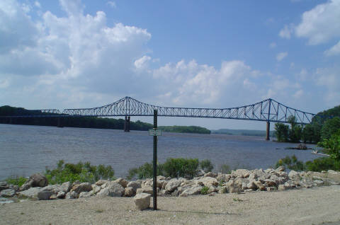
42°04′02″N 90°39′54″W / 42.067222°N 90.665°WMaquoketa 63 Savanna-Sabula Bridge 
August 27, 1999 U.S. Route 52/Iowa Highway 64 over the Mississippi River
42°06′14″N 90°10′01″W / 42.103889°N 90.166944°WSabula 64 Mrs. Margaret Sieben House July 24, 1992 0.3 miles east of County Road Y34 north of Baldwin
42°05′21″N 90°50′09″W / 42.089167°N 90.835833°WBaldwin 65 Thomas Slye House July 24, 1992 Southern side of 184th St. east of its junction with Iowa Highway 62
42°11′29″N 90°36′15″W / 42.191389°N 90.604167°WAndrew 66 Spring Side December 28, 1990 Junction of U.S. Route 52 and Ensign Rd.
42°16′13″N 90°26′00″W / 42.270278°N 90.433333°WBellevue 67 J.E. Squiers House April 20, 1995 418 W. Pleasant St.
42°04′05″N 90°40′16″W / 42.068056°N 90.671111°WMaquoketa 68 W.B. Swigert House August 9, 1991 309 N. Main St.
42°04′17″N 90°39′54″W / 42.071389°N 90.665°WMaquoketa 69 Henry Taubman House August 9, 1991 303 E. Pleasant St.
42°04′03″N 90°39′43″W / 42.0675°N 90.661944°WMaquoketa 70 Upper Paradise August 30, 1991 Paradise Valley Rd. west of Bellevue
42°16′24″N 90°30′20″W / 42.273333°N 90.505556°WBellevue 71 Village of St. Donatus Historic District November 8, 1989 Junction of U.S. Route 52/Main St. and 1st St.
42°21′42″N 90°32′26″W / 42.361667°N 90.540556°WSt. Donatus 72 West Pleasant Street Historic District August 9, 1991 Pleasant St. between 2nd and Prospect Sts.
42°04′04″N 90°40′11″W / 42.067778°N 90.669722°WMaquoketa 73 Seneca Williams Mill September 1, 1976 East of Maquoketa on Iowa Highway 64
42°04′05″N 90°38′44″W / 42.068056°N 90.645556°WMaquoketa 74 Anson Wilson House November 17, 1977 South of Marquoketa off U.S. Route 61
42°03′02″N 90°40′39″W / 42.050556°N 90.6775°WMaquoketa 75 Jeremiah Wood House November 10, 1982 802 River St.
42°04′05″N 90°10′13″W / 42.068056°N 90.170278°WSabula See also
References
- ^ The latitude and longitude information provided in this table was derived originally from the National Register Information System, which has been found to be fairly accurate for about 99% of listings. For about 1% of NRIS original coordinates, experience has shown that one or both coordinates are typos or otherwise extremely far off; some corrections may have been made. A more subtle problem causes many locations to be off by up to 150 yards, depending on location in the country: most NRIS coordinates were derived from tracing out latitude and longitudes off of USGS topographical quadrant maps created under the North American Datum of 1927, which differs from the current, highly accurate WGS84 GPS system used by Google maps. Chicago is about right, but NRIS longitudes in Washington are higher by about 4.5 seconds, and are lower by about 2.0 seconds in Maine. Latitudes differ by about 1.0 second in Florida. Some locations in this table may have been corrected to current GPS standards.
- ^ "National Register of Historic Places: Weekly List Actions". National Park Service, United States Department of the Interior. Retrieved on November 10, 2011.
- ^ Numbers represent an ordering by significant words. Various colorings, defined here, differentiate National Historic Landmark sites and National Register of Historic Places Districts from other NRHP buildings, structures, sites or objects.
- ^ "National Register Information System". National Register of Historic Places. National Park Service. . http://nrhp.focus.nps.gov/natreg/docs/All_Data.html.
U.S. National Register of Historic Places Topics Lists by states Alabama • Alaska • Arizona • Arkansas • California • Colorado • Connecticut • Delaware • Florida • Georgia • Hawaii • Idaho • Illinois • Indiana • Iowa • Kansas • Kentucky • Louisiana • Maine • Maryland • Massachusetts • Michigan • Minnesota • Mississippi • Missouri • Montana • Nebraska • Nevada • New Hampshire • New Jersey • New Mexico • New York • North Carolina • North Dakota • Ohio • Oklahoma • Oregon • Pennsylvania • Rhode Island • South Carolina • South Dakota • Tennessee • Texas • Utah • Vermont • Virginia • Washington • West Virginia • Wisconsin • WyomingLists by territories Lists by associated states Other Municipalities and communities of Jackson County, Iowa Cities Andrew | Baldwin | Bellevue | La Motte | Maquoketa‡ | Miles | Monmouth | Preston | Sabula | St. Donatus | Spragueville | Springbrook | Zwingle‡

Townships Bellevue | Brandon | Butler | Fairfield | Farmers Creek | Iowa | Jackson | Maquoketa | Monmouth | Otter Creek | Perry | Prairie Springs | Richland | South Fork | Tete Des Morts | Union | Van Buren | Washington
Unincorporated
communitiesCanton | Green Island
Footnotes ‡This populated place also has portions in an adjacent county or counties
Categories:- National Register of Historic Places in Iowa by county
- Jackson County, Iowa
- Buildings and structures in Jackson County, Iowa
-


Wikimedia Foundation. 2010.