- National Register of Historic Places listings in Dallas County, Iowa
-
 Location of Dallas County in Iowa
This is a list of the National Register of Historic Places listings in Dallas County, Iowa.
This is intended to be a complete list of the properties and districts on the National Register of Historic Places in Dallas County, Iowa, United States. Latitude and longitude coordinates are provided for many National Register properties and districts; these locations may be seen together in a Google map.[1]
There are 14 properties and districts listed on the National Register in the county.
-
- This National Park Service list is complete through NPS recent listings posted November 10, 2011.[2]
Current listings
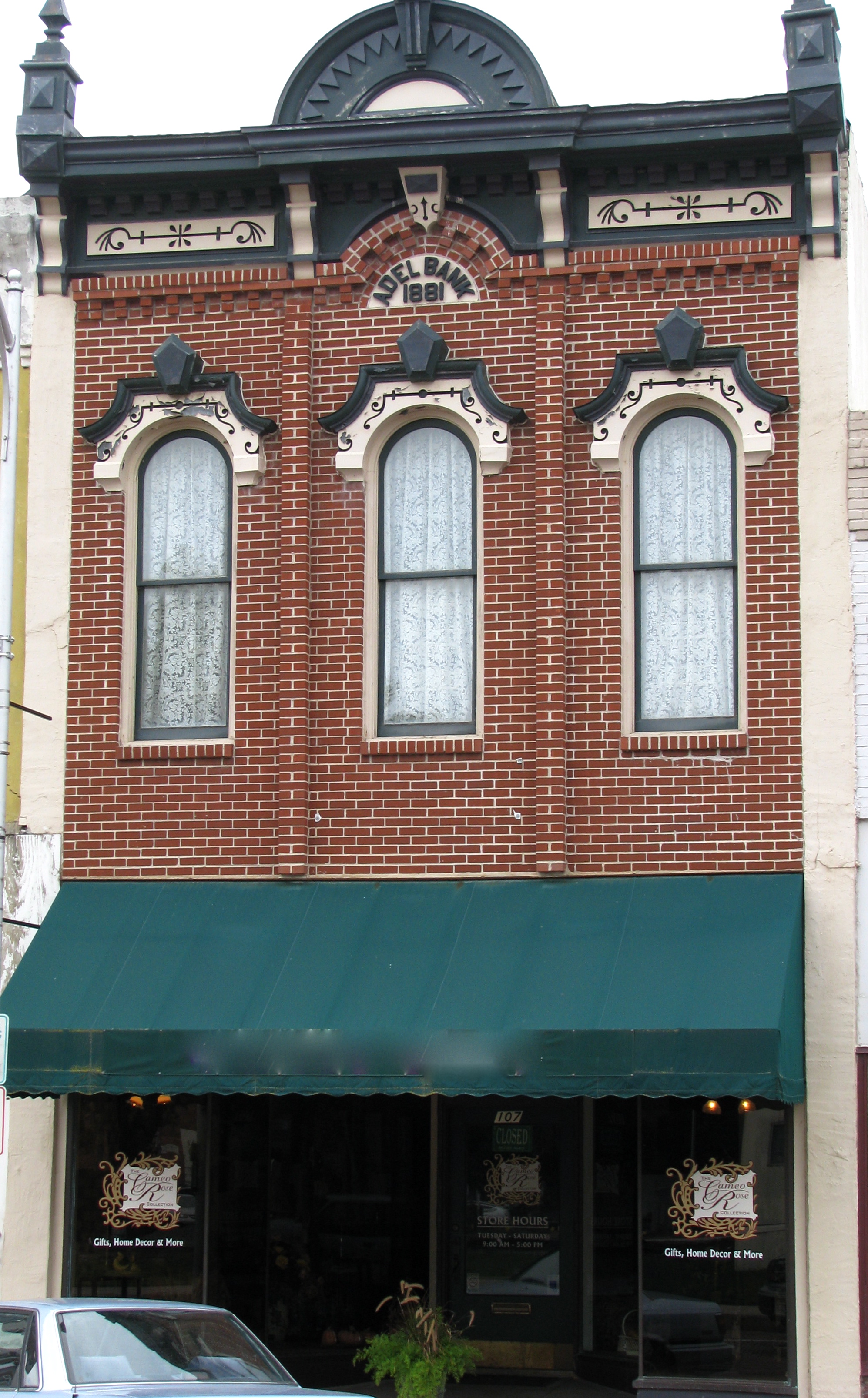
[3] Landmark name [4] Image Date listed Location City or town Summary 1 Adel Bridge April 18, 2002 River St.
41°36′57″N 94°00′43″W / 41.615833°N 94.011944°WAdel 2 Adel Public Square Historic District 
December 18, 2009 About four blocks in downtown Adel centered on the public square
41°37′04″N 94°01′05″W / 41.617778°N 94.018056°WAdel 3 Beaver Creek Bridge June 25, 1998 M Ave. over Beaver Creek
41°50′47″N 94°02′53″W / 41.846389°N 94.048056°WPerry 4 Bruce's Snowball Market No. 1 Addition September 8, 2000 921 Railroad St.
41°50′15″N 94°06′17″W / 41.8375°N 94.104722°WPerry 5 Dallas County Courthouse 
November 26, 1973 Town Sq.
41°37′04″N 94°01′03″W / 41.617778°N 94.0175°WAdel 6 Dexter Community House March 3, 1975 707 Dallas St.
41°31′01″N 94°13′36″W / 41.516944°N 94.226667°WDexter 7 Dowtown Perry Historic District September 8, 2000 Between 3rd St., Lucinda St., 1st Ave., and Railroad St.
41°50′24″N 94°06′14″W / 41.84°N 94.103889°WPerry 8 Robert William Andrew Feller Farmstead December 17, 1999 2965 340th Tr.
41°32′45″N 93°54′29″W / 41.545833°N 93.908056°WVan Meter 9 Jones Business College November 30, 2000 1305 Otley Ave.
41°50′15″N 94°06′12″W / 41.8375°N 94.103333°WPerry 10 Anthony M. McColl House February 5, 1987 502 S. Main St.
41°51′12″N 93°55′19″W / 41.853333°N 93.921944°WWoodward 11 Perry Carnegie Library Building October 3, 1996 1123 Willis Ave.
41°50′18″N 94°06′18″W / 41.838333°N 94.105°WPerry 12 Prairie Center Methodist Episcopal Church and Pleasand Hill Cemetery October 12, 2004 Beaumont Ave. and 200th St.
41°44′45″N 94°15′02″W / 41.745833°N 94.250556°WYale 13 St. Patrick's Catholic Church and Rectory March 22, 2011 1312 Third St.
41°50′27″N 94°06′12″W / 41.840833°N 94.103333°WPerry 14 John Wilson House March 30, 1979 Southwest of De Soto
41°30′30″N 94°05′33″W / 41.508333°N 94.0925°WDe Soto See also
References
- ^ The latitude and longitude information provided in this table was derived originally from the National Register Information System, which has been found to be fairly accurate for about 99% of listings. For about 1% of NRIS original coordinates, experience has shown that one or both coordinates are typos or otherwise extremely far off; some corrections may have been made. A more subtle problem causes many locations to be off by up to 150 yards, depending on location in the country: most NRIS coordinates were derived from tracing out latitude and longitudes off of USGS topographical quadrant maps created under the North American Datum of 1927, which differs from the current, highly accurate WGS84 GPS system used by Google maps. Chicago is about right, but NRIS longitudes in Washington are higher by about 4.5 seconds, and are lower by about 2.0 seconds in Maine. Latitudes differ by about 1.0 second in Florida. Some locations in this table may have been corrected to current GPS standards.
- ^ "National Register of Historic Places: Weekly List Actions". National Park Service, United States Department of the Interior. Retrieved on November 10, 2011.
- ^ Numbers represent an ordering by significant words. Various colorings, defined here, differentiate National Historic Landmark sites and National Register of Historic Places Districts from other NRHP buildings, structures, sites or objects.
- ^ "National Register Information System". National Register of Historic Places. National Park Service. . http://nrhp.focus.nps.gov/natreg/docs/All_Data.html.
U.S. National Register of Historic Places Topics Lists by states Alabama • Alaska • Arizona • Arkansas • California • Colorado • Connecticut • Delaware • Florida • Georgia • Hawaii • Idaho • Illinois • Indiana • Iowa • Kansas • Kentucky • Louisiana • Maine • Maryland • Massachusetts • Michigan • Minnesota • Mississippi • Missouri • Montana • Nebraska • Nevada • New Hampshire • New Jersey • New Mexico • New York • North Carolina • North Dakota • Ohio • Oklahoma • Oregon • Pennsylvania • Rhode Island • South Carolina • South Dakota • Tennessee • Texas • Utah • Vermont • Virginia • Washington • West Virginia • Wisconsin • WyomingLists by territories Lists by associated states Other Municipalities and communities of Dallas County, Iowa Cities 
Townships Adams | Adel | Beaver | Boone | Colfax | Dallas | Des Moines | Grant | Lincoln | Linn | Spring Valley | Sugar Grove | Union | Van Meter | Walnut | Washington
Unincorporated
communityFootnotes ‡This populated place also has portions in an adjacent county or counties
Categories:- National Register of Historic Places in Iowa by county
- Dallas County, Iowa
- Buildings and structures in Dallas County, Iowa
-


Wikimedia Foundation. 2010.