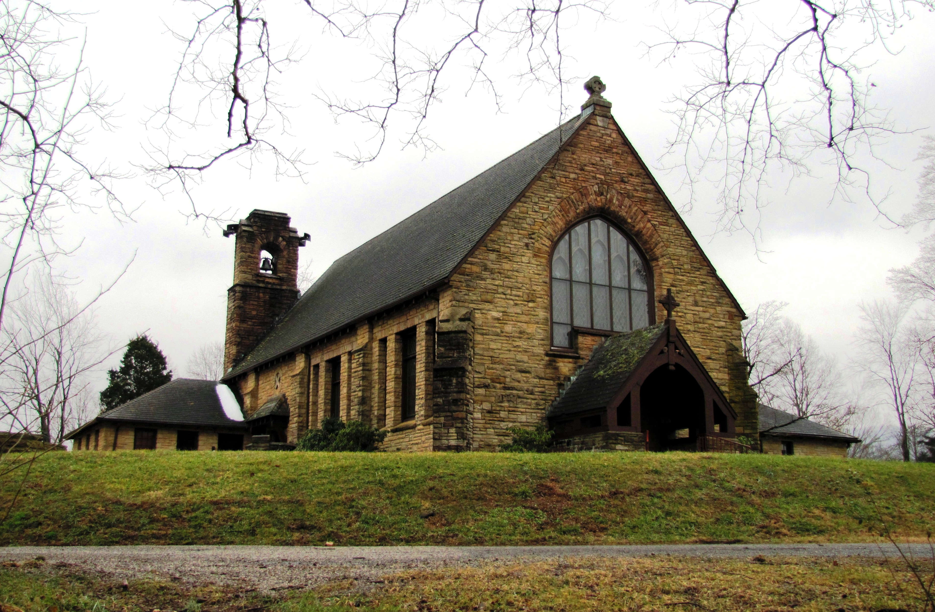
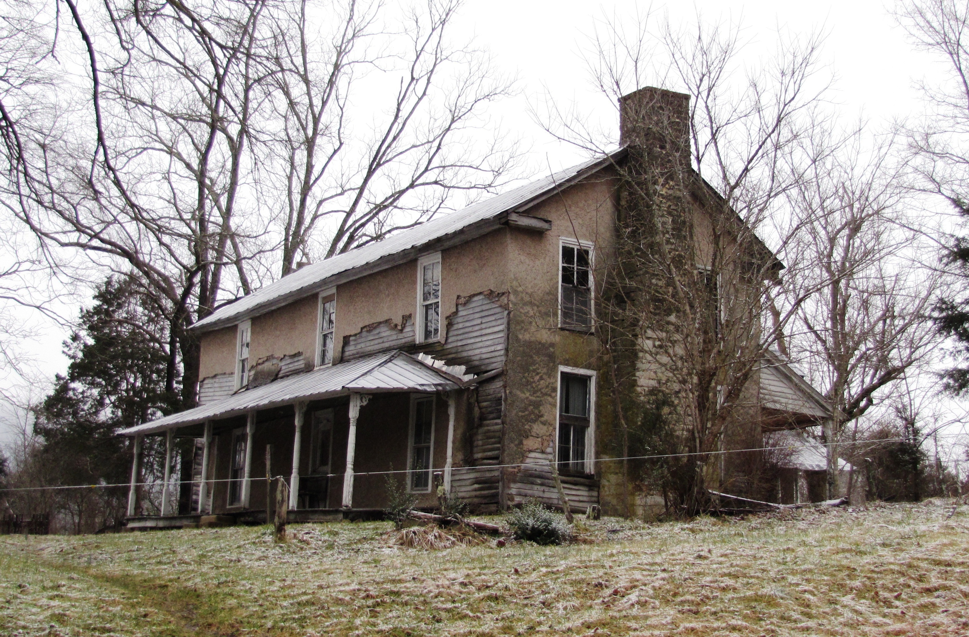
- National Register of Historic Places listings in Tennessee
-
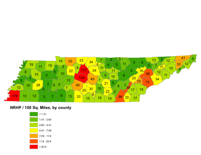
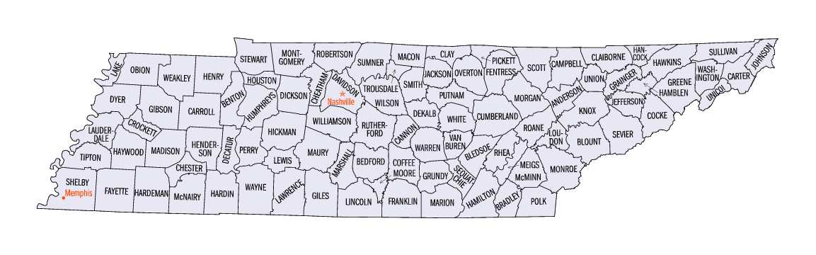
 Tennessee's counties
This is a list of properties and historic districts in Tennessee that are listed on the National Register of Historic Places. There are over 1,900 in total. Of these, 29 are National Historic Landmarks. Each of Tennessee's 95 counties has at least one listing.
The locations of National Register properties and districts (at least for all showing latitude and longitude coordinates below), may be seen in a Google map by clicking on "Map of all coordinates".[1]
Current listings by county
The following are approximate tallies of current listings by county. These counts are based on entries in the National Register Information Database as of April 24, 2008[2] and new weekly listings posted since then on the National Register of Historic Places web site.[3] There are frequent additions to the listings and occasional delistings and the counts here are approximate and not official. New entries are added to the official Register on a weekly basis.[4] Also, the counts in this table exclude boundary increase and decrease listings which only modify the area covered by an existing property or district, although carrying a separate National Register reference number.
-
- This National Park Service list is complete through NPS recent listings posted November 10, 2011.[5]
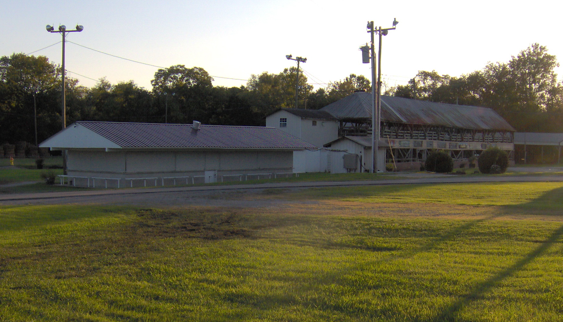
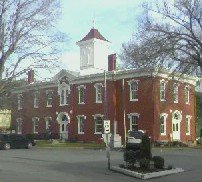
County # of Sites 1 Anderson 17 2 Bedford 30 3 Benton 5 4 Bledsoe 8 5 Blount 73 6 Bradley 20 7 Campbell 6 8 Cannon 7 9 Carroll 4 10 Carter 12 11 Cheatham 8 12 Chester 2 13 Claiborne 13 14 Clay 2 15 Cocke 12 16 Coffee 11 17 Crockett 1 18 Cumberland 8 19 Davidson 180 20 Decatur 5 21 DeKalb 5 22 Dickson 22 23 Dyer 8 24 Fayette 13 25 Fentress 11 26 Franklin 19 27 Gibson 16 28 Giles 34 29 Grainger 7 30 Greene 16 31 Grundy 22 32 Hamblen 11 33 Hamilton 100 34 Hancock 2 35 Hardeman 12 36 Hardin 7 37 Hawkins 12 38 Haywood 10 39 Henderson 4 40 Henry 15 41 Hickman 12 42 Houston 3 43 Humphreys 10 44 Jackson 4 45 Jefferson 12 46 Johnson 6 47 Knox 102 48 Lake 1 49 Lauderdale 5 50 Lawrence 13 51 Lewis 7 52 Lincoln 15 53 Loudon 19 54 Macon 7 55 Madison 28 56 Marion 14 57 Marshall 20 58 Maury 65 59 McMinn 17 60 McNairy 3 61 Meigs 38 62 Monroe 18 63 Montgomery 53 64 Moore 6 65 Morgan 2 66 Obion 19 67 Overton 5 68 Perry 6 69 Pickett 3 70 Polk 17 71 Putnam 13 72 Rhea 7 73 Roane 20 74 Robertson 24 75 Rutherford 46 76 Scott 5 77 Sequatchie 5 78 Sevier 34 79 Shelby 176 80 Smith 12 81 Stewart 15 82 Sullivan 43 83 Sumner 35 84 Tipton 12 85 Trousdale 6 86 Unicoi 4 87 Union 5 88 Van Buren 3 89 Warren 22 90 Washington 33 91 Wayne 8 92 Weakley 11 93 White 11 94 Williamson 136 95 Wilson 24 (duplicates) (19)[6] Total: 1,991 Anderson County
Bedford County
Benton County
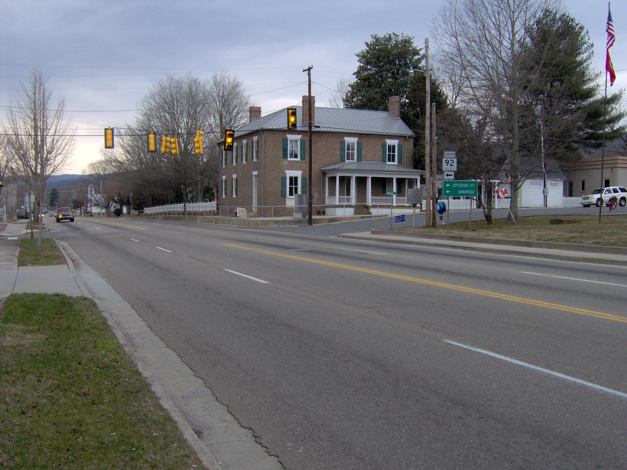
[7] Landmark name [2] Image Date listed Location City or town Summary 1 Mount Zion Church October 2, 1973 5.5 miles southeast of Big Sandy
36°10′41″N 88°01′10″W / 36.178056°N 88.019444°WBig Sandy 2 Reynoldsburg-Paris Road August 7, 2005 5.0 miles northeast of Camden off Chestnut Hill Rd.
36°06′00″N 87°58′36″W / 36.1°N 87.976667°WCamden 3 John Rushing Farm December 17, 1999 5760 N. State Route 69A
36°08′00″N 88°06′15″W / 36.133333°N 88.104167°WCamden 4 William Thompson House May 6, 1976 South of Camden, off State Route 69
36°02′24″N 88°05′37″W / 36.04°N 88.093611°WCamden 5 US Post Office September 23, 1988 81 N. Forest St.
36°03′30″N 88°05′49″W / 36.058333°N 88.096944°WCamden Bledsoe County
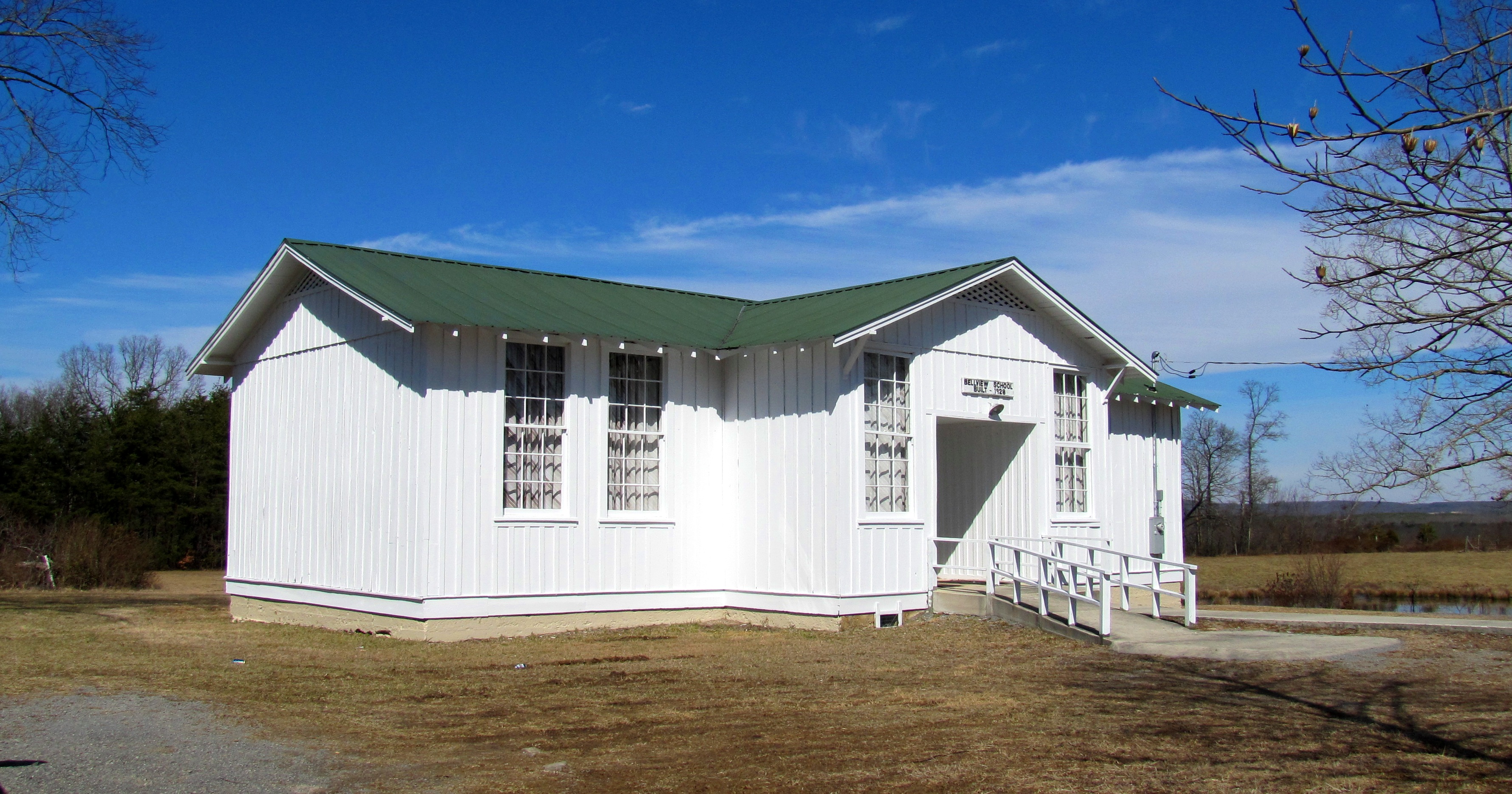
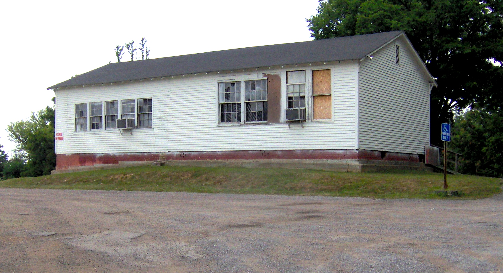
[7] Landmark name [2] Image Date listed Location City or town Summary 1 Bellview School 
March 5, 1999 State Route 101
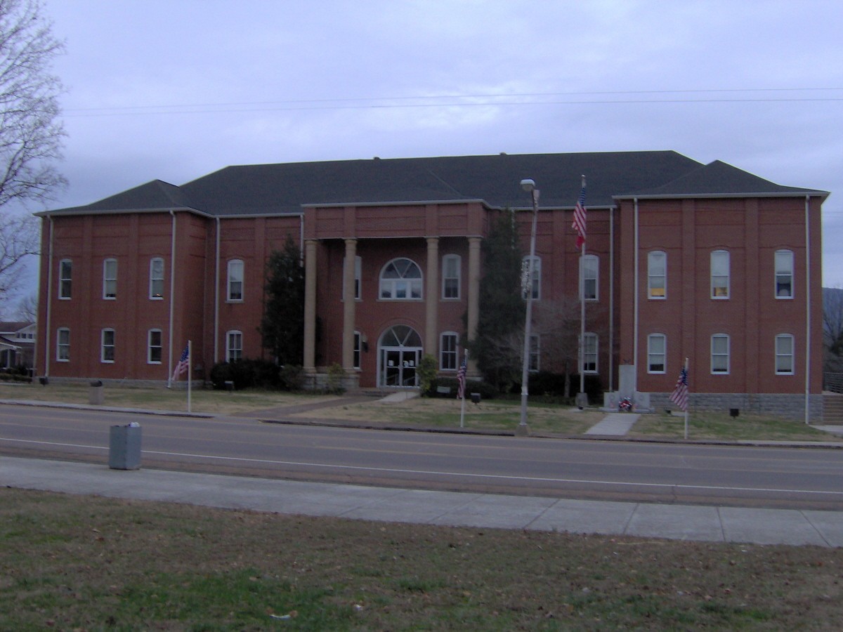
35°44′44″N 85°10′42″W / 35.745556°N 85.178333°WPikeville Rural schoolhouse built in 1928; now used as a community center 2 Bledsoe County Courthouse 
March 30, 1995 Town Sq.
35°36′20″N 85°11′19″W / 35.605556°N 85.188611°WPikeville 3 Bledsoe County Jail 
November 12, 2008 128 Frazier St. Pikeville Still serves as the county's jail 4 John Bridgman House 
June 24, 1993 106 E. Spring St.
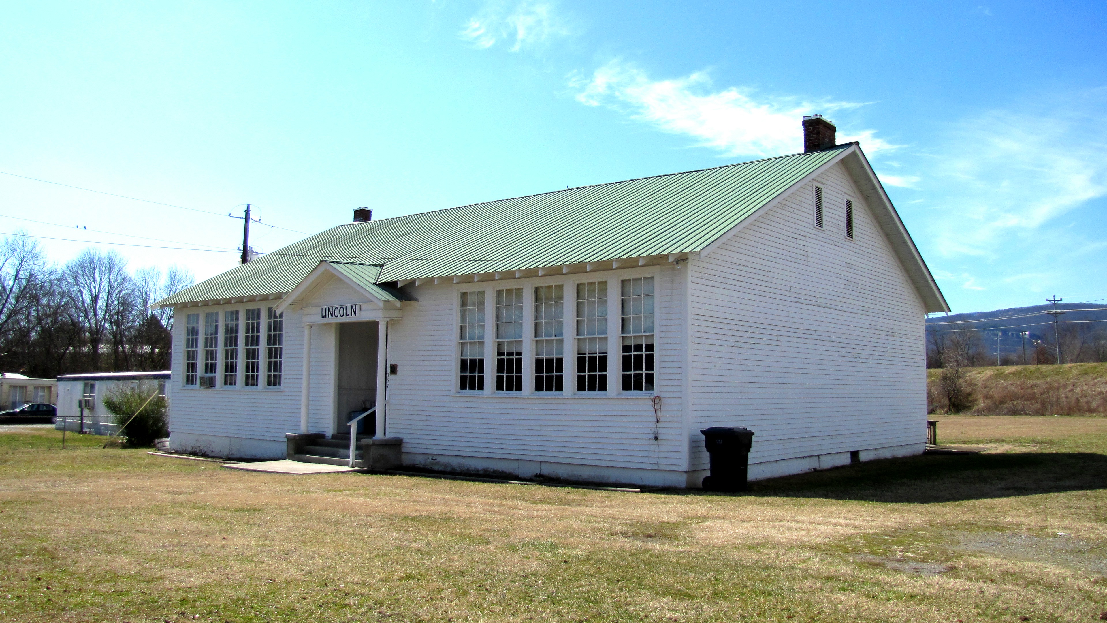
35°36′06″N 85°10′59″W / 35.601667°N 85.183056°WPikeville Federal-style house built in 1815 5 Lincoln School 
July 15, 1993 Old State Route 28 near Rockford Rd.
35°36′44″N 85°11′26″W / 35.612222°N 85.190556°WPikeville A Rosenwald school built in the 1920s 6 Pikeville Chapel African Methodist Episcopal Zion Church 
November 30, 1999 E. Valley Dr.
35°36′18″N 85°11′08″W / 35.605°N 85.185556°WPikeville Originally a Freedmen's Bureau school built in 1870; converted to AME Zion church in 1888 7 Dr. James A. Ross House 
June 25, 1999 102 Frazier St.
35°36′20″N 85°11′16″W / 35.605556°N 85.187778°WPikeville Home and office of Dr. James Ross, built c. 1872; now home to the Museum of Bledsoe County History 8 South Main Street Historic District 
April 21, 1994 200-422 S. Main St;.
35°36′06″N 85°11′25″W / 35.601667°N 85.190278°WPikeville Blount County
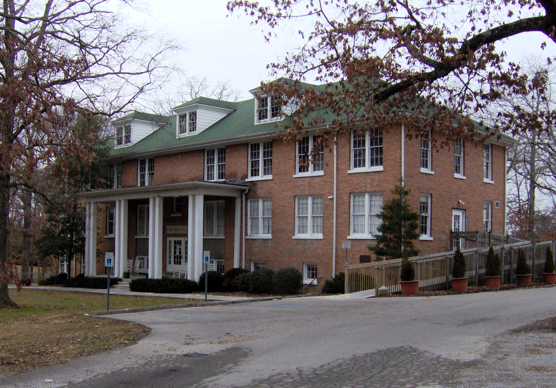
Bradley County
Campbell County
[7] Landmark name [2] Image Date listed Location City or town Summary 1 Jellico Commercial Historic District 
November 12, 1999 Roughly along North and South Main Sts.
36°35′15″N 84°07′44″W / 36.5875°N 84.128889°WJellico 2 Kincaid-Howard House March 16, 1976 State Route 63
36°24′32″N 84°03′04″W / 36.408889°N 84.051111°WFincastle 3 LaFollette House May 29, 1975 Indiana Ave.
36°23′01″N 84°07′06″W / 36.383611°N 84.118333°WLaFollette 4 A.E. Perkins House 
December 8, 1997 130 Valley St.
36°19′55″N 84°10′50″W / 36.331944°N 84.180556°WJacksboro 5 Smith-Little-Mars House November 7, 1976 West of Speedwell on State Route 63
36°26′41″N 83°55′45″W / 36.444722°N 83.929167°WSpeedwell 6 U.S. Post Office and Mine Rescue Station February 10, 1984 Main and 2nd Sts.
36°35′23″N 84°07′34″W / 36.589722°N 84.126111°WJellico Cannon County
[7] Landmark name [2] Image Date listed Location City or town Summary 1 Baptist Female College-Adams House June 25, 1987 210 S. College St.
35°49′34″N 86°04′31″W / 35.826111°N 86.075278°WWoodbury 2 Brevard-Macon House December 23, 1994 902 W. Main St.
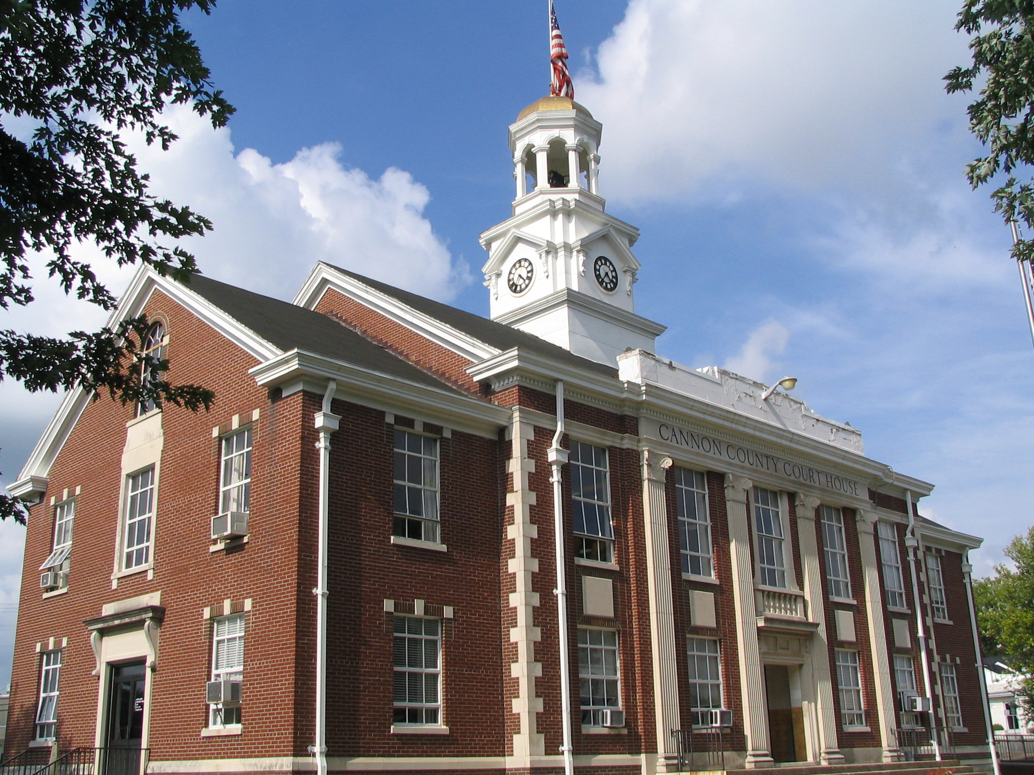
35°49′37″N 86°04′56″W / 35.826944°N 86.082222°WWoodbury 3 Cannon County Courthouse 
April 14, 1992 Court Sq.
35°49′42″N 86°04′15″W / 35.828333°N 86.070833°WWoodbury 4 William Cannon Houston House June 16, 1989 107 Houston Ln.
35°49′30″N 86°03′30″W / 35.825°N 86.058333°WWoodbury 5 Ready-Cates Farm July 27, 2005 1662 Northcutt Rd.
35°53′22″N 86°07′45″W / 35.889444°N 86.129167°WMilton 6 Readyville Mill July 2, 1973 On U.S. Route 70S
35°49′48″N 86°10′35″W / 35.83°N 86.176389°WReadyville 7 Rucker-Mason Farm January 9, 2007 837 Hare Ln.
35°54′13″N 86°08′40″W / 35.903611°N 86.144444°WPorterfield Carroll County
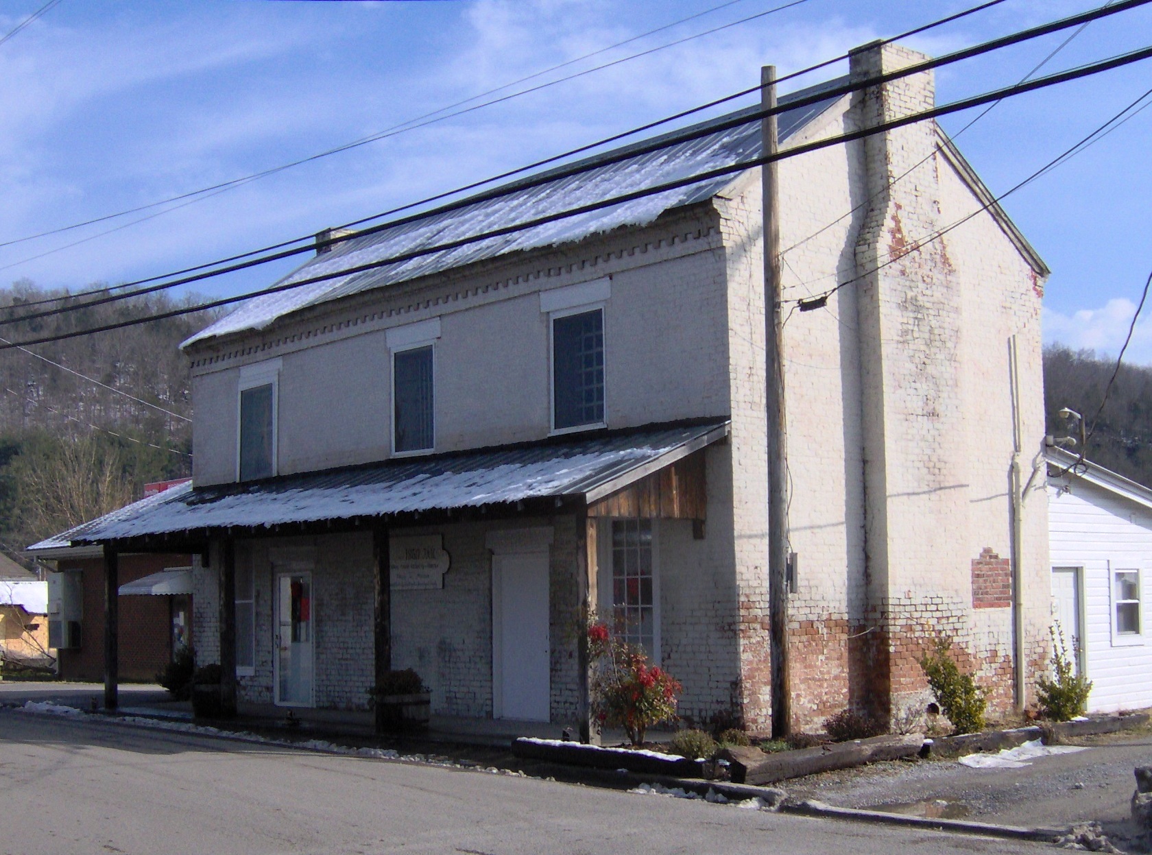
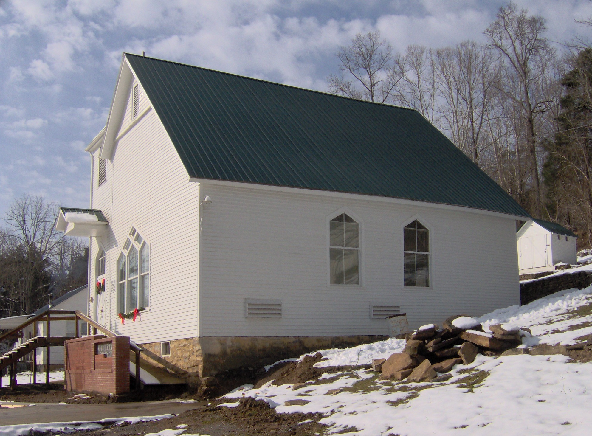
[7] Landmark name [2] Image Date listed Location City or town Summary 1 First Cumberland Presbyterian Church-McKenzie June 17, 1993 305 N. Stonewall St.
36°08′00″N 88°31′13″W / 36.133333°N 88.520278°WMcKenzie 2 Hillsman House March 25, 1982 Old Hinkledale-McKenzie Rd.
36°02′23″N 88°36′44″W / 36.039722°N 88.612222°WTrezevant 3 Long Rock Methodist Episcopal Church, South July 16, 2010 340 Long Rock Church Rd.
36°02′59″N 88°24′03″W / 36.049722°N 88.400833°WHuntingdon vicinity 4 McKenzie Depot March 28, 1996 85 E. Bruce St.
36°07′52″N 88°31′09″W / 36.131111°N 88.519167°WMcKenzie Carter County
Cheatham County
[7] Landmark name [2] Image Date listed Location City or town Summary 1 Cheatham County Courthouse 
December 12, 1976 Court Sq.
36°16′29″N 87°03′49″W / 36.274722°N 87.063611°WAshland City 2 Indian Town Bluff August 30, 1974 Address Restricted Ashland City 3 Kingston Springs Hotel and Buildings October 31, 1979 Kingston Springs Rd.
36°05′41″N 87°06′48″W / 36.094722°N 87.113333°WKingston Springs 4 Montgomery Bell Tunnel 
April 19, 1994 Junction of the Harpeth River and Bell Bend Rd.
36°08′49″N 87°07′19″W / 36.146944°N 87.121944°WWhite Bluff 5 Mound Bottom 
September 3, 1971 Along the Harpeth River below Kingston Springs, in Harpeth River State Park
36°8′23.35″N 87°6′4.93″W / 36.1398194°N 87.1013694°W[8]Kingston Springs 6 Patterson Forge (40CH87) April 16, 1971 Address Restricted Kingston Springs 7 Sycamore Mills Site July 9, 1979 Address Restricted Ashland City 8 Turnbull Forge (40CH97) July 20, 1988 Address Restricted Kingston Springs Chester County
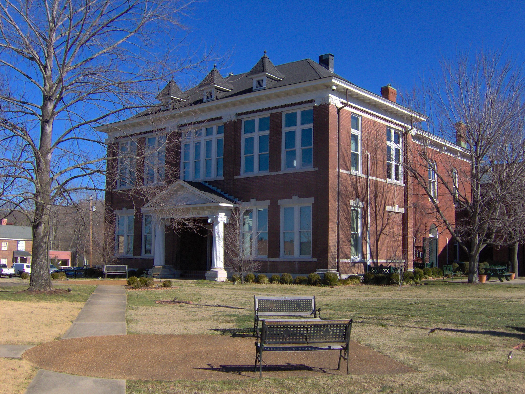
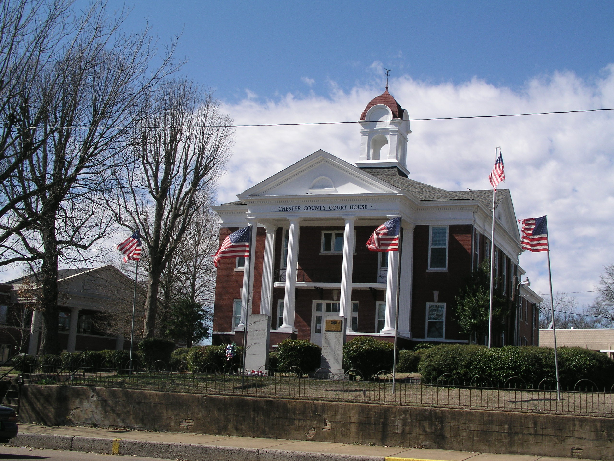
[7] Landmark name [2] Image Date listed Location City or town Summary 1 Chester County Courthouse 
March 26, 1979 Court Sq.
35°26′24″N 88°38′27″W / 35.44°N 88.640833°WHenderson 2 Hamlett-Smith House December 1, 1983 Jacks Creek-Mifflin Rd.
35°29′19″N 88°31′17″W / 35.488611°N 88.521389°WJacks Creek Claiborne County
Clay County
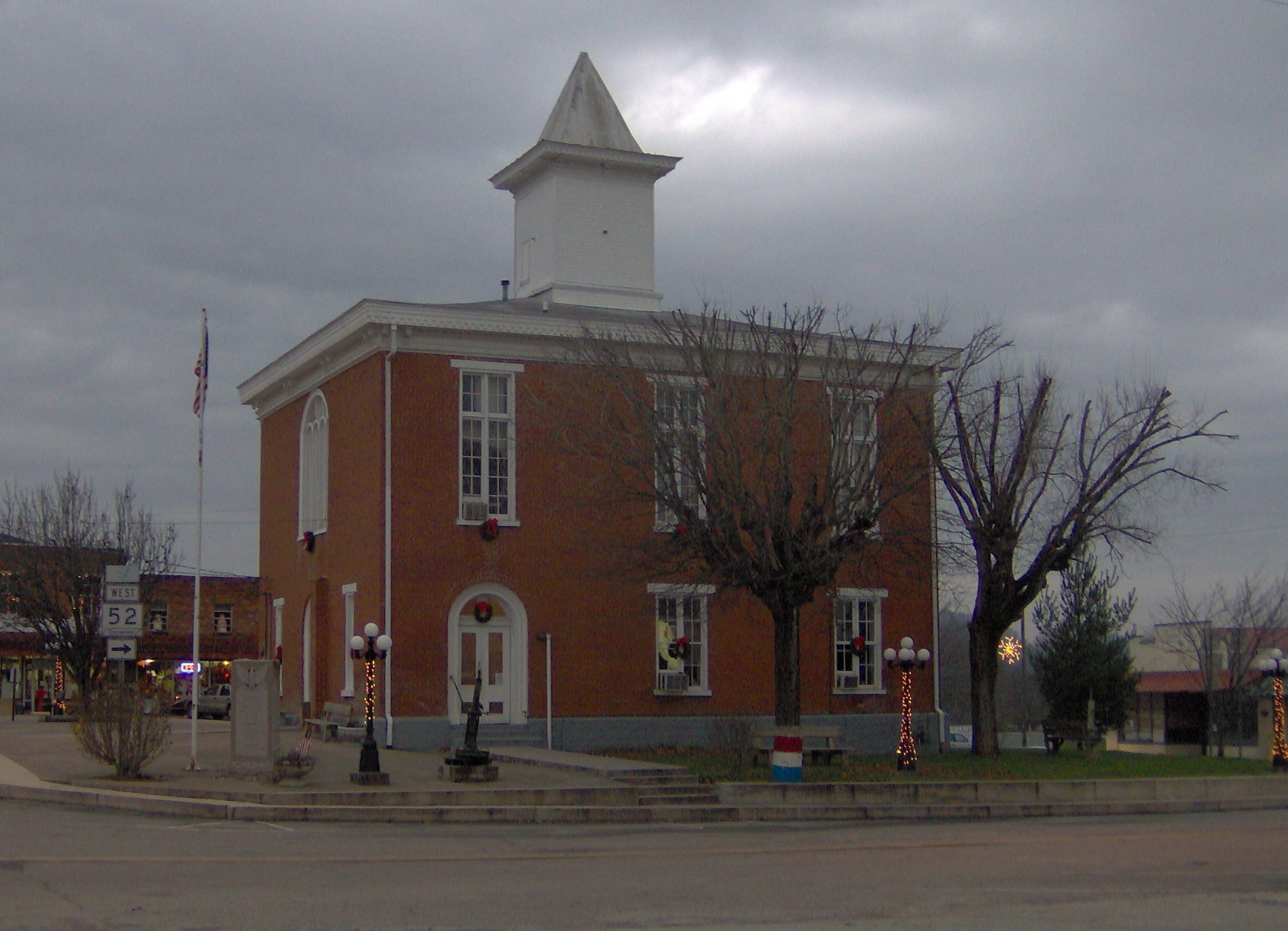
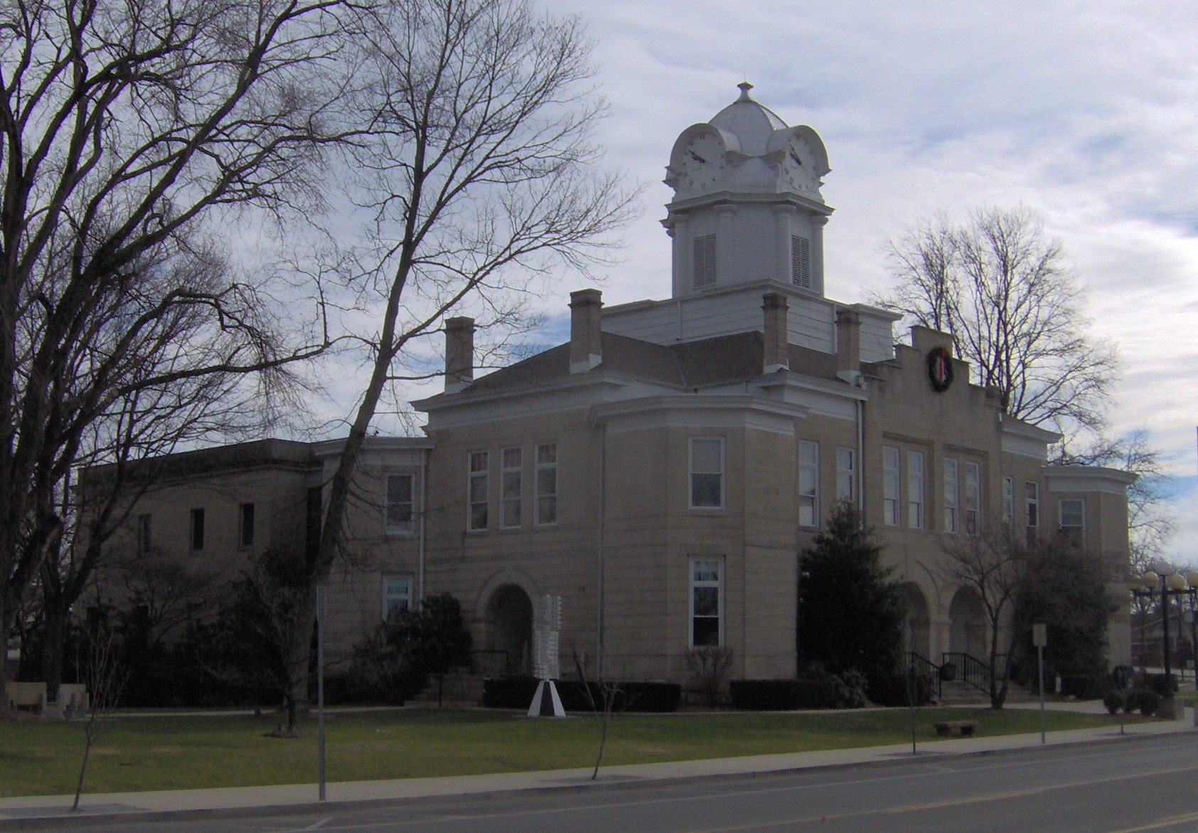
[7] Landmark name [2] Image Date listed Location City or town Summary 1 Clay County Courthouse 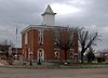
September 22, 1977 State Route 52
36°33′02″N 85°30′22″W / 36.550556°N 85.506111°WCelina 2 Free Hills Rosenwald School 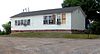
November 15, 1996 Free Hills Rd., east of State Route 52
36°33′49″N 85°29′23″W / 36.563611°N 85.489722°WFree Hill One of only about 30 Rosenwald schools still extant, was built to educate African Americans and used from circa 1925 to 1949. Cocke County
Coffee County
Crockett County
[7] Landmark name [2] Image Date listed Location City or town Summary 1 Bank of Alamo June 26, 1986 103 S. Bells St.
35°47′06″N 89°07′02″W / 35.785°N 89.117222°WAlamo Cumberland County
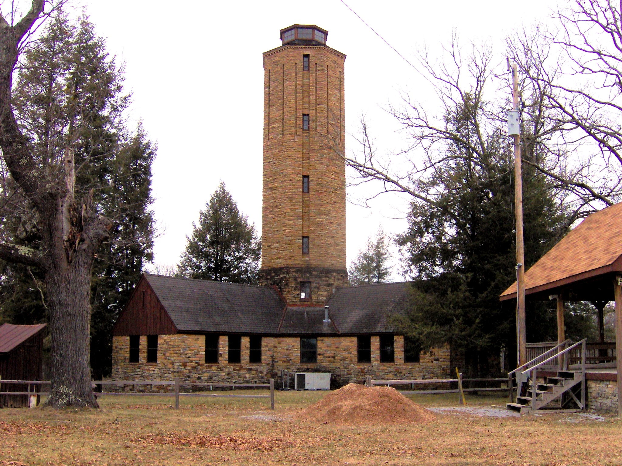
[7] Landmark name [2] Image Date listed Location City or town Summary 1 Camp Nakanawa Wigwam 
November 12, 1999 Camp Nakanawa Wigwam Rd.
36°03′48″N 85°11′45″W / 36.063333°N 85.195833°WMayland 2 Crossville Tennessee Highway Patrol Building 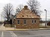
April 18, 2003 39 Main St.
35°56′51″N 85°01′33″W / 35.9475°N 85.025833°WCrossville Currently serves as the Tennessee Native Stone Museum to commemorate the uses and history of native Crab Orchard Stone. 3 Cumberland County Courthouses 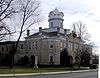
June 17, 1980 Main St.
35°56′53″N 85°01′37″W / 35.948056°N 85.026944°WCrossville 4 Cumberland Homesteads Historic District 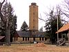
September 30, 1988 Roughly along County Seat and Valley Rds., Grassy Cove Rd., Deep Draw and Pigeon Ridge Rds.
35°54′22″N 84°58′58″W / 35.906111°N 84.982778°WCrossville Includes several hundred houses and public buildings of 1930s-era planned community; also includes parts of Cumberland Mountain State Park 5 Cumberland Mountain School 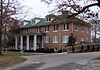
August 5, 1993 Western side of Old U.S. Route 127N, 2 miles north of Crossville
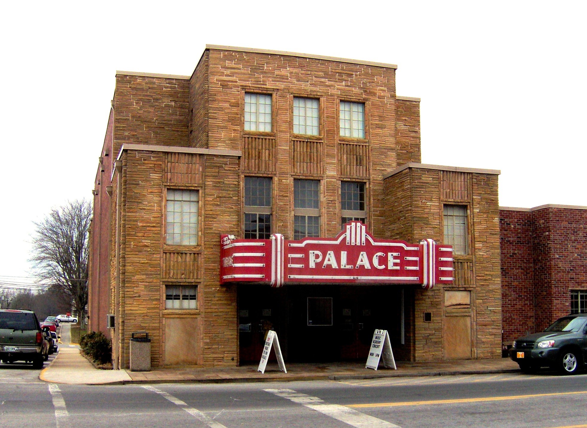
35°58′45″N 85°02′07″W / 35.979167°N 85.035278°WCrossville 6 Palace Theater 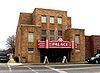
January 7, 1994 210 N. Main St.
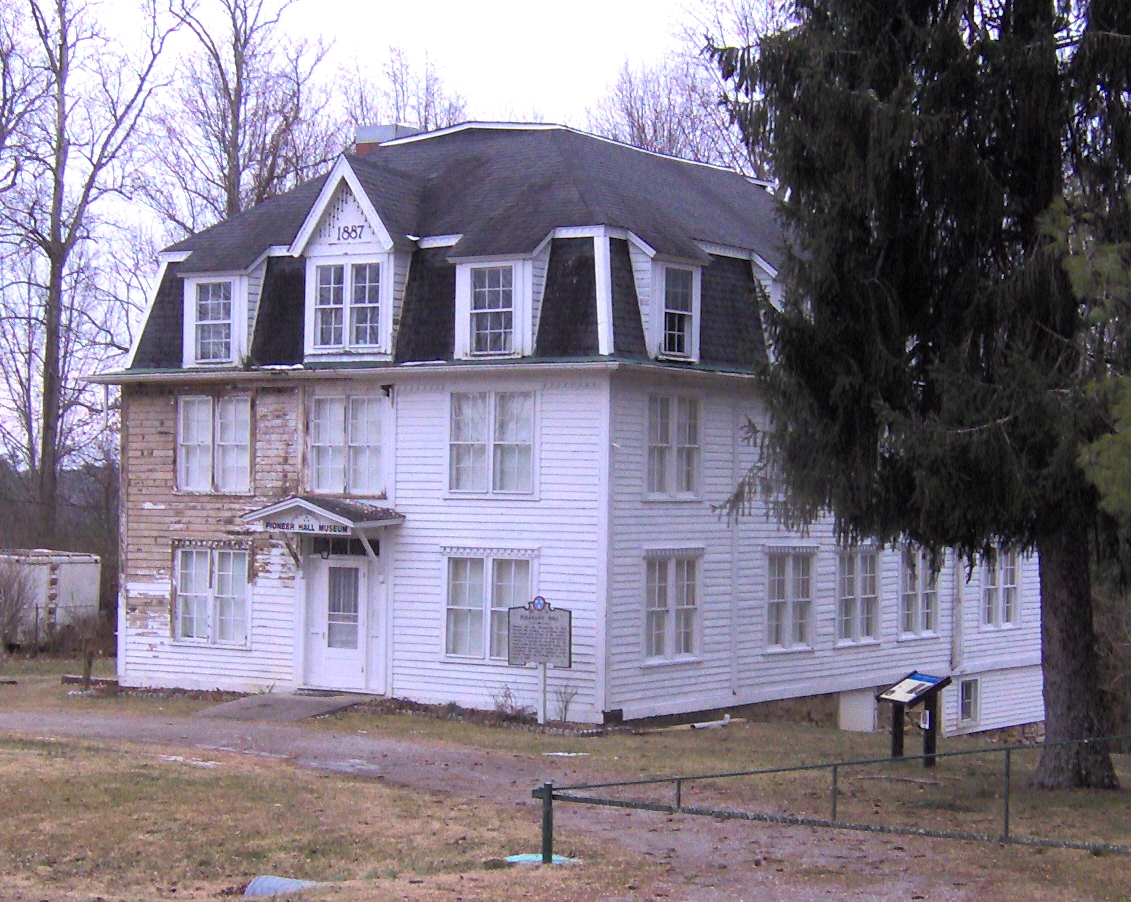
35°56′49″N 85°01′33″W / 35.946944°N 85.025833°WCrossville Now used as a community center 7 Pioneer Hall 
November 21, 1978 Main St.
35°58′34″N 85°11′40″W / 35.976111°N 85.194444°WPleasant Hill Once part of the Pleasant Hill Academy; now a local museum 8 Greenberry Wilson House June 28, 1996 E.G. Wilson Rd., 7 miles southeast of Crossville
35°46′08″N 85°01′53″W / 35.768889°N 85.031389°WBurke Davidson County
DeKalb County
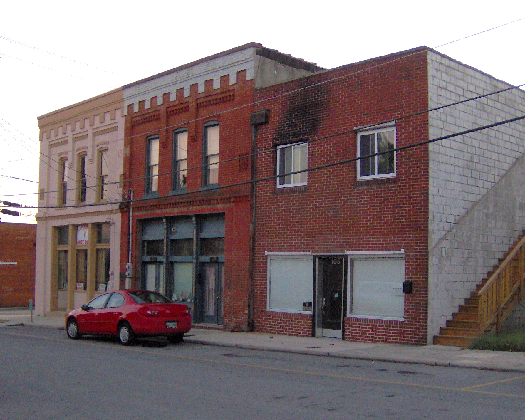
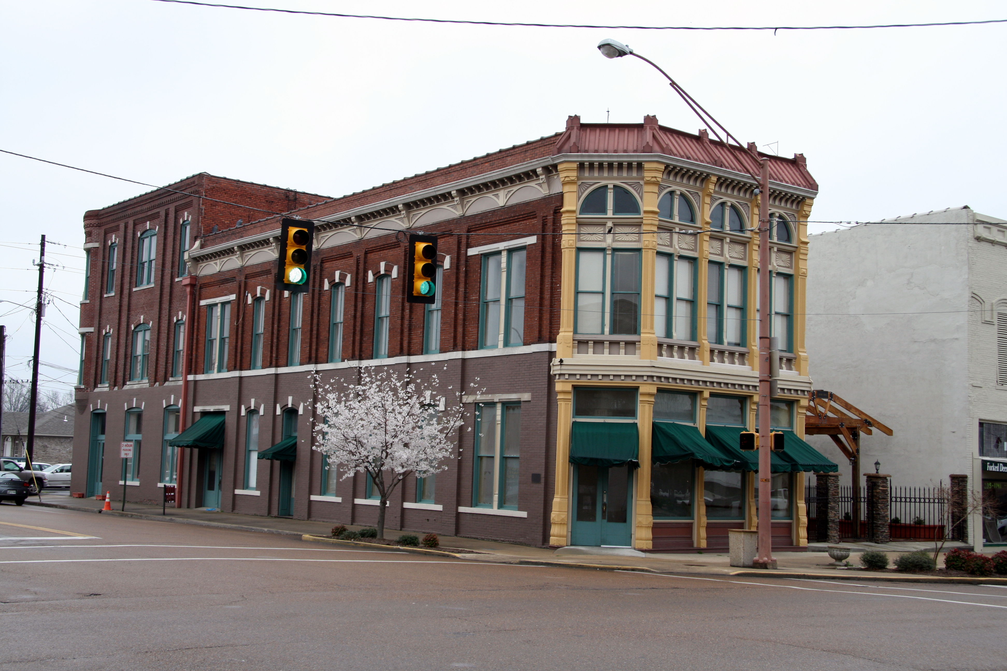
[7] Landmark name [2] Image Date listed Location City or town Summary 1 Alexandria Cemeteries Historic District 
May 30, 2002 Cemetery St.
36°04′34″N 86°01′44″W / 36.076111°N 86.028889°WAlexandria 2 DeKalb County Fairgrounds 
November 29, 1995 103 Fairground Rd.
36°04′41″N 86°01′55″W / 36.078056°N 86.031944°WAlexandria 3 Evans Block 
August 30, 1984 101 and 103 N. 4th St.
35°57′41″N 85°48′50″W / 35.961389°N 85.813889°WSmithville 4 Susie Foster Log House July 3, 2007 810 College St.
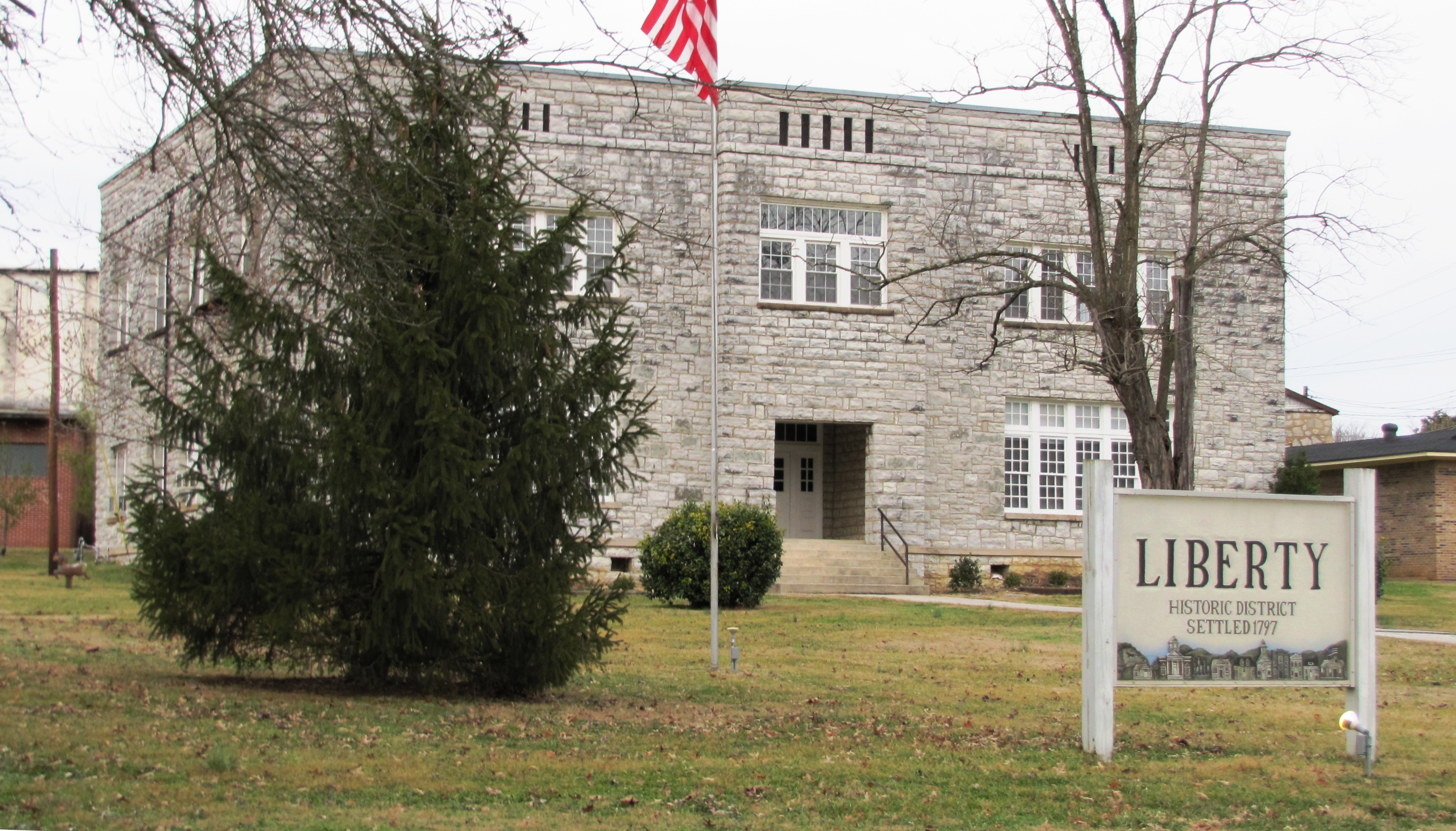
35°57′01″N 85°48′57″W / 35.950278°N 85.815833°WSmithville 5 Liberty Historic District 
June 25, 1987 Roughly along Main and N. Main Sts.
36°00′18″N 85°57′58″W / 36.005°N 85.966111°WLiberty Decatur County
[7] Landmark name [2] Image Date listed Location City or town Summary 1 Dr. Beauregard Martin Brooks House September 3, 1992 State Route 114 (Clifton Ferry Rd.) east of its junction with State Route 69
35°26′21″N 88°05′21″W / 35.439167°N 88.089167°WBath Springs 2 Brownsport I Furnace (40DR85) July 28, 1988 Address Restricted Gumdale 3 Brownsport II Furnace (40DR86) August 26, 1977 Address Restricted Decaturville 4 Decatur Furnace (40DR84) July 28, 1988 Address Restricted Bath Springs 5 John P. Rains Hotel November 21, 1978 106-108 Tennessee Ave., S.
35°38′57″N 88°07′36″W / 35.649167°N 88.126667°WParsons Dickson County
Dyer County
[7] Landmark name [2] Image Date listed Location City or town Summary 1 Bank of Dyersburg 
June 16, 1983 100 N. Main St.
36°01′57″N 89°23′07″W / 36.0325°N 89.385278°WDyersburg 2 Dyersburg Courthouse Square Historic District 
February 28, 1991 Roughly bounded by Church, Main, Cedar, and Court Sts.
36°01′48″N 89°23′02″W / 36.03°N 89.383889°WDyersburg 3 Gordon-Oak Streets Historic District May 8, 1992 107-302 Gordon and 114-305 Oak Sts., and the western side of 711-731 Sampson Ave.
36°02′22″N 89°22′58″W / 36.039444°N 89.382778°WDyersburg 4 Edward Moody King House 
October 25, 1990 512 Finley St.
36°02′03″N 89°23′27″W / 36.034167°N 89.390833°WDyersburg 5 Latta House November 14, 1978 917 Troy Ave.
36°02′31″N 89°23′06″W / 36.041944°N 89.385°WDyersburg 6 Newbern Illinois Central Depot 
March 25, 1993 Junction of Main and Jefferson Sts.
36°06′44″N 89°15′44″W / 36.112222°N 89.262222°WNewbern 7 Pleasant Hill Cemetery 
November 13, 2003 Approximately 0.7 miles west of the cattle gate at the end of Cemetery Rd.
36°02′45″N 89°29′04″W / 36.045833°N 89.484444°WFinley 8 Troy Avenue Historic District 
May 8, 1992 827-1445 Troy Ave., western side
36°02′36″N 89°23′07″W / 36.043333°N 89.385278°WDyersburg Fayette County
Fentress County
Franklin County
Gibson County
Giles County
Grainger County
[7] Landmark name [2] Image Date listed Location City or town Summary 1 William Cocke House July 3, 1980 Northeast of Rutledge
36°18′06″N 83°27′24″W / 36.301667°N 83.456667°WRutledge 2 Henderson Chapel African Methodist Episcopal Zion Church June 22, 2000 Church St.
36°16′53″N 83°30′59″W / 36.281389°N 83.516389°WRutledge 3 Lea Springs May 29, 1975 11 miles southwest of Rutledge off U.S. Route 11, west on Lea Lake Rd.
36°11′34″N 83°41′37″W / 36.192778°N 83.693611°WRutledge 4 Nance Building 
July 1, 1998 Junction of Marshall St. and U.S. Route 11W
36°16′51″N 83°30′54″W / 36.280833°N 83.515°WRutledge 5 Poplar Hill July 8, 1980 Northeast of Blaine
36°10′40″N 83°41′00″W / 36.177778°N 83.683333°WBlaine 6 Shields' Station April 24, 1973 U.S. Route 11W Blaine 7 Tate Springs Springhouse April 13, 1973 East of Bean Station on U.S. Route 11W
36°20′18″N 83°20′44″W / 36.338333°N 83.345556°WBean Station Greene County
Grundy County
Hamblen County
Hamilton County
Hancock County
[7] Landmark name [2] Image Date listed Location City or town Summary 1 Old Jail 
April 11, 1973 Jail St.
36°31′46″N 83°13′00″W / 36.529444°N 83.216667°WSneedville 2 Vardy School Community Historic District 
November 8, 1984 Blackwater Rd.
36°35′03″N 83°11′19″W / 36.584167°N 83.188611°WSneedville The school has collapsed, but other structures in the district intact and preserved. Hardeman County
Hardin County
[7] Landmark name [2] Image Date listed Location City or town Summary 1 Cherry Mansion 
August 16, 1977 101 Main St.
35°13′32″N 88°15′24″W / 35.225556°N 88.256667°WSavannah 2 James Graham House October 29, 1991 Junction of State Route 69 and Airport Rd.
35°09′39″N 88°13′02″W / 35.160833°N 88.217222°WSavannah 3 Savannah Historic District April 2, 1980 Irregular pattern along Main, Deford, Guinn, Church, College, Williams and Cook Sts.; also 410 and 506 Main St.; also roughly bounded by College St., Main St., Tennessee St., and Williams St.
35°13′38″N 88°14′59″W / 35.227222°N 88.249722°WSavannah 410/506 Main St. represent a boundary increase of November 8, 1993; "roughly bounded" represent a boundary increase of August 7, 2009 4 Shiloh Indian Mounds Site 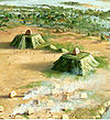
April 27, 1979 East of Hurley in Shiloh National Military Park
35°08′32″N 88°19′26″W / 35.142222°N 88.323889°WHurley 5 Shiloh National Military Park 
October 15, 1966 Off State Route 22
35°08′22″N 88°20′35″W / 35.139444°N 88.343056°WPittsburg Landing 6 Tanyard Branch Furnace (40HR121) April 9, 1988 Address Restricted Bath Springs 7 Meady White House July 1, 1993 Main St. (State Route 69)
35°22′39″N 88°12′31″W / 35.3775°N 88.208611°WSaltillo Hawkins County
Haywood County
Henderson County
[7] Landmark name [2] Image Date listed Location City or town Summary 1 Doe Creek School November 29, 2010 Doe Creek Rd., approximately ½ mile north of Dyer Rd.
35°28′11″N 88°14′51″W / 35.469722°N 88.2475°WSardis vicinity 2 Thompsie Edwards House June 30, 1983 113 Main St.
35°38′53″N 88°23′30″W / 35.648056°N 88.391667°WLexington 3 Montgomery High School July 3, 2007 Montgomery Ave.
35°39′02″N 88°23′58″W / 35.650556°N 88.399444°WLexington 4 Parker's Crossroads Battlefield February 22, 1999 State Route 22, 26 miles east of Jackson
35°47′33″N 88°23′40″W / 35.7925°N 88.394444°WParkers Crossroads Henry County
Hickman County
Houston County
[7] Landmark name [2] Image Date listed Location City or town Summary 1 Erin Limekilns November 10, 2004 708 McMillan St.
36°19′04″N 87°42′53″W / 36.317778°N 87.714722°WErin 2 V.R. Harris House August 18, 1983 Main St.
36°19′01″N 87°42′04″W / 36.316944°N 87.701111°WErin 3 Quarry Limekiln November 10, 2004 State Route 49, approximately 0.25 miles east of Denmark Rd.
36°19′01″N 87°42′47″W / 36.316944°N 87.713056°WErin Humphreys County
Jackson County
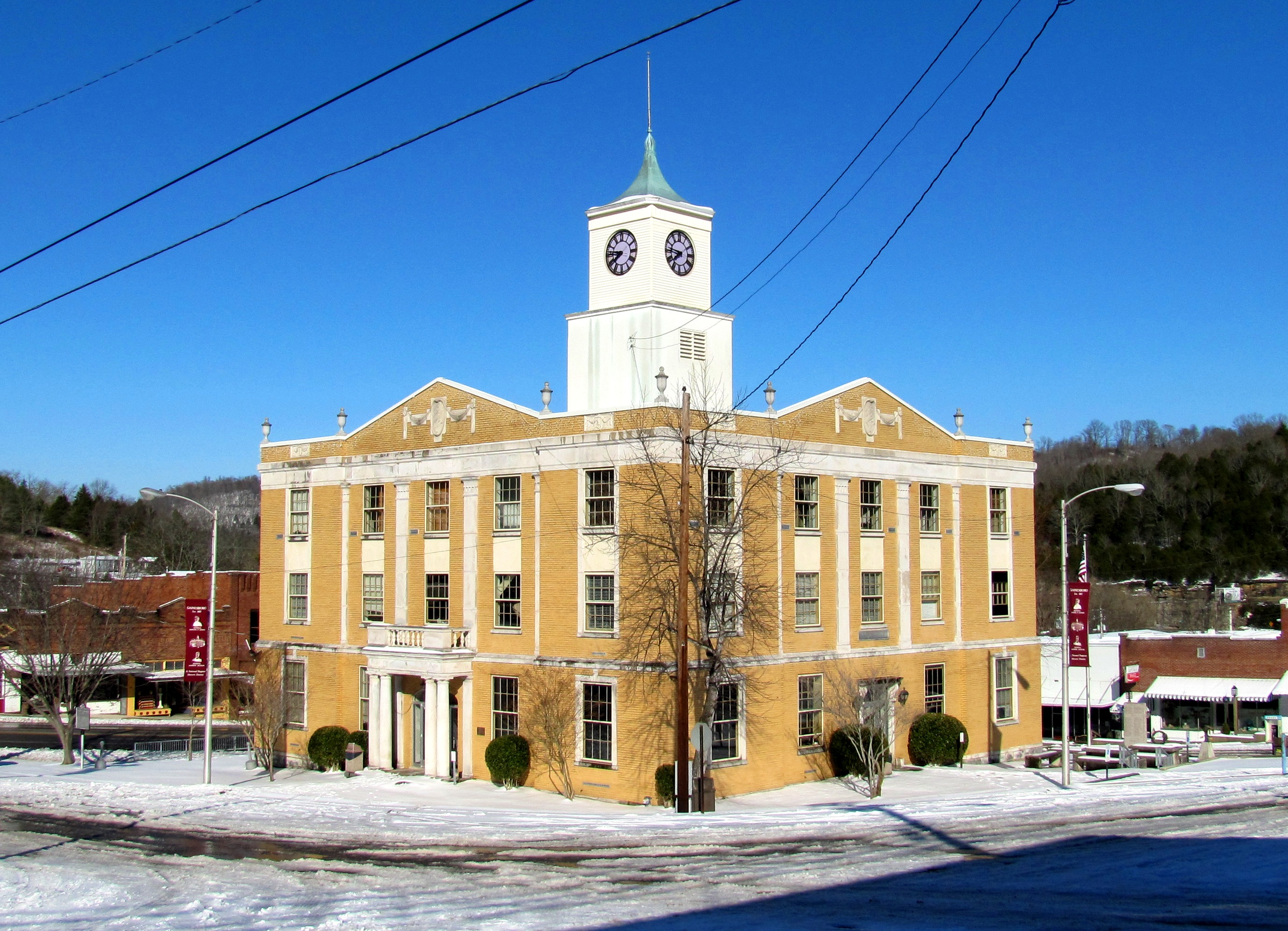
[7] Landmark name [2] Image Date listed Location City or town Summary 1 Fort Blount-Williamsburg Site 
July 17, 1974 On the Cumberland River south of Gainesboro
36°19′09″N 85°45′05″W / 36.319167°N 85.751389°WGainesboro Site of Fort Blount (1794-1798) and later town of Williamsburg (founded 1807) 2 Gainesboro Historic District 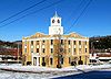
October 25, 1990 Roughly bounded by Cox, Minor, Montpelier, and Mark Twain Sts.
36°21′19″N 85°39′29″W / 36.355278°N 85.658056°WGainesboro 3 Gainesboro Residential Historic District 
July 11, 2001 Roughly along Dixie Ave. and Cox, Minor, and N. Murray Sts.
36°21′24″N 85°39′30″W / 36.356667°N 85.658333°WGainesboro 4 Jackson County High School 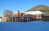
July 8, 2009 707 School Dr.
36°20′49″N 85°39′26″W / 36.346925°N 85.657139°WGainesboro Jefferson County
Johnson County
[7] Landmark name [2] Image Date listed Location City or town Summary 1 Butler House 
April 11, 1973 309 N. Church St.
36°28′19″N 81°48′07″W / 36.471944°N 81.801944°WMountain City Home of Congressman Roderick R. Butler, built circa 1870.[9] 2 Alfred Johnson Farm July 1, 1998 825 Johnson Hollow Rd.
36°29′40″N 81°47′59″W / 36.494444°N 81.799722°WMountain City 3 Morrison Farm and Store April 11, 1973 State Route 91
36°33′58″N 81°45′35″W / 36.566111°N 81.759722°WLaurel Bloomery 4 Rhea House April 11, 1973 U.S. Route 421
36°26′38″N 81°47′49″W / 36.443889°N 81.796944°WShouns 5 Dr. Wiley Wagner Vaught Office November 20, 2009 W.W. Vaught Ln., south of Dug Hill Rd.
36°24′22″N 81°48′33″W / 36.406056°N 81.809106°WMountain City 6 A.J. Wright Farm July 14, 2000 297 A.J. Wright Rd.
36°30′05″N 81°55′46″W / 36.501389°N 81.929444°WShady Valley Knox County
Lake County
[7] Landmark name [2] Image Date listed Location City or town Summary 1 Caldwell-Hopson House March 11, 1993 431 Wynn St.
36°22′33″N 89°28′50″W / 36.375833°N 89.480556°WTiptonville Lauderdale County
[7] Landmark name [2] Image Date listed Location City or town Summary 1 Fort Pillow 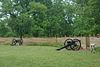
April 11, 1973 State Route 87
35°38′20″N 89°49′56″W / 35.638889°N 89.832222°WFort Pillow 2 Lauderdale County Courthouse March 30, 1995 Town Sq.
35°44′45″N 89°31′49″W / 35.745833°N 89.530278°WRipley 3 W.E. Palmer House 
December 14, 1978 Off U.S. Route 51
35°40′24″N 89°34′35″W / 35.673333°N 89.576389°WHenning 4 US Post Office September 23, 1988 17 E. Jackson Ave.
35°44′41″N 89°31′39″W / 35.744722°N 89.5275°WRipley 5 Wardlaw-Steele House January 8, 1980 128 Wardlaw Pl.
35°44′31″N 89°31′59″W / 35.741944°N 89.533056°WRipley Lawrence County
Lewis County
[7] Landmark name [2] Image Date listed Location City or town Summary 1 Ambrose Blackburn Farmstead March 28, 1985 Gordonsburg Rd.
35°33′58″N 87°23′55″W / 35.566111°N 87.398611°WGordonsburg 2 Hohenwald Railroad Depot May 14, 1987 State Route 99
35°32′50″N 87°32′59″W / 35.547222°N 87.549722°WHohenwald 3 Lewis County Courthouse March 29, 2006 110 N. Park St.
35°33′05″N 87°33′10″W / 35.551389°N 87.552778°WHohenwald 4 Napier Furnaces Historic District (40LS14) May 4, 1988 Address Restricted Napier 5 Old Natchez Trace May 30, 1975 From the Alabama/Tennessee border to State Route 100 in Davidson County Gordonsburg Extends into Davidson, Hickman, Lawrence, Maury, Wayne, and Williamson counties 6 Steele's Iron Works (40LS15) May 4, 1988 Address Restricted Napier 7 Netherland Tait House August 9, 1984 Napier Rd.
35°27′53″N 87°28′14″W / 35.464722°N 87.470556°WNapier Lincoln County
Loudon County
Macon County
[7] Landmark name [2] Image Date listed Location City or town Summary 1 Belview School 
March 21, 2007 Underwood Rd. near Akersville Rd.
36°36′45″N 85°59′17″W / 36.6125°N 85.988056°WUnderwood 2 Cloyd Hotel 
September 11, 1986 Market St.
36°31′45″N 85°50′20″W / 36.529167°N 85.838889°WRed Boiling Springs Now called the Thomas House 3 Counts Hotel 
September 11, 1986 Market St.
36°31′49″N 85°50′50″W / 36.530278°N 85.847222°WRed Boiling Springs Now called the Armour Hotel 4 Donoho Hotel Historic District 
September 11, 1986 Market St.
36°31′47″N 85°50′28″W / 36.529722°N 85.841111°WRed Boiling Springs Still in operation 5 Galen Elementary School 
February 22, 1993 Junction of Galen and Tucker Rds.
36°34′37″N 85°57′44″W / 36.576944°N 85.962222°WGalen 6 Keystone School February 22, 1993 State Route 52 west of Lafayette, just east of Gap of the Ridge
36°31′25″N 86°06′31″W / 36.523611°N 86.108611°WLafayette 7 Long Creek School 
February 22, 1993 Long Creek Rd. northwest of Lafayette
36°33′27″N 86°05′38″W / 36.5575°N 86.093889°WLafayette Madison County
Marion County
Marshall County
Maury County
McMinn County
McNairy County
[7] Landmark name [2] Image Date listed Location City or town Summary 1 Bethel Springs Presbyterian Church August 18, 1983 3rd Ave.
35°13′57″N 88°36′25″W / 35.2325°N 88.606944°WBethel Springs 2 Big Hill Pond Fortification September 29, 1998 John Howell Rd. and the former Southern railroad line
35°02′12″N 88°44′06″W / 35.036667°N 88.735°WPocahontas 3 Wray's Bluff Fortification September 29, 1998 Address Restricted Pocahontas Meigs County
Monroe County
Montgomery County
Moore County
[7] Landmark name [2] Image Date listed Location City or town Summary 1 Bobo Hotel April 7, 1994 Main St.
35°17′03″N 86°22′10″W / 35.284167°N 86.369444°WLynchburg 2 Green-Evans House December 17, 1992 Old State Route 55 north of Lynchburg
35°18′09″N 86°21′54″W / 35.3025°N 86.365°WLynchburg 3 Jack Daniel Distillery 
September 14, 1972 State Route 55
35°17′04″N 86°22′03″W / 35.284444°N 86.3675°WLynchburg 4 Ledfords Mill January 10, 1985 Ledford Mill Rd.
35°24′12″N 86°16′34″W / 35.403333°N 86.276111°WLynchburg 5 Lynchburg Historic District July 19, 1996 Roughly bounded by Majors, Main, Elm, and Wall Sts.
35°16′56″N 86°22′28″W / 35.282222°N 86.374444°WLynchburg 6 Moore County Courthouse and Jail 
September 26, 1979 Court Sq.
35°16′55″N 86°22′25″W / 35.281944°N 86.373611°WLynchburg Morgan County
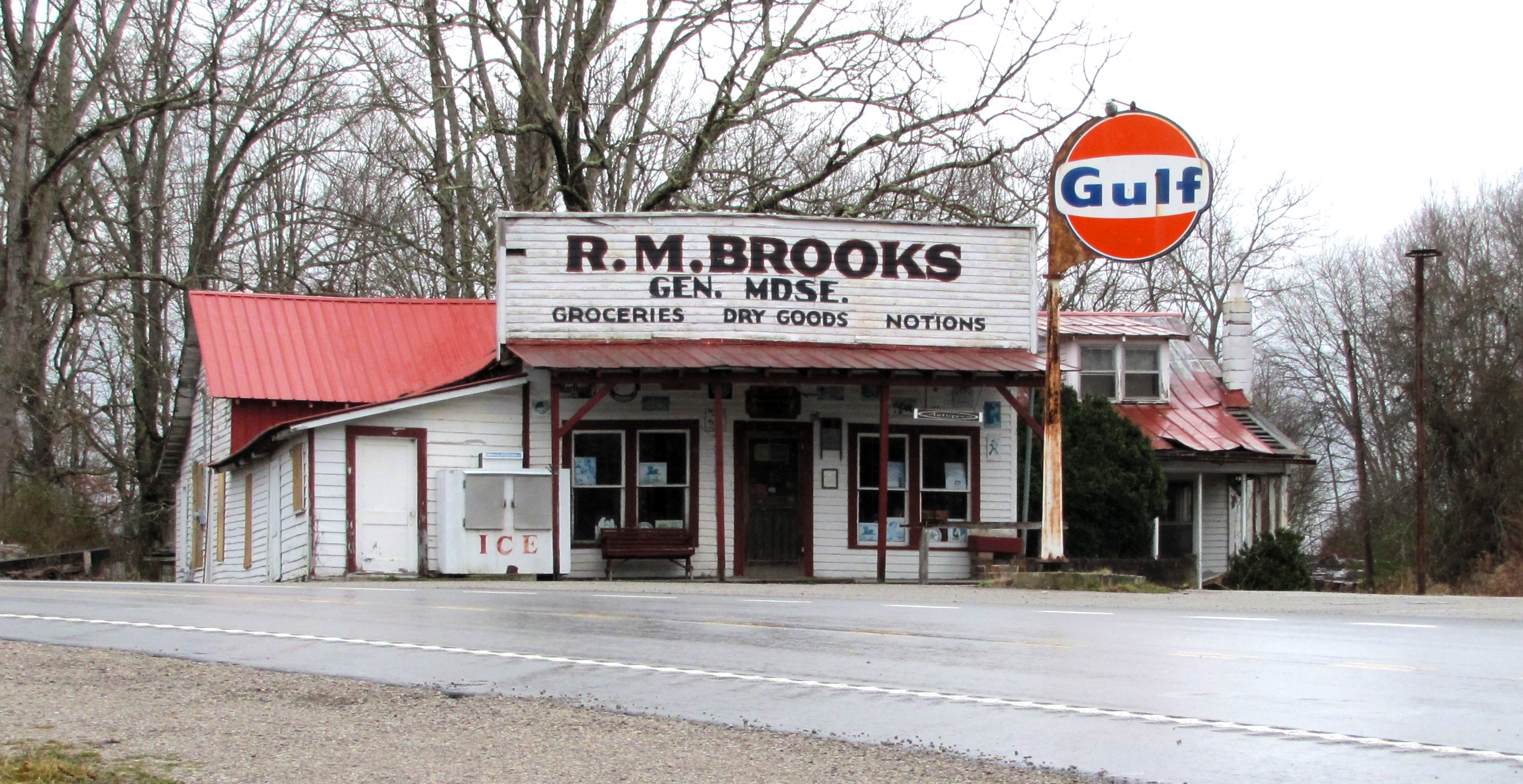
[7] Landmark name [2] Image Date listed Location City or town Summary 1 R.M. Brooks General Store and Residence 
April 14, 1992 Junction of State Route 52 and Brewstertown Rd.
36°21′23″N 84°43′21″W / 36.356389°N 84.7225°WRugby Served as a post office for Rugby in the mid-20th century 2 Rugby Colony 
April 26, 1972 State Route 52
36°21′40″N 84°42′01″W / 36.361111°N 84.700278°WRugby Extends into Scott County Obion County
Overton County
[7] Landmark name [2] Image Date listed Location City or town Summary 1 Alpine Institute 
November 15, 2002 State Route 52
36°23′35″N 85°13′08″W / 36.393056°N 85.218889°WAlpine Presbyterian mission school that operated between 1821 and 1947; a congregation still meets at the institute's church 2 Officer Farmstead 
May 2, 2001 189 Rock Springs Rd.
36°11′16″N 85°16′27″W / 36.187778°N 85.274167°WMonterey Maps indicate location as "Rock Springs Rd.," but the road's sign says "Rock Springs Church Rd." 3 Overton County Courthouse 
November 13, 1980 Court Sq.
36°22′58″N 85°19′23″W / 36.382778°N 85.323056°WLivingston 4 Gov. Albert H. Roberts Law Office 
February 20, 1975 114 E. Main St. Livingston Relocated a few blocks away to junction of Roberts St. and University Ave.; designed in the Victorian style known as Stick-Eastlake 5 Standing Stone Rustic Park Historic District 
July 8, 1986 Standing Stone State Park
36°27′45″N 85°24′42″W / 36.4625°N 85.411667°WLivingston Perry County
[7] Landmark name [2] Image Date listed Location City or town Summary 1 Dr. Richard Calvin Bromley House November 29, 1995 State Route 13 near its junction with Slink Shoals Rd.
35°46′52″N 87°49′46″W / 35.781111°N 87.829444°WFlat Woods 2 Cedar Grove Furnace (40PY77) June 19, 1973 Address Restricted Linden 3 Craig Family Farm May 15, 2006 1031 N. Fork Rd.
35°41′06″N 87°54′01″W / 35.685°N 87.900278°WLinden 4 James Dickson House March 28, 1985 Lower Lick Creek Rd.
35°41′20″N 87°57′37″W / 35.688889°N 87.960278°WLinden 5 Hufstedler Gravehouse June 25, 1987 Hurricane Creek Rd.
35°33′58″N 87°49′27″W / 35.566111°N 87.824167°WLinden 6 Perry County Courthouse March 30, 1995 Town Sq.
35°37′01″N 87°50′18″W / 35.616944°N 87.838333°WLinden Pickett County
[7] Landmark name [2] Image Date listed Location City or town Summary 1 Cordell Hull Birthplace 
May 5, 1972 About 2 miles west of Byrdstown
36°34′55″N 85°11′02″W / 36.581944°N 85.183889°WByrdstown The birthplace cabin of U.S. Secretary of State Cordell Hull 2 Pickett County Courthouse 
March 30, 1995 Town Sq.
36°34′11″N 85°07′44″W / 36.569722°N 85.128889°WByrdstown 3 Pickett State Rustic Park Historic District 
July 8, 1986 Pickett State Park and Forest
36°33′25″N 84°47′43″W / 36.556944°N 84.795278°WJamestown Contains several park structures built by the CCC in the 1930s and 1940s Polk County
Putnam County
Rhea County
[7] Landmark name [2] Image Date listed Location City or town Summary 1 Blythe Ferry 
January 5, 1983 North of Birchwood on State Route 60 at the Tennessee River
35°24′51″N 85°00′41″W / 35.414167°N 85.011389°WDayton Extends into Meigs County 2 Broyles-Darwin House June 28, 1996 108 Idaho
35°29′06″N 85°01′10″W / 35.485°N 85.019444°WDayton 3 Broyles-Darwin House July 9, 1997 108 Idaho
35°29′06″N 85°01′10″W / 35.485°N 85.019444°WDayton 4 Hastings-Locke Ferry January 5, 1983 East of Dayton on State Route 30 at the Tennessee River
35°32′15″N 84°52′41″W / 35.5375°N 84.878056°WDayton Extends into Meigs County 5 Hiwassee Garrison Site November 14, 1978 Address Restricted Dayton 6 Rhea County Courthouse 
November 7, 1972 Market St. between 2nd and 3rd Aves.
35°29′42″N 85°00′46″W / 35.495°N 85.012778°WDayton 7 Dr. Walter Thomison House September 11, 1997 656 Market St.
35°29′10″N 85°01′11″W / 35.486111°N 85.019722°WDayton Roane County
Robertson County
Rutherford County
Scott County
[7] Landmark name [2] Image Date listed Location City or town Summary 1 Barton Chapel 
July 12, 1984 U.S. Route 27
36°21′06″N 84°35′19″W / 36.351667°N 84.588611°WRobbins 2 Louis E. Bryant House May 29, 1975 2 miles east of Oneida on Bear Creek Rd.
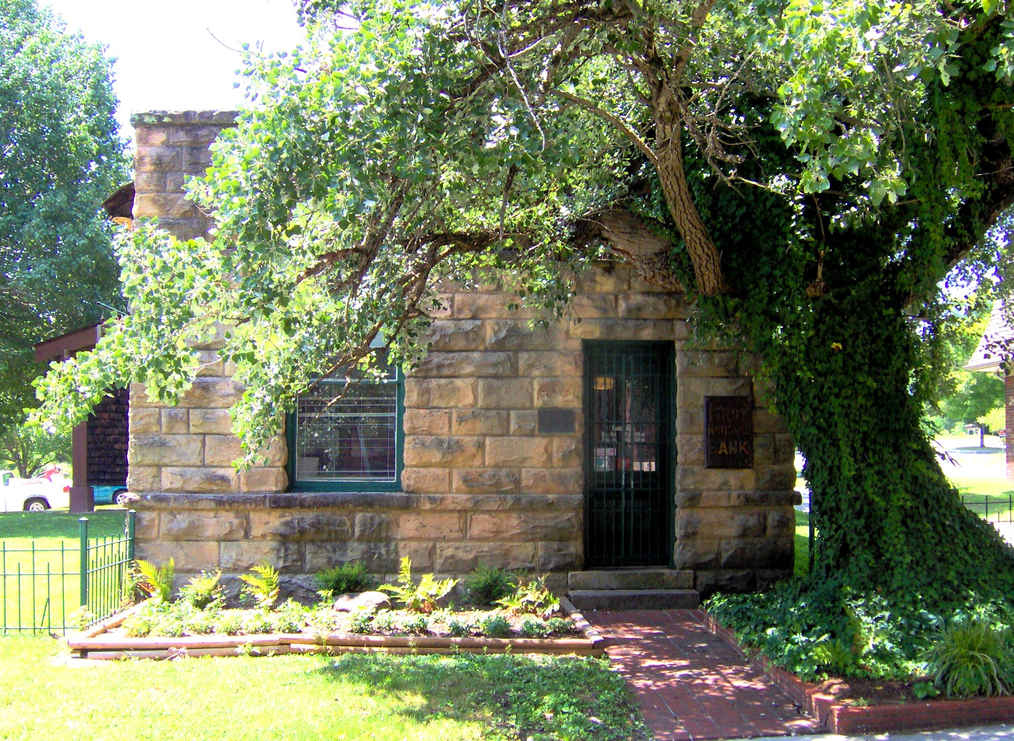
36°32′50″N 84°29′18″W / 36.547222°N 84.488333°WOneida 3 First National Bank of Huntsville 
July 11, 1985 4 Courthouse Square
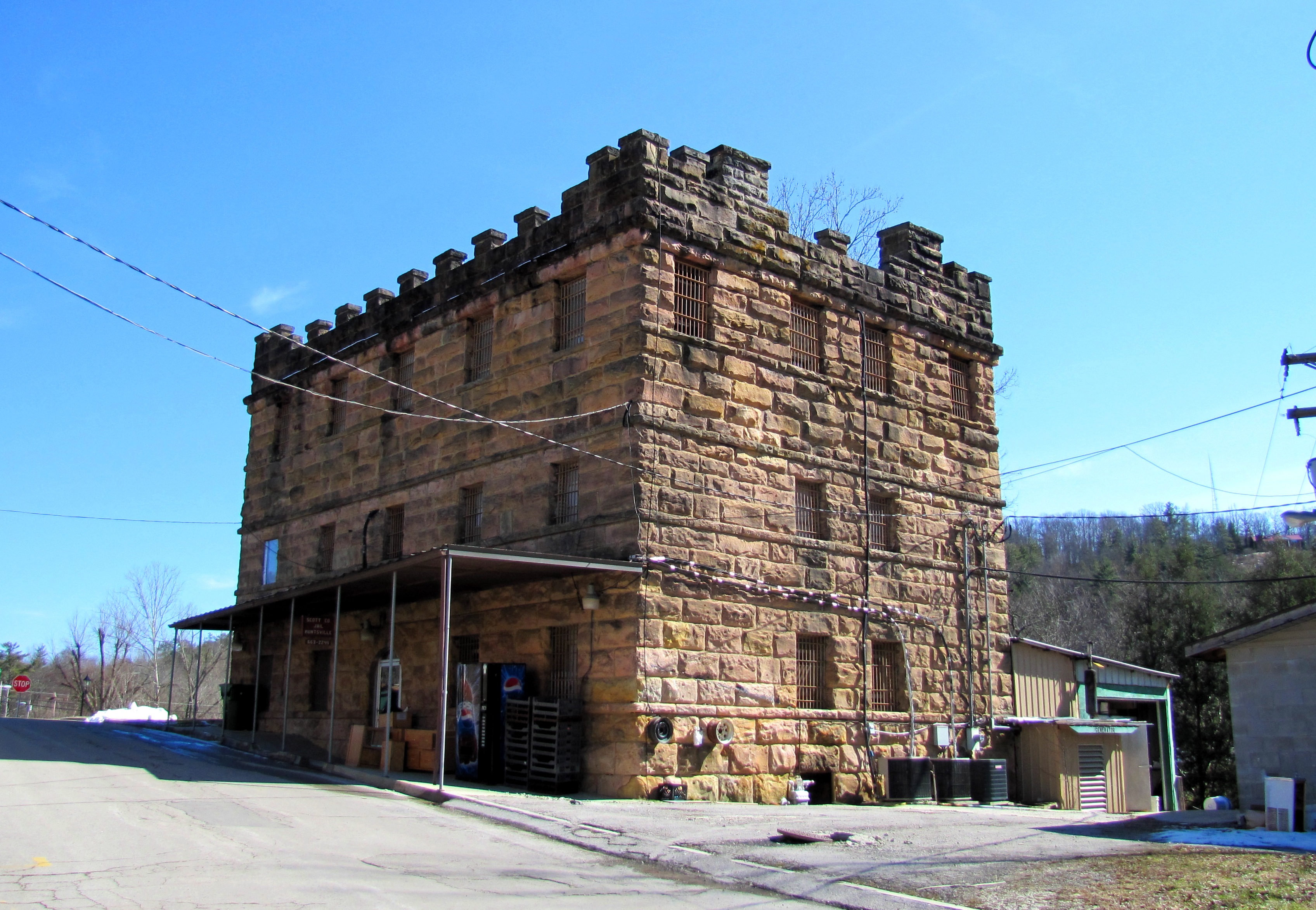
36°24′33″N 84°29′27″W / 36.409167°N 84.490833°WHuntsville 4 Old Scott County Jail 
April 18, 1974 Courthouse Sq.
36°24′30″N 84°29′27″W / 36.408333°N 84.490833°WHuntsville 5 Rugby Colony 
April 26, 1972 State Route 52
36°21′40″N 84°42′01″W / 36.361111°N 84.700278°WRugby Extends into Morgan County; Scott County section of the district includes Laurel Dale Cemetery. Sequatchie County
[7] Landmark name [2] Image Date listed Location City or town Summary 1 Douglas Coal and Coke Company Clubhouse November 7, 1996 512 Mountain View
35°22′38″N 85°23′55″W / 35.377222°N 85.398611°WDunlap 2 Dunlap Coke Ovens 
July 5, 1985 Hickory St. and Cordell Rd.
35°22′48″N 85°24′06″W / 35.38°N 85.401667°WDunlap 3 Dunlap Community Building November 21, 1994 Southeastern corner of the junction of Cherry and Rankin Sts.
35°22′18″N 85°23′26″W / 35.371667°N 85.390556°WDunlap 4 Hill Road at the Cumberland Plateau August 7, 2005 West of Fredonia Rd., 1.0 mile northwest of downtown Dunlap
35°23′08″N 85°23′59″W / 35.385556°N 85.399722°WDunlap 5 Sequatchie County Courthouse 
January 20, 1980 Cherry St.
35°22′17″N 85°23′14″W / 35.371389°N 85.387222°WDunlap Sevier County
Shelby County
Smith County
Stewart County
Sullivan County
Sumner County
Tipton County
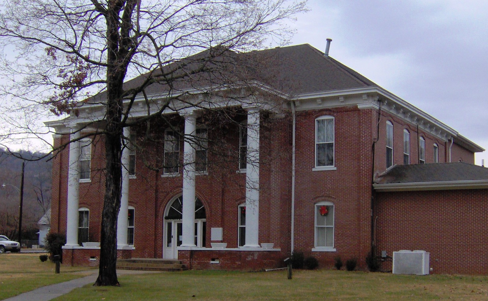
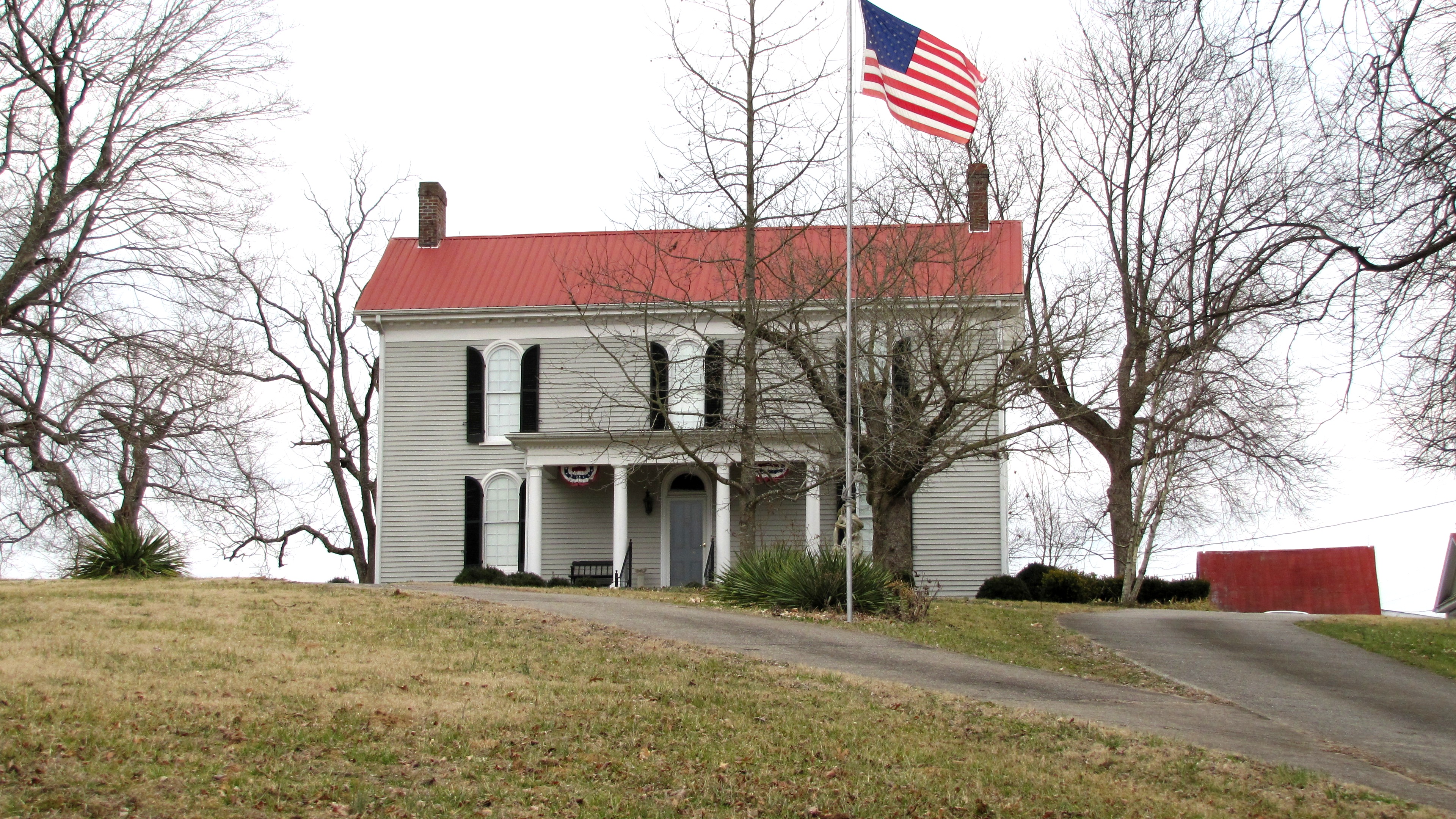
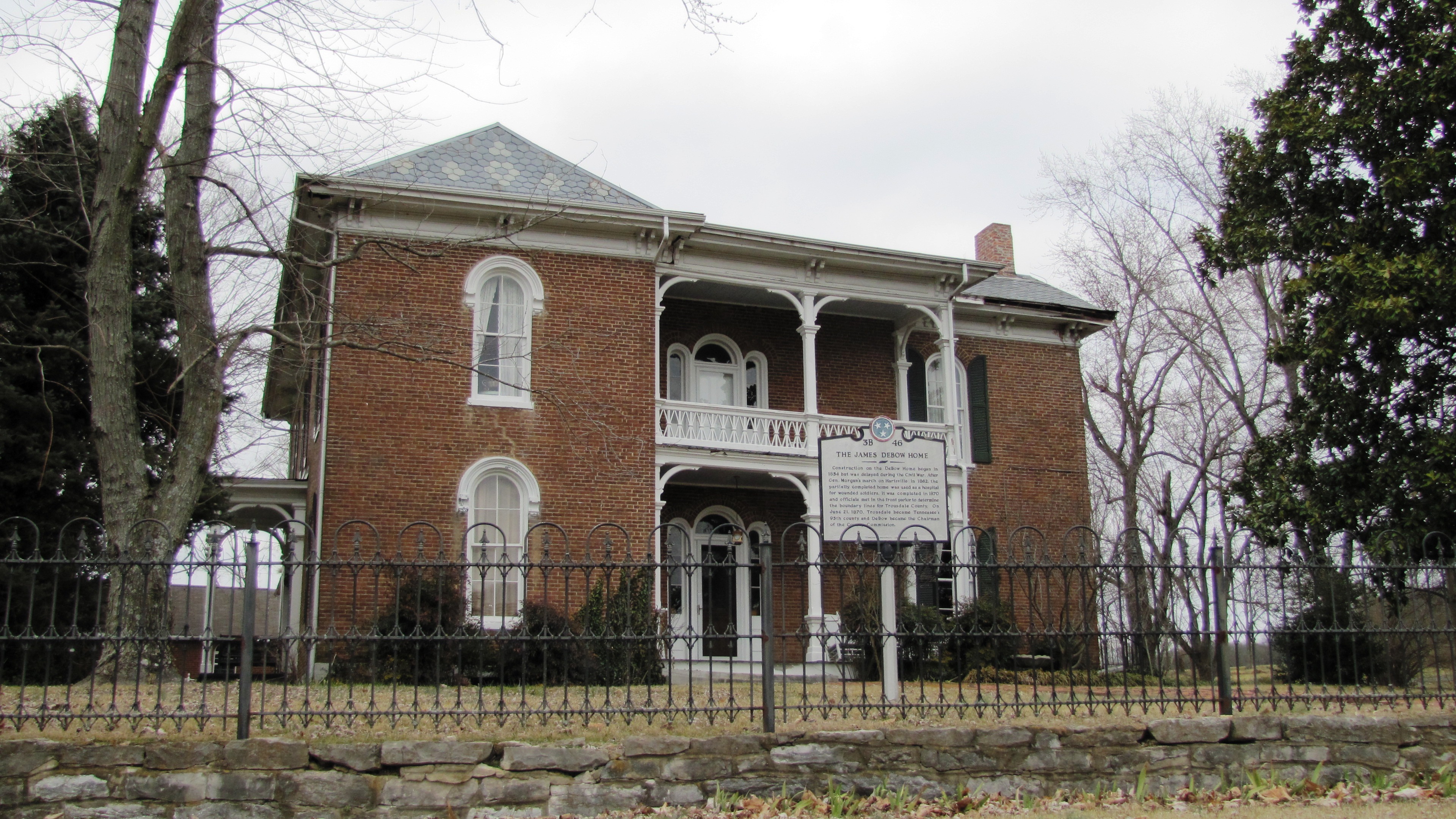
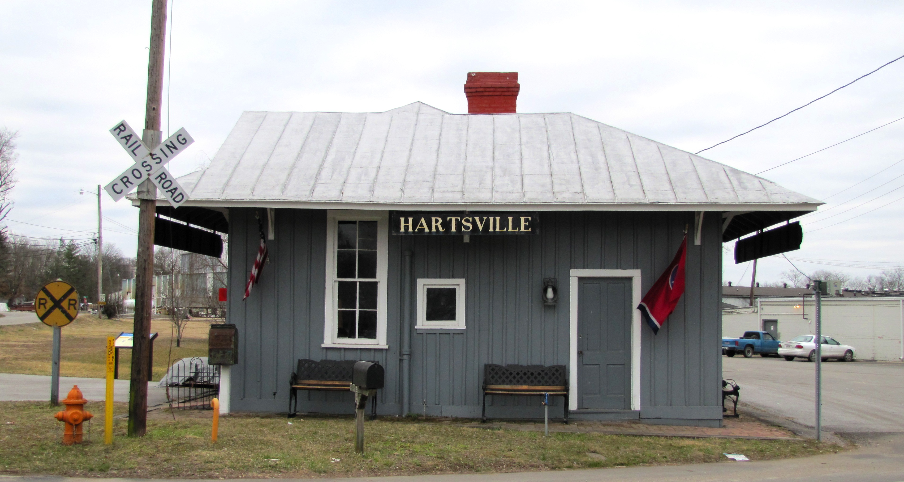
Trousdale County
[7] Landmark name [2] Image Date listed Location City or town Summary 1 Averitt-Herod House 
April 12, 1996 395 Herod Ln.
36°22′28″N 86°09′39″W / 36.374444°N 86.160833°WHartsville Originally built in 1832 2 James R. DeBow House 
November 3, 1988 State Route 25
36°23′02″N 86°07′16″W / 36.383889°N 86.121111°WHartsville Italianate-style house constructed intermittently between 1854 and 1870 3 Hartsville Battlefield October 28, 1998 Address Restricted Hartsville 4 Hartsville Depot 
July 3, 1980 Broadway
36°23′43″N 86°09′55″W / 36.395278°N 86.165278°WHartsville Now houses offices of the Hartsville-Trousdale Co. Chamber of Commerce 5 Hartsville Historic District 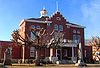
June 24, 1993 Roughly bounded by Church, Front, River, Greentop, and Court Sts.
36°23′26″N 86°10′02″W / 36.390556°N 86.167222°WHartsville 6 Turney-Hutchins House July 1, 1992 State Route 25
36°23′31″N 86°09′12″W / 36.391944°N 86.153333°WHartsville Unicoi County
[7] Landmark name [2] Image Date listed Location City or town Summary 1 A.R. Brown House November 8, 2007 241 S. Main Ave.
36°08′39″N 82°25′06″W / 36.144167°N 82.418333°WErwin 2 Clarksville Iron Furnace June 4, 1973 Southwest of Erwin off State Route 107 in the Cherokee National Forest
36°08′53″N 82°31′40″W / 36.148056°N 82.527778°WErwin 3 Clinchfield Depot 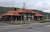
June 22, 1993 Junction of Nolichucky Ave. and Union St.
36°08′43″N 82°25′08″W / 36.145278°N 82.418889°WErwin 4 Tilson Farm June 17, 1994 242 Little Branch Rd. Flag Pond Union County
[7] Landmark name [2] Image Date listed Location City or town Summary 1 Booker Farm June 25, 1999 Corryton-Luttrell Rd.
36°10′11″N 83°46′11″W / 36.169722°N 83.769722°WLuttrell 2 Hamilton-Lay Store March 15, 2011 Intersection of Mill Pond Hollow Rd. and Walkers Ford Rd.
36°16′04″N 83°44′24″W / 36.267778°N 83.74°WMaynardville vicinity 3 Hamilton-Tolliver Complex March 12, 2010 158 Kettle Hollow Rd.
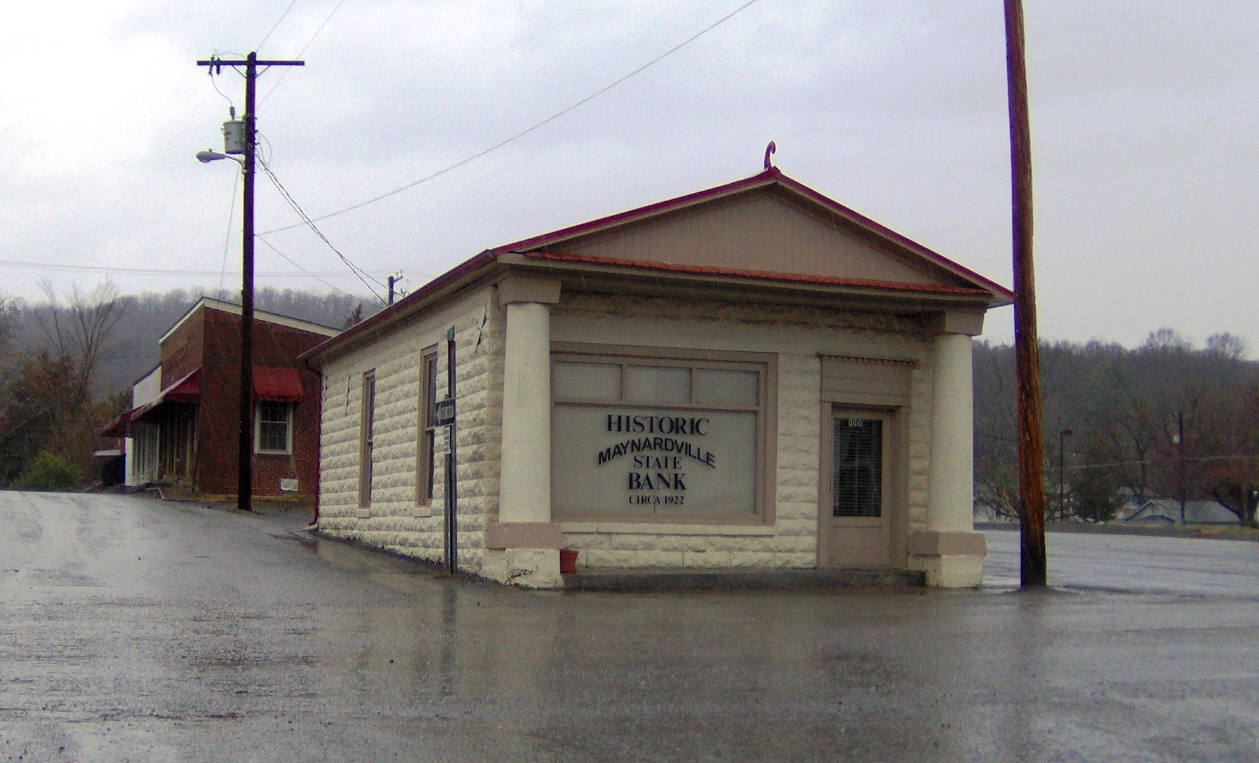
36°17′19″N 83°45′16″W / 36.288589°N 83.754558°WMaynardville 4 Maynardville State Bank 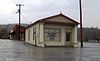
November 21, 2001 1001 Main St.
36°14′59″N 83°47′54″W / 36.249722°N 83.798333°WMaynardville 5 Baite Ousley House March 4, 1975 15 miles southwest of Tazewell, north of Norris Lake on Big Valley Rd.
36°19′05″N 83°51′15″W / 36.318056°N 83.854167°WSharps Chapel [1] Van Buren County
[7] Landmark name [2] Image Date listed Location City or town Summary 1 Big Bone Cave 
April 11, 1973 East of Bone Cave and west of the summit of Tandy Knob
35°46′37.92″N 85°33′18.864″W / 35.7772°N 85.55524°W[10]Bone Cave 2 Crain Hill School and Church March 21, 1985 Crain Hill Rd.
35°43′02″N 85°35′18″W / 35.717222°N 85.588333°WCrain Hill 3 Rocky River Crossing and Road November 15, 2006 Rocky River and a continuation of Pleasant Hill Cemetery Rd.
35°35′33″N 85°31′11″W / 35.5925°N 85.519722°WSpencer Warren County
Washington County
Wayne County
[7] Landmark name [2] Image Date listed Location City or town Summary 1 Collinwood Railroad Station March 24, 1988 Old railroad bed
35°10′25″N 87°44′21″W / 35.173611°N 87.739167°WCollinwood 2 Evans Chapel United Methodist Church July 9, 1999 Old Clifton Turnpike
35°21′13″N 87°57′19″W / 35.353611°N 87.955278°WWaynesboro 3 First Presbyterian Church of Clifton March 8, 1988 Main St.
35°23′05″N 87°59′39″W / 35.384722°N 87.994167°WClifton 4 Forty-eight Forge (40WY63) April 11, 1988 Address Restricted Waynesboro 5 Marion Furnace (40WY61) April 9, 1988 Address Restricted Eagle Creek 6 Old Natchez Trace May 30, 1975 From the Alabama/Tennessee border to State Route 100 in Davidson County
35°02′54″N 87°48′47″W / 35.048333°N 87.813056°WCollinwood Extends into Davidson, Hickman, Lawrence, Lewis, Maury, and Williamson counties 7 Water Street Historic District July 8, 1992 Water St. (State Route 128) between Polk and Cedar Sts.
35°23′15″N 87°59′33″W / 35.3875°N 87.9925°WClifton 8 Waynesboro Cumberland Presbyterian Church October 22, 1987 High St.
35°19′16″N 87°45′48″W / 35.321111°N 87.763333°WWaynesboro Weakley County
White County
Williamson County
Wilson County
References
- ^ The latitude and longitude information provided in this table was derived originally from the National Register Information System, which has been found to be fairly accurate for about 99% of listings. For about 1% of NRIS original coordinates, experience has shown that one or both coordinates are typos or otherwise extremely far off; some corrections may have been made. A more subtle problem causes many locations to be off by up to 150 yards, depending on location in the country: most NRIS coordinates were derived from tracing out latitude and longitudes off of USGS topographical quadrant maps created under the North American Datum of 1927, which differs from the current, highly accurate WGS84 GPS system used by Google maps. Chicago is about right, but NRIS longitudes in Washington are higher by about 4.5 seconds, and are lower by about 2.0 seconds in Maine. Latitudes differ by about 1.0 second in Florida. Some locations in this table may have been corrected to current GPS standards.
- ^ a b c d e f g h i j k l m n o p q r s t u v w x y z aa ab ac ad ae af ag ah ai aj ak al am "National Register Information System". National Register of Historic Places. National Park Service. 2008-04-24. http://nrhp.focus.nps.gov/natreg/docs/All_Data.html.
- ^ "National Register of Historic Places: Weekly List Actions". National Park Service. http://www.cr.nps.gov/nr/nrlist.htm. Retrieved January 2, 2009.
- ^ Weekly List Actions, National Register of Historic Places website
- ^ "National Register of Historic Places: Weekly List Actions". National Park Service, United States Department of the Interior. Retrieved on November 10, 2011.
- ^ The following sites are listed in multiple counties: Blythe Ferry (Meigs and Rhea), Boatyard Historic District (Hawkins and Sullivan), Bolivar-Somerville Stage Road (Fayette and Hardeman), Calderwood Dam (Blount and Monroe), Conway Bridge (Cocke and Greene), John Gordon House (Hickman and Maury), Great Falls Hydroelectric Station (Warren and White), Hastings-Locke Ferry (Meigs and Rhea), Old Natchez Trace (Davidson, Hickman, Lawrence, Lewis, Maury, Wayne, and Williamson), Palmetto Farm (Bedford and Marshall), Petersburg Historic District (Fayette and Lincoln), Rugby Colony (Morgan and Scott), Shelby Bend Archeological District (Hickman and Maury), and Warner Park Historic Park (Davidson and Williamson).
- ^ a b c d e f g h i j k l m n o p q r s t u v w x y z aa ab ac ad ae af ag ah ai aj ak al Numbers represent an ordering by significant words. Various colorings, defined here, differentiate National Historic Landmark sites and National Register of Historic Places Districts from other NRHP buildings, structures, sites or objects.
- ^ Location derived from this Harpeth River State Park map; the NRIS lists it as "Address Restricted"
- ^ Carolyn Sakowski (2007), Touring the East Tennessee Backroads, John F. Blair, Publisher. ISBN 0895873508, ISBN 9780895873507. Pages 28-29.
- ^ Location derived from a notice on USGS topographical maps accessible from this GNIS feature record; the NRIS lists the site as "Address Restricted"
See also
U.S. National Register of Historic Places Topics Lists by states Alabama • Alaska • Arizona • Arkansas • California • Colorado • Connecticut • Delaware • Florida • Georgia • Hawaii • Idaho • Illinois • Indiana • Iowa • Kansas • Kentucky • Louisiana • Maine • Maryland • Massachusetts • Michigan • Minnesota • Mississippi • Missouri • Montana • Nebraska • Nevada • New Hampshire • New Jersey • New Mexico • New York • North Carolina • North Dakota • Ohio • Oklahoma • Oregon • Pennsylvania • Rhode Island • South Carolina • South Dakota • Tennessee • Texas • Utah • Vermont • Virginia • Washington • West Virginia • Wisconsin • WyomingLists by territories Lists by associated states Other Categories:- National Register of Historic Places in Tennessee
- National Register of Historic Places lists by state
- Tennessee-related lists
-


Wikimedia Foundation. 2010.