- National Register of Historic Places listings in Sullivan County, Tennessee
-
 Location of Sullivan County in Tennessee
This is a list of the National Register of Historic Places listings in Sullivan County, Tennessee.
This is intended to be a complete list of the properties and districts on the National Register of Historic Places in Sullivan County, Tennessee, United States. Latitude and longitude coordinates are provided for many National Register properties and districts; these locations may be seen together in a Google map.[1]
There are 43 properties and districts listed on the National Register in the county, including 1 National Historic Landmark.
Contents: Counties in Tennessee Anderson – Bedford – Benton – Bledsoe – Blount – Bradley – Campbell – Cannon – Carroll – Carter – Cheatham – Chester – Claiborne – Clay – Cocke – Coffee – Crockett – Cumberland – Davidson – Decatur – DeKalb – Dickson – Dyer – Fayette – Fentress – Franklin – Gibson – Giles – Grainger – Greene – Grundy – Hamblen – Hamilton – Hancock – Hardeman – Hardin – Hawkins – Haywood – Henderson – Henry – Hickman – Houston – Humphreys – Jackson – Jefferson – Johnson – Knox – Lake – Lauderdale – Lawrence – Lewis – Lincoln – Loudon – Macon – Madison – Marion – Marshall – Maury – McMinn – McNairy – Meigs – Monroe – Montgomery – Moore – Morgan – Obion – Overton – Perry – Pickett – Polk – Putnam – Rhea – Roane – Robertson – Rutherford – Scott – Sequatchie – Sevier – Shelby – Smith – Stewart – Sullivan – Sumner – Tipton – Trousdale – Unicoi – Union – Van Buren – Warren – Washington – Wayne – Weakley – White – Williamson – Wilson -
- This National Park Service list is complete through NPS recent listings posted November 10, 2011.[2]
Current listings
[3] Landmark name [4] Image Date listed Location City or town Summary 1 Finlay Alison House April 11, 1973 West of Piney Flats off U.S. Route 11
36°25′22″N 82°21′34″W / 36.422778°N 82.359444°WPiney Flats 2 Jesse Alison House April 2, 1973 Southwest of Bluff City off U.S. Route 11E
36°26′08″N 82°21′17″W / 36.435556°N 82.354722°WBluff City 3 Arcadia April 11, 1973 East of Bloomingdale off U.S. Route 11W
36°35′18″N 82°24′31″W / 36.588333°N 82.408611°WArcadia 4 Blountville Historic District February 23, 1973 Center of Blountville along both sides of State Route 126
36°31′58″N 82°19′37″W / 36.532778°N 82.326944°WBlountville 5 Boatyard Historic District December 12, 1973 Southwest of Kingsport on the Holston River and the South Fork of the Holston River
36°33′02″N 82°36′17″W / 36.550556°N 82.604722°WKingsport 6 Bristol Commercial Historic District May 22, 2003 Roughly along State, Piedmont, Moore, Shelby, Bank, Progress, 5th, 6th, 7th, and 8th Sts.
36°35′38″N 82°11′03″W / 36.593889°N 82.184167°WBristol 7 Bristol Municipal Stadium June 25, 1987 1112 Edgemont Ave.
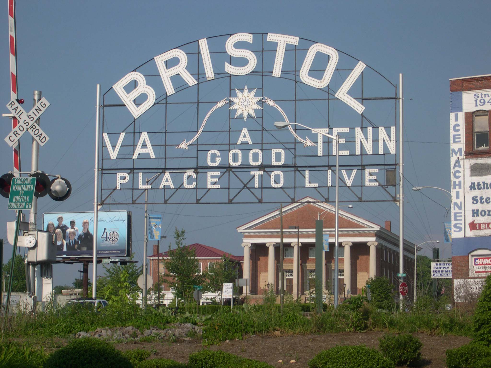
36°34′57″N 82°11′00″W / 36.5825°N 82.183333°WBristol 8 Bristol Virginia-Tennessee Slogan Sign 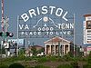
September 8, 1988 E. State St.
36°35′40″N 82°10′45″W / 36.594444°N 82.179167°WBristol Extends into Bristol, Virginia 9 Church Circle District April 11, 1973 Along Sullivan in the center of Kingsport
36°32′59″N 82°33′29″W / 36.549722°N 82.558056°WKingsport 10 Clinchfield Railroad Station April 24, 1973 101 E. Main St.
36°32′40″N 82°33′45″W / 36.544444°N 82.5625°WKingsport 11 DeVault-Masengill House March 28, 1985 Andrew Johnson Highway, U.S. Route 11E
36°24′20″N 82°20′40″W / 36.405556°N 82.344444°WPiney Flats 12 East Hill Cemetery March 28, 2011 East State Street at Georgia Avenue
36°35′39″N 82°10′16″W / 36.594167°N 82.171111°WBristol American Civil War-era cemetery with sections for Confederate soldiers and veterans as well as a small section for African American burials;[5] straddles the Tennessee-Virginia border and is also listed in the National Park Service NRIS database in Bristol, Virginia 13 Erwin Farm April 11, 1973 West of Blountville off State Route 75
36°31′24″N 82°22′30″W / 36.523333°N 82.375°WBlountville 14 Fairmont Neighborhood Historic District July 30, 2010 Roughly bounded by Taylor St., Pennsylvania Ave., Maple St., and Florida Ave.
36°35′20″N 82°10′13″W / 36.588889°N 82.170278°WBristol 15 First National Bank of Bristol July 25, 1985 500 State St.
36°35′41″N 82°10′57″W / 36.594722°N 82.1825°WBristol 16 Gammon House March 10, 2009 324 6th St.
36°35′28″N 82°11′02″W / 36.59116°N 82.18382°WBristol 17 Grass Dale October 25, 1984 774 Bloomingdale Pike
36°33′30″N 82°33′22″W / 36.558333°N 82.556111°WKingsport 18 Alexander Doak Hall Farm July 28, 1995 440 Proffitt Ln.
36°26′51″N 82°28′39″W / 36.4475°N 82.4775°WKingsport 19 J. Fred Johnson House April 11, 1973 1322 Watauga Ave.
36°32′38″N 82°32′22″W / 36.543889°N 82.539444°WKingsport 20 Edward Washington King House November 18, 1999 308 7th St.
36°35′32″N 82°11′10″W / 36.592222°N 82.186111°WBristol 21 Long Island of the Holston 
October 15, 1966 South Fork of the Holston River
36°31′49″N 82°33′39″W / 36.530278°N 82.560833°WKingsport 22 Moses Looney Fort House January 18, 1978 5436 Old Island Rd.
36°33′19″N 82°25′28″W / 36.555278°N 82.424444°WKingsport 23 Mount Ida April 2, 1973 1010-1012 Sevier Terrace Dr.
36°33′29″N 82°34′12″W / 36.558056°N 82.57°WKingsport 24 Netherland Inn and Complex December 23, 1969 2144 Netherland Inn Rd.
36°33′05″N 82°35′48″W / 36.551389°N 82.596667°WKingsport 25 Old Deery Inn 
May 7, 1973 Main St.
36°31′59″N 82°19′34″W / 36.533056°N 82.326111°WBlountville 26 Old Kingsport Presbyterian Church October 2, 1973 Stone Dr. (U.S. Route 11W) and Afton
36°33′22″N 82°35′32″W / 36.556111°N 82.592222°WKingsport 27 Paramount Theatre and Office Building April 4, 1985 516 State St.
36°35′41″N 82°10′59″W / 36.594722°N 82.183056°WBristol 28 Parlett House August 18, 1983 728 Georgia Ave.
36°35′18″N 82°10′04″W / 36.588333°N 82.167778°WBristol 29 Pearson Brick House April 11, 1973 East of Kingsport on Shipley Ferry Rd.
36°28′55″N 82°28′21″W / 36.481944°N 82.4725°WKingsport 30 Pemberton Mansion and Oak March 14, 1973 9 miles northeast of Bristol on State Route 34
36°33′45″N 82°04′24″W / 36.5625°N 82.073333°WBristol 31 Pierce Chapel AME Church Cemetery July 14, 2000 Seaver Rd. at Horse Creek Rd.
36°30′04″N 82°34′40″W / 36.501111°N 82.577778°WKingsport 32 Preston Farm September 3, 1971 4812 Orebank Rd.
36°32′38″N 82°29′10″W / 36.543889°N 82.486111°WKingsport 33 Rock Ledge May 24, 1978 117 Stuffle Place
36°34′35″N 82°30′52″W / 36.576389°N 82.514444°WKingsport 34 Rocky Mount February 26, 1970 Southwest of Piney Flats off U.S. Route 11E
36°24′21″N 82°20′12″W / 36.405833°N 82.336667°WPiney Flats 35 Roller-Pettyjohn Mill December 7, 1977 West of Blountville on Fall Creek Rd.
36°31′48″N 82°26′52″W / 36.53°N 82.447778°WBlountville 36 Roseland April 2, 1973 South of Kingsport on Shipp St.
36°31′24″N 82°33′43″W / 36.523333°N 82.561944°WKingsport 37 Spring Place April 11, 1973 Northwest of Kingsport on W. Carter's Valley Rd., off U.S. Route 23
36°35′26″N 82°36′13″W / 36.590556°N 82.603611°WKingsport 38 Steel-Seneker Houses August 22, 1977 4 miles west of Bristol on State Route 126
36°33′56″N 82°15′44″W / 36.565556°N 82.262222°WBristol 39 Stone-Penn House November 15, 1984 1306 Watauga St.
36°32′39″N 82°32′25″W / 36.544167°N 82.540278°WKingsport 40 US Post Office-Shelby Street Station November 7, 1985 620 Shelby St.
36°35′37″N 82°11′04″W / 36.593611°N 82.184444°WBristol 41 George Washington School March 21, 2007 205 E. Sevier Ave.
36°32′54″N 82°33′13″W / 36.548333°N 82.553611°WKingsport 42 Wills-Dickey Stone House March 30, 1973 Northwest of Kingsport off U.S. Route 23 on W. Carter's Valley Rd.
36°35′22″N 82°34′18″W / 36.589444°N 82.571667°WKingsport 43 Yancey's Tavern April 11, 1973 East of Kingsport on State Route 126
36°32′55″N 82°27′28″W / 36.548611°N 82.457778°WKingsport See also
- List of National Historic Landmarks in Tennessee
- National Register of Historic Places listings in Tennessee
References
- ^ The latitude and longitude information provided in this table was derived originally from the National Register Information System, which has been found to be fairly accurate for about 99% of listings. For about 1% of NRIS original coordinates, experience has shown that one or both coordinates are typos or otherwise extremely far off; some corrections may have been made. A more subtle problem causes many locations to be off by up to 150 yards, depending on location in the country: most NRIS coordinates were derived from tracing out latitude and longitudes off of USGS topographical quadrant maps created under the North American Datum of 1927, which differs from the current, highly accurate WGS84 GPS system used by Google maps. Chicago is about right, but NRIS longitudes in Washington are higher by about 4.5 seconds, and are lower by about 2.0 seconds in Maine. Latitudes differ by about 1.0 second in Florida. Some locations in this table may have been corrected to current GPS standards.
- ^ "National Register of Historic Places: Weekly List Actions". National Park Service, United States Department of the Interior. Retrieved on November 10, 2011.
- ^ Numbers represent an ordering by significant words. Various colorings, defined here, differentiate National Historic Landmark sites and National Register of Historic Places Districts from other NRHP buildings, structures, sites or objects.
- ^ "National Register Information System". National Register of Historic Places. National Park Service. . http://nrhp.focus.nps.gov/natreg/docs/All_Data.html.
- ^ "East Hill Cemetery Brochure". [{Bristol, Tennessee]]: Bristol Historical Association. http://www.bristolhistoricalassociation.com/docs/East%20Hill%20Cemetery%20Brochure.pdf. Retrieved April 14, 2011.
U.S. National Register of Historic Places Topics Lists by states Alabama • Alaska • Arizona • Arkansas • California • Colorado • Connecticut • Delaware • Florida • Georgia • Hawaii • Idaho • Illinois • Indiana • Iowa • Kansas • Kentucky • Louisiana • Maine • Maryland • Massachusetts • Michigan • Minnesota • Mississippi • Missouri • Montana • Nebraska • Nevada • New Hampshire • New Jersey • New Mexico • New York • North Carolina • North Dakota • Ohio • Oklahoma • Oregon • Pennsylvania • Rhode Island • South Carolina • South Dakota • Tennessee • Texas • Utah • Vermont • Virginia • Washington • West Virginia • Wisconsin • WyomingLists by territories Lists by associated states Other Municipalities and communities of Sullivan County, Tennessee Cities Bluff City | Bristol | Johnson City‡ | Kingsport‡

CDPs Unincorporated
communitiesFootnotes ‡This populated place also has portions in an adjacent county or counties
Categories:- National Register of Historic Places in Tennessee by county
- Sullivan County, Tennessee
- Buildings and structures in Sullivan County, Tennessee
-


Wikimedia Foundation. 2010.