National Register of Historic Places listings in Sullivan County, Pennsylvania
- National Register of Historic Places listings in Sullivan County, Pennsylvania
-

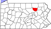
Location of Sullivan County in Pennsylvania
This is a list of the National Register of Historic Places listings in Sullivan County, Pennsylvania.
This is intended to be a complete list of the properties and districts on National Register of Historic Places in Sullivan County, Pennsylvania. The locations of National Register properties and districts for which the latitude and longitude coordinates are included below, may be seen in a Google map.[1]
There are 7 properties and districts listed on the National Register in the county.
-
- This National Park Service list is complete through NPS recent listings posted November 10, 2011.[2]
Current listings
| [3] |
Landmark name[4] |
Image |
Date listed |
Location |
City or Town |
Summary |
| 1 |
Eagles Mere Historic District |
|
01996-06-28 June 28, 1996 |
Roughly bounded by Pennsylvania Route 42, Lakewood, LaPorte, and Forest Avenues
41°25′2″N 76°34′36″W / 41.41722°N 76.57667°W / 41.41722; -76.57667 (Eagles Mere Historic District) |
Eagles Mere and Shrewsbury Township |
|
| 2 |
Forksville Covered Bridge |
 |
01980-07-24 July 24, 1980 |
Legislative Route 56007 spur
41°29′18″N 76°36′0″W / 41.48833°N 76.6°W / 41.48833; -76.6 (Forksville Covered Bridge) |
Forksville |
|
| 3 |
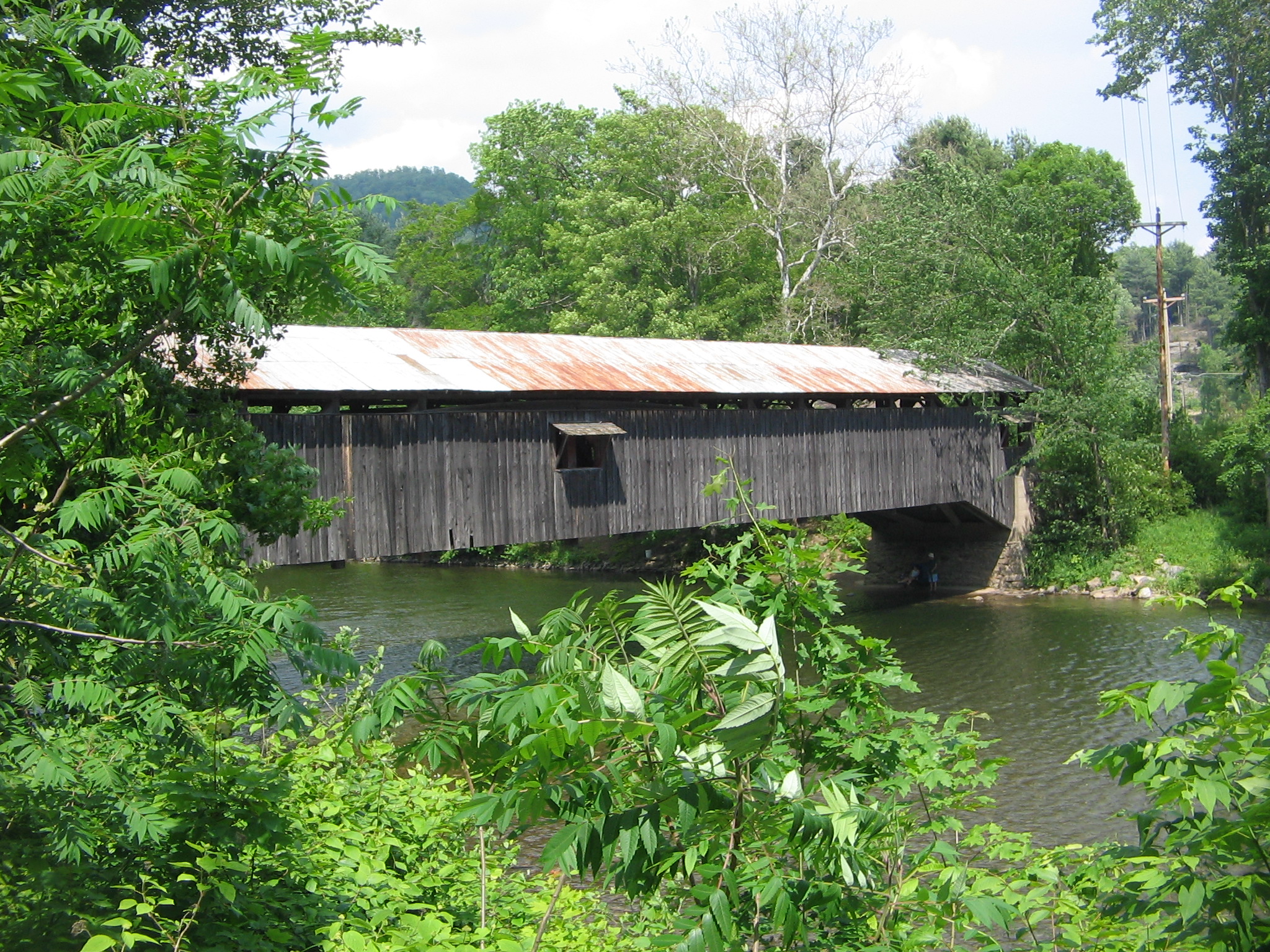
Hillsgrove Covered Bridge |
 |
01973-07-02 July 2, 1973 |
3 miles (4.8 km) east of Hillsgrove off Pennsylvania Route 87 over Loyalsock Creek
41°27′39″N 76°40′17″W / 41.46083°N 76.67139°W / 41.46083; -76.67139 (Hillsgrove Covered Bridge) |
Hillsgrove Township |
|
| 4 |
Clemuel Ricketts Mansion |
 |
01983-06-09 June 9, 1983 |
Off Pennsylvania Route 487
41°21′8″N 76°19′14″W / 41.35222°N 76.32056°W / 41.35222; -76.32056 (Clemuel Ricketts Mansion) |
Colley Township |
|
| 5 |
Sonestown Covered Bridge |
 |
01980-07-24 July 24, 1980 |
South of Sonestown on Township 310
41°20′47″N 76°33′19″W / 41.34639°N 76.55528°W / 41.34639; -76.55528 (Sonestown Covered Bridge) |
Davidson Township |
|
| 6 |
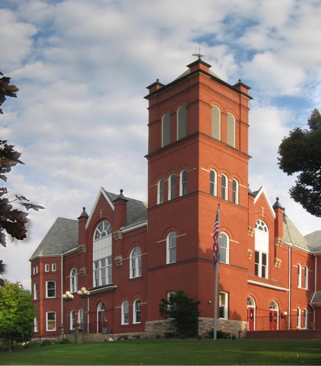
Sullivan County Courthouse |
 |
01978-12-15 December 15, 1978 |
Main and Muncy Streets
41°25′25″N 76°29′39″W / 41.42361°N 76.49417°W / 41.42361; -76.49417 (Sullivan County Courthouse) |
Laporte |
|
| 7 |
Worlds End State Park Family Cabin District |
 |
01987-05-18 May 18, 1987 |
2 miles (3.2 km) southeast of Forksville on Pennsylvania Route 154
41°28′2″N 76°34′35″W / 41.46722°N 76.57639°W / 41.46722; -76.57639 (Worlds End State Park Family Cabin District) |
Forks Township |
|
See also
References
- ^ The latitude and longitude information provided in this table was derived originally from the National Register Information System, which has been found to be fairly accurate for about 99% of listings. For about 1% of NRIS original coordinates, experience has shown that one or both coordinates are typos or otherwise extremely far off; some corrections may have been made. A more subtle problem causes many locations to be off by up to 150 yards, depending on location in the country: most NRIS coordinates were derived from tracing out latitude and longitudes off of USGS topographical quadrant maps created under North American Datum of 1927, which differs from the current, highly accurate GPS system used by Google maps. Chicago is about right, but NRIS longitudes in Washington are higher by about 4.5 seconds, and are lower by about 2.0 seconds in Maine. Latitudes differ by about 1.0 second in Florida. Some locations in this table may have been corrected to current GPS standards.
- ^ "National Register of Historic Places: Weekly List Actions". National Park Service, United States Department of the Interior. Retrieved on November 10, 2011.
- ^ Numbers represent an ordering by significant words. Various colorings, defined here, differentiate National Historic Landmark sites and National Register of Historic Places Districts from other NRHP buildings, structures, sites or objects.
- ^ "NPS Focus". National Register of Historic Places. National Park Service. http://nrhp.focus.nps.gov. Retrieved November 20, 2009.
Wikimedia Foundation.
2010.
Look at other dictionaries:
National Register of Historic Places listings in Pike County, Pennsylvania — Location of Pike County in Pennsylvania This is a list of the National Register of Historic Places listings in Pike County, Pennsylvania. This is intended to be a complete list of the properties and districts on the National Register of Historic… … Wikipedia
National Register of Historic Places listings in Wayne County, Pennsylvania — Location of Wayne County in Pennsylvania This is a list of the National Register of Historic Places listings in Wayne County, Pennsylvania. This is intended to be a complete list of the properties and districts on the National Register of… … Wikipedia
National Register of Historic Places listings in Lancaster County, Pennsylvania — Location of Lancaster County in Pennsylvania This is a list of the National Register of Historic Places listings in Lancaster County, Pennsylvania. This is intended to be a complete list of the properties and districts on the National Register of … Wikipedia
National Register of Historic Places listings in Tioga County, Pennsylvania — Location of Tioga County in Pennsylvania This is a list of the National Register of Historic Places listings in Tioga County, Pennsylvania. This is intended to be a complete list of the properties and districts on the National Register of… … Wikipedia
National Register of Historic Places listings in Allegheny County, Pennsylvania — Location of Allegheny County in Pennsylvania This is a list of the National Register of Historic Places listings in Allegheny County, Pennsylvania. This is intended to be a complete list of the properties and districts on the National Register of … Wikipedia
National Register of Historic Places listings in Bucks County, Pennsylvania — Location of Bucks County in Pennsylvania This is a list of the National Register of Historic Places listings in Bucks County, Pennsylvania. This is intended to be a complete list of the properties and districts on National Register of Historic… … Wikipedia
National Register of Historic Places listings in Montgomery County, Pennsylvania — Location of Montgomery County in Pennsylvania This is a list of the National Register of Historic Places listings in Montgomery County, Pennsylvania. This is intended to be a complete list of the properties and districts on National Register of… … Wikipedia
National Register of Historic Places listings in Washington County, Pennsylvania — Location of Washington County in Pennsylvania This is a list of the National Register of Historic Places listings in Washington County, Pennsylvania. This is intended to be a complete list of the properties and districts on the National Register… … Wikipedia
National Register of Historic Places listings in Dauphin County, Pennsylvania — Location of Dauphin County in Pennsylvania This is a list of the National Register of Historic Places listings in Dauphin County, Pennsylvania. This is intended to be a complete list of the properties and districts on the National Register of… … Wikipedia
National Register of Historic Places listings in Beaver County, Pennsylvania — Location of Beaver County in Pennsylvania This is a list of the National Register of Historic Places listings in Beaver County, Pennsylvania. This is intended to be a complete list of the properties and districts on the National Register of… … Wikipedia