- National Register of Historic Places listings in Shelby County, Tennessee
-
 Location of Shelby County in Tennessee
This is a list of the National Register of Historic Places listings in Shelby County, Tennessee.
This is intended to be a complete list of the properties and districts on the National Register of Historic Places in Shelby County, Tennessee, United States. Latitude and longitude coordinates are provided for many National Register properties and districts; these locations may be seen together in a Google map.[1]
There are 176 properties and districts listed on the National Register in the county, including 4 National Historic Landmarks.
Contents: Counties in Tennessee Anderson – Bedford – Benton – Bledsoe – Blount – Bradley – Campbell – Cannon – Carroll – Carter – Cheatham – Chester – Claiborne – Clay – Cocke – Coffee – Crockett – Cumberland – Davidson – Decatur – DeKalb – Dickson – Dyer – Fayette – Fentress – Franklin – Gibson – Giles – Grainger – Greene – Grundy – Hamblen – Hamilton – Hancock – Hardeman – Hardin – Hawkins – Haywood – Henderson – Henry – Hickman – Houston – Humphreys – Jackson – Jefferson – Johnson – Knox – Lake – Lauderdale – Lawrence – Lewis – Lincoln – Loudon – Macon – Madison – Marion – Marshall – Maury – McMinn – McNairy – Meigs – Monroe – Montgomery – Moore – Morgan – Obion – Overton – Perry – Pickett – Polk – Putnam – Rhea – Roane – Robertson – Rutherford – Scott – Sequatchie – Sevier – Shelby – Smith – Stewart – Sullivan – Sumner – Tipton – Trousdale – Unicoi – Union – Van Buren – Warren – Washington – Wayne – Weakley – White – Williamson – Wilson -
- This National Park Service list is complete through NPS recent listings posted November 10, 2011.[2]
Current listings
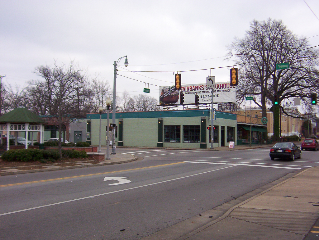
[3] Landmark name [4] Image Date listed Location City or town Summary 1 Adams Avenue Historic District November 25, 1980 Adams and Washington Aves.
35°08′54″N 90°02′59″W / 35.148333°N 90.049722°WMemphis 2 Walter Granville Allen House February 23, 1990 8504 Macon Rd.
35°09′22″N 89°46′44″W / 35.156111°N 89.778889°WCordova 3 Anderson-Coward House March 13, 1986 919 Coward Pl.
35°07′50″N 90°01′53″W / 35.130556°N 90.031389°WMemphis 4 Annesdale November 25, 1980 1325 Lamar Ave.
35°07′30″N 90°01′03″W / 35.125°N 90.0175°WMemphis 5 Annesdale Park Historic District December 22, 1978 Roughly bounded by Peabody and Goodbar Aves., Cleveland St. and Rosenstein Pl.
35°07′49″N 90°01′09″W / 35.130278°N 90.019167°WMemphis 6 Annesdale-Snowden Historic District October 25, 1979 Roughly bounded by Interstate 240, Lamar Ave. and Heistan Pl
35°07′33″N 90°01′40″W / 35.125833°N 90.027778°WMemphis 7 Arlington Historic District May 17, 1982 Brown, Campbell, Chester, Quintard, Greenlee, and Walker Sts.
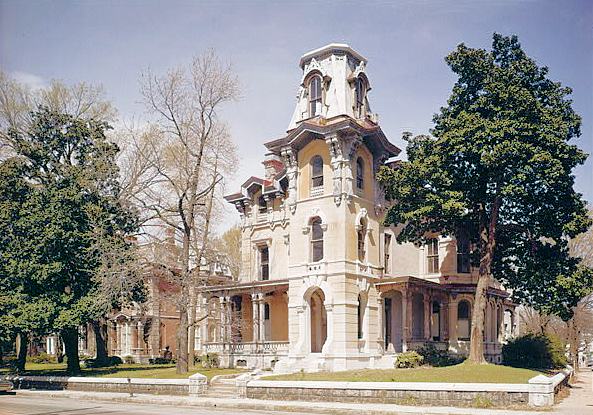
35°17′37″N 89°39′44″W / 35.293611°N 89.662222°WArlington 8 Ashlar Hall January 13, 1983 1397 Central Ave.
35°07′34″N 90°00′57″W / 35.126111°N 90.015833°WMemphis 9 John Alexander Austin House July 12, 1984 290 S. Front St.
35°08′19″N 90°03′26″W / 35.138611°N 90.057222°WMemphis 10 Bank of Commerce and Trust Company Building May 7, 1980 45 S. 2nd St.
35°08′36″N 90°03′08″W / 35.143333°N 90.052222°WMemphis 11 Pauline Cheek Barton House September 7, 1995 6562 Green Shadows Ln.
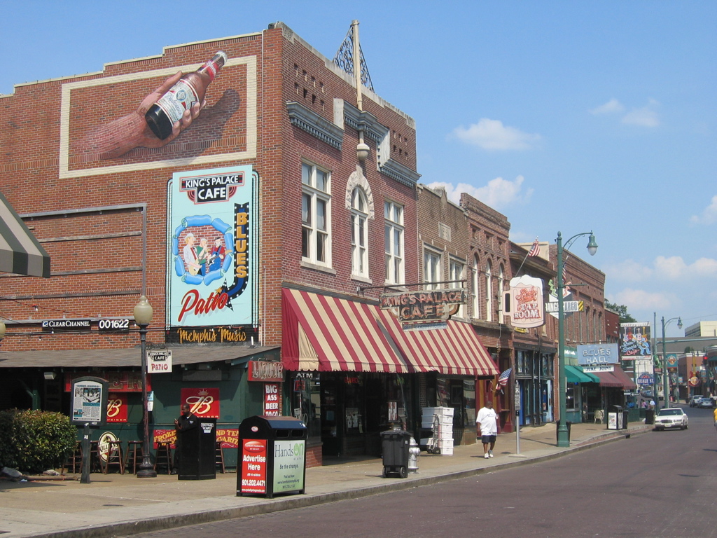
35°05′24″N 89°50′42″W / 35.09°N 89.845°WMemphis 12 Beale Street Historic District 
October 15, 1966 Beale St. from 2nd to 4th Sts.
35°08′23″N 90°03′05″W / 35.139722°N 90.051389°WMemphis 13 Boyce-Gregg House December 19, 1979 317 S. Highland St.
35°07′22″N 89°56′45″W / 35.122778°N 89.945833°WMemphis 14 Bradford-Maydwell House December 26, 1979 648 Poplar Ave.
35°08′48″N 90°02′17″W / 35.146667°N 90.038056°WMemphis 15 John Willard Brister Library July 11, 1980 Memphis State University campus
35°07′05″N 89°56′24″W / 35.118056°N 89.94°WMemphis 16 Wilks Brooks House May 16, 1980 2000 Old Oak Dr.
35°06′12″N 89°50′52″W / 35.103333°N 89.847778°WMemphis 17 Calvary Episcopal Church and Parish House 
April 27, 1982 102 N. 2nd St.
35°08′50″N 90°03′00″W / 35.147222°N 90.05°WMemphis 18 Joseph A. Campbell House March 29, 1991 215 South St.
35°02′21″N 89°39′58″W / 35.039167°N 89.666111°WCollierville 19 Capleville Methodist Church April 3, 1979 5053 Shelby Dr.
35°01′12″N 89°53′43″W / 35.02°N 89.895278°WCapleville 20 Capt. Harris House December 19, 1979 2106 Young St.
35°07′10″N 89°59′30″W / 35.119444°N 89.991667°WMemphis 21 Robert M. Carrier House May 27, 1980 642 S. Willett St.
35°07′43″N 90°00′35″W / 35.128611°N 90.009722°WMemphis 22 Central Gardens Historic District 
September 9, 1982 Roughly bounded by Rembert St., York, Cleveland, and Eastmoreland Aves.
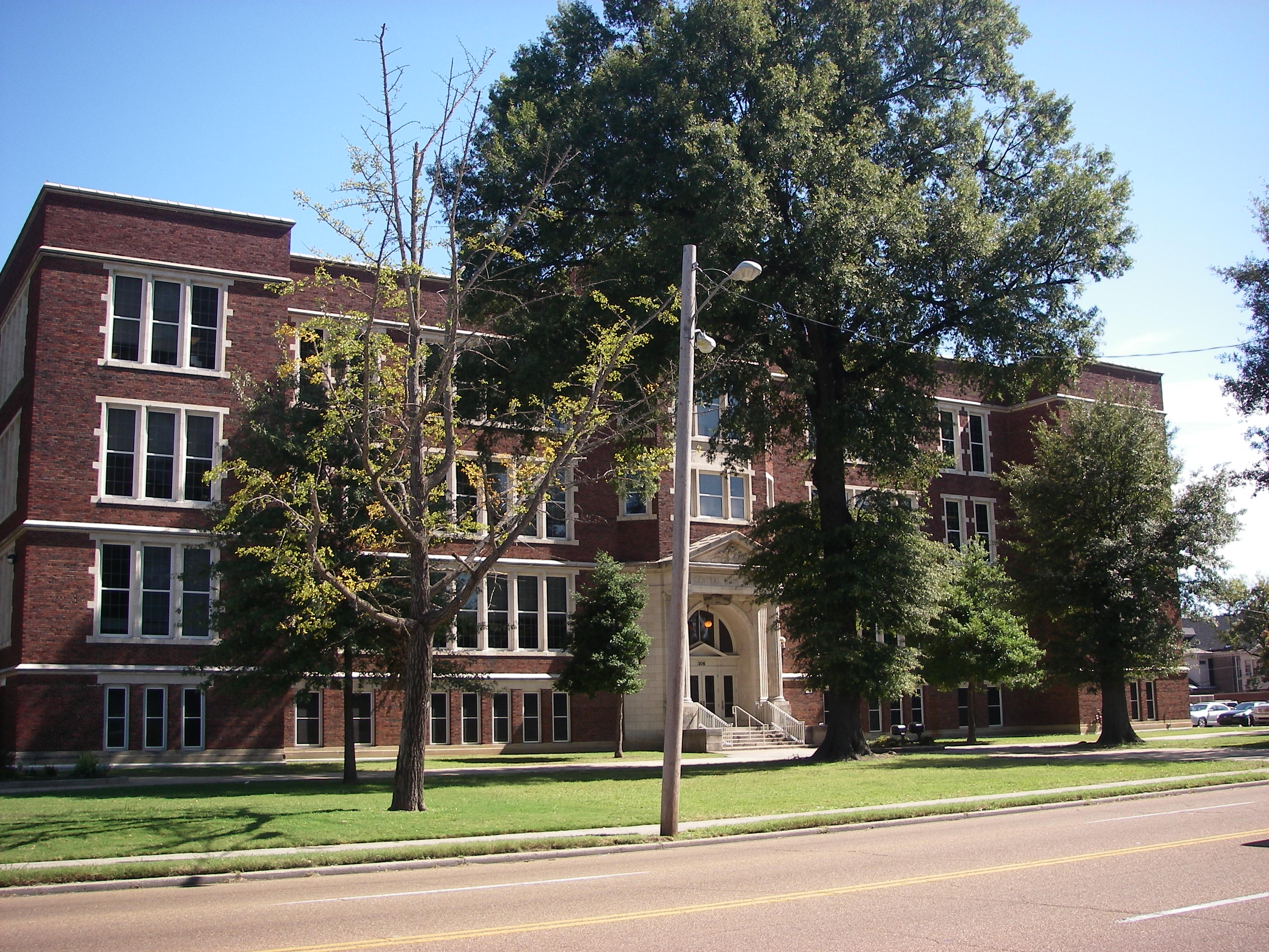
35°07′47″N 90°00′24″W / 35.129722°N 90.006667°WMemphis 23 Central High School 
September 17, 1982 306 S. Bellevue Boulevard
35°08′01″N 90°01′11″W / 35.133611°N 90.019722°WMemphis 24 Chickasaw Heritage Park 
November 25, 1997 Junction of Riverside Boulevard and Ornamental Metal Museum Dr.
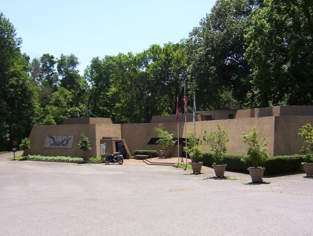
35°07′21″N 90°04′28″W / 35.1225°N 90.074444°WMemphis 25 Chucalissa Indian Village 
May 7, 1973 Mitchell Rd.
35°03′45″N 90°07′44″W / 35.0625°N 90.128889°WMemphis 26 Cornelius Lawrence Clancy House November 25, 1983 911 Kerr Ave.
35°06′23″N 90°01′57″W / 35.106389°N 90.0325°WMemphis 27 Collierville Historic District 
March 12, 1990 Roughly N. and S. Rowlett, Poplar, and Walnut Sts.
35°02′35″N 89°40′02″W / 35.043056°N 89.667222°WCollierville 28 Collins Chapel CME Church and Site March 29, 1991 678 Washington Ave.
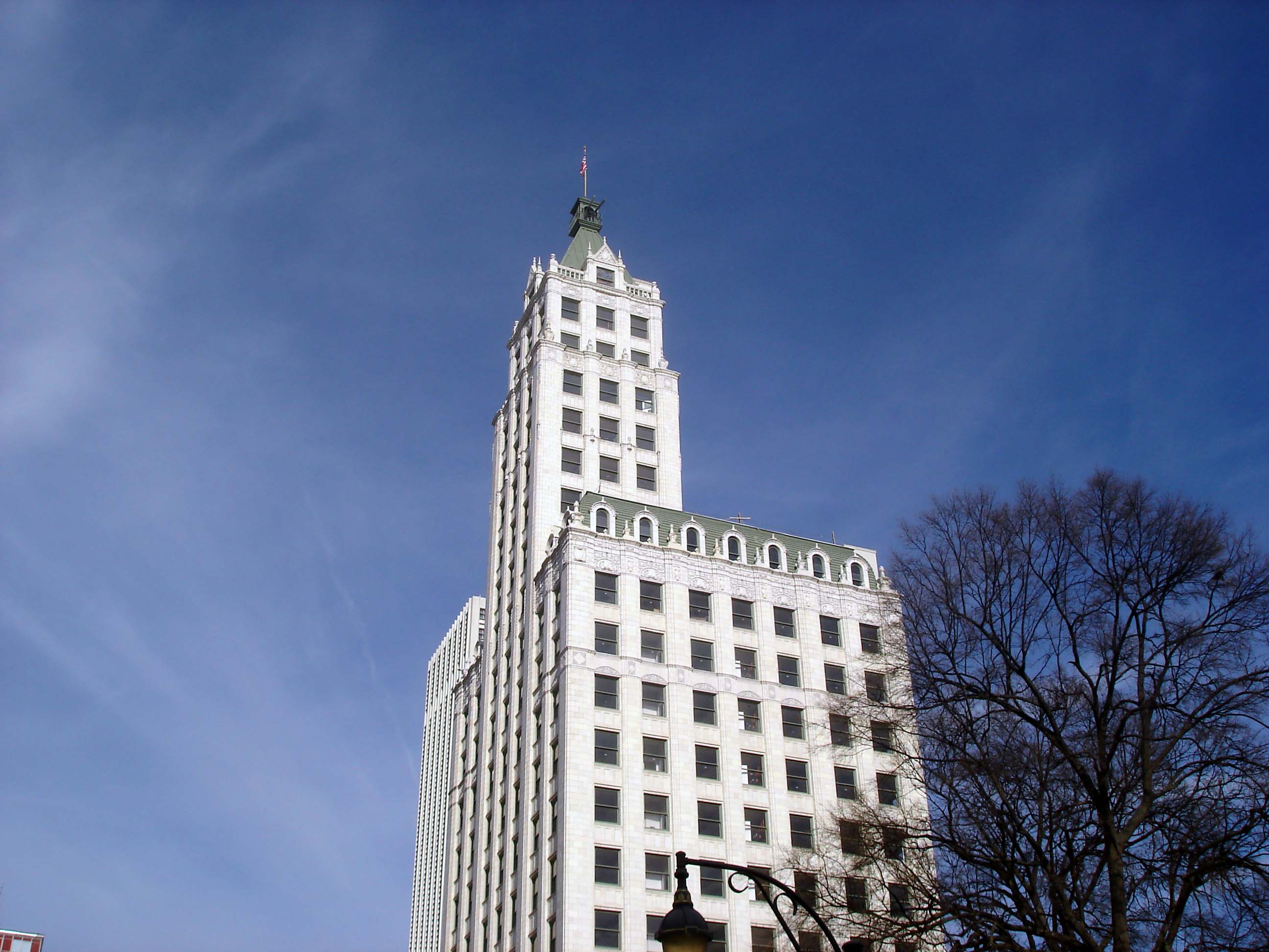
35°08′44″N 90°02′17″W / 35.145556°N 90.038056°WMemphis 29 Columbian Mutual Tower 
July 24, 1978 60 N. Main St.
35°08′48″N 90°03′06″W / 35.146667°N 90.051667°WMemphis 30 Cooper-Young Historic District 
June 22, 1989 Roughly bounded by the former L&N railroad tracks, E. Parkway S., Southern Ave., and S. McLean Boulevard
35°07′13″N 89°59′32″W / 35.120278°N 89.992222°WMemphis 31 Cordova School 
July 28, 1995 1017 Sanga Rd.
35°09′11″N 89°46′18″W / 35.153056°N 89.771667°WMemphis 32 Cotton Row Historic District 
August 1, 1979 S. Front St. between Monroe and Gayoso Aves.
35°08′26″N 90°03′21″W / 35.140556°N 90.055833°WMemphis 33 Court Square Historic District 
April 15, 1982 Roughly bounded by Riverside Dr., N. 2nd St., and Madison and Jefferson Aves.
35°08′46″N 90°03′09″W / 35.146111°N 90.0525°WMemphis 34 Crisscross Lodge April 6, 1989 10056 Poplar Ave.
35°03′02″N 89°43′41″W / 35.050556°N 89.728056°WCollierville 35 E.H. Crump House December 26, 1979 1962 Peabody Ave.
35°07′55″N 89°59′45″W / 35.131944°N 89.995833°WMemphis 36 Rowland J. Darnell House March 26, 1979 1433 Union Ave.
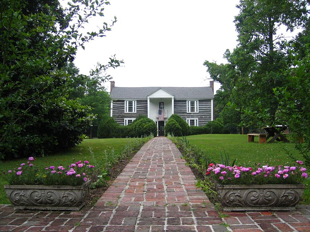
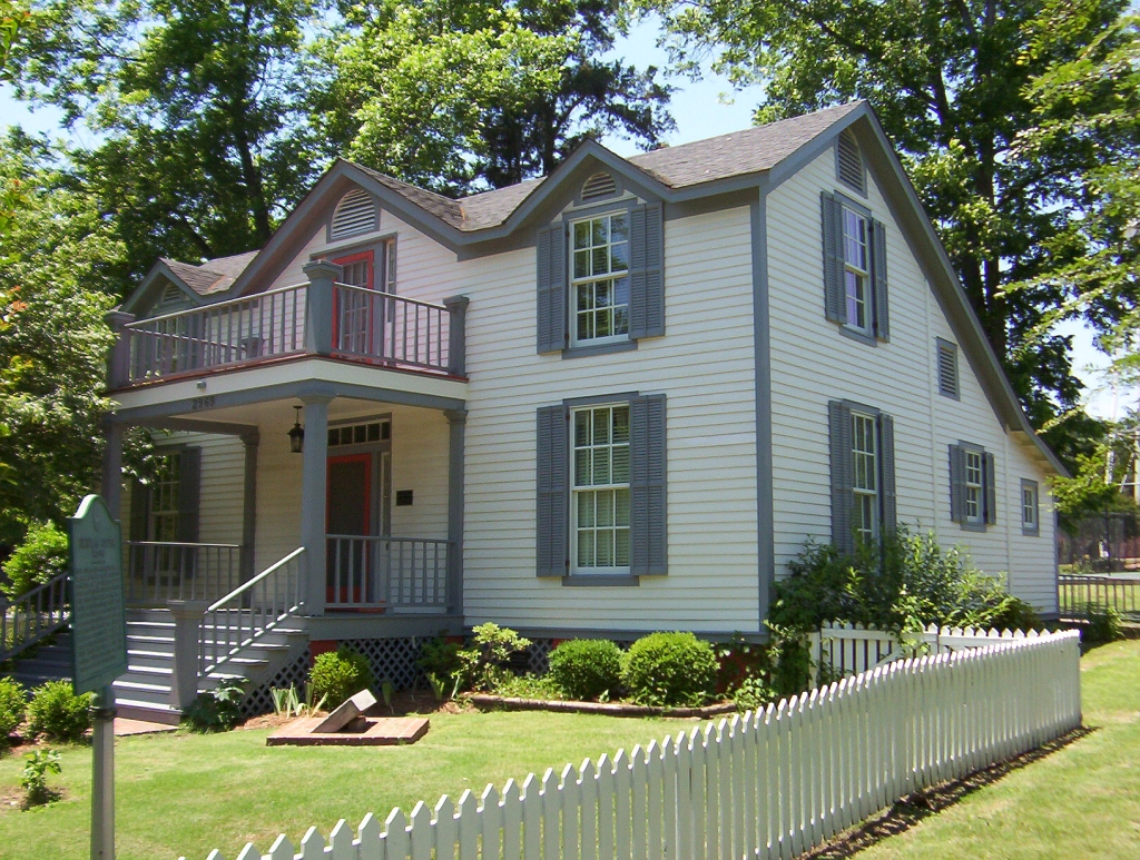
35°08′10″N 90°00′49″W / 35.136111°N 90.013611°WMemphis 37 Davies Manor 
March 19, 1975 9336 Davies Plantation Rd.
35°13′13″N 89°45′04″W / 35.220278°N 89.751111°WMemphis 38 Delmar-Lema Historic District March 12, 1998 1044-1066 Delmar Ave; 1044–1060, 1041-1061 Lemar Pl.
35°08′54″N 90°01′31″W / 35.148333°N 90.025278°WMemphis 39 Dermon Building 
March 15, 1984 46 N. 3rd St.
35°08′44″N 90°02′58″W / 35.145556°N 90.049444°WMemphis 40 Dixie Greyhound Bus Lines Complex 
November 21, 2003 525 N. Main St.
35°09′31″N 90°02′53″W / 35.158611°N 90.048056°WMemphis 41 Douglass High School November 9, 2007 3200 Mount Olive Rd.
35°10′32″N 89°57′06″W / 35.175556°N 89.951667°WMemphis 42 Jack Dudney House March 29, 1991 90 W. Poplar Ave.
35°02′45″N 89°39′55″W / 35.045833°N 89.665278°WCollierville 43 East Buntyn Historic District November 22, 1995 Roughly bounded by Central and Southern Aves. and Ellsworth and Greer Sts.
35°07′11″N 89°57′09″W / 35.119722°N 89.9525°WMemphis 44 Elam Homestead September 18, 1980 1428 Fox St.
35°05′33″N 89°57′05″W / 35.0925°N 89.951389°WMemphis 45 William C. Ellis and Sons Ironworks and Machine Shop August 25, 1983 231-245 S. Front St.
35°08′24″N 90°03′25″W / 35.14°N 90.056944°WMemphis 46 Elmwood Cemetery 
March 20, 2002 824 Dudley St.
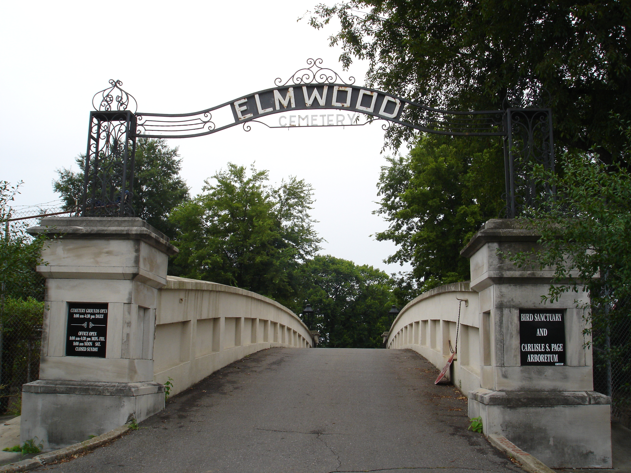
35°07′28″N 90°01′46″W / 35.124317°N 90.029467°WMemphis 47 Elmwood Cemetery Office and Entrance Bridge 
May 22, 1978 824 S. Dudley St.
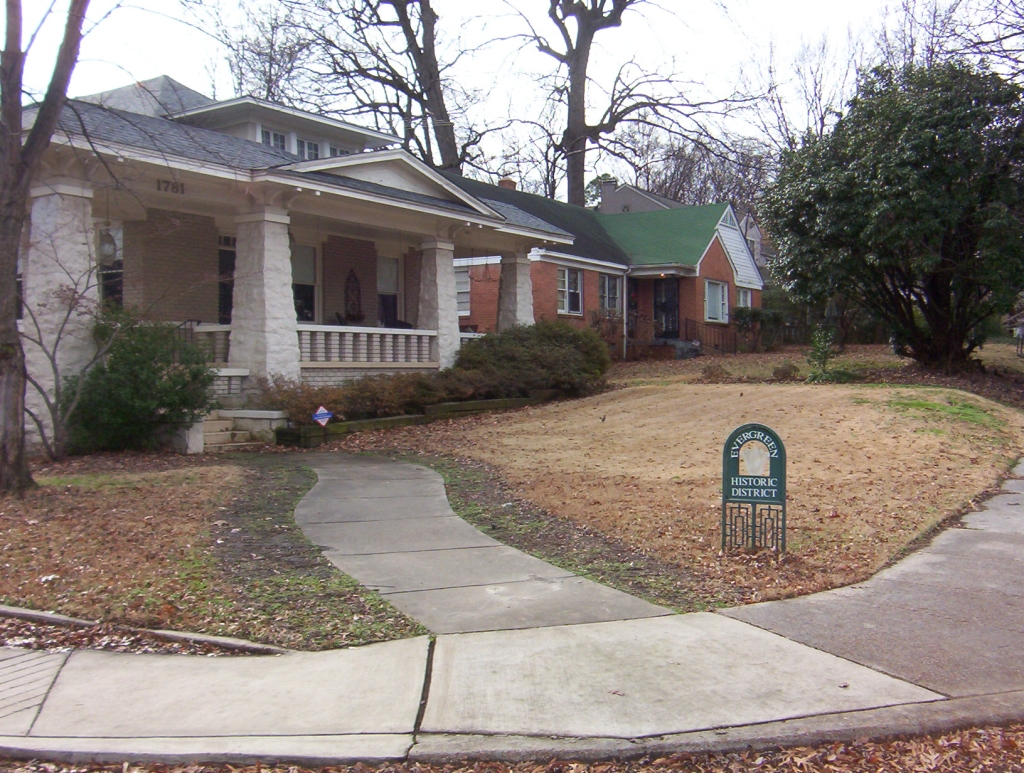
35°07′27″N 90°01′45″W / 35.124167°N 90.029167°WMemphis 48 Evergreen Historic District 
January 11, 1985 Roughly bounded by N. Parkway, Kenilworth St., Watkins St., and Court Ave.
35°08′41″N 90°00′43″W / 35.144722°N 90.011944°WMemphis 49 Fairview Junior High School October 25, 1990 750 E. Parkway South
35°07′30″N 89°58′55″W / 35.125°N 89.981944°WMemphis 50 First Baptist Church March 15, 2005 538 Linden Ave.
35°08′19″N 90°02′38″W / 35.138611°N 90.043889°WMemphis 51 First Baptist Church February 11, 1971 379 Beale Ave.
35°08′19″N 90°02′54″W / 35.138611°N 90.048333°WMemphis 52 First Colored Baptist Church July 14, 2000 682 S. Lauderdale St.
35°07′43″N 90°02′37″W / 35.128611°N 90.043611°WMemphis 53 First Congregational Church and Parish House July 21, 1980 234 S. Watkins St.
35°08′07″N 90°00′54″W / 35.135278°N 90.015°WMemphis 54 First Presbyterian Church March 15, 2005 166 Poplar Ave.
35°09′06″N 90°02′55″W / 35.151667°N 90.048611°WMemphis 55 John M. Fleming Home Place December 6, 1990 1545 S. Byhalia Rd.
35°00′09″N 89°41′51″W / 35.0025°N 89.6975°WCollierville 56 Forrest Park Historic District 
March 4, 2009 S. Manassas St. and Union Ave.
35°08′22″N 90°02′05″W / 35.13953°N 90.03474°WMemphis 57 Fountain Court Historic District December 17, 1998 1155-1229 Fountain Court
35°06′59″N 90°02′02″W / 35.116389°N 90.033889°WMemphis 58 Fowlkes-Boyle House August 7, 1974 208 Adams Ave.
35°08′49″N 90°02′50″W / 35.146944°N 90.047222°WMemphis 59 Galloway-Speedway Historic District July 28, 2004 N. Parkway, Faxon, Greenlaw, Galloway, and Forrest Aves.
35°09′25″N 90°01′37″W / 35.156944°N 90.026944°WMemphis 60 Gaston Park Historic District July 3, 1989 1046 S. 3rd St.
35°07′09″N 90°03′15″W / 35.119167°N 90.054167°WMemphis 61 Gayoso-Peabody Historic District May 7, 1980 Roughly along S. Main St. from McCall Pl. to Monroe Ave.
35°08′31″N 90°03′11″W / 35.141944°N 90.053056°WMemphis 62 Germantown Baptist Church April 1, 1975 2216 Germantown Rd.
35°05′04″N 89°48′38″W / 35.084444°N 89.810556°WGermantown 63 Germantown Redoubt June 6, 1991 Honey Tree Dr. south of its junction with Poplar Pike
35°04′25″N 89°47′37″W / 35.073611°N 89.793611°WGermantown 64 Glenview Historic District October 7, 1999 Bounded by the former Southern railroad line, Lamar Ave., S. Parkway East, and the former St. Louis – San Francisco railroad line
35°06′24″N 89°59′58″W / 35.106681°N 89.999372°WMemphis 65 Goodwinslow December 6, 1979 4066 James Rd.
35°12′35″N 89°55′35″W / 35.209722°N 89.926389°WRaleigh 66 Goodwyn Street Historic District March 9, 1990 Goodwyn St. from Central to Southern Aves.
35°07′11″N 89°57′45″W / 35.119722°N 89.9625°WMemphis 67 Nicholas Gotten House 
March 20, 2002 2969 Court St.
35°12′23″N 89°52′26″W / 35.206389°N 89.873889°WBartlett 68 Grace Episcopal Church March 15, 2005 555 Vance Ave.
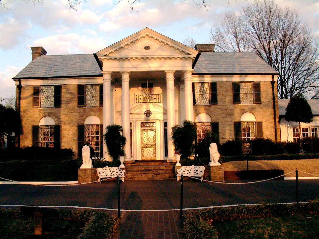
35°08′10″N 90°02′38″W / 35.136111°N 90.043889°WMemphis 69 Graceland 
November 7, 1991 3764 Elvis Presley Boulevard
35°02′45″N 90°01′22″W / 35.045833°N 90.022778°WMemphis 70 Green Meadows-Poplar Glen Historic District April 22, 2003 Roughly along Union Ave. Extension, Patricia Dr., Madison Ave., Ashlawn Rd., Ashlawn Cove, and Alicia Dr.
35°08′09″N 89°58′44″W / 35.135833°N 89.978889°WMemphis 71 Greenlaw Addition Historic District August 16, 1984 Roughly bounded by Bethel, Thomas, 7th, Auction, and 2nd Sts.
35°09′34″N 90°02′30″W / 35.159444°N 90.041667°WMemphis 72 Greenlevel March 6, 1987 853 Collierville-Arlington Rd., S.
35°06′06″N 89°39′33″W / 35.101667°N 89.659167°WCollierville 73 Greenstone Apartments May 14, 1980 1116-1118 Poplar Ave. and 200 Waldran Boulevard
35°08′41″N 90°01′23″W / 35.144722°N 90.023056°WMemphis 74 Greenwood July 9, 1979 1560 Central Ave.
35°07′36″N 90°00′36″W / 35.126667°N 90.01°WMemphis 75 Hein Park Historic District November 16, 1988 Bounded by Charles Pl., Jackson Ave., Trezevant St., and N. Parkway Dr.
35°09′17″N 89°59′00″W / 35.154722°N 89.983333°WMemphis 76 High Point Terrace Historic District 
December 12, 2002 Bounded by Highland, Eastland and Swan Ridge Circle, Walnut Grove and Sam Cooper
35°08′23″N 89°56′18″W / 35.139722°N 89.938333°WMemphis 77 Hotel Claridge April 29, 1982 109 N. Main St.
35°08′52″N 90°03′06″W / 35.147778°N 90.051667°WMemphis 78 J.W. Houston House March 29, 1991 259 S. Center St.
35°02′15″N 89°39′58″W / 35.0375°N 89.666111°WCollierville 79 L.C. Humes High School July 12, 2004 659 N. Manassas
35°09′23″N 90°01′49″W / 35.156389°N 90.030278°WMemphis 80 Hunt-Phelan House 
February 11, 1971 533 Beale Ave.
35°08′15″N 90°02′38″W / 35.1375°N 90.043889°WMemphis 81 Idlewild Historic District March 5, 1999 Roughly bounded by S. Cooper St., Linden Ave., Rembert St., and Central Ave.
35°07′47″N 89°59′35″W / 35.129722°N 89.993056°WMemphis 82 Idlewild Presbyterian Church July 7, 2009 1750 Union Ave.
35°08′09″N 90°00′12″W / 35.135889°N 90.003206°WMemphis 83 The Knickerbocker Apartments November 8, 2007 23-25 S. McLean Boulevard
35°08′13″N 89°59′59″W / 35.136944°N 89.999722°WMemphis 84 Lauderdale Courts Public Housing Project July 25, 1996 Danny Thomas Boulevard, Alabama Ave., Exchange Ave., 3rd St., and Winchester
35°09′03″N 90°02′41″W / 35.150833°N 90.044722°WMemphis 85 Lee and Fontaine Houses of the James Lee Memorial 
February 11, 1971 680-690 Adams Ave.
35°08′38″N 90°02′07″W / 35.143889°N 90.035278°WMemphis 86 James Lee House October 2, 1978 239 Adams Ave.
35°08′49″N 90°02′51″W / 35.146944°N 90.0475°WMemphis 87 Lt. George W. Lee House May 2, 1994 563 Stephens Pl.
35°07′14″N 90°02′36″W / 35.120556°N 90.043333°WMemphis 88 LeMoyne College Historic District November 9, 2005 Roughly bounded by Walker, Hollis Price, Crown, and the alley to the rear of Sweeney Hall
35°07′15″N 90°02′05″W / 35.120833°N 90.034722°WMemphis 89 LeMoyne Gardens Public Housing Project July 25, 1996 Walker, Porter, Provine, and Neptune Sts.
35°07′18″N 90°02′04″W / 35.121667°N 90.034444°WMemphis 90 Lenox School July 30, 1981 519 S. Edgewood Ave.
35°07′53″N 89°59′12″W / 35.131389°N 89.986667°WMemphis 91 George Collins Love House April 2, 1979 619 N. 7th St.
35°09′33″N 90°02′22″W / 35.159167°N 90.039444°WMemphis 92 Lowenstein House March 23, 1979 756 Jefferson Ave.
35°08′34″N 90°02′07″W / 35.142778°N 90.035278°WMemphis 93 Abraham Lowenstein House January 5, 1984 217 N. Waldran Boulevard
35°08′44″N 90°01′26″W / 35.145556°N 90.023889°WMemphis 94 B. Lowenstein & Brothers Building June 16, 1983 27 S. Main St.
35°08′39″N 90°03′11″W / 35.144167°N 90.053056°WMemphis 95 Madison-Monroe Historic District May 19, 1983 Madison and Monroe Aves., Main and 2nd Sts.
35°08′38″N 90°03′09″W / 35.143889°N 90.0525°WMemphis 96 Magevney House 
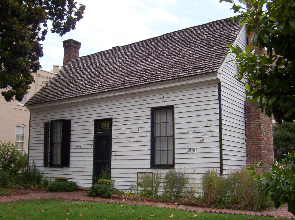
November 6, 1973 198 Adams Ave.
35°08′50″N 90°02′53″W / 35.147222°N 90.048056°WMemphis 97 Martin Memorial Temple CME Church November 20, 2002 65 S. Parkway West
35°06′27″N 90°03′51″W / 35.1075°N 90.064167°WMemphis 98 Mason Temple, Church of God in Christ April 10, 1992 958 Mason St.
35°07′18″N 90°02′56″W / 35.121667°N 90.048889°WMemphis 99 Maxwelton March 10, 1980 3105 Southern Ave.
35°06′53″N 89°57′27″W / 35.114722°N 89.9575°WMemphis 100 John H. McFadden House June 10, 1994 3712 Broadway
35°13′34″N 89°49′05″W / 35.226111°N 89.818056°WBartlett 101 John B. McFerrin House March 29, 1991 156 W. Poplar Ave.
35°02′46″N 89°40′02″W / 35.046111°N 89.667222°WCollierville 102 Medical Arts Building and Garage August 16, 1984 248 Madison Ave. and 11 N. 4th St.
35°08′38″N 90°02′51″W / 35.143889°N 90.0475°WMemphis 103 Melrose School May 2, 2001 843 Dallas St.
35°06′34″N 89°57′52″W / 35.109444°N 89.964444°WMemphis 104 Memphis Merchants Exchange 
May 8, 1979 2nd St. and Madison Ave.
35°08′42″N 90°03′06″W / 35.145°N 90.051667°WMemphis 105 Memphis National Cemetery 
October 30, 1996 3568 Townes Ave.
35°10′23″N 89°56′13″W / 35.173056°N 89.936944°WMemphis 106 Memphis Parkway System 
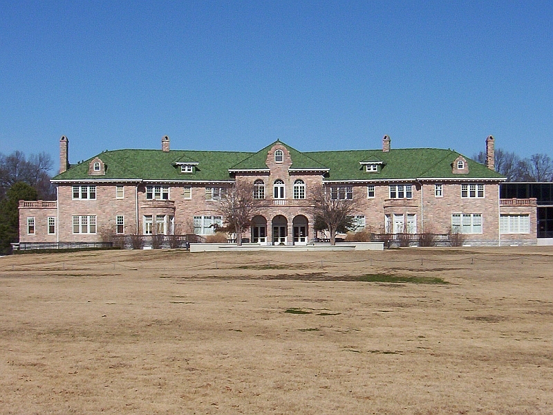
July 3, 1989 S. Parkway West, S. Parkway East, E Parkway South, E. Parkway North, N. Parkway Memphis 107 Memphis Pink Palace Museum 
July 9, 1980 3050 Central Ave.
35°07′29″N 89°57′37″W / 35.124722°N 89.960278°WMemphis 108 Memphis Queen II Floating Vessel July 5, 2006 Foot of Monroe at Riverside Dr.
35°08′46″N 90°03′24″W / 35.146111°N 90.056667°WMemphis 109 Memphis Trust Building November 25, 1980 12 S. Main St.
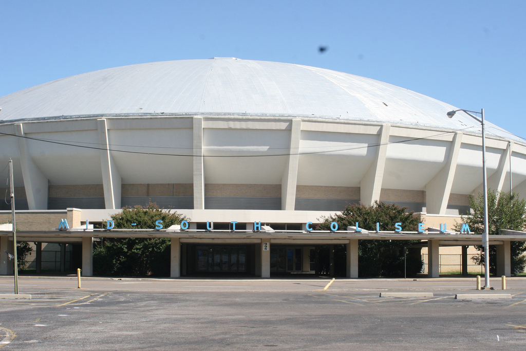
35°08′40″N 90°03′09″W / 35.144444°N 90.0525°WMemphis 110 Mid-South Coliseum 
December 6, 2000 996 Early Maxwell Boulevard
35°07′04″N 89°58′51″W / 35.117778°N 89.980833°WMemphis 111 William R. Moore Dry Goods Building August 26, 1982 183 Monroe Ave.
35°08′34″N 90°03′01″W / 35.142778°N 90.050278°WMemphis 112 Mosby-Bennett House May 27, 1980 626 Poplar Pike
35°06′05″N 89°51′17″W / 35.101389°N 89.854722°WMemphis 113 Mt. Airy February 14, 2002 10700 Latting Rd.
35°10′50″N 89°42′01″W / 35.180556°N 89.700278°WCordova 114 Nelson-Kirby House October 23, 1986 6792 Poplar Pike
35°05′48″N 89°50′10″W / 35.096667°N 89.836111°WGermantown 115 Joseph Newburger House April 29, 1982 168 E. Parkway South
35°07′58″N 89°58′58″W / 35.132778°N 89.982778°WMemphis 116 Normal Station Historic District August 10, 2005 Roughly bounded by Highland, Goodlett, the former Southern railroad line, and the rear property lines of Marion and parcels on Park
35°05′49″N 89°55′57″W / 35.096944°N 89.9325°WMemphis 117 Orpheum Theatre 
August 15, 1977 197 S. Main St.
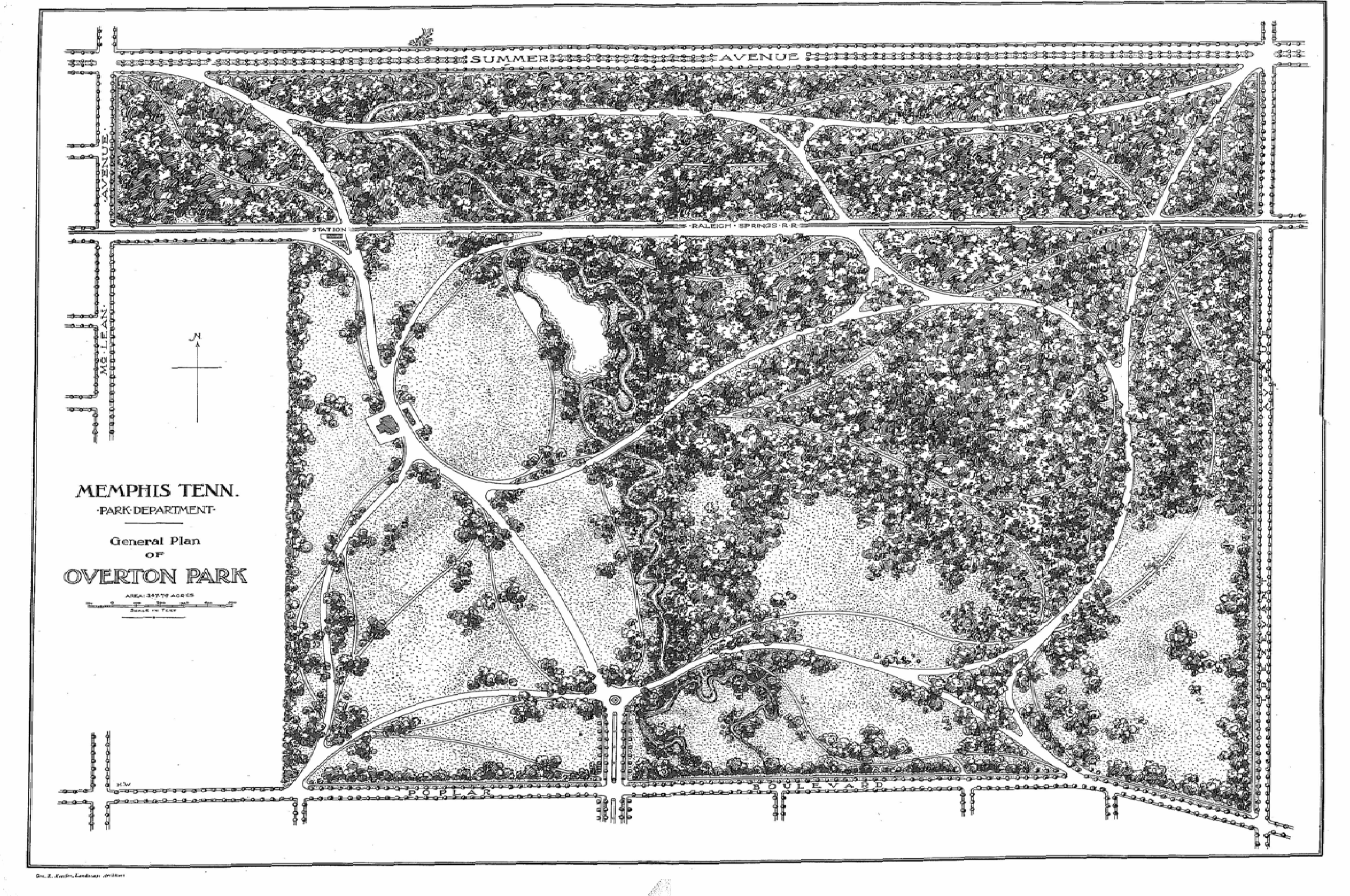
35°08′23″N 90°03′18″W / 35.139722°N 90.055°WMemphis 118 Overton Park Historic District 
October 25, 1979 Roughly bounded by Poplar Ave., E. Parkway North, N. Parkway East, and Kenilworth St.
35°08′48″N 89°59′21″W / 35.146667°N 89.989167°WMemphis 119 Overton Parkway Historic District November 18, 1999 Roughly bounded by Cooper St., E. Parkway, Poplar and Madison Sts.
35°08′19″N 89°59′13″W / 35.138611°N 89.986944°WMemphis 120 Paisley Hall February 12, 1980 1822 Overton Park Ave.
35°08′55″N 89°59′54″W / 35.148611°N 89.998333°WMemphis 121 Patton-Bejach House July 27, 1979 1085 Poplar St.
35°08′38″N 90°01′25″W / 35.143889°N 90.023611°WMemphis 122 Peabody Elementary School September 17, 1982 2086 Young Ave.
35°07′11″N 89°59′33″W / 35.119722°N 89.9925°WMemphis 123 Peabody Hotel 
September 14, 1977 149 Union Ave.
35°08′33″N 90°03′11″W / 35.1425°N 90.053056°WMemphis 124 Pinch-North Main Commercial District October 18, 1979 Roughly bounded by N. Front and N. 2nd Sts., Commerce and Auction Aves.; also 122 Jackson Ave.
35°09′20″N 90°02′56″W / 35.155556°N 90.048889°WMemphis 122 Jackson represents a boundary increase of October 25, 1990 125 Dr. D.T. Porter Building April 18, 1977 10 N. Main St.
35°08′43″N 90°03′08″W / 35.145278°N 90.052222°WMemphis 126 Porter-Leath May 8, 1979 850 N. Manassas St.
35°09′54″N 90°01′53″W / 35.165°N 90.031389°WMemphis 127 Elvis Presley House March 9, 2006 1034 Audubon Dr.
35°06′19″N 89°55′12″W / 35.105278°N 89.92°WMemphis 128 Eli Rayner House May 9, 1977 1020 Rayner St.
35°07′06″N 90°00′40″W / 35.118333°N 90.011111°WMemphis 129 Newton Copeland Richards House July 12, 1984 975 Peabody Ave.
35°07′57″N 90°01′44″W / 35.1325°N 90.028889°WMemphis 130 Dr. Christopher M. Roulhac House April 15, 2004 810 McLemore Ave.
35°07′04″N 90°02′07″W / 35.117778°N 90.035278°WMemphis 131 Rozelle Elementary School September 17, 1982 993 Roland St.
35°07′08″N 90°00′34″W / 35.118889°N 90.009444°WMemphis 132 St. Mary's Cathedral, Chapel, and Diocesan House 
January 19, 1979 700, 714, and 692 Poplar Ave.
35°08′47″N 90°02′11″W / 35.146389°N 90.036389°WMemphis 133 St. Mary's Catholic Church August 7, 1974 155 Market St.
35°09′04″N 90°02′52″W / 35.151111°N 90.047778°WMemphis 134 St. Paul Avenue Historic District December 17, 1998 751-53 to 775-77 St. Paul Ave., and 558 Boyd St.
35°07′59″N 90°02′11″W / 35.133056°N 90.036389°WMemphis 135 St. Thomas Catholic Church and Convent March 15, 2005 588 E. Trigg Ave.
35°06′52″N 90°02′36″W / 35.114444°N 90.043333°WMemphis 136 Scimitar Building June 30, 1983 179 Madison Ave.
35°08′38″N 90°03′00″W / 35.143889°N 90.05°WMemphis 137 Sculptures of Dionicio Rodriguez at Memorial Park Cemetery 
January 31, 1991 5668 Poplar Ave.
35°06′30″N 89°52′25″W / 35.108333°N 89.873611°WMemphis 138 Second Congregational Church 
August 26, 1982 764 Walker Ave.
35°07′10″N 90°02′11″W / 35.119444°N 90.036389°WMemphis 139 Second Presbyterian Church September 4, 1979 280 Hernando St.
35°08′07″N 90°03′04″W / 35.135278°N 90.051111°WMemphis 140 Shadowlawn Historic District August 14, 1995 Roughly bounded by Shadowlawn, Wellington, S. Parkway and Essex Sts.
35°06′15″N 90°02′50″W / 35.104167°N 90.047222°WMemphis 141 Shrine Building March 29, 1979 66 Monroe Ave.
35°08′40″N 90°03′16″W / 35.144444°N 90.054444°WMemphis 142 South Bluffs Warehouse Historic District June 4, 1987 Roughly S. Front St., Wagner Pl., and Tennessee St. from Beale St. to Calhoun Ave.
35°08′09″N 90°03′36″W / 35.135833°N 90.06°WMemphis 143 South Main Street Historic District 
September 2, 1982 Roughly S. Main St. between Webster and Linden, and Mulberry between Calhoun and Vance Aves.; also 663 S. Main St.; also 384 Mulberry and 129 Talbot
35°08′01″N 90°03′28″W / 35.133611°N 90.057778°WMemphis 663 S. Main represents a boundary increase of March 8, 1997; 384 Mulberry and 129 Tablot represent a boundary increase of July 9, 1999 144 South Parkway-Heiskell Farm Historic District February 11, 1983 S. Parkway East and E. Parkway South
35°06′47″N 89°59′27″W / 35.113056°N 89.990833°WMemphis 145 Southern Railway Industrial Historic District April 24, 2007 Roughly bounded by Beale, Myrtle, and the former Southern railroad tracks, Linden, Jessamine and Orleans
35°08′14″N 90°02′24″W / 35.137328°N 90.04°WMemphis 146 Southwestern at Memphis Historic District July 20, 1978 2000 N. Parkway
35°09′13″N 89°59′24″W / 35.153611°N 89.99°WMemphis 147 Southwestern at Memphis Sorority Row Historic District July 12, 2006 2000 North Parkway at Rhodes College
35°09′24″N 89°59′15″W / 35.156667°N 89.9875°WMemphis 148 Speedway Terrace Historic District 
March 19, 1999 Roughly bounded by N. Watkins, Snowden, N. Bellevue, and Forrest Ave.
35°09′23″N 90°01′04″W / 35.156389°N 90.017778°WMemphis 149 Squire's Rest May 31, 2007 8993 Barret Rd.
35°22′19″N 89°45′54″W / 35.371944°N 89.765°WBarretville 150 Steele Hall March 23, 1979 LeMoyne-Owen College campus
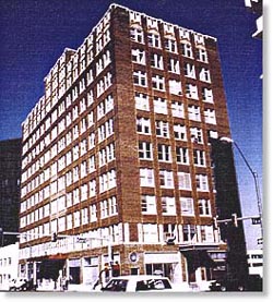
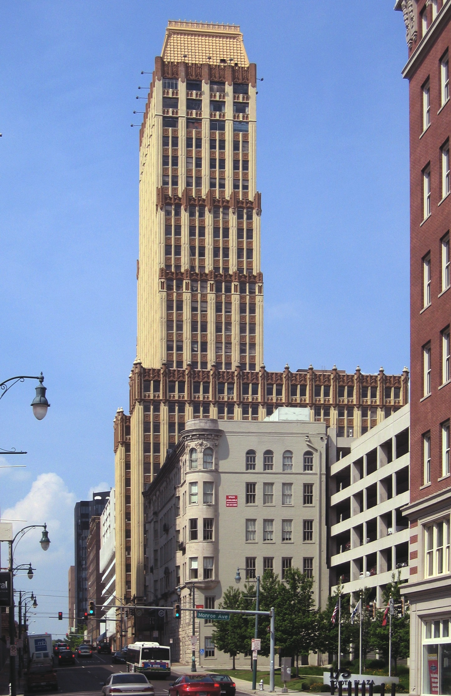
35°07′09″N 90°02′09″W / 35.119167°N 90.035833°WMemphis 151 Sterick Building 
October 2, 1978 8 N. 3rd St.
35°08′40″N 90°02′59″W / 35.144444°N 90.049722°WMemphis 152 Stonewall Place Historic District March 25, 1982 Stonewall St. between Poplar Ave. and North Parkway
35°08′52″N 90°00′36″W / 35.147778°N 90.01°WMemphis 153 Strathmore Place Historic District December 17, 1998 Strathmore Circle East, North, and South, and 280 and 292 East Parkway
35°08′04″N 89°58′51″W / 35.134444°N 89.980833°WMemphis 154 Leslie M. Stratton YMCA June 30, 1983 245 Madison Ave.
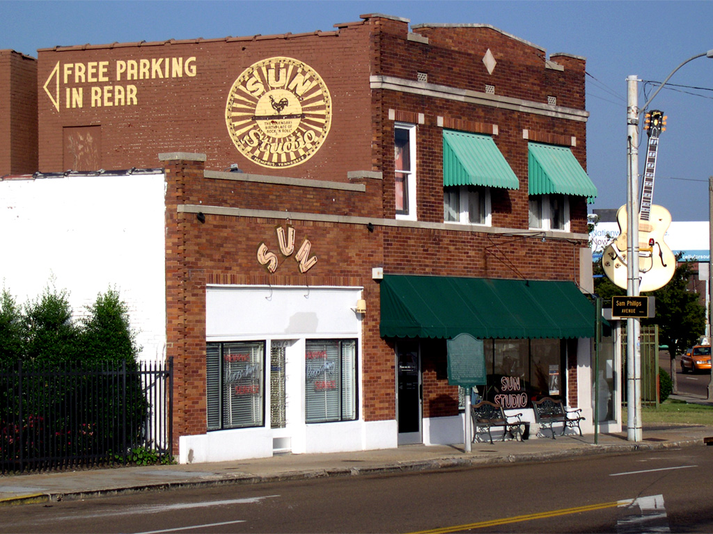
35°08′36″N 90°02′52″W / 35.143333°N 90.047778°WMemphis 155 Sun Record Company, Memphis Recording Service 
July 31, 2003 706 Union Ave.
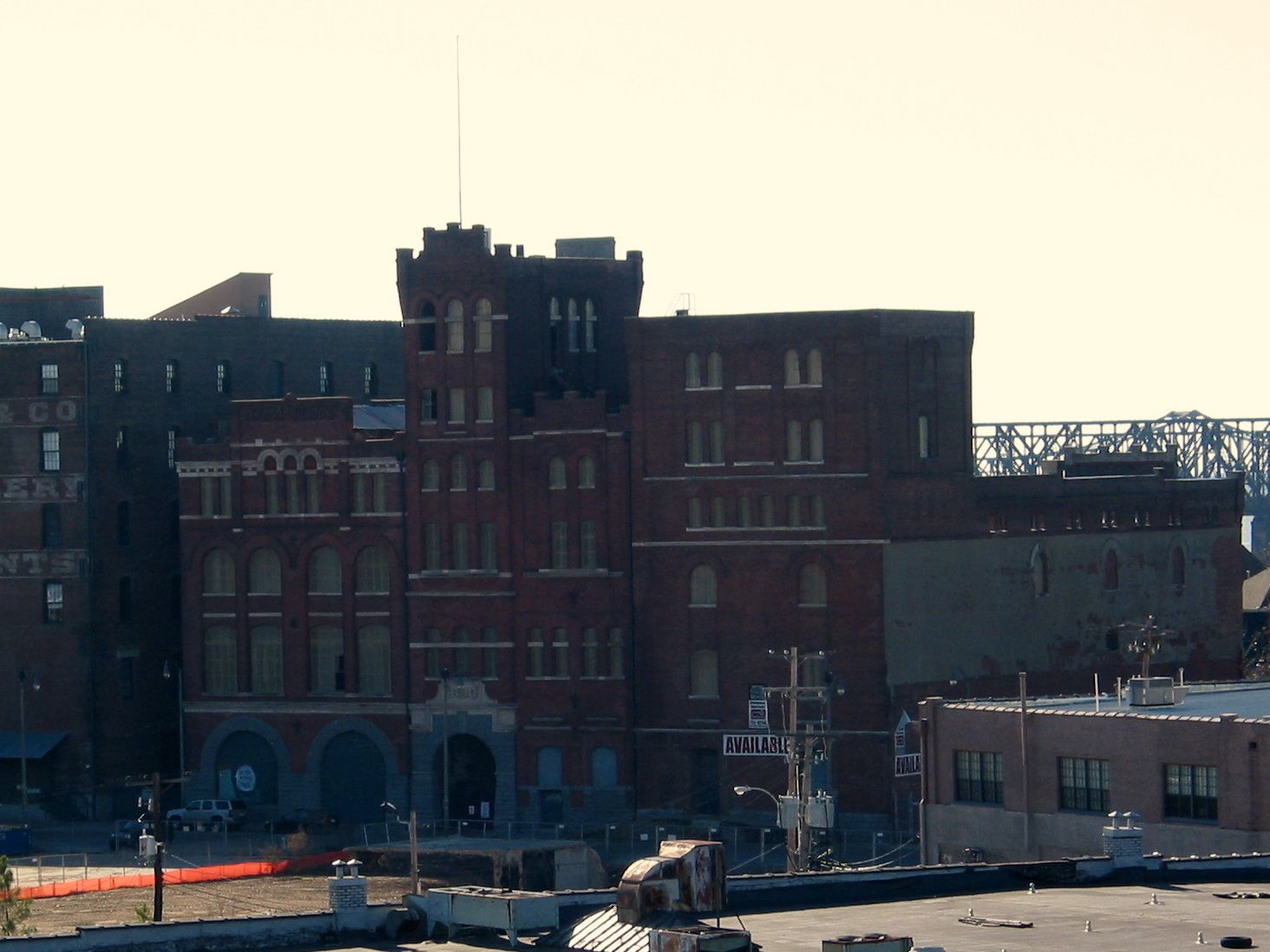
35°08′21″N 90°02′15″W / 35.139167°N 90.0375°WMemphis 156 Tennessee Brewery 
November 25, 1980 477 Tennessee St.
35°08′05″N 90°03′39″W / 35.134722°N 90.060833°WMemphis 157 Tennessee Club-Overall Goodbar Building April 22, 1982 128-130 Court Ave.
35°08′47″N 90°03′04″W / 35.146389°N 90.051111°WMemphis 158 Tennessee Trust Building 
December 9, 1982 81 Madison Ave.
35°08′42″N 90°03′12″W / 35.145°N 90.053333°WMemphis 159 Third Addition to Jackson Terrace Historic District November 21, 2001 Henry Ave., Hardin Ave., Atlantic Ave., and Crump Ave.
35°09′46″N 89°57′12″W / 35.162778°N 89.953333°WMemphis 160 John W. Thomas House March 29, 1991 245 W. Poplar Ave.
35°02′43″N 89°40′13″W / 35.045278°N 89.670278°WCollierville 161 Toof Building 
August 26, 1982 195 Madison Ave.
35°08′37″N 90°02′58″W / 35.143611°N 90.049444°WMemphis 162 John S. Toof House March 25, 1982 246 Adams Ave.
35°08′49″N 90°02′48″W / 35.146944°N 90.046667°WMemphis 163 Tri State Iron Works April 17, 1997 61 Keel Ave.
35°09′48″N 90°02′47″W / 35.163333°N 90.046389°WMemphis 164 Tri-State Bank February 11, 1971 386 Beale St.
35°08′22″N 90°02′53″W / 35.139444°N 90.048056°WMemphis 165 U.S. Marine Hospital Executive Building and Laundry-Kitchen July 2, 1980 360 and 374 W. California Ave.
35°07′25″N 90°04′27″W / 35.123611°N 90.074167°WMemphis 166 U.S. Post Office-Front Street Station June 30, 1980 1 N. Front St.
35°08′43″N 90°03′16″W / 35.145278°N 90.054444°WMemphis 167 Union Avenue Methodist Episcopal Church, South March 6, 1987 2117 Union Ave.
35°07′52″N 89°59′14″W / 35.131111°N 89.987222°WMemphis 168 Universal Life Insurance Company July 24, 2007 480 Linden Ave.
35°08′13″N 90°02′44″W / 35.136944°N 90.045556°WMemphis 169 Victorian Village District December 11, 1972 Adams and Jefferson Sts.
35°08′42″N 90°02′20″W / 35.145°N 90.038889°WMemphis 170 Vollintine Evergreen Avalon Historic District May 23, 1997 Roughly bounded by Stonewall, Vollintine, and Evergreen Sts., and Cypress Creek
35°09′57″N 90°00′14″W / 35.165833°N 90.003889°WMemphis 171 Vollintine Evergreen Historic District April 12, 1996 Roughly bounded by Watkins St., Vollintine Ave., Faxon Ave., Jackson Ave., and University St.
35°09′26″N 90°00′35″W / 35.157222°N 90.009722°WMemphis 172 Vollintine Evergreen North Historic District 
May 23, 1997 Roughly bounded by Mclean Boulevard, Vollintine Ave., University St., and Rainbow Cir.
35°09′52″N 89°59′35″W / 35.164444°N 89.993056°WMemphis 173 Vollintine Hills Historic District July 11, 2007 Roughly bounded by Vollintine, Brown, McLean, and Evergreen
35°09′53″N 89°59′56″W / 35.1647°N 89.9989°WMemphis 174 Wells School March 31, 1995 4140 Collierville-Arlington Rd.
35°14′20″N 89°38′58″W / 35.238889°N 89.649444°WEads 175 Wells-Arrington Historic District April 22, 1999 563-610 Arrington Ave. and 556-601 Wells Ave.
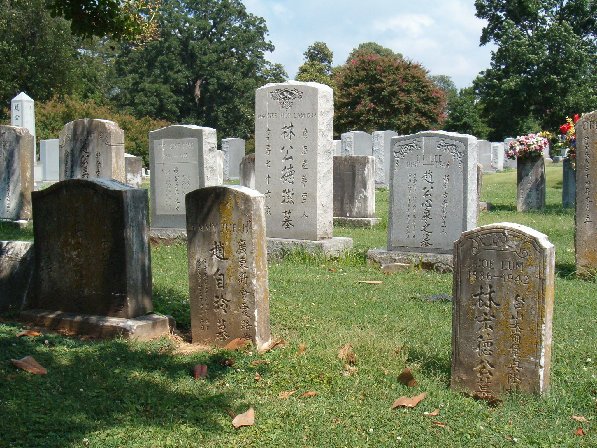
35°10′23″N 90°02′18″W / 35.173056°N 90.038333°WMemphis 176 Zion Cemetery 
February 23, 1990 S. Parkway East at Pillow St.
35°06′39″N 90°00′51″W / 35.110833°N 90.014167°WMemphis Former listings
Landmark name Image Date removed Location City or Town Summary 1 Libertyland Grand Carousel November 18, 2009 Libertyland Theme Park
35°7′8″N 89°59′1″W / 35.11889°N 89.98361°WMemphis Listed July 3, 1980 2 Pippin Roller Coaster 
March 21, 2011 Mid-South Fairgrounds bounded by E. Parkway, Central and Southern Aves. and Early Maxwell Boulevard
35°7′8″N 89°58′53″W / 35.11889°N 89.98139°WMemphis Wooden roller coaster being moved to Bay Beach Amusement Park at Green Bay, Wisconsin by May 2011; listed November 8, 2007 See also
- List of National Historic Landmarks in Tennessee
- National Register of Historic Places listings in Tennessee
References
- ^ The latitude and longitude information provided in this table was derived originally from the National Register Information System, which has been found to be fairly accurate for about 99% of listings. For about 1% of NRIS original coordinates, experience has shown that one or both coordinates are typos or otherwise extremely far off; some corrections may have been made. A more subtle problem causes many locations to be off by up to 150 yards, depending on location in the country: most NRIS coordinates were derived from tracing out latitude and longitudes off of USGS topographical quadrant maps created under North American Datum of 1927, which differs from the current, highly accurate GPS system used by Google maps. Chicago is about right, but NRIS longitudes in Washington are higher by about 4.5 seconds, and are lower by about 2.0 seconds in Maine. Latitudes differ by about 1.0 second in Florida. Some locations in this table may have been corrected to current GPS standards.
- ^ "National Register of Historic Places: Weekly List Actions". National Park Service, United States Department of the Interior. Retrieved on November 10, 2011.
- ^ Numbers represent an ordering by significant words. Various colorings, defined here, differentiate National Historic Landmark sites and National Register of Historic Places Districts from other NRHP buildings, structures, sites or objects.
- ^ "National Register Information System". National Register of Historic Places. National Park Service. . http://nrhp.focus.nps.gov/natreg/docs/All_Data.html.
U.S. National Register of Historic Places Topics Lists by states Alabama • Alaska • Arizona • Arkansas • California • Colorado • Connecticut • Delaware • Florida • Georgia • Hawaii • Idaho • Illinois • Indiana • Iowa • Kansas • Kentucky • Louisiana • Maine • Maryland • Massachusetts • Michigan • Minnesota • Mississippi • Missouri • Montana • Nebraska • Nevada • New Hampshire • New Jersey • New Mexico • New York • North Carolina • North Dakota • Ohio • Oklahoma • Oregon • Pennsylvania • Rhode Island • South Carolina • South Dakota • Tennessee • Texas • Utah • Vermont • Virginia • Washington • West Virginia • Wisconsin • WyomingLists by territories Lists by associated states Other  Category:National Register of Historic Places •
  Portal:National Register of Historic Places
Municipalities and communities of Shelby County, Tennessee County seat: Memphis Cities Bartlett | Germantown | Lakeland | Memphis | Millington

Towns Unincorporated
communitiesBrunswick | Capleville | Cordova | Eads | Ellendale | Fisherville | Rosemark | Shelby Forest
Categories:- National Register of Historic Places in Tennessee by county
- Shelby County, Tennessee
- Buildings and structures in Shelby County, Tennessee
-


Wikimedia Foundation. 2010.