- National Register of Historic Places listings in Shelter Island (town), New York
-
This is a List of the National Register of Historic Places listings on Shelter, New York
This list is intended to provide a comprehensive listing of entries in the National Register of Historic Places in the Town of Shelter Island, New York. The locations of National Register properties for which the latitude and longitude coordinates are included below, may be seen in a Google map.[1]
Contents
Listings
[2] Landmark name Image Date listed Location City or Town Summary 1 Camp Quinipet 
October 5, 2005 78 Shore Road
41°4′15″N 72°22′56″W / 41.07083°N 72.38222°WShelter Island Heights 2 James Havens Homestead 
April 10, 1986 NY 114
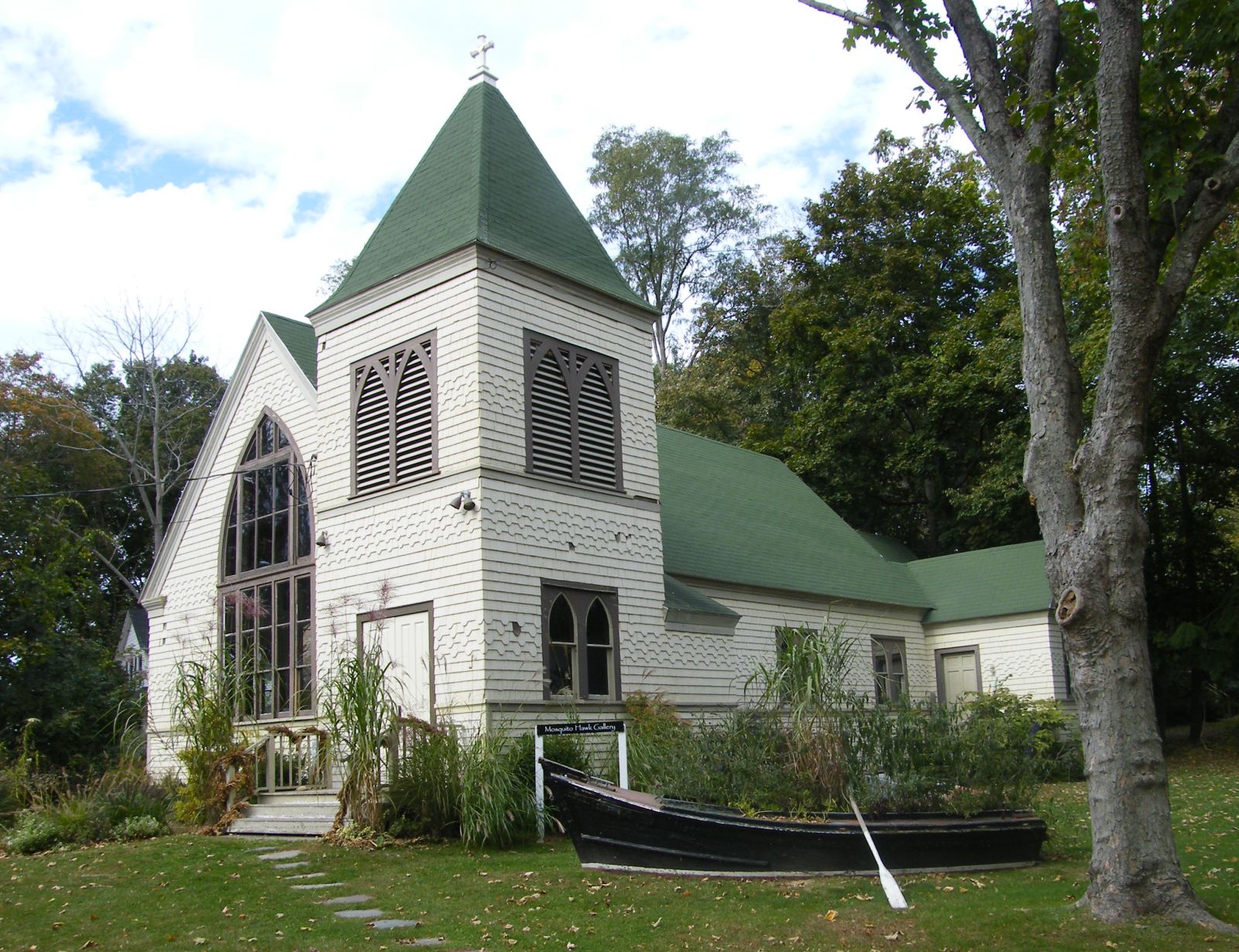
41°3′49″N 72°19′53″W / 41.06361°N 72.33139°WShelter Island 3 Manhanset Chapel 
August 29, 1997 24 North Ferry Road
41°4′5″N 72°20′10″W / 41.06806°N 72.33611°WShelter Island 4 Shelter Island Country Club February 25, 2009 26 Sunnyside Avenue
41°4′39.03″N 72°21′33″W / 41.0775083°N 72.35917°WShelter Island 5 Shelter Island Heights Historic District 
May 7, 1993 Roughly bounded by St. Johns Street, Tower Hill Road, Sunnyside Avenue, Meadow Place, Chase Creek, and Dering Harbor
41°5′4″N 72°21′26″W / 41.08444°N 72.35722°WShelter Island Heights 6 Shelter Island Windmill 
December 27, 1978 N of Manwaring Road
41°4′33″N 72°20′8″W / 41.07583°N 72.33556°WShelter Island 7 Smith-Taylor Cabin 
September 28, 2007 Taylor's Island
41°4′17″N 72°17′55″W / 41.07139°N 72.29861°WShelter Island On Taylor Island 8 Union Chapel 
November 23, 1984 The Grove
41°5′2″N 72°21′32″W / 41.08389°N 72.35889°WShelter Island Heights See also
- National Register of Historic Places listings in New York
- National Register of Historic Places listings in Suffolk County, New York
References
- ^ The latitude and longitude information provided is primarily from the National Register Information System, and has been found to be fairly accurate for about 99% of listings. For 1%, the location info may be way off. We seek to correct the coordinate information wherever it is found to be erroneous. Please leave a note in the Discussion page for this article if you believe any specific location is incorrect.
- ^ Numbers represent an ordering by significant words. Various colorings, defined here, differentiate the Historic districts, National Historic Landmarks, and other designations from other NRHP buildings, structures, sites or objects.
External links
- NRHP applications for New York State sites (Note, interface works best with Microsoft Internet Explorer browser; hit "Results" after searching, to actually see the results).
Town of Shelter Island, New York County Villages Hamlets Website: shelter-island.org/Categories:- Shelter Island (town), New York
- National Register of Historic Places in Shelter Island, New York
- Buildings and structures in Suffolk County, New York


Wikimedia Foundation. 2010.