- National Register of Historic Places listings in Manhattan from 14th to 59th Streets
-
This is a list of properties and districts in Manhattan from 14th to 59th Streets that are listed on the National Register of Historic Places.
This is intended to be a complete list of properties and districts listed on the National Register of Historic Places in Manhattan from 14th to 59th Streets. For properties and districts in other parts of Manhattan and the other islands of New York County, see National Register of Historic Places listings in New York County, New York. The locations of National Register properties and districts (at least for all showing latitude and longitude coordinates below) may be seen in a Google map by clicking on "Map of all coordinates".[1]
-
- This National Park Service list is complete through NPS recent listings posted November 18, 2011.[2]
Contents: Counties in New York Albany (Albany) – Allegany – Bronx – Broome – Cattaraugus – Cayuga – Chautauqua – Chemung – Chenango – Clinton – Columbia – Cortland – Delaware – Dutchess – Erie (Buffalo) – Essex – Franklin – Fulton – Genesee – Greene – Hamilton – Herkimer – Jefferson – Kings (Brooklyn) – Lewis – Livingston – Madison – Monroe (Rochester) – Montgomery – Nassau – New York (Manhattan – Below 14th Street, 14th to 59th Streets, 59th to 110th Streets, Above 110th Street, Islands) – Niagara – Oneida – Onondaga (Syracuse) – Ontario – Orange – Orleans – Oswego – Otsego – Putnam – Queens – Rensselaer – Richmond (Staten Island) – Rockland – Saratoga – Schenectady – Schoharie – Schuyler – Seneca – St. Lawrence – Steuben – Suffolk – Sullivan – Tioga – Tompkins – Ulster – Warren – Washington – Wayne – Westchester (New Rochelle, Peekskill, Yonkers) – Wyoming – Yates Current listings from 14th to 59th Streets
Landmark name Image Date listed Location Neighborhood Summary 1 14th Street – Union Square Subway station (4 5 6 <6> L N Q R trains) 
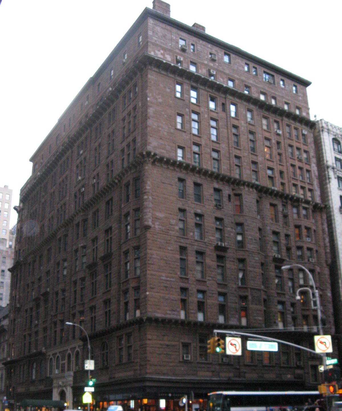
July 6, 2005 Broadway, Fourth ave., and E. 14th St.
40°44′7″N 73°59′28″W / 40.73528°N 73.99111°WUnion Square 2 240 Central Park South 
May 12, 2009 240 Central Park South
40°46′3.59″N 73°58′51.54″W / 40.7676639°N 73.9809833°WNew York 3 28th Street Subway station (4 6 <6> trains) 
March 30, 2005 Under Park Avenue S, bet E 29th and 27th Sts.
40°44′36″N 73°59′4″W / 40.74333°N 73.98444°WNew York 4 33rd Street Subway station (4 6 <6> trains) 
September 17, 2004 33rd St. and Park Ave.
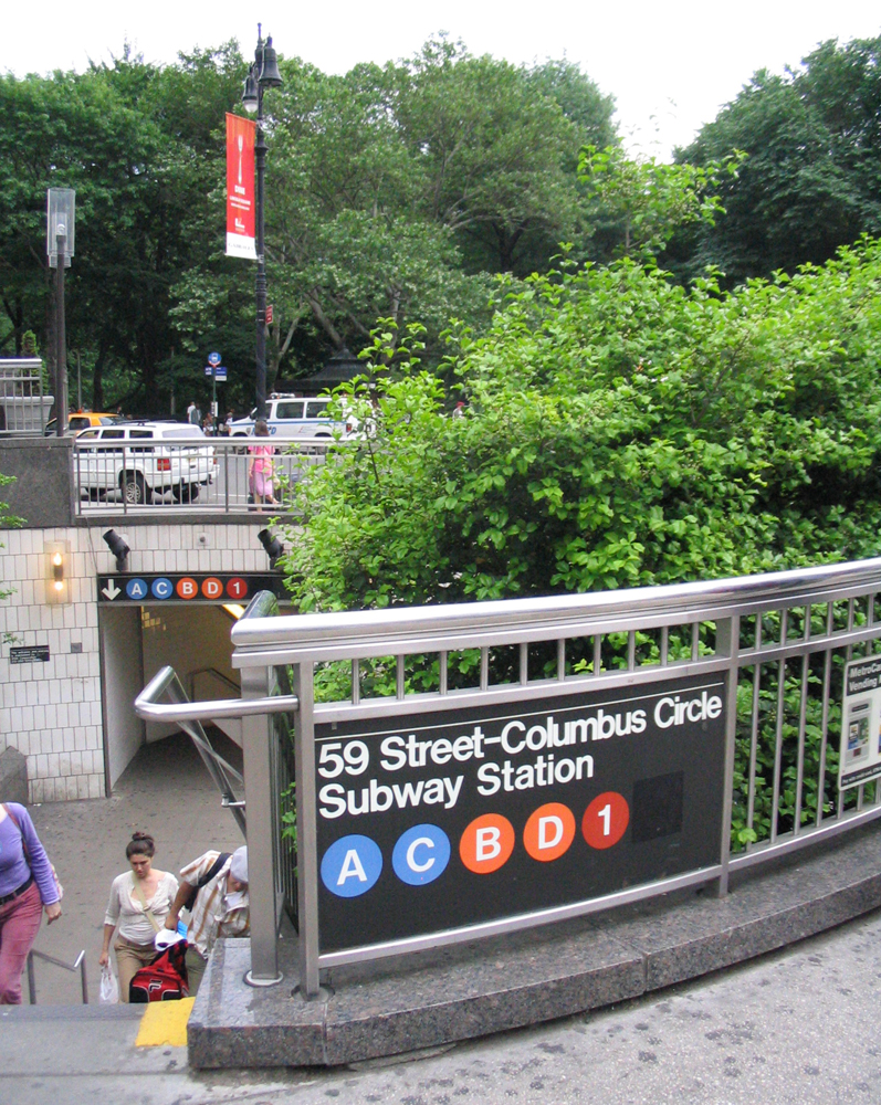
40°44′53″N 73°58′55″W / 40.74806°N 73.98194°WMurray Hill 5 59th Street – Columbus Circle Subway station (1 2 trains) 
September 17, 2004 Jct. of Broadway and Central Park South
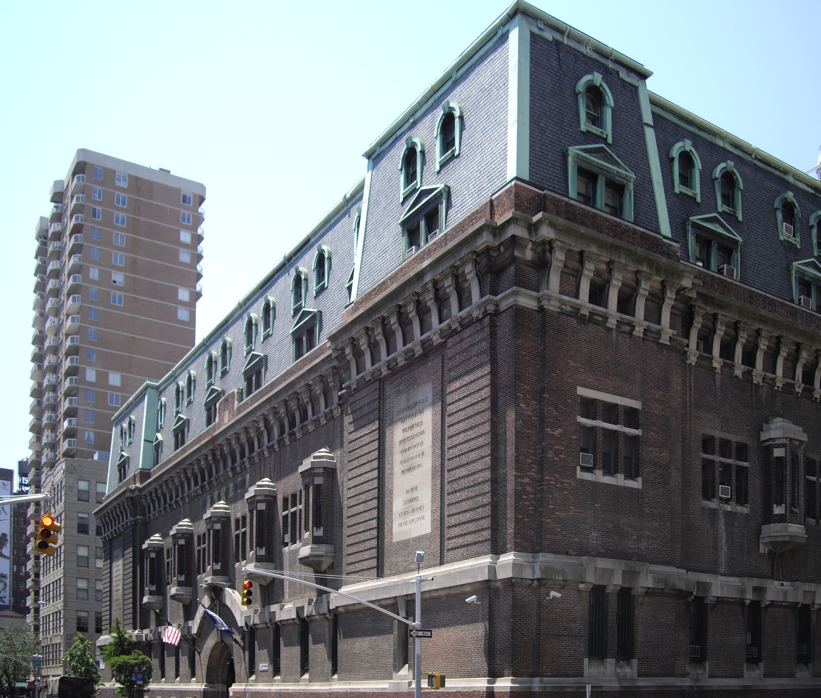
40°46′5″N 73°58′57″W / 40.76806°N 73.9825°WNew York 6 69th Regiment Armory 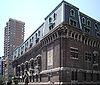
January 28, 1994 68 Lexington Ave.
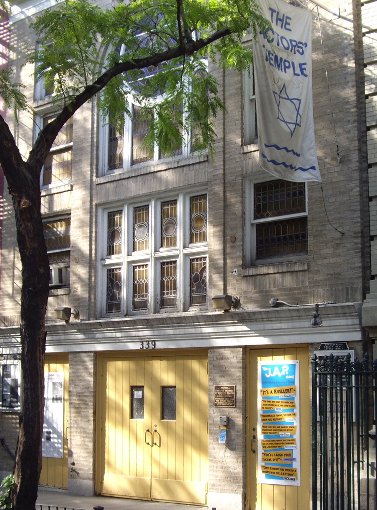
40°44′28″N 73°59′5″W / 40.74111°N 73.98472°WNew York 7 Actors Temple 
May 19, 2005 339 W. 47th St.
40°45′40″N 73°59′22″W / 40.76111°N 73.98944°WNew York 8 Alwyn Court Apartments 
December 26, 1979 180 W. 58th St.
40°45′57″N 73°58′48″W / 40.76583°N 73.98°WNew York 9 American Fine Arts Society 
May 6, 1980 215 W. 57th St.
40°45′57″N 73°58′52″W / 40.76583°N 73.98111°WNew York 10 American Radiator Building 
May 7, 1980 40-52 W. 40th St.
40°45′10″N 73°59′4″W / 40.75278°N 73.98444°WNew York Black and gold building aka American Standard Building and recently The Bryant Park Hotel 11 Appellate Division Courthouse of New York State 
July 26, 1982 27 Madison Ave.
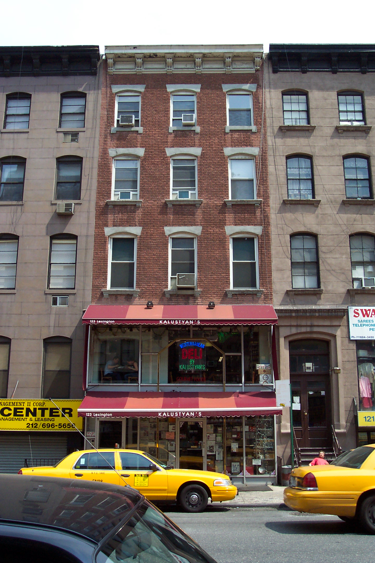
40°44′32″N 73°59′13″W / 40.74222°N 73.98694°WNew York 12 Chester A. Arthur House 
October 15, 1966 123 Lexington Ave.
40°44′34″N 73°58′57″W / 40.74278°N 73.9825°WNew York Home of former president Chester A. Arthur 13 Association of the Bar of the City of New York 
January 3, 1980 42 W. 44th St.
40°45′18″N 73°58′57″W / 40.755°N 73.9825°WNew York 14 Bank of the Metropolis 
November 15, 2003 31 Union Square West
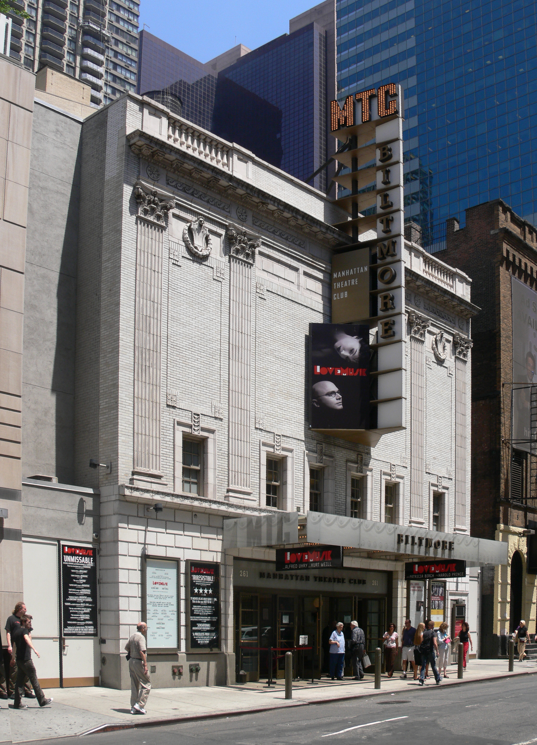
40°44′12″N 73°59′29″W / 40.73667°N 73.99139°WNew York 15 Biltmore Theater 
October 27, 2004 261-265 W. 47th St.
40°45′37″N 73°59′14″W / 40.76028°N 73.98722°WNew York 16 Building at 304 Park Avenue South 
March 15, 2005 304 Park Ave. S
40°44′24″N 73°59′14″W / 40.74°N 73.98722°WNew York 17 Building at 315-325 West 36th Street 
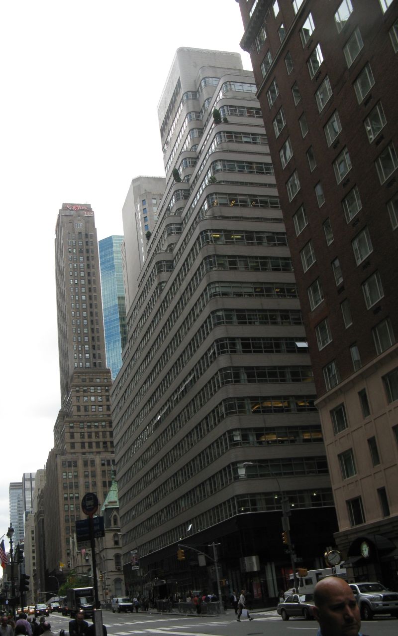
May 27, 2004 315-325 W. 36th St.
40°45′15″N 73°59′39″W / 40.75417°N 73.99417°WNew York 18 Candler Building 
July 8, 1982 220 West 42nd St. and 221 West 41st St.
40°45′22″N 73°59′18″W / 40.75611°N 73.98833°WNew York 19 Carnegie Hall 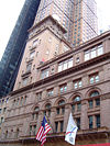
October 15, 1966 7th Ave., 56th to 57th Sts.
40°45′55″N 73°58′48″W / 40.76528°N 73.98°WNew York Internationally-known classical music venue 20 Central IND Substation 
February 9, 2006 136 W. 53rd St. (btwn 6th & 7th)
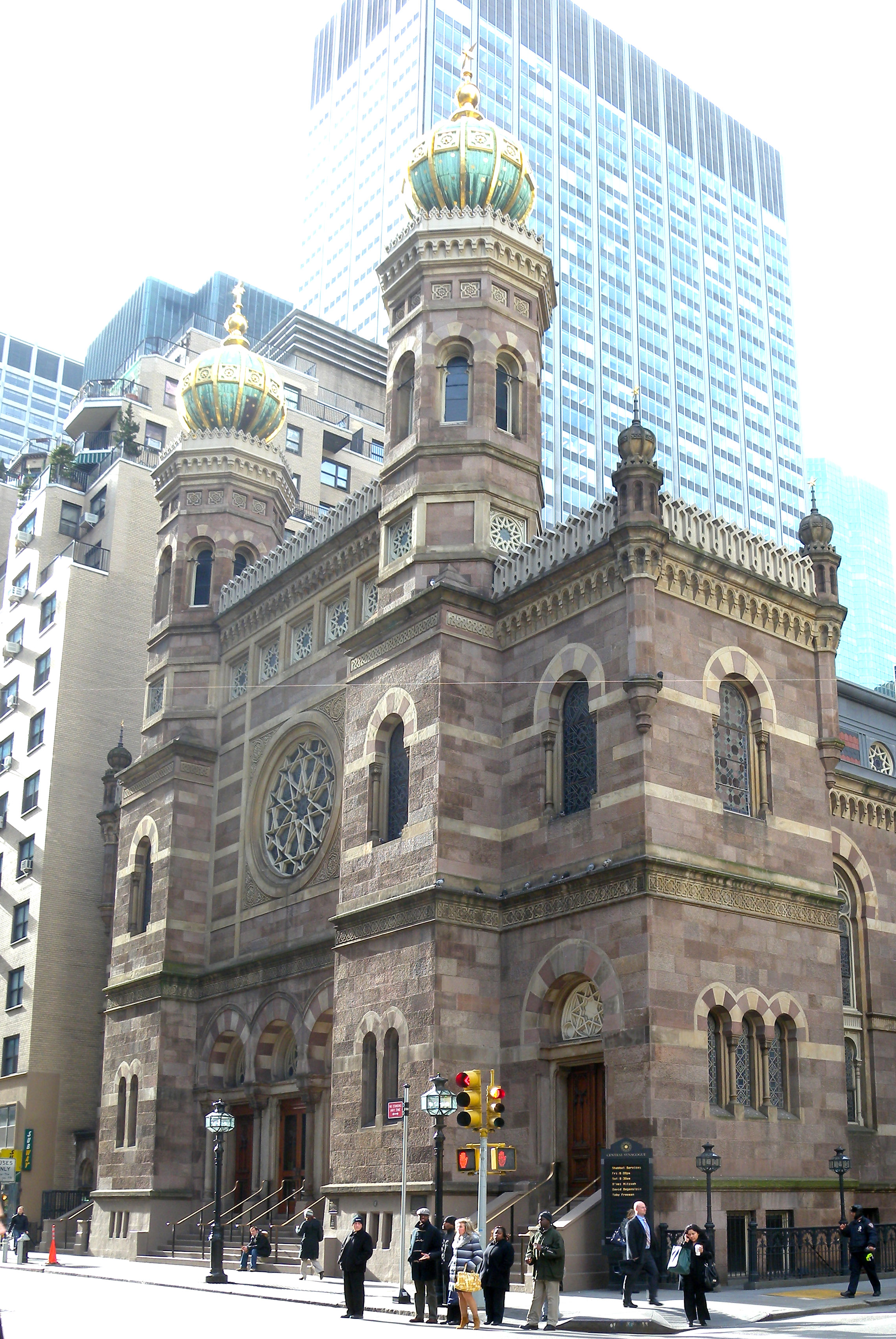
40°45′44″N 73°58′52″W / 40.76222°N 73.98111°WNew York 21 Central Synagogue 
October 9, 1970 646-652 Lexington Ave.
40°45′34″N 73°58′16″W / 40.75944°N 73.97111°WNew York 22 Century Association Building 
July 15, 1982 5-7 W. 43rd St.
40°45′16″N 73°58′52″W / 40.75444°N 73.98111°WNew York 23 Century Building 
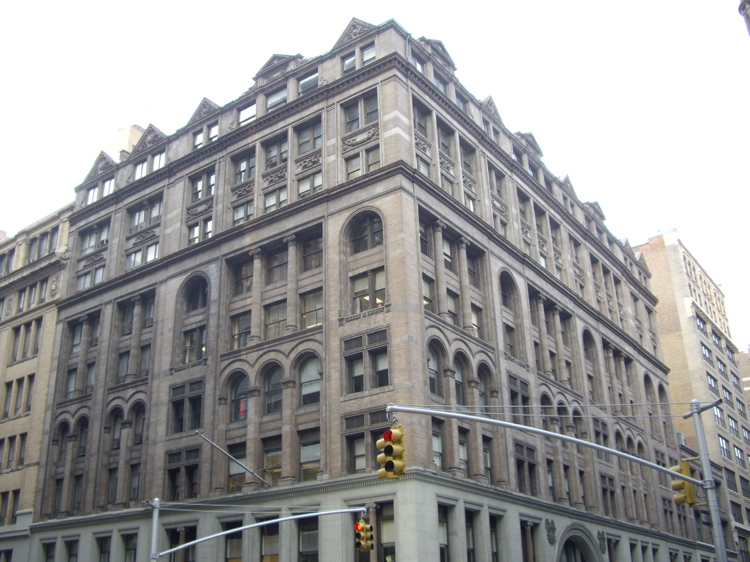
September 18, 1997 33 E. 17th St.
40°44′13″N 73°59′25″W / 40.73694°N 73.99028°WNew York 24 Chanin Building 
April 23, 1980 122 E. 42nd St.
40°45′4″N 73°58′32″W / 40.75111°N 73.97556°WNew York 25 Chelsea Historic District 
December 6, 1977 Roughly bounded by 19th and 22nd Sts., 9th and 10th Aves.
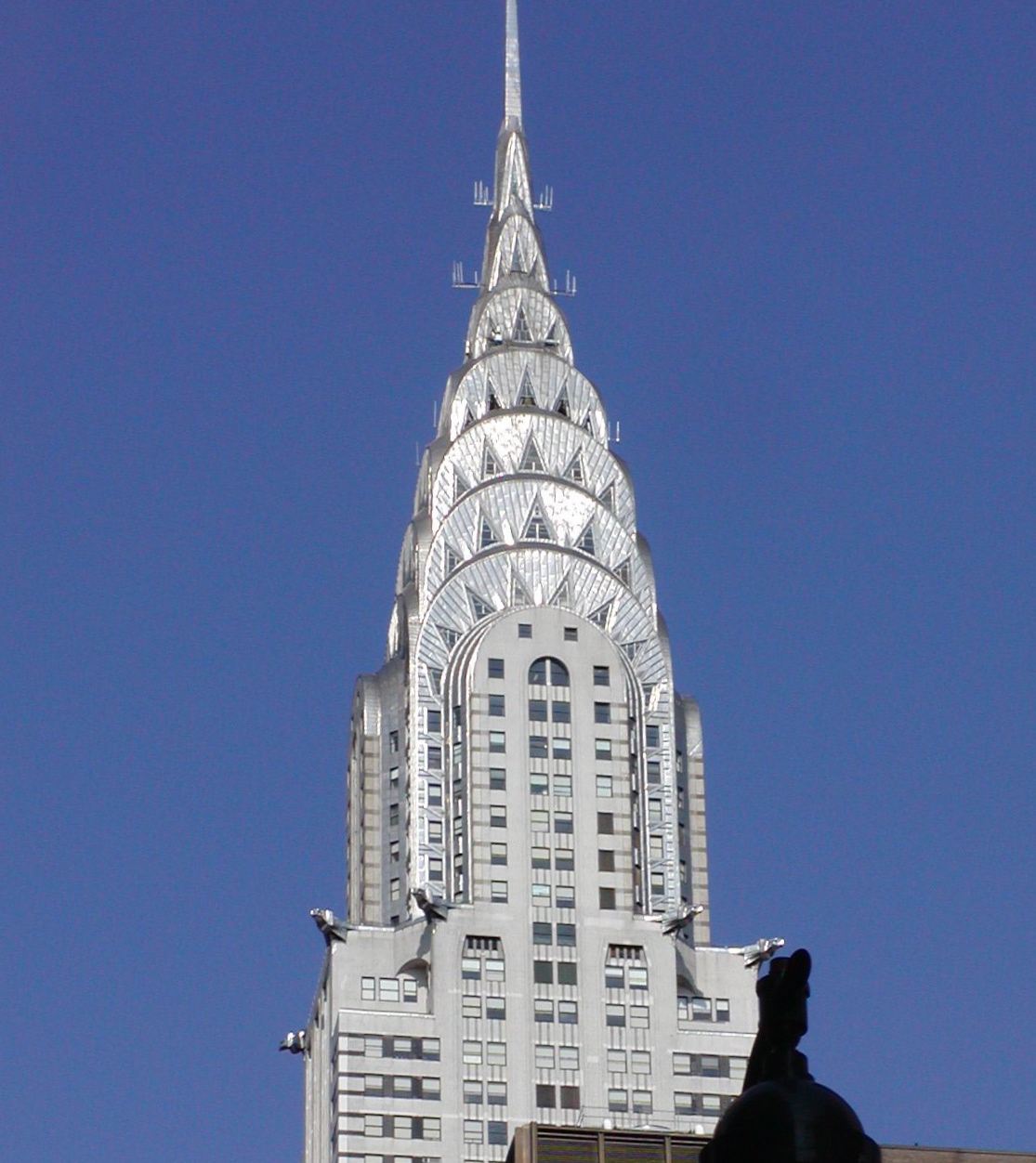
40°44′43″N 74°0′15″W / 40.74528°N 74.00417°WNew York 26 Chrysler Building 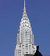
December 8, 1976 405 Lexington Ave.
40°45′5″N 73°58′31″W / 40.75139°N 73.97528°WNew York 27 Church of St. Mary the Virgin Complex 
April 16, 1990 145 W. 46th St.
40°45′30″N 73°59′2″W / 40.75833°N 73.98389°WNew York 28 Church of the Holy Apostles 
April 26, 1972 300 9th Ave.
40°44′57″N 73°59′57″W / 40.74917°N 73.99917°WNew York 29 Church of the Holy Communion and Buildings 
April 17, 1980 656-662 6th Ave. (@ 20th)
40°44′28″N 73°59′40″W / 40.74111°N 73.99444°WNew York Location of The Limelight nightclub 30 Church of the Immaculate Conception and Clergy Houses 
March 28, 1980 406-414 E. 14th St.
40°43′52″N 73°58′56″W / 40.73111°N 73.98222°WNew York 31 Church of the Incarnation and Parish House 
July 8, 1982 205-209 Madison Ave. (@ 35th)
40°44′54″N 73°58′57″W / 40.74833°N 73.9825°WNew York 32 Church of the Transfiguration and Rectory 
June 4, 1973 1 E. 29th St.
40°44′44″N 73°59′14″W / 40.74556°N 73.98722°WNew York 33 Church Missions House 
June 3, 1982 281 Park Ave., S. (@ 22nd)
40°44′21″N 73°59′14″W / 40.73917°N 73.98722°WNew York 34 Civic Club 
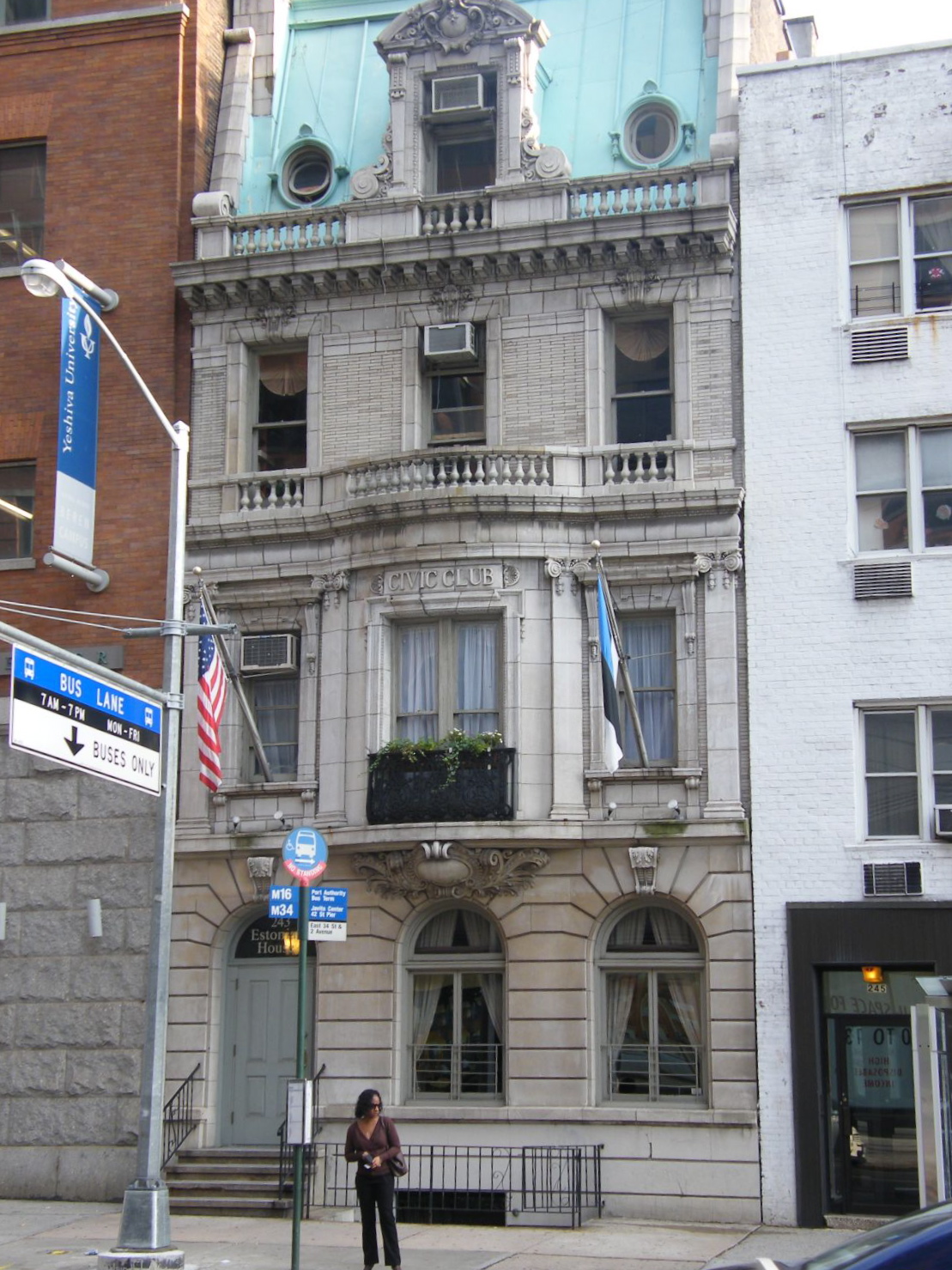
September 16, 1982 243 E. 34th St.
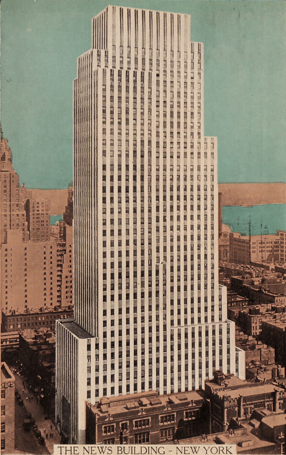
40°44′41″N 73°58′34″W / 40.74472°N 73.97611°WNew York Nowadays it's the New York Estonian House. 35 Daily News Building 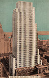
November 14, 1982 220 E. 42nd St.
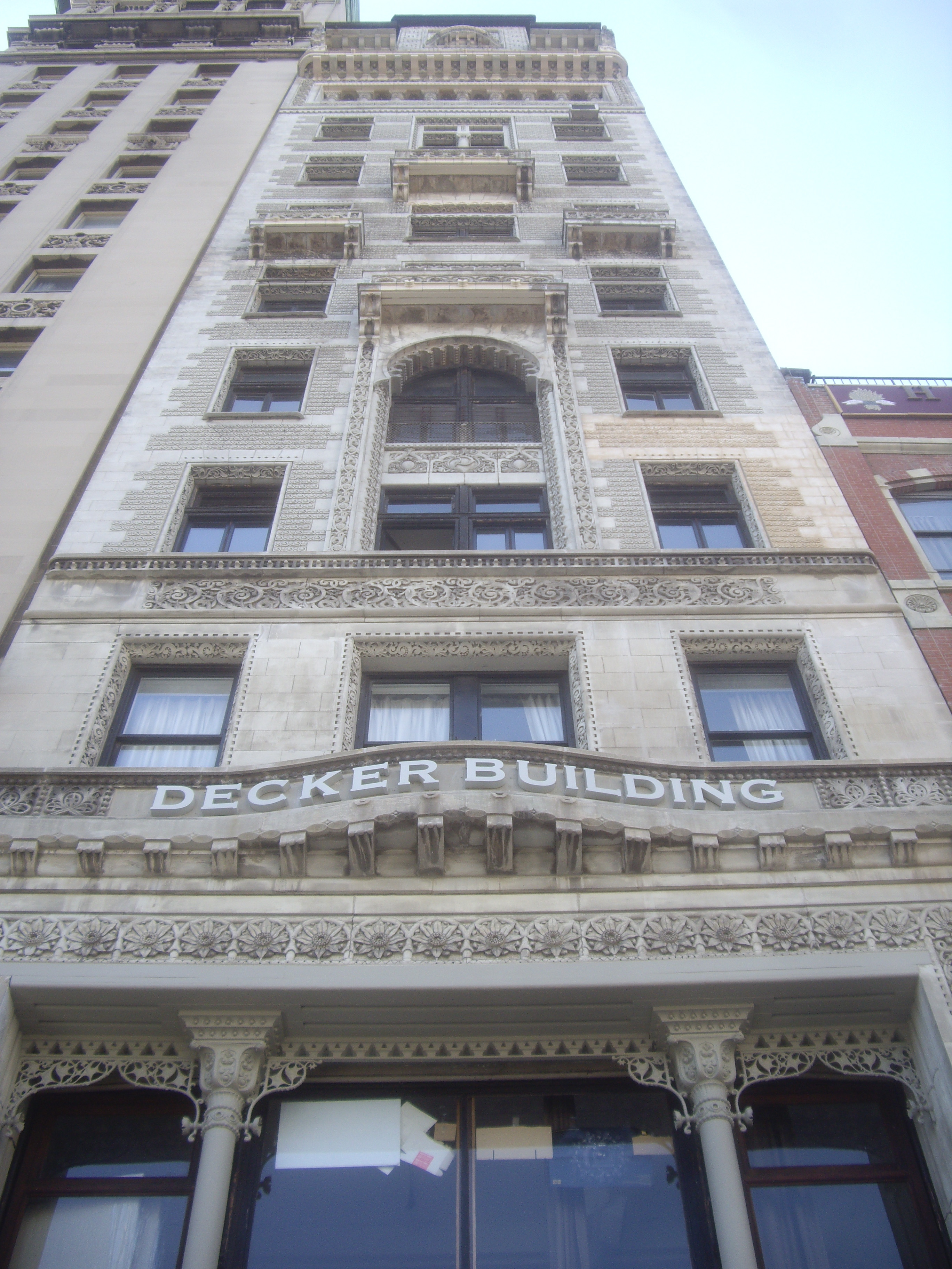
40°44′58″N 73°58′25″W / 40.74944°N 73.97361°WNew York 36 Decker Building 
November 21, 2003 33 Union Square W.
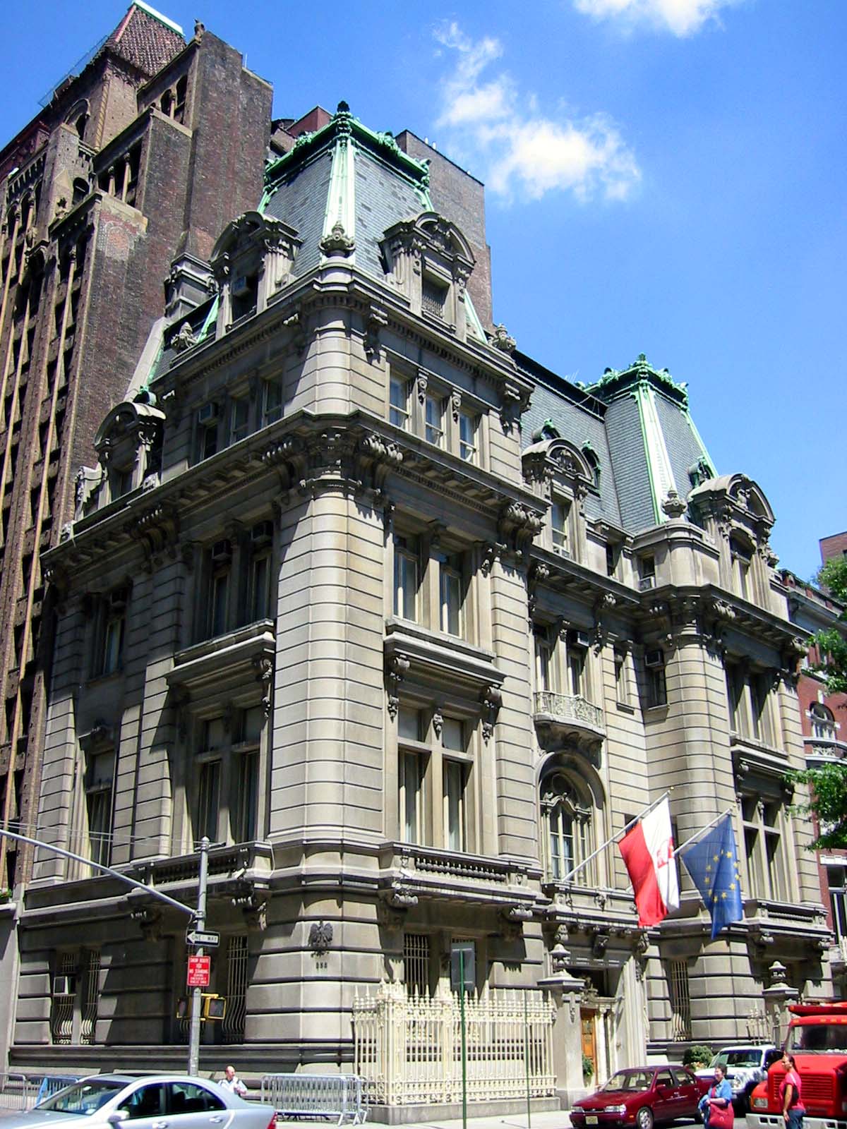
40°44′12″N 73°59′29″W / 40.73667°N 73.99139°WNew York 37 DeLamar Mansion 
August 25, 1983 233 Madison Ave. (@ 37th)
40°44′59″N 73°58′54″W / 40.74972°N 73.98167°WNew York 38 Adelaide L. T. Douglas House 
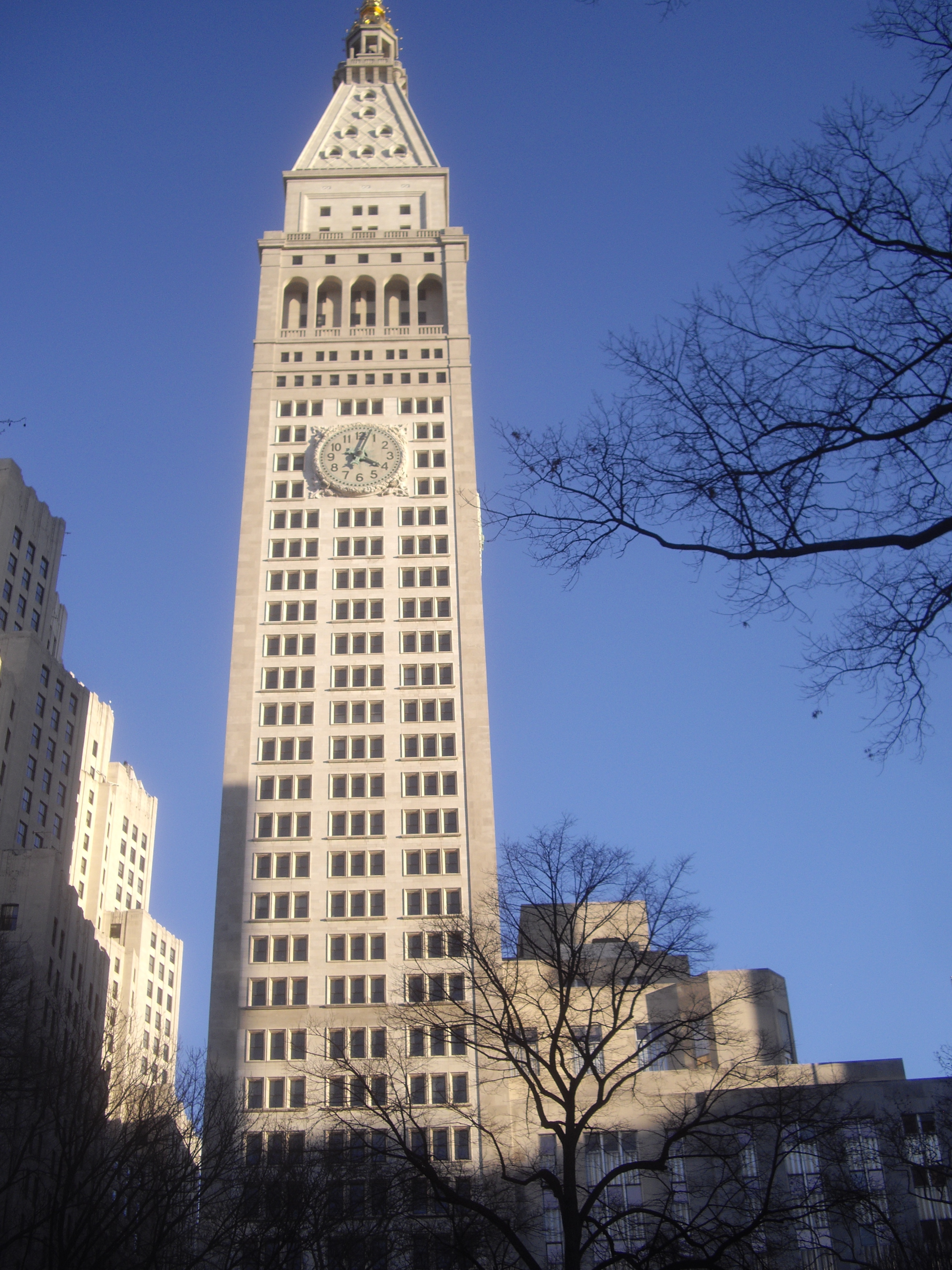
July 15, 1982 57 Park Ave. (@ 37th)
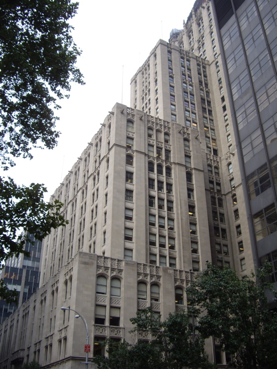
40°44′57″N 73°58′48″W / 40.74917°N 73.98°WNew York aka Guatemalan Mission to the UN 39 The Emerson 
August 20, 2009 554 W. 53rd St.
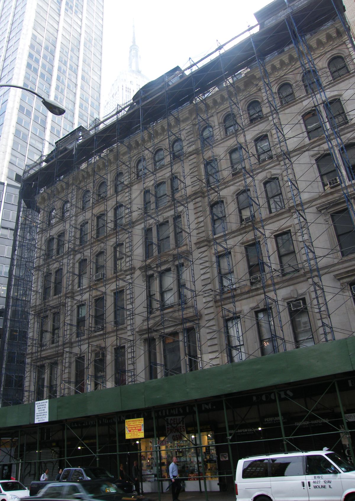
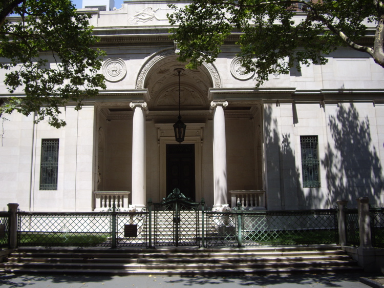
40°46′1.26″N 73°59′29.5″W / 40.7670167°N 73.991528°WNew York New listing; refnum 09000634 40 Empire State Building 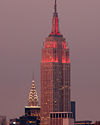
November 17, 1982 350 Fifth Ave.
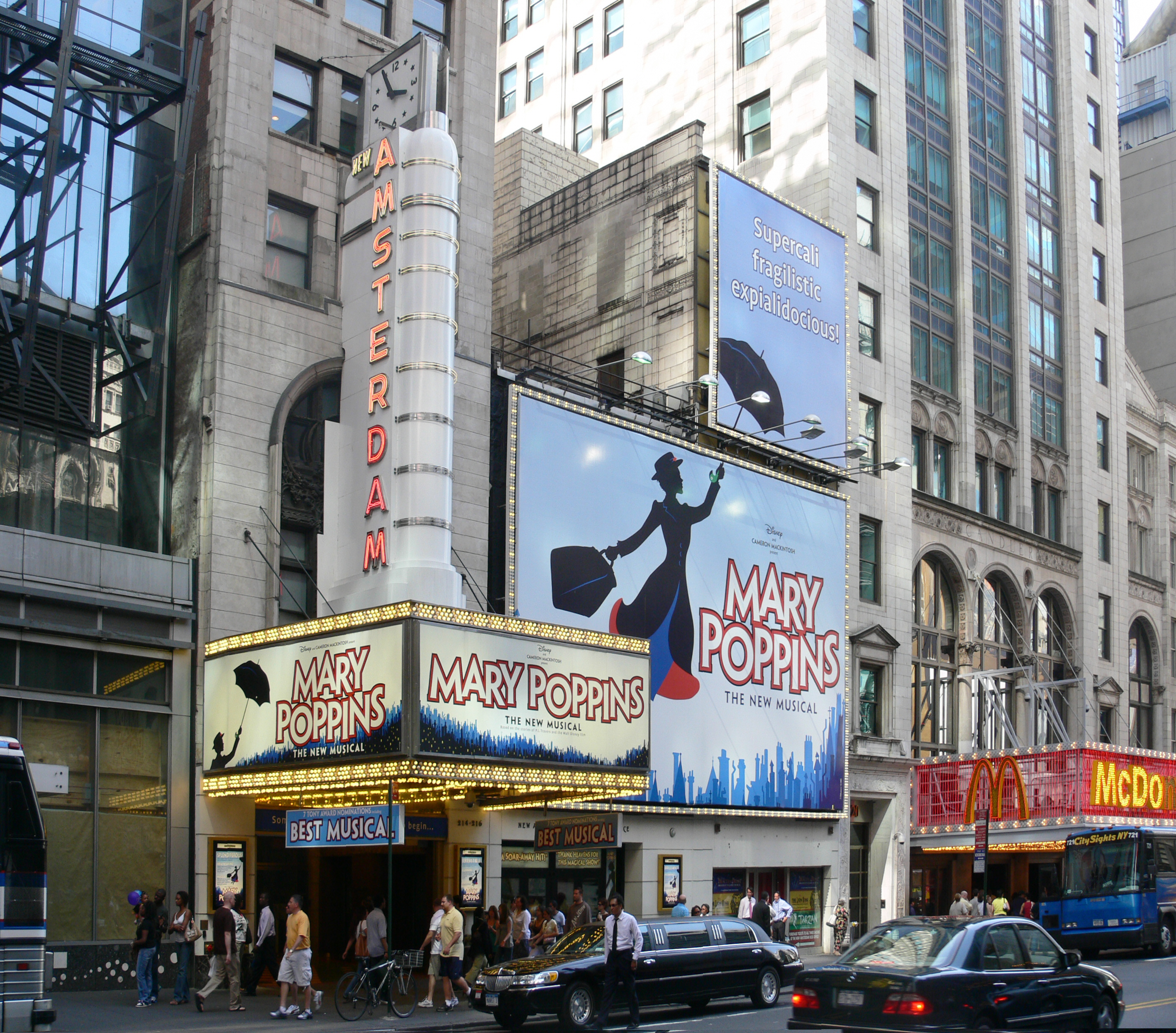
40°44′53″N 73°59′10″W / 40.74806°N 73.98611°WNew York Tallest building in Manhattan (until Freedom Tower is completed) and an international symbol of New York City 41 Engineering Societies' Building and Engineers' Club 
August 30, 2007 23 and 25-33 W. 39th St., 28,32-34 and 36 W. 40th St.
40°45′9″N 73°59′4″W / 40.7525°N 73.98444°WNew York 42 Father Francis D. Duffy Statue and Duffy Square 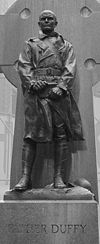
March 12, 2001 Triangle bounded by Broadway, Seventh Ave., W. 47th. and W. 46th St.
40°45′32″N 73°59′7″W / 40.75889°N 73.98528°WNew York 43 Film Center Building 
September 7, 1984 630-9th Ave.
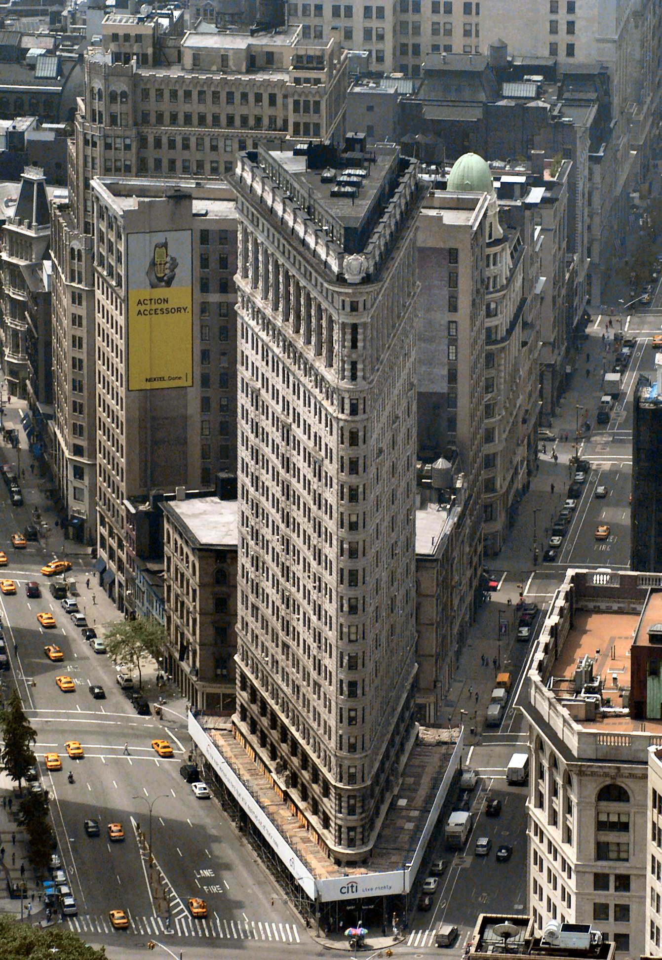
40°45′35″N 73°59′30″W / 40.75972°N 73.99167°WNew York 44 Flatiron Building 
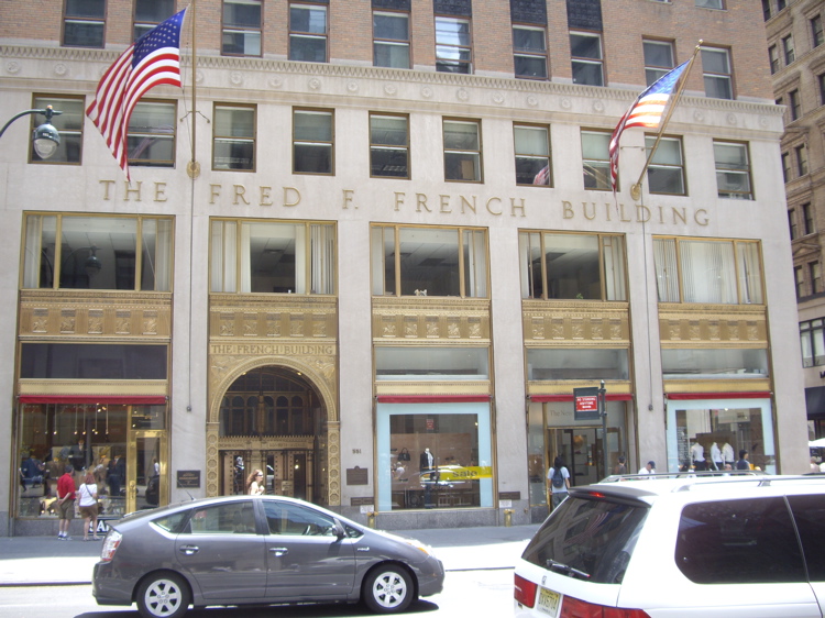
November 20, 1979 5th Ave. and Broadway New York 45 Fred F. French Building 
January 28, 2004 551 Fifth Ave.
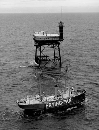
40°45′20″N 73°58′47″W / 40.75556°N 73.97972°WNew York 46 FRYING PAN SHOALS LIGHTSHIP NO. 115 (lightship) 
January 28, 1999 Pier 63 North River (per NRIS[3] or Pier 66, W26th and West Side Highway?
40°45′0″N 74°0′37″W / 40.75°N 74.01028°WNew York 47 Garment Center Historic District 
November 5, 2008 Roughly bounded by Sixth Ave. on the E., Ninth Ave. on the W., W. 35th St. on the S., and W. 41st St. on the N.
40°45′13.53″N 73°59′25.41″W / 40.7537583°N 73.9903917°WNew York New listing; refnum #08001034 48 General Electric Building 
January 28, 2004 570 Lexington Ave.
40°45′26″N 73°58′38″W / 40.75722°N 73.97722°WRockefeller Center 49 General Society of Mechanics and Tradesmen 
November 12, 2008 20 W. 44th St
40°45′19.18″N 73°58′52.74″W / 40.7553278°N 73.9813167°WNew York 50 Germania Life Insurance Company Building 
May 25, 2001 50 Union Sq. E
40°44′12″N 73°59′21″W / 40.73667°N 73.98917°WNew York 51 Gilsey Hotel 
December 14, 1978 1200 Broadway (@ 29th)
40°44′45″N 73°59′19″W / 40.74583°N 73.98861°WNew York 52 Gramercy Park Historic District 
January 23, 1980 Roughly bounded by 3rd and Park Aves., S., E. 18th and 22nd Sts.
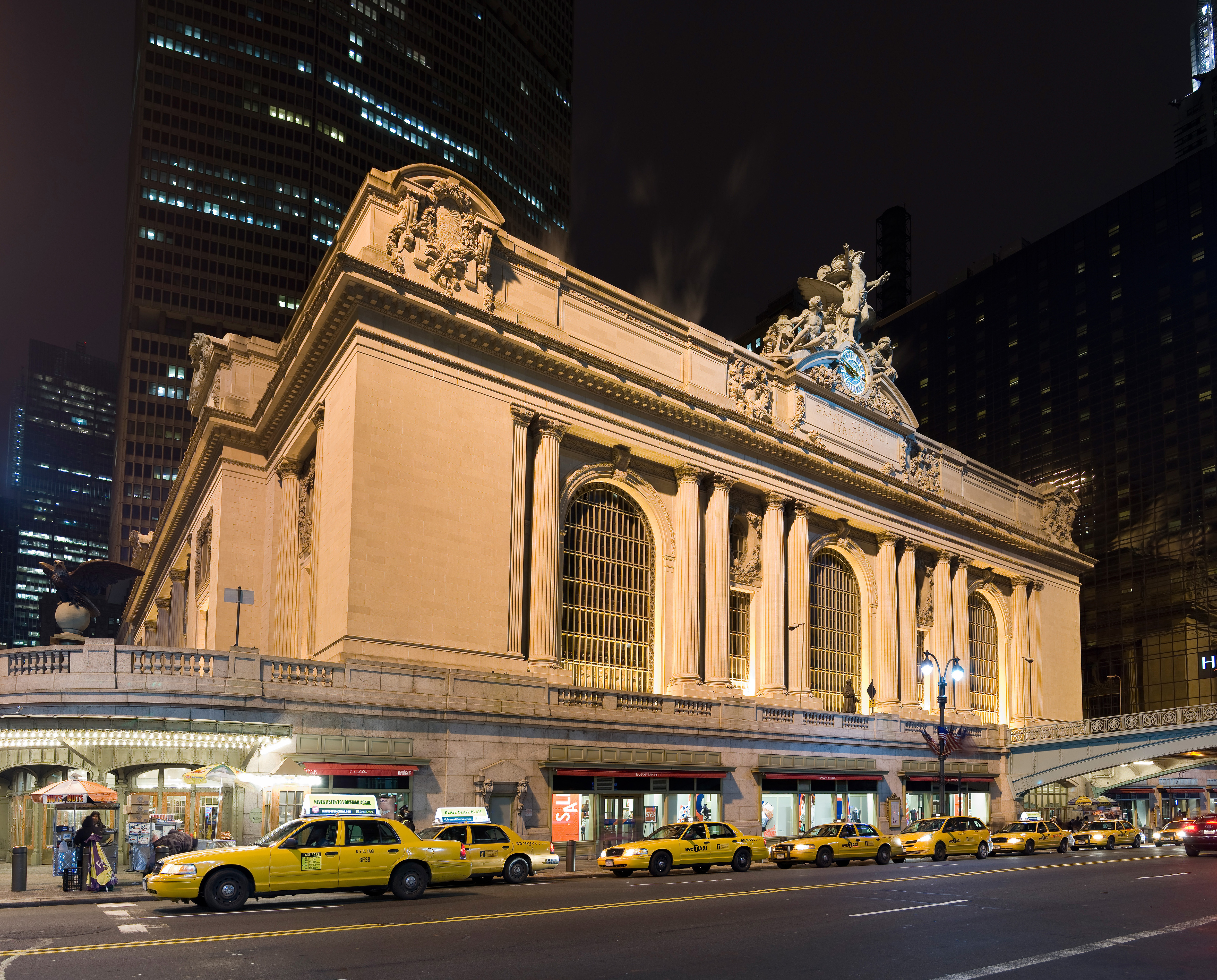
40°44′16″N 73°59′10″W / 40.73778°N 73.98611°WNew York 53 Grand Central Terminal 
January 17, 1975 71-105 E. 42nd St.
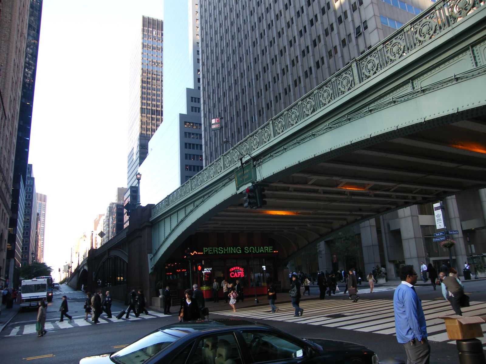
40°45′10″N 73°58′35″W / 40.75278°N 73.97639°WNew York 1913 Beaux Arts landmark still used by Metro-North Railroad. Construction helped trigger development of Park Avenue. 54 Grand Central Terminal Park Avenue Viaduct 
August 11, 1983 71-105 E. 42nd St., Park Ave. between E. 40th and E. 42nd Sts.
40°44′59″N 73°58′40″W / 40.74972°N 73.97778°WNew York Elevated roadway bringing Park Avenue around Grand Central Terminal 55 Grand Hotel 
September 15, 1983 1232-1238 Broadway
40°44′50″N 73°59′19″W / 40.74722°N 73.98861°WNew York 56 Greenwich Savings Bank 
November 16, 2005 1352-1362 Broadway (@ 35th)
40°45′5″N 73°59′15″W / 40.75139°N 73.9875°WNew York 57 Harvard Club of New York City 
March 28, 1980 27 W. 44th St.
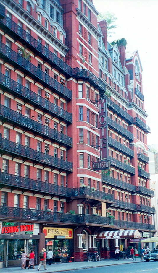
40°45′18″N 73°58′53″W / 40.755°N 73.98139°WNew York 58 Hotel Chelsea 
December 27, 1977 222 W. 23rd St.
40°44′35″N 73°59′39″W / 40.74306°N 73.99417°WNew York 59 Hotel Gerard 
February 10, 1983 123 W. 44th St.
40°45′48″N 73°59′34″W / 40.76333°N 73.99278°WNew York 60 House at 146 East 38th Street 
May 21, 2008 145 E. 38th St.
40°44′54.84″N 73°58′37.2″W / 40.7485667°N 73.977°WNew York (new listing; refnum08000450; Murray Hill, New York County, New York MPS) 61 House at 17 West 16th Street 
May 26, 1983 17 W. 16th St.
40°44′16″N 73°59′38″W / 40.73778°N 73.99389°WNew York 62 House at 20 West 16th St 
May 30, 2007 20 W. 16th St.
40°44′15″N 73°59′40″W / 40.7375°N 73.99444°WNew York 63 House at 203 East 29 Street 
July 8, 1982 203 E. 29th St.
40°44′33″N 73°58′49″W / 40.7425°N 73.98028°WNew York 64 Houses at 311 and 313 East 58th Street 
November 14, 1982 311-313 E. 58th St.
40°45′35″N 73°57′53″W / 40.75972°N 73.96472°WNew York 65 Houses at 326, 328 and 330 East 18th Street 
September 30, 1982 326-330 E. 18th St.
40°44′3″N 73°58′57″W / 40.73417°N 73.9825°WKips Bay 66 Houses at 437-459 West 24th Street 
October 29, 1982 437-459 W. 24th St.
40°44′53″N 74°0′11″W / 40.74806°N 74.00306°WNew York 67 Houses at 647, 651-53 Fifth Avenue and 4 East 52nd Street 
September 8, 1983 647, 651-53 5th Ave. and 4 E. 52nd St.
40°45′34″N 73°58′36″W / 40.75944°N 73.97667°WNew York 68 JOHN J. HARVEY (fireboat) 
June 15, 2000 Pier 63, North R.
40°45′0″N 74°0′39″W / 40.75°N 74.01083°WNew York (or is at Pier 66, W26th and West Side Highway?) 69 Knickerbocker Hotel 
April 11, 1980 142 W. 42nd St.
40°45′19″N 73°59′12″W / 40.75528°N 73.98667°WNew York 70 Knox Building 
June 3, 1982 452 5th Ave. (@ 40th)
40°45′8″N 73°58′57″W / 40.75222°N 73.9825°WNew York 71 Lamb's Club 
June 3, 1982 128 W. 44th St.
40°45′23″N 73°59′7″W / 40.75639°N 73.98528°WNew York Former home of the Lamb's Club, is being gut renovated into a hotel in 2009. 72 James F. D. Lanier Residence 
June 3, 1982 123 E. 35th
40°44′51″N 73°58′49″W / 40.7475°N 73.98028°WNew York 73 Lescaze House 
May 19, 1980 211 E. 48th St.
40°45′15″N 73°58′17″W / 40.75417°N 73.97139°WNew York 74 Lever House 
October 2, 1983 390 Park Ave.
40°45′34″N 73°58′23″W / 40.75944°N 73.97306°WNew York 75 Lincoln Building 
September 8, 1983 1 Union Sq. W.
40°44′8″N 73°59′32″W / 40.73556°N 73.99222°WNew York 76 Look Building 
February 24, 2005 488 Madison Ave. (@ 52nd)
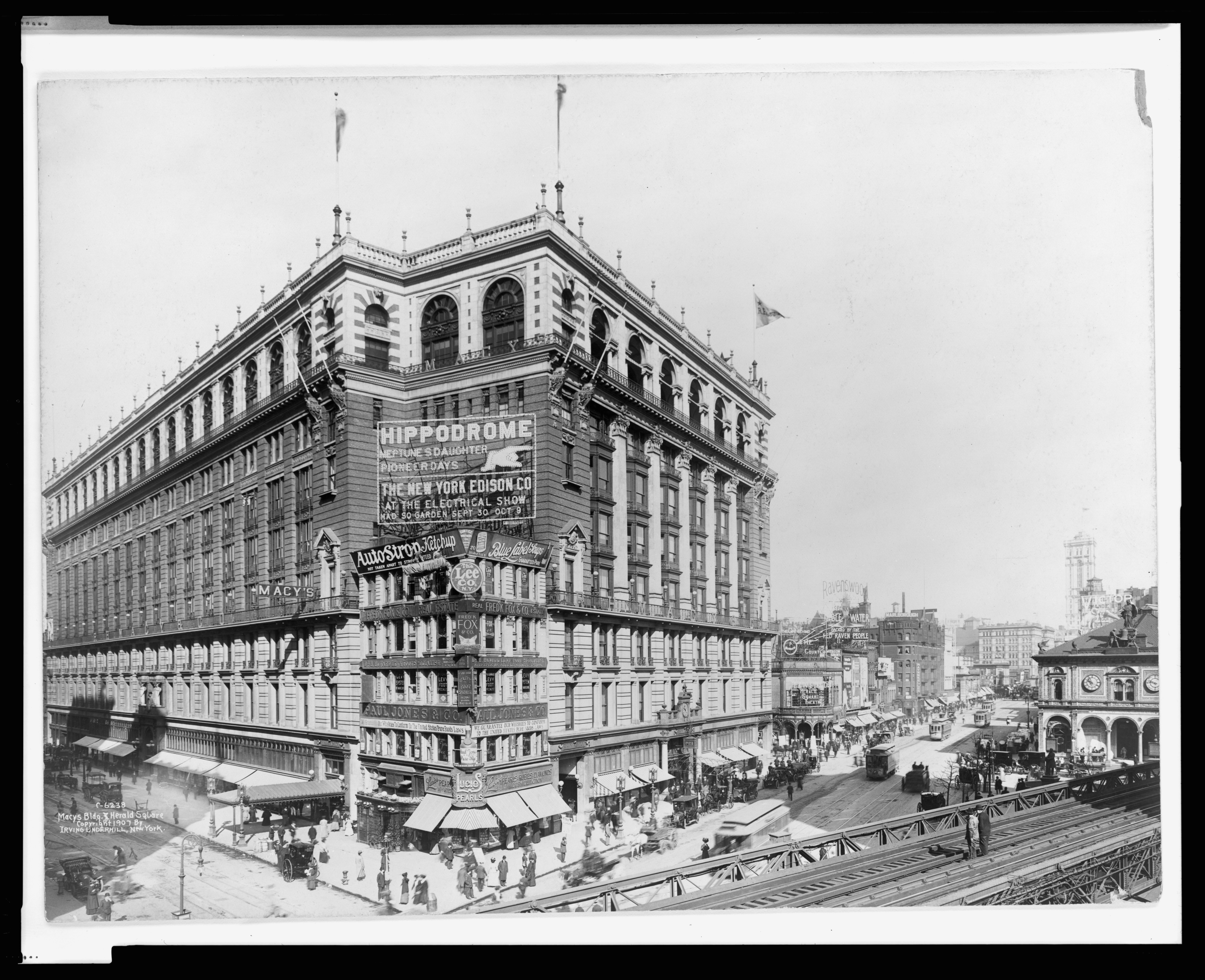
40°45′31″N 73°58′33″W / 40.75861°N 73.97583°WNew York 77 R. H. Macy and Company Store 
June 2, 1978 151 W. 34th St.
40°45′41″N 73°58′22″W / 40.76139°N 73.97278°WHerald Square Home of first major American department store. 78 Marble Collegiate Reformed Church 
April 9, 1980 275 5th Ave. (@ 30th)
40°44′44″N 73°59′15″W / 40.74556°N 73.9875°WNew York 79 McGraw-Hill Building 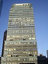
March 28, 1980 326 W. 42nd St.
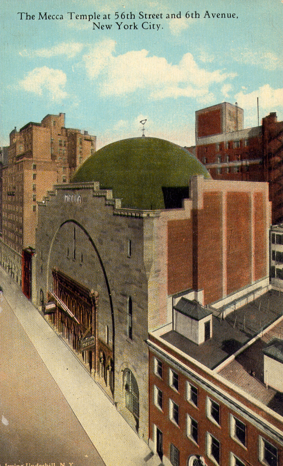
40°45′25″N 73°59′31″W / 40.75694°N 73.99194°WNew York 80 Mecca Temple 
September 7, 1984 131 N. 55th St.
40°45′50″N 73°58′48″W / 40.76389°N 73.98°WNew York Known as New York City Center Theater. Moorish-revival interior and exterior details. Harry P. Knowles, architect. 81 Merchants Refrigerating Company Warehouse 
May 31, 1985 501 W. 16th St.
40°44′38″N 74°0′28″W / 40.74389°N 74.00778°WNew York 82 Metropolitan Life Home Office Complex 
January 19, 1996 Roughly bounded by Madison Ave., E. 23rd St., Park Ave. S. and E. 25th St.
40°44′28″N 73°59′14″W / 40.74111°N 73.98722°WNew York 83 Metropolitan Life Insurance Company 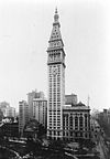
June 2, 1978 1 Madison Ave.
40°44′29″N 73°59′16″W / 40.74139°N 73.98778°WNew York 84 William H. Moore House 
March 16, 1972 4 E. 54th St.
40°45′38″N 73°58′31″W / 40.76056°N 73.97528°WNew York 85 Pierpont Morgan Library 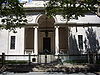
November 13, 1966 33 E. 36th St.
40°44′56″N 73°58′54″W / 40.74889°N 73.98167°WNew York Now known as "The Morgan Library & Museum" 86 Murray Hill Historic District 
October 5, 2003 Roughly bounded by East 35th St., East 39th St., Park Ave. and Lexington Ave.
40°44′54″N 73°58′47″W / 40.74833°N 73.97972°WNew York 87 New Amsterdam Theater 
January 10, 1980 214 W. 42nd St.
40°45′21″N 73°59′18″W / 40.75583°N 73.98833°WNew York 88 New York Life Building 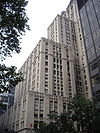
June 2, 1978 51 Madison Ave. (@ 27th)
40°44′34″N 73°59′9″W / 40.74278°N 73.98583°WNew York 89 New York Public Library 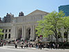
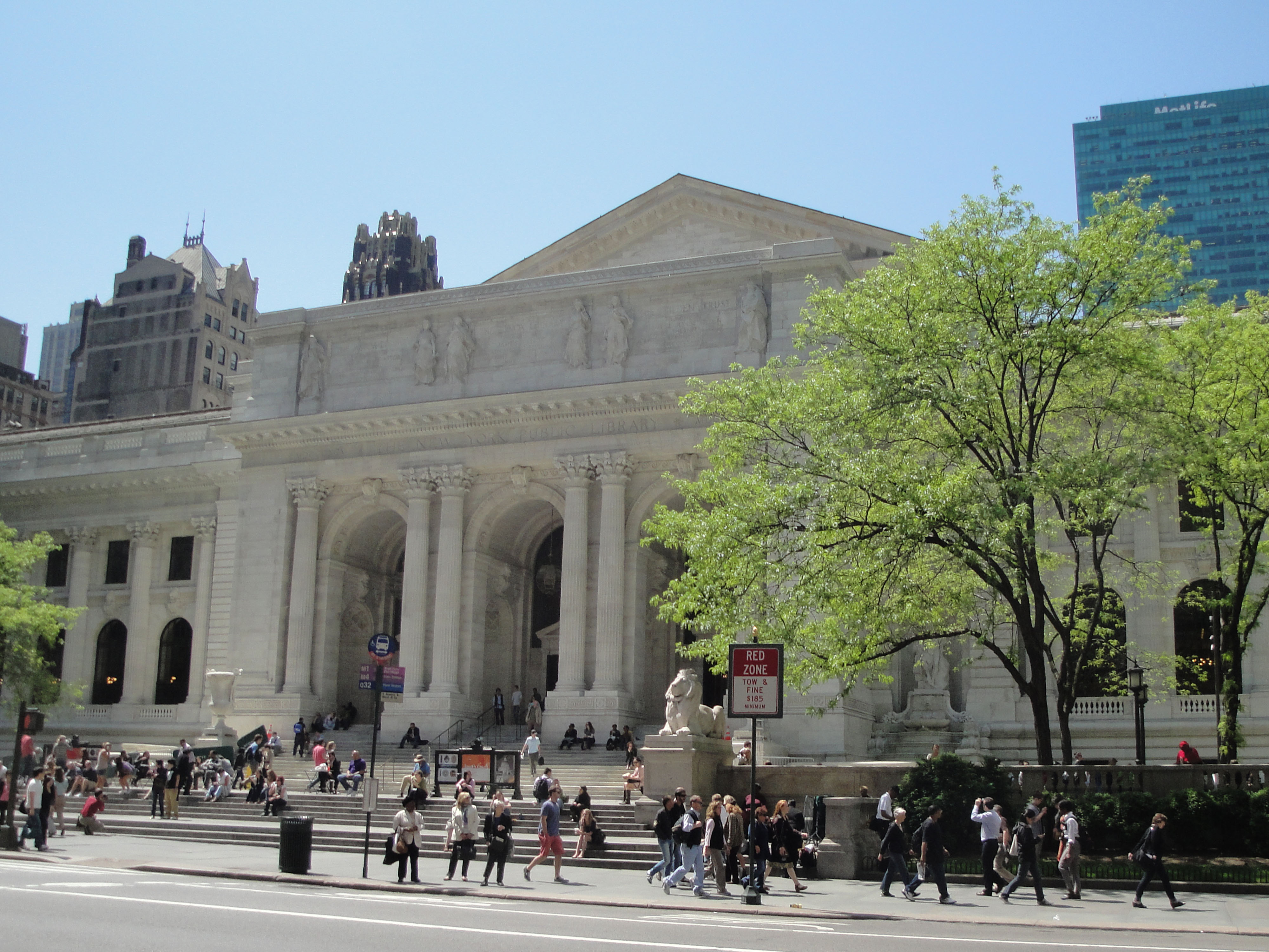
October 15, 1966 5th Ave. and 42nd St.
40°45′12″N 73°58′56″W / 40.75333°N 73.98222°WNew York Main branch of New York Public Library system; one of the world's largest public libraries. 90 New York Public Library and Bryant Park 
October 15, 1966 Avenue of the Americas, 5th Ave., 40th and 42nd Sts.
40°45′12″N 73°58′56″W / 40.75333°N 73.98222°WNew York 91 New York Savings Bank 
January 7, 2000 81 Eighth Ave. (@ 14th)
40°44′24″N 74°0′11″W / 40.74°N 74.00306°WNew York ; 92 New York School of Applied Design 
December 16, 1982 160 Lexington Ave. (@ 30th)
40°44′38″N 73°58′56″W / 40.74389°N 73.98222°WNew York 93 New York Yacht Club 
October 29, 1982 37 W. 44th St.
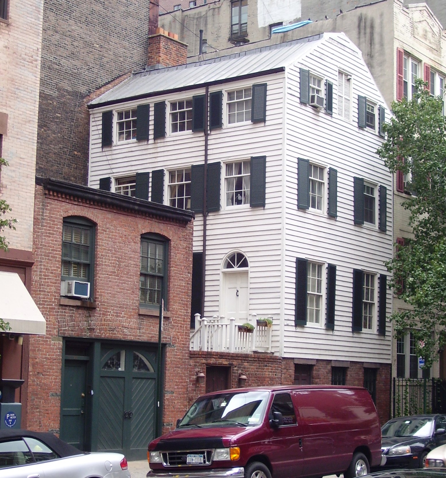
40°45′19″N 73°58′54″W / 40.75528°N 73.98167°WNew York 94 Andrew S. Norwood House 
July 9, 1979 241 W. 14th St.
40°44′23″N 74°0′7″W / 40.73972°N 74.00194°WNew York 95 Old Colony Club 
April 23, 1980 120 Madison Ave.
40°44′43″N 73°59′6″W / 40.74528°N 73.985°WNew York 96 Old Grolier Club 
April 23, 1980 29 E. 32nd St.
40°44′47″N 73°59′2″W / 40.74639°N 73.98389°WNew York 97 Osborne Apartments 
April 22, 1993 205 W. 57th St.
40°45′56″N 73°58′51″W / 40.76556°N 73.98083°WNew York 98 Pier 57 
August 11, 2004 Eleventh Ave. at end of W. 15th St.
40°44′37″N 74°0′40″W / 40.74361°N 74.01111°WNew York 99 The Players 
October 15, 1966 16 Gramercy Park
40°44′15″N 73°59′13″W / 40.7375°N 73.98694°WNew York 100 Plaza Hotel 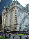
November 29, 1978 Fifth Ave. and Fifty-ninth St.
40°45′51″N 73°58′27″W / 40.76417°N 73.97417°WNew York Famous Upper East Side hotel being remodeled into condos. Setting for Eloise books. 101 Prince George Hotel 
February 12, 1999 10-20 E. 28th and 17-19 E. 27 Sts.
40°44′41″N 73°59′12″W / 40.74472°N 73.98667°WNew York 102 Public Baths (New York, New York) 
April 23, 1980 Asser Levy Pl. and E. 23rd St.
40°44′9″N 73°58′35″W / 40.73583°N 73.97639°WKips Bay 103 Public School 35 
October 27, 1980 931 1st Ave. (@ 52nd)
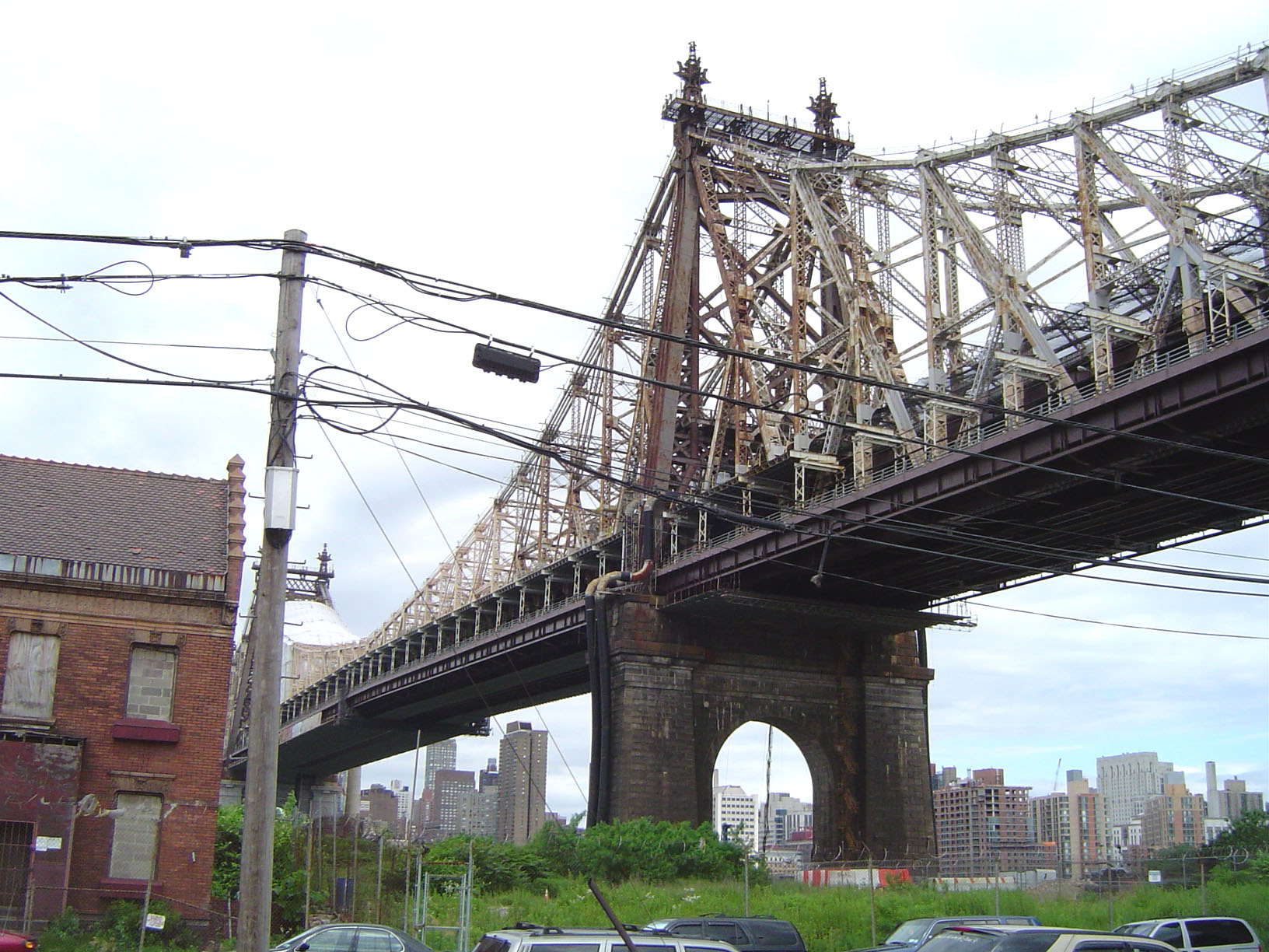
40°45′17″N 73°57′57″W / 40.75472°N 73.96583°WNew York 104 Queensboro Bridge 
December 20, 1978 59th St.
40°45′26″N 73°57′22″W / 40.75722°N 73.95611°WNew York 105 R & S Building 
September 22, 1986 492 First Ave. (@ 29th)
40°44′26″N 73°58′31″W / 40.74056°N 73.97528°WKips Bay 106 Racquet and Tennis Club Building 
July 13, 1983 370 Park Ave. (@ 53rd)
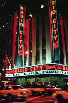
40°45′31″N 73°58′25″W / 40.75861°N 73.97361°WNew York Ornate private club; now a foil 107 Radio City Music Hall 
May 8, 1978 1260 Avenue of the Americas (50th and 6th)
40°45′36″N 73°59′3″W / 40.76°N 73.98417°WNew York Major live-entertainment venue since the 1920s; home to the Rockettes 108 Residences at 5-15 West 54th Street 
January 4, 1990 5-15 W. 54th St.
40°45′42″N 73°58′35″W / 40.76167°N 73.97639°WNew York 109 Rockefeller Center 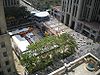
December 23, 1987 Bounded by Fifth Ave., W. Forty-eighth St., Seventh Ave., & W. Fifty-first St.
40°45′32″N 73°58′46″W / 40.75889°N 73.97944°WNew York Trend-setting urban office complex. Home to many NBC broadcasts. Setting and location for 2000s sitcom 30 Rock. 110 St. Bartholomew's Church and Community House 
April 16, 1980 109 E. 50th St.
40°45′26″N 73°58′25″W / 40.75722°N 73.97361°WNew York 111 St. George's Episcopal Church 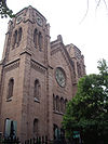
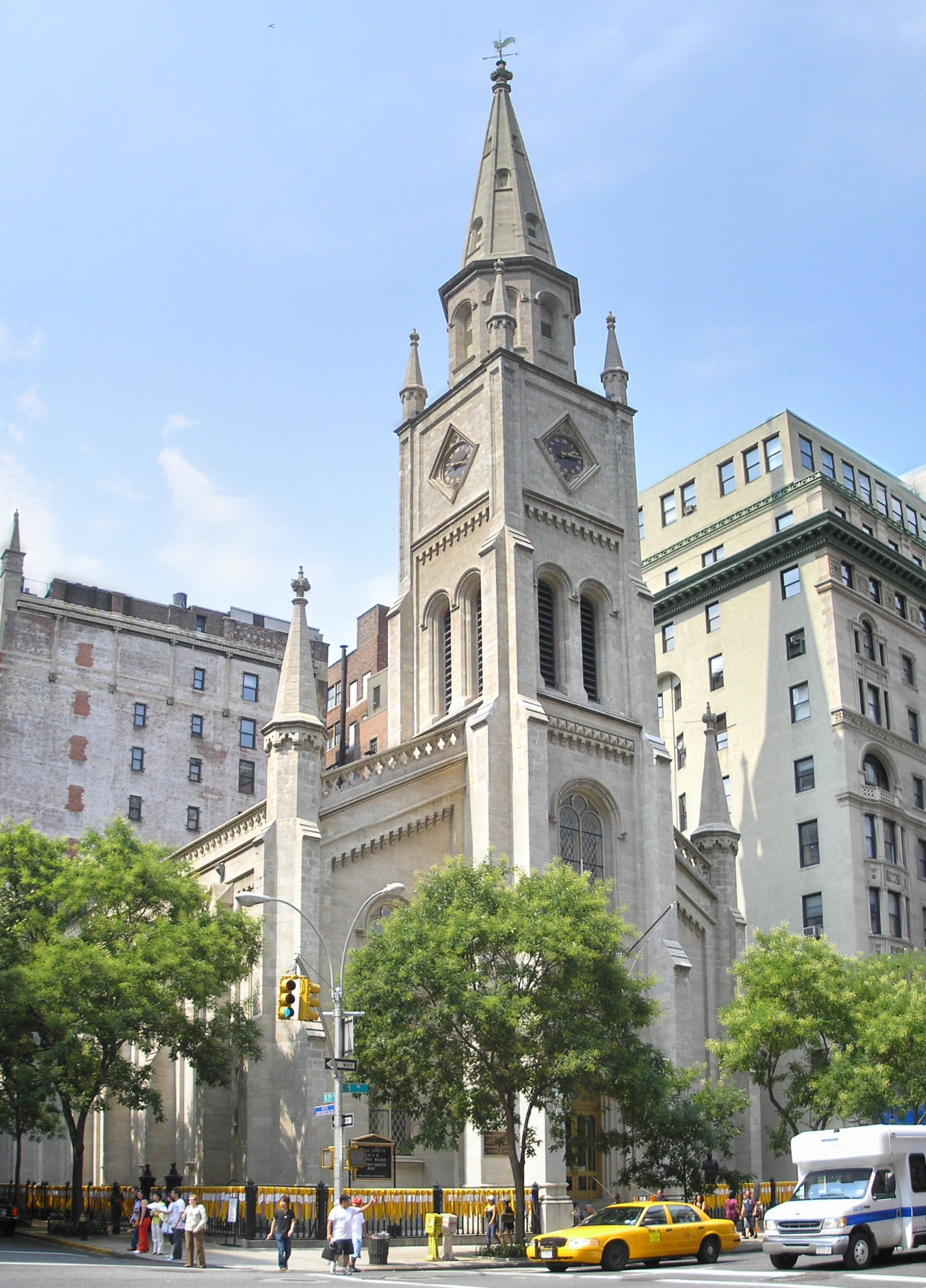
December 8, 1976 E. 16th St. and Rutherford Place
40°44′4″N 73°59′6″W / 40.73444°N 73.985°WNew York 112 St. Luke's Evangelical Lutheran Church 
June 1, 2007 208 W. 46th St.
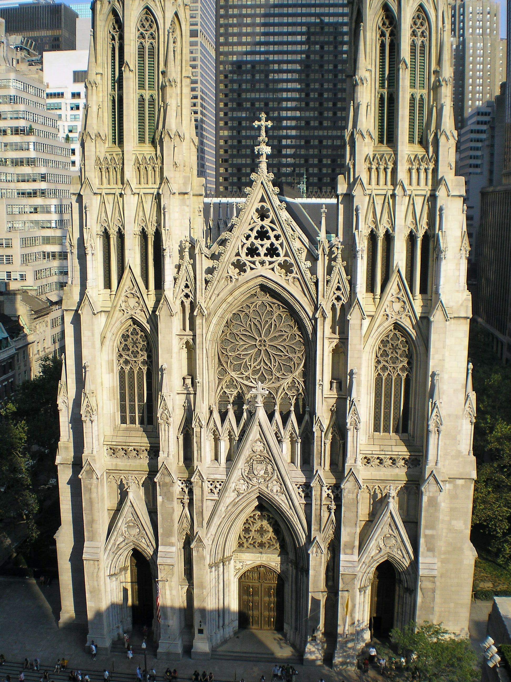
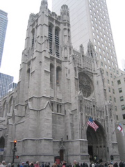
40°45′35″N 73°59′21″W / 40.75972°N 73.98917°WNew York 113 St. Patrick's Cathedral Complex 
December 8, 1976 Bounded by 5th and Madison Aves., E. 50th and E. 51st Sts.
40°45′31″N 73°58′35″W / 40.75861°N 73.97639°WNew York 114 St. Thomas Church and Parish House 
April 9, 1980 1-3 W. 53rd St.
40°45′39″N 73°58′36″W / 40.76083°N 73.97667°WNew York 115 Salmagundi Club 
July 25, 1974 47 5th Ave.
40°44′3″N 73°59′0″W / 40.73417°N 73.983333°WKips Bay 116 Margaret Sanger Clinic 
September 14, 1993 17 W. 16th St.
40°44′17″N 73°59′39″W / 40.73806°N 73.99417°WNew York Workplace of birth control pioneer Margaret Sanger. 117 Scribner Building 
May 6, 1980 153-157 5th Ave. (@ 21st)
40°44′25″N 73°59′27″W / 40.74028°N 73.99083°WNew York Known also as the Old Scribner Building. Note, Charles Scribner Building is different. 118 Seagram Building 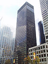
February 24, 2006 375 Park Ave.
40°45′30″N 73°58′22″W / 40.75833°N 73.97278°WNew York Milestone modernist building by Ludwig Mies van der Rohe 119 Seville Hotel 
February 24, 2005 22 East 29th St.
40°44′40″N 73°59′10″W / 40.74444°N 73.98611°WNew York 120 Sidewalk Clock at 200 5th Avenue, Manhattan 
April 18, 1985 200 5th Ave.
40°44′30″N 73°59′24″W / 40.74167°N 73.99°WNew York 121 Sidewalk Clock at 519 3rd Avenue, Manhattan 
April 18, 1985 519 3rd Ave.
40°44′46″N 73°58′41″W / 40.74611°N 73.97806°WNew York No longer in location. 122 Sidewalk Clock at 522 5th Avenue, Manhattan 
April 18, 1985 522 5th Ave.
40°45′16″N 73°58′50″W / 40.75444°N 73.98056°WNew York 123 Sniffen Court Historic District 
November 28, 1973 E. 36th St., between Lexington and 3rd Aves.
40°44′51″N 73°58′40″W / 40.7475°N 73.97778°WNew York 124 Society for the Lying-In Hospital 
September 1, 1983 305 2nd Ave. (@ 18th)
40°44′5″N 73°59′3″W / 40.73472°N 73.98417°WNew York 125 Stuyvesant Square Historic District 
November 21, 1980 Roughly bounded by Nathan D. Perleman Pl., 3rd Ave., E. 18th and E. 15th Sts.
40°44′2″N 73°59′6″W / 40.73389°N 73.985°WNew York 126 Substation 13 
February 9, 2006 225 W 53rd St.
40°45′50″N 73°59′3″W / 40.76389°N 73.98417°WNew York 127 Substation 42 
February 9, 2006 154 E. 57th St.
40°45′37″N 73°58′9″W / 40.76028°N 73.96917°WNew York 128 Ed Sullivan Theater 
November 17, 1997 1697-1699 Broadway
40°45′49″N 73°59′0″W / 40.76361°N 73.983333°WNew York 129 Sutton Place Historic District 
September 12, 1985 1-21 Sutton Pl. & 4-16 Sutton Sq.
40°45′28″N 73°57′57″W / 40.75778°N 73.96583°WNew York 130 Theodore Roosevelt Birthplace National Historic Site 
October 15, 1966 28 E. 20th St.
40°44′18″N 73°59′21″W / 40.73833°N 73.98917°WNew York Birthplace of Theodore Roosevelt 131 Tiffany and Company Building 
June 2, 1978 401 5th Ave., at 36th
40°45′0″N 73°58′53″W / 40.75°N 73.98139°WNew York Former Tiffany's building 132 Samuel J. Tilden House 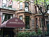
May 11, 1976 14-15 Gramercy Park South
40°44′15″N 73°59′14″W / 40.7375°N 73.98722°WNew York Also known as "National Arts Club". Home of Tilden, winner of popular vote in disputed 1876 presidential election 133 Times Square Hotel 
May 4, 1995 255 W. 43rd St.
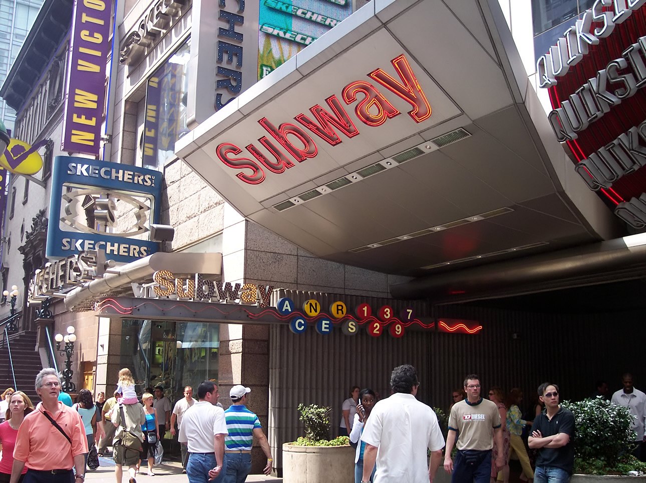
40°45′28″N 73°59′22″W / 40.75778°N 73.98944°WNew York 134 Times Square – 42nd Street (New York City Subway) Subway station (1 2 3 7 <7> N Q R S trains) 
September 17, 2004 Jct. of West 42nd St, and Broadway/Seventh Ave.
40°45′19″N 73°59′15″W / 40.75528°N 73.9875°WNew York 135 Town Hall 
April 23, 1980 113-123 W. 43rd St.
40°45′21″N 73°59′5″W / 40.75583°N 73.98472°WNew York 136 Trinity Chapel Complex 
December 16, 1982 15 W. 25th St.
40°44′37″N 73°59′25″W / 40.74361°N 73.99028°WNew York 137 Tudor City Historic District 
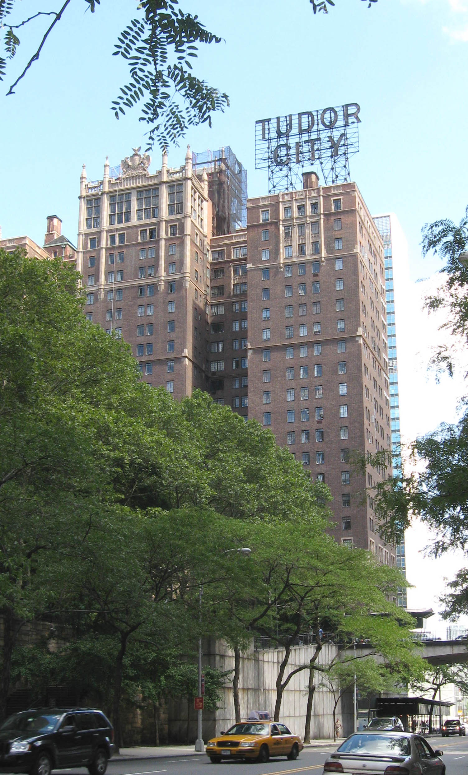
September 11, 1986 Roughly bounded by Forty-third St., First Ave., Forty-first St., and Second Ave.
40°44′56″N 73°58′17″W / 40.74889°N 73.97139°WNew York 138 Turtle Bay Gardens Historic District 
July 21, 1983 226-246 E. 49th St. and 227-245 E. 48th St.
40°45′15″N 73°58′13″W / 40.75417°N 73.97028°WNew York 139 U.S. General Post Office 
January 29, 1973 8th Ave. between 31st and 33rd Sts.
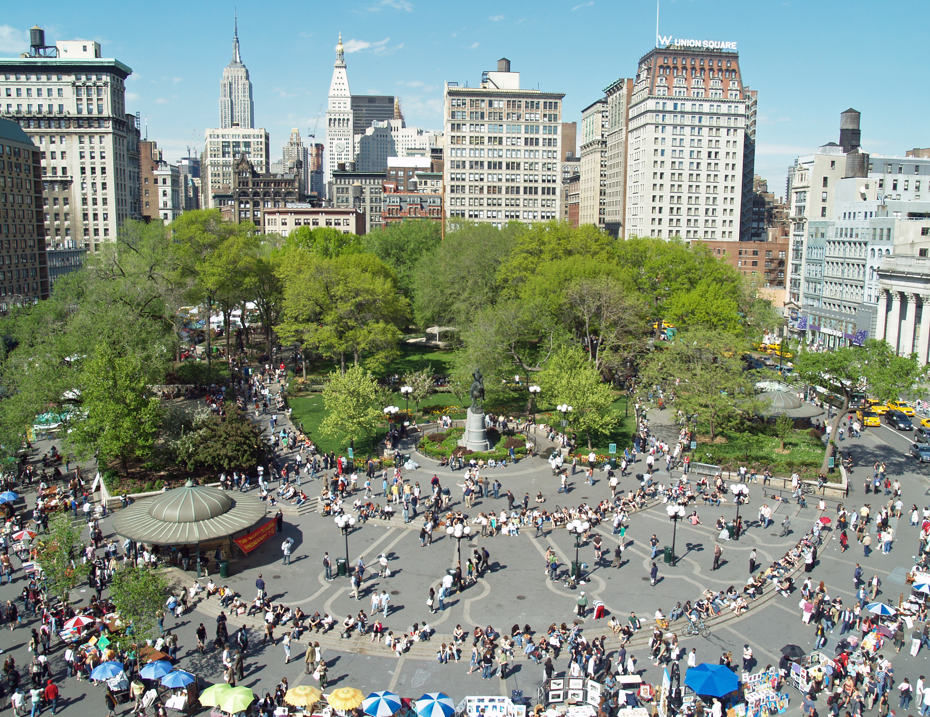
40°45′37″N 73°59′3″W / 40.76028°N 73.98417°WNew York 140 Union Square 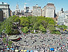
December 9, 1997 Bounded by E 14th & E 17th Sts. and Union Square East & Union Square West
40°44′10″N 73°59′25″W / 40.73611°N 73.99028°WNew York Site of many political demonstrations over the years 141 United Charities Building Complex 
March 28, 1985 105 E. 22nd St,. 289 Park Ave. S. and 111-113 E. 22nd St.
40°44′22″N 73°59′14″W / 40.73944°N 73.98722°WNew York 142 University Club 
April 16, 1980 1 W. 54th St.
40°45′40″N 73°58′34″W / 40.76111°N 73.97611°WNew York 143 US Post Office-Madison Square Station 
May 11, 1989 149-153 E. 23rd St.
40°44′23″N 73°59′4″W / 40.73972°N 73.98444°WNew York 144 US Post Office-Old Chelsea Station 
May 11, 1989 217 W. 18th St.
40°46′7″N 73°59′56″W / 40.76861°N 73.99889°WNew York 145 USS EDSON (DD-946) 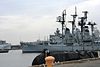
June 21, 1990 Intrepid Sq., foot of 46th St. at West Side Highway
40°45′51″N 73°59′59″W / 40.76417°N 73.99972°WNew York 146 USS INTREPID (aircraft carrier) 
January 14, 1986 Intrepid Sq., 45th and West Side Highway
40°45′51″N 73°59′59″W / 40.76417°N 73.99972°WNew York 147 Villard Houses 
September 2, 1975 29½ 50th St., 24-26 E. 51st St., and 451, 453, 455, and 457 Madison Ave.
40°45′29″N 73°58′31″W / 40.75806°N 73.97528°WNew York 148 Webster Hotel 
September 7, 1984 40 W. 45th St.
40°45′22″N 73°58′56″W / 40.75611°N 73.98222°WNew York 149 West 28th Street Subway station (1 2 trains) 
March 30, 2005 Seventh Ave. bet. West 26th and West 29th Sts.
40°44′48″N 73°59′39″W / 40.74667°N 73.99417°WChelsea 150 R. C. Williams Warehouse 
February 24, 2005 259-273 Tenth Ave.
40°44′57″N 74°0′14″W / 40.74917°N 74.00389°WNew York See also
- County: National Register of Historic Places listings in New York County, New York
- State: National Register of Historic Places listings in New York
- Municipal: List of New York City Designated Landmarks in Manhattan from 14th to 59th Streets
References
- Notes
- ^ The latitude and longitude information provided in this table was derived originally from the National Register Information System, which has been found to be fairly accurate for about 99% of listings. For about 1% of NRIS original coordinates, experience has shown that one or both coordinates are typos or otherwise extremely far off; some corrections may have been made. A more subtle problem causes many locations to be off by up to 150 yards, depending on location in the country: most NRIS coordinates were derived from tracing out latitude and longitudes off of USGS topographical quadrant maps created under North American Datum of 1927, which differs from the current, highly accurate GPS system used by Google maps. Chicago is about right, but NRIS longitudes in Washington are higher by about 4.5 seconds, and are lower by about 2.0 seconds in Maine. Latitudes differ by about 1.0 second in Florida. Some locations in this table may have been corrected to current GPS standards.
- ^ "National Register of Historic Places: Weekly List Actions". National Park Service, United States Department of the Interior. Retrieved on November 18, 2011.
- ^ "National Register Information System". National Register of Historic Places. National Park Service. 2008-04-15. http://nrhp.focus.nps.gov/natreg/docs/All_Data.html.
Categories:- National Register of Historic Places in Manhattan
-


Wikimedia Foundation. 2010.