- National Register of Historic Places listings in Manhattan above 59th to 110th Streets
-
List of the National Register of Historic Places listings in Manhattan from 59th to 110th Streets
This is intended to be a complete list of properties and districts listed on the National Register of Historic Places between 59th and 110th Streets in Manhattan. For properties and districts in other parts of Manhattan and the other islands of New York County, see National Register of Historic Places listings in New York County, New York. The locations of National Register properties and districts (at least for all showing latitude and longitude coordinates below) may be seen in a Google map by clicking on "Map of all coordinates".[1]
-
- This National Park Service list is complete through NPS recent listings posted November 18, 2011.[2]
Contents: Counties in New York Albany (Albany) – Allegany – Bronx – Broome – Cattaraugus – Cayuga – Chautauqua – Chemung – Chenango – Clinton – Columbia – Cortland – Delaware – Dutchess – Erie (Buffalo) – Essex – Franklin – Fulton – Genesee – Greene – Hamilton – Herkimer – Jefferson – Kings (Brooklyn) – Lewis – Livingston – Madison – Monroe (Rochester) – Montgomery – Nassau – New York (Manhattan – Below 14th Street, 14th to 59th Streets, 59th to 110th Streets, Above 110th Street, Islands) – Niagara – Oneida – Onondaga (Syracuse) – Ontario – Orange – Orleans – Oswego – Otsego – Putnam – Queens – Rensselaer – Richmond (Staten Island) – Rockland – Saratoga – Schenectady – Schoharie – Schuyler – Seneca – St. Lawrence – Steuben – Suffolk – Sullivan – Tioga – Tompkins – Ulster – Warren – Washington – Wayne – Westchester (New Rochelle, Peekskill, Yonkers) – Wyoming – Yates Listings from 59th to 110th Streets
Landmark name Image Date listed Location Neighborhood Summary 1 110th Street – Cathedral Parkway Subway station (1 train) 
September 17, 2004 Jct. of Broadway, W. 110th St. and Cathedral Pkwy.
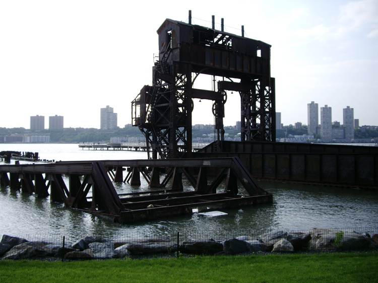
40°48′14″N 73°58′1″W / 40.80389°N 73.96694°WMorningside Heights 2 69th Street Transfer Bridge 
June 26, 2003 Hudson River W of the West Side Highway bet. W 66th and 70th Sts.
40°46′44″N 73°59′26″W / 40.77889°N 73.99056°WRiverside Park 3 72nd Street Subway station (1 2 3 trains) 
September 17, 2004 jct. of Broadway and W. 72nd St.
40°46′42″N 73°58′57″W / 40.77833°N 73.9825°WUpper West Side 4 79th Street Subway station (1 2 trains) 
September 17, 2004 Jxt. of W. 79th St. and Broadway
40°47′1″N 73°58′50″W / 40.78361°N 73.98056°WUpper West Side 5 86th Street Subway station (4 5 6 <6> trains) 
March 30, 2005 Under Lexington Ave., bet E. 85th and E. 87th Sts.
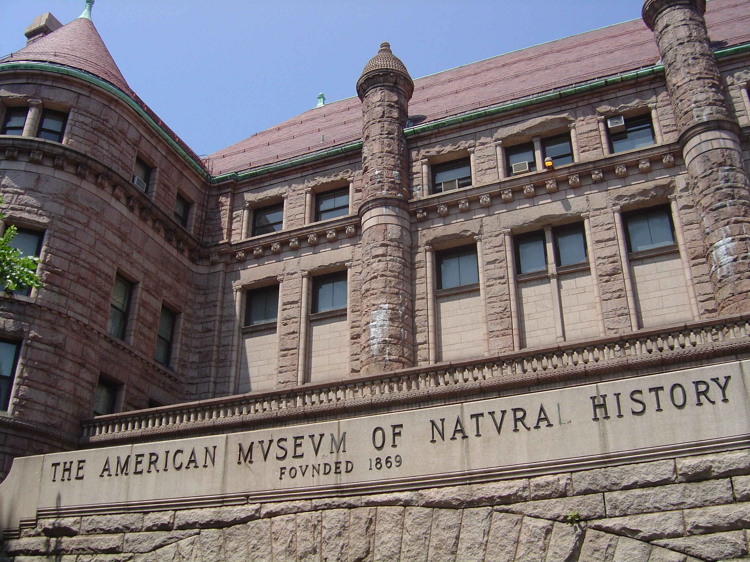
40°46′46″N 73°57′22″W / 40.77944°N 73.95611°WUpper East Side 6 American Museum of Natural History 
June 24, 1976 Central Park West and 77th St.
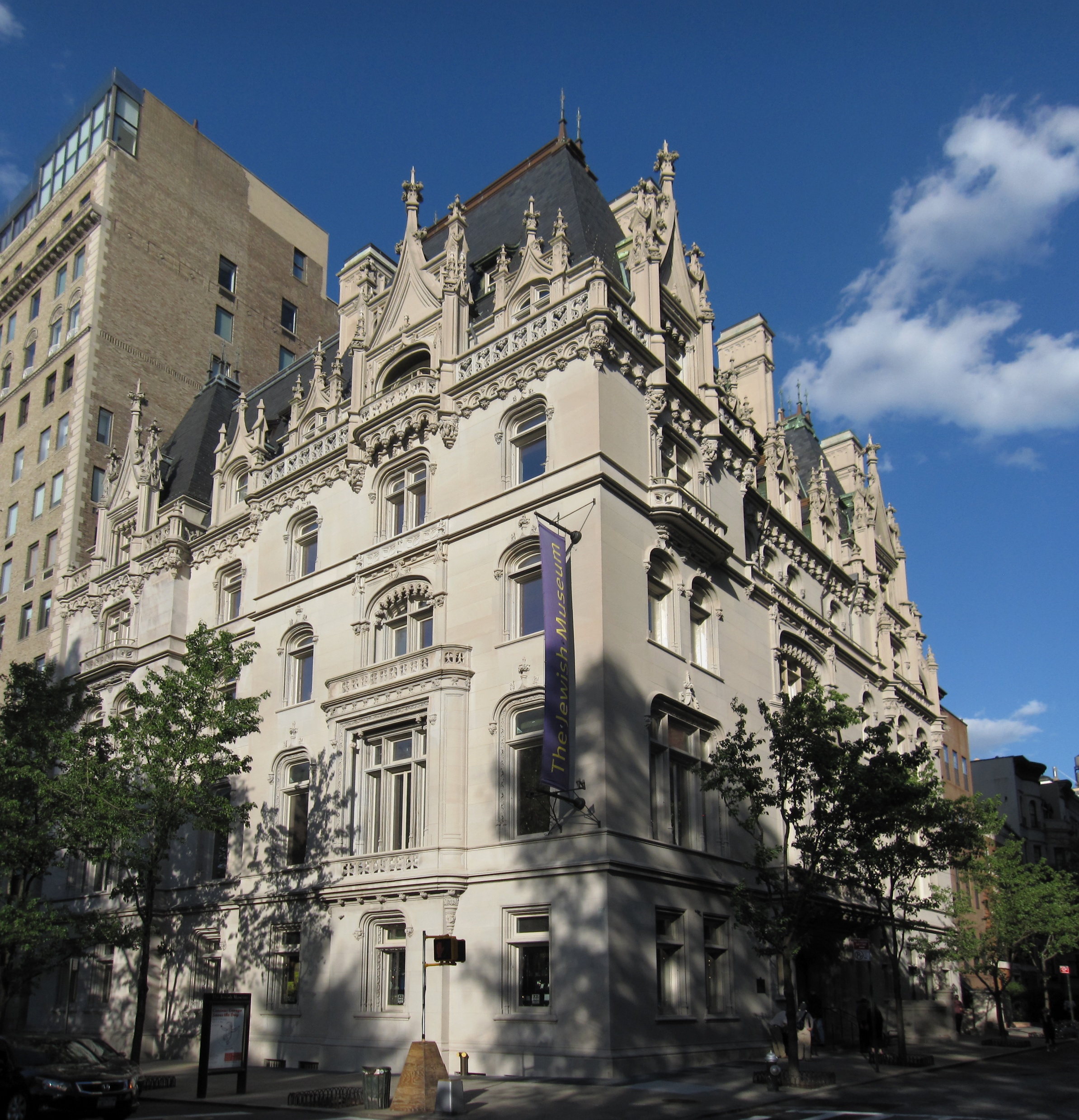
40°46′53″N 73°58′28″W / 40.78139°N 73.97444°WNew York 7 Ansonia Hotel 
January 10, 1980 2101-2119 Broadway
40°46′48″N 73°58′57″W / 40.78°N 73.9825°WUpper West Side 8 Apartment at 1261 Madison Avenue 
October 29, 1982 1261 Madison Ave.
40°47′0″N 73°57′25″W / 40.783333°N 73.95694°WNew York 9 Apthorp Apartments 
January 30, 1978 2201-2219 Broadway
40°47′2″N 73°58′53″W / 40.78389°N 73.98139°WUpper West Side 10 Association Residence Nursing Home 
February 20, 1975 891 Amsterdam Ave. (@ 104)
40°47′55″N 73°58′1″W / 40.79861°N 73.96694°WNew York 11 George F. Baker Jr. and Sr. Houses 
June 3, 1982 67, 69, and 75 E. 93rd St.
40°47′6″N 73°57′15″W / 40.785°N 73.95417°WNew York 12 Barbizon Hotel for Women 
October 29, 1982 140 E. 63rd St.
40°45′52.79″N 73°57′58.46″W / 40.7646639°N 73.9662389°WNew York 13 Beacon Theater and Hotel 
November 4, 1982 2124 Broadway
40°46′50″N 73°58′52″W / 40.78056°N 73.98111°WNew York 14 Belnord Apartments 
April 23, 1980 225 W. 86th St.
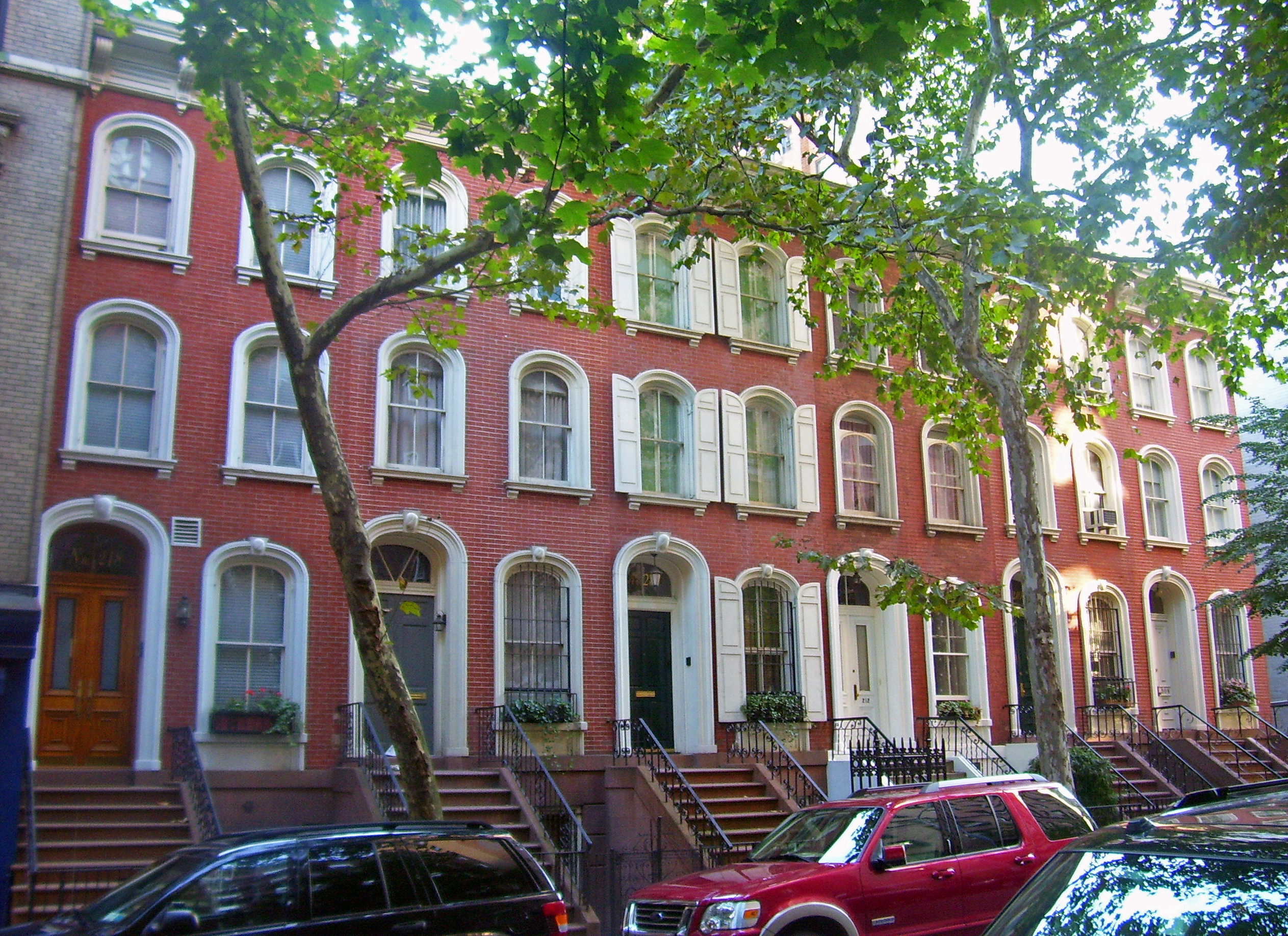
40°47′18″N 73°58′34″W / 40.78833°N 73.97611°WNew York 15 Building at 133 East 80th Street 
August 16, 2010 133 E. 80th St.
40°46′33″N 73°57′31″W / 40.77583°N 73.95861°WNew York Architecturally distinctive building home to McGeorge Bundy and other notable public figures 16 Building at 210 East 68th Street 
June 16, 2005 210 E. 68th St.
40°46′1″N 73°57′46″W / 40.76694°N 73.96278°WNew York 17 Building at 45 East 66th Street 
May 6, 1980 45 E. 66th St.
40°46′5″N 73°58′5″W / 40.76806°N 73.96806°WNew York 18 James A. Burden Jr. House and Otto H. Kahn House 
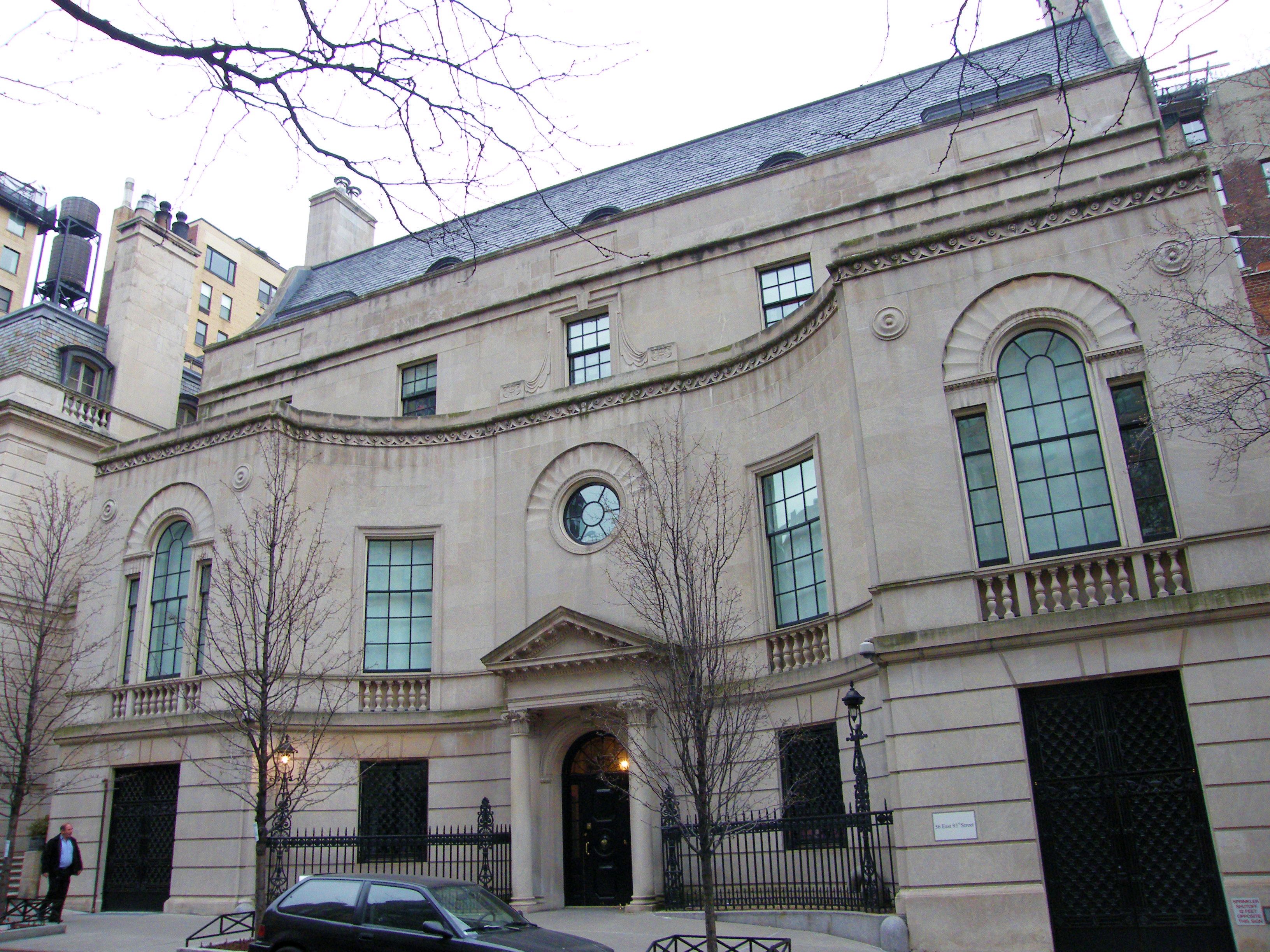
September 12, 2006 70 and 1 E. 91st St. (@ 5th)
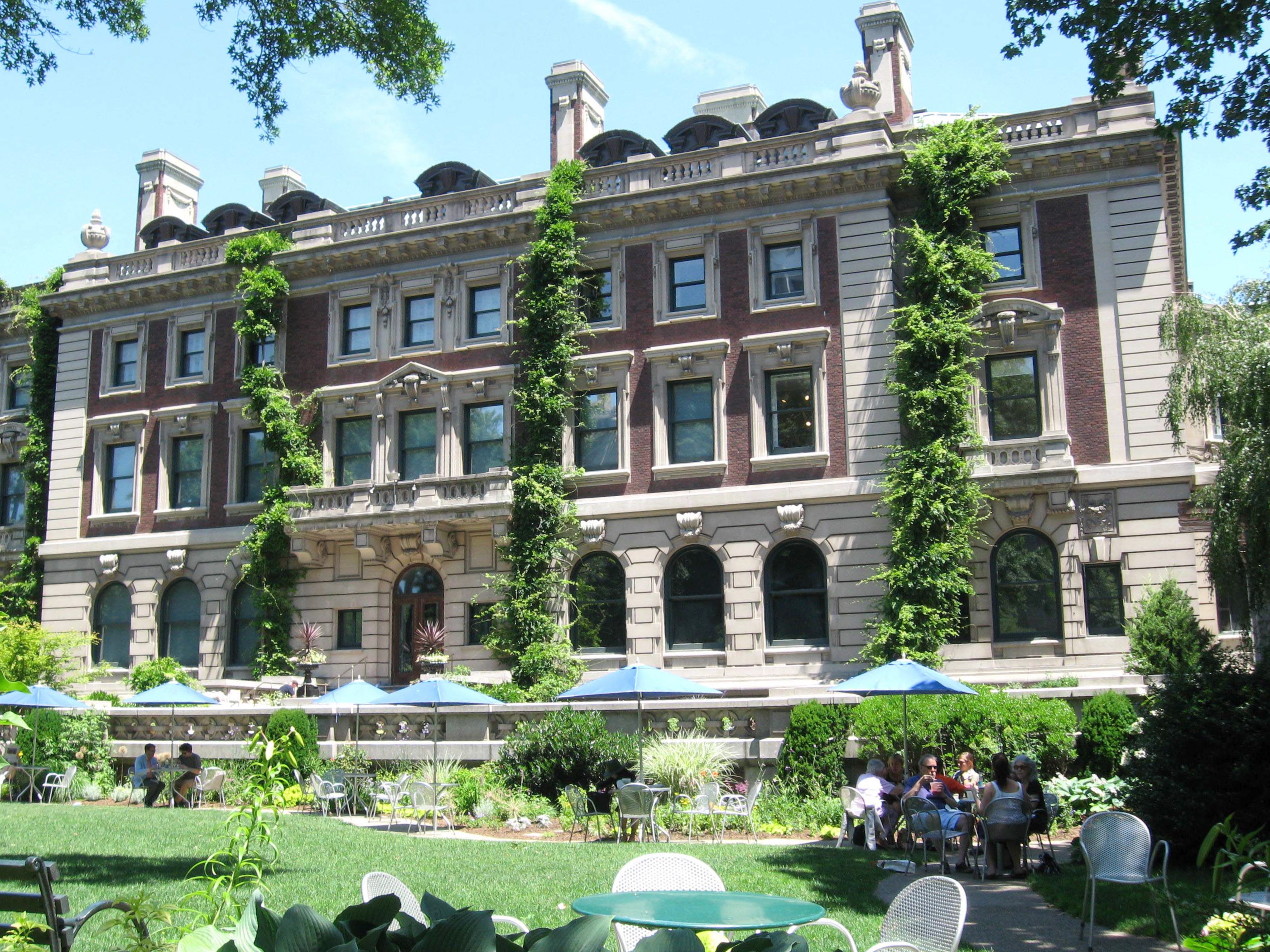
40°47′5″N 73°57′29″W / 40.78472°N 73.95806°WNew York 19 Andrew Carnegie Mansion 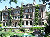
November 13, 1966 2 E. 91st St. (@ Fifth Ave.)
40°47′4″N 73°57′29″W / 40.78444°N 73.95806°WNew York Now the Cooper-Hewitt, National Design Museum 20 Central Park 
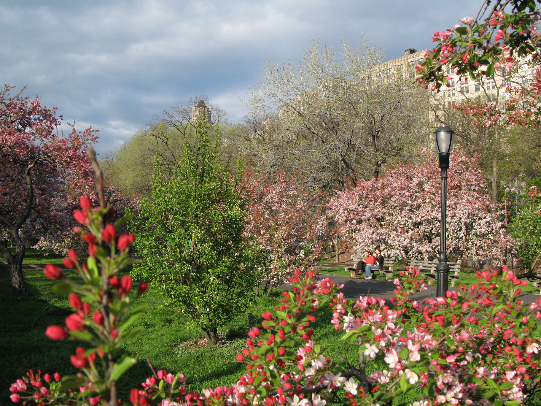
October 15, 1966 Bounded by Central Park S., 5th Ave., Central Park W., 110th St.
40°46′57″N 73°57′57″W / 40.7825°N 73.96583°WNew York Frederick Law Olmstead and Calvert Vaux-designed park is their best-known work. One of the world's most famous parks. 21 Central Park West Historic District 
November 9, 1982 Central Park West between 61st and 97th Sts.
40°46′44″N 73°58′32″W / 40.77889°N 73.97556°WNew York Unique and distinctive skyline over park 22 Central Savings Bank 
September 8, 1983 2100-2108 Broadway
40°46′47″N 73°58′54″W / 40.77972°N 73.98167°WNew York aka Apple Bank for Savings 23 Church of St. Ignatius Loyola Complex 
July 24, 1980 Park Ave., 83rd and 84th Sts.
40°46′44″N 73°57′34″W / 40.77889°N 73.95944°WNew York 24 Church of St. Paul the Apostle 
December 5, 1991 415 W. 59th St.
40°46′11″N 73°59′7″W / 40.76972°N 73.98528°WNew York 25 City and Suburban Homes Company's First Avenue Estate Historic District 
August 1, 1986 1168-1200 First Ave., 401-429 E. Sixty-fourth, and 402-430 E. Sixty-fifth Sts.
40°45′45″N 73°57′32″W / 40.7625°N 73.95889°WNew York 26 City and Suburban Homes Company's York Avenue Estate and Shively Sanitary Tenements Historic District 
September 15, 1994 Roughly bounded by York Ave., E. 77th St., Franklin D. Roosevelt Dr., and E. 79th St.
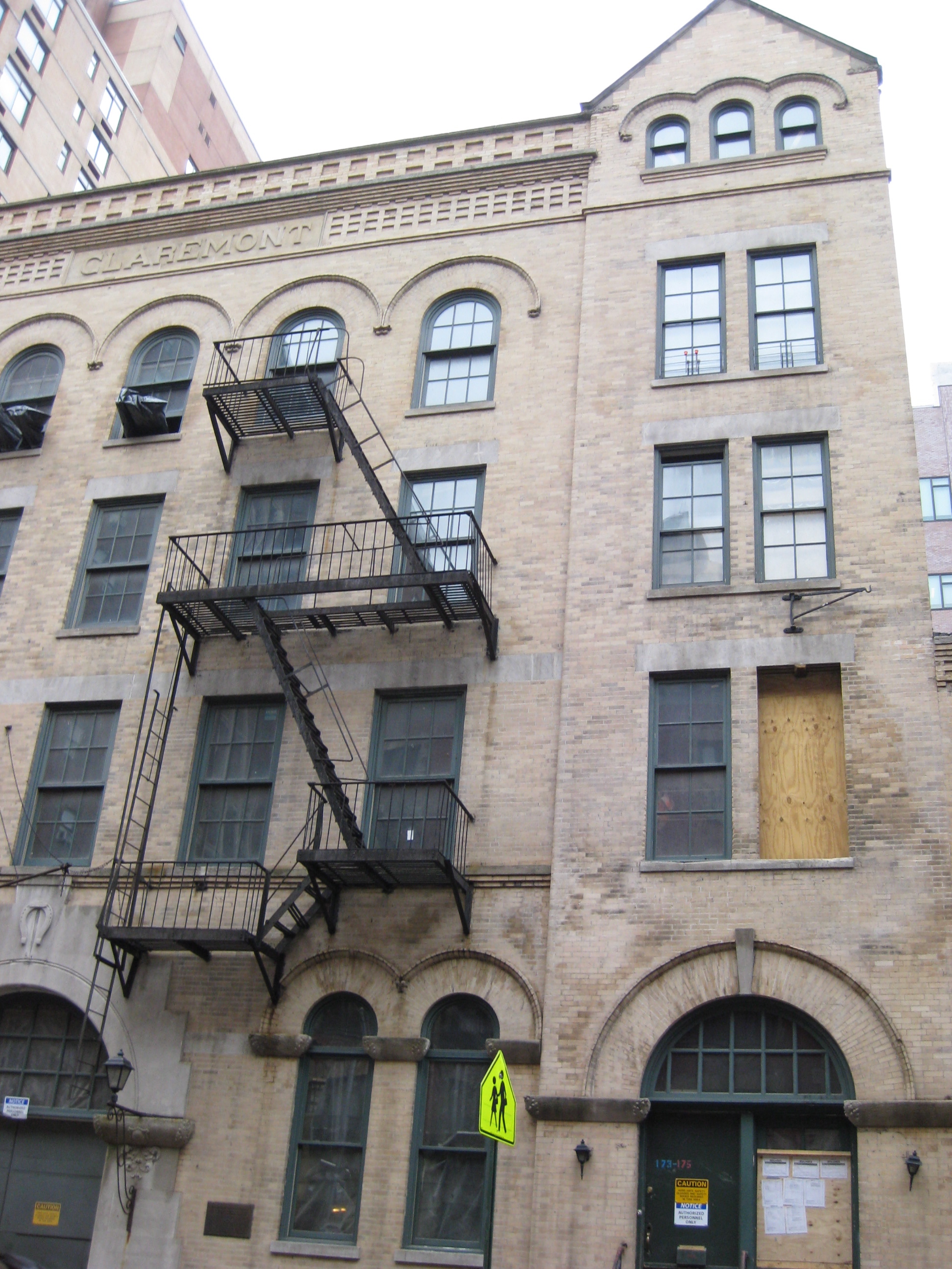
40°46′13″N 73°56′59″W / 40.77028°N 73.94972°WNew York 27 Claremont Stables 
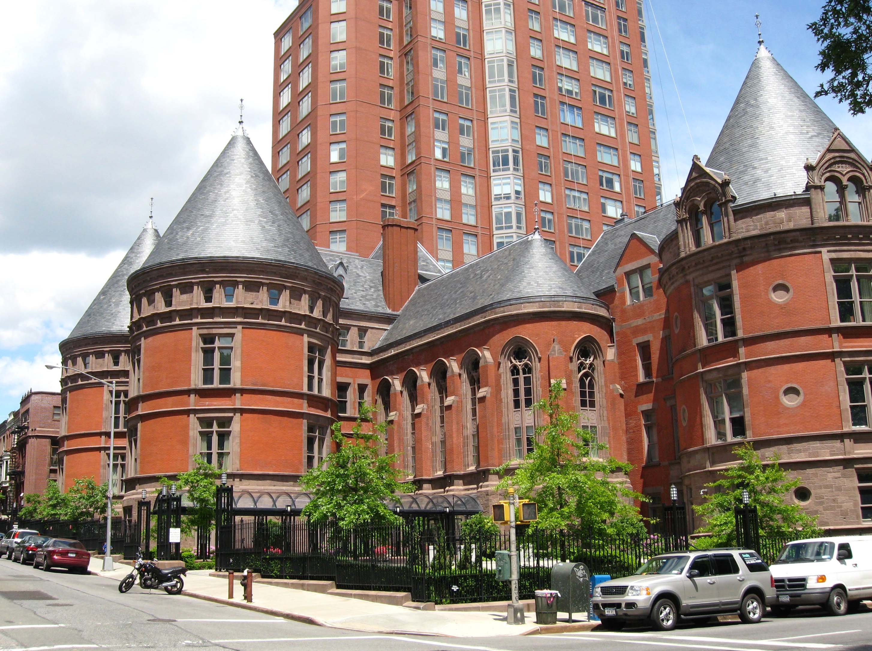
April 16, 1980 173-177 W. 89th St.
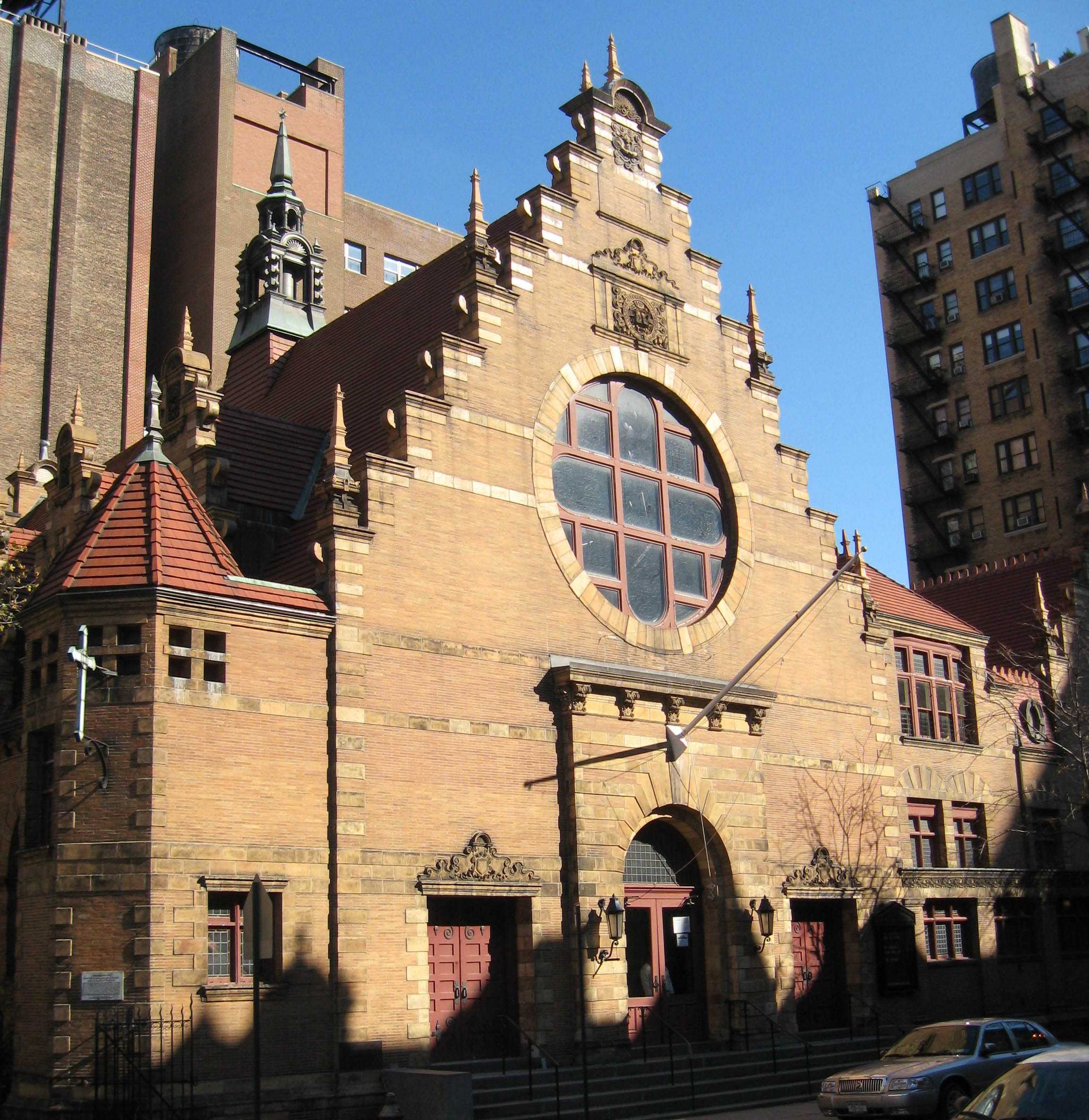
40°47′22″N 73°58′24″W / 40.78944°N 73.97333°WNew York 28 Congregation B'nai Jeshurun Synagogue and Community House 
June 2, 1989 257 W. 88th St. and 270 W. 89th St.
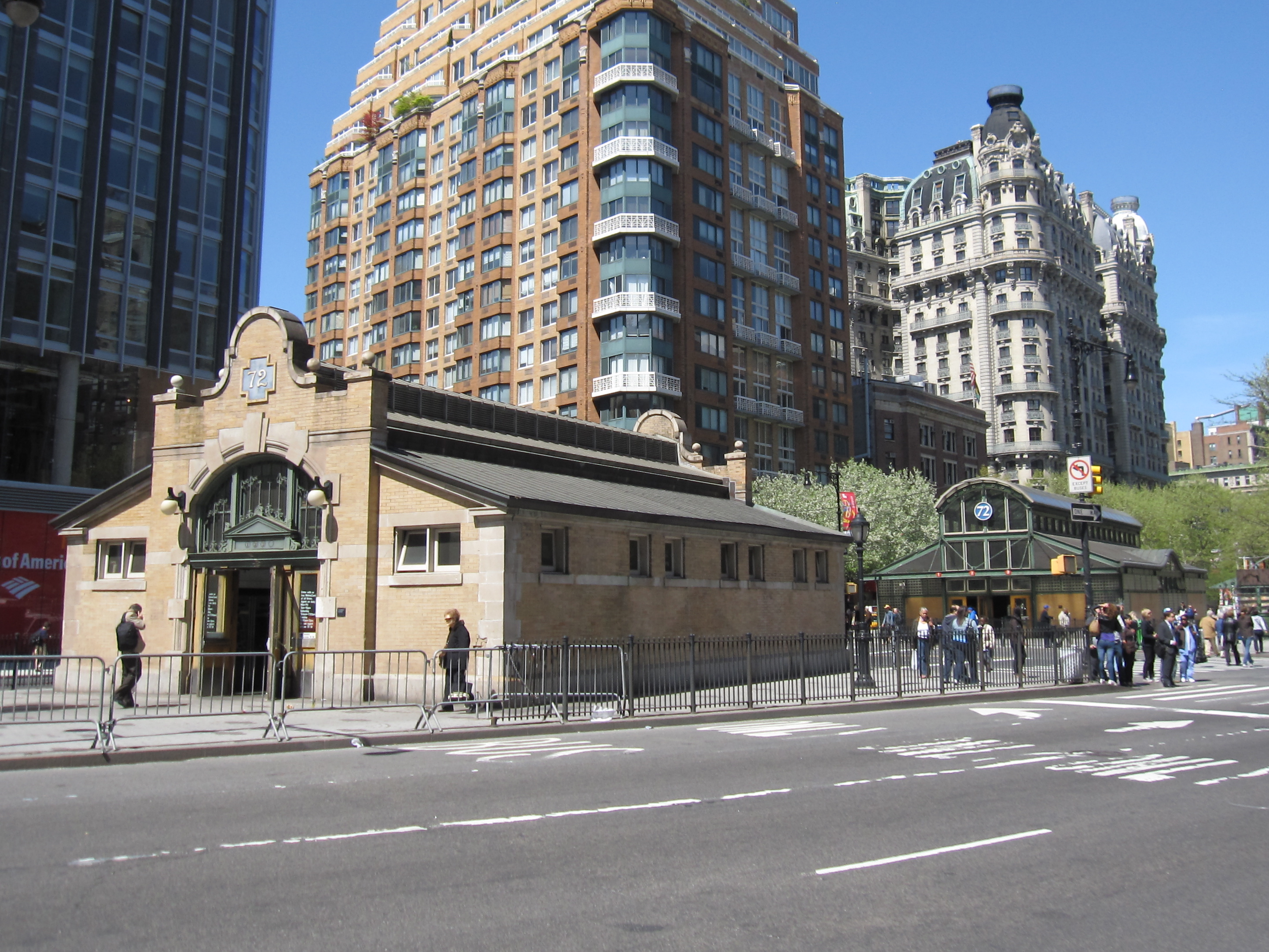
40°47′24″N 73°58′35″W / 40.79°N 73.97639°WNew York 29 Control House on 72nd Street (1 2 3 trains) 
May 6, 1980 W. 72nd St. and Broadway
40°46′42″N 73°58′57″W / 40.77833°N 73.9825°WUpper West Side 30 Lucy Drexel Dahlgren House 
July 20, 1989 15 E. 96th St.
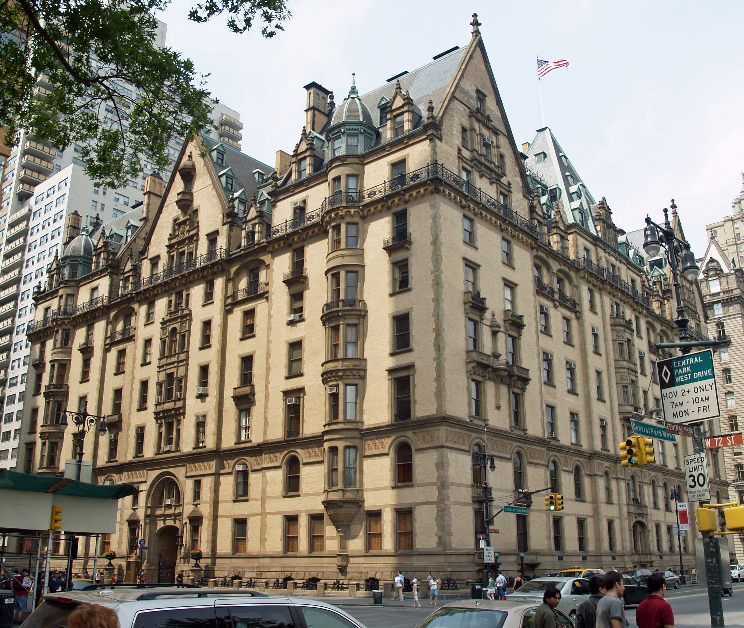
40°47′13″N 73°57′15″W / 40.78694°N 73.95417°WNew York 31 Dakota Apartments 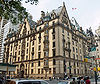
April 26, 1972 1 W. 72nd St. (@ CPW)
40°46′36″N 73°58′35″W / 40.77667°N 73.97639°WUpper West Side Architecturally distinctive late 19th-century apartment complex on Central Park; used for exteriors in Rosemary's Baby and site of John Lennon's murder. 32 The Dorilton 
September 8, 1983 171 W. 71st St.
40°46′41″N 73°58′55″W / 40.77806°N 73.98194°WUpper West Side 33 Duke Residence 
December 7, 1989 1009 Fifth Ave. (@ 82nd)
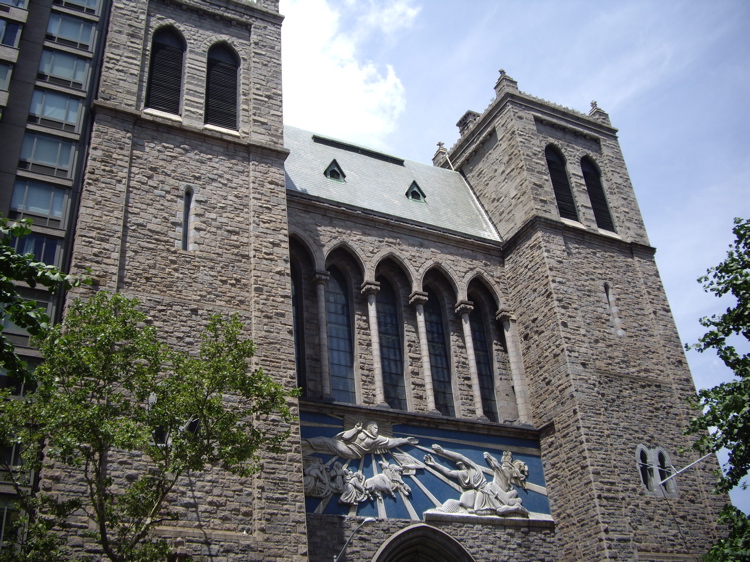
40°46′43″N 73°57′45″W / 40.77861°N 73.9625°WNew York 34 James B. Duke House 
November 10, 1977 1 E. 78th St.
40°46′35″N 73°57′51″W / 40.77639°N 73.96417°WNew York Associated with James Buchanan Duke 35 East 73rd Street Historic District 
July 22, 1982 161-179 and 166-182 E. 73rd St.
40°46′14″N 73°57′41″W / 40.77056°N 73.96139°WNew York Small enclave of intact former carriage houses of area's wealthy residents 36 East 78th Street Houses 
March 25, 1980 157,159,161, and 163-165 E. 78th St.
40°46′26″N 73°57′32″W / 40.77389°N 73.95889°WNew York Oldest townhouses on the Upper East Side 37 East 80th Street Houses 
March 26, 1980 116-130 E. 80th St.
40°46′0″N 73°57′36″W / 40.766667°N 73.96°WNew York Intact high-end 1920s townhouses; homes of Vincent Astor and George Whitney 38 First Hungarian Reformed Church 
August 31, 2000 344-346 East 69th St.
40°45′57″N 73°57′32″W / 40.76583°N 73.95889°WNew York 1916 Emery Roth church in Hungarian vernacular style is his only Christian religious building 39 Founder's Hall, The Rockefeller University 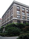
September 13, 1974 66th St. and York Ave.
40°45′47″N 73°57′18″W / 40.76306°N 73.955°WNew York 40 Archibald Gracie Mansion 
May 12, 1975 East End Ave. at 88th St.
40°46′34″N 73°56′36″W / 40.77611°N 73.94333°WNew York New York City mayor's residence (HHT) 41 Solomon R. Guggenheim Museum 
May 19, 2005 1071 Fifth Ave. (@ 88th)
40°46′58″N 73°57′34″W / 40.78278°N 73.95944°WNew York Frank Lloyd Wright's best-known late work 42 Barbara Rutherford Hatch House 
June 9, 1983 153 E. 63rd St.
40°45′52″N 73°57′57″W / 40.76444°N 73.96583°WNew York 43 Henderson Place Historic District 
June 20, 1974 Henderson Pl. (E86th nr East End Ave)
40°46′31″N 73°56′42″W / 40.77528°N 73.945°WNew York 44 Holy Trinity Church, St. Christopher House and Parsonage 
May 30, 1980 312-316 and 332 E. 88th St.
40°46′41″N 73°56′59″W / 40.77806°N 73.94972°WUpper East Side 45 House at 49 East 80th Street 
November 15, 2007 49 E 80th St.
40°46′44″N 73°57′40″W / 40.77889°N 73.96111°WNew York 46 Houses at 1026-1028 Fifth Ave. 
February 12, 1999 1026-1028 Fifth Ave.
40°46′47″N 73°57′42″W / 40.77972°N 73.96167°WNew York 47 Houses at 120 and 122 East 92nd Street 
October 29, 1982 120-122 East 92nd St.
40°47′0″N 73°57′15″W / 40.783333°N 73.95417°WNew York 48 Houses at 146-156 East 89th Street 
June 3, 1982 146-156 E. 89th St.
40°46′52″N 73°57′15″W / 40.78111°N 73.95417°WNew York 49 Houses at 208-218 East 78th Street 
June 30, 1983 208-218 E. 78th St.
40°46′23″N 73°57′28″W / 40.77306°N 73.95778°WNew York Five remaining Civil War-era townhouses of an original row of 16; rounded window lintels unusual in Italianate buildings 50 Level Club 
April 9, 1984 253 W. 73rd St.
40°46′49″N 73°59′0″W / 40.78028°N 73.983333°WNew York 51 William Goadby Loew House 
July 15, 1982 56 E. 93rd St.
40°47′6″N 73°57′20″W / 40.785°N 73.95556°WNew York 52 Madison Avenue Facade of the Squadron A Armory 
March 24, 1972 Madison Ave. between 94th and 95th Sts.
40°47′10″N 73°57′18″W / 40.78611°N 73.955°WNew York 53 Metropolitan Museum of Art 
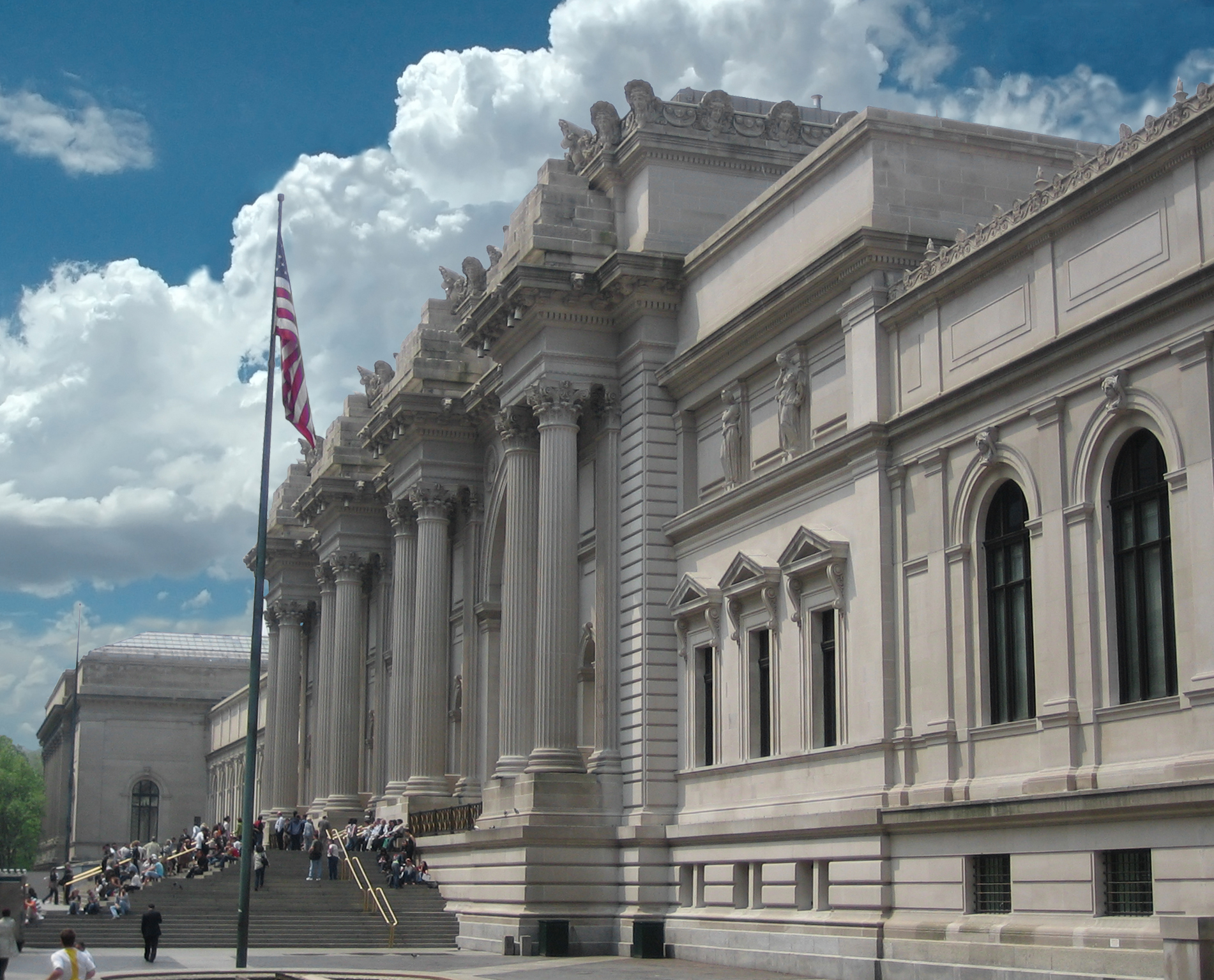
June 24, 1986 Fifth Ave. at Eighty-second St.
40°46′46″N 73°57′7″W / 40.77944°N 73.95194°WNew York Richard Morris Hunt's best-known building; America's most important art museum. 54 Lewis G. Morris House 
February 12, 1977 100 E. 85th St.
40°46′46″N 73°57′28″W / 40.77944°N 73.95778°WNew York 55 Municipal Asphalt Plant 
May 23, 1980 East End Ave. between 90th and 91st Sts.
40°46′42″N 73°56′39″W / 40.77833°N 73.94417°WNew York 56 New York Cancer Hospital 
April 29, 1977 2 W. 106th St.
40°47′52″N 73°57′39″W / 40.79778°N 73.96083°WNew York Converted to condominiums; also known as Towers Nursing Home 57 New York Public Library, Yorkville Branch 
July 15, 1982 222 E. 79th St.
40°46′25″N 73°57′25″W / 40.77361°N 73.95694°WNew York (need to create a more distinct article name for this specific branch) 58 Park Avenue Historic District 
August 29, 2010 900-1240 and 903-1235 Park Ave.
40°46′53″N 73°57′23″W / 40.78139°N 73.95639°WNew York Many architecturally distinguished apartment houses from late 19th and early 20th centuries 59 Park Avenue Houses 
January 3, 1980 680, 684, 686 and 690 Park Ave. (@ 68th)
40°46′3″N 73°57′59″W / 40.7675°N 73.96639°WNew York 60 Park East Synagogue, Congregation Zichron Ephraim 
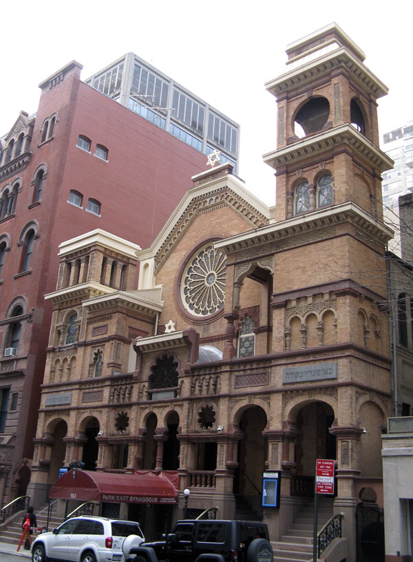
August 18, 1983 163 E. 67th St.
40°46′1″N 73°57′50″W / 40.76694°N 73.96389°WNew York 61 Pomander Walk District 
September 8, 1983 261-267 W. 94th St., 260-274 W. 95th St. and Pomander Walk
40°47′38″N 73°58′25″W / 40.79389°N 73.97361°WNew York 62 Public School 109 
September 22, 2000 215 East 99th St.
40°47′13″N 73°56′51″W / 40.78694°N 73.9475°WNew York 63 Public School 9 
August 3, 1987 466 W. End Ave.
40°47′11″N 73°58′46″W / 40.78639°N 73.97944°WNew York 64 Red House 
September 8, 1983 350 W. 85th St.
40°47′20″N 73°58′51″W / 40.78889°N 73.98083°WNew York 65 Isaac L. Rice Mansion 
June 25, 1980 346 W. 89th St.
40°47′29″N 73°58′45″W / 40.79139°N 73.97917°WNew York 66 Riverside Drive-West 80th-81st Streets Historic District 
May 10, 1984 Riverside Dr., W. 80th and W. 81st Sts.
40°47′28″N 73°58′56″W / 40.79111°N 73.98222°WNew York 67 Riverside Park and Drive 
September 2, 1983 From 72nd St. to 129th St.
40°47′53″N 73°58′31″W / 40.79806°N 73.97528°WNew York First major Robert Moses project in Manhattan; speeded up travel time to Bronx and Westchester and made river accessible via park 68 Riverside-West 105th Street Historic District 
August 19, 1980 Roughly bounded by W. End Ave., Riverside Dr., W. 104th and W. 106th Sts.
40°48′5″N 73°58′14″W / 40.80139°N 73.97056°WNew York 69 John S. Rogers House 
June 30, 1983 53 E. 79th St.
40°46′34″N 73°57′43″W / 40.77611°N 73.96194°WNew York 1917 Renaissance Revival mansion has been home to city's oldest cultural instiution, New York Society Library, since 1937 70 Sara Delano Roosevelt Memorial House 
March 28, 1980 47 and 49 E. 65th St.
40°46′0″N 73°58′5″W / 40.766667°N 73.96806°WNew York 71 Rowhouses at 322-344 East 69th Street 
September 7, 1984 322-344 E. 69th St.
40°45′58″N 73°57′31″W / 40.76611°N 73.95861°WUpper East Side Group of remaining low-rise townhouses from late 19th century 72 St. Cecilia's Church and Convent 
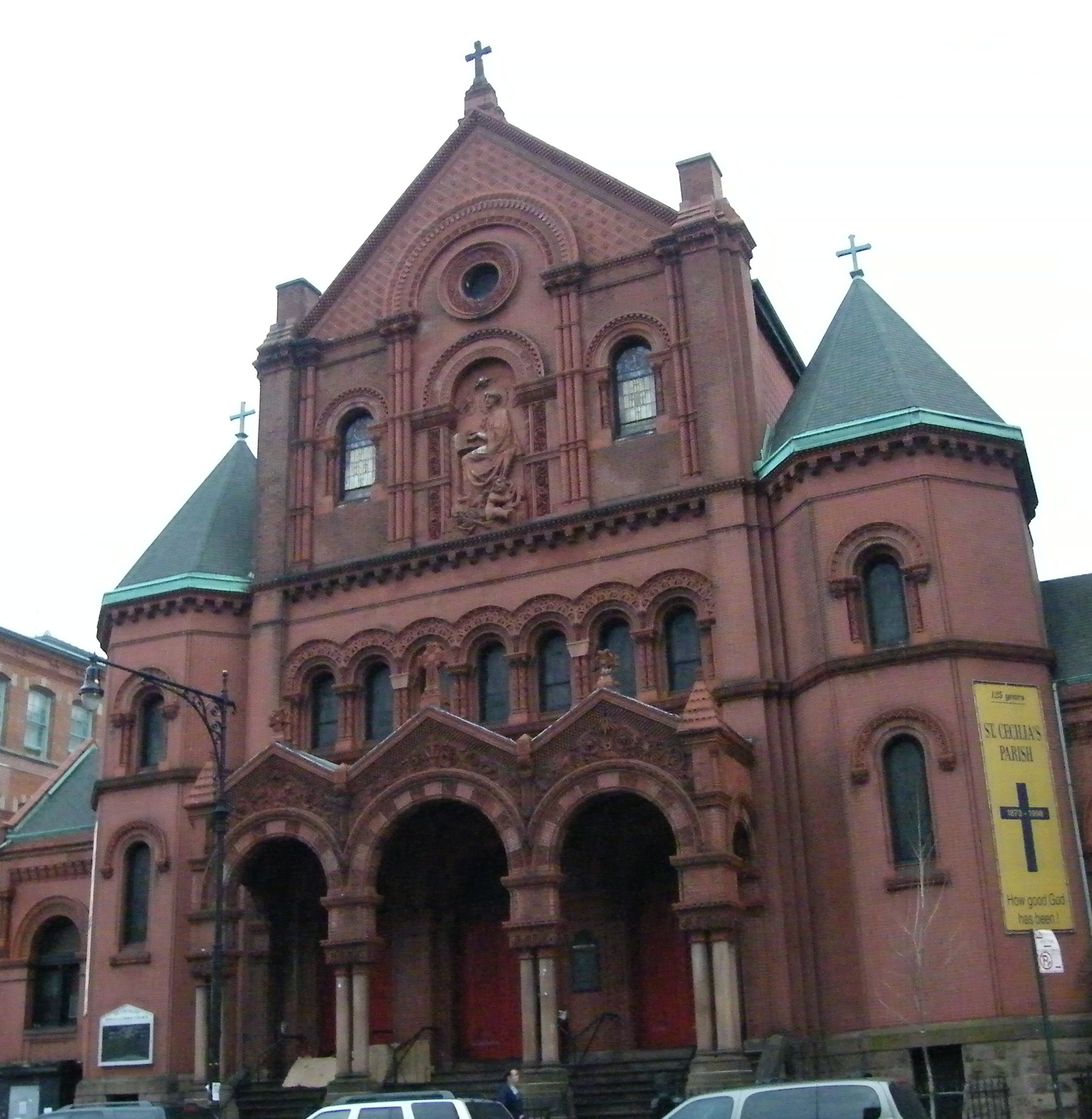
February 2, 1984 112-120 E. 106th St.
40°47′32″N 73°56′52″W / 40.79222°N 73.94778°WNew York 73 St. Ignatius of Antioch Church (New York City) 
November 30, 1999 552 W. End Ave.
40°47′21″N 73°58′40″W / 40.78917°N 73.97778°WNew York 74 St. Jean Baptiste Church and Rectory 
April 23, 1980 1067-1071 Lexington Ave.
40°46′21″N 73°57′38″W / 40.7725°N 73.96056°WNew York 1910 church is one of few Catholic churches in city with dome and only one besides St. Patrick's Cathedral to have stained glass made in Chartres. Architect Nicholas Serracino's only work in New York City won a prize in an international competition. 75 St. Michael's Church 
November 15, 1996 225 W. 99th St.
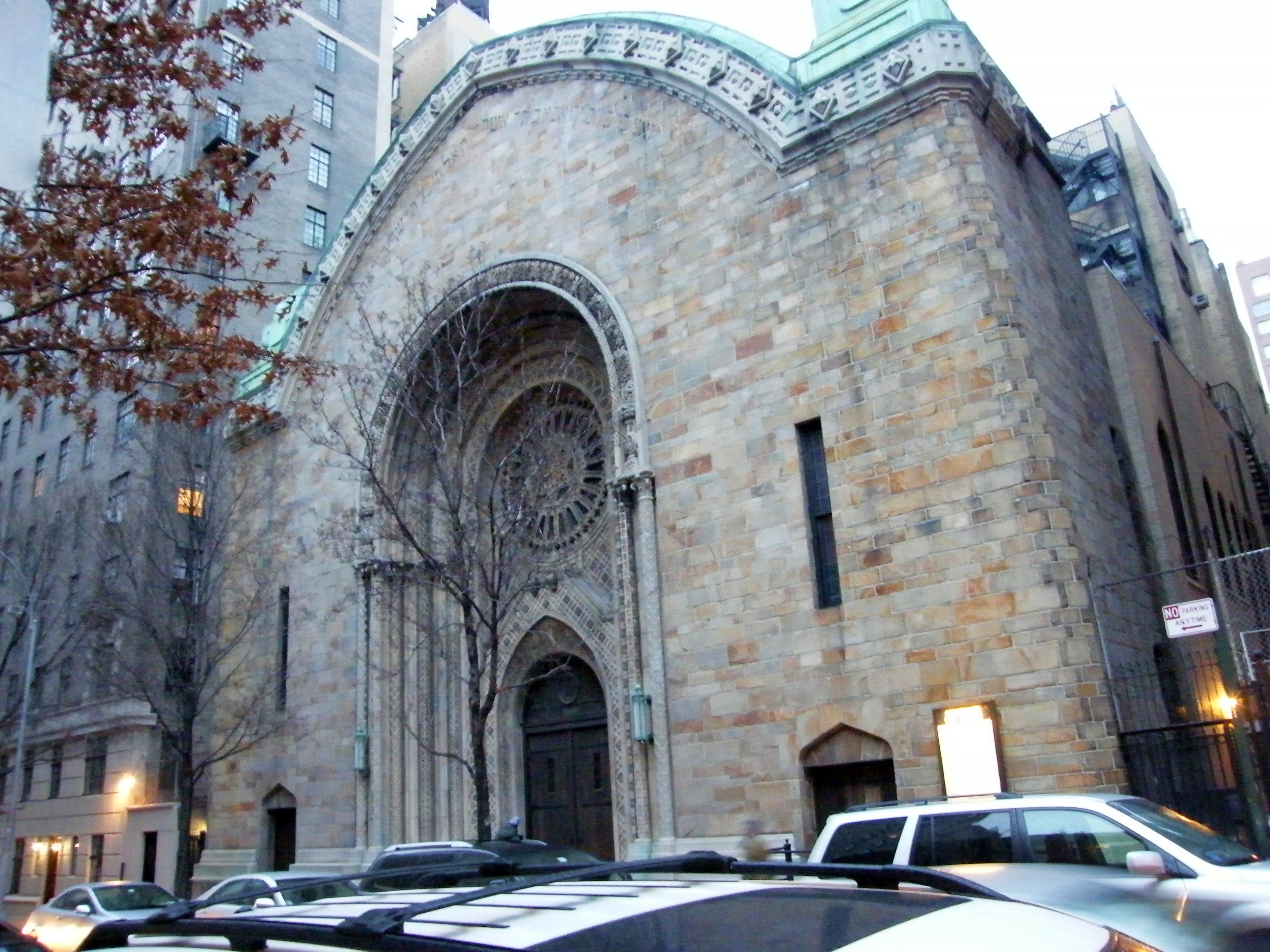
40°47′46″N 73°58′10″W / 40.79611°N 73.96944°WNew York 76 St. Vincent Ferrer Church and Priory 
June 14, 1984 869 and 871 Lexington Ave.
40°45′58″N 73°57′55″W / 40.76611°N 73.96528°WNew York 1916 Bertram Goodhue Gothic church has unusual touches like Crucifixion carving on front entrance and paintings at Stations of the Cross inside. Complemented by 1880 William Schickel priory. 77 William Schickel House 
December 6, 2004 52 E. 83rd St.
40°46′43″N 73°57′37″W / 40.77861°N 73.96028°WNew York 78 Schinasi House 
April 23, 1980 351 Riverside Dr.
40°48′10.76″N 73°58′9.14″W / 40.8029889°N 73.9692056°WNew York 79 Seventh Regiment Armory 
April 14, 1975 643 Park Ave.
40°46′1″N 73°57′58″W / 40.76694°N 73.96611°WNew York 80 Sidewalk Clock at 1501 3rd Avenue, Manhattan 
April 18, 1985 1501 3rd Ave. (@ 85th)
40°46′40.2″N 73°57′16.3″W / 40.777833°N 73.954528°WUpper East Side 81 Sidewalk Clock at 783 5th Avenue, Manhattan 
April 18, 1985 783 5th Ave.
40°45′52″N 73°58′24″W / 40.76444°N 73.97333°WNew York 82 Harry F. Sinclair House 
June 2, 1978 2 E. 79th St.
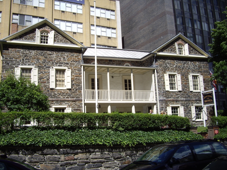
40°46′36″N 73°57′50″W / 40.77667°N 73.96389°WNew York 83 Abigail Adams Smith Museum 
January 12, 1973 421 E. 61st St.
40°45′37″N 73°57′37″W / 40.76028°N 73.96028°WNew York Also known as Mount Vernon Hotel Museum 84 Sofia Warehouse 
September 27, 1984 43 W. 61st St.
40°46′13″N 73°59′1″W / 40.77028°N 73.98361°WUpper West Side Also known as "Kent Automatic Garages" 85 Stables at 167, 169 and 171 West 89th Street 
August 25, 1983 167-171 W. 89th St.
40°47′21″N 73°58′23″W / 40.78917°N 73.97306°WUpper West Side 86 Studio Apartments 
May 19, 1983 44 W. 77th St.
40°46′48″N 73°58′34″W / 40.78°N 73.97611°WUpper West Side 87 Substation 7 
February 9, 2006 1782 Third Avenue (@ 99th)
40°47′13″N 73°56′55″W / 40.78694°N 73.94861°WNew York 88 Townhouses at 352 and 353 Riverside Dr. 
September 1, 2005 352 and 353 Riverside Dr.
40°48′11″N 73°58′10″W / 40.80306°N 73.96944°WNew York 89 Treadwell Farm Historic District 
May 27, 2004 E. 61st and 62nd Sts. bet. Second and Third Aves.
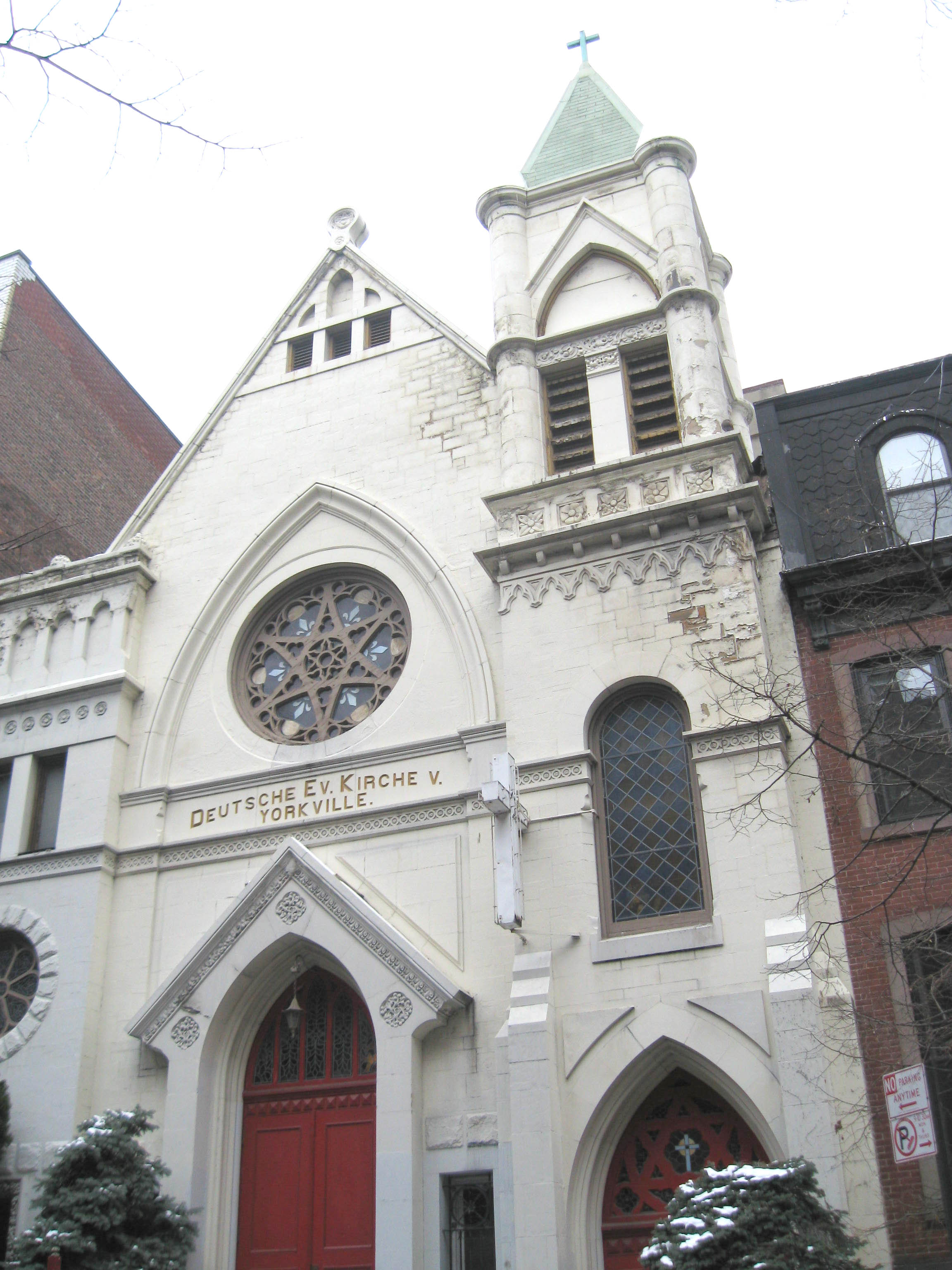
40°45′45″N 73°57′53″W / 40.7625°N 73.96472°WNew York 90 Trinity Lutheran Church of Manhattan 
September 16, 2009 164 W. 100th St.
40°47′46.34″N 73°58′5.12″W / 40.7962056°N 73.9680889°WNew York New listing; refnum 09000722 91 Upper East Side Historic District 
September 7, 1984 Roughly bounded by 3rd and 5th Aves., 59th and 79th Sts.
40°46′11″N 73°57′59″W / 40.76972°N 73.96639°WNew York 92 US Post Office-Lenox Hill Station 
May 11, 1989 221 E. 70th St.
40°46′5″N 73°57′38″W / 40.76806°N 73.96056°WNew York 93 Mrs. Graham Fair Vanderbilt House 
October 29, 1982 60 E. 93rd St.
40°47′5″N 73°57′19″W / 40.78472°N 73.95528°WNew York Also known as Lycee Francais de New York 94 Giuseppe Verdi Monument 
October 4, 1990 Verdi Square Park (72nd at Broadway)
40°46′45″N 73°58′55″W / 40.77917°N 73.98194°WUpper West Side 95 Gertrude Rhinelander Waldo Mansion 
May 6, 1980 867 Madison Ave.
40°46′17″N 73°57′57″W / 40.77139°N 73.96583°WNew York (also known as Rhinelander Mansion) 96 Felix M. Warburg House 
October 29, 1982 1109 5th Ave., at 92nd
40°47′7″N 73°57′27″W / 40.78528°N 73.9575°WUpper East Side 97 West 67th Street Artists' Colony Historic District 
July 11, 1985 1-39 and 40-50 W. 67th St.
40°45′58″N 73°58′13″W / 40.76611°N 73.97028°WUpper West Side 98 West 73rd-74th Street Historic District 
September 8, 1983 73rd, 74th Sts. and Columbus Ave.
40°46′40″N 73°58′38″W / 40.77778°N 73.97722°WNew York 99 West 76th Street Historic District 
July 24, 1980 W. 76th St.
40°46′45″N 73°58′34″W / 40.77917°N 73.97611°WUpper West Side 100 West End Collegiate Church and Collegiate School 
May 6, 1980 W. End Ave. and W. 77th St.
40°46′58″N 73°58′55″W / 40.78278°N 73.98194°WNew York 101 Zion-St. Mark's Evangelical Lutheran Church 
March 23, 1995 339-341 E. 84th St.
40°46′34″N 73°57′5″W / 40.77611°N 73.95139°WNew York See also
- List of New York City Designated Landmarks in Manhattan from 59th to 110th Streets
- County: National Register of Historic Places listings in New York County, New York
- State: National Register of Historic Places listings in New York
References
- ^ The latitude and longitude information provided in this table was derived originally from the National Register Information System, which has been found to be fairly accurate for about 99% of listings. For about 1% of NRIS original coordinates, experience has shown that one or both coordinates are typos or otherwise extremely far off; some corrections may have been made. A more subtle problem causes many locations to be off by up to 150 yards, depending on location in the country: most NRIS coordinates were derived from tracing out latitude and longitudes off of USGS topographical quadrant maps created under North American Datum of 1927, which differs from the current, highly accurate GPS system used by Google maps. Chicago is about right, but NRIS longitudes in Washington are higher by about 4.5 seconds, and are lower by about 2.0 seconds in Maine. Latitudes differ by about 1.0 second in Florida. Some locations in this table may have been corrected to current GPS standards.
- ^ "National Register of Historic Places: Weekly List Actions". National Park Service, United States Department of the Interior. Retrieved on November 18, 2011.
Categories:- National Register of Historic Places in Manhattan
-


Wikimedia Foundation. 2010.