- National Register of Historic Places listings in Saratoga County, New York
-
 Location of Saratoga County in New York
List of the National Register of Historic Places listings in Saratoga County, New York
This is intended to be a complete list of properties and districts listed on the National Register of Historic Places in Saratoga County, New York. The locations of National Register properties and districts (at least for all showing latitude and longitude coordinates below) may be seen in a Google map by clicking on "Map of all coordinates".[1] Three of the properties and districts are further designated U.S. National Historic Landmarks.
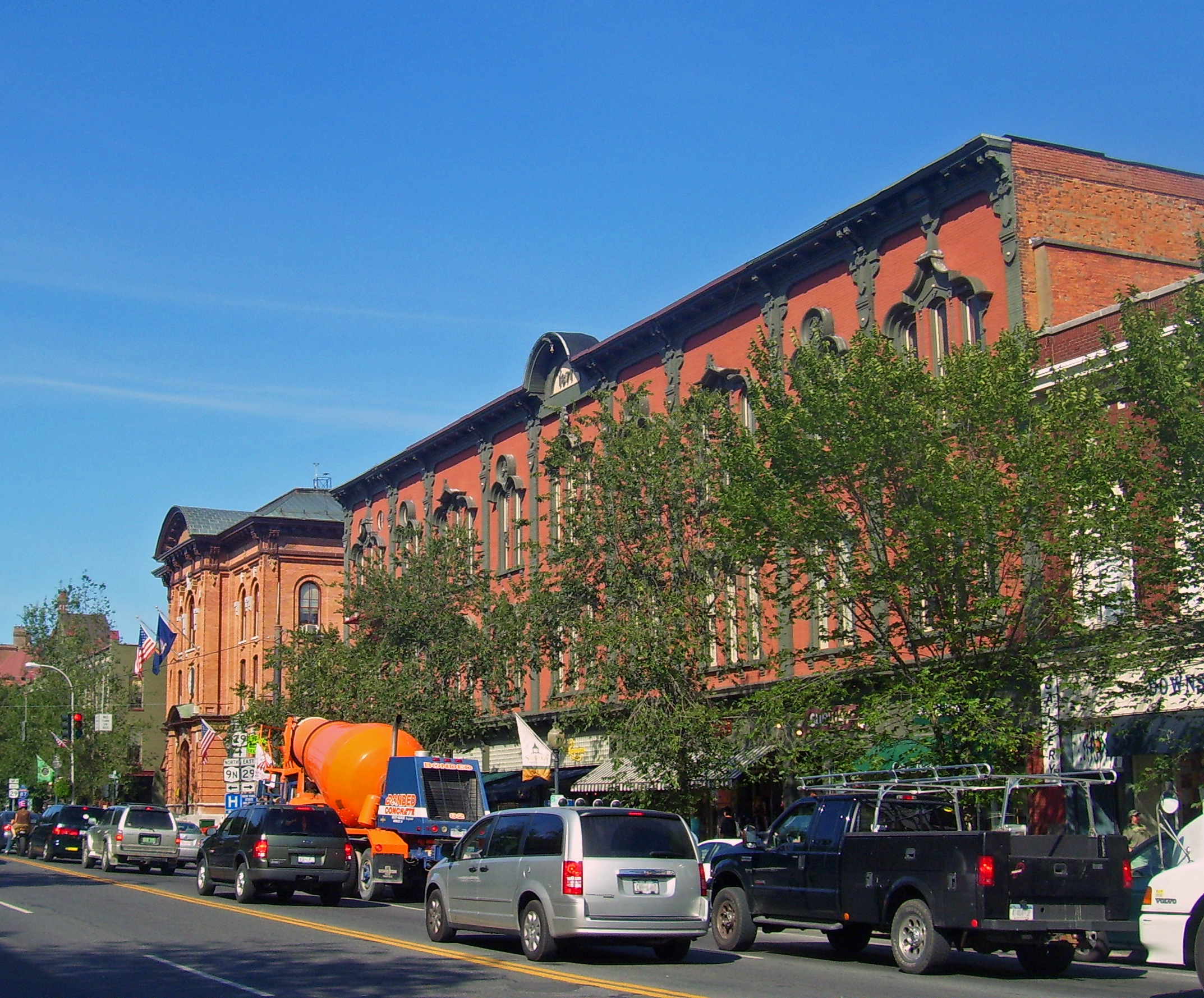
-
- This National Park Service list is complete through NPS recent listings posted November 18, 2011.[2]
Contents: Counties in New York Albany (Albany) – Allegany – Bronx – Broome – Cattaraugus – Cayuga – Chautauqua – Chemung – Chenango – Clinton – Columbia – Cortland – Delaware – Dutchess – Erie (Buffalo) – Essex – Franklin – Fulton – Genesee – Greene – Hamilton – Herkimer – Jefferson – Kings (Brooklyn) – Lewis – Livingston – Madison – Monroe (Rochester) – Montgomery – Nassau – New York (Manhattan – Below 14th Street, 14th to 59th Streets, 59th to 110th Streets, Above 110th Street, Islands) – Niagara – Oneida – Onondaga (Syracuse) – Ontario – Orange – Orleans – Oswego – Otsego – Putnam – Queens – Rensselaer – Richmond (Staten Island) – Rockland – Saratoga – Schenectady – Schoharie – Schuyler – Seneca – St. Lawrence – Steuben – Suffolk – Sullivan – Tioga – Tompkins – Ulster – Warren – Washington – Wayne – Westchester (New Rochelle, Peekskill, Yonkers) – Wyoming – Yates Listings county-wide
Landmark name Image Date listed Location City or Town Summary 1 Arrowhead Casino Prehistoric Site 
May 1, 2000 Address Restricted Saratoga Springs 2 Barker General Store April 1, 2002 1 Military Rd.
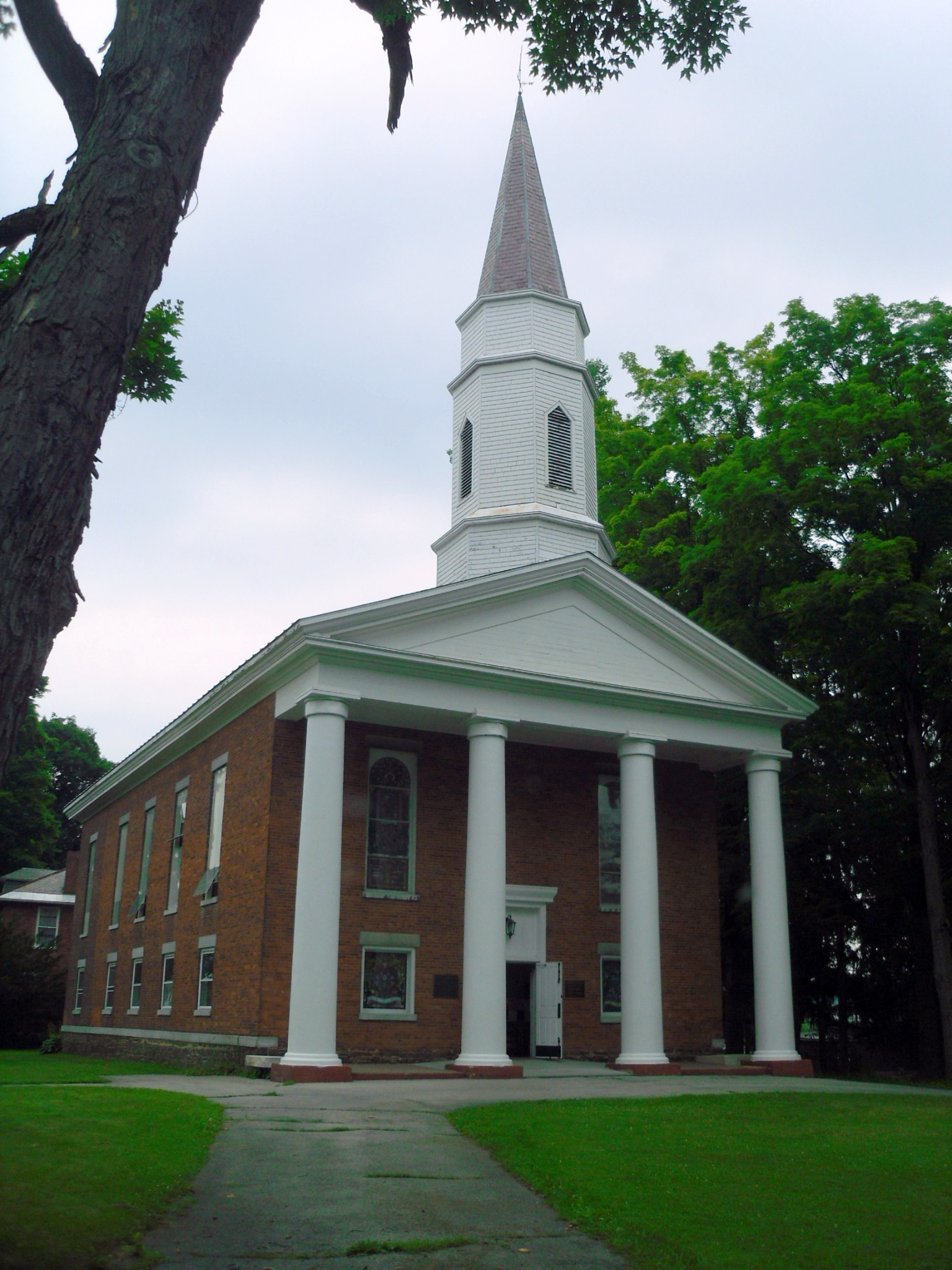
43°13′18″N 74°6′16″W / 43.22167°N 74.10444°WBeecher Hollow 3 Batchellerville Presbyterian Church June 16, 2000 Co. Rt. 7
43°12′33″N 74°3′21″W / 43.20917°N 74.05583°WBatchellerville 4 Col. Sidney Berry House December 12, 2003 725 W. River Rd.
43°12′46″N 73°35′8″W / 43.21278°N 73.58556°WNorthumberland 5 Abraham Best House July 14, 2011 113 Vischer Ferry Rd.
42°48′44″N 73°49′34″W / 42.81222°N 73.82611°WVischer Ferry vicinity New listing; refnum 11000452 6 Broadway Historic District 
September 12, 1979 Originally on Broadway, Washington and Rock Sts., later increased
43°5′12″N 73°47′1″W / 43.08667°N 73.78361°WSaratoga Springs Commercial and residential core of city, with many buildings intact from 19th century 7 Brookside 
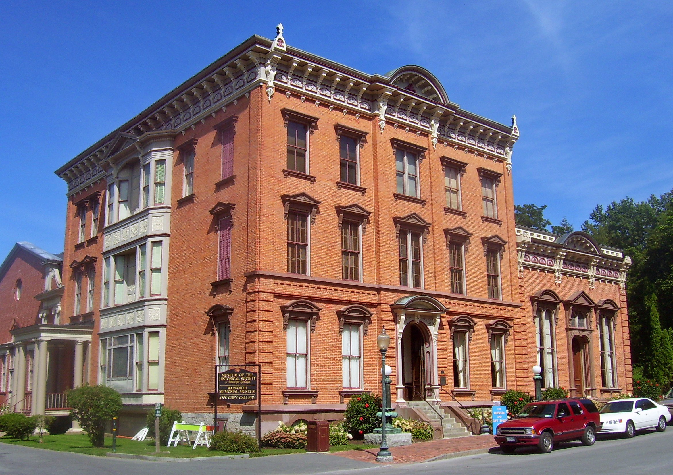
May 21, 1975 Charlton St.
43°0′7″N 73°51′22″W / 43.00194°N 73.85611°WBallston Spa 1793 house, modified later, was first built at springs for travelers. James Fenimore Cooper wrote part of Last of the Mohicans there. Now home to county historical society. 8 Bullard Block 
September 16, 2009 90-98 Broad St.
43°5′56.25″N 73°34′54.03″W / 43.0989583°N 73.581675°WSchuylerville New listing; refnum 09000723 9 Canfield Casino and Congress Park 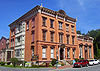
February 27, 1987 Roughly bounded by Spring and Circular Sts., Park Pl., and Broadway
43°4′41″N 73°47′5″W / 43.07806°N 73.78472°WSaratoga Springs Site of early bottling plant and hotel now used as public park and history museum 10 Casino-Congress Park-Circular Street Historic District June 19, 1972 Bounded by Broadway, Spring, and Circular Sts.
43°4′38″N 73°47′2″W / 43.07722°N 73.78389°WSaratoga Springs Original listing for above 11 Catawissa (tugboat) August 8, 1996 Lock 3, New York State Barge Canal, Erie Division
42°47′57″N 73°41′22″W / 42.79917°N 73.68944°WWaterford 12 Champlain Canal 
September 1, 1976 Extends north from Troy to Whitehall
43°10′0″N 73°33′24″W / 43.166667°N 73.55667°WTroy 13 Charlton Historic District January 1, 1976 Main St. (SR 51)
42°56′2″N 73°57′55″W / 42.93389°N 73.96528°WCharlton 14 Clifton Park Center Baptist Church and Cemetery September 24, 2004 713 Clifton Park Center Rd.
42°51′31″N 73°49′55″W / 42.85861°N 73.83194°WClifton Park Center 15 Clifton Park Hotel June 18, 1998 Old NY 146 and US 9
42°51′57″N 73°46′15″W / 42.86583°N 73.77083°WClifton Park and Halfmoon 16 Copeland Covered Bridge August 6, 1998 North Shore Rd., over Beecher Cr.
43°13′15″N 74°6′2″W / 43.22083°N 74.10056°WEdinburg 17 Crescent Methodist Episcopal Church February 10, 2000 Crescent
42°49′29″N 73°43′53″W / 42.82472°N 73.73139°WCrescent 18 The Drinkhall 
November 20, 1974 297 Broadway
43°5′6″N 73°47′45″W / 43.085°N 73.79583°WSaratoga Springs 19 Dutch Reformed Church of Gansevoort January 20, 1995 10 Catherine St.
43°11′56″N 73°39′6″W / 43.19889°N 73.65167°WGansevoort 20 East Side Historic District 
October 29, 1982 Roughly bounded by George, Henry, East, and North Sts.
43°4′49″N 73°46′41″W / 43.08028°N 73.77806°WSaratoga Springs Intact residential area of well-to-do 19th century residents east of downtown. 21 Col. Elmer E. Ellsworth Monument and Grave November 13, 1976 Hudson View Cemetery
42°53′53″N 73°41′32″W / 42.89806°N 73.69222°WMechanicville 22 Franklin Square Historic District 
October 9, 1973 In an irregular pattern from Beekman St. along both sides of Grand Ave., Franklin, and Clinton Sts. to Van Dam
43°4′58″N 73°47′25″W / 43.08278°N 73.79028°WSaratoga Springs Upscale area of Greek Revival housing later incorporated into West Side Historic District 23 Gansevoort Mansion 
June 23, 1976 Off NY 32
43°11′48″N 73°39′13″W / 43.19667°N 73.65361°WGansevoort 24 Gideon Putnam Burying Ground 
December 12, 2003 Franklin St.
43°4′42″N 73°47′30″W / 43.07833°N 73.79167°WSaratoga Springs Early graveyard contains grave of city founder and his family. Only trace of him on the city's West Side. 25 Grant Cottage 
February 18, 1971 CR 101 north of Rte. 9
43°12′3″N 73°44′45″W / 43.20083°N 73.74583°WMount McGregor 26 Grooms Tavern Complex February 10, 2000 Sugar Hill Rd. at Grooms Rd.
42°50′5″N 73°50′41″W / 42.83472°N 73.84472°WGrooms Corners 27 Hadley Mountain Fire Observation Station September 23, 2001 Hadley Mountain
43°22′26″N 73°57′3″W / 43.37389°N 73.95083°WHadley 28 Hadley Parabolic Bridge 
March 25, 1977 CR 1
43°18′50″N 73°50′44″W / 43.31389°N 73.84556°WHadley Built in 1895. Only iron semi-deck lenticular truss bridge extant in state. 29 Jonesville Store January 14, 2011 989 Main St.
42°54′37″N 73°49′24″W / 42.91028°N 73.82333°WJonesville vicinity 30 Marshall House August 22, 2002 136 NY 32N
43°6′40″N 73°34′50″W / 43.11111°N 73.58056°WSchuylerville 31 Mead House May 12, 2004 2210 Galway Rd.
43°0′57″N 74°1′20″W / 43.01583°N 74.02222°WGalway 32 Mechanicville Hydroelectric Plant November 13, 1989 At NY 32 on Hudson River
42°52′41″N 73°40′47″W / 42.87806°N 73.67972°WMechanicville 33 Northside Historic District December 4, 1975 Both sides of Saratoga Ave. (NY 32) from Maple Ave. to Roosevelt Bridge
42°47′6″N 73°41′34″W / 42.785°N 73.69278°WWaterford 34 Noxon Bank Building December 4, 2003 9 Terminal Rd.
42°49′25″N 73°43′58″W / 42.82361°N 73.73278°WCrescent 35 Oakcliff June 1, 1998 78 Church Hill Rd.
42°49′28″N 73°43′49″W / 42.82444°N 73.73028°WCrescent 36 Ormsby-Laughlin Textile Companies Mill 
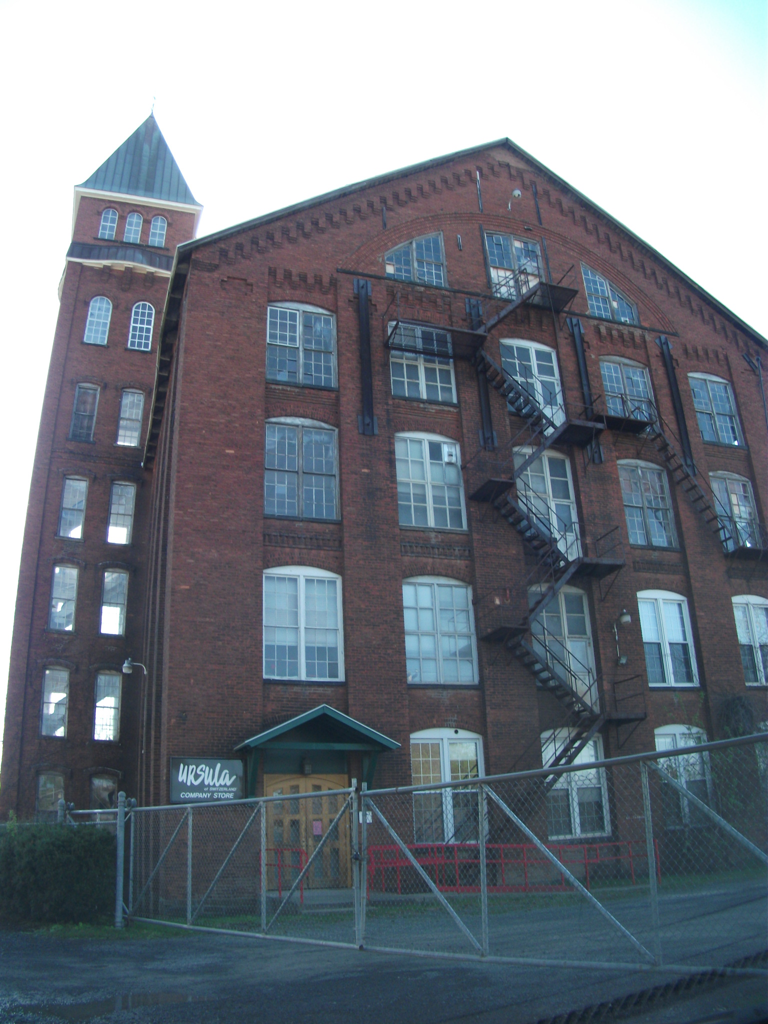
March 20, 1986 31 Mohawk Ave.
42°47′18″N 73°41′0″W / 42.78833°N 73.683333°WWaterford 37 Parks-Bentley House April 21, 1994 53 Ferry Blvd.
43°18′0″N 73°37′27″W / 43.3°N 73.62417°WSouth Glens Falls 38 Peebles (Peobles) Island 
October 2, 1973 At jct. of Mohawk and Hudson rivers
42°46′53″N 73°41′12″W / 42.78139°N 73.68667°WWaterford 39 Petrified Sea Gardens 
January 20, 1999 42 Petrified Gardens Road
43°4′59″N 73°50′40″W / 43.08306°N 73.84444°WSaratoga Springs Site of discovery of stromatolites; New York State Paleontologist Winifred Goldring, a pioneering 19th-century woman in science, researched them extensively here. 40 Pure Oil Gas Station October 18, 1978 65 Spring St.
43°4′45″N 73°46′57″W / 43.07917°N 73.7825°WSaratoga Springs Moved from Broadway to this address and apparently no longer extant 41 David Rayfiel House November 10, 2009 1266 Kathan Rd.
43°18′0.52″N 73°56′31.27″W / 43.3001444°N 73.9420194°WDay New listing; refnum 09000909 42 Cyrus Rexford House January 14, 2011 1643 Route 146
42°51′20″N 73°53′21″W / 42.85556°N 73.88917°WRexford vicinity 43 Round Lake Historic District April 24, 1975 U.S. 9
42°56′14″N 73°47′41″W / 42.93722°N 73.79472°WRound Lake covers Round Lake and ___ 44 Ruhle Road Lenticular Metal Truss Bridge September 4, 2004 Ruhle Rd over Ballston Creek
42°57′30.38″N 73°49′0.19″W / 42.9584389°N 73.8167194°WMalta 45 St. Stephen's Episcopal Church 
April 6, 2005 1 Grove St.
43°5′48″N 73°35′2″W / 43.09667°N 73.58389°WSchuylerville 46 Saratoga Gas, Electric Light and Power Company Complex 

May 1, 2001 Excelsior Ave.
43°5′24″N 73°46′32″W / 43.09°N 73.77556°WSaratoga Springs Two buildings remain from early gas-generating power station started in 1873. Site also has archeological evidence of other buildings. 47 Saratoga National Historical Park 
October 15, 1966 30 mi. N of Albany via U.S. 4 and NY 32
42°59′24″N 73°38′2″W / 42.99°N 73.63389°WSaratoga 48 Old Saratoga Reformed Church 
November 7, 1997 Junction of Burgoyne and Pearl Sts.
43°5′54″N 73°35′5″W / 43.09833°N 73.58472°WSchuylerville 49 Saratoga Spa State Park District 
September 12, 1985 US 9 & NY 50
43°3′20″N 73°48′1″W / 43.05556°N 73.80028°WSaratoga Springs Renowned springs over only geysers in eastern U.S. made Saratoga a famous and popular resort 50 Stillwater United Church 
September 28, 2006 135 Hudson Ave.
42°56′20″N 73°39′15″W / 42.93889°N 73.65417°WStillwater 51 Hiram Charles Todd House 
May 31, 1972 4 Franklin Sq.
43°4′57″N 73°47′23″W / 43.0825°N 73.78972°WSaratoga Springs 1837 Greek Revival home near former site of railroad station 52 Union Avenue Historic District April 4, 1978 Union Ave.
43°4′16″N 73°45′56″W / 43.07111°N 73.76556°WSaratoga Springs 53 Union Mill Complex 
June 17, 1982 NY 50, Milton Ave.
43°0′33″N 73°51′4″W / 43.00917°N 73.85111°WBallston Spa Center of George West's paper-bag–making business. Later a chocolate factory and today a retail complex. 54 Urger (canal tugboat) November 29, 2001 near eastern terminus of the Erie Division of the New York State Barge Canal.
42°47′47″N 73°41′15″W / 42.79639°N 73.6875°WWaterford 55 US Post Office-Ballston Spa 
November 17, 1988 1 Front St.
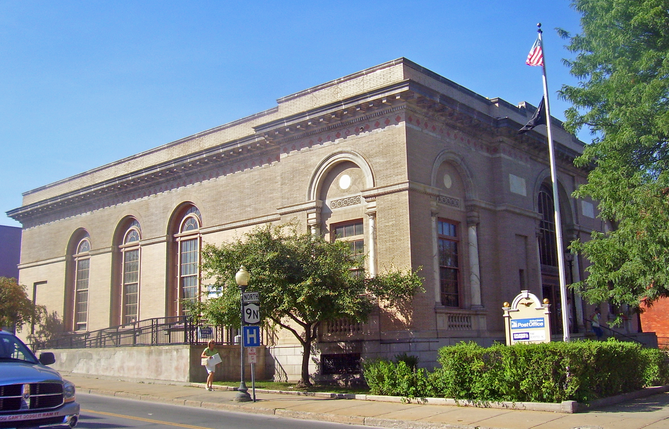
43°0′8″N 73°50′58″W / 43.00222°N 73.84944°WBallston Spa 1936 building in extremely restrained Colonial Revival style is like only one other post office in state 56 US Post Office-Saratoga Springs 
May 11, 1989 475 Broadway
43°5′0″N 73°47′8″W / 43.083333°N 73.78556°WSaratoga Springs Ornate 1910 Classical Revival building once had most elaborate postal lobby in state 57 Verbeck House 
April 7, 1983 20 Church Ave.
43°0′1″N 73°50′59″W / 43.00028°N 73.84972°WBallston Spa Rare late residence by Marcus F. Cummings. Later used as National Bottle Museum. 58 Victory Mills January 19, 2010 42 Gates Ave.
43°5′20.7″N 73°35′30.78″W / 43.089083°N 73.5918833°WVictory New listing; refnum 09001271 59 Vischer Ferry Historic District October 15, 1975 SW of Clifton Park at jcts. of River View, Vischer Ferry, and Crescent Rds.
42°47′41″N 73°49′12″W / 42.79472°N 73.82°WClifton Park 60 Waterford Village Historic District July 14, 1977 Roughly bounded by the Hudson River, Erie Canal, and State St.
42°47′26″N 73°40′46″W / 42.79056°N 73.67944°WWaterford 61 West Charlton United Presbyterian Church February 20, 1998 1331 Sacandaga Rd.
42°58′22″N 74°1′50″W / 42.97278°N 74.03056°WWest Charlton 62 West Side Historic District 
April 4, 1994 Roughly, along Church, Van Dam, State and Washington Sts., Woodlawn and Grand Aves. and Franklin Sq.
43°5′13″N 73°47′8″W / 43.08694°N 73.78556°WSaratoga Springs Large intact residential area of working-class housing from 19th century 63 George West House April 20, 2005 801 NY 29
43°3′59″N 73°55′38″W / 43.06639°N 73.92722°WRock City Falls 64 Wiggins-Collamer House October 31, 2007 450 E. High St.
42°59′47″N 73°47′28″W / 42.99639°N 73.79111°WMalta See also
References
- ^ The latitude and longitude information provided in this table was derived originally from the National Register Information System, which has been found to be fairly accurate for about 99% of listings. For about 1% of NRIS original coordinates, experience has shown that one or both coordinates are typos or otherwise extremely far off; some corrections may have been made. A more subtle problem causes many locations to be off by up to 150 yards, depending on location in the country: most NRIS coordinates were derived from tracing out latitude and longitudes off of USGS topographical quadrant maps created under North American Datum of 1927, which differs from the current, highly accurate GPS system used by Google maps. Chicago is about right, but NRIS longitudes in Washington are higher by about 4.5 seconds, and are lower by about 2.0 seconds in Maine. Latitudes differ by about 1.0 second in Florida. Some locations in this table may have been corrected to current GPS standards.
- ^ "National Register of Historic Places: Weekly List Actions". National Park Service, United States Department of the Interior. Retrieved on November 18, 2011.
Categories:- National Register of Historic Places in New York by county
- Buildings and structures in Saratoga County, New York
-


Wikimedia Foundation. 2010.