- National Register of Historic Places listings in Rochester, New York
-
 Detailed map of Rochester
This is a list of the National Register of Historic Places listings in Rochester, New York.
This is intended to be a complete list of properties and districts listed on the National Register of Historic Places in Rochester, New York, United States. The locations of National Register properties and districts (at least for all showing latitude and longitude coordinates below) may be seen in a Google map by clicking on "Map of all coordinates".[1]
There are 166 properties and districts listed on the National Register in Monroe County, including 2 National Historic Landmarks. The city of Rochester includes 89 of these properties and districts, including both National Historic Landmarks; they are listed here, while the remaining 77 properties and districts are listed separately.
-
- This National Park Service list is complete through NPS recent listings posted November 18, 2011.[2]
Current listings
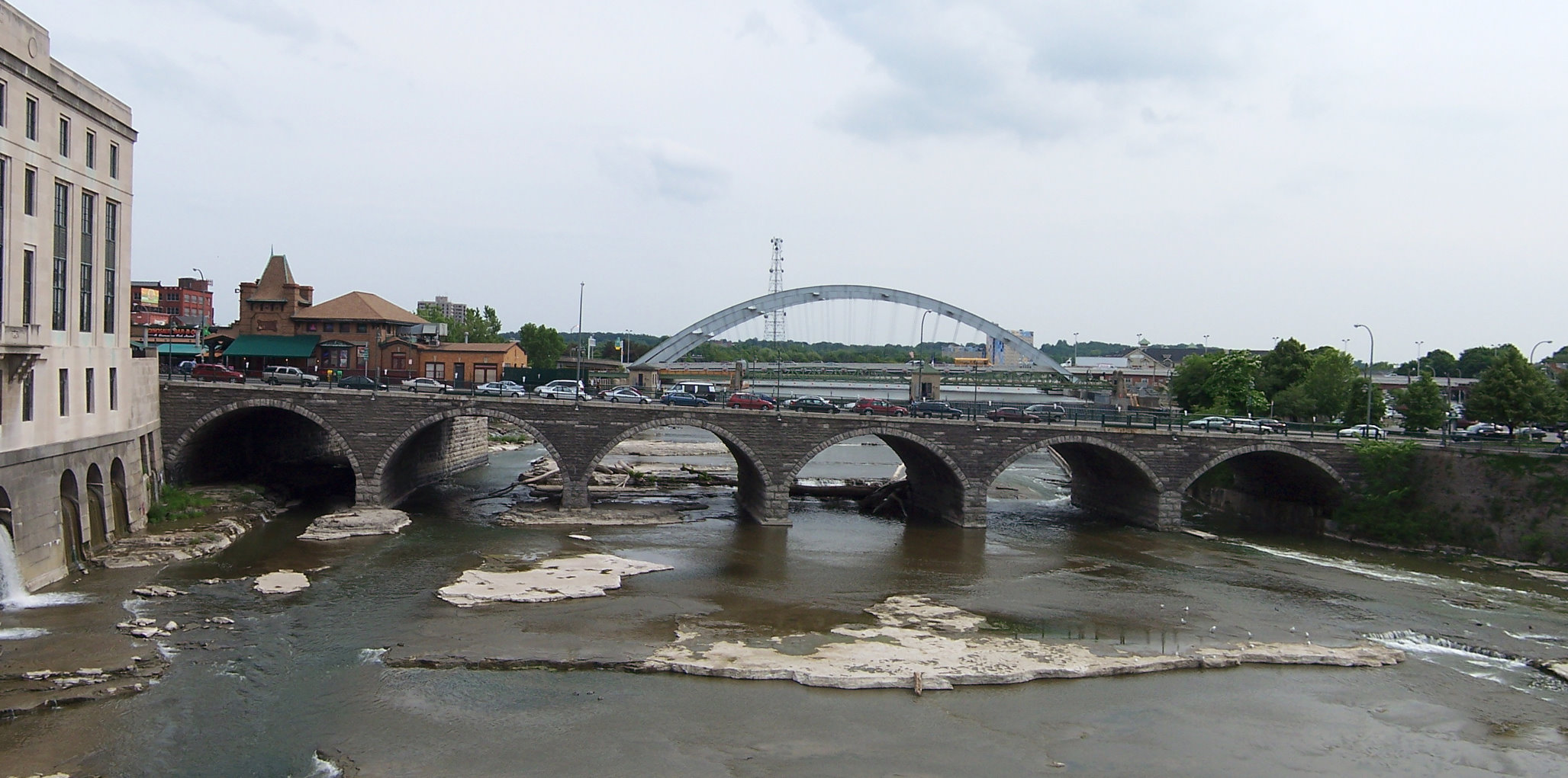
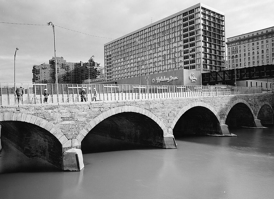
Landmark name Image Date listed Location City or Town Summary 1 Andrews Street Bridge 
October 11, 1984 Andrews St. at Genesee River
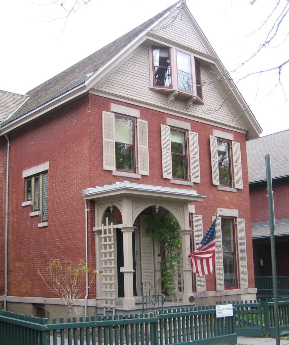
43°9′32″N 77°36′45″W / 43.15889°N 77.6125°WRochester 2 Susan B. Anthony House 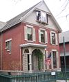
October 15, 1966 17 Madison St.
43°9′12″N 77°37′41″W / 43.15333°N 77.62806°WRochester This NHL is where Susan B. Anthony was arrested after attempting to vote in the 1872 Presidential Election 3 Aquinas Institute June 8, 1989 1127 Dewey Ave.
43°11′15″N 77°38′26″W / 43.1875°N 77.64056°WRochester 4 Bevier Memorial Building 
October 25, 1973 Washington St.
43°9′12″N 77°36′59″W / 43.15333°N 77.61639°WRochester 5 Brick Presbyterian Church Complex March 12, 1992 121 N. Fitzhugh St.
43°9′27″N 77°37′1″W / 43.1575°N 77.61694°WRochester 6 Bridge Square Historic District October 11, 1984 Roughly bounded by Inner Loop, Centre Park, Washington and W. Main Sts.
43°9′17″N 77°37′8″W / 43.15472°N 77.61889°WRochester Inner Loop MRA 7 Brown's Race Historic District March 2, 1989 Brown's Race St. from Platt St. to Conrail railroad tracks
43°9′38″N 77°36′59″W / 43.16056°N 77.61639°WRochester 8 Adam Brown Block October 4, 1985 480 E. Main St.
43°9′31″N 77°35′59″W / 43.15861°N 77.59972°WRochester 9 Browncroft Historic District April 20, 2004 Roughly bounded by Browncroft Blvd., Newcastle, Blossom, and Winton Rds.
43°9′16″N 77°32′44″W / 43.15444°N 77.54556°WRochester 10 Building at 551-555 North Goodman Street 
March 20, 1986 551-555 N. Goodman St.
43°9′50″N 77°35′0″W / 43.16389°N 77.583333°WRochester 11 Campbell-Whittlesey House 
February 18, 1971 123 S. Fitzhugh St.
43°9′4″N 77°36′45″W / 43.15111°N 77.6125°WRochester 12 Chamber of Commerce October 4, 1985 55 Saint Paul St.
43°9′28″N 77°36′36″W / 43.15778°N 77.61°WRochester 13 Jonathan Child House & Brewster-Burke House Historic District 
February 18, 1971 37 S. Washington St. and 130 Spring St.
43°9′10″N 77°37′1″W / 43.15278°N 77.61694°WRochester 14 Christ Church February 12, 2008 141 East Ave.
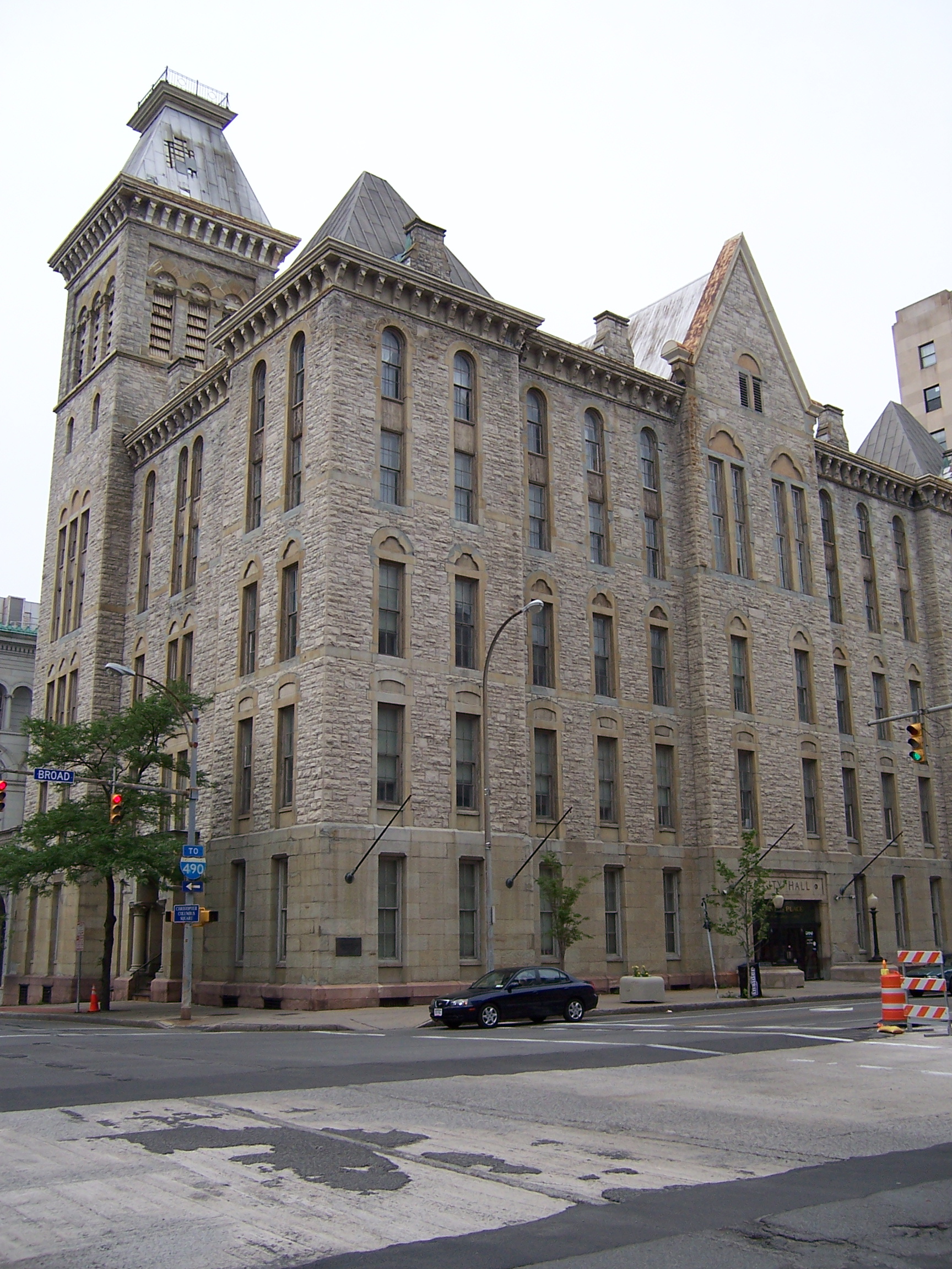
43°9′12″N 77°35′26″W / 43.15333°N 77.59056°WRochester 15 City Hall Historic District 
September 17, 1974 S. Fitzhugh St. between Broad and W. Main Sts.
43°9′16″N 77°36′50″W / 43.15444°N 77.61389°WRochester 16 Fernwood Park Historic District June 21, 2010 Bounded by Fernwood Ave., Woodman Park, Culver Rd., and Waring Rd.
43°10′48″N 77°33′45″W / 43.18°N 77.5625°WRochester New listing; refnum 10000360 17 H. C. Cohen Company Building-Andrews Building October 4, 1985 216 Andrews St.
43°9′35″N 77°36′34″W / 43.15972°N 77.60944°WRochester 18 Court Exchange Building-National Casket Company 
October 4, 1985 142 Exchange St.
43°9′9″N 77°36′40″W / 43.1525°N 77.61111°WRochester 19 Court Street Bridge 
October 11, 1984 Court St. at Genesee River
43°9′12″N 77°36′34″W / 43.15333°N 77.60944°WRochester 20 Cox Building October 11, 1984 36-48 St. Paul St.
43°9′27″N 77°36′34″W / 43.1575°N 77.60944°WRochester 21 Chester Dewey School No. 14 October 4, 1985 200 University Ave.
43°9′35″N 77°35′51″W / 43.15972°N 77.5975°WRochester 22 East Avenue Historic District April 17, 1979 Irregular pattern along East Ave. from Probert St. to Alexander St.
43°9′9″N 77°34′51″W / 43.1525°N 77.58083°WRochester 23 East High School June 30, 1983 410 Alexander St.
43°9′35″N 77°35′31″W / 43.15972°N 77.59194°WRochester 24 East Side Presbyterian Church November 10, 2010 345 Parsells St.
43°9′56″N 77°34′10″W / 43.16556°N 77.56944°WRochester New listing: refnum 10000898 25 Eastman Dental Dispensary 
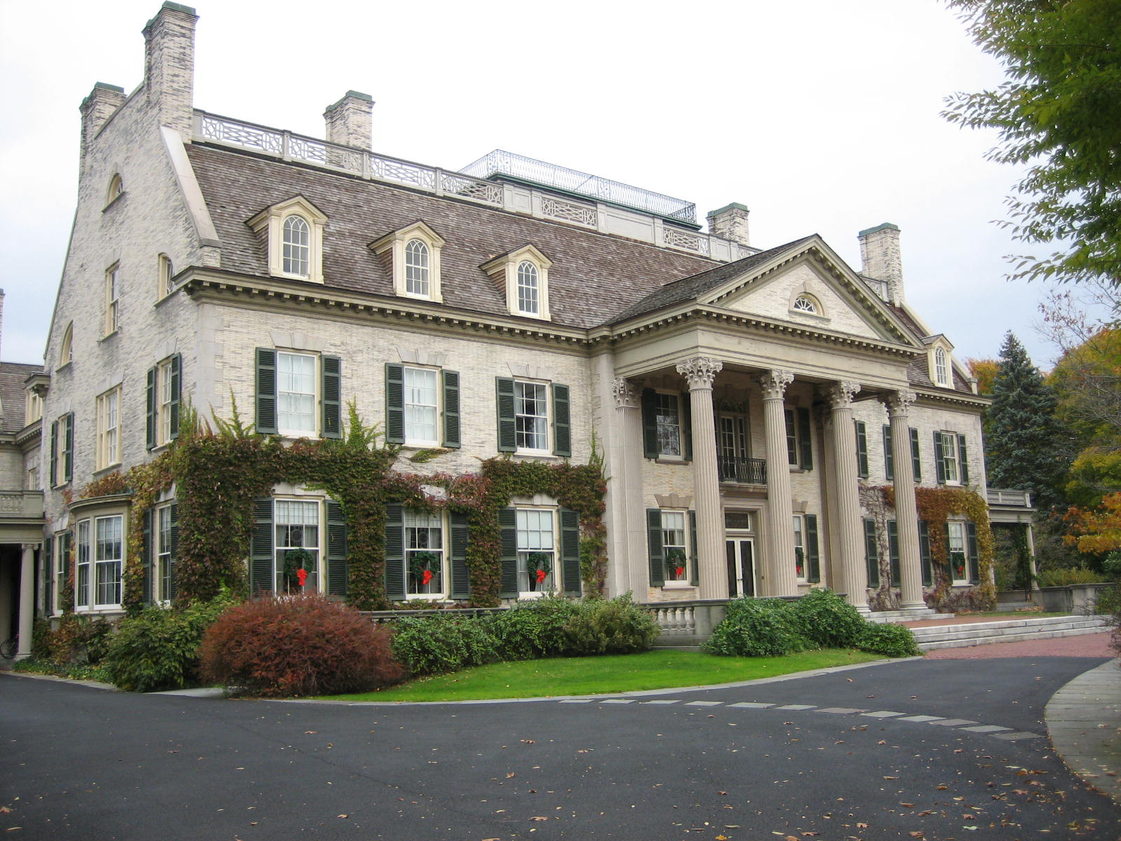
April 28, 1983 800 E. Main St.
43°9′38″N 77°35′30″W / 43.16056°N 77.59167°WRochester 26 George Eastman House 
November 13, 1966 900 East Ave.
43°9′12″N 77°34′54″W / 43.15333°N 77.58167°WRochester 27 Edwards Building October 11, 1984 26-34 St. Paul St.
43°9′26″N 77°36′33″W / 43.15722°N 77.60917°WRochester 28 Hervey Ely House 
August 12, 1971 138 Troup St.
43°9′5″N 77°37′6″W / 43.15139°N 77.61833°WRochester 29 Emmanuel Presbyterian Church March 29, 2001 Jefferson Ave. at 9 Shelter St.
43°8′19″N 77°37′47″W / 43.13861°N 77.62972°WRochester 30 English Evangelical Church of the Reformation and Parish House March 12, 1992 111 N. Chestnut St.
43°9′32″N 77°36′12″W / 43.15889°N 77.60333°WRochester 31 Erie Canal: Second Genesee Aqueduct 
September 29, 1976 Broad St.
43°9′17″N 77°36′35″W / 43.15472°N 77.60972°WRochester 32 Federal Building April 13, 1972 N. Fitzhugh and Church Sts.
43°9′25″N 77°36′54″W / 43.15694°N 77.615°WRochester 33 First National Bank of Rochester-Old Monroe County Savings Bank Building October 4, 1985 35 State St.
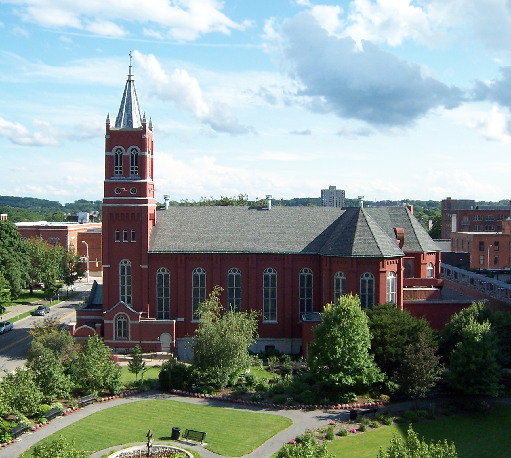
43°9′22″N 77°36′49″W / 43.15611°N 77.61361°WRochester 34 First Presbyterian Church (Rochester) 
October 25, 1973 101 S. Plymouth Ave.
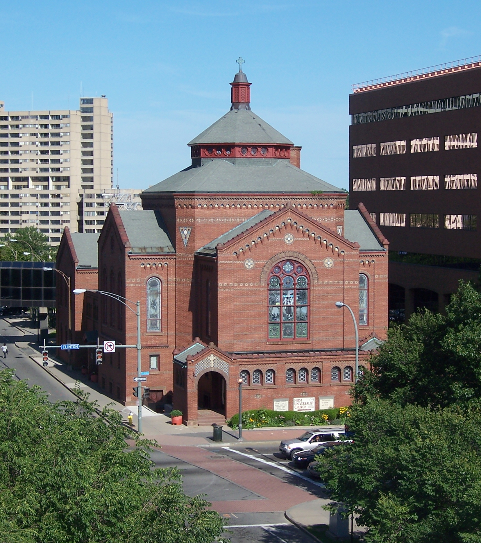
43°9′10″N 77°36′56″W / 43.15278°N 77.61556°WRochester 35 First Universalist Church 
May 27, 1971 SE corner of S. Clinton Ave. and Court St.
43°9′14″N 77°36′17″W / 43.15389°N 77.60472°WRochester 36 Gannett Building 
October 4, 1985 55 Exchange St.
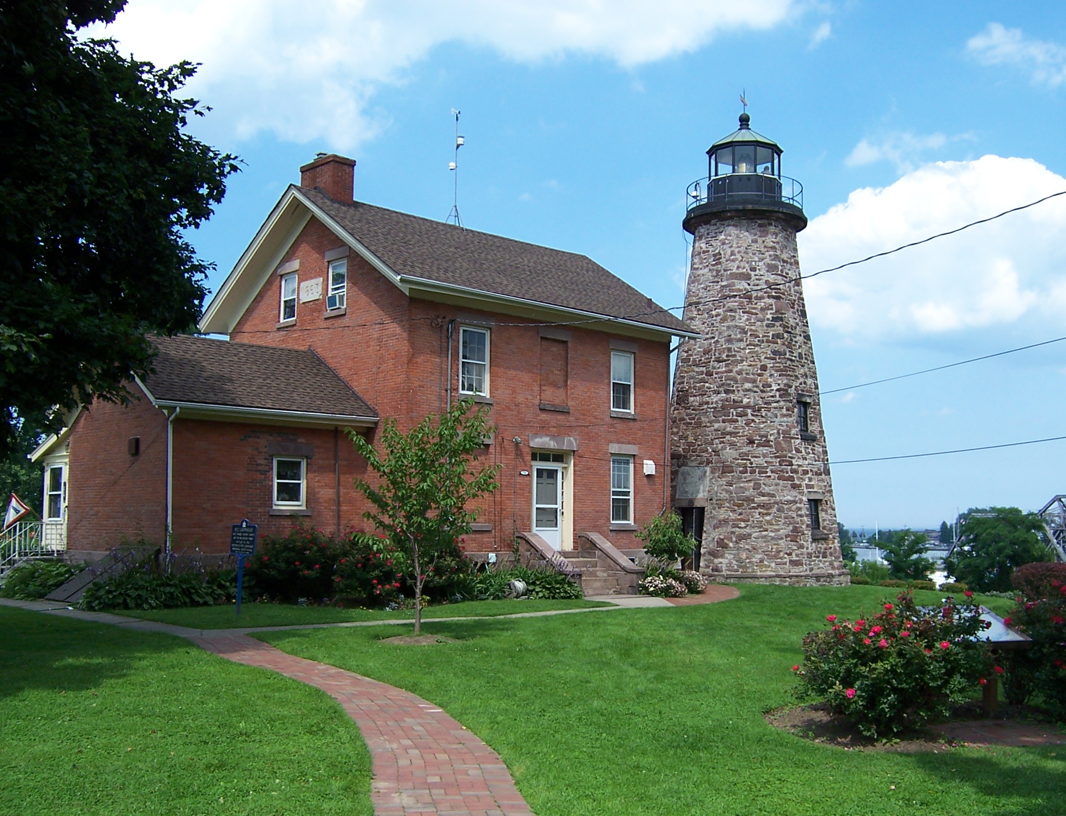
43°9′14″N 77°36′45″W / 43.15389°N 77.6125°WRochester 37 Genesee Lighthouse 
August 13, 1974 70 Lighthouse St.
43°15′10″N 77°36′40″W / 43.25278°N 77.61111°WRochester 38 German United Evangelical Church Complex March 12, 1992 60-90 Bittner St.
43°9′38″N 77°36′34″W / 43.16056°N 77.60944°WRochester 39 Granite Building October 11, 1984 130 E. Main St.
43°9′25″N 77°36′33″W / 43.15694°N 77.60917°WRochester Built in 1894 to house the Sibley, Lindsay and Curr department store. 40 Grove Place Historic District October 11, 1984 Gibbs, Selden, Grove and Windsor Sts.
43°9′35″N 77°36′3″W / 43.15972°N 77.60083°WRochester 41 David Hagaman House December 23, 1994 661 Highland Ave.
43°7′50″N 77°35′45″W / 43.13056°N 77.59583°WRochester 42 House at 235-237 Reynolds Street September 12, 1985 235-237 Reynolds St.
43°8′35″N 77°37′36″W / 43.14306°N 77.62667°WRochester 43 Immaculate Conception Roman Catholic Church Complex March 31, 1992 445 Frederick Douglass St. and 187 and 205 Edinburgh St.
43°8′47″N 77°37′4″W / 43.14639°N 77.61778°WRochester 44 Immanuel Baptist Church February 5, 2002 815 Park Ave.
43°8′48″N 77°34′28″W / 43.14667°N 77.57444°WRochester 45 Jewish Young Men's and Women's Association October 4, 1985 400 Andrews St.
43°9′37″N 77°36′16″W / 43.16028°N 77.60444°WRochester 46 Kirstein Building October 4, 1985 242 Andrews St.
43°9′36″N 77°36′28″W / 43.16°N 77.60778°WRochester 47 Lehigh Valley Railroad Station 
October 4, 1985 99 Court St.
43°9′11″N 77°36′29″W / 43.15306°N 77.60806°WRochester Currently Dinosaur Bar-B-Que 48 Leopold Street Shule June 7, 1974 30 Leopold St.
43°9′53″N 77°36′16″W / 43.16472°N 77.60444°WRochester 49 Linden-South Historic District August 26, 2009 25-272 Linden St., both sides; 809-835 South Ave., odd numbers only
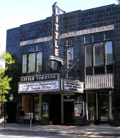
43°8′19.89″N 77°36′21.47″W / 43.1388583°N 77.6059639°WRochester New listing; refnum 09000655 50 Little Theatre 
October 4, 1985 240 East Ave.
43°9′21″N 77°35′52″W / 43.15583°N 77.59778°WRochester 51 Madison Square-West Main Street Historic District November 3, 1988 Roughly bounded by Silver, Canal, W. Main and Madison Sts.
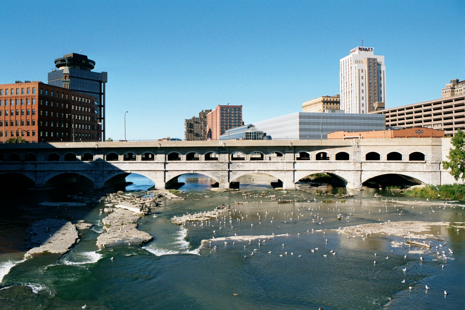
43°9′14″N 77°37′37″W / 43.15389°N 77.62694°WRochester 52 Main Street Bridge 
October 11, 1984 Main St. at Genesee River
43°9′22″N 77°36′39″W / 43.15611°N 77.61083°WRochester 53 Maplewood Historic District December 8, 1997 Roughly along Lakeview Park, Lake Ave., Seneca Pkwy., and Maplewood Ave.
43°7′26″N 77°37′44″W / 43.12389°N 77.62889°WRochester 54 Michaels-Stern Building October 4, 1985 87 N. Clinton Ave.
43°9′31″N 77°36′28″W / 43.15861°N 77.60778°WRochester 55 Mt. Hope-Highland Historic District January 21, 1974 Bounded roughly by the Clarissa St. Bridge, Genesee River, Grove and Mt. Hope Aves., plus
43°8′9″N 77°36′40″W / 43.13583°N 77.61111°WRochester 56 National Company Building October 11, 1984 159 E. Main St.
43°9′23″N 77°36′29″W / 43.15639°N 77.60806°WRochester 57 Naval Armory-Convention Hall 
October 4, 1985 75 Woodbury Blvd.
43°9′8″N 77°36′19″W / 43.15222°N 77.60528°WRochester Currently houses the Geva Theatre Center. 58 Nazareth House April 12, 1984 94 Averill Ave.
43°8′39″N 77°36′35″W / 43.14417°N 77.60972°WRochester 59 Norton Village Historic District June 21, 2010 Norton St., Norton Village Ln., Village Way, and Veteran St.
43°11′14″N 77°33′58″W / 43.18722°N 77.56611°WRochester New listing; refnum 10000362 60 O'Kane Market and O'Kane Building September 12, 1985 104-106 Bartlett St. & 239-255 Reynolds St.
43°8′34″N 77°37′36″W / 43.14278°N 77.62667°WRochester 61 Old Stone Warehouse October 15, 1973 1 Mt. Hope Ave.
43°8′54″N 77°36′24″W / 43.14833°N 77.60667°WRochester 62 Our Lady of Victory Roman Catholic Church March 12, 1992 210 Pleasant St.
43°9′32″N 77°36′33″W / 43.15889°N 77.60917°WRochester 63 Powers Building 
April 3, 1973 W. Main and State Sts.
43°9′21″N 77°36′48″W / 43.15583°N 77.61333°WRochester 64 Pulaski Library February 5, 2002 1151 Hudson Ave.
43°11′11″N 77°36′0″W / 43.18639°N 77.6°WRochester 65 Ramona Park Historic District June 21, 2010 Ramona Park
43°11′50″N 77°39′6″W / 43.19722°N 77.65167°WRochester New listing; refnum 10000363 66 Reynolds Arcade October 4, 1985 16 E. Main St.
43°9′21″N 77°36′44″W / 43.15583°N 77.61222°WRochester 67 Rochester City School No. 24 September 15, 1983 Meigs St.
43°8′10″N 77°36′5″W / 43.13611°N 77.60139°WRochester 68 Rochester Fire Department Headquarters and Shops October 21, 1985 185 North St.
43°9′39″N 77°36′16″W / 43.16083°N 77.60444°WRochester 69 Rochester Savings Bank March 16, 1972 40 Franklin St.
43°9′31″N 77°36′18″W / 43.15861°N 77.605°WRochester 70 Rundel Memorial Library 
October 4, 1985 115 South Ave.
43°9′13″N 77°37′6″W / 43.15361°N 77.61833°WRochester 71 Saint Andrew's Episcopal Church September 28, 2006 95 Averill Ave.
43°8′44″N 77°36′30″W / 43.14556°N 77.60833°WRochester 72 Saint Bernard's Seminary April 18, 1996 2260 Lake Ave.
43°12′34″N 77°37′44″W / 43.20944°N 77.62889°WRochester 73 Saint Mark's and Saint John's Episcopal Church December 16, 2004 1245 Culver Rd.
43°10′5″N 77°33′45″W / 43.16806°N 77.5625°WRochester 74 Seneca Park East and West September 26, 2003 Saint Paul Blvd., Maplewood Dr, Lake Ave.
43°11′46″N 77°37′31″W / 43.19611°N 77.62528°WRochester 75 Shingleside September 13, 1984 476 Beach Ave.
43°15′46″N 77°36′56″W / 43.26278°N 77.61556°WRochester 76 Sibley Triangle Building October 4, 1985 20-30 East Ave.
43°9′26″N 77°36′15″W / 43.15722°N 77.60417°WRochester 77 St. Joseph's Church and Rectory (Rochester, New York) 
May 29, 1975 108 Franklin St.
43°9′34″N 77°36′24″W / 43.15944°N 77.60667°WRochester 78 St. Mary's Roman Catholic Church and Rectory 
March 12, 1992 15 St. Mary's Pl.
43°9′12″N 77°36′23″W / 43.15333°N 77.60639°WRochester 79 St. Paul-North Water Streets Historic District October 11, 1984 St. Paul, N. Water, and Andrews Sts.
43°9′37″N 77°36′41″W / 43.16028°N 77.61139°WRochester 80 State Street Historic District 
October 11, 1984 109-173 State St.
43°9′27″N 77°36′55″W / 43.1575°N 77.61528°WRochester 81 Teoronto Block Historic District September 24, 2010 Bounded by State, Brown, Factory and Mill Streets
43°9′43″N 77°37′9″W / 43.16194°N 77.61917°WRochester New listing; refnum 10000798 82 Third Ward Historic District July 12, 1974 Roughly bounded by Adams and Peach Sts., I-490, and both sides of Troup and Fitzhugh Sts.
43°9′1″N 77°36′56″W / 43.15028°N 77.61556°WRochester 83 University Club October 4, 1985 26 Broadway
43°9′20″N 77°36′0″W / 43.15556°N 77.6°WRochester 84 Vanderbeck House April 9, 1984 1295 Lake Ave.
43°11′24″N 77°37′50″W / 43.19°N 77.63056°WRochester 85 Timothy Wallace House February 4, 1994 2169 S. Clinton Ave.
43°6′59″N 77°35′50″W / 43.11639°N 77.59722°WRochester 86 H. H. Warner Building October 4, 1985 72-82 St. Paul St.
43°9′30″N 77°36′34″W / 43.15833°N 77.60944°WRochester 87 Washington Street Rowhouses October 4, 1985 30-32 N. Washington St.
43°9′21″N 77°37′4″W / 43.15583°N 77.61778°WRochester 88 Ebenezer Watts House 
October 18, 1996 47 S. Fitzhugh St.
43°9′13″N 77°36′50″W / 43.15361°N 77.61389°WRochester 89 Wilder Building October 4, 1985 1 E. Main St.
43°9′19″N 77°36′44″W / 43.15528°N 77.61222°WRochester References
- ^ The latitude and longitude information provided in this table was derived originally from the National Register Information System, which has been found to be fairly accurate for about 99% of listings. For about 1% of NRIS original coordinates, experience has shown that one or both coordinates are typos or otherwise extremely far off; some corrections may have been made. A more subtle problem causes many locations to be off by up to 150 yards, depending on location in the country: most NRIS coordinates were derived from tracing out latitude and longitudes off of USGS topographical quadrant maps created under North American Datum of 1927, which differs from the current, highly accurate GPS system used by Google maps. Chicago is about right, but NRIS longitudes in Washington are higher by about 4.5 seconds, and are lower by about 2.0 seconds in Maine. Latitudes differ by about 1.0 second in Florida. Some locations in this table may have been corrected to current GPS standards.
- ^ "National Register of Historic Places: Weekly List Actions". National Park Service, United States Department of the Interior. Retrieved on November 18, 2011.
Categories:- History of Rochester, New York
- National Register of Historic Places in New York
-


Wikimedia Foundation. 2010.