- National Register of Historic Places listings in Rensselaer County, New York
-
 Municipal breakdown of Rensselaer County
This is the list of the National Register of Historic Places listings in Rensselaer County, New York. It is intended to be a complete compilation of properties and districts listed on the National Register of Historic Places in Rensselaer County, New York, United States. The locations of National Register properties and districts (at least for all showing latitude and longitude coordinates below) may be seen in a Google map by clicking on "Map of all coordinates".[1] Five of the properties are further designated National Historic Landmarks.
Rensselaer County sits east of the Hudson River in New York's Capital District and borders both Massachusetts and Vermont on the east. The area was originally inhabited by the Mohican Indian tribe until it was bought by the Dutch jeweler and merchant Kiliaen van Rensselaer in 1630 and incorporated in his patroonship Rensselaerswyck (which, in turn, was part of the Dutch colony New Netherland). The land passed into English hands in 1664 until the Dutch regained control for a year in 1673, but the English took it back in 1674. Until 1776, the year of American independence, it was under English or British control.[2] However, the county didn't actually exist as a legal entity until 1791 when it was created from land that was originally part of Albany County.
Rensselaer County consists of two cities: Rensselaer and Troy; and fourteen towns: Berlin, Brunswick, East Greenbush, Grafton, Hoosick, Nassau, North Greenbush, Petersburgh, Pittstown, Poestenkill, Sand Lake, Schaghticoke, Schodack, and Stephentown; and contains six villages: Castleton, East Nassau, Hoosick Falls, Nassau, Schaghticoke, and Valley Falls.
-
- This National Park Service list is complete through NPS recent listings posted November 18, 2011.[3]
Listings county-wide
Legend: National Register of Historic Places listing National Historic Landmark Historic district National Historic Landmark District
Landmark name Image Date listed Location City or Town Summary 1 Aiken House 
December 31, 1974 NE corner of Riverside and Aiken Aves.
42°38′8″N 73°44′58″W / 42.63556°N 73.74944°WRensselaer 2 Albany Avenue Historic District November 21, 1978 Albany Ave.
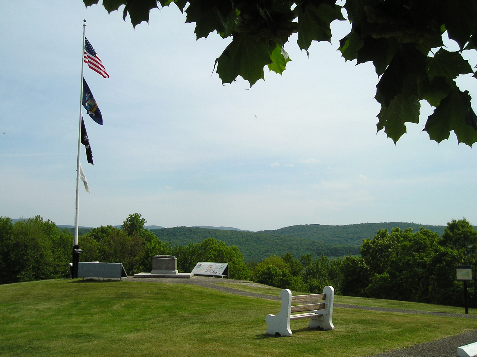
42°31′1″N 73°36′55″W / 42.51694°N 73.61528°WNassau 3 Bennington Battlefield[4] 
October 15, 1966 NY 67, on VT state line
42°56′2″N 73°18′25″W / 42.93389°N 73.30694°WWalloomsac Site of key American victory over British during Revolution 4 Beverwyck Manor 
August 3, 1979 St. Anthonys Lane.
42°39′48″N 73°43′22″W / 42.66333°N 73.72278°WRensselaer 5 Blink Bonnie August 10, 2000 1368 Sunset Rd.
42°34′6″N 73°42′9″W / 42.56833°N 73.7025°WSchodack 6 Breese-Reynolds House March 1, 2007 601 South St.
42°51′28.911″N 73°19′27.3684″W / 42.85803083°N 73.324269°WHoosick Built by Perry Eldridge in 1880. 7 Burden Iron Works Site 
November 10, 1977 Address Restricted Troy 8 Burden Ironworks Office Building 
March 16, 1972 Polk St.
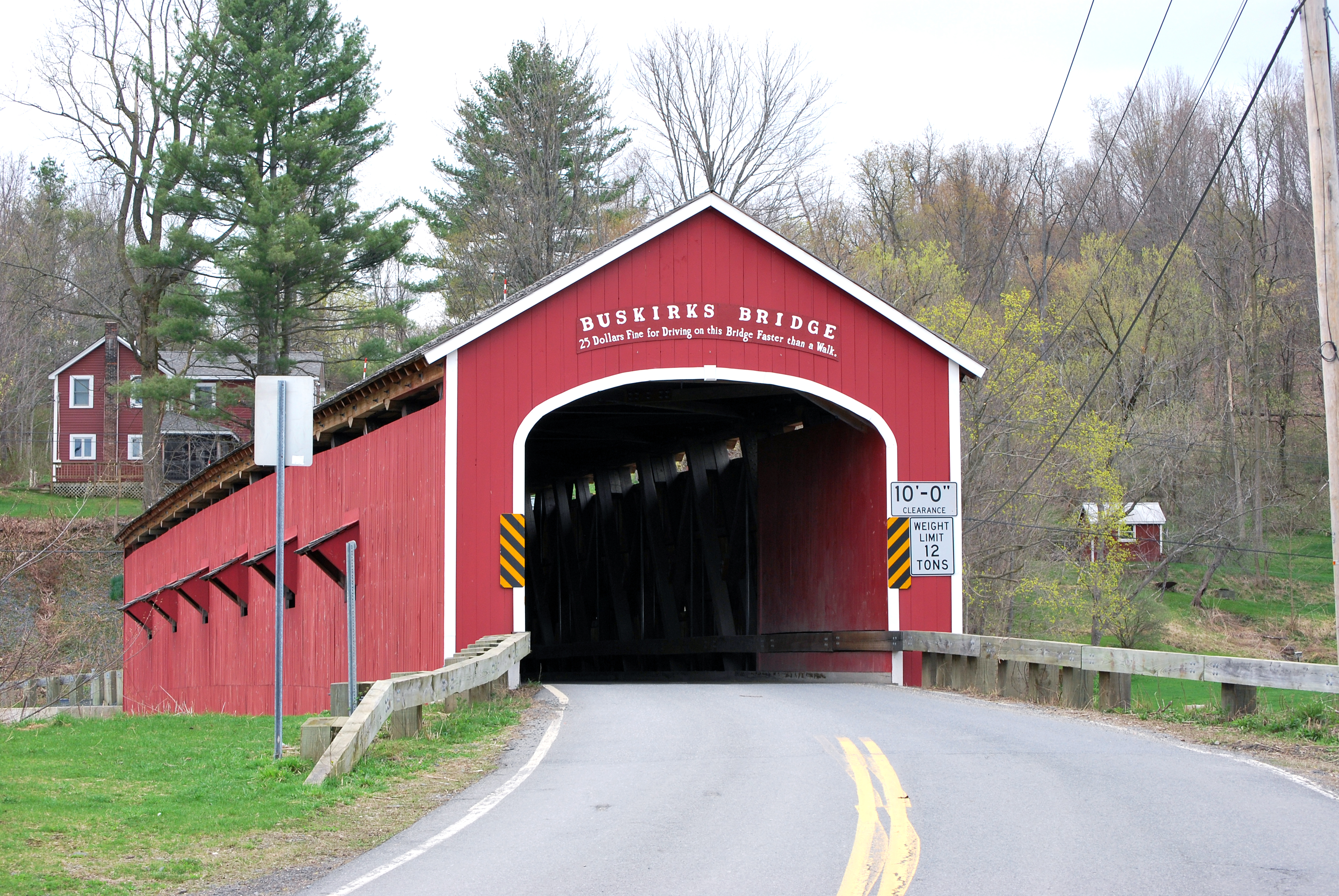
42°42′35″N 73°41′58″W / 42.70972°N 73.69944°WTroy 9 Buskirk Covered Bridge 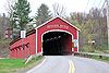
March 8, 1978 Spans Hoosic River N of NY 67
42°57′30″N 73°26′0″W / 42.95833°N 73.433333°WBuskirk 10 Esek Bussey Firehouse July 16, 1973 302 10th St.
42°44′21″N 73°40′26″W / 42.73917°N 73.67389°WTroy 11 Cannon Building[5] 
March 5, 1970 1 Broadway
42°43′53″N 73°41′32″W / 42.73139°N 73.69222°WTroy 1835 Alexander Jackson Davis-Ithiel Town commercial building further enhanced with mansard roof after 1870s fire. 12 John Carner Jr. House January 16, 2004 1310 Best Rd.
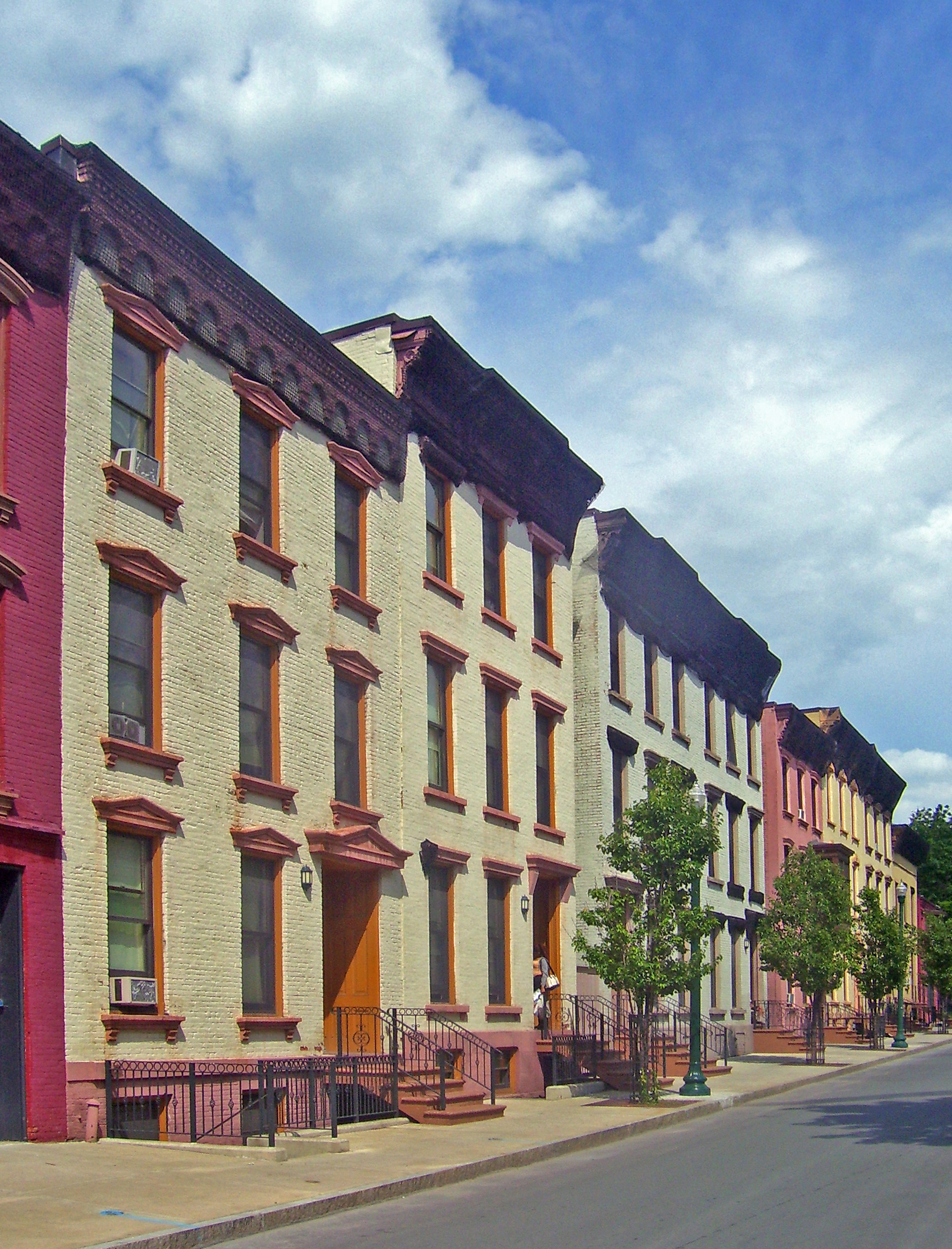
42°37′50″N 73°39′58″W / 42.63056°N 73.66611°WEast Greenbush 13 Central Troy Historic District[6] 
August 13, 1986 Roughly bounded by Grand St., Fifth Ave. and Third, Adams, and First and River Sts.
42°43′41″N 73°41′31″W / 42.72806°N 73.69194°WTroy 96-acre (39 ha) commercial section of downtown Troy with many buildings, including two National Historic Landmarks, from 1787-1940. 14 Chapel and Cultural Center February 22, 2011 2125 Burdett Ave.
42°43′55″N 73°40′21″W / 42.73194°N 73.6725°WTroy New listing; refnum 11000041 15 Chatham Street Row December 1, 1978 Chatham St.
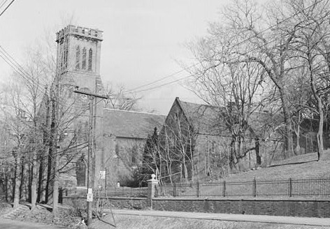
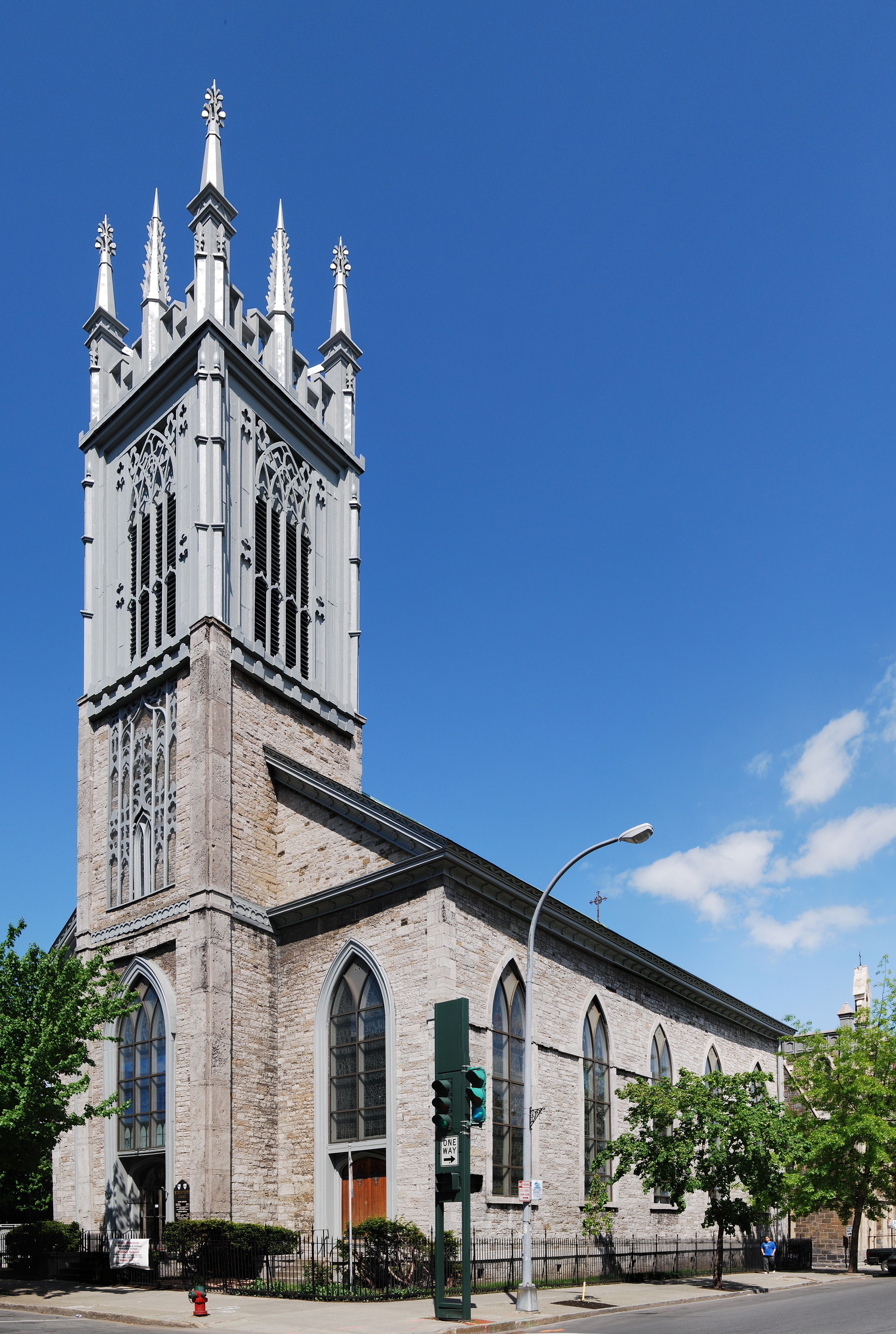
42°30′53″N 73°36′40″W / 42.51472°N 73.61111°WNassau 16 Church of the Holy Cross 
June 4, 1973 136 8th St.
42°43′57″N 73°41′1″W / 42.7325°N 73.68361°WTroy Gothic Revival church built in 1844. 17 Church Street Historic District 
November 21, 1978 Church St.
42°30′54″N 73°36′26″W / 42.515°N 73.60722°WNassau 18 Clark-Dearstyne-Miller Inn January 9, 2008 11-13 Forbes Ave.
42°39′32″N 73°44′6″W / 42.65889°N 73.735°WRensselaer 19 Craver Farmstead December 16, 1996 115 Craver Rd.
42°37′23″N 73°38′37″W / 42.62306°N 73.64361°WEast Greenbush 20 Defreest Homestead August 2, 1977 S of Troy at U.S. 4 and Jordan Rd.
42°40′32″N 73°41′39″W / 42.67556°N 73.69417°WTroy Early Dutch house built around 1750 and early Dutch barn 21 Delaney Hotel[7] 
June 21, 1996 Jct. of NY 22 and NY 67
42°55′37″N 73°20′38″W / 42.92694°N 73.34389°WNorth Hoosick Intact Greek Revival hotel with vernacular Victorian features built ca. 1850 22 District School No. 3 August 28, 1998 1125 S. Schodack Rd.
42°30′9″N 73°42′26″W / 42.5025°N 73.70722°WCastleton-on-Hudson 23 District #6 Schoolhouse[8] 
July 3, 2008[8] Brick Church Rd. and Buck Rd.
42°45′4.29″N 73°34′28.8″W / 42.7511917°N 73.574667°WBrunswick One-room schoolhouse built c. 1830 and closed in 1952. Believed to be one of the oldest remaining schoolhouses in Rensselaer County. 24 East Nassau Central School May 23, 1997 37 Garfield Rd.
42°30′33″N 73°30′19″W / 42.50917°N 73.50528°WEast Nassau 25 Elmbrook Farm May 21, 2001 2567 Brookview Rd.
42°34′22″N 73°42′39″W / 42.57278°N 73.71083°WSchodack 26 Estabrook Octagon House[9] 
February 8, 1980 8 River St.
42°53′47″N 73°21′11″W / 42.89639°N 73.35306°WHoosick Falls 1854 octagon house built closely following specifications of Orson Squire Fowler 27 Fifth Avenue-Fulton Street Historic District 
March 5, 1970 Bounded by Grand, William, and Union Sts., and Broadway
42°44′0″N 73°40′59″W / 42.733333°N 73.68306°WTroy 1860s-era homes of city's business elite. One of five districts consolidated into Central Troy Historic District 28 Fire Alarm, Telegraph and Police Signaling Building[10] 
January 15, 2003 67 State St.
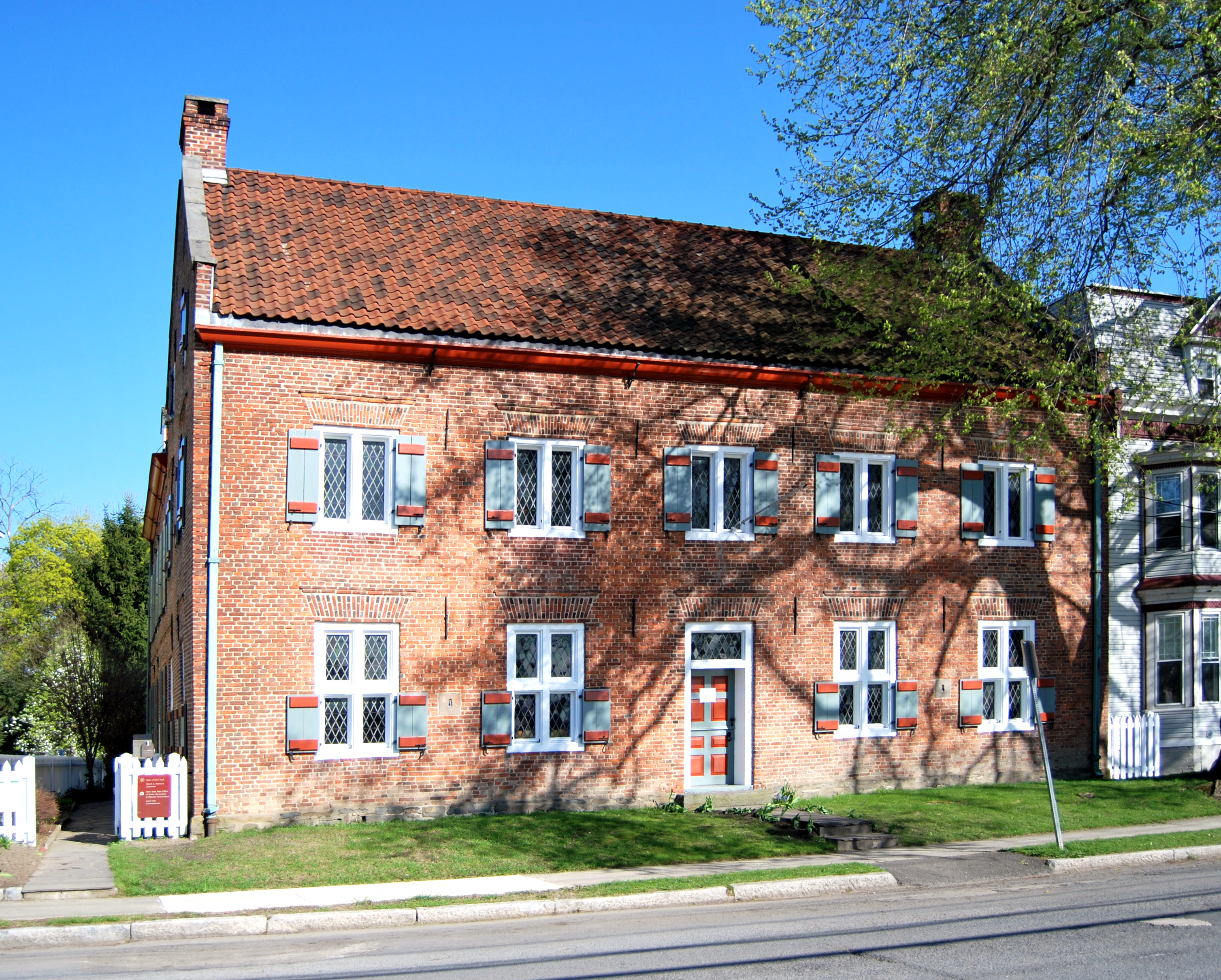
42°43′47″N 73°41′12″W / 42.72972°N 73.68667°WTroy 1922 building consolidated city's public safety communications systems, in wake of history of devastating fires. After a period of vacancy in late 20th century, back in service as police headquarters 29 Fort Crailo[11] 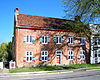
October 15, 1966 S of Columbia St. on Riverside Ave.
42°38′8″N 73°44′59″W / 42.63556°N 73.74972°WRensselaer Only well-preserved Dutch patroon house in upper Hudson Valley 30 Albert R. Fox House April 25, 2001 2801 NY 66
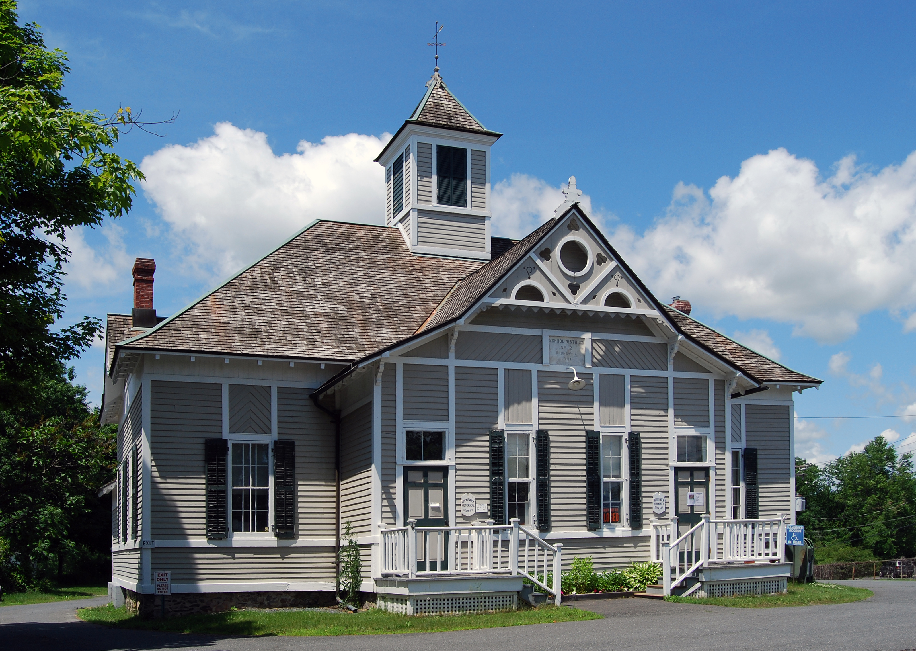
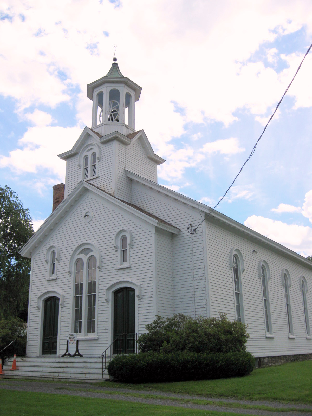
42°38′4″N 73°32′18″W / 42.63444°N 73.53833°WSand Lake 31 Garfield School[12] 
June 9, 1988 NY 2 and Moonlawn Rd.
42°43′52″N 73°35′56″W / 42.73111°N 73.59889°WBrunswick First building in Brunswick to be added to the NRHP.[13] 32 Glenwood May 25, 1973 Eddy's Lane
42°45′4″N 73°40′33″W / 42.75111°N 73.67583°WTroy 33 Grand Street Historic District 
February 27, 1973 Grand St. between 5th and 6th Aves.
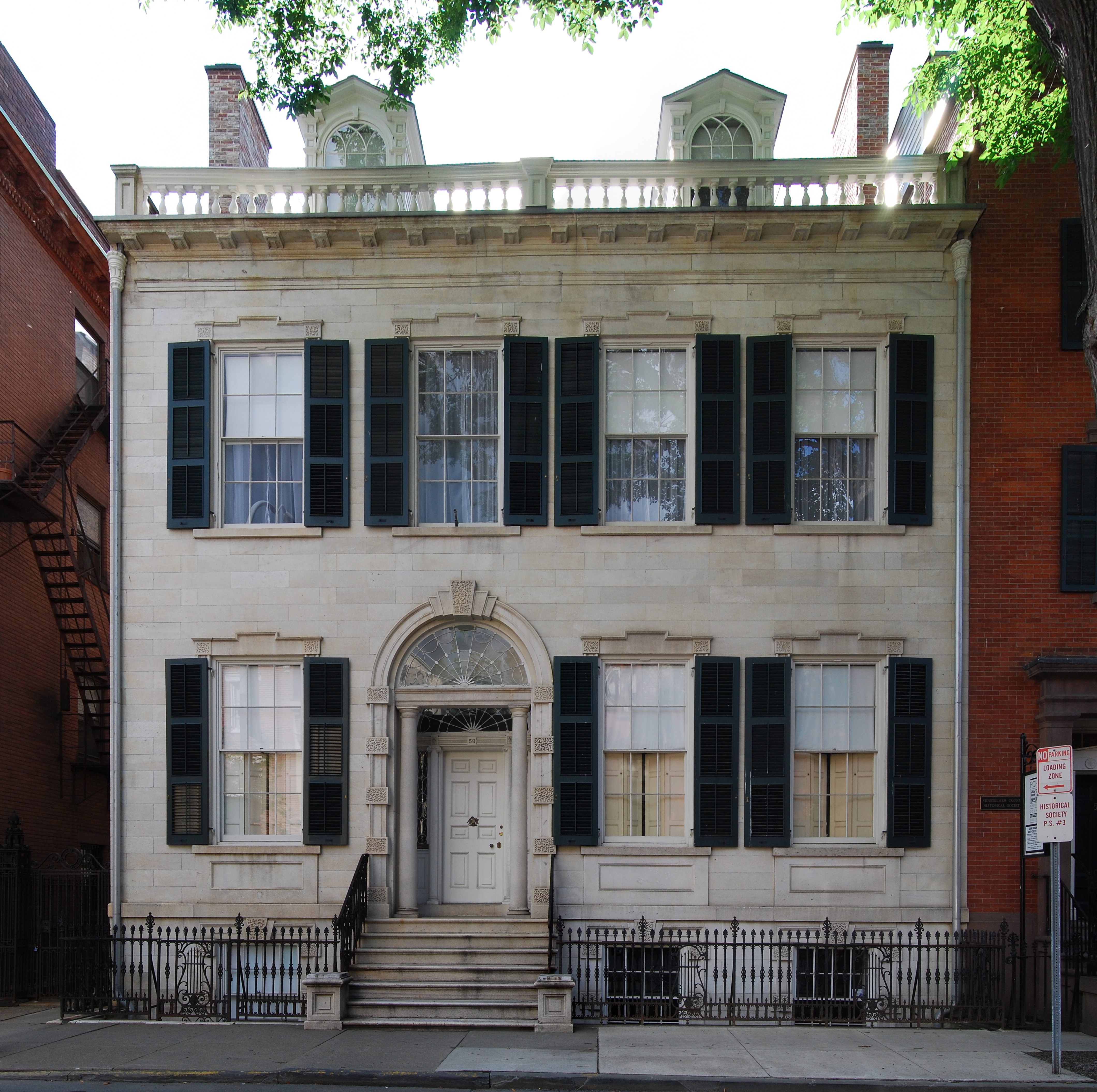
42°43′59″N 73°41′13″W / 42.73306°N 73.68694°WTroy Civil War-era rowhouses built in wake of devastating 1862 fire. Now part of Central Troy Historic District. 34 Hart-Cluett Mansion[14] 
April 11, 1973 59 2nd St.
42°43′46″N 73°41′38″W / 42.72944°N 73.69389°WTroy 1827 Federal style mansion is one of the best in that style in city. Home to Rensselaer County Historical Society since 1950s 35 Haskell School September 19, 2003 150 Sixth Ave.
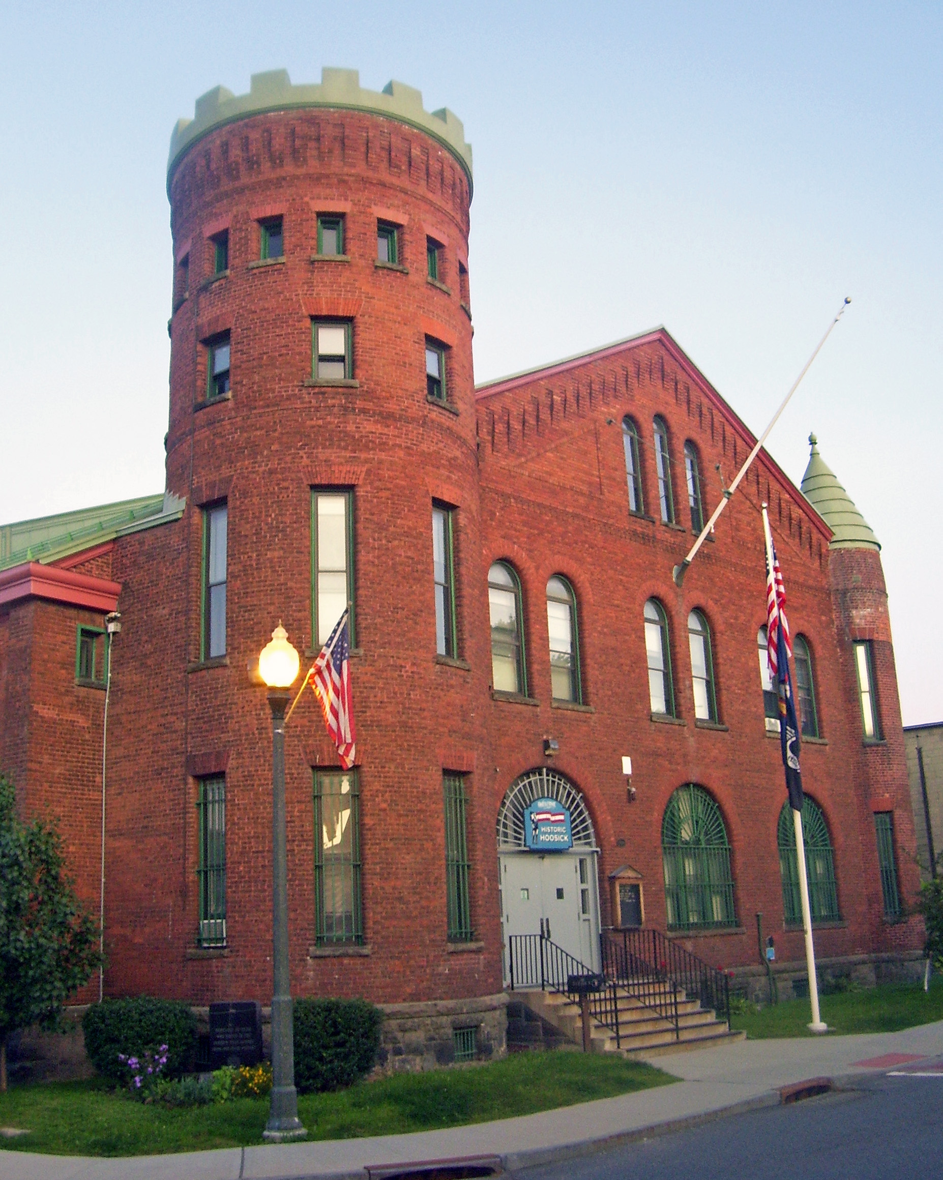
42°45′28″N 73°40′42″W / 42.75778°N 73.67833°WTroy 36 Hoosick Falls Armory[15] 
March 2, 1995 Jct. of Church and Elm Sts.
42°53′57″N 73°21′15″W / 42.89917°N 73.35417°WHoosick Falls Intact 1889 Isaac Perry-designed armory. Home to units that have fought in the Mexican Border Campaign and Battle of Saipan 37 Hoosick Falls Historic District[16] 
December 3, 1980 Central Ave. and Main St.
42°54′4″N 73°21′6″W / 42.90111°N 73.35167°WHoosick Falls Eight-acre commercial core of village with intact buildings from turn-of-the-century industrial peak 38 Ilium Building[17] 
December 18, 1970 NE corner of Fulton and 4th Sts.
42°43′57″N 73°41′20″W / 42.7325°N 73.68889°WTroy Intact 1904 Marcus F. Cummings commercial building 39 W. P. Irwin Bank Building 
October 3, 2007 156 Broadway
42°38′25″N 73°44′49″W / 42.64028°N 73.74694°WRensselaer 40 Knickerbocker Mansion December 11, 1972 Knickerbocker Rd.
42°54′18″N 73°39′8″W / 42.905°N 73.65222°WSchaghticoke 41 Henry Koon House February 21, 1997 171 Pawling Ave.
42°43′0″N 73°40′13″W / 42.716667°N 73.67028°WTroy 42 Lansingburgh Academy 
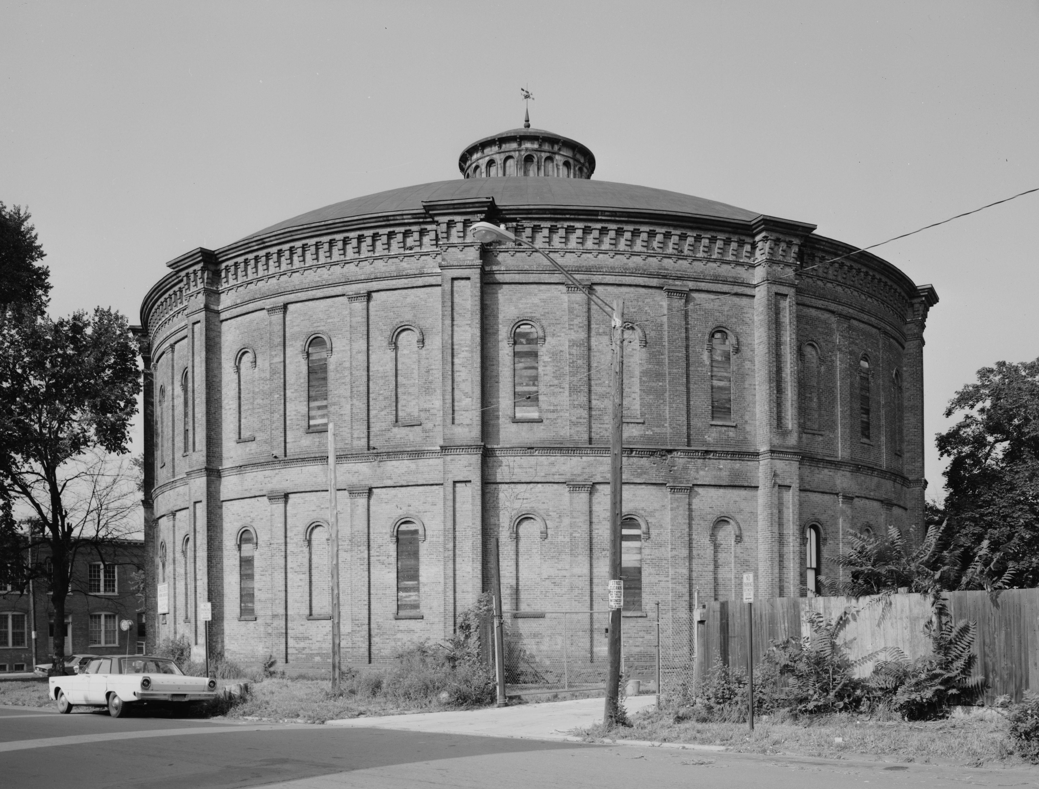
October 14, 1976 4th and 114th Sts.
42°46′22″N 73°40′34″W / 42.77278°N 73.67611°WTroy 43 Lansingburgh Village Burial Ground November 21, 2002 Third Ave. and 107th St.
42°45′52″N 73°40′48″W / 42.76444°N 73.68°WTroy 44 David Mathews House September 10, 1979 VT 67
42°56′27″N 73°16′28″W / 42.94083°N 73.27444°WHoosick 45 McCarthy Building[18] 
March 5, 1970 255-257 River St.
42°43′56″N 73°41′30″W / 42.73222°N 73.69167°WTroy Downtown Troy landmark built in 1904 and largely intact 46 Mechanicville Hydroelectric Plant November 13, 1989 At NY 32 on Hudson River
42°52′41″N 73°40′47″W / 42.87806°N 73.67972°WMechanicville 47 Herman Melville House August 21, 1992 2 114th St.
42°46′23″N 73°40′45″W / 42.77306°N 73.67917°WTroy 48 Muitzes Kill Historic District 
July 24, 1974 An irregular pattern on both sides of Schodack Landing Rd.
42°28′35″N 73°43′22″W / 42.47639°N 73.72278°WSchodack 49 Kate Mullany House[19] 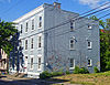
April 1, 1998 350 8th St.
42°44′24″N 73°40′54″W / 42.74°N 73.68167°WTroy Apartment building of teenaged Irish immigrant who organized her fellow garment workers and went on to become first major female U.S. labor leader 50 National State Bank Building[20] 
December 29, 1970 297 River St.
42°43′57″N 73°41′27″W / 42.7325°N 73.69083°WTroy 1904 Marcus F. Cummings building shows influence of early skyscrapers; has been Monument Square landmark since its construction. 51 Northern River Street Historic District[21] 
May 19, 1988 403-429 and 420-430 River St.
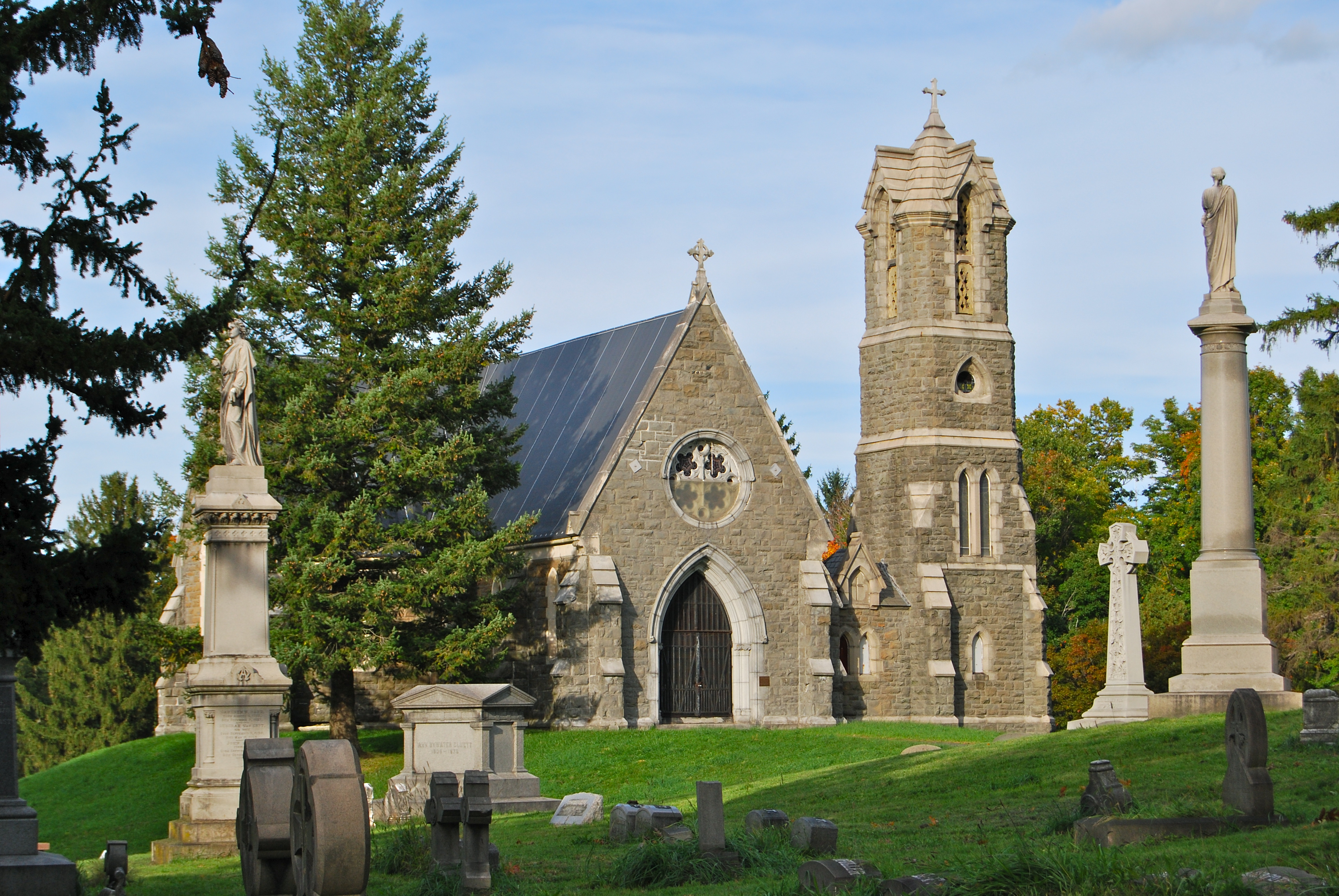
42°44′8″N 73°41′17″W / 42.73556°N 73.68806°WTroy Transitional neighborhood between downtown and industrial areas in late 19th century; largely unchanged since then 52 Oakwood Cemetery[22] 
October 4, 1984 50 101st St.
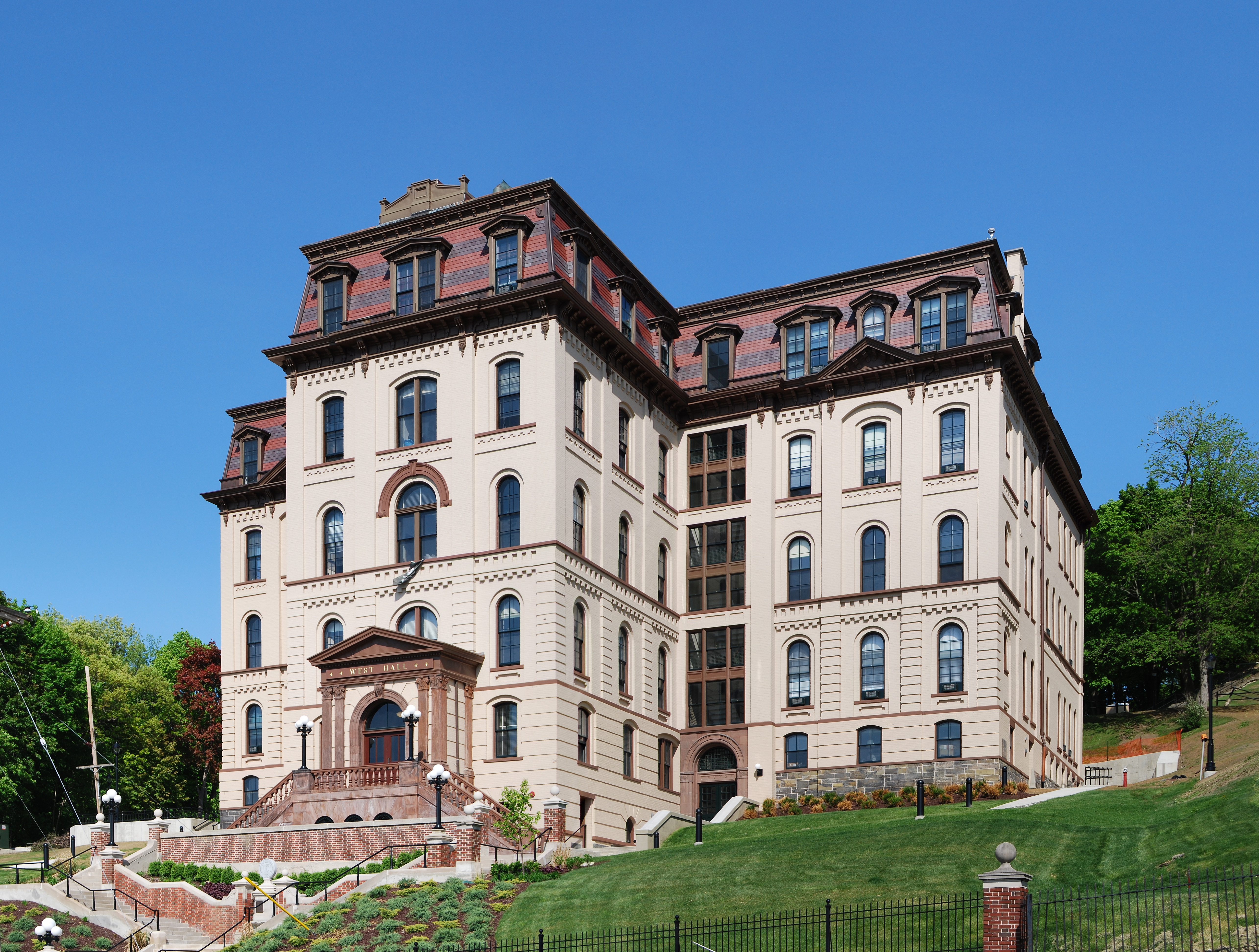
42°45′44″N 73°40′12″W / 42.76222°N 73.67°WTroy Burial site of "Uncle Sam" Wilson and Civil War Gen. George H. Thomas 53 Old Troy Hospital (also known as West Hall) 
October 25, 1973 8th St.
42°43′54″N 73°41′0″W / 42.73167°N 73.683333°WTroy French Second Empire structure home to Arts Department at RPI 54 J. C. Osgood Firehouse November 2, 2000 316-324 Third St.
42°43′10″N 73°41′35″W / 42.71944°N 73.69306°WTroy 55 Patroon Agent's House and Office August 3, 1979 15 Forbes Ave.
42°39′26″N 73°44′7″W / 42.65722°N 73.73528°WRensselaer 56 Petersburgh United Methodist Church 
January 2, 2004 12 Head of Lane Rd.
42°45′8″N 73°20′44″W / 42.75222°N 73.34556°WPetersburgh 57 Poesten Kill Gorge Historic District March 8, 1978 Address Restricted Troy Try also Poestenkill Gorge Historic District 58 Powers Home April 16, 1974 819 3rd Ave.
42°47′2″N 73°40′22″W / 42.78389°N 73.67278°WTroy 59 Proctor's Theater[23] 
October 4, 1979 82 4th St.
42°43′55″N 73°41′25″W / 42.73194°N 73.69028°WTroy 1914 theater shows transition between eras of live entertainment and motion picture. 60 Public School No. 10 November 4, 1994 77 Adams St.
42°43′22″N 73°41′34″W / 42.72278°N 73.69278°WTroy 61 Pumpkin House June 8, 1998 180 Fourth St.
42°43′35″N 73°41′26″W / 42.72639°N 73.69056°WTroy 62 River Street Historic District 
June 3, 1976 Both sides of River St. from Congress St. to jct. with 1st St.
42°43′49″N 73°41′42″W / 42.73028°N 73.695°WTroy Oldest downtown neighborhood in city, largely rebuilt after 1820 fire. Now part of Central Troy Historic District. 63 Sand Lake Baptist Church 
January 2, 2004 2960 NY 43
42°38′7″N 73°32′59″W / 42.63528°N 73.54972°WAverill Park 64 Schodack Landing Historic District September 15, 1977 NY 9J
42°28′58″N 73°46′7″W / 42.48278°N 73.76861°WSchodack Landing 65 Second Street Historic District 
August 7, 1974 Both sides of 2nd St.
42°43′53″N 73°41′40″W / 42.73139°N 73.69444°WTroy Troy's first desirable residential neighborhood. Many houses from 1820s-1840s. Merged into Central Troy Historic District in 1986. 66 Sharpe Homestead and Cemetery May 19, 2005 44 Laura Ln.
42°39′40″N 73°41′57″W / 42.66111°N 73.69917°WDefreestville 67 Sherman Farm July 5, 2003 35 Sherman Rd.
42°51′23″N 73°30′37″W / 42.85639°N 73.51028°WPittstown 68 Henry Tunis Smith Farm September 18, 1975 S of Nassau on NY 203
42°29′37″N 73°37′10″W / 42.49361°N 73.61944°WNassau 69 St. Barnabas Episcopal Church January 28, 2004 2900 Fifth Ave.
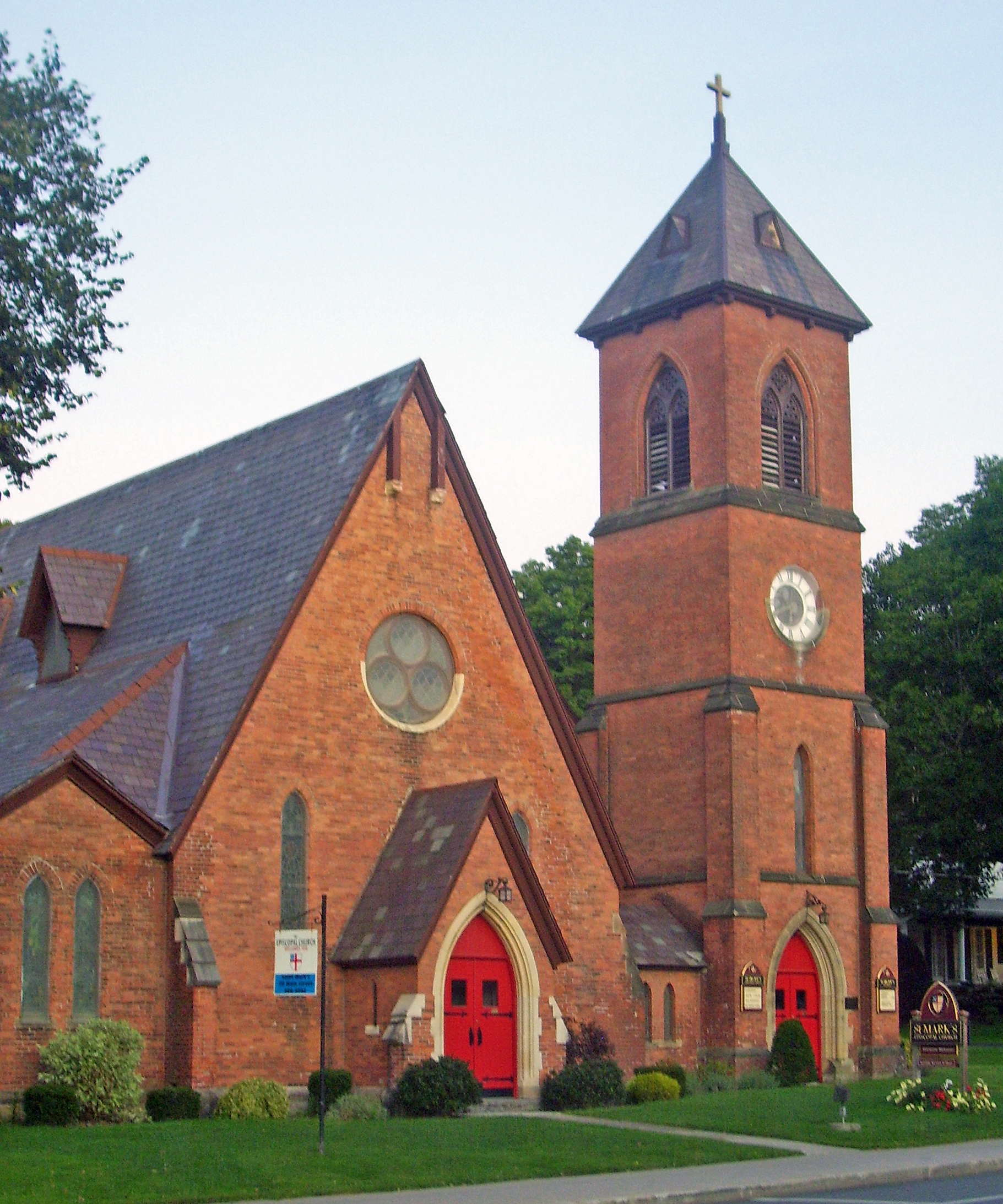
42°44′46″N 73°40′58″W / 42.74611°N 73.68278°WTroy 70 St. Mark's Episcopal Church[24] 
July 27, 2000 Main St.
42°53′59″N 73°21′2″W / 42.89972°N 73.35056°WHoosick Falls 1858 Henry Dudley church done in brick rather than his usual stone 71 St. Paul's Episcopal Church Complex[25] 
September 7, 1979 58 3rd St.
42°43′49″N 73°41′24″W / 42.73028°N 73.69°WTroy 1828 church is early Gothic Revival imitation of Ithiel Town's Trinity Church in New Haven, Connecticut 72 Joachim Staats House and Gerrit Staats Ruin December 15, 1978 N of Castleton-on-Hudson
42°34′15″N 73°44′58″W / 42.57083°N 73.74944°WCastleton-on-Hudson 73 Tibbits House May 22, 1978 S of Hoosick at jct. of NY 22 and NY 7
42°51′28″N 73°20′37″W / 42.85778°N 73.34361°WHoosick 74 Trinity Church Lansingburgh 
May 1, 1995 585 Fourth Ave.
42°46′28″N 73°40′32″W / 42.77444°N 73.67556°WTroy 75 Troy Gas Light Company 
February 18, 1971 NW corner of Jefferson St. and 5th Ave.
42°43′17″N 73°41′26″W / 42.72139°N 73.69056°WTroy Unusual structure used to hold coal gas in the 1800s. 76 Troy Public Library 
January 17, 1973 100 2nd St.
42°44′46″N 73°40′59″W / 42.74611°N 73.68306°WTroy 77 Troy Savings Bank and Music Hall 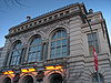
April 11, 1989 32 Second St.
42°43′49″N 73°41′31″W / 42.73028°N 73.69194°WTroy Late 19th-century bank building with full theater, including pipe organ, upstairs 78 US Post Office-Hoosick Falls[26] 
November 17, 1988 35 Main St.
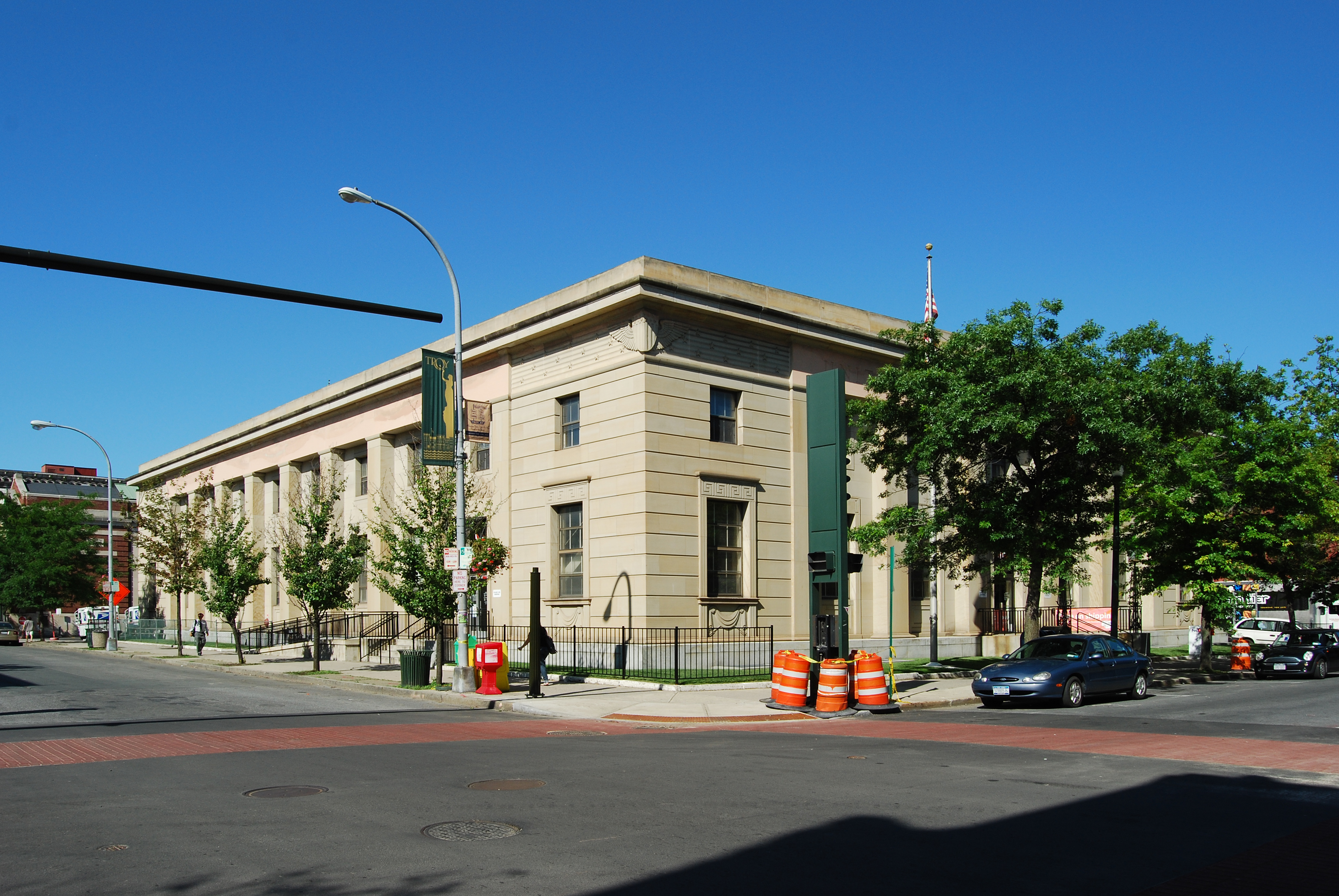
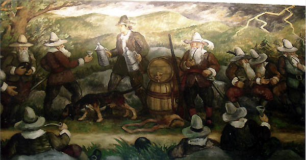
42°54′2″N 73°21′5″W / 42.90056°N 73.35139°WHoosick Falls 1925 brick Colonial Revival building mostly intact 79 US Post Office-Troy[27] 

May 11, 1989 400 Broadway
42°43′53″N 73°41′21″W / 42.73139°N 73.68917°WTroy Stripped Classical Revival-style building from 1936, excellent example of that sort of architecture in larger city post offices during Depression. One of only three in the U.S. with interior mural by Waldo Peirce. 80 John Evert Van Alen House August 20, 2004 1744 Washington Ave. Ext.
42°39′11″N 73°41′56″W / 42.65306°N 73.69889°WDefreestville 81 W. & L. E. Gurley Building[28] 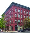
March 5, 1970 514 Fulton St.
42°43′57″N 73°41′18″W / 42.7325°N 73.68833°WTroy Exemplary Neoclassical commercial building preserved nearly intact; built in only eight months on site of 1845 original after 1862 fire. Home of Gurley Precision Instruments for over 150 years. 82 Washington Park Historic District 
May 25, 1973 Washington Park and adjacent properties on 2nd, 3rd, and Washington Sts. and Washington Pl.
42°43′26″N 73°41′35″W / 42.72389°N 73.69306°WTroy Rows of townhouses built by local businessmen in 1839 on the model of British residential squares in Bloomsbury. Residents are still assessed for the maintenance of the park. Now part of Central Troy Historic District. 83 Emma Willard School 
August 30, 1979 Pawling and Elmgrove Aves.
42°42′48″N 73°39′44″W / 42.71333°N 73.66222°WTroy 84 Winslow Chemical Laboratory 
November 4, 1994 105 Eighth St.
42°43′52″N 73°41′5″W / 42.73111°N 73.68472°WTroy 1866 structure on RPI campus. See also
- National Register of Historic Places listings in New York
- List of New York State Historic Markers in Rensselaer County, New York
References and notes
- ^ The latitude and longitude information provided in this table was derived originally from the National Register Information System, which has been found to be fairly accurate for about 99% of listings. For about 1% of NRIS original coordinates, experience has shown that one or both coordinates are typos or otherwise extremely far off; some corrections may have been made. A more subtle problem causes many locations to be off by up to 150 yards, depending on location in the country: most NRIS coordinates were derived from tracing out latitude and longitudes off of USGS topographical quadrant maps created under North American Datum of 1927, which differs from the current, highly accurate GPS system used by Google maps. Chicago is about right, but NRIS longitudes in Washington are higher by about 4.5 seconds, and are lower by about 2.0 seconds in Maine. Latitudes differ by about 1.0 second in Florida. Some locations in this table may have been corrected to current GPS standards.
- ^ The Kingdom of England existed until the Acts of Union 1707, when Scotland and England came together to form the Kingdom of Great Britain.
- ^ "National Register of Historic Places: Weekly List Actions". National Park Service, United States Department of the Interior. Retrieved on November 18, 2011.
- ^ Richard Greenwood (November 24, 1975), National Register of Historic Places Inventory-Nomination: Bennington BattlefieldPDF (242 KB), National Park Service and Accompanying 10 photos from 1967 and 1975PDF (1.28 MB)
- ^ Peckham, Mark (July 1986). "National Register of Historic Places nomination, Central Troy Historic District (requires JavaScript)". New York State Office of Parks, Recreation and Historic Preservation. http://www.oprhp.state.ny.us/hpimaging/hp_view.asp?GroupView=7683. Retrieved 2008-10-26.. Also see excerpts at "Central Troy Historic District". Livingplaces.com. http://www.livingplaces.com/NY/Rensselaer_County/Troy_City/Central_Troy_Historic_District.html., which does not require JavaScript to view.
- ^ Peckham, Mark (July 1986). "National Register of Historic Places nomination, Central Troy Historic District". New York State Office of Parks, Recreation and Historic Preservation (NYSOPRHP). http://www.oprhp.state.ny.us/hpimaging/hp_view.asp?GroupView=7683. Retrieved 2008-10-26.. Also see excerpts at "Central Troy Historic District". Livingplaces.com. http://www.livingplaces.com/NY/Rensselaer_County/Troy_City/Central_Troy_Historic_District.html., which does not require JavaScript to view. Page numbers used for the former version are those assigned by the JavaScript reader at the NYSOPRHP site, not those used in the document itself.
- ^ DiSanto, Victor. "National Register of Historic Places nomination, Delaney Hotel". New York State Office of Parks, Recreation and Historic Preservation. http://www.oprhp.state.ny.us/hpimaging/hp_view.asp?GroupView=7508. Retrieved October 27, 2009.
- ^ a b Zankel, Sharon (2008-04-22). "National Register of Historic Places nomination, District 6 Schoolhouse (Javascript)". New York State Office of Parks, Recreation and Historic Preservation. http://www.oprhp.state.ny.us/hpimaging/hp_view.asp?GroupView=102534. Retrieved 2009-06-25.
- ^ Harwood, John (November 15, 1979). "National Register of Historic Places nomination, Estabrook Octagon House". New York State Office of Parks, Recreation and Historic Preservation. http://www.oprhp.state.ny.us/hpimaging/hp_view.asp?GroupView=7510. Retrieved OCtober 27, 2009.
- ^ Shaver, Peter (2002-06-17). "National Register of Historic Places nomination; Fire Alarm, Telegraph and Police Signaling Building". New York State Office of Parks, Recreation and Historic Preservation. http://www.oprhp.state.ny.us/hpimaging/hp_view.asp?GroupView=11183. Retrieved 2008-10-26.
- ^ James Dillon (1983), National Register of Historic Places Inventory-Nomination: Fort CrailoPDF (303 KB), National Park Service and Accompanying photos, exterior, from 1965.PDF (1.27 MB)
- ^ Waite, Diana S. (1988-04-29). "National Register of Historic Places Registration nomination, Garfield School (Javascript)". New York State Office of Parks, Recreation and Historic Preservation. http://www.oprhp.state.ny.us/hpimaging/hp_view.asp?GroupView=7501. Retrieved 2009-06-25.
- ^ Ingraham, Frances (1993-04-25). "Eagle Mills' Rural Charm Keeps Longtime Residents". Times Union (Albany). pp. G1. http://archives.timesunion.com/mweb/wmsql.wm.request?oneimage&imageid=5664949. Retrieved 2009-06-14.
- ^ Brooke, Cornelia (September 1971). "National Register of Historic Places nomination, Hart-Cluett Mansion". New York State Office of Parks, Recreation and Historic Preservation. http://www.oprhp.state.ny.us/hpimaging/hp_view.asp?GroupView=7616. Retrieved 2008-11-01.
- ^ Todd, Nancy (December 1994). "National Register of Historic Places nomination, Hoosick Falls Armory". New York State Office of Parks, Recreation and Historic Preservation. http://www.oprhp.state.ny.us/hpimaging/hp_view.asp?GroupView=7503. Retrieved October 25, 2009.
- ^ Powers, Robert (August 1979). "National Register of Historic Places nomination, Hoosick Falls Historic District". New York State Office of Parks, Recreation and Historic Preservation. http://www.oprhp.state.ny.us/hpimaging/hp_view.asp?GroupView=7512. Retrieved October 22, 2009.
- ^ Liebs, Chester (May 1970). "National Register of Historic Places nomination, Ilium Building". New York State Office of Parks, Recreation and Historic Preservation. http://www.oprhp.state.ny.us/hpimaging/hp_view.asp?GroupView=7620. Retrieved 2008-11-11.
- ^ Waite, Diana (December 1969). "National Register of Historic Places nomination, McCarthy Building". New York State Office of Parks, Recreation and Historic Preservation. http://www.oprhp.state.ny.us/hpimaging/hp_view.asp?GroupView=7623. Retrieved 2008-11-06.
- ^ Page Putnam Miller, Jill S. Mesirow, Andrew Laas, John W. Bond, and Rachel Bliven (September 4, 1997), National Historic Landmark Nomination—Kate Mullany HousePDF (864 KB), National Park Service and Accompanying 2 photos, from 1994.PDF (493 KB)
- ^ Liebs, Chester (May 1970). "National Register of Historic Places nomination, National State Bank Building". New York State Office of Parks, Recreation and Historic Preservation. http://www.oprhp.state.ny.us/hpimaging/hp_view.asp?GroupView=7626. Retrieved 2008-11-01.
- ^ Smith, Raymond (February 1988). "National Register of Historic Places nomination, Northern River Street Historic District". New York State Office of Parks, Recreation and Historic Preservation. http://www.oprhp.state.ny.us/hpimaging/hp_view.asp?GroupView=7640. Retrieved 2008-10-26.
- ^ Harrison, A. Rebecca (1984-08-03). "National Register of Historic Places Registration nomination, Oakwood Cemetery (Javascript)". New York State Office of Parks, Recreation and Historic Preservation. http://www.oprhp.state.ny.us/hpimaging/hp_view.asp?GroupView=7627. Retrieved 2009-10-06.
- ^ Powers, Robert (May 1979). "National Register of Historic Places nomination, Proctor's Theater". New York State Office of Parks, Recreation and Historic Preservation. http://www.oprhp.state.ny.us/hpimaging/hp_view.asp?GroupView=11276. Retrieved 2008-10-28.
- ^ Shaver, Peter (November 24, 1999). "National Register of Historic Places nomination, St. Mark's Episcopal Church". New York State Office of Parks, Recreation and Historic Preservation. http://www.oprhp.state.ny.us/hpimaging/hp_view.asp?GroupView=7552. Retrieved October 24, 2009.
- ^ Dunn, Shirley (June 19, 1979). "National Register of Historic Places nomination, St. Paul's Episcopal Church (JavaScript)". New York State Office of Parks, Recreation and Historic Preservation. http://www.oprhp.state.ny.us/hpimaging/hp_view.asp?GroupView=7655. Retrieved 2008-11-08.
- ^ Gobrecht, Larry (December 1986). "National Register of Historic Places nomination, US Post Office–Hoosick Falls". New York State Office of Parks, Recreation and Historic Preservation. http://www.oprhp.state.ny.us/hpimaging/hp_view.asp?GroupView=7514. Retrieved October 21, 2009.
- ^ Gobrecht, Larry (December 1986). "National Register of Historic Places nomination, U.S. Post Office-Troy". New York State Office of Parks, Recreation and Historic Preservation. http://www.oprhp.state.ny.us/hpimaging/hp_view.asp?GroupView=7658. Retrieved 2008-10-25.
- ^ George R. Adams (November, 1977), National Register of Historic Places Inventory-Nomination: W. & L.E. Gurley BuildingPDF (641 KB), National Park Service and Accompanying 6 photos, 5 exterior and 1 interior, from 1977 and c.1970PDF (1.53 MB)
Municipalities and communities of Rensselaer County, New York County seat: Troy Cities 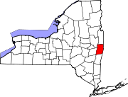
Towns Berlin | Brunswick | East Greenbush | Grafton | Hoosick | Nassau | North Greenbush | Petersburgh | Pittstown | Poestenkill | Sand Lake | Schaghticoke | Schodack | Stephentown
Villages CDPs Other
hamletsCherry Plain | Cropseyville | Defreestville | Eagle Bridge | East Schodack | Johnsonville | Melrose | Schodack Center | Speigletown
Capital District of New York Central communities Albany (History · City Hall · Coat of Arms) · Schenectady (City Hall) · Troy (History) · List of all incorporated places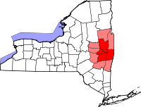
Largest communities
(over 20,000 in 2000)Medium-sized communities
(10,000 to 20,000 in 2000)City of Amsterdam · Brunswick · Cohoes · East Greenbush · Glens Falls · Gloversville · Halfmoon · Malta · North Greenbush · Schodack · Watervliet · WiltonSmall communities
(5,000 to 10,000 in 2000)Town of Amsterdam · Ballston Spa · Cobleskill · Village of Colonie · Duanesburg · City of Johnstown · Town of Johnstown · Kinderhook · Mechanicville · New Scotland · Rensselaer · Sand Lake · Scotia · Town of Stillwater · WaterfordCounties Albany · Columbia · Fulton · Greene · Montgomery · Rensselaer · Saratoga · Schenectady · Schoharie · Warren · WashingtonHistory Mohawks · Mahicans · Fort Orange · Rensselaerswyck · Beverwyck · Albany Plan of Union · Timeline of town creation · Toponymies of places · Tech ValleyGeography Hudson River (Valley) · Mohawk River · Erie Canal · Lake Albany · Lake George · Albany Pine Bush (Rensselaer Lake · Woodlawn Preserve) · Adirondack Mountains · Catskill Mountains · Rensselaer PlateauReligion and culture Culture in New York's Capital District · Sports in New York's Capital District · Episcopal Diocese of Albany · Roman Catholic Diocese of AlbanyEducation Public school districtsList of school districts in New York's Capital DistrictHigher educationNewspapers TV/Radio Broadcast television in the Capital District Local stations WRGB (6.1 CBS, 6.2 This TV) • WTEN (10.1 ABC, 10.2 Weather, 10.3 RTV) • WNYT (13.1 NBC, 13.2 Weather, 13.3 Weather Radar) • WMHT (17.1 PBS, 17.2 ThinkBright, 17.3 HD) • WXXA (23.1 Fox, 23.2 The Cool TV) • WNGN-LP 35 / WNGX-LP 42 (FN) • WCWN (45.1 The CW, 45.2 Uni Sp) • WNYA / WNYA-CD (51.1 MNTV, 51.2 Antenna TV) • W52DF 52 (silent)
Outlying area stations WVBK-CA 2 (RSN' Manchester, VT) • W04AJ 4 (PBS; Glens Falls) • W04BD 4 (PBS; Schoharie) •
WNCE-CA 8 (A1; Glens Falls) • WYBN-CA 14 (RSN; Cobleskill) • WCDC (19.1 ABC; Adams, MA) • WVBG-LP 25 (RSN; Greenwich) • W36AX 36 (PBS / VPT; Manchester, VT) • W47CM 47 (silent; Glens Falls) • WYPX (55.1 Ion, 55.2 qubo, 55.3 Life; Amsterdam) • W53AS 53 (PBS / VPT; Bennington, VT)Adjacent locals Cable-only stations YNN Capital Region • TW3 • YES • SNY • MSG Network
Defunct stations New York State television: Albany/Schenectady • Binghamton • Buffalo • Burlington/Plattsburgh • Elmira • New York City • Rochester • Syracuse • Utica • Watertown
Vermont Broadcast television: Albany/Schenectady • Boston, MA • Burlington/Plattsburgh
Massachusetts television: Albany • Boston • Providence • Springfield
Radio stations in the Albany / Schenectady / Troy market by FM frequency 88.3 · 89.1² · 89.7 · 89.9 · 90.3/93.1² · 90.7/94.9 · 90.7 · 90.7 · 90.9 · 91.1 · 91.5 · 92.3 · 92.9 · 93.5 · 93.7 · 94.5 · 94.7 · 95.5 · 95.9 · 96.3 · 96.7 · 97.3 · 97.5 · 97.7 · 97.9 · 98.3² · 98.5 · 98.5 · 99.1 · 99.5² · 100.3 · 100.9 · 101.3 · 101.7 · 101.9 · 102.3² · 102.7 · 103.1² · 103.5 · 103.9 · 104.5 · 104.9 · 105.7² · 106.1 · 106.5² · 107.1 · 107.7²by AM frequency NOAA Weather Radio frequency 162.550by callsign W226AC · W235AY · W256BU · W291BY · WABY · WAJZ · WAMC (AM) · WAMC-FM² · WBAR · WBPM · WCDB · WCKL · WCKM · WCQL · WCSS · WCTW · WDCD · WDCD-FM · WDDY² · WENT · WEQX · WEXT · WFFG · WFLY · WFNY · WGDJ · WGNA² · WGXC · WGY¹² · WGY-FM² · WHAZ · WHAZ-FM · WHUC · WHVP · WIZR · WJIV · WKBE · WKKF² · WKLI · WLJH · WMHT² · WMYY · WNYQ · WOFX² · WOPG · WPGL · WPYX² · WQAR · WQBJ · WQBK · WQSH² · WRIP · WROW · WRPI · WRUC · WRVE² · WSDE · WTMM · WTRY² · WUAM · WVCR · WVKZ · WVTL · WXL34 · WYAI · WYJB · WYKV · WZCR · WZMRDefunct stations New York Radio Markets: Albany-Schenectady-Troy • Binghamton • Buffalo-Niagara Falls • Elmira-Corning • Hamptons-Riverhead • Ithaca • Nassau-Suffolk (Long Island) • New York City • Newburgh-Middletown (Mid Hudson Valley) • Olean • Plattsburgh • Poughkeepsie • Rochester • Syracuse • Utica-Rome • Watertown
Other New York Radio Regions: Jamestown-Dunkirk • North Country • Saratoga
See also: List of radio stations in New York Capital District PortalCategories:
- National Register of Historic Places in New York by county
- National Register of Historic Places in Rensselaer County, New York
- Buildings and structures in Rensselaer County, New York
-


Wikimedia Foundation. 2010.