- Cohoes, New York
-
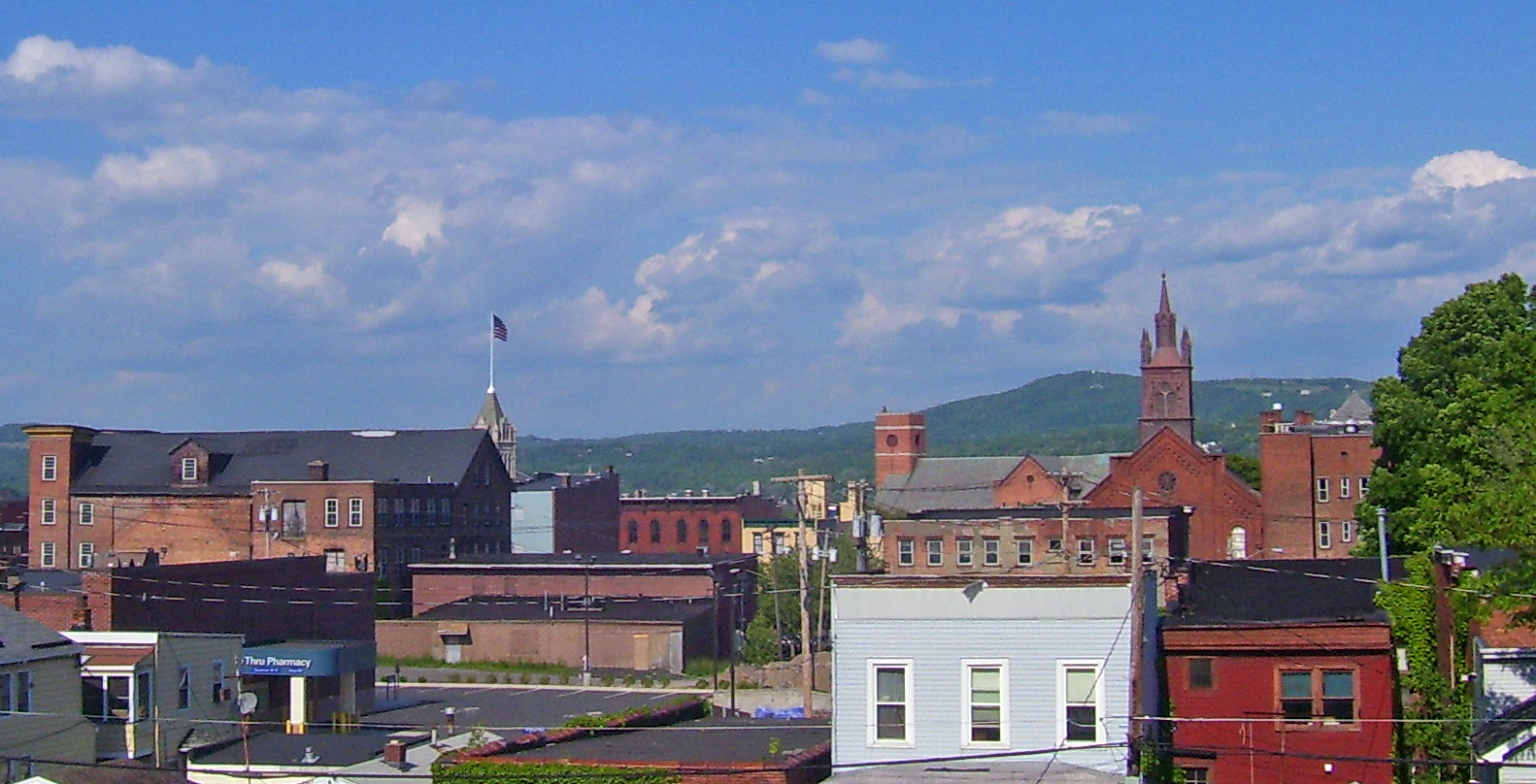
Cohoes City 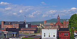 Downtown seen from the west
 Logo
LogoName origin: Dutch adaptation of Mohawk "Ga-ha-oose" for "place of the falling canoe" Motto: A Community That Cares Nickname: Spindle City Country United States State New York Region Capital District County Albany Landmark Cohoes Falls, Harmony Mills River Hudson, Mohawk Center City Hall - elevation 80 ft (24 m) - coordinates 42°46′45″N 73°42′46″W / 42.77917°N 73.71278°W Highest point Elizabeth Court - elevation 310 ft (94 m) - coordinates 42°46′54″N 73°43′40″W / 42.78167°N 73.72778°W Lowest point Hudson River - elevation 10 ft (3 m) Area 4.2 sq mi (11 km2) - land 3.7 sq mi (10 km2) - water 0.5 sq mi (1 km2) Population 16,168 (2010) Density 4,145.8 / sq mi (1,601 / km2) Incorporation as village 1848 Incorporation as city 1869 Government City Hall - location 97 Mohawk Street Cohoes, NY 12047
- coordinates 42°46′28″N 73°41′59″W / 42.77444°N 73.69972°W Mayor John T. McDonald, III (D) - W1: April Kennedy (D)
- W2: Alfred J. Turcotte (D)
- W3: George Primeau (D)
- W4: Dianne Rigney-Nolin (D)
- W5: Roger R. Ceccucci (D)
- W6: Ralph V. Signoracci, IV (D)
Timezone Eastern (EST) (UTC-5) - summer (DST) EDT (UTC-4) ZIP Code 12047 Area code 518 FIPS code 36-16749 GNIS feature ID 0947009 Official newspaper[1] The Record 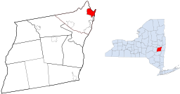 Location of Cohoes within Albany County and the state of New York
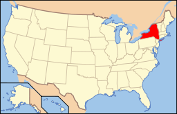 Location of New York in the United States
Wikimedia Commons: Cohoes, New York Statistics: City-data.com Website: City of Cohoes, NY Cohoes (
 /kəˈhoʊs/ kə-hohss) is an incorporated city located at the northeast corner of Albany County in the US state of New York. It is called the "Spindle City" because of the importance of textile production to its growth. As of the 2010 census, the city population was 16,168. The name was believed to have arisen from a Mohawk expression, "Ga-ha-oose", referring to the Cohoes Falls and meaning "Place of the Falling Canoe," an interpretation originated by Horatio Gates Spafford in his 1823 publication "A Gazetteer of the State of New York". Later historians posited that the name is derived from the Algonquian "Cohos," which is a place name based on a word meaning 'pine tree'.[2][3]
Contents
History
The majority of the city was once part of the Manor of Rensselaerswyck, a Dutch colonial feudal system; however the land north of a line crossing the Cohoes Falls (today Manor Avenue) was outside of the Manor and was owned by the Van Olohde family between 1725 and 1750.[4] Rensselaerswyck was established by Killiaen Van Rensselaer, the patroon and a Dutch merchant. In 1632 he had an agent of his pace off an enormous triangle-shaped area around the confluence of the Mohawk and Hudson rivers, from the Peebles Island northwest to the Cohoes Falls and south to today's Watervliet;[5] this area was the core of the future city of Cohoes. Starting in the 1690s the Patroon began to issue leases for the area of Cohoes, though he did reserve for himself a strip below the Cohoes Falls for the future site of mills.[6]
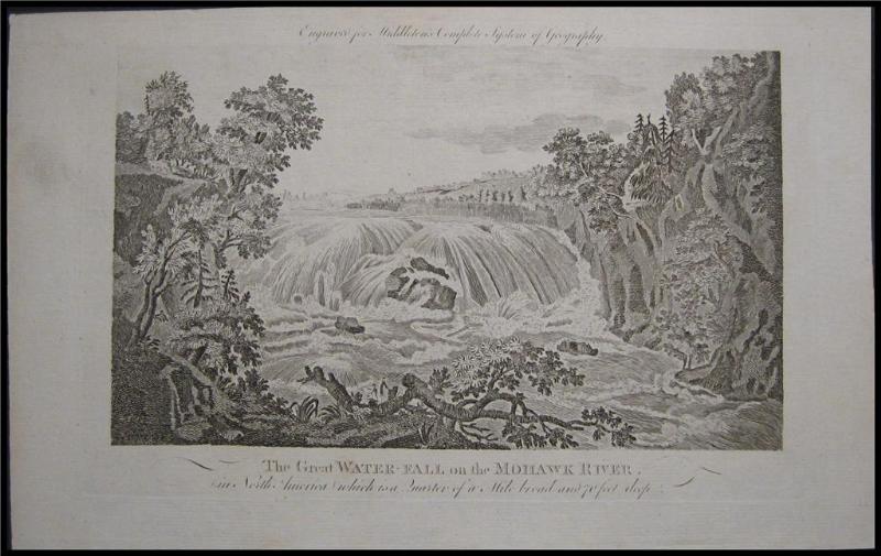
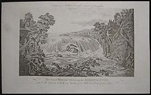 Engraving of the Cohoes Falls in 1778, one of the earliest images of the falls.
Though the area wasn't immediately heavily settled it was well-known for many reasons. The main was geographic, with the Cohoes Falls being the centerpiece. One of the earliest descriptions of the falls was in 1642 by Johannes Megapolensis, the first dominie (Reverend) of Beverwyck. Another early description was in 1656 by Adriaen van der Donck in his Description of New Netherland.[4] In the early-to-mid 17th century a whale had found itself stranded in the Mohawk River on an island just below the Cohoes Falls, it was impossible for the Dutch settlers of the area to remove the carcass and as it rotted the river became slick for three weeks from the rotting carcass and one commented that "the air was infected with its stench... perceptible for two miles to leeward"; around 1646 this island came to be known as Whale Island due to this occurrence.[5]
During the various French and Indian Wars during the mid-18th century Van Schaick Island became the site of a military road that came from Albany north along the islands at the mouth of the Mohawk River. These islands allowed for easier fords across the various mouths of the Mohawk and access to Waterford and points north. The islands would be the site of many military encampments during both the French and Indian Wars and the US Revolutionary War.[7] The Van Schaick Mansion on Van Schaick Island was built in the 1730s and was one of the sites used as a military headquarters by the Americans under General Philip Schuyler and General Horatio Gates.[7] Van Schaick Island was the first part of Cohoes to be settled and farmed, it was formerly known as Cohoes Island and Anthony's Island.[4]
Until the Revolutionary war Cohoes was a small quiet hamlet with isolated farms, after the Revolution things slowly began to pick up and Cohoes was linked to the larger settlements of Lansingburg and Albany. In 1795 at Cohoes the first bridge across the Mohawk River was constructed, it was 900 feet long, 24 feet wide, 15 feet high and sat on 13 stone piers. It cost $12,000 to build and was a toll bridge. This bridge increased the importance of Cohoes as it became one of the main routes north.[4] It was rebuilt in 1806 by the Cohoes Bridge Company and tolls increased.[8] The Erie and Champlain Canals were begun in 1817 and the section in Cohoes finished in 1823, they would impact Cohoes in a every aspect, Cohoes was even known as Juncta because of this. Every farm in Cohoes was crossed by one or both of the canals, and Cohoes was the site of the junction of the two canals.[4] Even with the canals and the bridge bringing easier access to larger markets Cohoes was a sleepy place to be in prior to 1831, the nearest post office was at Waterford and fresh meat and groceries were a luxury hard to come by in Cohoes.[4] A post office in Cohoes was finally built in 1831.[4]
In 1811 the Cohoes Manufacturing Company, owned entirely by men from Lansingburg, was incorporated and began a factory for making screws, this would be the first use of large industry in Cohoes and the harnessing of the Mohawk River and Cohoes Falls for power.[8]
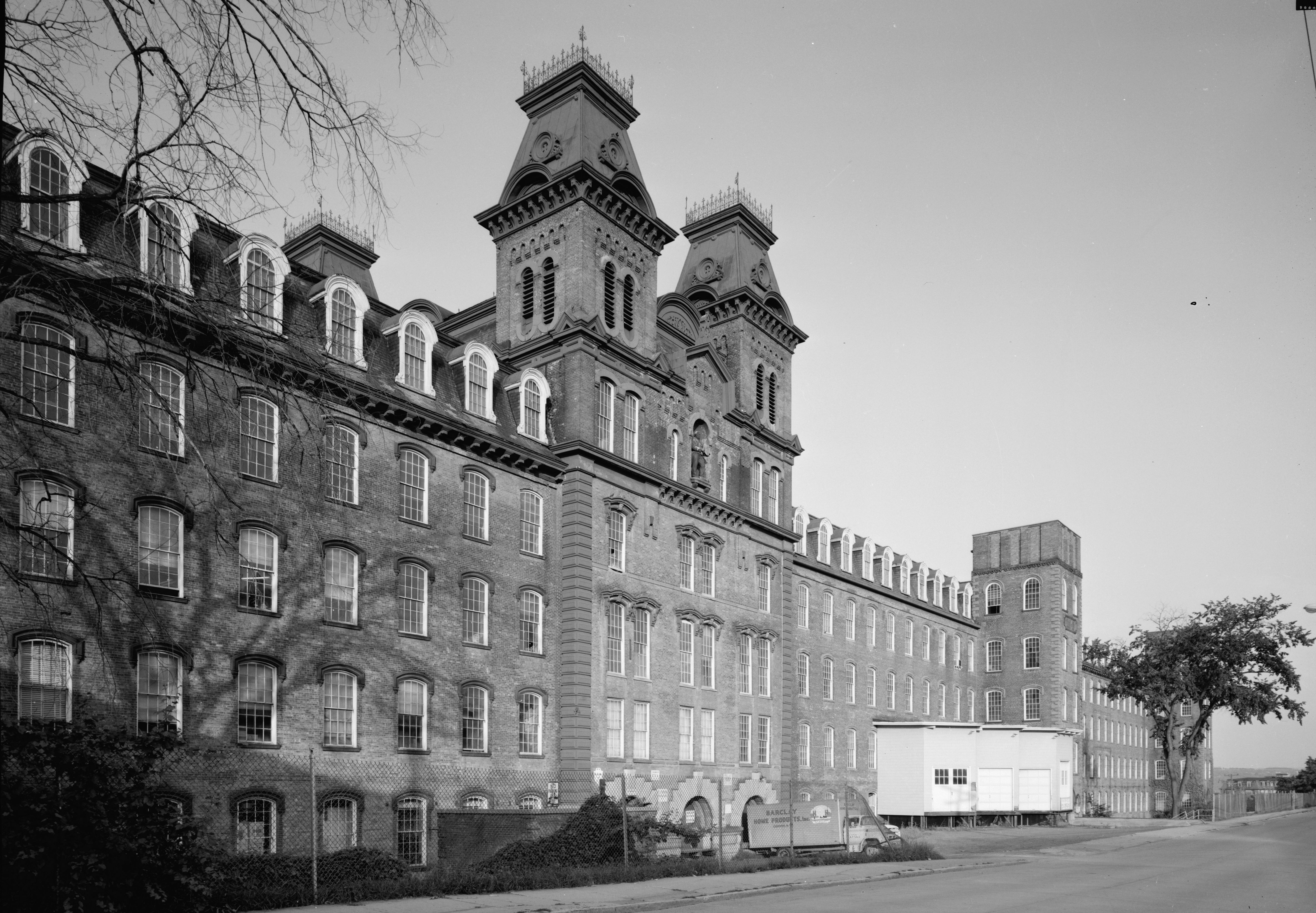
In 1831, a dam was constructed on the Mohawk River above the city's waterfall by the new Cohoes Company, it was soon swept away by ice and a new one was built the following year. Two canals from the dam provided power for industries.[4] Originally ironworks were the main industry calling Cohoes home, in this it was similar to Troy, Menands, and West Troy. Daniel Simmons' Simmons Axe Company was famous throughout the United States and the Cohoes Iron Foundry was a large business enterprise in the 1830s. Cotton however would be the future of Cohoes. It had a small start in the 1820s when the only cotton mill in Albany County was located in Cohoes. Egberts and Bailey was the first factory to use knitting machinery run by power thanks to the Cohoes Company's power canals.[4] This provided power to make the community a leading textile center with the establishment in 1836 of the Harmony Manufacturing Company, later famous as Harmony Mills. Cohoes became a mill town and to an extent a company town. During the 1870s the mills were enormously profitable because of the Erie Canal, which flowed past them at that time. Mill #3, at over 1,000 feet (300 m) long, has been considered the longest continuous textile mill in the country at the time. In 1848, Cohoes was incorporated as a village within the town of Watervliet, and in 1869 chartered as a city.
 Harmony Mill No. 3, in 1969
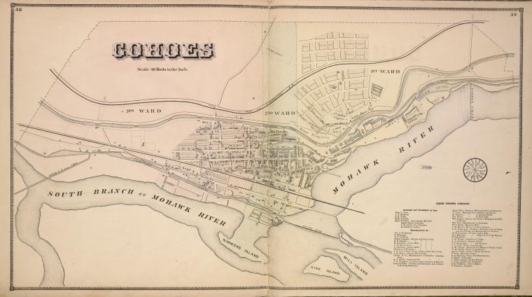
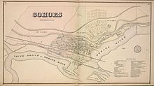 Map of the village of Cohoes in 1866. North is to the right.
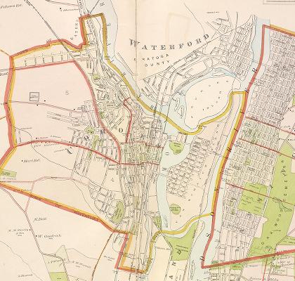
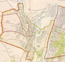 Map of Cohoes in 1891
In 1866, during excavation work for construction of Mill #3 of the Harmony Mills, the bones of a mastodon were unearthed over a period of several weeks. The Cohoes Mastodon skeleton was on display in the lobby of the New York State Museum in Albany, New York, but has recently been moved to a new location away from the windows of the lobby, where temperature and humidity fluxuations risked damaging the skeleton, to a new display near the rear of the museum. A furry replica can be seen at the Cohoes Public Library.
The 19th century saw an influx of immigrants to Cohoes to work in the mills, particularly French Canadians from Quebec, and Irish.
Around the turn of the century, daredevil Bobby Leach practiced going over the Cohoes Falls in a barrel before he performed the same stunt at Niagara. Cohoes residents watched this feat from the lawn or the porch of The Cataract House, the Victorian hotel at the corner of North Mohawk and School Streets, site of the present School Street Power Station.
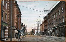 A view down Remsen Street in 1908.
Historic sites
A number of sites in Cohoes are included on the U.S. National Register of Historic Places, including -
- Harmony Mills Historic District
- Downtown Historic District
- Godfrey Farmhouse
- Fonda House
- J. Leonard Lackman House
- William J. Dickey House
- Enlarged Erie Canal Sites Historic District, which includes Lock 18
- Cohoes Music Hall
- Delaware & Hudson Freight House
- Olmstead Street Historic District
- Van Schaick Mansion
Residents of note
Charles H. Adams served as mayor from 1870 to 1872 and as Congressman from 1877 to 1879.
Ron Canestrari served as mayor from 1976–1988 and as Assemblyman from 1988–Present, becoming Majority Leader in 2007.
Renowned author Kurt Vonnegut created a fictional character, the writer Kilgore Trout, who was said to have been a resident of Cohoes.[9]
Geography
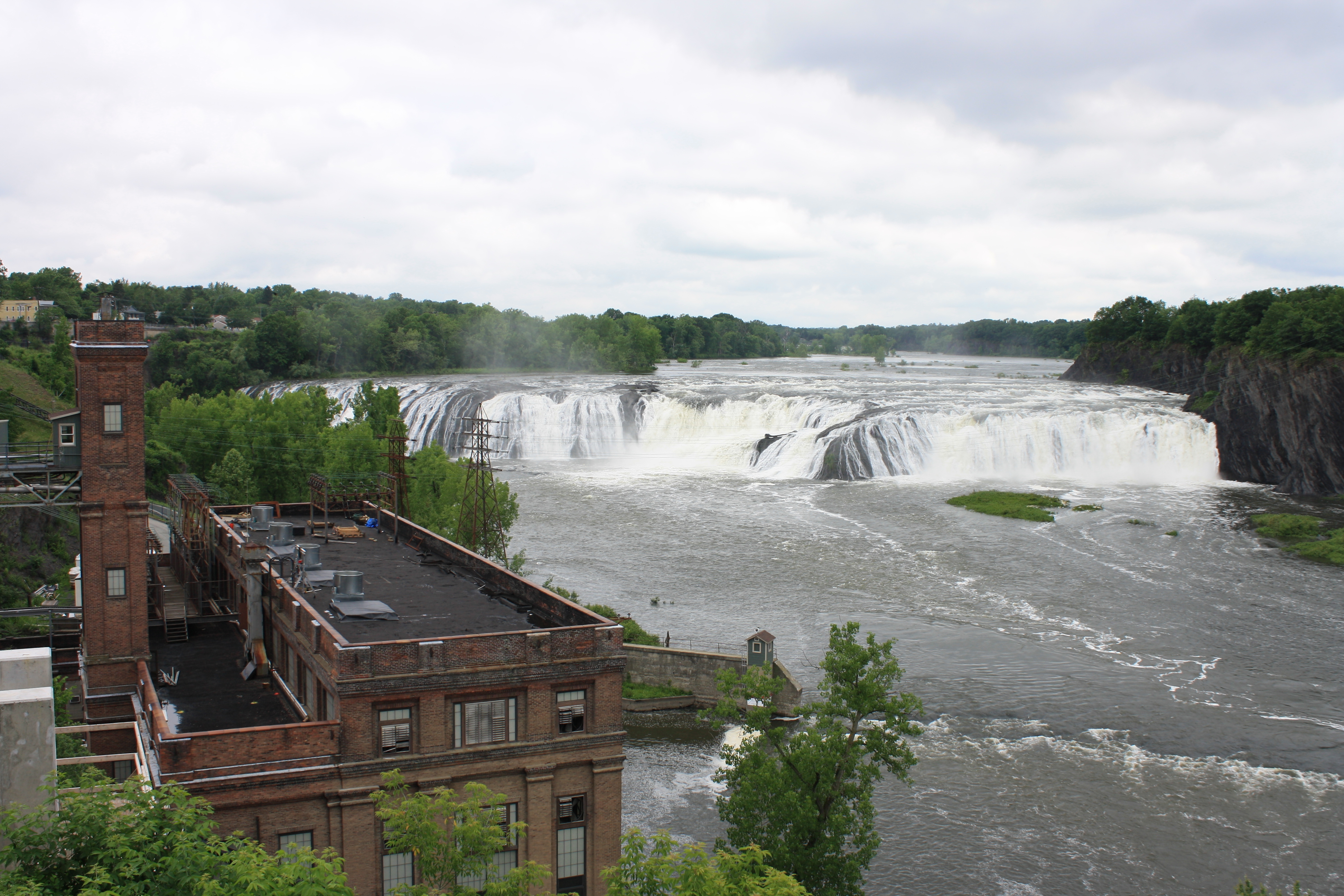
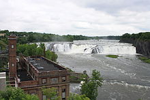 Cohoes Falls seen from Cohoes Falls Park in Cohoes.
Cohoes is located at 42°46′24″N 73°42′11″W / 42.77333°N 73.70306°W (42.773250, -73.703110)[10].
According to the United States Census Bureau, the city has a total area of 4.2 square miles (11 km2), of which, 3.7 square miles (9.6 km2) of it is land and 0.5 square miles (1.3 km2) of it (11.79%) is water.
Cohoes is at the confluence of the Mohawk River and the Hudson River, where the Mohawk forms several channels and islands. Cohoes is named for its most famous landmark, the Cohoes Falls, a majestic waterfall that was discovered by the region's original settlers, the Mohawk Nation. The city includes Van Schaick Island, where the historic Van Schaick Mansion is located, and Simmons Island.
The city borders to the north Saratoga County, and Rensselaer County to the east. Within Albany County the city has the town of Colonie to its northwest, west, and south; with the town and village of Green Island to the south of Van Schaick Island. To the east of Van Schaick Island across the Hudson River is Rensselaer County and the city of Troy's Lansingburg neighborhood. To the north across the Mohawk River is Saratoga County and the town of Waterford's hamlet of Northside. A bridge connects Cohoes to Waterford, and the 112th Street Bridge connects Van Schaick Island to Troy.
Location

Town of Colonie Hamlet of Crescent Station
Mohawk River/Saratoga County Town of Waterford Hamlet of Northside and Peebles Island
Town of Colonie Hamlet of Boght Corners

Hudson River/Rensselaer County City of Troy Neighborhood of Lansingburgh
 City of Cohoes

Town of Colonie Hamlet of Latham
Town/Village of Green Island Town of Colonie Hamlet of Maplewood
Demographics
Cohoes Historical Populations Year Pop. ±% 1850 4,229 — 1860 8,800 +108.1% 1870 15,357 +74.5% 1880 19,416 +26.4% 1890 22,509 +15.9% 1900 23,910 +6.2% 1910 24,709 +3.3% 1920 22,987 −7.0% 1930 23,226 +1.0% 1940 21,955 −5.5% 1950 21,272 −3.1% 1960 20,129 −5.4% 1970 18,653 −7.3% 1980 18,144 −2.7% 1990 16,825 −7.3% 2000 15,521 −7.8% 2010 16,168 +4.2% Note: Cohoes was incorporated in 1848 as a village, therefore the Censuses from 1790 to 1840 are not applicable to Cohoes, which did not exist; incorporated as a city in 1868, 1870 was the first census under current boundaries.
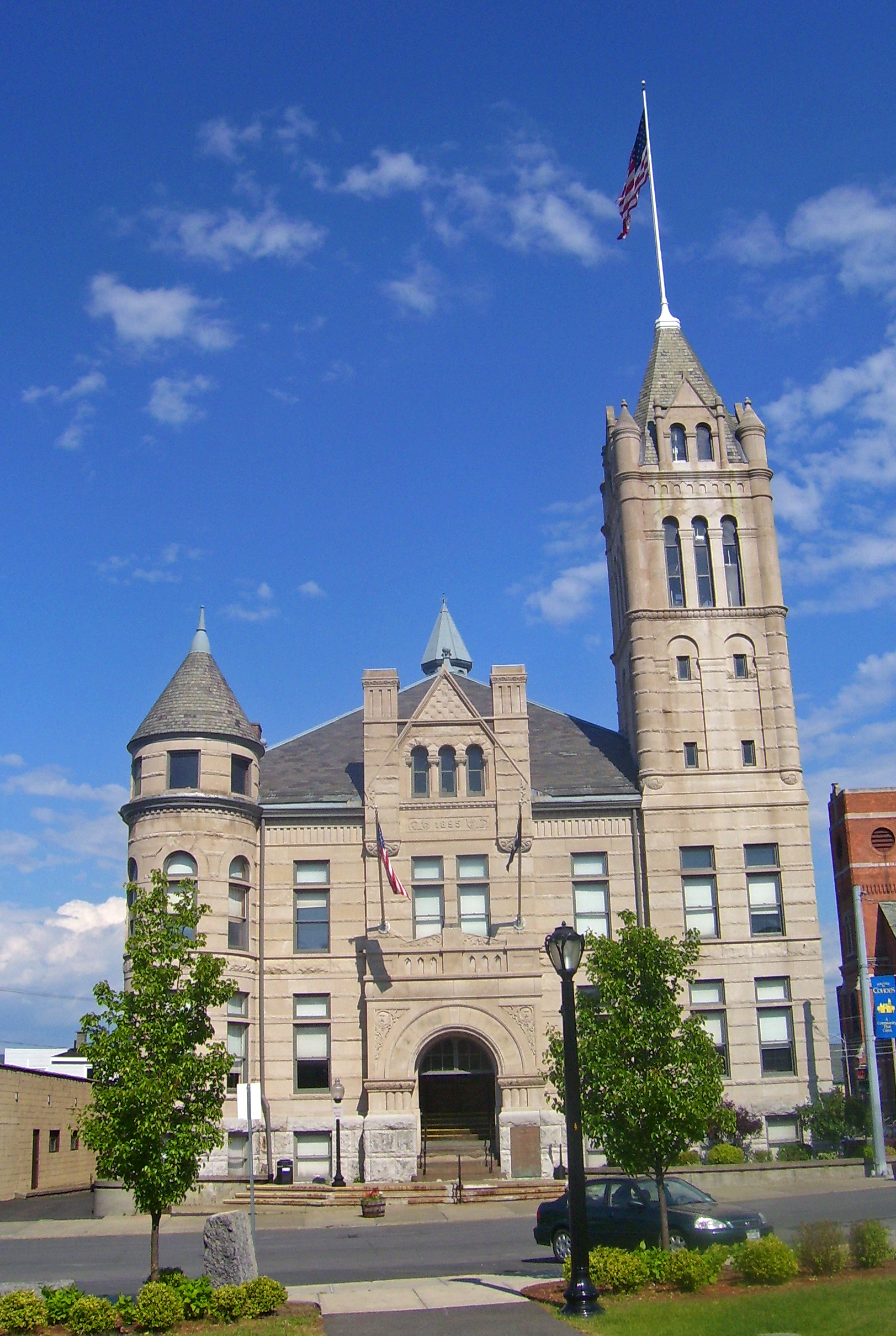
Sources: Censuses 1850-2000[11] City Hall
As of the census[12] of 2000, there were 15,521 people (1,304 fewer than the 1990 census), 6,932 households, and 3,861 families residing in the city. The population density was 4,145.8 people per square mile (1,602.3/km²). There were 7,689 housing units at an average density of 2,053.8 per square mile (793.8/km²). The racial makeup of the city was 95.14% White, 2.16% African American, 0.16% Native American, 0.68% Asian, 0.04% Pacific Islander, 0.59% from other races, and 1.23% from two or more races. Hispanic or Latino of any race were 2.03% of the population.
There were 6,932 households out of which 25.9% had children under the age of 18 living with them, 36.4% were married couples living together, 15.3% had a female householder with no husband present, and 44.3% were non-families. 38.0% of all households were made up of individuals and 15.6% had someone living alone who was 65 years of age or older. The average household size was 2.20 and the average family size was 2.91.
In the city the population was spread out with 22.4% under the age of 18, 8.5% from 18 to 24, 29.3% from 25 to 44, 22.5% from 45 to 64, and 17.3% who were 65 years of age or older. The median age was 38 years. For every 100 females there were 86.1 males. For every 100 females age 18 and over, there were 81.6 males.
The median income for a household in the city was $32,856, and the median income for a family was $42,054. Males had a median income of $31,972 versus $25,845 for females. The per capita income for the city was $18,416. About 11.2% of families and 13.3% of the population were below the poverty line, including 22.9% of those under age 18 and 6.3% of those age 65 or over.
References
- ^ "Common Council Proceedings". City of Cohoes. December 22, 2009. http://www.cohoes.com/Cit-e-Access/towncouncil/index.cfm?tid=34&tpid=6356&mid=13672&view=M&Print=1. Retrieved August 29, 2010.
- ^ Edward M. Rutenber (1906). A Indian Geographical Names. New York State Historical Society. p. 200. http://books.google.com/books?id=i9sTAAAAYAAJ&pg=RA1-PA200&dq=kahoos. Retrieved 2009-11-03., Google Book Search
- ^ Bulletin of the New York State Museum, Aboriginal Place Names of New York. 1907. p. 19. http://books.google.com/books?id=jHcVAAAAYAAJ&pg=PA19#v=onepage&q=&f=false. Retrieved 2009-11-03., Google Book Search
- ^ a b c d e f g h i Masten, Arthur (1877). The History of Cohoes, New York. Joel Munsell. http://www.archive.org/stream/historycohoes00mastrich#page/n13/mode/2up. Retrieved 2010-01-20.
- ^ a b Thomas Phelan and P. Thomas Carroll (2001). Hudson Mohawk Gateway. American Historical Press. p. 14. ISBN 1-892724-17-0.
- ^ Thomas Phelan and P. Thomas Carroll (2001). Hudson Mohawk Gateway. American Historical Press. p. 15. ISBN 1-892724-17-0.
- ^ a b Thomas Phelan and P. Thomas Carroll (2001). Hudson Mohawk Gateway. American Historical Press. p. 17. ISBN 1-892724-17-0.
- ^ a b Thomas Phelan and P. Thomas Carroll (2001). Hudson Mohawk Gateway. American Historical Press. p. 22. ISBN 1-892724-17-0.
- ^ Vonnegut, Kurt. 'Requiem For a Dreamer.' In These Times.
- ^ "US Gazetteer files: 2010, 2000, and 1990". United States Census Bureau. 2011-02-12. http://www.census.gov/geo/www/gazetteer/gazette.html. Retrieved 2011-04-23.
- ^ "Census of Population and Housing". United States Census Bureau. http://www.census.gov/prod/www/abs/decennial/. Retrieved 2010-06-28.
- ^ "American FactFinder". United States Census Bureau. http://factfinder.census.gov. Retrieved 2008-01-31.
External links
- Cohoes official website
- Cohoes Chamber of Commerce
- Van Schaick Mansion
- Picture of Cohoes Falls, updated daily
- Cohoes City Court
Capital District of New York Central communities Albany (History · City Hall · Coat of Arms) · Schenectady (City Hall) · Troy (History) · List of all incorporated places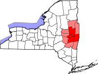
Largest communities
(over 20,000 in 2000)Medium-sized communities
(10,000 to 20,000 in 2000)City of Amsterdam · Brunswick · Cohoes · East Greenbush · Glens Falls · Gloversville · Halfmoon · Malta · North Greenbush · Schodack · Watervliet · WiltonSmall communities
(5,000 to 10,000 in 2000)Town of Amsterdam · Ballston Spa · Cobleskill · Village of Colonie · Duanesburg · City of Johnstown · Town of Johnstown · Kinderhook · Mechanicville · New Scotland · Rensselaer · Sand Lake · Scotia · Town of Stillwater · WaterfordCounties Albany · Columbia · Fulton · Greene · Montgomery · Rensselaer · Saratoga · Schenectady · Schoharie · Warren · WashingtonHistory Mohawks · Mahicans · Fort Orange · Rensselaerswyck · Beverwyck · Albany Plan of Union · Timeline of town creation · Toponymies of places · Tech ValleyGeography Hudson River (Valley) · Mohawk River · Erie Canal · Lake Albany · Lake George · Albany Pine Bush (Rensselaer Lake · Woodlawn Preserve) · Adirondack Mountains · Catskill Mountains · Rensselaer PlateauReligion and culture Culture in New York's Capital District · Sports in New York's Capital District · Episcopal Diocese of Albany · Roman Catholic Diocese of AlbanyEducation Public school districtsList of school districts in New York's Capital DistrictHigher educationNewspapers TV/Radio Broadcast television in the Capital District Local stations WRGB (6.1 CBS, 6.2 This TV) • WTEN (10.1 ABC, 10.2 Weather, 10.3 RTV) • WNYT (13.1 NBC, 13.2 Weather, 13.3 Weather Radar) • WMHT (17.1 PBS, 17.2 ThinkBright, 17.3 HD) • WXXA (23.1 Fox, 23.2 The Cool TV) • WNGN-LP 35 / WNGX-LP 42 (FN) • WCWN (45.1 The CW, 45.2 Uni Sp) • WNYA / WNYA-CD (51.1 MNTV, 51.2 Antenna TV) • W52DF 52 (silent)
Outlying area stations WVBK-CA 2 (RSN' Manchester, VT) • W04AJ 4 (PBS; Glens Falls) • W04BD 4 (PBS; Schoharie) •
WNCE-CA 8 (A1; Glens Falls) • WYBN-CA 14 (RSN; Cobleskill) • WCDC (19.1 ABC; Adams, MA) • WVBG-LP 25 (RSN; Greenwich) • W36AX 36 (PBS / VPT; Manchester, VT) • W47CM 47 (silent; Glens Falls) • WYPX (55.1 Ion, 55.2 qubo, 55.3 Life; Amsterdam) • W53AS 53 (PBS / VPT; Bennington, VT)Adjacent locals Cable-only stations YNN Capital Region • TW3 • YES • SNY • MSG Network
Defunct stations New York State television: Albany/Schenectady • Binghamton • Buffalo • Burlington/Plattsburgh • Elmira • New York City • Rochester • Syracuse • Utica • Watertown
Vermont Broadcast television: Albany/Schenectady • Boston, MA • Burlington/Plattsburgh
Massachusetts television: Albany • Boston • Providence • Springfield
Radio stations in the Albany / Schenectady / Troy market by FM frequency 88.3 · 89.1² · 89.7 · 89.9 · 90.3/93.1² · 90.7/94.9 · 90.7 · 90.7 · 90.9 · 91.1 · 91.5 · 92.3 · 92.9 · 93.5 · 93.7 · 94.5 · 94.7 · 95.5 · 95.9 · 96.3 · 96.7 · 97.3 · 97.5 · 97.7 · 97.9 · 98.3² · 98.5 · 98.5 · 99.1 · 99.5² · 100.3 · 100.9 · 101.3 · 101.7 · 101.9 · 102.3² · 102.7 · 103.1² · 103.5 · 103.9 · 104.5 · 104.9 · 105.7² · 106.1 · 106.5² · 107.1 · 107.7²by AM frequency NOAA Weather Radio frequency 162.550by callsign W226AC · W235AY · W256BU · W291BY · WABY · WAJZ · WAMC (AM) · WAMC-FM² · WBAR · WBPM · WCDB · WCKL · WCKM · WCQL · WCSS · WCTW · WDCD · WDCD-FM · WDDY² · WENT · WEQX · WEXT · WFFG · WFLY · WFNY · WGDJ · WGNA² · WGXC · WGY¹² · WGY-FM² · WHAZ · WHAZ-FM · WHUC · WHVP · WIZR · WJIV · WKBE · WKKF² · WKLI · WLJH · WMHT² · WMYY · WNYQ · WOFX² · WOPG · WPGL · WPYX² · WQAR · WQBJ · WQBK · WQSH² · WRIP · WROW · WRPI · WRUC · WRVE² · WSDE · WTMM · WTRY² · WUAM · WVCR · WVKZ · WVTL · WXL34 · WYAI · WYJB · WYKV · WZCR · WZMRDefunct stations New York Radio Markets: Albany-Schenectady-Troy • Binghamton • Buffalo-Niagara Falls • Elmira-Corning • Hamptons-Riverhead • Ithaca • Nassau-Suffolk (Long Island) • New York City • Newburgh-Middletown (Mid Hudson Valley) • Olean • Plattsburgh • Poughkeepsie • Rochester • Syracuse • Utica-Rome • Watertown
Other New York Radio Regions: Jamestown-Dunkirk • North Country • Saratoga
See also: List of radio stations in New YorkMunicipalities and communities of Albany County, New York Cities Albany | Cohoes | Watervliet

Towns Berne | Bethlehem | Coeymans | Colonie | Green Island | Guilderland | Knox | New Scotland | Rensselaerville | Westerlo
Villages Altamont | Colonie | Green Island | Menands | Ravena | Voorheesville
CDPs Other
hamletsAlcove | Boght Corners | Clarksville | Crescent Station | Dunsbach Ferry | Elsmere | Feura Bush | Fort Hunter | Fullers | Glenmont | Guilderland | Guilderland Center | Karner | Latham | Lisha Kill | Loudonville | Mannsville | McKownville | New Salem | Newtonville | Normansville | Roessleville | Selkirk | Slingerlands | South Bethlehem | Verdoy | West Albany
Categories:- Cohoes, New York
- Cities in New York
- Early American industrial centers
- Company towns in New York
- Populated places in Albany County, New York


Wikimedia Foundation. 2010.