- New York State Route 9R
-
NYS Route 9R
Route information Auxiliary route of US 9 Maintained by NYSDOT Length: 3.22 mi[3] (5.18 km) Existed: ca. 1939[1][2] – present Major junctions South end: 

 I-87 / US 9 / NY 7 in Colonie
North end: US 9 in ColonieLocation Counties: Albany Highway system Numbered highways in New York
Interstate • U.S. • N.Y. (former) • Reference • County←  NY 9P
NY 9PUS 9W  →
→New York State Route 9R (NY 9R) is a north–south state highway in northeastern Albany County, New York, in the United States. The route is a 3.22-mile (5.18 km) eastern loop of U.S. Route 9 (US 9), connecting that route to the city of Cohoes 1.5 miles (2.4 km) to the east. It leaves US 9 in the hamlet of Latham and rejoins its parent in the hamlet of Boght Corners, both located in the town of Colonie. Most of NY 9R is a two-lane highway that passes through residential areas; however, the southwesternmost portion of the route is four lanes wide and serves a commercial district. The route was assigned ca. 1939 and has remained largely unchanged since that time, save for a brief period during the 1970s where NY 9R was partially replaced by NY 470.
Contents
Route description
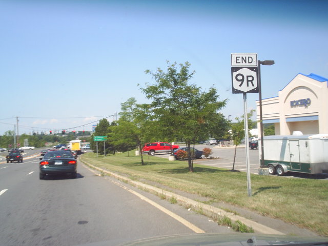
 Southern terminus of NY 9R
NY 9R begins opposite the entrance to the on-ramp for Interstate 87 (I-87) exit 7 at an intersection with US 9 (Loudon Road) in the Colonie hamlet of Latham, located north of the city of Albany. The junction is also the termination of the off-ramp from the limited-access NY 7 west onto US 9. NY 9R heads east as the four-lane Columbia Street Extension, initially passing through a commercialized area centered around the route's intersections with US 9 and the nearby Old Loudon Road. The commercial strip ends at Johnson Road, where the route turns northeastward and narrows to two lanes as it heads into a lightly populated area of Colonie. This section of Columbia Street Extension passes by some commercial buildings; however, most of the development along the highway is residential, with most of the homes located in cul-de-sacs leading away from NY 9R.[4][5]
Roughly 0.5 miles (0.8 km) west of an intersection with NY 470 on the western edge of the city of Cohoes, the area surrounding the highway changes drastically as the route becomes lined with residential dwellings. The string of homes continue to the junction with NY 470 on the Cohoes city line, where NY 9R turns north onto Baker Avenue, a two-lane street that runs along the border between the town of Colonie and the city of Cohoes. Columbia Street, meanwhile, continues east into downtown Cohoes as NY 470, which begins at NY 9R. Heading north, NY 9R passes through both residential neighborhoods and lightly populated areas. The homes along the Colonie (west) side of the route give way to woods after just 0.3 miles (0.5 km); however, the Cohoes (east) side remains lined with fully populated and developed neighborhoods for another 0.7 miles (1.1 km).[4]
The 1-mile (1.6 km) north–south stretch ends at a junction with Boght Road, known as Manor Avenue within Cohoes. Both highways sit on the northern boundary of what was once the Manor of Rensselaerswyck. NY 9R turns left at this intersection, leaving the city boundary and proceeding westward along Boght Road. The complexion of the roadway is similar to that of the first 0.3 miles of Baker Avenue, as the two-lane road is lined with a steady stream of houses. After 0.75 miles (1.21 km), NY 9R enters a lightly populated hamlet named Boght Corners, where it ends at an intersection with US 9. While the state route ends here,[4] Boght Road continues westward as a town road to Dunsbach Ferry Road, a north–south town highway paralleling I-87 through northern Colonie.[5]
History
NY 9R was assigned ca. 1939 to most of its current alignment. Originally, the southern half of the route followed Johnson Road and St. Agnes Highway through Colonie;[1][2] however, it was realigned in the early 1940s to follow an extension of Columbia Street between US 9 and the Cohoes city line.[6][7] In the mid-1970s, NY 9R was removed and partially replaced with the new NY 470, an east–west route extending from the current southern terminus of NY 9R east through Cohoes to Troy.[8][9] The NY 9R designation was reinstated in the late 1970s, resulting in the truncation of NY 470 to its present length.[9][10]
Major intersections
The entire route is in Albany County.
Location Mile[3] Destinations Notes Colonie 0.00 I-87 / NY 7 / US 9Cohoes 1.54  NY 470
Western terminus of NY 470 Colonie 3.22 US 91.000 mi = 1.609 km; 1.000 km = 0.621 mi References
- ^ a b Esso (1938). New York Road Map for 1938 (Map). Cartography by General Drafting.
- ^ a b Standard Oil Company (1939). New York (Map). Cartography by General Drafting.
- ^ a b "2008 Traffic Volume Report for New York State" (PDF). New York State Department of Transportation. June 16, 2009. p. 30. https://www.nysdot.gov/divisions/engineering/technical-services/hds-respository/NYSDOT%20TVR%202008%20by%20Route.pdf. Retrieved January 31, 2010.
- ^ a b c Yahoo! Inc. Yahoo! Maps – overview map of NY 9R (Map). Cartography by NAVTEQ. http://maps.yahoo.com/#mvt=h&lat=42.773655&lon=-73.74238&zoom=15&q1=42.762613%2C-73.755843&q2=42.771718%2C-73.728935&q3=42.783247%2C-73.744385. Retrieved February 17, 2011.
- ^ a b Town of Colonie (January 2007) (PDF). Town of Colonie Street Map (Map). http://www.colonie.org/Town%20Maps/street%20map_withindex.pdf. Retrieved February 17, 2011.
- ^ Esso (1940). New York (Map). Cartography by General Drafting.
- ^ Esso (1942). New York with Pictorial Guide (Map). Cartography by General Drafting.
- ^ Gulf Oil Company (1974). New York and New Jersey Tourgide Map (Map). Cartography by Rand McNally and Company.
- ^ a b Exxon (1977). New York (Map). Cartography by General Drafting (1977–78 ed.).
- ^ Exxon (1979). New York (Map). Cartography by General Drafting.
External links
Categories:- State highways in New York
- U.S. Route 9
- Transportation in Albany County, New York

Wikimedia Foundation. 2010.