- Interstate 87
-
Interstate 87

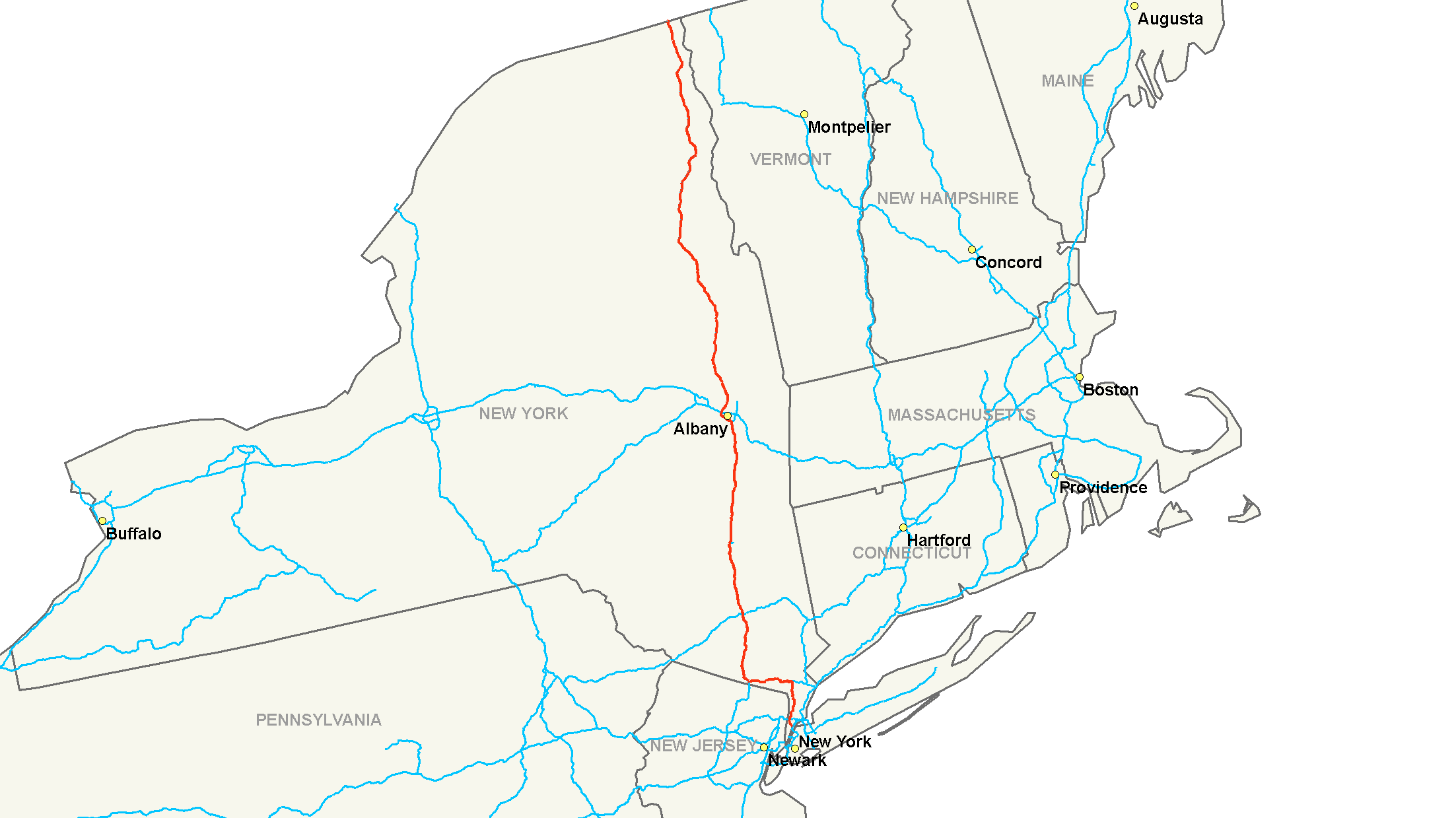
Map of the northeastern United States with I-87 highlighted in redRoute information Maintained by NYSTA and NYSDOT Length: 333.49 mi[2] (536.70 km) Existed: August 14, 1957[1] – present Major junctions South end:  I-278 in The Bronx
 I-95 in The Bronx
 I-287 in Elmsford / Hillburn
 Palisades Parkway in Nanuet
 G.S. Pkwy. in Chestnut Ridge
 NY 17 near Harriman
 I-84 near Newburgh
 I-90 in Albany
 US 11 near Champlain
North end:  A-15 at the Canadian-American border in Champlain (town), New York
Highway system Main route of the Interstate Highway System
Main • Auxiliary • BusinessNumbered highways in New York
Interstate • U.S. • N.Y. (former) • Reference • County←  NY 86
NY 86I-88  →
→Interstate 87 (I-87) is a 333.49-mile (536.70 km) Interstate Highway located entirely within New York State in the United States of America. I-87 is the longest intrastate Interstate highway in the Interstate Highway System. Its southern end is at the Bronx approaches of the (Triboro) Robert F. Kennedy Bridge in New York City. Its northern end is at the Canada – United States border in Champlain (town), New York, where it continues into Quebec as Autoroute 15, which connects it to the City of Montreal. I-87 connects with Interstate 95 in New York City; New York State Route 17 (NY 17); future I-86) near Harriman; Interstate 84 near Newburgh; and Interstate 90 in Albany. The portion of I-87 between the New York City line and Albany is part of the New York State Thruway. North of Albany, I-87 is nicknamed the Adirondack Northway.
Contents
Route description
Major Deegan Expressway
Main article: Major Deegan ExpresswayInterstate 87 begins at an intersection with the Bruckner Expressway (I-278) at the Robert F. Kennedy Bridge. For the next 8.4 miles (13.5 km), Interstate 87 is named the Major William Francis Deegan Expressway as it travels through The Bronx. The first exit along the Major Deegan northbound is for Willis Avenue and the nearby Third Avenue Bridge. There is an exit before this going southbound, for Brook Avenue. At 1.20 miles (1.93 km), Grand Concourse interchanges at Exit 3. East 149th Street is the next exit, which heads into the heart of The Bronx. Exit 5, which is signed for East 161st Street, actually lets off at Jerome Avenue, near Yankee Stadium. Exit 6 is only accessible via Exit 5 (going northbound) and is for East 153rd Street. Exit 7 is for the Cross Bronx Expressway and Trans-Manhattan Expressway, both of which are signed as I - 95 and U.S. Highway 1. Exit 8 is for West 179th Street, which becomes Burnside Avenue soon thereafter. Exit 9 runs parallel with Major Deegan for ending at West Fordham Road.
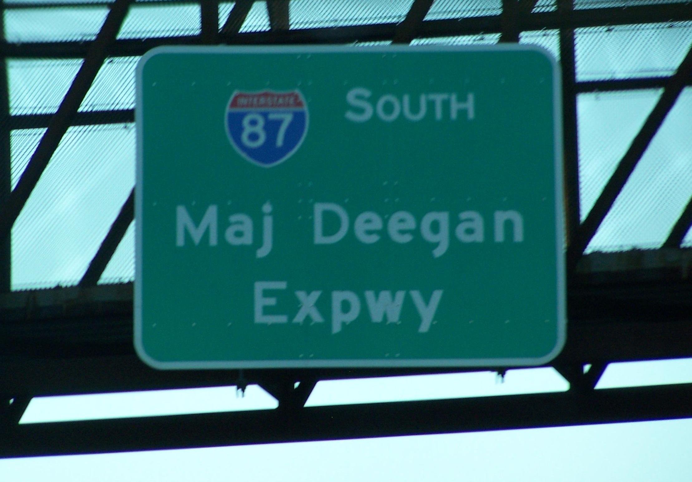
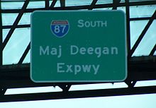 Signage for the Major Deegan Expressway
U.S. Route 9 now runs parallel with Major Deegan, which is accessible via Exit 10 for West 230th Street. Interstate 87 next enters Van Cortlandt Park and has an interchange with Van Cortlandt Park South at Exit 11. Exit 12 is for the Henry Hudson Parkway and Saw Mill River Parkway, both of which are accessible by the Mosholu Parkway. Exit 13 is for East 233rd Street and Jerome Avenue. Exit 14 is at the northern end of Van Cortlandt Park, is for McLean Ave. The Major Deegan Expressway crosses into Westchester County at Yonkers and becomes the New York State Thruway, a 496-mile (798 km), state-wide toll highway.
New York State Thruway
Main article: New York State ThruwayThe section of highway between the New York City line and the junction with Interstate 90 at Albany is part of the New York State Thruway. Interstate 87 enters Westchester at Yonkers. The first exit going northbound is for Hall Place, while going southbound it is for Hall Place and McLean Avenue. (McLean Avenue is Exit 14 going northbound on the Major Deegan. There is no southbound Exit 14.) The Yonkers Avenue interchange is at 9.80 miles (15.77 km). Present just off Exit 2 is Yonkers Raceway. Exit 3 is for Mile Square Road, which interchanges just before the Cross County Shopping Center. Exit 4 is for the Cross County Parkway, which interchanges just after the shopping center. Exit 5 follows a frontage road, which heads for New York State Route 100 and the Sprain Brook Parkway. Soon after, Tuckahoe Road interchanges just before leaving Yonkers. Exit 6A is for Stew Leonard Drive, which is just a road for Sprain Ridge Park.
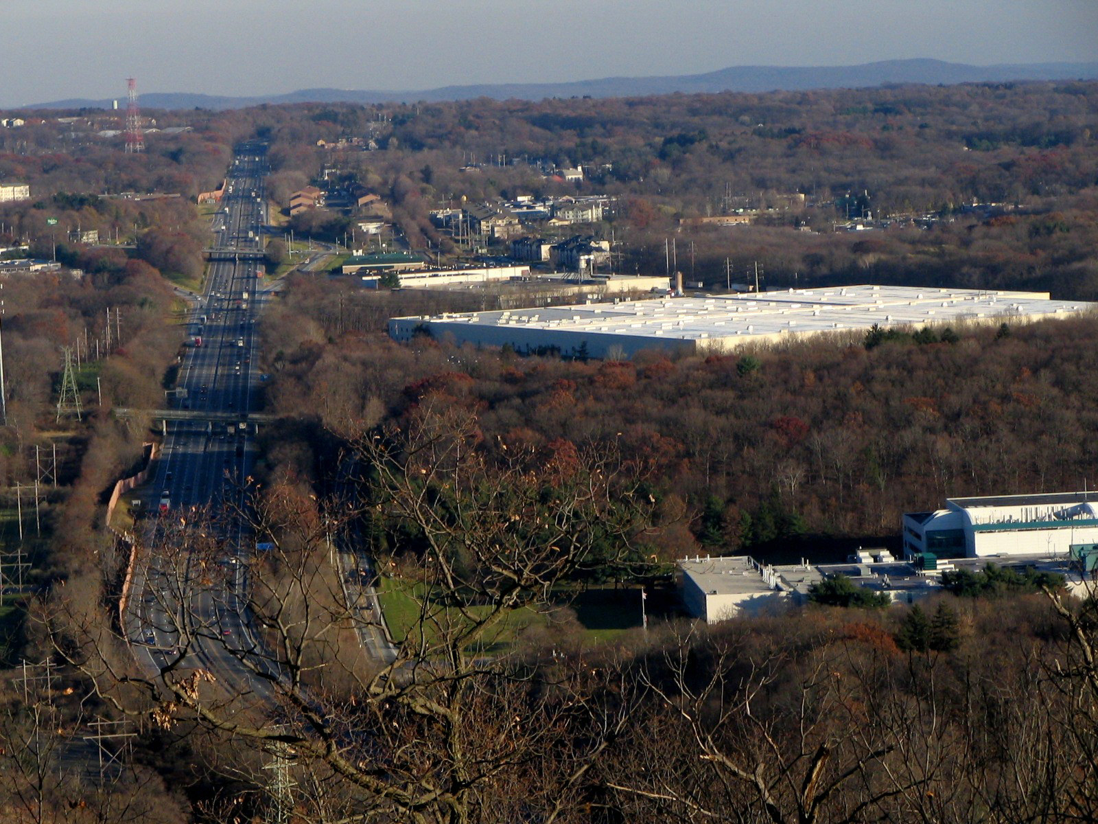
 Looking east along I - 87 toward the Tappan Zee Bridge from Nordkop Mountain in Suffern
As Interstate 87 heads northward, New York State Route 9A begins to run parallel with it, having an interchange at Exit 7. The Saw Mill River Parkway also runs parallel, intersecting at Exit 7A. Before Exit 8, the Ardsley Service Area is accessible northbound. Exit 8 is for Interstate 287, beginning a concurrency for the next 19 miles (31 km). The exit is also the access for the Cross-Westchester Expressway. Exit 9 is the final exit before the Tappan Zee Bridge. The exit is for New York State Route 119 and the nearby U.S. Highway 9. All trucks with Class A and Class B explosives must leave at Exit 9. Interstates 287 and 87 cross the Tappan Zee and enter Rockland County.
Interstate 87 begins a 25-mile (40 km) stretch in Rockland County. Exit 10 is the first exit after the Tappan Zee and is for U.S. Route 9W in Nyack. Exit 11 is in downtown Nyack, for Highway 9W going northbound and New York State Route 59 going southbound. 87 then passes the Mountainview Nature County Park as it reaches Exit 12, which is located in the outskirts of Nyack. Exit 12 is a folded-diamond interchange for New York State Route 303 and the Palisades Center Mall. The first highway in 9.63 miles (15.50 km) interchanges at Exit 13, the Palisades Interstate Parkway.
 Exit 21 sign in Cairo
The road has three current spur routes: Interstate 287 connects with its parent in a 19-mile (31 km) long concurrency near the southern end of the highway, with I - 87 signed as north - south, and I - 287 signed as east – west. This is a bypass around New York City. West of the concurrency at Exit 15, it loops around New York to meet the New Jersey Turnpike in Middlesex County, New Jersey. East of the concurrency, I - 287 continues as the Cross Westchester Expressway to end at Interstate 95 (the New England Thruway) in Rye, New York, near the Connecticut border. Note that I - 287 leaves New York state, while its parent does not, making I - 287 one of only a few three-digit Interstate Highways that goes through more states than does its parent. Moving north, Interstate 587 is less than two miles (3.2 km) long. It is unusual in that it has no interchanges along its length, and its eastern terminus is at a traffic light, while its western terminus is at a roundabout (where it connects with Interstate 87). Because there is no direct exit from I - 87 into Albany, the 15-kilometer-long Interstate 787 carries traffic to and from the Thruway and the capital city.
Adirondack Northway
North of Albany, Interstate 87 is named the Adirondack Northway (or simply the "Northway"), and it continues all the way to the Canadian–American border at Champlain, New York. I - 87 joins the Northway at Exit 1. However, the Northway begins 0.86 miles (1.38 km) south of the interchange with I - 87 and I -90 at U.S. Highway 20 in Guilderland, NY. This short expressway spur, known locally as Fuller Road Alternate,[2] is designated as NY 910F, an unsigned reference route, by the New York State Department of Transportation.[2]
Between Exit 1 (where I - 87 begins on the Northway) and Exit 22 (at Lake George, New York) I - 87 is a six-lane freeway with three lanes in each direction.
There is no Exit 3, since this number was reserved for an interchange with Interstate 687, which has never been built. Planning is underway to relieve congestion at Exit 4 and provide better access to the Albany International Airport. Several of the proposed alternatives add a new Exit 3.
Between Exits 2 and 5, I - 87 runs parallel to Wolf Road, a business thoroughfare through the town of Colonie. The northbound exit ramp 2E ends at the intersection of New York Route 5 (Central Avenue) and Wolf Road. Wolf Road is east of the expressway to Exit 4 (County Route 151, Albany Shaker Road) southeast of the Albany International Airport. The remainder of Wolf Road runs along the west side of I - 87 from Albany Shaker Road to Watervliet Shaker Road a short distance to the west of Exit 5. Wolf Road serves as a main access point for Colonie Center, one of the Capital District's largest enclosed shopping malls, from I - 87.
The southern portion of the Northway through Colonie and Saratoga County is now a heavily-traveled commuter route. Since the highway's construction, Saratoga County has become the fastest growing area of the Capital District, and indeed all of upstate New York.[3]
In Lake George, I - 87 connects with U.S. Highway 9 and New York State Route 9N at Exit 22 by way of a short two-lane highway known infrequently as the Lake George Connector. It is here where the first signs of Quebec Autoroute 15 are posted as motorists head north towards Canada. From here the Northway becomes four lanes all the way to the Canadian border[citation needed] (with the highway, both north and south slightly becoming six lanes once again just before the customs).[citation needed]
At milepost 100 on southbound I - 87, there is a United States Customs border patrol station. This was added after the 2001 terrorist attacks.
In Clinton County, exit signs from Exit 34 to 43 are bilingual in English and French because of its proximity to Quebec. Also, signs for Quebec Autoroute 15 are posted on I - 87 North as the Northway approaches the Canadian border.
History
See also: Major Deegan Expressway and New York State ThruwayThe designation Interstate 87 was assigned on August 14, 1957, as part of the establishment of the Interstate Highway System.[1] The highway initially utilized the pre-existing New York State Thruway from Albany to Newburgh and in lower Westchester County, and the Major Deegan Expressway in New York City. From Newburgh to the Elmsford area, I - 87 was to follow a new highway running parallel to U.S. Highway 9 northward along the eastern bank of the Hudson River to Fishkill. I - 87 would then have followed the proposed I - 84 across the Hudson to rejoin the Thruway outside of Newburgh. Meanwhile, all of the Adirondack Northway, the portion of I - 87 slated to extend from Albany north to the Canadian–American border, had yet to be built.[4][5]
Adirondack Northway
 Map of NY 912Q, once part of I-87
The Northway was built in segments, which became I - 87 as they were completed and linked to the pre-existing route. Construction began in the late 1950s on the portion of the Northway between the Thruway and New York State Route 7 near Latham.[6] This segment was open to traffic by 1960, by which time work had begun on two additional segments from Latham to Malta (at New York State Route 67) and from U.S. Highway 9 in northern Saratoga County to U.S. 9 and New York State Route 149 midway between Glens Falls and Lake George village.[5] The expressway was completed between Latham and Clifton Park (New York State Route 146) and from U.S. 9 south of Glens Falls to the Hudson River ca. 1961.[7] Work on the Latham–Malta and US 9 – NY 149 segments concluded ca. 1962.[8] Construction on the portion of highway between the two segments began about 1962 and was completed by 1964. During this same period, another extension brought the northern terminus of the Northway to New York State Route 9N south of Lake George village.[7][8][9]
By 1966, the Northway was completed from Albany north to Lake George and from the Canadian border south to Keeseville. At the time, I - 87 curved around the outskirts of Lake George to end at N.Y. 9N north of the village[10] on a highway built ca. 1964.[11] The last section of the Northway to be built—a 30-mile (48 km) stretch between Underwood (exit 30) and Keeseville (exit 34)—was completed in spring 1968.[citation needed] I - 87 was reconfigured slightly near Lake George as a result: instead of heading east to N.Y. 9N, it continued north on a parallel routing to U.S. 9.[12] I - 87's former routing to N.Y. 9N, known infrequently today as the Lake George Connector, is now N.Y. 912Q, an unsigned reference route 0.66 miles (1.06 km) in length. N.Y. 912Q has one intermediate interchange with U.S. 9.[2] The completion of I - 87 linked New York City with Montreal by way of a direct, limited-access highway (with I - 87 becoming Autoroute 15 at the Canadian border).[citation needed]
Parade Magazine designated the Northway as America's Most Scenic Highway in 1967.[citation needed] In 2007, the New York State Department of Transportation (NYSDOT) ceremonially designated the entire 176-mile (283 km) Northway as the Adirondack Veterans' Memorial Highway.[citation needed]
A long stretch of the Northway through the Adirondack Park had been an unserved zone for cellular telephone service. In 2007, a driver crashed off the road was unable to summon help, prompting messages from local governments to telephone companies to add new wireless towers to address the problem, and also for warning signs to inform travelers of the so-called "dark zone".[13] Throughout this area, roadside emergency call boxes are located approximately every two miles on both sides of the roadway. These boxes use a two-way UHF radio network to connect directly to New York State Police dispatchers. The first of 13 new cellular phone towers along I - 87 was installed in October 2008. A second cellular phone tower was completed just one month later.[14]
Fuller Road Alternate, the lone portion of the Adirondack Northway not part of I - 87, was originally intended to be part of the Southern Albany Expressway, a proposed highway which would have connected the Northway with Interstate 787 and run parallel to the New York State Thruway between Exits 23 and 24.[15]
Lower Hudson Valley
By 1962, the plan to build I - 87 along the proposed Hudson River Expressway had been scrapped. Instead, I - 87 was then proposed to begin in Port Chester and follow a new routing through Purchase, Armonk, and Katonah to Brewster, where it would join I - 84.[16] The routing was modified slightly by 1968: I - 87 still began in New York City, then overlapped with Interstate 287 east to Purchase. From there, I - 87 headed north along the now-open expressway to Armonk, where it ended at New York State Route 22. Another portion of the highway, from Goldens Bridge (New York State Route 138) to Brewster, was open as well while the part from Armonk to Katonah was under construction.[12] This segment, as well as the part from Katonah to Goldens Bridge, was completed by 1971.[17]
On January 1, 1970, I - 87 was rerouted between Elmsford and Newburgh to follow the mainline of the Thruway instead. The former routing of I - 87 between Purchase and Brewster was then redesignated as Interstate 684.[18]
Other developments
Exit 6 on the Adirondack Northway was originally a diamond interchange.[19] Construction to convert the junction into a single-point urban interchange began in mid-2008[20] and was completed on September 12, 2010.[21] The total cost of the project was $41.9 million.[20]
Future
A project is in the early stages of design to improve access to the Albany International Airport, either by constructing a new Exit 3, or by reconfiguring Exit 4. As of January 2010, the project is expected to be completed in late 2015.[22]
Exit list
South of Albany
See Major Deegan Expressway for exits in New York City and New York State Thruway for exits between New York City and Albany.
Northway
This exit list includes the segment of the Northway designated as NY 910F. Note that mile markers begin from where I - 87 leaves the Thruway, and not the mileage from the highway's beginning in New York City.
County Location Mile[2] Exit Destinations Notes Albany County Guilderland 0.00  US 20 (Western Avenue) – Albany, Duanesburg
At-grade intersection with a single lane flyover ramp serving eastbound to northbound traffic Albany 0.49 Crossgates Mall Road Southbound exit and northbound entrance 0.86
0.001E-W  I-87 south / I-90 – Buffalo, Boston
To New York State Thruway; southbound I - 87 follows westbound I - 90 Village of Colonie 1.39 2W-E  NY 5 (Central Avenue) – Albany, Schenectady
Town of Colonie 3.30 4  NY 155 west (Albany-Shaker Road)
Serves Albany International Airport 4.27 5 NY 155 east (Watervliet-Shaker Road)5.53 6 
 NY 7 west / NY 2 (Troy-Schenectady Road) – Schenectady, Watervliet
NY 7 joins northbound and leaves southbound 6.12 7 NY 7 east – Troy, CohoesNY 7 leaves northbound and joins southbound Saratoga County Halfmoon/Clifton Park
town line10.33 8 Crescent Road (CR 92) / Vischers Ferry Road (CR 90) CR 92 becomes CR 90 at the junction Clifton Park 11.76 8A Grooms Road (CR 91) 13.30 9  NY 146 – Clifton Park, Mechanicville, Halfmoon
Signed as exits 9W (west) and 9E (east) southbound 16.22 10 Ushers Road — Jonesville, Ballston Lake Malta / Round Lake
town line18.79 11 Curry Avenue / Round Lake Road (CR 80) CR 80 terminates here, only Round Lake is designated as such Malta 21.05 12  NY 67 (Dunning Street) – Ballston Spa, Malta
Roundabouts at tops of ramps replaced signals in 2006 24.81 13N-S  US 9 – Saratoga Springs, Ballston Spa, Malta
Saratoga Springs 28.86 14  NY 9P – Saratoga Springs, Schuylerville
Parclo hybrid, Saratoga Race Course 30.67 15  NY 50 – Saratoga Springs, Gansevoort
Wilton 36.15 16 Ballard Road (CR 33) - Wilton Moreau 40.94 17N-S US 9 – South Glens Falls, Moreau Lake State ParkWarren Queensbury 45.49 18 Glens Falls, Corinth 47.83 19  NY 254 (Aviation Road) – Glens Falls, Queensbury
50.11 20  NY 149 – Fort Ann, Whitehall
Southern extent of Adirondack Park Town of Lake George 53.31 21  NY 9N – Lake Luzerne, Lake George
55.35 22 To US 9 to NY 9N – Lake Luzerne, Lake George59.79 23 Warrensburg and Diamond Point Road Town of Warrensburg 68.21 24 Bolton Landing and Riverbank Road Chester 73.58 25  NY 8 – Chestertown, Hague, Brant Lake
78.12 26 US 9 – Pottersville, MinervaEssex Schroon 82.36 27 US 9 – Schroon Lake89.07 28  NY 74 – Ticonderoga, Crown Point
North Hudson 95.01 29 Newcomb and Boreas Road/Blue Ridge Road 104.85 30  US 9 to NY 73 – Lake Placid, Keene
Westport 117.99 31 NY 9N – Elizabethtown, WestportLewis 123.75 32 Stowersville Road — Lewis, Willsboro Chesterfield 135.43 33  US 9 / NY 22 – Keeseville, Willsboro
Clinton Au Sable 139.22 34 NY 9N – Keeseville, Au Sable ForksNorthern extent of Adirondack Park Peru 144.97 35  NY 442 (Bear Swamp Road) – Peru, Valcour, Port Kent
Town of Plattsburgh 150.58 36 NY 22 Plattsburgh International Airport153.51 37  NY 3 (Cornelia Street) – Plattsburgh, Saranac Lake
155.31 38S-N  NY 22 / NY 374 – Plattsburgh, Dannemora, Tupper Lake
156.87 39  NY 314 / Moffitt Road – Cumberland Head, Plattsburgh Bay
Signed as exits 39N (north) and 39E (east) southbound Beekmantown 160.64 40  NY 456 – Beekmantown, Point au Roche
Chazy 168.26 41  NY 191 – Sciota, Chazy
Town of Champlain 174.75 42 US 11 – Mooers, Rouses Point176.02 43 US 9 – Champlain176.70 Canadian-American border. I - 87 continues north as Quebec Autoroute 15 1.000 mi = 1.609 km; 1.000 km = 0.621 mi Auxiliary routes
Auxiliary routes of Interstate 87 
References
- ^ a b American Association of State Highway Officials (August 14, 1957). Official route numbering for the National System of Interstate and Defense Highways (Map).
- ^ a b c d e "2008 Traffic Volume Report for New York State" (PDF). New York State Department of Transportation. June 16, 2009. pp. 142–144, 261, 263. https://www.nysdot.gov/divisions/engineering/technical-services/hds-respository/NYSDOT%20TVR%202008%20by%20Route.pdf. Retrieved January 30, 2010.
- ^ Aaron, Kenneth (October 3, 2004). "Growing predicament". Times Union (Albany, New York).
- ^ Esso (1958). New York with Special Maps of Putnam–Rockland–Westchester Counties and Finger Lakes Region (Map). Cartography by General Drafting (1958 ed.).
- ^ a b Gulf (1960). New York and New Jersey Tourgide Map (Map). Cartography by Rand McNally and Company.
- ^ Esso (1954). New York with Special Maps of Putnam–Rockland–Westchester Counties and Finger Lakes Region (Map). Cartography by General Drafting (1955–56 ed.).
- ^ a b Sunoco (1961). New York and Metropolitan New York (Map). Cartography by H.M. Gousha Company (1961–62 ed.).
- ^ a b Esso (1962). New York with Sight-Seeing Guide (Map). Cartography by General Drafting.
- ^ Sinclair (1964). New York and Metropolitan New York (Map). Cartography by Rand McNally and Company.
- ^ Lamy, Margaret (May 18, 1966). "Big Gaps Are Being Closed in the Link Between the Thruway and Canada". The New York Times. http://select.nytimes.com/gst/abstract.html?res=FA0716FC3C5F137A93CAA9178ED85F428685F9. Retrieved May 13, 2009.
- ^ Federal Highway Administration (2008). "Structure 1033530". National Bridge Inventory. United States Department of Transportation. http://nationalbridges.com/nbi_record.php?StateCode=36&struct=000000001033530. Retrieved January 3, 2010.
- ^ a b Esso (1968). New York (Map). Cartography by General Drafting (1969–70 ed.).
- ^ "DOT to Erect Signs on N'thway Noting Limited Cell Service". WTEN (Albany, New York). January 19, 2008. http://www.wten.com/Global/story.asp?S=7746034. Retrieved January 31, 2010.
- ^ Smith Dedam, Kim (November 21, 2008). "Verizon lights up second I-87 cell tower". Press-Republican (Plattsburgh, New York). http://www.pressrepublican.com/archivesearch/local_story_326224629.html. Retrieved January 31, 2010.
- ^ Field, Andy; Nitzman, Alex (September 1, 2009). "Interstate 787 Southbound". AARoads. http://www.aaroads.com/northeast/i-787b_ny.html. Retrieved January 31, 2010.
- ^ Sinclair (1962). New York and Metropolitan New York (Map). Cartography by Rand McNally and Company.
- ^ New York State Thruway Authority (1971). New York Thruway (Map). Cartography by Rand McNally and Company.
- ^ State of New York Department of Transportation (January 1, 1970) (PDF). Official Description of Touring Routes in New York State. http://www.greaternyroads.info/pdfs/state70.pdf. Retrieved May 13, 2009.
- ^ United States Geological Survey (1980). Niskayuna Quadrangle – New York (Map). 1:24,000. 7.5 Minute Series (Topographic). http://www.nysgis.state.ny.us/gisdata/quads/drg24/usgspreview/index.cfm?code=o42073g7. Retrieved November 23, 2010.
- ^ a b "I-87 Exit 6 Bridge Replacement". New York State Department of Transportation. 2010. https://www.nysdot.gov/regional-offices/region1/projects/i87-exit6. Retrieved November 23, 2010.
- ^ "I-87 Exit 6 Bridge Replacement – News/Updates". New York State Department of Transportation. 2010. https://www.nysdot.gov/regional-offices/region1/projects/i87-exit6/news. Retrieved November 23, 2010.
- ^ "I-87 Exit 3/4 Project". New York State Department of Transportation. 2010. https://www.nysdot.gov/regional-offices/region1/projects/i87exit3. Retrieved January 31, 2010.
External links
- Alps' Roads – Interstate 87
- New York Routes – Interstate 87
- Aerial photos of both ends of Interstate 87
- Covering Interstate 87, the Adirondack Northway from Albany to Quebec through the Adirondacks
Main Interstate Highways (major interstates highlighted)
4 5 8 10 12 15 16 17 19 20 22 24 25 26 27 29 30 35 37 39 40 43 44 45 49 55 57 59 64 65 66 68 69 70 71 72 73 74 75 76 (W) 76 (E) 77 78 79 80 81 82 83 84 (W) 84 (E) 85 86 (W) 86 (E) 87 88 (W) 88 (E) 89 90 91 93 94 95 96 97 99 H-1 H-2 H-3 Unsigned A-1 A-2 A-3 A-4 PRI-1 PRI-2 PRI-3 Lists Primary Main - Intrastate - Suffixed - Temporary - Future - Gaps Auxiliary Main - Future - Unsigned Other Standards - Business - Bypassed - Tolled Transportation routes in the Hudson River corridor between New York City and Albany West of river Roads: Interstate 87 / New York State Thruway • U.S. Route 9W • New York State Route 32
Rail (freight): CSX River SubdivisionEast of river Roads: Taconic State Parkway • U.S. Route 9
Rail (passenger): Amtrak Empire Service • Metro-North Hudson Line
Rail (freight): CSX Hudson SubdivisionExpressways in New York City Manhattan–Bronx Bruckner (I-95/I-278) · Cross Bronx (I-95/I-295) · Major Deegan (I-87) · New England Thruway (I-95) · Sheridan (I-895) · Throgs Neck (I-695) · Trans-Manhattan (I-95)Brooklyn–Queens Staten Island Categories:- Interstate Highway System
- Interstate Highways in New York
- Robert Moses projects
- New York State Thruway Authority
- Interstate 87
- Expressways in New York City
- Transportation in the Bronx
- Transportation in Westchester County, New York
- Transportation in Yonkers, New York
- Transportation in Rockland County, New York
- Transportation in Orange County, New York
- Transportation in Ulster County, New York
- Transportation in Greene County, New York
- Transportation in Albany County, New York
- Transportation in Saratoga County, New York
- Transportation in Clinton County, New York
- Transportation in Essex County, New York
- Transportation in Warren County, New York


Wikimedia Foundation. 2010.