- Interstate 17
Infobox road
state=AZ
type=I
route=17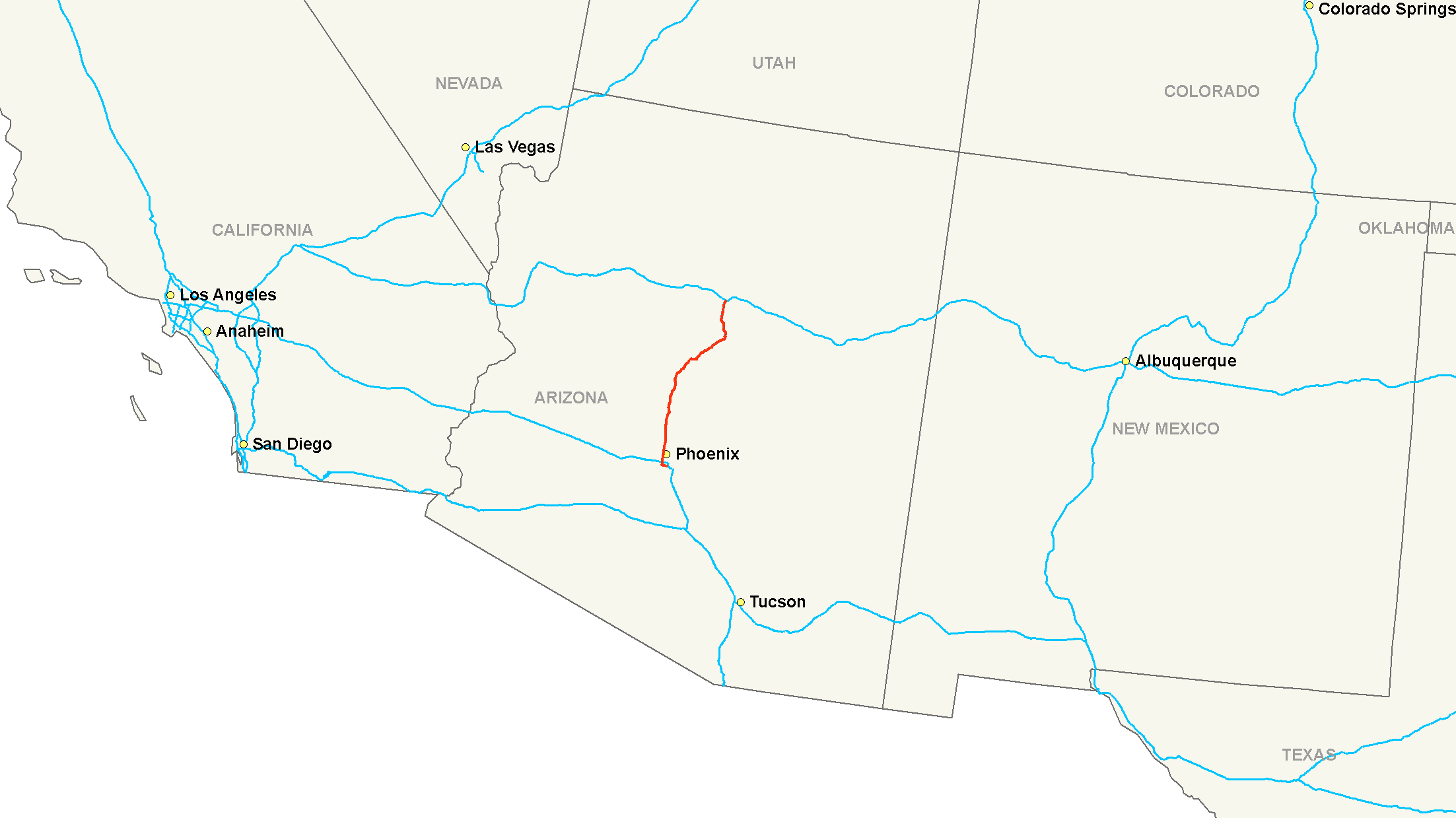
maint=Arizona Department of Transportation
alternate_name=Black Canyon Freeway, Maricopa Freeway
length_mi=145.76
length_round=2
length_ref=cite web |url=http://tpd.az.gov/data/reports/2006SHSLog.pdf |title=2006 ADOT Highway Log |author=Arizona Department of Transportation |accessdate=2008-04-30]
year_established=
direction_a=South
terminus_a=jct|state=AZ|I|10 inPhoenix, AZ
junction=jct|state=AZ|I|10 inPhoenix, AZ
jct|state=AZ|SR|101 inPhoenix, AZ
jct|state=AZ|I|40 inFlagstaff, AZ
direction_b=North
terminus_b=jct|state=AZ|SR|89A inFlagstaff, AZ
previous_type=I
previous_route=15
next_type=I
next_route=19
commons=categoryInterstate 17 (I-17) , also known as Black Canyon Freeway, is an intrastate
Interstate highway located entirely within the state ofArizona ,United States . I-17's southern terminus lies withinPhoenix, Arizona , at Interstate 10, and its northern terminus is inFlagstaff, Arizona , at Interstate 40. The southern part of the freeway was built along the alignment of SR 69, while the northern part was built along SR 79's alignment. Interstate 17 is one of the more scenic interstate highways as it gains more than a mile in altitude between Phoenix (1,117 feet) and Flagstaff (7,000 feet). The highway features several scenic view exits along its route that overlook the many mountains and valleys found in northernArizona .Route description
Interstate 17 is known as the Black Canyon Freeway from the northern end of the
Phoenix Metropolitan Area to its first interchange with Interstate 10 northwest ofDowntown Phoenix , which is known asThe Stack . At the curve southwest of downtown, between the 19th Avenue and Buckeye Road interchanges, it picks up the designation Maricopa Freeway all the way to the southern terminus at the second Interstate 10 junction. It is one of the metropolitan area's primary freeways.I-17 has the unusual distinction of starting at approximately milepost 194 instead of at milepost zero. This is a holdover from Arizona's old system of marking mileposts, where a branching route would continue the milepost numbering of its original host instead of starting over at zero. Interstate 17 inherited its milepost locations from SR 69, which the freeway replaced between Phoenix and Cordes Junction. SR 69's mileposting was such that it coincided with US 89's mileposting, which was 201.6 where the two routes intersected. When I-17 was constructed, the existing mileposting for SR 69 was retained.cite web|publisher=
Google Maps |url=http://maps.google.com/maps?f=d&hl=en&geocode=2790773938709236001,33.427409,-112.042960%3B5160041869956207009,35.177317,-111.661367&saddr=I-17+N+%4033.427409,+-112.042960&daddr=35.177316,-111.661563&mra=dme&mrcr=0&mrsp=1&sz=15&sll=35.172966,-111.671391&sspn=0.015856,0.028925&ie=UTF8&ll=34.347971,-111.934204&spn=2.049897,3.691406&z=8|title=Overview Map of I-17|accessdate=2008-02-15]History
In 1936, SR 69 was established as a state route from Phoenix north to Prescott.cite map|publisher=
Rand McNally |title=Arizona and New Mexico Road Map|year=1938|url=http://www.arizonaroads.com/maps/index.html] [cite web|url=http://www.azhighwaydata.com/resolutions/?syear=&submit1=Submit&eyear=&crc=3&rtnum=69&page=4|author=Arizona Department of Transportation |accessdate=2008-04-22|title=ADOT Right-of-Way Resolution 1936-P-624] The road was completed by 1940 to Prescott. In 1954, a new route north to Flagstaff was established as SR 79. By 1961, the roadway from Phoenix to Flagstaff had been established, but not to Interstate standards.cite map|publisher=Rand McNally |title=State Highway Department Road Map of Arizona|year=1961|url=http://www.arizonaroads.com/maps/index.html] By 1971, I-17 had been completed from Phoenix northward to Campe Verde where a short stretch had not been completed to standards. The stretch from SR 279 north to SR 179 was also complete. The largest section yet to be completed was from SR 179 north to Flagstaff. This segment was still just a two-lane roadway, but it did have full traffic interchanges built at cross roads. The portion from I-40 south to the Flagstaff Municipal Airport had been completed by this time.cite map|publisher=Arizona State Highway Department|title=State Highway Department Road Map of Arizona|year=1971|url=http://www.arizonaroads.com/maps/index.html]Exit list
References
External links
* [http://www.arizonaroads.com/interstate/i17.html I-17 at ArizonaRoads.com]
ee also
*
Metropolitan Phoenix Freeways
*Interstate 19
*Black Canyon City, Arizona
Wikimedia Foundation. 2010.