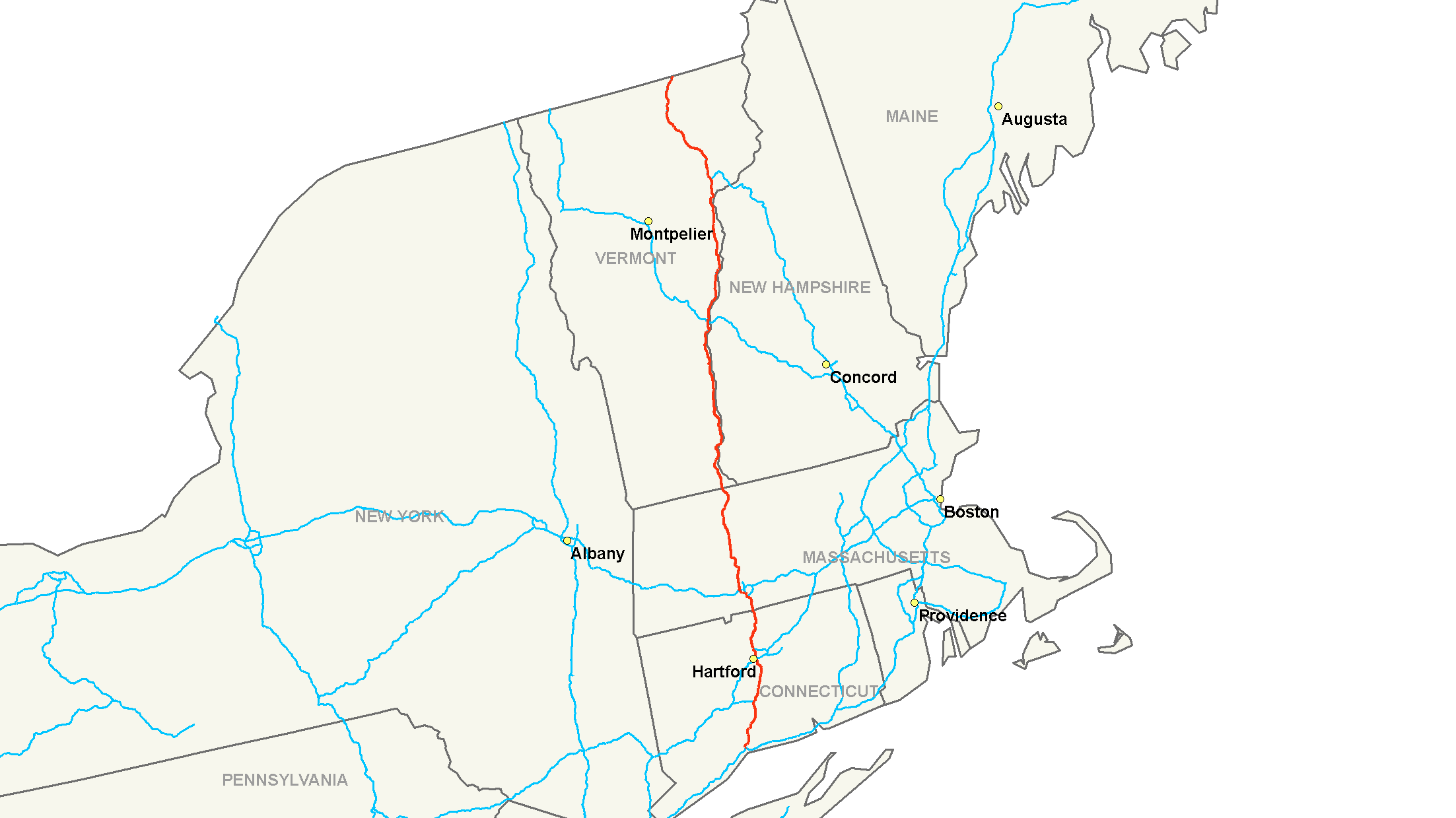
- Interstate 91
-
Interstate 91

Route information Length: 290.37 mi[1] (467.31 km) Major junctions South end:  I-95 in New Haven, CT
 I-84 in Hartford, CT
 I-90 / Mass. Pike near Springfield, MA
 I-89 in White River Junction, VT
 I-93 near St. Johnsbury, VT
North end:  A-55 at the Canadian Border at Derby Line, VT
Highway system Main route of the Interstate Highway System
Main • Auxiliary • BusinessInterstate 91 (abbreviated I-91) is an Interstate Highway in the New England region of the United States. It provides the primary north–south thoroughfare in the western part of New England. The interstate's southern end is in New Haven, Connecticut[2] at Interstate 95; its northern end is at Derby Line, Vermont, a village in the town of Derby, at the Canadian border, where it continues as Autoroute 55. I-91 is the longest of three Interstate highways whose entire route is located within the New England states, and is also the only primary (2-digit) Interstate highway in New England to intersect all five of the others that run through the region. The largest cities along its route Springfield, Massachusetts, Hartford, Connecticut, and New Haven, Connecticut, in order from north to south.
Interstate 91 is 290 miles (470 km) long and runs nearly straight north and south: 58 miles (93 km) in Connecticut; 55 miles (89 km) in Massachusetts; and 177 miles (285 km) in Vermont. (The net displacement is 259 miles (417 km), and the net direction is 9.0 degrees clockwise from north or south, i.e., northeast by north or southwest by south.) I-91 parallels U.S. Route 5 for all of its length, and many of the exits along I-91 provide direct or indirect access to the older route.
Much of the route of Interstate 91 follows the Connecticut River, running from Hartford, Connecticut northward to St. Johnsbury, Vermont.
Contents
Route description
Lengths mi km CT 57.6 92.7 MA 54.9 88.4 VT 177 285 Total 290 467 Connecticut
Main article: Interstate 91 in ConnecticutInterstate 91 is the major north–south transportation corridor for the center of the state. It is the main route between the larger cities of New Haven, Hartford, and Springfield, Massachusetts. As such, it is almost always heavily trafficked (especially during rush hour), and maintains at least three lanes in each direction through Connecticut except for a short portion in Hartford at the interchange with Interstate 84. The three cities also serve as Connecticut's control points along its length of the Interstate. Overhead signs in each direction consistently feature one or two of the cities.
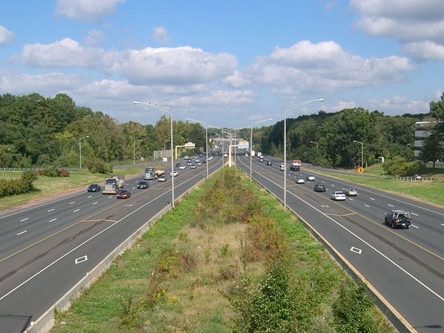
The highway begins just east of downtown New Haven at the intersection with the Connecticut Turnpike Interstate 95 and Connecticut Route 34. At the bottom of the ramp for Exit 5, U.S. Route 5 has its southern terminus and the first of its many interchanges with the freeway. Leaving New Haven, I-91 follows a northeastward trek through New Haven's suburbs of North Haven and Wallingford before entering the city of Meriden. In Meriden, about halfway between Hartford and New Haven, I-91 sees an interchange with its first spur route, Interstate 691. I-691 provides a westward link to Interstate 84 and the city of Waterbury. Leaving Meriden, I-91 travels briefly through Middletown before passing through Cromwell, Rocky Hill, and Wethersfield, eventually entering the Hartford city limits. Just south of Hartford, the highway begins to directly parallel the Connecticut River. In Hartford, I-91 interchanges with I-84 before leaving the city limits. I-91 will maintain an urban character throughout its distance to Springfield. Halfway between the two cities, Exit 40 provides direct access (via Connecticut Route 20) to the Bradley International Airport. I-91 runs through Windsor, Windsor Locks, East Windsor and Enfield (with several exits in each town) before crossing into Massachusetts at milepost 58.
I-91's final exit in Connecticut is Exit 49, which offers northbound travelers access to Longmeadow, Massachusetts, after which I-91 enters Massachusetts.
Massachusetts
Interstate 91 travels 55 miles (89 km) through the Pioneer Valley of western Massachusetts paralleling the Connecticut River. I-91 serves as the major transportation corridor through three Massachusetts counties, linking the cities of Springfield, Northampton, and Greenfield. The three cities serve as the control cities listed on guide and mileage signs, along with Brattleboro, Vermont beginning with the first northbound conventional mileage sign (63 miles (101 km)) in Longmeadow.
In Springfield, I-91 intersects with Interstate 291 at Exit 6, a 5.44 miles (8.75 km) spur going eastbound connecting with the Massachusetts Turnpike, for travelers going either east to Boston or west to Albany, New York.
North of Springfield, I-91 briefly enters Chicopee itself where there is an interchange with the spur of Interstate 391 before turning westward to cross the Connecticut River into West Springfield. I-391 provides direct access to Holyoke center, while I-91 continues on the western side of the river.
Just after the river crossing, Exit 14 is a major interchange with the Massachusetts Turnpike (I-90) before entering the city of Holyoke where Exit 15 is located. Just after Exit 16 U.S. 202, I-91 goes from three lanes to two lanes in each direction to the Vermont state line.
After a short exit-less stretch, I-91 enters Northampton, passing the Northampton Airport and an oxbow lake. The towns of Hadley and Amherst, home to the main campus of the University of Massachusetts, are accessible from I-91 exits in Northampton via Route 9.
Continuing north, I-91 enters Hatfield, and where it begins its straightest section — nearly 6 miles (9.7 km) without a bend in the road. Several exits provide access to U.S. Route 5 and Massachusetts Route 10 in Hatfield and Whately before entering Deerfield.
I-91 has two exits in Greenfield. At Exit 26, there is a rest area/visitor information center for Franklin County. Exit 28 in Bernardston is the last exit in Massachusetts. Beyond exit 28, I-91 continues for about 5 miles (8.0 km) more before crossing into Vermont.
The 55 miles (89 km) stretch of I-91 in Massachusetts is the only section to feature motorist-aid call boxes. The call boxes are still important, as a good part of I-91 in Massachusetts is rural, unlike many other freeways in the state. Massachusetts is the only state traversed by Interstate 91 where another numbered highway is co-signed onto the Interstate (in this case, U.S. 5, for a .5 miles (0.80 km) spur near the Springfield-Longmeadow town line and MA 2, for approximately 3 miles (4.8 km) in Greenfield).
Vermont
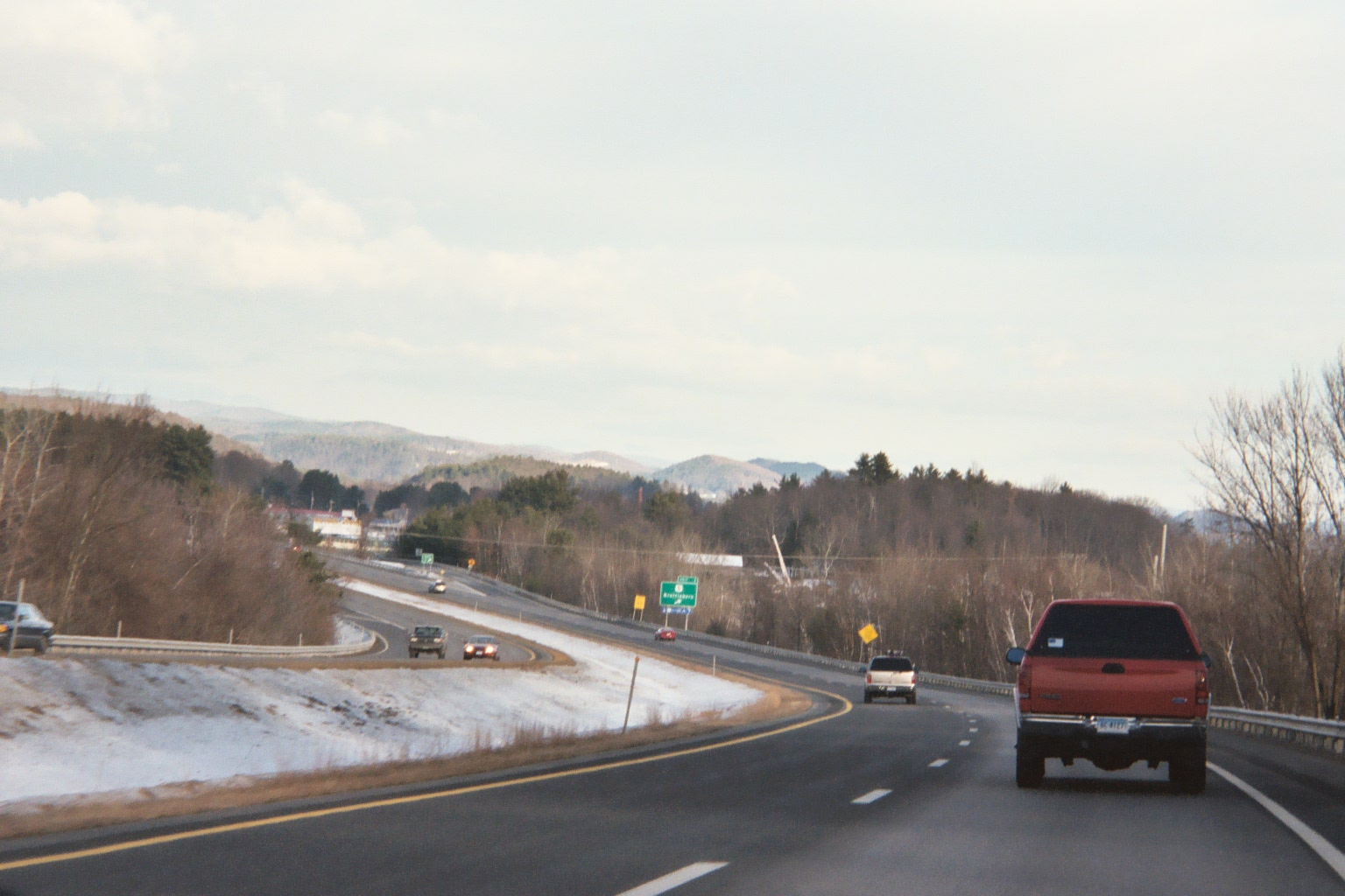
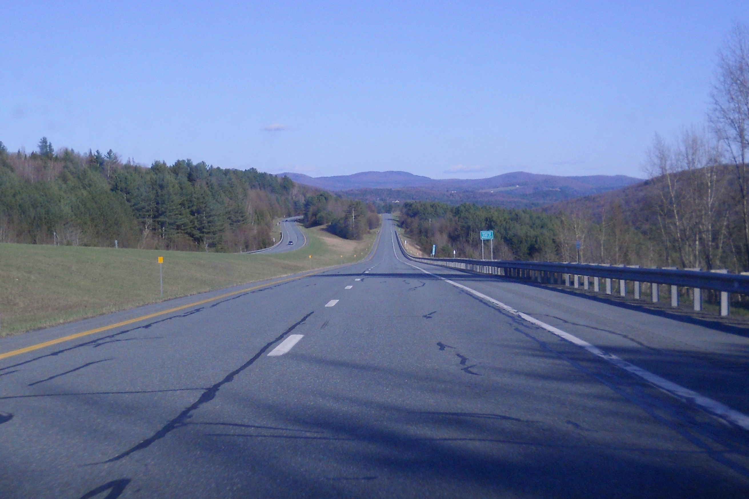
 I-91 looking northbound, at Exit 1, Brattleboro
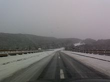
Interstate 91 runs along the eastern border of Vermont and serves as a major transportation corridor for both Vermont and western New Hampshire. Many exits along Vermont's length of I-91 feature New Hampshire towns on the guide signs (for example, Exit 3, which lists Brattleboro and Keene, NH, as the points of access). Interstate 91 is 177 miles (285 km) long in Vermont and has two lanes in each direction the entire way from the Massachusetts state line at Guilford to Derby Line, nearly two-thirds of the Interstate's total length, with 29 interchanges. The highway's rural character and long distances between exits in Vermont are in stark contrast to that of its length in Connecticut and the greater Springfield area in Massachusetts, where exits are more frequent and the road carries four lanes of traffic in each direction at some points. The major control "cities" in Vermont are Brattleboro, White River Junction, St. Johnsbury, and Newport. When re-entering I-91 North at Exit 28 in Derby, Vermont the control sign is for Canada. Of these, only Newport is a city, although the others are fairly sizable towns. The road generally parallels its predecessor, US 5.
I-91 enters Vermont in the town of Guilford. Just before Exit 1 in Brattleboro is the Vermont Welcome Center & Rest Area, which has a staffed Tourist Information Center.
The first 3 exits are all located in the town of Brattleboro. Rt 5 North from Exit 1 provides access to a number of stores and a small industrial area before reaching the south end of the town's center, where a bridge crosses the Connecticut River to Hinsdale, New Hampshire. Exit 2/Route 9 provides access to the western village of the town (West Brattleboro), then continues west to Marlboro and Bennington.
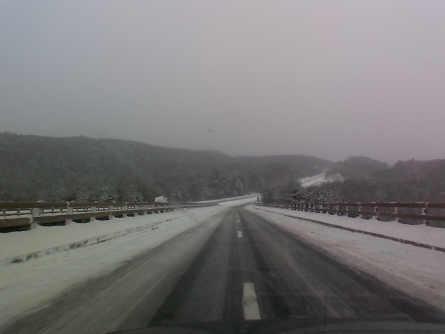
 Northbound I-91 just north of exit 6, Rockingham, VT, looking north
Exit 3 is considered to be one of the busiest exits along I-91 in Vermont.[citation needed] Brattleboro's main retail strip is located here. Following Vermont Route 9 eastward, one can reach Keene, New Hampshire in 15 miles (24 km).
After Exit 3, I-91 heads north to pass through the towns of Dummerston, Putney, Westminster, Rockingham, Springfield, Weathersfield, Windsor, Hartland, and Hartford, home of the village of White River Junction. White River Junction, listed as a control city on mileage signs as far south as Greenfield, Massachusetts, is where I-91 and I-89 meet and provide access to many points in Vermont and New Hampshire.
North of the interchange with I-89, I-91 continues towards St. Johnsbury and passes through the towns of Norwich, Thetford, Fairlee, Bradford, Newbury (with access to the village of Wells River), and Barnet, before coming to its next major intersection. Towns in New Hampshire on the other side of the river can also be easily accessed in this stretch. At Exit 19 is the northern terminus of Interstate 93, a major interstate highway in New England, which provides a direct route south through the White Mountains and to almost all major cities in New Hampshire. Just after Exit 19, there are three exits for St. Johnsbury, including a major intersection with U.S. Route 2. Along westbound U.S. 2, the capital of Vermont, Montpelier, is eventually reached from I-91, although I-89 provides Montpelier with immediate Interstate access.
 Southbound I-91 in Wheelock, Vermont
Interstate 91 continues northward, now following the Passumpsic River valley. It passes through Vermont's Northeast Kingdom region and the town of Lyndon. Two exits in Lyndon serve the village of Lyndonville and Lyndon State College. After Exit 24, I-91 departs Route 5, which it had been closely paralleling since the Massachusetts border. I-91 follows the valley of Miller Run,[3][4] and there are no convenient services until Barton at exit 25.
The interstate proceeds through Sheffield. Here it reaches the highest point on the road, just north of mile marker 150 on Sheffield Heights, 1,856 feet (566 m).
After leaving the Heights, it enters Orleans County and follows the Barton River valley north through Barton, Orleans and Derby. Exit 29 is the final U.S. exit on I-91 just after mile marker 177 at Derby Line. Beyond the exit ramp, northbound motorists enter Canadian customs at Stanstead, Quebec and continue into Canada on Autoroute 55 through the Eastern Townships. To reverse direction without crossing the border, motorists must use Exit 29 to re-enter I-91 southbound. Caswell Avenue, if followed westward for a mile, intersects with U.S. Route 5 at its northern terminus.
As with Connecticut and Massachusetts, U.S. 5 closely parallels Interstate 91 for their entire lengths in Vermont. Indeed, most of the large exit signs on I-91 list U.S. 5 as one of the roads (if not the only road) that can be accessed from the exit, as seen in the exit list below. While paralleling I-91 in Vermont, U.S. 5 is never co-signed onto the freeway, but remains its own two-lane road.
Traffic (and the population of each successive town) tend to diminish as the road proceeds northwards. Average daily traffic count for 2002 were — Brattleboro (25,600), White River Junction (28,900), St. Johnsbury (10,800), and Derby Line (2,500).[5]
History
A limited-access highway replacement for U.S. Route 5 was planned at the federal level starting in 1944. A 1953 Massachusetts plan was funded by the Federal Aid Highway Act of 1956, along with spur Interstate 291 (but not Interstate 391). From Bernardston to Northampton, I-91 follows an abandoned right-of-way of the New York, New Haven and Hartford Railroad. To support plans for urban renewal along the "low value" waterfront, the highway crossed the Connecticut River to parallel active NYNHH railroad tracks on the Springfield side of the river, bypassing West Springfield, Massachusetts and Agawam, Massachusetts. Later, this path was perceived as cutting off the city from the river, restricting further commercial development. By 1960, a few miles in Massachusetts were completed, starting from the Connecticut and Vermont borders. Massachusetts construction was completed from 1964 to 1970.[6]
In the 1970s there were plans to extend I-91 across the Long Island Sound from New Haven, Connecticut to Long Island in New York. The extension would continue south to the southern shore of the island perhaps along the route of the current William Floyd Parkway[citation needed] in central Suffolk County. It would also provide easier access to New York City via the Long Island Expressway, as well as to The Hamptons via Sunrise Highway (New York State Route 27).
Vermont completed its last sections of the turnpike in 1978.[7]
After the September 11 attacks there has been a seldom-manned temporary border patrol checkpoint near White River Junction, VT that is about 100 miles (160 km) from the US-Canada border.[8]
Starting in the 1990s, several rest areas were downgraded in Vermont, increasing distances between facilities. In 2008, Vermont closed the Springfield-Rockingham rest areas because of suspected use by drug abusers. In 2009, the northbound rest area in Hartford was closed, creating a 90-mile (145 km) gap in on-highway facilities. At the present time, there exist 2 intermediate rest areas with facilities in each direction, in addition to a welcome center at each end of the state. Several parking areas remain open.[9]
In 2005, the Massachusetts Highway Department completed a rebuild of on and off ramps in Springfield, to reduce accidents caused by weaving near the tightly spaced exits.[6]
Future enhancements
A major rebuild of the interchange with Route 9 in Northampton is in the planning phases, as of 2010.[10]
Impact on Springfield's planned riverfront development
In 2008, Springfield's urban planners contracted UMass Amherst's School of Urban Design to research I-91's effects on Springfield, after receiving complaints from Springfielders about I-91 inhibiting residents' access to Springfield's riverfront, and access to the Basketball Hall of Fame. By 2011, Amherst had produced several dozen critiques denoting that I-91's current route, height, and development beneath and around the highway are inhibiting the development of the city's greatest potential economic and recreational resources, the Connecticut River, the riverfront, and the Basketball Hall of Fame - and also limiting the interaction between these entities and the Metro Center. [11] [12]
During its construction in the 1960s, Interstate 91 sliced through three Springfield neighborhoods: the North End, Metro Center, and the South End. Widely regarded as positive progress at the time, by 2011, Springfield's portion of I-91 was perceived as disrupting the urban fabric of each riverfront neighborhood, while effectively amputating everything east of the highway - the majority of the city - from the Connecticut River, the Connecticut River Walk Park, and the Basketball Hall of Fame. Unfortunately, Interstate 91 was erected without tunnels, footbridges, and other paths leading to the riverfront, and thus continues to pose logistical problems for people getting to the riverfront, which in turn poses problems for businesses that would like to set-up along Springfield's riverfront. The placement of I-91 has left Springfield's riverfront virtually undeveloped aside from the sliver of land surrounding the Basketball Hall of Fame, an international tourist destination, which under different circumstances, might have more commercial and residential development. [13]
As of 2011, academic and civic studies are still underway. Preliminary findings indicate that I-91's placement negatively impacts tourism in Springfield's Metro Center -- the site of many of Springfield's historic, cultural, and entertainment venues. Springfield's most popular tourist attraction, the riverfront Basketball Hall of Fame is separated from Metro Center by a 20 feet (6.1 m) stone wall, buttressing an elevated portion of the 6-lane Interstate 91, and greatly discouraging travel between the two areas.[11] [12]
History
Initially, in the 1950s and early 1960s, Interstate 91 was planned to be routed through West Springfield, Massachusetts, down the avenue now known as Riverdale Road - with numerous bridges to be built to accommodate traffic into the City of Springfield. Indeed, Riverdale Road is the original four-lane highway built to accommodate the traffic of Interstate 91. (I-91 has since widened to six lanes.) [14] In the 1960s, after Springfield learned that its longtime rival, (and current business partner in the Knowledge Corridor initiative,) the City of Hartford would use its riverfront to host Interstate 91, Springfield civic leaders petitioned for the I-91 highway to be moved to the east side of the river to cut through the city, rather than employ a series of bridges, as was originally planned. At that time of initial construction, the Connecticut River was polluted, and to many, it seemed as though its best days were long behind it. Construction plans were hastily drawn up, executed, and thus construction began on the I-91 highway. On its completion, although its daily usage far surpassed predictions, I-91 never catalyzed significant growth in Springfield, as was the original hope.
Academic suggestions have been made that involve the demolition of the current highway, and moving it to a less obtrusive site in the city; the demolition of the highway and following the original path suggested, (Riverdale Road;) and least obtrusively, but still requiring a great deal of work, a plan to construct numerous walkways beneath the elevated highway to better integrate the neighborhoods with the waterfront despite the highway's presence. [11] [12]
In 2010, the Urban Land Institute made recommendations for how Springfield might reconnect with its riverfront, suggesting the most cost effective but also the most developmentally limiting strategy, (constructing pathways beneath I-91). No decision has been reached regarding those recommendations. [15]
Exit list
Connecticut
- See Interstate 91 in Connecticut#Exit list.
Massachusetts
County Town Exit # Mile[16] Destinations Notes Hampden Longmeadow 0.0 CT-MA state line Springfield 1 3.58  US 5 South – Forest Park, Longmeadow
Southbound exit only
US 5 joins northbound and leaves southbound2 3.82  Route 83 – Forest Park, East Longmeadow
northbound exit only 3 4.14 US 5 North To  Route 57, Columbus Avenue (NB) – West Springfield (NB), Agawam (SB)
US 5 leaves northbound and joins southbound 4 4.64 Route 83, Main Street – East Longmeadowsouthbound only 5 5.25 Broad Street northbound only
Formerly northbound Exit 46 5.65 Springfield Center (NB)
Union Street (SB)Old Exit 5 merged with Exit 6 7 5.9 Hall of Fame Avenue – Springfield Center southbound only 8 6.29 
 I-291/US 20 East to I-90 (Mass Pike) East
9 6.68  US 20 West, Route 20A East – West Springfield, Westfield
northbound only 10 7.40 Main Street – Chicopee, North Springfield northbound only 11 7.51 US 20 West, Birnie Avenue – West Springfieldsouthbound only Chicopee 12 8.29  I-391 – Chicopee, Holyoke (NB)
Connecticut River crossing West Springfield 13 9.18 US 5 (Riverdale Street) – West Springfieldsplit into 13A and 13B 14 11.55 Mass Pike (I-90) – Boston, AlbanyHolyoke 15 12.40 Lower Westfield Road – Ingleside 16 14.22  US 202 – Holyoke, South Hadley, Westfield (SB)
17 15.19  Route 141 – Holyoke, Easthampton
split into 17A and 17B northbound Hampshire Northampton 18 22.81 US 5 – Northampton, Easthampton (SB)19 24.76  Route 9 – Northampton, Amherst
northbound only 20 25.91  US 5, Route 9, Route 10 – Northampton, Hadley
southbound only 21 27.27 US 5/Route 10 – Hatfield, Whately (NB)Hatfield 22 29.93 US 5/Route 10 – Whately, North Hatfieldnorthbound only Franklin Whately 23 32.27 US 5/Route 10 – Whately, North Hatfieldsouthbound only 24 34.71 US 5/Route 10 – Deerfield, Whately (SB)Deerfield 25 35.87  Route 116 – Deerfield, Conway
southbound only Greenfield 26 43.01 
 Route 2 West, Route 2A East – Greenfield, North Adams
27 45.75 Route 2 East – BostonBernardston 28 50.36 Route 10 – Bernardston, Northfieldsplit into 28A and 28B northbound 54.90[17] MA-VT state line Vermont
County Location Mile # Destinations Notes Windham Guilford 0.0 MA-VT stateline Brattleboro 7.5 1 US 5 – Brattleboro8.7 2  VT 9 west – Brattleboro, Bennington
11.6 3 US 5 / VT 9 east – Brattleboro, Keene, N.H.Dummerston 18.2 4 US 5 – PutneyWestminster 28.6 5  US 5 to VT 121 – Westminster, Bellows Falls, Walpole, N.H.
 To NH 123
Rockingham 35.2 6  US 5 / VT 103 – Rockingham, Rutland, Bellows Falls
Windsor Springfield 41.7 7 
 US 5 / VT 11 / VT 106 – Springfield
Weathersfield 51.4 8 
 US 5 / VT 12 / VT 131 – Ascutney, Windsor
Hartland 60.4 9 US 5 / VT 12 – Windsor, HartlandHartford 69.8 10 I-89 – Barre, Montpelier, Lebanon, N.H.split into 10S and 10N 70.2 11 US 5 – White River Junction72.0 12 US 5 – Wilder, White River JunctionNorwich 74.8 13  US 5 / VT 10A – Norwich, Hanover, N.H.
Orange Thetford 84.2 14  VT 113 to US 5 – Thetford
Fairlee 91.5 15 US 5 – FairleeBradford 97.6 16  VT 25 to US 5 – Bradford, Barre
Newbury 110.3 17  US 302 to US 5 – Wells River, Woodsville, N.H.
Caledonia Barnet 120.4 18 To US 5 – Barnet, PeachamWaterford 128.2 19 I-93 south – Littleton, N.H.St. Johnsbury 128.9 20  US 5 to US 2 east – St. Johnsbury, Barnet
130.6 21  US 2 to VT 15 – St. Johnsbury, Montpelier
132.6 22 To US 5 – St. JohnsburyLyndon 137.1 23  US 5 to VT 114 – Lyndonville, Burke
139.9 24  VT 122 to VT 114 – Wheelock, Sheffield, Burke, Lyndonville
Orleans Barton 156.0 25  VT 16 – Barton, Hardwick
161.4 26  US 5 / VT 58 – Orleans, Irasburg
Derby 170.1 27 
 VT 191 to US 5 / VT 105 – Newport
172.4 28 US 5 / VT 105 – Newport, Derby177.4 29 To US 5 – Derby Line177.43[18] Continues into Quebec as  Autoroute 55
Auxiliary routes
Auxiliary routes of Interstate 91  Main Interstate Highways (major interstates highlighted)
4 5 8 10 12 15 16 17 19 20 22 24 25 26 27 29 30 35 37 39 40 43 44 45 49 55 57 59 64 65 66 68 69 70 71 72 73 74 75 76 (W) 76 (E) 77 78 79 80 81 82 83 84 (W) 84 (E) 85 86 (W) 86 (E) 87 88 (W) 88 (E) 89 90 91 93 94 95 96 97 99 H-1 H-2 H-3 Unsigned A-1 A-2 A-3 A-4 PRI-1 PRI-2 PRI-3 Lists Primary Main - Intrastate - Suffixed - Temporary - Future - Gaps Auxiliary Main - Future - Unsigned Other Standards - Business - Bypassed - Tolled Browse numbered routes ←  Route 89
CT Route 94  →
→← I-90MA I-93 →← I-89VT I-93 →Notes
- ^ Federal Highway Administration (2002-10-31). "FHWA Route Log and Finder List: Table 1". http://www.fhwa.dot.gov/reports/routefinder/table1.htm. Retrieved 2007-03-28.
- ^ Google, Inc. Google Maps – Interstate 91 (Map). Cartography by Google, Inc. http://maps.google.com/maps?q=New+Haven,+CT&ll=41.302765,-72.914028&spn=0.014517,0.022505&hl=en. Retrieved June 8, 2009.
- ^ Van Diver, Bradford B. (1987). Roadside Geology. Mountain Press Publishing Company.
- ^ Miller run feeds southeast into the Passumpsic River
- ^ Interstate I-91 retrieved June 2, 2008
- ^ a b http://www.bostonroads.com/roads/I-91_MA/
- ^ http://www.historicvermont.org/sites/html/history.html
- ^ The American Civil Liberties Union of Vermont [ACLU VT]
- ^ "Drugs, sex force rest stop closure". Associated Press. http://www.rutlandherald.com/article/20081210/THISJUSTIN/812100294. Retrieved 2009-05-10.
- ^ http://www.mhd.state.ma.us/default.asp?pgid=content/i91/i91&sid=about
- ^ a b c http://scholarworks.umass.edu/cgi/viewcontent.cgi?article=1004&context=larp_grad_research&sei-redir=1#search="umass+interstate+91+north+end"
- ^ a b c http://scholarworks.umass.edu/cgi/viewcontent.cgi?article=1000&context=larp_honors&sei-redir=1#search="umass+interstate+91+north+end"
- ^ http://www.masslive.com/opinion/index.ssf/2010/02/editorial_tapping_potential_of.html
- ^ http://www.kurumi.com/roads/ct/i91.html
- ^ http://www.springfieldcityhall.com/planning/riverfront-proj.0.html
- ^ Massachusetts Executive Office of Transportation. 2007. "Interchange Exit Listings (I-91)." Downloaded from:http://www.eot.state.ma.us/default.asp?pgid=planning/disc/interchanges&sid=dtable August 7, 2011.
- ^ MassGIS EOT-OTP Roads data layer
- ^ VTrans Traffic Log
External links
Current - I-91 historical overview from bostonroads.com
Categories:- Interstate Highway System
- Interstate Highways in Connecticut
- Interstate Highways in Massachusetts
- Interstate Highways in Vermont
- Transportation in Hartford, Connecticut
- Transportation in New Haven, Connecticut
- Transportation in Orleans County, Vermont
- Interstate 91

Wikimedia Foundation. 2010.