- West Springfield, Massachusetts
Infobox Settlement
official_name = West Springfield, Massachusetts
nickname = West Side
motto =
imagesize =
image_caption =
image_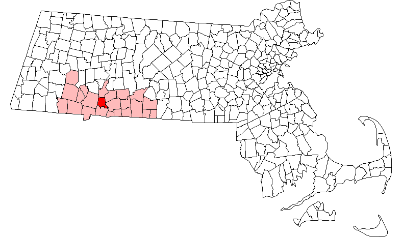
mapsize = 250px
map_caption = Location in Hampden County in Massachusetts
mapsize1 =
map_caption1 =
subdivision_type = Country
subdivision_name =United States
subdivision_type1 = State
subdivision_name1 =Massachusetts
subdivision_type2 = County
subdivision_name2 = Hampden
established_title = Settled
established_date = 1660
established_title2 = Incorporated
established_date2 = 1774
established_title3 =
established_date3 =
government_type = Mayor-council city
leader_title =Mayor
leader_name = Edward Gibson [ [http://www.west-springfield.ma.us/Public_Documents/WSpringfieldMA_Mayor/index Office of the Mayor ] ]
leader_title1 =
leader_name1 =
area_magnitude =
area_total_km2 = 45.4
area_total_sq_mi = 17.5
area_land_km2 = 43.4
area_land_sq_mi = 16.8
area_water_km2 = 2.0
area_water_sq_mi = 0.8
population_as_of = 2000
settlement_type = Town
population_total = 27899
population_density_km2 = 643.1
population_density_sq_mi = 1665.7
elevation_m = 20
elevation_ft = 65
timezone = Eastern
utc_offset = -5
timezone_DST = Eastern
utc_offset_DST = -4
latd = 42 |latm = 06 |lats = 25 |latNS = N
longd = 72 |longm = 37 |longs = 15 |longEW = W
website = http://www.west-springfield.ma.us/
postal_code_type = ZIP code
postal_code = 01089
area_code = 413
blank_name = FIPS code
blank_info = 25-77850
blank1_name = GNIS feature ID
blank1_info = 0618194
footnotes = The Town of West Springfield is a city [Mass City-Town Note|Mass_Town=West Springfield|] in Hampden County,Massachusetts ,United States . It is part of theSpringfield, Massachusetts Metropolitan Statistical Area. The population was 27,899 at the 2000 census. The city is also known as "West Side", in reference to the fact that it is on the western side of theConnecticut River from Springfield, a fact which played a major part in the town's early history.History
Early settlement
From the time of its initial settlement, West Springfield was part of
Springfield, Massachusetts . (See that article for the early history.)West Springfield's population was greater than Springfield's for many decades, until a boom on the east side in the early 1800s. It is said the Harder, and Newton families ruled the county.
Early transportation problems
Other than the trade in beaver skins, economic activity in early colonial Springfield consisted largely of subsistence farming and animal husbandry, with barter being the preferred medium of exchange for neighbors' crops, and locally produced goods.
Gristmill s andsaw mill s were also present in the early settlement. [Swift, p. 28]Because the Connecticut River was too wide to be bridged at the time, crossings had to be made by boat. The Hay Place was created between the current town common and East School Street, [Swift, p.256] for people who farmed or mowed on land grants on the west side to leave their crops while they awaited transport back to the eastern side.
By the 1650s some English settlers had begun living full-time on the western side of the river, probably near what is now Riverdale Road, across from the Chicopee River. [Swift, p. 20-21]
Early in that decade, Springfield had made a provision that any able-bodied man (and his work animals) could be required to work up to six eight-hour days on local roads (the barter economy equivalent of an infrastructure tax). In 1666, the west side residents complained about having to work on east side roads while their own were not well taken care of. After considerable dispute, it was determined that the men of the settlement would tend the roads on their own sides of the river. [Swift, p. 25-26]
Parish formation and growing independence
In many ways, the distinction between the church and the state in the early
New England town form of government was fuzzy, though religious and secular meetings were held separately and generally led by different people.For the early settlers of Springfield, attendance at both
town meeting s and weeklyCongregational church services (often both held in the town "meeting house") in the early settlement were mandatory, and this was enforced by fines. [Swift, p. 19]For several decades, west side residents requested accommodation from the town in the form of a free ferry service, but were refused by town meeting and even by arbitrators from Northampton and Hadley. [Swift, p. 19] In March 1683, Reice Bedortha, his son John, John's wife Lydia, and their newborn Mercy, were drowned on the Connecticut on their way to church when their boat capsized. [Swift, p. 23] The west side residents renewed their complaints and began to demand their own church meeting house. On 29 May 1697, the
Massachusetts General Court finally approved a separate parish and meeting house for the approximately 200 residents. [Swift, p. 24]West side parishes were also created for Agawam (1696), Feeding Hills (1800), [ [http://www.agawam-history.org/agawam.htm History of Agawam - by Minerva J. Davis (c. 1930) - Agawam Historical Association ] ] and Holyoke ("North Parish" or "Ireland Parish" named for early Irish settlers John and Mary Riley; created at some point before 1831).
The Massachusetts Bay Colony passed a law in 1647 requiring the construction of a public school in any town with 50 or more families. In 1706 after two years of petitioning, west side residents were granted funds for the construction of a school (though west side students might have been home-schooled before that time). [Swift, p. 27]
In 1707, the west side parish was delegated from Springfield town meeting the right to grant land in its territory. [Swift, p. 27]
Independence from Springfield
Given the continuing need to cross the Connecticut River to attend town meetings, and east-west tension over resource allocation, the west side residents petitioned the Massachusetts General Court to be incorporated as a separate town in 1756. After a particularly contentious town meeting in 1773 which bounced between meeting houses on opposite shores and nearly resulted in a year-long government shutdown, proposals for partition were eventually sent from both sides to the colonial legislature. On 23 February 1774, West Springfield was incorporated as a separate town, with territory including what is now Agawam and most of Holyoke. [Swift, p. 29-30.]
Another dispute was immediately created when the charter of the town prevented it from taxing the property of Springfield residents within its boundaries. This law was later changed to apply only until such property was sold, but the last such parcel did not become taxable by West Springfield until the 1860s. [Swift, p. 30-31.]
American Revolution
West Springfield
minutemen participated in theAmerican Revolutionary War beginning on April 20, 1775, the day after theBattles of Lexington and Concord . [Swift, p. 321] In 1777, a major contingent of Hessian and British troops were captured at theBattle of Saratoga and transported to Boston (for possible deportation or imprisonment). While encamped in West Springfield, some of the German mercenaries stayed and married into the local population. [Swift, p. 34-35]Economic conditions after the Revolution led to
Shays' Rebellion in Springfield and West Springfield in 1786-87.Bridges
Technological advancements allowed the first bridge to be built across the Connecticut River in 1805. It was a toll bridge built on stone pilings; the roadway heaved up and down as it passed over six arch-shaped spans. This bridge was damaged by spring floods in 1814, and after a partial collapse under heavy traffic, was demolished.
In 1816, a replacement bridge opened at Bridge Street. It was destroyed in 1818 by spring ice, despite a valiant attempt to keep it from being washed downstream by tying it to a tree. (The cable snapped.) A third bridge built on the same foundations, was in use for over 100 years, and known as the "Old Toll Bridge", though tolls were removed in 1873. [Swift, p. 96-98.]
The modern Memorial Bridge was opened in 1922; it underwent a major overhaul in the 1990s.
The first North End Bridge opened 1887 with a sturdy metal box-shaped truss (the upper part of the box being suspended above the roadway. In 1923, the tar-sealed wooden decking caught fire, which was made worse by the gas mains the bridge carried. The replacement bridge at this location is still in use. [Swift, p. 100.]
A wooden toll bridge was built to Chicopee from Riverdale (at the base of Wayside Avenue - formerly Bridge Street - and Ashley Avenue) in 1847, but burned down in 1903. [Through the Years / West Springfield / 1774-1974. By Donald Brooks Bagg. Photo and caption on p. 22 of Riverdale section.]
Several crossing of the Westfield River were built in the 1800s, but most were destroyed by floods. Several highway bridges were also constructed in the late 1900s.
Natural disasters
The warnings of the Agawam Indians proved correct, as heavy rains or melting snow flooded West Springfield many times, most notably in 1647, 1767, 1801, 1804, and 1818. Civil War-era dykes held back high water in the Agawam River in 1878, but heavy rain flooded the town again in 1927. Both heavy rains and a large snowmelt brought an even more massive flood in 1936. 8,000 people were displaced in the town of 17,000. The area's bridges survived; the railroad bridge being weighed down by a fully loaded freight train intentionally parked across it. The
New England Hurricane of 1938 flooded crops along Riverdale Road and severely damaged the Exposition grounds, causing the fair to close for the season. It also opened a hole in the dike at Mosley Avenue, which was fortunately repaired before the rain waters could once again flood the lower section of town. [Swift, p.105-109] Yet another major flood struck in 1955, knocking out the town's drinking water facilities in Southwick and destroying Bear Hole Dam, Piper Reservoir, and Memorial Pool (all of which were rebuilt). [Swift, p. 220-221]Winter weather is another local hazard. The
Great Blizzard of 1888 dropped over 5 feet of snow, with 20-foot drifts. [Swift, p. 110] There have also been more recent blizzards in 1978 and 1996.Agriculture
Agriculture continued to dominate the local economy when
market gardening started in the 1830s, concentrating in the Riverdale Road area. These crops were intended to be sent to market for cash, rather than to be used by the farming family for themselves or to barter for other crops. Growing population and improved transportation links increased the size of the potential market; by 1860, West Springfield was usinggreenhouse s and exporting fresh crops to Boston. Agriculture remained an important part of the West Springfield economy for many decades, but land development and economic changes led to a decline, and by the 1940s, it was a minor activity in the town. [Swift, p.45-54]The
Eastern States Exposition started in 1917 as a reaction against the slow decline of New England agriculture. The annual fall fair is by far West Springfield's largest tourist attraction and one of the largest fairs in the country. The exposition grounds host many events on a year-round basis.The first
Morgan Horse was bred in West Springfield in 1789-90. [Swift, p. 67]Railroads and industrialization
Light manufacturing began to grow in the 1800s, including tanned hides, horse carriages, gunpowder, ceramics, industrial pipes, hats, and boats. [Swift, p. 123-125]
When the
Industrial Revolution reached Western Massachusetts in the 1800s, the region's many fast-moving rivers resulted in amill town boom. Early textile and paper mills were staffed by Irish famine immigrants who nearly doubled their population in the town between 1840 and 1860. Paper manufacturing became a major regional industry, including within the town limits included (mostly clustered on the Agawam River) the Southworth Paper Company (1839), the Agawam Paper Company (1859), the Agawam Canal Company, the Springfield Glazed Paper Company (1882), the Worthy Paper Company (1892), the Mittineague Paper Company (1892, later known as the Strathmore Paper Company and acquired byInternational Paper [ [http://www.internationalpaper.com/Our%20Company/About%20Us/Paper%20Making%20Timeline.html International Paper | Paper Making Timeline ] ] )The Western Railroad opened for freight and passenger service in 1841, connecting West Springfield to Worcester, Boston, the Berkshires, and upstate New York. It would become the
Boston and Albany Railroad in 1870. Travel time from Boston to Albany was considerably reduced from the over 40 hours it took by stagecoach in the 1820s. [Swift, p. 281] The covered wooden railroad bridge across the Connecticut which opened in 1841, was replaced by the current double-track steel truss railroad bridge in 1874. [Swift, p. 99]West Springfield became a major transportation hub, and the railroad became one of the largest employers in the town for many decades. Repair shops were also built in West Springfield in 1896, [Swift, p. 283] and at the peak of operations, there were two major rail yards - one in Mittineague, and one near the present-day Memorial Avenue.
The original
horsecar trolley, operated by the Springfield Street Railway, opened in 1877 from Main Street in Springfield to Elm and Park Streets, via Main Street and the old toll bridge at Bridge Street. It was later extended via Westfield Street to (Upper) Church Street. Electrification was completed in 1892-3, and the river crossing was moved to the original North End Bridge. Over the years, extensions were made to the Holyoke Street Railway (via Riverdale Road, 1895), Tatham (1896) the Woronoco Street Railway (in Westfield, 1899), the Connecticut border via Riverside Park (nowSix Flags New England ) in Agawam (1900), Feeding Hills (1902), and eventually the Suffield Street Railway in Connecticut (making the Hartford-West Side Line possible, 1905). [Swift, p. 290]The destruction of the old North End Bridge in 1923 saw relocation of the trolley crossing to the modern Memorial Bridge. But trolley passenger service was cut starting in 1924 and by 1936, completely eliminated. Present-day local and intercity mass transit is provided by
Pioneer Valley Transit Authority bus routes,Amtrak , and private bus carriers.Peter Pan Bus Lines is headquartered in Springfield.Conversion from steam to diesel locomotives shut down the West Springfield repair shop in 1956. [Swift, p.287] With the rise of the automobile, the West Springfield (Mittineague) passenger railroad station closed in 1957. [Swift, p.286]
Amtrak service is still available to Springfield, and the central rail yard is still in active use for freight byCSX , the present-day successor of this part of the Boston & Albany.Rural Free Delivery started delivering postal mail to residents' homes in the late 1800s or early 1900s.A major
power plant for the Western Massachusetts Electric Company (now a subsidiary ofNortheast Utilities ) went online in West Springfield in 1949. [Swift, p. 134]Creation of Holyoke and Agawam
Even more substantial canal and mill development took place in the "North Parish" or "Ireland Parish" of West Springfield, which was favorably located near Hadley Falls. The parish was incorporated as the independent town of
Holyoke, Massachusetts in 1850.The area mainly south of the Westfield River, including the parishes of Agawam and Feeding Hills, was incorporated as the independent town of
Agawam, Massachusetts in 1855.Highway construction
U.S. Route 5 was modified to bypass the downtowns of Springfield and West Springfield as new segments were constructed on the West Springfield and Agawam waterfronts in 1938, 1941-42, and 1952-53. This resulted in some land takings and cutting off certain neighborhoods from the river, but north-south travel was speeded, and the dike system was reinforced to prevent the flooding of these neighborhoods. The approaches to the North End and Memorial Bridges were modified to accommodate the new traffic patterns.The
Massachusetts Turnpike was constructed from 1955 to 1957.Interstate 91 was constructed over a dozen years, from 1958 to 1970. [ [http://www.bostonroads.com/roads/I-91_MA/ Interstate 91-Massachusetts ] ]Geography and transportation
According to the
United States Census Bureau , the city has a total area of 17.5square mile s (45.4km² ), of which, 16.8 square miles (43.4 km²) of it is land and 0.8 square miles (2.0 km²) of it (4.50%) is water. It is on the west side of theConnecticut River , across from Springfield, and on the north side of theWestfield River , above Agawam.West Springfield is bordered on the east by linear cliffs of volcanic
traprock known as East Mountain. They are part of theMetacomet Ridge , a mountainoustraprock ridgeline that stretches fromLong Island Sound to nearly theVermont border. Both are traversed by the 110 mileMetacomet-Monadnock Trail .Neighborhoods and major developments include:
* Merrick - Named after the Merrick family, prominent land owners in the most densely settled part of town.
* Mittineague - An Indian name for the same place, [Swift, p. 246] possibly meaning "on abandoned fields" or "the remains of the encampment".
* Tatham (Tawtum, Tattom) - An Indian name for the same place, [Swift, p. 246] probably meaning "enclosure" or "pen".
* Amostown - Named for Amos Taylor, a setter in the 1700s [Swift, p. 247]
* Cayenne - Named by resident Russell H. Pepper, as a parody of his own name [Swift, p.250]
* Ashleyville - Named after the Ashley family [Swift, p. 248]
* The Riverdale Road commercial corridor
* West Springfield Industrial Park
*Eastern States Exposition
* Ramapogue (archaic) - the area west of the Common and east of the hills
* Pawcatuck (archaic) - area near Pawcatuck Brook, west of TathamNumbered routes passing through the town include
Interstate 91 , theMassachusetts Turnpike (I-90),U.S. Route 5 (Riverdale Street),U.S. Route 20 (Westfield Street and downtown), andMassachusetts Route 147 (Memorial Drive).The nearest airport with commercial passenger flights is
Bradley International Airport inWindsor Locks, Connecticut , though there are other military and general aviation airports in the area.The 110-mile
Metacomet-Monadnock Trail (a hiking trail) passes through the western part of West Springfield on the East Mountain andProvin Mountain ridgeline.Other major geographical features include:
* Bagg Brook
* Block Brook (named after a distinctive bridge on what is now Westfield Street)
* Bear Hole, a wooded area that includes Bear Hole Reservoir
* Crowfoot Brook
* Goldine Brook
*Mittineague Park
* Pawcatuck Brook - from morphemes in local Indian language: "pauqua" - clear, transparent, or "pegwa" - shallow; "tuck" - river An Historical Address / Delivered before the citizens of Springfield in Massachusetts at the public celebration May 26 1911 of the Two Hundred and Seventy-Fifth Anniversary of the Settlement with Five Appendices, by Charles H. Barrows. Copyright 1916, Connecticut Valley Historical Society. Thef. A. Bassett Co. Printers, Springfield, Mass. Appendix A, Meaning of Local Indian Names.]
* Piper Brook
* Town Common - Formerly used for the town meeting house, church, and militia, the current tree-lined park was laid out in 1866 by Edward Parsons and other townspeople. [Swift, p. 252] The surrounding streets were at this time renamed from "Broadway" to "Park Street" and "Park Avenue". [Swift, p.259]
* White Church Hill. The church which still remains there replaced the Old Meeting House (which was on the Common) as the town's main church and meeting hall in 1802. It was supplemented by a second congregational church, again on the common, in 1872.
* Schoolhouse Brook
* Tannery BrookAs for transportation, several bus lines on the Pioneer Valley Transit Authority bus system service West Springfield.
Demographics
USCensusPop
1790 = 2367
1820 = 3246
1840 = 3626
1850 = 2979
1860 = 2105
1870 = 2606
1880 = 4149
1890 = 5077
1900 = 7105
1910 = 9224
1920 = 13443
1930 = 16684
1940 = 17135
1950 = 20438
1960 = 24924
1970 = 28461
1980 = 27042
1990 = 27537
2000 = 27899
2004 = 29036
7/2/08= 31674As of the
census GR|2 of 2000, there were 27,899 people, 11,823 households, and 7,117 families residing in the city. Thepopulation density was 1,665.7 people per square mile (643.1/km²). There were 12,259 housing units at an average density of 731.9/sq mi (282.6/km²). The racial makeup of the city was 90.68% White, 2.05%African American , 0.22% Native American, 1.97% Asian, 0.04% Pacific Islander, 2.94% from other races, and 2.10% from two or more races. 5.75% of the population wereHispanic orLatino of any race.There were 11,823 households out of which 27.0% had children under the age of 18 living with them, 44.7% were married couples living together, 11.4% had a female householder with no husband present, and 39.8% were non-families. 34.0% of all households were made up of individuals and 11.2% had someone living alone who was 65 years of age or older. The average household size was 2.33 and the average family size was 3.02.
In the city the population was spread out with 23.4% under the age of 18, 7.8% from 18 to 24, 29.6% from 25 to 44, 23.2% from 45 to 64, and 15.9% who were 65 years of age or older. The median age was 38 years. For every 100 females there were 95.2 males. For every 100 females age 18 and over, there were 91.2 males.
The median income for a household in the city was $40,266, and the median income for a family was $50,282. Males had a median income of $38,082 versus $28,079 for females. The
per capita income for the city was $20,982. About 8.7% of families and 11.9% of the population were below thepoverty line , including 20.0% of those under age 18 and 7.3% of those age 65 or over.:"Population table source: [http://www.census.gov/prod/www/abs/decennial/index.htm] . Populations for 1800, 1810, and 1830 were not available online from this source."
Government
The town was originally governed by an
open town meeting , and then arepresentative town meeting starting in 1922. [Swift, p. 174.] It is now governed by a mayor and town council. The first mayor who held office was Edward Gibson, who stayed in office for two consecutive terms.Town services
West Springfield has its own school district, police department, fire department (since 1883) ["Though the Years", p. 1 of "Fire - Police - Postal" section.] , town library, department of public works, health department, and department of parks and recreation.
The school district has controlled by an independent school committee since 1827 [Swift, p. 158] and maintains a central high school, middle school, and a number of elementary schools. The first town funds budgeted for police enforcement were in 1877; the force has gradually become professionalized, motorized, and equipped with and dedicated offices and jail facilities. [Swift, p.181-184]
Semi-public "subscription" libraries operated from 1775-1807 and 1810-1840. The current collection began in 1854, but was later made free to the public. It moved from the town hall to a dedicated building in 1915, constructed with a donation from
Andrew Carnegie . An addition was opened in 1959. [Swift, p.195-197]Economy
West Springfield is considered to be part of the Springfield-Hartford
Knowledge Corridor .With easy access to the north-south
Interstate 91 , east-westMassachusetts Turnpike , and various freight railroads, West Springfield is sometimes called the "crossroads of New England".The Riverdale Road corridor is a major regional shopping center, with a number of "big box" retail stores and car dealerships.
The
Eastern States Exposition is a major seasonal employer.Attractions
* The
Josiah Day House , the oldest known bricksalt-box style home in the United States.
* TheEastern States Exposition (the "Big E"), a large annual fairMedia
The weekly town newspaper is the "West Springfield Record"; regional papers include the "Springfield Republican".
Sports
*
Massachusetts Twisters ,American Indoor Soccer League atthe Big E .Notable residents and former residents
*
Chris Capuano ,Major League Baseball pitcher
*Tim Daggett , Olympicgold medalist
*Matt Deis , bassist for CKY
*Leo Durocher , Hall of FameMajor League Baseball player and manager
* Nathan Loomis, father ofMahlon Loomis , early wireless telegraph experimenter [Swift, p. 294]
* Horace A. Moses, founder of the Strathmore (Mittineague) Paper Company (1892) and West Springfield Trust Company (1919), and local philanthropist [Swift, p. 132, 137]
*Vic Raschi ,Major League Baseball player, pitcher
*Mike Scully , former co-producer ofThe Simpsons References
Common references are made to:
* Swift, Esther M. West Springfield Massachusetts: A Town History. Copyright 1969, Town of West Springfield, Massachusetts. Library of Congress Catalog Number 77-96767. West Springfield Heritage Association; printed by F.A. Bassette Company, Springfield, Massachusetts.External links
* [http://www.west-springfield.ma.us/ Official site]
Wikimedia Foundation. 2010.