- West Stockbridge, Massachusetts
Infobox Settlement
official_name = West Stockbridge, Massachusetts
nickname =
motto =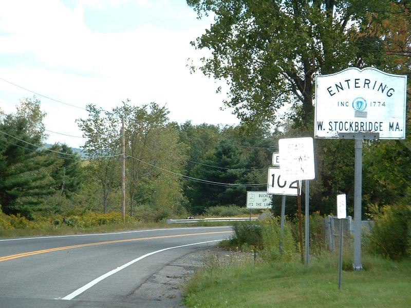
imagesize =
image_caption = The Massachusetts state line along Route 102.
image_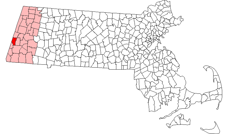
mapsize = 250px
map_caption = Location in Berkshire County in Massachusetts
mapsize1 =
map_caption1 =
subdivision_type = Country
subdivision_name =United States
subdivision_type1 = State
subdivision_name1 =Massachusetts
subdivision_type2 = County
subdivision_name2 = Berkshire
established_title = Settled
established_date = 1766
established_title2 = Incorporated
established_date2 = 1775
established_title3 =
established_date3 =
government_type =Open town meeting
leader_title =
leader_name =
leader_title1 =
leader_name1 =
area_magnitude =
area_total_km2 = 48.3
area_total_sq_mi = 18.6
area_land_km2 = 47.9
area_land_sq_mi = 18.5
area_water_km2 = 0.4
area_water_sq_mi = 0.2
population_as_of = 2000
settlement_type = Town
population_total = 1416
population_density_km2 = 29.6
population_density_sq_mi = 76.6
elevation_m = 275
elevation_ft = 901
timezone = Eastern
utc_offset = -5
timezone_DST = Eastern
utc_offset_DST = -4
latd = 42 |latm = 20 |lats = 45 |latNS = N
longd = 73 |longm = 22 |longs = 00 |longEW = W
website =
postal_code_type = ZIP code
postal_code = 01266
area_code = 413
blank_name = FIPS code
blank_info = 25-77990
blank1_name = GNIS feature ID
blank1_info = 0618276
footnotes =West Stockbridge is a town in Berkshire County,
Massachusetts ,United States . It is part of the Pittsfield,Massachusetts Metropolitan Statistical Area . The population was 1,416 at the 2000 census.History
West Stockbridge was first settled in 1766 and was officially incorporated in 1775. The town grew out of Stockbridge, formerly known as Indiantown, and was originally called Queensborough. The area was part of the disputed border between Massachusetts and New York, which eventually left the town in its current state. The town grew as five separate villages (West Center, West Stockbridge, Freedleyville, Rockdale and Williamsville), with West Stockbridge growing the largest because of the railroad, which hauled iron ore and marble. The town had an ironworks in Williamsville, founded by Colonel Elijah Williams, and the furnace smokestack is the only part which remains of the works. [ [http://www.berkshireweb.com/themap/weststockbridge/weststockbridge.html West Stockbridge, Massachusetts - The BerkshireWeb] ]
Geography
According to the
United States Census Bureau , the town has a total area of 18.6square mile s (48.3km² ), of which, 18.5 square miles (47.9 km²) of it is land and 0.2 square miles (0.4 km²) of it (0.86%) is water.West Stockbridge is bordered on the north by Richmond, on the east by Stockbridge, on the south by Great Barrington, on the southwest by Alford, and on the west by Austerlitz and Canaan,
New York . West Stockbridge is eleven miles south-southwest of Pittsfield,Massachusetts , fifty miles west-northwest of Springfield and 132 miles west of Boston.West Stockbridge is situated along the Williams River, a marshy tributary of the
Housatonic River . To the northeast, West Stockbridge Mountain lies along the Stockbridge town line. To the southwest, Tom Ball Mountain rises above the Alford town line, and Harvey Mountain rises on the state border. Maple Hill rises in the center of town, and is covered by a wildlife management area.Interstate 90 , also known as theMassachusetts Turnpike , crosses into the state in West Stockbridge. Exit 1, which solely consists of a western exit and eastern entrance, is located near the center of town, near the southern junction of Route 41 and Route 102, which begins on the state border in the village of State Line.An abandoned rail line crosses through town, adjoining the active line in State Line and heading southward through town towards Great Barrington. The nearest regional transportation services can all be reached in Pittsfield, including bus,
Amtrak and air service. The nearest national air service is atAlbany International Airport in New York.Demographics
As of the
census GR|2 of 2000, there were 1,416 people, 601 households, and 406 families residing in the town. By population, West Stockbridge ranks 18th out of the 32 cities and towns in Berkshire County, and 310th out of 351 cities and towns in Massachusetts. Thepopulation density was 76.6 people per square mile (29.6/km²), which rank 15th in the county and 299th in the Commonwealth. There were 769 housing units at an average density of 41.6/sq mi (16.1/km²). The racial makeup of the town was 98.09% White, 0.28% African American, 0.07% Native American, 0.92% Asian, 0.07% from other races, and 0.56% from two or more races. Hispanic or Latino of any race were 0.85% of the population.There were 601 households out of which 28.1% had children under the age of 18 living with them, 56.9% were married couples living together, 8.5% had a female householder with no husband present, and 32.4% were non-families. 27.0% of all households were made up of individuals and 13.1% had someone living alone who was 65 years of age or older. The average household size was 2.35 and the average family size was 2.86.
In the town the population was spread out with 21.8% under the age of 18, 4.9% from 18 to 24, 24.8% from 25 to 44, 31.6% from 45 to 64, and 16.9% who were 65 years of age or older. The median age was 44 years. For every 100 females there were 96.1 males. For every 100 females age 18 and over, there were 92.2 males.
The median income for a household in the town was $51,000, and the median income for a family was $64,464. Males had a median income of $40,865 versus $32,273 for females. The
per capita income for the town was $31,425. About 1.8% of families and 4.3% of the population were below thepoverty line , including 1.3% of those under age 18 and 3.8% of those age 65 or over.Government
West Stockbridge employs the
open town meeting form of government, and is led by aboard of selectmen and an administrative assistant. The town has its own services, including police, fire and public works, as well as a post office. The town operates a library four days a week, which is connected to the regional library systems.On the state level, West Stockbridge is represented in the
Massachusetts House of Representatives by the Fourth Berkshire district, which covers southern Berkshire County, as well as the westernmost towns in Hampden County. In theMassachusetts Senate , the town is represented by the Berkshire, Hampshire and Franklin district, which includes all of Berkshire County and western Hampshire and Franklin Counties. [ [http://www.mass.gov/legis/citytown.htm Senators and Representatives by City and Town] ] The town is patrolled by the First (Lee) Station of Barracks "B" of theMassachusetts State Police . [ [http://www.mass.gov/?pageID=eopsterminal&L=5&L0=Home&L1=Law+Enforcement+%26+Criminal+Justice&L2=Law+Enforcement&L3=State+Police+Troops&L4=Troop+B&sid=Eeops&b=terminalcontent&f=msp_divisions_field_services_troops_troop_b_msp_field_troop_b_station_b1&csid=Eeops Station B-1, SP Lee] ]On the national level, West Stockbridge is represented in the
United States House of Representatives as part ofMassachusetts's 1st congressional district , and has been represented byJohn Olver of Amherst since June 1991. Massachusetts is represented in theUnited States Senate by senior SenatorTed Kennedy and junior SenatorJohn Kerry .Education
West Stockbridge is a member of the Berkshire Hills Regional School District, along with Stockbridge and Great Barrington, which hosts all the district's schools. All students in the district attend the Muddy Hills Regional School from pre-kindergarten through fourth grades. Middle school students attend Monument Valley Regional Middle School, and high school students attend Monument Mountain Regional High School. There are private schools located in the nearby towns of Great Barrington and Lenox which are also open to students from the town.
The nearest
community college is the South County branch ofBerkshire Community College in Great Barrington. The nearest state college isMassachusetts College of Liberal Arts in North Adams, and the nearest state university is theUniversity of Massachusetts Amherst . The nearest private college isBard College at Simon's Rock , also in Great Barrington.References
External links
* [http://www.weststockbridge-ma.gov/Pages/index Town of West Stockbridge website]
* [http://www.bhrsd.org/ Berkshire Hills Regional School District website]
Wikimedia Foundation. 2010.