- Great Barrington, Massachusetts
-
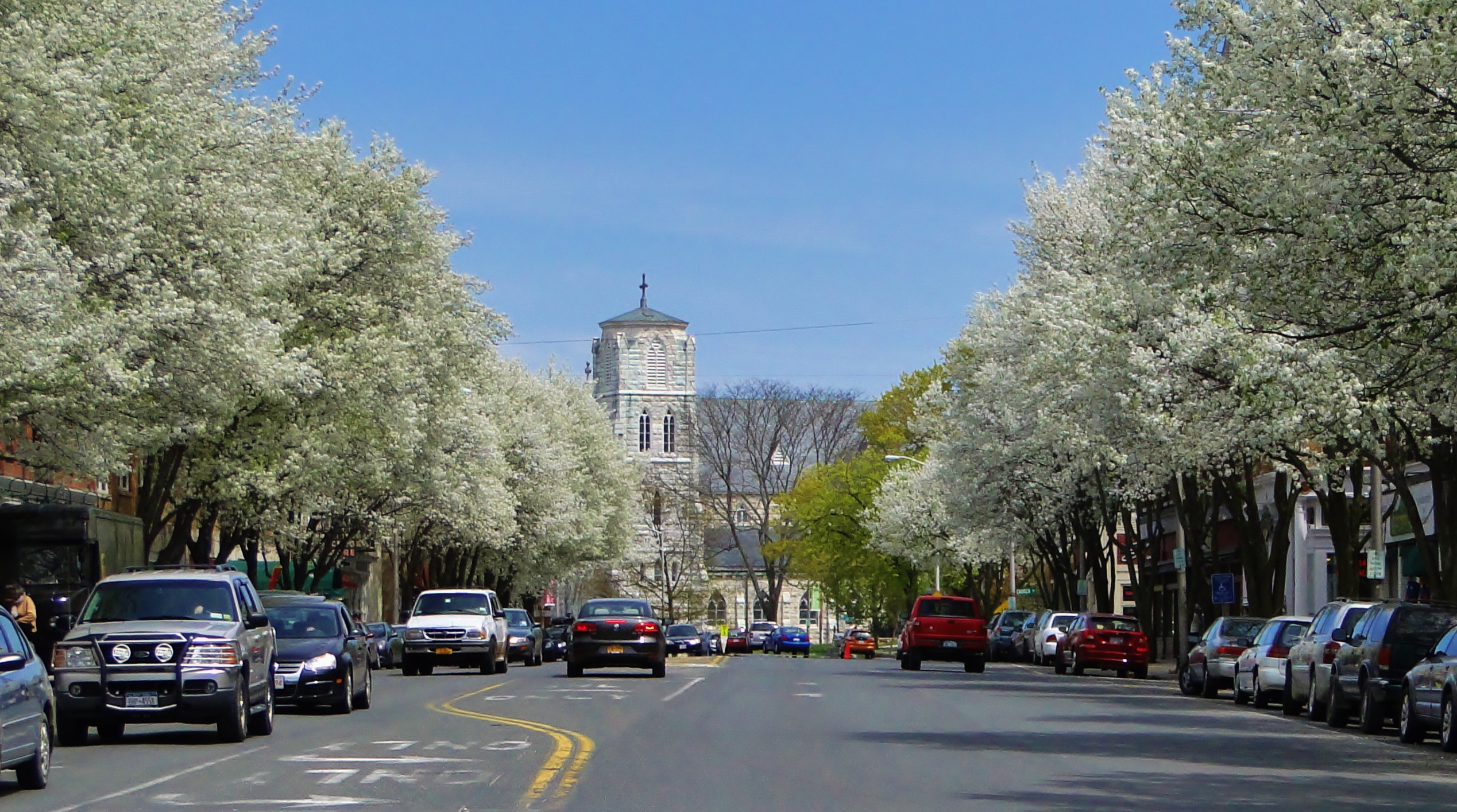
Great Barrington Town 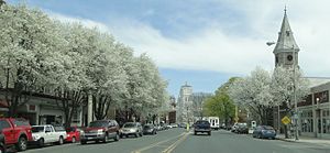 View from Main Street in the spring.
 Town Seal
Name origin: Village of Great Barrington in Gloucestershire, England. Country  United States
State  Massachusetts
Region Western Massachusetts County Berkshire County, Massachusetts Landmark W.E.B. Du Bois Homesite River Housatonic Coordinates 42°11′45″N 73°21′45″W / 42.19583°N 73.3625°W Highest point Monument Mountain - elevation 1,642 ft (500 m) - coordinates 42°14′50.4″N 73°20′26.6″W / 42.247333°N 73.340722°W Area 45.7 sq mi (118 km2) - land 45.2 sq mi (117 km2) - water 0.5 sq mi (1 km2) Population 7,104 (2010) Density 157.2 / sq mi (61 / km2) Settled 1726 Incorporation as town 1761 Government Open town meeting - location 334 Main Street (Town Hall) Timezone Eastern (EST) (UTC-5) - summer (DST) EDT (UTC-4) ZIP Code 01230 Area code 413 FIPS code 25-26815 GNIS feature ID 0619420  Location of Great Barrington in Berkshire County, Massachusetts
Website: townofgb.org/ Great Barrington is a town in Berkshire County, Massachusetts, United States. It is part of the Pittsfield, Massachusetts Metropolitan Statistical Area. The population was 7,104 at the 2010 census. Both a summer resort and home to Ski Butternut, Great Barrington includes the villages of Van Deusenville and Housatonic. It is also the birthplace of W. E. B. Du Bois.
Contents
History
The Mahican Indians called the area Mahaiwe, meaning "the place downstream." It lay on the New England Path, which connected Fort Orange near Albany, New York with Springfield and then Massachusetts Bay. The village was first settled in 1726, and from 1742–1761 was the north parish of Sheffield. In 1761, it was officially incorporated as Great Barrington, named after the village of Great Barrington in Gloucestershire, England.[1]
In the summer of 1774, 1,500 men shut down the Berkshire County Court in response to British oppression.
In the winter of 1776 Henry Knox passed through Great Barrington while transporting the cannon from Fort Ticonderoga to the Siege of Boston which established an agricultural interest in the area of Great Barrington.
With the arrival of the railroad, Great Barrington developed into a Gilded Age resort community for those seeking relief from the heat and pollution of cities, although it is now considered a small city in itself. Wealthy families built grand homes called Berkshire Cottages here, as others would in Lenox and Stockbridge. Among the earliest estates was that built by New York City banker, industrialist and art patron David Leavitt, who built an elaborate 300-acre (1.2 km2) estate, and was soon followed by those of his sons nearby.[2][3] Leavitt was instrumental in the development of the local Housatonic Railroad, serving as its president.
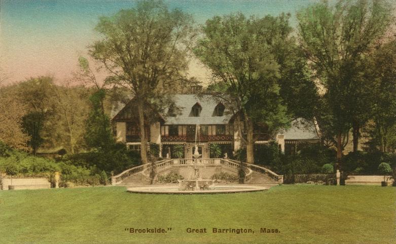
Other later estates included Searles Castle, commissioned in 1888 by the widow of Mark Hopkins together with her second husband, Edward Francis Searles, and Brookside, built for William Hall Walker. In 1895, Colonel William L. Brown, part owner of the New York Daily News, presented Great Barrington with a statue of a newsboy, now a landmark on the western edge of town.[4]
In March 1886, the water mill at Great Barrington was the site of an experiment that first used water to drive an alternating current generator. A transformer was used to increase the voltage and the current was transmitted over a mile away to the nearest town to power street lights.
The town was the site of an F4 tornado around 7:00 PM on Memorial Day, May 29, 1995. The tornado killed three people and caused damage in the area.[5]
Arlo Guthrie's "Alice's Restaurant," which runs for 18½ minutes, is based on true-life events that occurred in Great Barrington and the adjoining towns of Stockbridge and Lee.,[6] which is at the Old Trinity Church and was the home of Ray and Alice Brock at the time of the incidents related in the song, is at 4 Van Deusenville Road in Great Barrington.[7]
Great Barrington offers the use of its own local currency, called BerkShare notes. There are about 844,000 BerkShare notes in circulation worth about $801,800 at the current exchange rate of one BerkShare to 95 U.S. cents, according to program organizers. The paper money is available in denominations of one, five, ten, twenty, and fifty.[8]
Great Barrington today is a vibrant small town acting as the hub for "South County". The Town and its surrounds support not only a vibrant year round population but second home owners in the surrounding communities. GB as it is known is home to over 55 restaurants catering to a wide spectrum. The recently renovated Mahaiwe Theater has become a center for year round music and cultural events.
The Town celebrated its 250th anniversary with a large parade on July 10th, 2011. Other events celebrating the 250th anniversary were held throughout the year as well.[9]
Geography
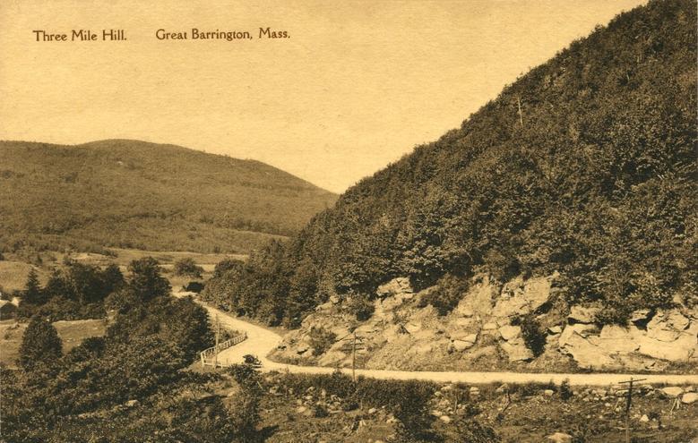
 Three Mile Hill in c. 1915
According to the United States Census Bureau, the town has a total area of 45.7 square miles (118.4 km²), of which, 45.2 square miles (117.0 km²) of it is land and 0.5 square miles (1.3 km²) of it (1.12%) is water. Great Barrington is bordered by West Stockbridge, Stockbridge and Lee to the north, Tyringham to the northeast, Monterey to the east, New Marlborough to the southeast, Sheffield to the south, Egremont to the southwest, and Alford to the northwest. The town is located 20 miles (32 km) south of Pittsfield, 46 miles (74 km) west of Springfield, and 135 miles (217 km) west of Boston.
Great Barrington is located within the valley of the Housatonic River, and is also served by the Williams River, Green River and several brooks. To the east of the river, several mountains of the Berkshires rise, including East Mountain (site of Butternut Basin and a state forest), Beartown Mountain (and the majority of Beartown State Forest) and Monument Mountain. The Appalachian Trail crosses through East Mountain State Forest in the southwest corner of town. The southwest corner of town is also the site of several country clubs and a fairgrounds.
U.S. Route 7 passes through the center of town, and was once part of New England Interstate Route 4 (also known as the New York-Berkshire-Burlington Way). Route 23 also passes from west to east through town, combining with Route 41 and Route 7 in the western part of town and Route 183 in the eastern part of town, which also follows part of the path of Route 7 northward from Route 23 before splitting towards the village of Housatonic. Great Barrington is located approximately twelve miles south of Exit 2 of Interstate 90 (also known as the Massachusetts Turnpike), the nearest interstate highway.
Great Barrington is equidistant to New York City and Boston, although it is not the halfway point on the highways between those two cities.
Demographics
See also: Great Barrington (CDP), Massachusetts
Historical populations Year Pop. ±% 1850 3,264 — 1860 3,871 +18.6% 1870 4,320 +11.6% 1880 4,653 +7.7% 1890 4,012 −13.8% 1900 5,854 +45.9% 1910 5,926 +1.2% 1920 6,315 +6.6% 1930 5,934 −6.0% 1940 5,824 −1.9% 1950 6,712 +15.2% 1960 6,624 −1.3% 1970 7,537 +13.8% 1980 7,405 −1.8% 1990 7,725 +4.3% 2000 7,527 −2.6% 2001* 7,466 −0.8% 2002* 7,441 −0.3% 2003* 7,426 −0.2% 2004* 7,404 −0.3% 2005* 7,407 +0.0% 2006* 7,374 −0.4% 2007* 7,406 +0.4% 2008* 7,382 −0.3% 2009* 7,355 −0.4% 2010 7,104 −3.4% * = population estimate.
Source: United States Census records and Population Estimates Program data.[10][11][12][13][14][15][16][17][18][19]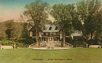 Brookside in c. 1915, the estate of William Hall Walker
As of the census[20] of 2000, there were 7,527 people, 3,008 households, and 1,825 families residing in the town. By population, the town ranks fifth out of the 32 cities and towns in Berkshire County, and 202nd out of 351 cities and towns in Massachusetts. The population density was 166.6 people per square mile (64.3/km²), ranking it eighth in the county and 268th in the Commonwealth. There were 3,352 housing units at an average density of 74.2 per square mile (28.6/km²). The racial makeup of the town was 94.74% White, 2.09% Black or African American, 0.16% Native American, 1.25% Asian, 0.03% Pacific Islander, 0.70% from other races, and 1.04% from two or more races. Hispanic or Latino of any race were 2.07% of the population. 17% were of Irish descent, 12% Italian, 11% German, 10% English and 9% Polish.
There were 3,008 households out of which 27.3% had children under the age of 18 living with them, 45.8% were married couples living together, 11.5% had a female householder with no husband present, and 39.3% were non-families. 32.6% of all households were made up of individuals and 13.3% had someone living alone who was 65 years of age or older. The average household size was 2.28 and the average family size was 2.89.
In the town the population was spread out with 22.6% under the age of 18, 9.0% from 18 to 24, 23.5% from 25 to 44, 26.2% from 45 to 64, and 18.8% who were 65 years of age or older. The median age was 42 years. For every 100 females there were 87.2 males. For every 100 females age 18 and over, there were 83.8 males.
The median income for a household in the town was $45,490, and the median income for a family was $53,135. Males had a median income of $38,163 versus $29,474 for females. The per capita income for the town was $22,655. About 3.4% of families and 7.2% of the population were below the poverty line, including 6.6% of those under age 18 and 4.5% of those age 65 or over.
Government
 Town Hall
Great Barrington employs the open town meeting form of government, and is led by a board of selectmen and a town manager. Great Barrington has its own public services, including police, fire and public works departments. The town has two libraries,[21] with the main branch, Mason Library, located at 231 Main Street in Great Barrington, and a branch library, Ramsdell Library, located at 1087 Main Street in the village of Housatonic. Both are part of the regional library network. The town is also home to Southern Berkshire District Court,[22] as well as Fairview Hospital, the largest hospital in the southern end of the county (Based on the number of beds).[23]
On the state level, Great Barrington is represented in the Massachusetts House of Representatives by the Fourth Berkshire district, which covers southern Berkshire County, as well as the westernmost towns in Hampden County. In the Massachusetts Senate, the town is represented by the Berkshire, Hampshire and Franklin district, which includes all of Berkshire County and western Hampshire and Franklin Counties.[24] The town is patrolled by the First (Lee) Station of Barracks "B" of the Massachusetts State Police.[25]
On the national level, Great Barrington is represented in the United States House of Representatives as part of Massachusetts's 1st congressional district, and has been represented by John Olver of Amherst since June 1991.
Local currency
The local currency of the region, including Great Barrington, is the BerkShares; proponents say that the currency gets residents to shop at local stores. Local areas may have their own currencies as long as they do not resemble the United States dollar and are in paper only.[26]
Education
Great Barrington is the central town of the Berkshire Hills Regional School District, which includes the towns of Stockbridge and West Stockbridge. All three school levels are located in Great Barrington. Muddy Brook Regional Elementary School offers pre-kindergarten through fourth grade classes and is located off of Route 7 in the northern part of town. Monument Valley Regional Middle School offers grades five through eight and Monument Mountain Regional High School serves the high school students of the district. The school's athletic teams are called the Spartans, and their colors are maroon and white. Students from Otis and Sandisfield also attend the school as part of a tuition agreement for high schools. The town also is home to several private schools, including the Rudolf Steiner School, the Great Barrington Waldorf High School, and the John Dewey Academy.
Great Barrington is home to Bard College at Simon's Rock, a private college, and the South County Center of the Berkshire Community College. The nearest state university is Westfield State University.
Great Barrington also plays host to the American Institute for Economic Research. AIER was founded in 1933 as non-profit scientific and educational organization. Originally located at MIT, it relocated to the southern shore of Great Barrington's Long Pond in 1946.
Transportation
Ground
Great Barrington is served by the Berkshire Regional Transit Authority, which offers bus transportation throughout Berkshire County. Peter Pan Bus Lines and Greyhound Bus Lines have stops in Great Barrington for long-range bus transportation. The town lies along the Housatonic Railroad line, which roughly follows Route 7 and the river through southern New England.
Air
Walter J. Koladza Airport is located in Great Barrington, and features a full service FBO for General Aviation aircraft. The nearest international airports are Bradley International Airport in Windsor Locks, CT, and Albany International Airport in Albany, NY.
Media
 Main Street in the Spring
Great Barrington is served by a local weekly newspaper, The Berkshire Record, and a weekly shopper, The Shoppers Guide.
The town also gets newspaper delivery from The Berkshire Eagle. There used to be a second newspaper, The Berkshire Courier, which has since gone out of print but the masthead of the Berkshire Courier was incorporated by the Berkshire Record in 1995.
Great Barrington has a few local radio stations.
- WSBS 860 kHz (Full Service)
- W231AK 94.1 MHz (//WSBS Full Service)
- WBCR-LP 97.7 MHz (Local Variety)
- W254AU 98.7 MHz (//WFCR NPR Amherst)
- WAMQ 105.1 MHz (//WAMC NPR Albany)
Great Barrington is in the Albany, New York television market with three Springfield TV stations appearing on the cable lineup, WWLP(NBC 22), WGBY (PBS 57), WSHM-LP (CBS 67). The town is served by Time Warner cable out of Lee.
Sites of interest
 First Congregational Church of Great Barrington in c. 1910, built in 1882
- Aston Magna Festival
- Bard College at Simon's Rock
- First Congregational Church of Great Barrington
- Great Barrington Historical Society & Museum
- Mahaiwe Performing Arts Center
Notable natives
- Phyllis Birkby, architect & feminist[27]
- John Schroeder, golfer
- W.E.B. Du Bois, Academic, scholar, activist, journalist, sociologist
References
- ^ http://berkshirecountryhomesrealestate.com/berkshirehomesforsale/great-barrington-ma-real-estate-town-history/
- ^ David Leavitt, Obituary, The New York Times, Dec. 31, 1879
- ^ Mrs. Hopkins's Recent Art Purchase, The New York Times, Dec. 18, 1881
- ^ http://www.neace.com/newsboy/index.html
- ^ Strzempko, Adam. "Great Barrington tornado 14 years later". WWLP.com. http://www.wwlp.com/dpp/news/local/wwlp_local_great_barrington_tornado_14_years_later_200905281710. Retrieved 13 June 2010.
- ^ The Guthrie Center
- ^ Guthrie Center
- ^ [1]
- ^ http://www.gb250th.com/GB_250_Calendar_of_Events424.pdf
- ^ "TOTAL POPULATION (P1), 2010 Census Summary File 1, All County Subdivisions within Massachusetts". United States Census Bureau. http://factfinder2.census.gov/bkmk/table/1.0/en/DEC/10_SF1/P1/0400000US25.06000. Retrieved September 13, 2011.
- ^ "Massachusetts by Place and County Subdivision - GCT-T1. Population Estimates". United States Census Bureau. http://factfinder.census.gov/servlet/GCTTable?_bm=y&-geo_id=04000US25&-_box_head_nbr=GCT-T1&-ds_name=PEP_2009_EST&-_lang=en&-format=ST-9&-_sse=on. Retrieved July 12, 2011.
- ^ "1990 Census of Population, General Population Characteristics: Massachusetts". US Census Bureau. December 1990. Table 76: General Characteristics of Persons, Households, and Families: 1990. 1990 CP-1-23. http://www.census.gov/prod/cen1990/cp1/cp-1-23.pdf. Retrieved July 12, 2011.
- ^ "1980 Census of the Population, Number of Inhabitants: Massachusetts". US Census Bureau. December 1981. Table 4. Populations of County Subdivisions: 1960 to 1980. PC80-1-A23. http://www2.census.gov/prod2/decennial/documents/1980a_maABC-01.pdf. Retrieved July 12, 2011.
- ^ "1950 Census of Population". Bureau of the Census. 1952. Section 6, Pages 21-10 and 21-11, Massachusetts Table 6. Population of Counties by Minor Civil Divisions: 1930 to 1950. http://www2.census.gov/prod2/decennial/documents/23761117v1ch06.pdf. Retrieved July 12, 2011.
- ^ "1920 Census of Population". Bureau of the Census. Number of Inhabitants, by Counties and Minor Civil Divisions. Pages 21-5 through 21-7. Massachusetts Table 2. Population of Counties by Minor Civil Divisions: 1920, 1910, and 1920. http://www2.census.gov/prod2/decennial/documents/41084506no553ch2.pdf. Retrieved July 12, 2011.
- ^ "1890 Census of the Population". Department of the Interior, Census Office. Pages 179 through 182. Massachusetts Table 5. Population of States and Territories by Minor Civil Divisions: 1880 and 1890. http://www2.census.gov/prod2/decennial/documents/41084506no553ch2.pdf. Retrieved July 12, 2011.
- ^ "1870 Census of the Population". Department of the Interior, Census Office. 1872. Pages 217 through 220. Table IX. Population of Minor Civil Divisions, &c. Massachusetts. http://www2.census.gov/prod2/decennial/documents/1870e-05.pdf. Retrieved July 12, 2011.
- ^ "1860 Census". Department of the Interior, Census Office. 1864. Pages 220 through 226. State of Massachusetts Table No. 3. Populations of Cities, Towns, &c.. http://www2.census.gov/prod2/decennial/documents/1860a-08.pdf. Retrieved July 12, 2011.
- ^ "1850 Census". Department of the Interior, Census Office. 1854. Pages 338 through 393. Populations of Cities, Towns, &c.. http://www2.census.gov/prod2/decennial/documents/1850c-11.pdf. Retrieved July 12, 2011.
- ^ "American FactFinder". United States Census Bureau. http://factfinder.census.gov. Retrieved 2008-01-31.
- ^ http://gblibraries.org/
- ^ http://www.mass.gov/courts/courtsandjudges/courts/southberkshiredistrictmain.html
- ^ http://www.ahd.com/freelist.php3?mname=&mcity=&mstate%5B%5D=&mzip=&mphone=413&submitted=Search
- ^ Senators and Representatives by City and Town
- ^ Station B-1, SP Lee
- ^ "Some communities are printing their own currency." CNN. April 22, 2009. Retrieved on April 22, 2009.
- ^ "Noel Phyllis Birkby Papers, Sophia Smith Collection". Smith College. 1998. http://asteria.fivecolleges.edu/findaids/sophiasmith/mnsss3_admin.html. Retrieved 12 Aug 2011.
External links
Municipalities and communities of Berkshire County, Massachusetts Cities 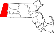
Towns Adams | Alford | Becket | Cheshire | Clarksburg | Dalton | Egremont | Florida | Great Barrington | Hancock | Hinsdale | Lanesborough | Lee | Lenox | Monterey | Mount Washington | New Ashford | New Marlborough | Otis | Peru | Richmond | Sandisfield | Savoy | Sheffield | Stockbridge | Tyringham | Washington | West Stockbridge | Williamstown | Windsor
CDPs Adams | Great Barrington | Housatonic | Lee | Lenox | Williamstown
Other
villagesCategories:- Great Barrington, Massachusetts
- Towns in Berkshire County, Massachusetts


Wikimedia Foundation. 2010.