- Washington, Massachusetts
Infobox Settlement
official_name = Washington, Massachusetts
nickname =
motto =
imagesize =
image_caption =
image_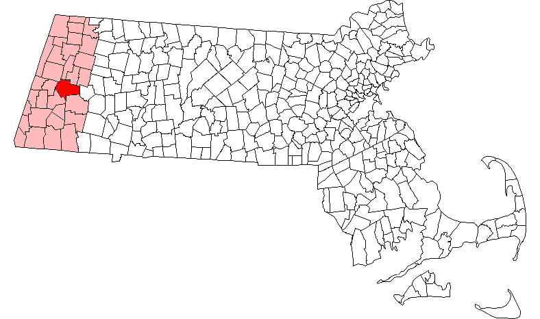
mapsize = 250px
map_caption = Location in Berkshire County in Massachusetts
mapsize1 =
map_caption1 =
subdivision_type = Country
subdivision_name =United States
subdivision_type1 = State
subdivision_name1 =Massachusetts
subdivision_type2 = County
subdivision_name2 = Berkshire
established_title = Settled
established_date = 1760
established_title2 = Incorporated
established_date2 = 1777
established_title3 =
established_date3 =
government_type =Open town meeting
leader_title =
leader_name =
leader_title1 =
leader_name1 =
area_magnitude =
area_total_km2 = 100.2
area_total_sq_mi = 38.7
area_land_km2 = 97.8
area_land_sq_mi = 37.8
area_water_km2 = 2.4
area_water_sq_mi = 0.9
population_as_of = 2000
settlement_type = Town
population_total = 544
population_density_km2 = 5.6
population_density_sq_mi = 14.4
elevation_m = 430
elevation_ft = 1412
timezone = Eastern
utc_offset = -5
timezone_DST = Eastern
utc_offset_DST = -4
latd = 42 |latm = 21 |lats = 57 |latNS = N
longd = 73 |longm = 07 |longs = 00 |longEW = W
website = http://town.washington.ma.us/
postal_code_type = ZIP code
postal_code = 01223
area_code = 413
blank_name = FIPS code
blank_info = 25-73335
blank1_name = GNIS feature ID
blank1_info = 0618275
footnotes =Washington is a town in Berkshire County,
Massachusetts ,United States . It is part of the Pittsfield,Massachusetts Metropolitan Statistical Area . The population was 544 at the 2000 census.History
Washington was first settled in 1760 and was officially incorporated in 1777. The town was called several different names, including Greenoch, Watsontown and Hartville, before being renamed in 1784 for
George Washington . [ [http://www.berkshireweb.com/themap/washington/washington.html The Berkshire Web - Washington, Massachusetts] ] The town has always been rural, with few small industries, known more for being along the stage road to Pittsfield and along the rail line later.Geography
According to the
United States Census Bureau , the town has a total area of 38.7square mile s (100.2km² ), of which, 37.8 square miles (97.8 km²) of it is land and 0.9 square miles (2.4 km²) of it (2.38%) is water. Located in central Berkshire County along theHampshire County line, the town, which is roughly shaped, is bordered by Dalton, Hinsdale and Peru to the north, Middlefield to the east, Becket to the southeast, Lee to the southwest, and Lenox to the west. Washington is 11 miles southeast of Pittsfield, 39 miles northwest of Springfield, and 123 miles west of Boston.Washington lies within the Berkshire Hills, and its geography is dominated by October Mountain in the western part of town. The mountain, which is surrounded by the October Mountain State Forest rises to its high plain above the banks of the
Housatonic River , falling slowly eastward towards the valley where the Depot Brook (which feeds into a branch of theWestfield River ) and the east branch of the Housatonic rise. There are several small reservoirs and lakes throughout the town as well. Along the mountain, theAppalachian Trail crosses through town, and the town is also home to the Bucksteep Manor Cross Country Ski Area.Route 8 is the only state route through town, passing from Becket to Hinsdale. The nearest interstate highway,
Interstate 90 (also known as theMassachusetts Turnpike ), is accessible in neighboring Lee. The town has a rail line, operated by CSX and used byAmtrak . The nearest regional airport isPittsfield Municipal Airport , and the nearest national flights are atBradley International Airport in Connecticut.Demographics
As of the
census GR|2 of 2000, there were 544 people, 203 households, and 163 families residing in the town. The town ranks 28th out of 32 cities and towns in Berkshire County by population, and 340th out of 351 cities and towns in Massachusetts. Thepopulation density was 14.4 people per square mile (5.6/km²), ranking it second to last in the county and sixth to last in the state. There were 236 housing units at an average density of 6.2/sq mi (2.4/km²). The racial makeup of the town was 99.45% White, 0.37% African American, and 0.18% from two or more races. Hispanic or Latino of any race were 0.74% of the population.There were 203 households out of which 36.5% had children under the age of 18 living with them, 67.0% were married couples living together, 8.4% had a female householder with no husband present, and 19.7% were non-families. 14.8% of all households were made up of individuals and 6.4% had someone living alone who was 65 years of age or older. The average household size was 2.68 and the average family size was 2.96.
In the town the population was spread out with 26.5% under the age of 18, 5.7% from 18 to 24, 25.2% from 25 to 44, 32.7% from 45 to 64, and 9.9% who were 65 years of age or older. The median age was 41 years. For every 100 females there were 106.1 males. For every 100 females age 18 and over, there were 104.1 males.
The median income for a household in the town was $54,583, and the median income for a family was $55,357. Males had a median income of $40,417 versus $27,143 for females. The
per capita income for the town was $23,610. About 4.8% of families and 6.9% of the population were below thepoverty line , including 12.5% of those under age 18 and 7.1% of those age 65 or over.Government
Washington uses the
open town meeting form of government, and is led by aboard of selectmen . The town has its own police, fire and public works department. There is no public library in the town, with both Hinsdale and Becket having facilities. The nearest hospital, Berkshire Medical Center, is in Pittsfield.On the state level, Washington is represented in the
Massachusetts House of Representatives by the Second Berkshire district, which covers central Berkshire County, as well as portions of Hampshire and Franklin Counties. In theMassachusetts Senate , the town is represented by the Berkshire, Hampshire and Franklin district, which includes all of Berkshire County and western Hampshire and Franklin Counties. [ [http://www.mass.gov/legis/citytown.htm Senators and Representatives by City and Town] ] The town is patrolled by the Fourth (Cheshire) Station of Barracks "B" of theMassachusetts State Police , and is the southernmost town in that station's patrol area. [ [http://www.mass.gov/?pageID=eopsterminal&L=5&L0=Home&L1=Law+Enforcement+%26+Criminal+Justice&L2=Law+Enforcement&L3=State+Police+Troops&L4=Troop+B&sid=Eeops&b=terminalcontent&f=msp_divisions_field_services_troops_troop_b_msp_field_troop_b_station_b4&csid=Eeops Station B-4, SP Cheshire] ]On the national level, Washington is represented in the
United States House of Representatives as part ofMassachusetts's 1st congressional district , and has been represented byJohn Olver of Amherst since June 1991. Massachusetts is represented in theUnited States Senate by senior SenatorTed Kennedy and junior SenatorJohn Kerry .Education
Washington is one of the seven towns in the
Central Berkshire Regional School District , the largest district (by land area) in the Commonwealth. Students in Washington attend the Beckett-Washington Elementary School in neighboring Becket for elementary school. All students in the district travel to Dalton to attend Nessacus Regional Middle School for sixth through eighth grades and Wahconah Regional High School for the high grades. There are no private schools in Washington, with the nearest being in the Pittsfield area.The nearest community college is
Berkshire Community College in Pittsfield. The nearest state colleges areMassachusetts College of Liberal Arts in North Adams andWestfield State College in Westfield, and the nearest state university is theUniversity of Massachusetts Amherst .References
Wikimedia Foundation. 2010.