- Becket, Massachusetts
Infobox Settlement
official_name = Becket, Massachusetts
nickname =
motto =
imagesize =
image_caption = The Becket Arts Center
image_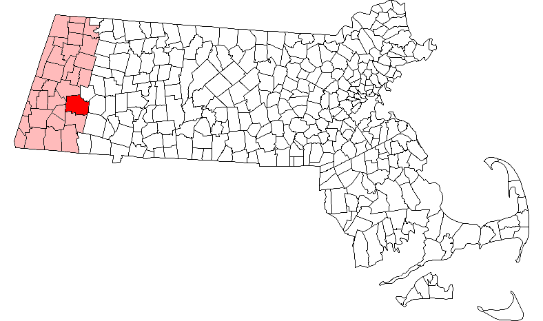
mapsize = 250x200px
map_caption = Location in Berkshire County in Massachusetts
mapsize1 =
map_caption1 =
subdivision_type = Country
subdivision_name =United States
subdivision_type1 = State
subdivision_name1 =Massachusetts
subdivision_type2 = County
subdivision_name2 = Berkshire
established_title = Settled
established_date = 1740
established_title2 = Incorporated
established_date2 = 1765
established_title3 =
established_date3 =
government_type =Open town meeting
leader_title =
leader_name =
leader_title1 =
leader_name1 =
area_magnitude =
area_total_km2 = 123.7
area_total_sq_mi = 47.8
area_land_km2 = 119.8
area_land_sq_mi = 46.3
area_water_km2 = 3.9
area_water_sq_mi = 1.5
population_as_of = 2000
settlement_type = Town
population_total = 1755
population_density_km2 = 14.6
population_density_sq_mi = 37.9
elevation_m = 366
elevation_ft = 1200
timezone = Eastern
utc_offset = -5
timezone_DST = Eastern
utc_offset_DST = -4
latd = 42 |latm = 19 |lats = 55 |latNS = N
longd = 73 |longm = 05 |longs = 00 |longEW = W
website = [http://www.townofbecket.org/ www.townofbecket.org]
postal_code_type = ZIP code
postal_code = 01223
area_code = 413
blank_name = FIPS code
blank_info = 25-04545
blank1_name = GNIS feature ID
blank1_info = 0619416
footnotes =Becket is a town in Berkshire County,
Massachusetts ,United States . It is part of the Pittsfield,Massachusetts Metropolitan Statistical Area . The population was 1,755 at the 2000 census.History
Becket was first settled in 1740 and was officially incorporated in 1765. The town, most likely named for Saint Thomas Becket, was the site of an experiment in the late eighteenth century involving the local church. Seeing the problems involved with communities who supported congregational churches, the town established its own church society, where local citizens supported the church without any tax monies. It was one of the first frontier communities to employ this model of supporting churches.
From its earliest days, Becket was involved in the woodland industries of lumber and quarries. As time went on, dairy production, basketry and silk also were products of the town. After a flood in the early twentieth century, most of the industries died out, and today Becket is mostly known as a resort town with an artists' community surrounding the Jacob's Pillow Company. [ [http://www.townofbecket.org/Public_Documents/BecketMA_WebDocs/about Town of Becket - A Brief History of Becket] ] [ [http://www.berkshireweb.com/themap/becket/becket.html the Berkshire Web - Town of Becket] ]
Geography
According to the
United States Census Bureau , the town has a total area of 47.8square mile s (123.7km² ), of which, 46.3 square miles (119.8 km²) of it is land and 1.5 square miles (3.9 km²) of it (3.12%) is water. Becket is located on the eastern border of Berkshire County, at the junction of Hampshire County and Hampden County. Becket is bordered by Washington to the northwest, Middlefield to the northeast, Chester and Blandford to the east, Otis to the south, and Tyringham and Lee to the west. Becket is 17 miles southeast of Pittsfield, 32 miles northwest of Springfield, and 118 miles west of Boston.Becket is located in the southern
Berkshire Mountains , and is dotted with hills on the interior, and surrounded on two sides by Becket Mountain and Walking Mountain to the west, and Mount Gobble to the east. The west branch of theWestfield River flows along much of the Middlefield town line, flowing eastward towards Chester. Several marshy brooks flow through the town, and there are several ponds, lakes and the Palmer Brook Reservoir. Along the river, a small portion of the Walnut Hill Wildlife Management Area lies within the town, and to the west, the southeastern corner of October Mountain State Forest. TheAppalachian Trail passes through the western part of town, circumventing the town of Lee while heading from Tyringham to Washington over Becket Mountain.Interstate 90 , also known as theMassachusetts Turnpike , passes through town, with the nearest exit (Exit 2) being in neighboring Lee. The town also lies alongU.S. Route 20 , which is the main east-west route through the town. Route 8 is combined with the road for 5 miles starting at the center of town, with the majority of the town's population lying around Robin Hood Lake south of this stretch. A portion of the CSX rail line passes along the river valley, providing access between Pittsfield and Springfield. The nearest rail, bus and regional air service can be found in Pittsfield, with the nearest national air service coming fromBradley International Airport in Windsor Locks,Connecticut .Demographics
As of the
census GR|2 of 2000, there were 1,755 people, 692 households, and 505 families residing in the town. In terms of population, Becket ranks fourteenth out of the 32 cities and towns in Berkshire County, and 297th out of the 351 cities and towns in Massachusetts. Thepopulation density was 37.9 people per square mile (14.6/km²), ranking it 19th in the county and 322nd in the Commonwealth. There were 1,451 housing units at an average density of 31.4/sq mi (12.1/km²). The racial makeup of the town was 97.44% White, 0.68% African American, 0.17% Native American, 0.51% Asian, 0.11% from other races, and 1.08% from two or more races. Hispanic or Latino of any race were 1.08% of the population.There were 692 households out of which 30.9% had children under the age of 18 living with them, 61.7% were married couples living together, 6.5% had a female householder with no husband present, and 27.0% were non-families. 22.0% of all households were made up of individuals and 7.7% had someone living alone who was 65 years of age or older. The average household size was 2.50 and the average family size was 2.92.
In the town the population was spread out with 23.6% under the age of 18, 5.6% from 18 to 24, 29.2% from 25 to 44, 28.6% from 45 to 64, and 13.0% who were 65 years of age or older. The median age was 41 years. For every 100 females there were 101.3 males. For every 100 females age 18 and over, there were 101.4 males.
The median income for a household in the town was $46,806, and the median income for a family was $53,417. Males had a median income of $40,774 versus $30,300 for females. The
per capita income for the town was $21,861. About 3.2% of families and 4.5% of the population were below thepoverty line , including 5.0% of those under age 18 and 3.7% of those age 65 or over.Government
Becket employs the
open town meeting form of government, and is led by aboard of selectmen and administrative assistant. The town has a police station near the geographic center of town (the area known as Becket Center), and a post office also in Becket Center (the post office was moved from North Becket to Becket Center in the early 2000s). There are two fire stations, one in North Becket and the other located near the Sherwood Forest housing community (along Routes 8 & 20). The nearest hospital, Berkshire Medical Center, is located in Pittsfield.On the state level, Becket is represented in the
Massachusetts House of Representatives by the Fourth Berkshire district, which covers southern Berkshire County, as well as the westernmost towns in Hampden County. In theMassachusetts Senate , the town is represented by the Berkshire, Hampshire and Franklin district, which includes all of Berkshire County and western Hampshire and Franklin Counties. [ [http://www.mass.gov/legis/citytown.htm Senators and Representatives by City and Town] ] The town is patrolled by the First (Lee) Station of Barracks "B" of theMassachusetts State Police . [ [http://www.mass.gov/?pageID=eopsterminal&L=5&L0=Home&L1=Law+Enforcement+%26+Criminal+Justice&L2=Law+Enforcement&L3=State+Police+Troops&L4=Troop+B&sid=Eeops&b=terminalcontent&f=msp_divisions_field_services_troops_troop_b_msp_field_troop_b_station_b1&csid=Eeops Station B-1, SP Lee] ]On the national level, Becket is represented in the
United States House of Representatives as part ofMassachusetts's 1st congressional district , and has been represented byJohn Olver of Amherst since June 1991. Massachusetts is represented in theUnited States Senate by senior SenatorTed Kennedy and junior SenatorJohn Kerry .Education
Becket is one of the seven towns in the
Central Berkshire Regional School District , the largest district (by land area) in the Commonwealth. Students in Becket attend the Beckett-Washington Elementary School in town for elementary school. All students in the district travel to Dalton to attend Nessacus Regional Middle School for sixth through eighth grades and Wahconah Regional High School for the high grades. There are no private schools in Becket, with the nearest being in Lee and the Pittsfield area.The nearest community college is
Berkshire Community College in Pittsfield. The nearest state college isWestfield State College in Westfield, and the nearest state university is theUniversity of Massachusetts Amherst . The nearest private college isBard College at Simon's Rock in Great Barrington, with other private colleges in Springfield.Points of interest
*
Jacob's Pillow Dance Festival
* The Kushi Institute (http://www.kushiinstitute.org) world renowned center for macrobiotics
* Becket Arts Center http://www.becketartscenter.org/Founded by pianist Emanuel Levenson and painterFay Kleinman , known also as Fay Levenson. http://www.geocities.com/faykleinman/paintings.html
*Becket Chimney Corners YMCA http://www.bccymca.org
* Canterbury Ski Farm.
* The population of Becket increases significantly in the summer, as it is home to several largesummer camp s, most notablyBecket Chimney Corners YMCA . The town also includes the all-boys campCamp Greylock .Notable residents
* Sylvester Smith, early Mormon leader
* Michio and Aveline Kushi (http://www.michiokushi.org), leaders of the worldwide macrobiotic movementReferences
External links
* http://www.masspike.com/aboutus/aboutus_faq.html#11
Wikimedia Foundation. 2010.