- Massachusetts Turnpike
-
Massachusetts Turnpike

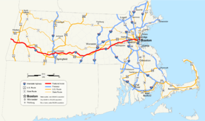
Route information Maintained by MassDOT Length: 138.1 mi[1] (222.25 km) Existed: 1958 (final construction in 2003) – present Major junctions West end: 
 I-90 / Thruway at New York state line
 I-91 / US 5 in West Springfield
 I-84 in Sturbridge


 I-290 / I-395 / Route 12 in Auburn
 I-495 in Hopkinton


 I-95 / Route 30 / Route 128 in Weston


 I-93 / US 1 / Route 3 in Boston
East end:  Route 1A in Boston
Highway system Massachusetts State Highway Routes
←  Route 88
I-91 →The Massachusetts Turnpike (commonly shortened to the MassPike or The Pike) is the easternmost 138-mile (222 km) stretch of Interstate 90. The Turnpike begins at the western border of Massachusetts in West Stockbridge connecting with the Berkshire Connector portion of the New York State Thruway. From there, the MassPike heads east, traversing the state and serving the major cities of Springfield, Worcester, and Boston, and ends at Logan International Airport in East Boston, where the road meets Route 1A. The highest point on the Turnpike is in the Town of Becket, Massachusetts at elevation 1,724 feet (525 m) above sea level.
Contents
History
 The original logo depicted Paul Revere on horseback with the words "Massachusetts Turnpike Authority" in a circle around him.
 The original Masspike pilgrim hat, on a shield for the Sumner Tunnel. The previous incarnation of the logo had a Native American arrow sticking through the pilgrim hat. It was replaced with a plain hat and the words "Mass Pike" in 1989 primarily due to confusion among motorists who sometimes mistakenly turned in the direction the arrow pointed (right) when attempting to enter the turnpike.[2]
Plans for the Turnpike date back to at least 1948, when the Western Expressway was being planned. The original section would have connected Boston's Inner Belt to Newton with connections with US 20 and Route 30 for traffic continuing west. Later extensions would take the road to and beyond Worcester. From the beginning, the corridor was included in federal plans for the Interstate Highway System, stretching west to the New York state line and beyond to Albany.
Also included in the route was the planned Springfield Bypass, which had been proposed to provide a bypass of US 20 in the Springfield area. Part of this route (and that of the eventual Turnpike) used the grading from the never-opened Hampden Railroad. Similarly, the West Stockbridge Bypass provided a new route of Route 102 from Route 183 in Stockbridge west to Route 102 just east of the state line in West Stockbridge; this latter route was built prior to the Turnpike.
The Massachusetts Turnpike Authority was created in 1952 by a special act of the Massachusetts General Court (legislature) upon the recommendation of Governor Dever and his Commissioner of Public Works, William F. Callahan. (1952 Acts and Resolves chapter 354; 1952 Senate Doc. 1.) The enabling act was modeled upon that of the Mystic River Bridge Authority (1946 Acts and Resolves chapter 562), but several changes were made that would prove of great importance fifty years later. Callahan served as chairman of the Authority until his death in April 1964.
When the attorneys were searching land titles along the proposed route, they discovered that sections of the original land had been granted by the King of England to some of the landowner's ancestors.[citation needed] Construction began in 1955, and the whole four-lane road from Route 102 at the state line to Route 128 in Weston opened on May 15, 1957. The Berkshire Thruway opened on May 26, 1959, connecting the west end to the New York State Thruway mainline south of Albany. Prior to its opening, traffic used Route 22 and US 20 in New York. At the Massachusetts/New York state line, one can see where the Turnpike made an abrupt right turn before terminating at Route 102, as the old pavement still exists for Turnpike Authority and State Police vehicles to access this remote stretch of highway.[3]
After political and legal battles related to the Boston Extension inside Route 128, construction began on March 5, 1962, with the chosen alignment running next to the Boston and Albany Railroad and reducing that line to two tracks. In September 1964 the part from Route 128 east to exit 18 (Allston) opened, and the rest was finished on February 18, 1965, taking it to the Central Artery.
The Interstate 90 designation was assigned to the Turnpike in 1959 with the completion of plans for the Interstate Highway System. Early proposals took I-90 across the northern part of the state, along Route 2, but this was rejected as too costly. With the completion of the Boston Extension, that too was designated as I-90.
In the 1990s, then-Governor William Weld took the decision to turn over the assets of Boston's Big Dig project to the Turnpike Authority.[4][5][6] During this time he appointed James Kerasiotes to the Turnpike Authority to continue the authority's oversight of the Big Dig project.[7]
In 1991, construction began on the extension of the Massachusetts Turnpike to Logan Airport, via the Ted Williams Tunnel as part of the Big Dig interstate/tunnel project. The final extension opened in 2003; the eastern end of I-90 now merges into Route 1A.
The legislature separated the Turnpike into a western portion, from the New York border to Route 128, and the eastern Metropolitan Highway System, which includes a 15-mile (24 km) stretch of the Turnpike from Route 128 to East Boston, the Ted Williams, Sumner and Callahan tunnels under Boston Harbor, and I-93 from Southampton Street through the Thomas P. "Tip" O'Neill tunnel and the Leonard P. Zakim Bridge to the foot of the Tobin Bridge.[8] Finances for the two parts of the Turnpike are accounted for separately.
2009 changes
In a January 22 board meeting, the Turnpike stopped charging a one time $25.95 fee for the acquisition of a Fast Lane toll transponder, replacing it with a 50-cent monthly recurring service fee.[9] The implementation of the 50-cent monthly fee was canceled after long delays at toll plazas on Easter Sunday.[10][11]
Under a plan to save state funds, the Massachusetts Registry of Motor Vehicles (MRMV) announced plans to close eleven of its branches in leased locations and move the operations into facilities owned by MassHighway and Massachusetts Turnpike Authority located in toll plazas, visitor centers and offices. MRMV branch closings were planned for Framingham, Lowell, North Attleboro, Cambridgeside Galleria Mall in Cambridge, New Bedford, Eastfield Mall in Springfield, Southbridge, Falmouth, Eastham, Beverly and Boston.[12] Also, a portion of the newly increased sales tax in the state averted a planned toll increase. The MTA will receive approximately $100 million dollars from the state general fund over the next few years, alleviating the need for the toll hike.[13]
Under legislation signed into law by Gov. Deval Patrick on June 26, the turnpike was folded into a new super-agency that controls all surface transportation in the state. The new agency, the Massachusetts Department of Transportation (MassDOT), now operates all highways formerly under MassHighway and the Turnpike Authority as well as eight urban roadways formerly owned and maintained by the state Department of Conservation and Recreation.[14] In addition, MassDOT oversees the MRMV, MBTA, regional transit authorities and the state aeronautics commission.[15] The new Transportation Department began operations on November 1, 2009.[16] According to MTA board member Mary Z. Connaughton's blog entry for the Boston Herald, all of the pilgrim-hat signage unique to the Turnpike are in the process of being eliminated.[17] However, in a personal correspondence with AARoads.com’s road blog, a MassDOT official said that usage of the hat would actually increase. When guide signs on Routes 128 and 495 are replaced, the current “MassPike” signage will be replaced with pilgrim hat shields. [18]
Former Turnpike Authority funding and jurisdiction
The Turnpike Authority also owned the Callahan Tunnel and Sumner Tunnel, the other two road connections between downtown Boston and East Boston under Boston Harbor.[19] Upon completion of the Central Artery/Tunnel Project, all tunnels constructed as part of the Big Dig, including the O'Neill Tunnel segment of I-93, were transferred to its control.[20] The Authority received no state or federal government funding. Its revenues came from tolls, leases on air rights and service areas, and advertising. Its assets were all transferred to the new MassDOT agency as part of the restructuring of agencies.[21]
Toll revenue

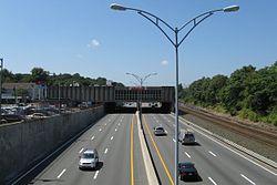
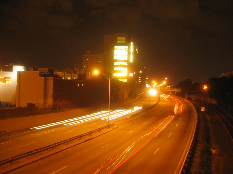
 The Pike at Exit 17 (just out of view at left) in Newton, looking west. To the right side of this image, MBTA Commuter Rail tracks are visible.
The Massachusetts Turnpike is a toll road; it costs $5.10 for a Class 1 passenger vehicle to travel east from Exit 1 (Route 41), in West Stockbridge, to Logan Airport, in East Boston. Additionally, a flat-rate toll barrier for the Ted Williams Tunnel exists on the westbound side of the turnpike between exits 26 and 25, imposing a $3.50 charge for Class 1 passenger vehicles. Therefore, motorists who are destined to travel away from Logan International Airport via I-90 West will be assessed a $3.50 additional charge, since the only interchange east of this toll barrier other than the eastern terminus at Route 1A is Exit 26, leading into the airport terminals, parking garages, rental car center, on-site hotels, etc. From Exit 1, in West Stockbridge, to Exit 14/15 (Route 128 / I-95), in Weston, the Massachusetts Turnpike is a closed-system toll road, using long-distance tickets obtained once by a motorist on entrance, and surrendered on exit, at toll gates. The toll gates exist at all exits and entrances from Exit 1 to Exit 14/15. From Exit 14/15 to its eastern end in East Boston (in other words, east of the toll barrier residing between Exits 14 and 15), the Massachusetts Turnpike is an open-system toll road. There are toll plazas at Exit 18/19/20 in Allston, Massachusetts, in both mainline directions and on the interchange ramps. There also is a toll plaza on the mainline at the westbound entrance to the Ted Williams Tunnel, in East Boston. Exits 16, 17, and 21–26, plus the eastbound-only Route 1A junction have no toll plazas on their ramps.
 The toll plaza in Weston marking the transition point between closed-system tolling west of this toll plaza, and open-system to the east.
Toll plazas on the interchange ramps at Exit 16 were removed in 1996 at the direction of then Governor William Weld.
After protests from Western Massachusetts residents that their toll money was funding the Big Dig, a Boston highway project, tolls were removed on a western portion of the freeway in July 1996: no toll is charged for passenger-vehicle travel between Springfield (Exit 6, Interstate 291) and the New York (Exit 1, West Stockbridge) border in either direction.
Travel between exits 16 and 17, both in Newton, is a "free movement": no toll is charged for travel between these two exits. At exit 16, traffic can enter the Turnpike only eastbound and may exit from the Turnpike only westbound.
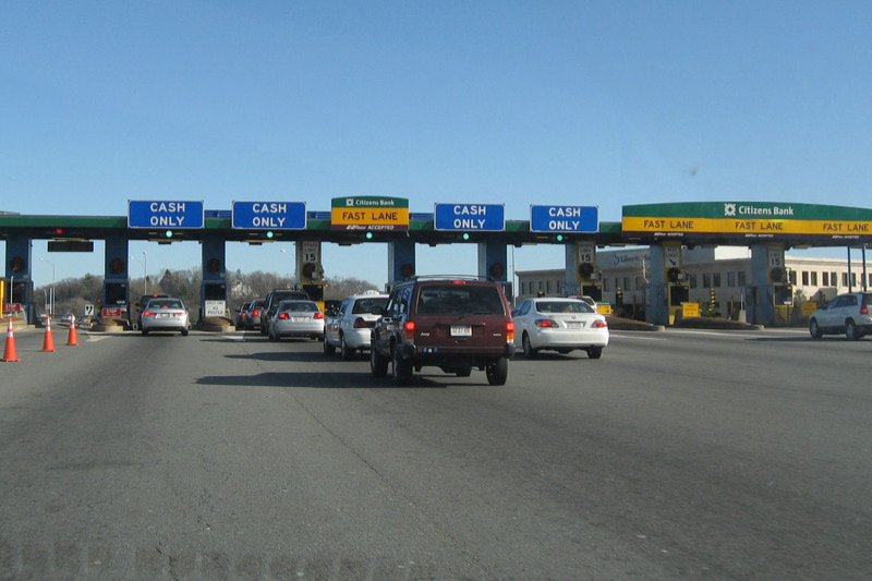
Motorists can pay tolls to toll-booth personnel or use the Fast Lane electronic toll-collection system, whereby transponders installed in the cars (typically on the inner windshields) are recognized automatically in special lanes at toll plazas, the toll amounts then being withdrawn from the motorists' accounts. Fast Lane is compatible with the E-ZPass electronic toll-collection system, which is used in the northeastern United States, south to Virginia and west to Chicago. MassDOT plans to eliminate the name Fast Lane, and begin simply using the EZPass brand name for the ETS system beginning in October 2011, when the current Citizens Bank sponsorship contract expires. All signage at toll plazas will be changed to the standard white-on-purple EZPass signs.
Air rights
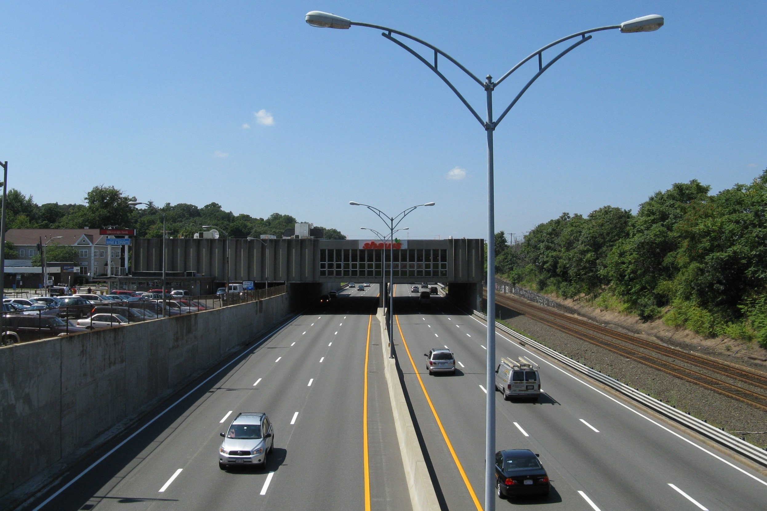
A Shaw's Supermarket built over
the Massachusetts Turnpike in NewtonThe MTA has leased much of the air space over the highway east of Exit 15; these are the structures that have been constructed or are planned:[22]
- The Shaw's Supermarket between exits 16 and 17.
- The Crowne Plaza and Gateway Office complex in Newton Corner at exit 17.
- The Copley Place Mall at exit 22. (1984)
- The new One Beacon development at parcel 9, between Beacon st and Brookline Ave., including a 23 story apartment complex and mixed use development.[23]
- New construction on parcels 8, and 10 adjacent to Fenway Park. (2008–2018)
- Near BU Bridge, Boston University announced long-term plans to extend its campus over the highway[24]
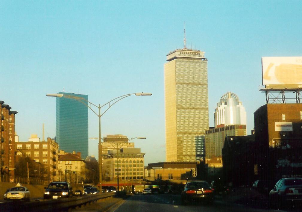
There is one major air rights property that the MTA does not own and that is the Prudential Center Complex constructed beginning in 1965. This property includes a Shaw's Supermarket, the Prudential Tower office and residential buildings, the Shops at Prudential Center mall, the Hynes Convention Center and the Back Bay MBTA station.
In 2001, the Turnpike Authority and the City of Boston agreed on guidelines for air rights development for the remaining parcels over the highway in Boston from the I-93 interchange to Commonwealth Avenue (with the exception of a parcel adjacent to the historic Fenway Studios). While development is not presently planned for all of this corridor, the agreement provides de facto zoning rules should it take place.
Controversies

MTA Board firings
Since 2001, the Turnpike Authority had come under fire from state politicians in a fight for control of the quasi-state agency. Beginning in 2001, former Massachusetts acting governor Jane Swift (R) attempted to fire Christy Mihos, a former Turnpike board member and Jordan Levy, the current[when?] Vice Chairman of the board.
Mihos and Levy had cast votes on the board to postpone a toll hike. Swift objected, saying such a delay was "fiscally irresponsible” and saying the two men "interfered with the effective daily management of the Authority."[25] Mihos and Levy refused to step down and sued Swift to retain their positions. The Massachusetts Supreme Judicial Court (SJC) ruled that the Turnpike was "not part of the machinery of the government" and therefore not subject to Swift’s decisions.[26]
Proposed MTA/MassHighway merger
Gov. Mitt Romney (R), elected in 2002 during a fiscal crisis, ran on a platform of streamlining state government and eliminating waste. Part of this was the elimination of the Turnpike Authority. Gov. Romney wanted to fold the Turnpike into MassHighway, the state highway department, operated under the Executive Office of Transportation. A first step to this was to replace the Chairman of the Board, Matthew J. Amorello with someone loyal to the governor. The governor has the power to appoint members to the board, but the SJC advised in an advisory opinion that "nothing in G. L. c. 81A explicitly provides for the removal and reassignment of the chairperson to the position of "member."[27][28]
The governor took the case to the court of the public opinion and put enormous pressure on Mr. Amorello to step down. Mr. Amorello announced he would do so in 2007, after Gov. Romney would have left office. Gov. Romney continued to press the legislature to give him the power to remove members from the board, specifically the chairman, pointing to a series of financial and construction mishaps over the last several years. However, the legislature instead sought to keep Mr. Amorello on board by extending the terms of various board members to prevent Gov. Romney from removing Mr. Amorello.[29]
I-90 connector ceiling collapse
In response to a fatality caused by the collapse of the ceiling of the eastbound I-90 connector tunnel approaching the Ted Williams Tunnel on July 10, 2006, and in response to Amorello's refusal (at the time) to resign, Gov. Romney took legal steps to have Amorello forcibly removed as head of the Massachusetts Turnpike Authority,[30] culminating in Amorello's resignation on August 15, 2006. The next day, John Cogliano was sworn in as the new Chairman of the Turnpike Authority by Gov. Romney.[31]
On November 27, 2006, departing Attorney General Tom Reilly (D) announced the state will launch a civil suit over the collapse of the ceiling in the Ted Williams Tunnel. The Commonwealth will be seeking over $150 million dollars from project manager Bechtel/Parsons Brinckerhoff, builder Modern Continental Construction Co. and the manufacturer of the epoxy used to hold the ceiling bolts.[32][33][34][35]
Toll removal
On October 18, 2006, the Turnpike board voted to remove all tolls west of the Route 128 Toll Plaza in response to a recommendation made by Eric Kriss,[36] a former fiscal adviser to the governor, whom Gov. Romney asked to review the Turnpike situation following the July 2006 tunnel ceiling collapse.[37]
On October 19, 2006, members of the Massachusetts Legislature Transportation Committee were quoted in The Boston Globe as saying that the governor's actions may require state law to be amended for the toll removal to happen. In addition, questions have been raised in regard to how the State would fund the maintenance of the Turnpike after the removal of the tolls.[38]
The issue of the removal of the tolls is highly charged politically. Several members of the state Democratic Party declared this as a political maneuver to bolster the gubernatorial campaign of Lieutenant Governor Kerry Healy, a Republican, who was behind in the polls at the time of the announcement. Also, because the MTA Board is composed of Romney appointees, Kriss's former association with the Romney administration and the ongoing election at the time, the issue was clouded by accusations of partiality and political agendas from both sides of the aisle.
In the November 9, 2006, edition of The Boston Globe, Romney announced his intention to try to remove the tolls before Governor-elect Deval Patrick, a Democrat, was inaugurated in January 2007, but this did not occur. As of January 2009, Patrick's plan was to remove all tolls west of Route 128, except at the West Stockbridge and Sturbridge tolls.[citation needed]
Route description
The Massachusetts Turnpike is the major east-west highway in Massachusetts, connecting three of its major cities, Springfield, Worcester and Boston. It is also the eastern-most portion of Interstate 90. The roadway begins at the New York border and continues in a south-easterly direction until the junction with Interstate 84 in Sturbridge; from that point it continues in a north-easterly direction into Boston.
Between the New York border and the I-84 junction, the roadway is a four-lane divided highway, two lanes in either direction. Between I-84 and exit 18 in Newton, Massachusetts, it is a six-lane divided highway which grows to eight lanes between the Newton and Cambridge exits where it drops back to six lanes. It stays as a six lane roadway until the Ted Williams Tunnel where it drops back to four lanes until the exit of the tunnel in East Boston.
Exit list
The Massachusetts Turnpike uses a system of sequential exit numbered interchanges. Since the time that the interchanges were originally numbered, more have been added, leading to situations like Exit 11, which is a minor state route, and 11A, which is a major Interstate Highway 10 miles (16 km) away.
Also, near Boston, some of the interchanges are solely onramps and are not signed as exits, so, for instance, there is no Exit 21 signed.[39]
County Location Mile[40] # Destinations Notes New York state line.
I-90 continues west as the Berkshire Connector as part of the New York State Thruway toward I-87 to New York City.
Berkshire West Stockbridge 2.7 1 
 Route 41 to Route 102 – West Stockbridge
Westbound exit and eastbound entrance West Stockbridge Toll Plaza (western end of ticket system, all traffic must stop.)
All Eastbound Traffic Get Ticket, All Westbound Traffic Surrender Ticket and Pay Toll, New York State Thruway AheadLee Lee Service Plaza 10.3 2  US 20 – Lee, Pittsfield
Hampden Blandford Blandford Service Plaza Westfield 40.6 3 
 US 202 / Route 10 – Westfield, Northampton
West Springfield 45.3 4 I-91 / US 5 – Springfield, HolyokeBridge over the Connecticut River Chicopee 49.0 5  Route 33 – Chicopee, Westover Joint Air Reserve Base/Metropolitan Airport
50.9 6  I-291 west / Burnett Road – Springfield, Hartford
Ludlow 54.3 7  Route 21 – Ludlow, Belchertown
Ludlow Service Plaza Palmer 63.3 8  Route 32 to US 20 – Palmer, Ware, Amherst
Worcester Sturbridge 78.3 9 I-84 west to US 20 – Hartford, Sturbridge, New York City via I-87 SouthFormer I-86 west Charlton Charlton Service Plaza Weigh Station, all eastbound trucks must exit when station is open. Auburn 90.5 10 I-290 east / I-395 south / Route 12 – Auburn, WorcesterMillbury 94.0 10A 
 US 20 / Route 146 / Route 122A – WorcesterProvidence
96.3 11  Route 122 – Millbury, Worcester, Grafton, Uxbridge
Westborough Westborough Service Plaza (westbound only) Westborough, Hopkinton 106.5 11A I-495 – New Hampshire, Maine, Cape CodMiddlesex Framingham 111.4 12  Route 9 – Framingham, Marlborough, Southborough
Framingham Service Plaza (westbound only) 117.1 13 Route 30 – Natick, Framingham, WaylandNatick Natick Service Plaza/Fast Lane Service Center (eastbound only) Weston 123.1 14 I-95 / Route 128 – New Hampshire, Maine, South ShoreEastbound exit and westbound entrance Weston Toll Plaza (eastern end of ticket system, all traffic must stop. All tandems must exit no further east of Exit 14.)
All Eastbound Traffic Surrender Ticket and Pay Toll, All Westbound Traffic Get Ticket.123.4 15 I-95 / Route 128 – Westwood, WalthamWestbound exit and eastbound entrance Newton 125.2 16  Route 16 – Newton, Wellesley
Westbound exit and eastbound entrance 127.5 17 Washington Street, Galen Street, Centre Street – Newton, Watertown Suffolk Allston, Brighton 130.6 18 Cambridge Street, Storrow Drive – Allston, Brighton, Cambridge Eastbound exit and westbound entrance 19 Allston Toll Barrier, all traffic must stop to pay flat rate toll. Car toll $1.25 Cash/Fast Lane, 25 cent discount for Fast Lane subscribers. 20 Cambridge Street, Storrow Drive – Allston, Brighton, Cambridge Westbound exit and eastbound entrance Back Bay 132.8 21 Massachusetts Avenue Westbound entrance only; no exit ramps Prudential Tunnel under the Prudential Center Copley Square 133.3 22 Dartmouth Street, Prudential Center, Copley Square Eastbound exit and westbound entrance Copley Square 22A Clarendon Street Westbound entrance only; no exit ramps Theater District 133.8 23 Arlington Street Westbound entrance only; no exit ramps South Station 134.3 24A-B-C I-93 / US 1 / Route 3 – South Station, Concord, QuincyNo eastbound entrance from I-93 south / US 1 south / Route 3 south Summer Street (South Boston) 135.0 25 Summer Street (South Boston) Ted Williams Tunnel under the Boston Harbor, max. clearance 13 ft 6 in (4.1 m) and hazardous cargo prohibited. East Boston Toll Barrier (Westbound Only), all westbound traffic must stop. Car toll: $3.50, 2-axle commercial vehicle and any 3-axle vehicle toll: $5.25, $1.75 each additional axle up to and including 7 axles, $12.25 thereafter. 137.2 26 Logan Int'l Airport East Boston 137.8 Route 1A NorthEastbound exit and westbound entrance. No access from I-90 East to Route 1A South. Eastern end of Massachusetts Turnpike and . 3,099 miles (4,987 km) to Seattle, Washington.Toll ticket colors
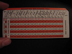 A Massachusetts Turnpike toll ticket, obtained at exit 1 from September 2006.
Toll tickets obtained by motorists traveling on the Mass Pike are color-coded based on the interchange where the motorist entered the Pike. In addition to the black stripe on the back which is read by a magnetic reader, this color coding allows rapid identification by the toll collector, expediting the process of toll collection. There are other reasons why this schematic is in effect on the only tolled road in Massachusetts, such as environmental concerns.
- Exit 1 is orange.
- Exits 2-8, 11 and 12 are gray.
- Exit 9 is purple.
- Exit 10 is light blue.
- Exit 10A is dark blue/purple.
- Exit 11A is brown.
- Exit 13 is yellow.
- Exit 14 (before Weston Toll Plaza exiting East, and after entering West) is green.
- Exit 15 (known as "Newton" and "Boston" on ticket, before Weston Toll Plaza exiting West, and after entering East) is pink.
Service plazas
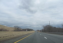
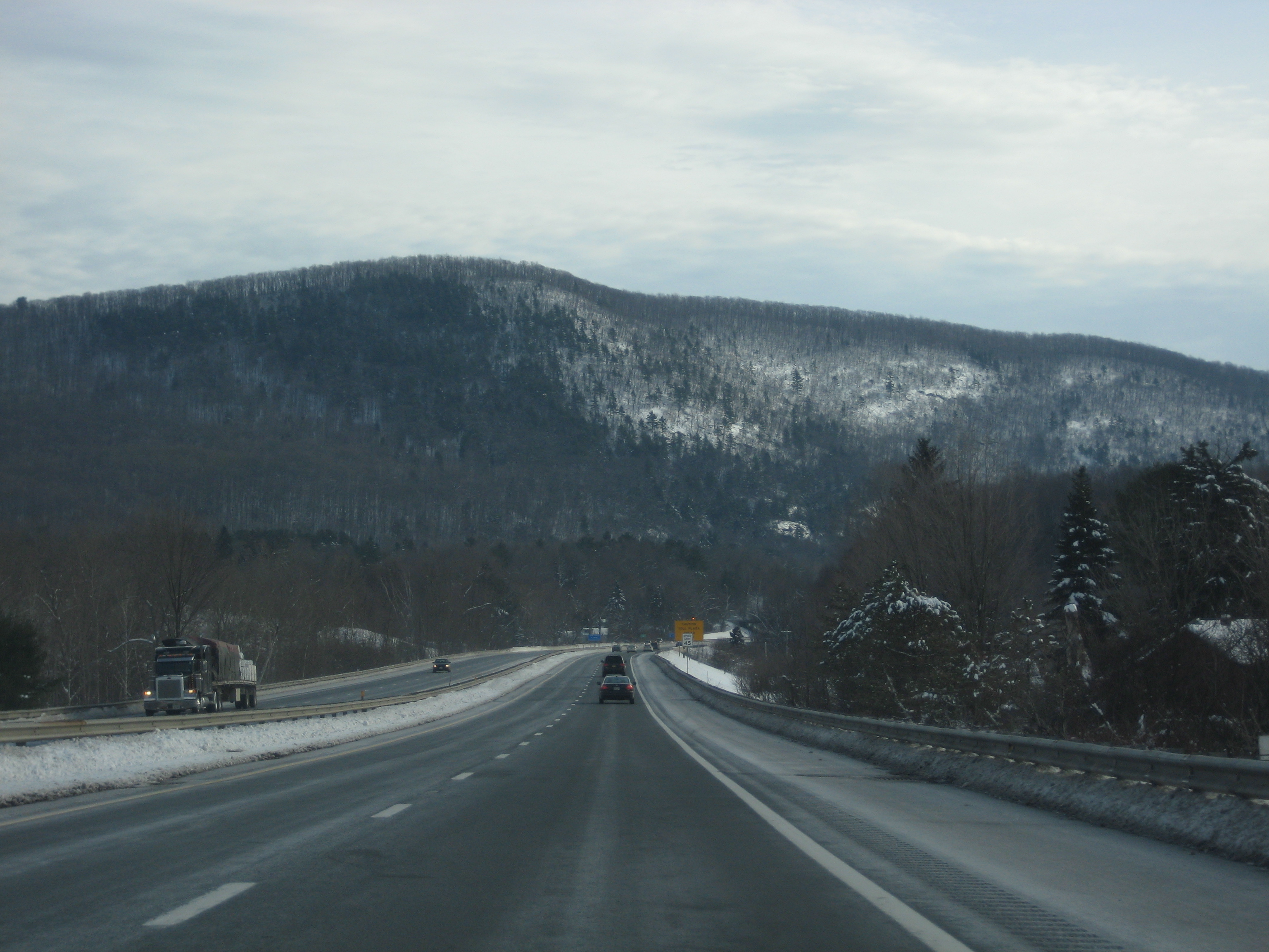
 Interstate 90 eastbound approaching the West Stockbridge toll plaza, the western limit for the toll ticket system.
There are 11 service areas (plazas) on the Massachusetts Turnpike, named for the towns in which they are located. Each plaza offers Gulf gas stations and Gulf Express convenience stores. Most offer McDonald's restaurants, with two plazas (Ludlow WB and Westboro WB) having Boston Market and D'Angelo as the main food offerings. Some plazas also have secondary food such as Auntie Anne's pretzels, Ben & Jerry's ice cream, Papa Gino's pizza, Original Pizza, and Fresh City restaurants. Some restaurants at some plazas also offer a drive thru.
The plazas are:
- Lee Plaza (Eastbound and Westbound) between exits 1 and 2 East and 2 and 1 West.
- Blandford Plaza (Eastbound and Westbound) between exits 2 and 3 East and 3 and 2 West.
- Ludlow Plaza (Eastbound and Westbound) between exits 7 and 8 East and 8 and 7 West.
- Charlton Plaza (Eastbound and Westbound) between exits 9 and 10 East and Exits 10 and 9 West.
- Westborough Plaza (Westbound) between exits 11A and 11.
- Framingham Plaza (Westbound) between exits 13 and 12.
- Natick Plaza (Eastbound) between exits 13 and 14.
The Lee Plaza in the Westbound direction plus the Blandford Plaza in the Eastbound direction are the only service plazas that do not feature a dog walk area. The only service plazas that do not offer family restrooms are Lee (Westbound), Blandford, and Ludlow.
A weigh station is located on the eastbound side of the turnpike in Charlton between exits 9 and 10.
Cultural significance
In his 1970 song "Sweet Baby James," Boston-born and western Massachusetts resident James Taylor includes a reference to a drive along the Massachusetts Turnpike:
- Now the First of December was covered with snow
- And so was the Turnpike from Stockbridge to Boston
- Lord, the Berkshires seemed dream-like on account of that frostin'
- With ten miles behind me and ten thousand more to go
References
- ^ "State Numbered Routes with Milepoints in District 4". Commonwealth of Massachusetts. http://www.eot.state.ma.us/downloads/planning/dataResources/NumRoutesMilePt-District4.pdf. Retrieved 2009-11-04.
- ^ Montgomery, M. R. (February 28, 1991). "Redrawing the Native American Image". The Boston Globe: p. 69. http://pqasb.pqarchiver.com/boston/access/59150596.html?FMT=ABS&FMTS=ABS:FT&type=current&date=Feb+28%2C+1991&author=M.+R.+Montgomery%2C+Globe+Staff&pub=Boston+Globe+(pre-1997+Fulltext)&edition=&startpage=NOPGCIT&desc=Redrawing+the+Native+American+image. Retrieved 2010-04-03. "Too many tourists, non-English readers and reflexive drivers were always turning right, following the politically incorrect arrow to nowhere."
- ^ "View". http://maps.google.com/maps?f=q&source=s_q&hl=en&geocode=&q=42.347834,-73.41181&sll=42.348427,-73.416138&sspn=0.00915,0.027852&ie=UTF8&t=h&ll=42.348284,-73.41176&spn=0.00915,0.019677&z=18.
- ^ The real builder of the Big Dig
- ^ Lessons of Boston’s Big Dig
- ^ "Massachusetts Turnpike (I-90)". http://www.bostonroads.com/roads/mass-pike/.
- ^ "A Handy Guide to the Big Dig Screw-Up". http://thephoenix.com/Boston/News/18726-A-Handy-Guide-to-the-Big-Dig-Screw-Up/?rel=inf.
- ^ "MGL Chapter 81A, Section 3". http://www.mass.gov/legis/laws/mgl/81a-3.htm.
- ^ Martin Finucane (January 21, 2009). "Fast Lane transponders will be free, but users will see a new fee". The Boston Globe. http://www.boston.com/news/local/breaking_news/2009/01/millions_chose.html. Retrieved April 3, 2010.
- ^ Noah Bierman (April 22, 2009). "After Easter snafus, Pike puts toll taker layoffs on hold". The Boston Globe. http://www.boston.com/news/local/breaking_news/2009/04/after_easter_sn.html. Retrieved April 3, 2010.
- ^ "Fast Lane Transponders Are Now Fee Free". WBZ TV. http://wbztv.com/local/free.fast.lane.2.991261.html. Retrieved 2009-08-06.[dead link]
- ^ Riley, David Riley (July 3, 2009). "Registry to close Framingham branch, 10 other locations". The MetroWest Daily News. http://www.metrowestdailynews.com/homepage/x877771291/Registry-to-close-Framingham-branch-10-other-locations. Retrieved 2009-08-01.
- ^ "Masspike toll hike scrapped". WWLP. Associated Press. June 29, 2009. http://www.wwlp.com/dpp/news/massachusetts/wwlp_ap_ma_masspiketollhikescrapped_200906290717. Retrieved 2009-08-01.
- ^ "Chapter 25 of the Acts of 2009". The 186th General Court of The Commonwealth of Massachusetts. http://www.mass.gov/legis/laws/seslaw09/sl090025.htm. Retrieved 2009-11-05.
- ^ "Governor Patrick signs bill to dramatically reform transportation system". Commonwealth of Massachusetts. June 26, 2009. http://www.mass.gov/?pageID=gov3pressrelease&L=1&L0=Home&sid=Agov3&b=pressrelease&f=090626_transportation_reform_bill&csid=Agov3. Retrieved 2009-08-01.
- ^ "Welcome to MassDOT - About US". Commonwealth of Massachusetts. http://www.massdot.state.ma.us/main/MassDOTAboutUs.aspx. Retrieved 2009-11-03.
- ^ Connaughton, Mary Z. (July 21, 2009). "Hats off, Governor". Boston Herald. http://www.bostonherald.com/blogs/news/toll_talk/index.php/2009/07/21/hats-off-governor/. Retrieved 2009-08-01.
- ^ http://www.aaroads.com/forum/index.php?topic=661.20;wap2
- ^ http://www.state.ma.us/eot/downloads/planning/dataResources/Jurisdiction-District4.pdf
- ^ The Big Dig
- ^ Schworm, Peter (October 16, 2009). "End of the road for Mass. Pike". The Boston Globe. http://www.boston.com/news/local/massachusetts/articles/2009/10/16/end_of_road_for_mass_pike_board/?page=full. Retrieved 2009-11-03.
- ^ "The Future of Boston". The Boston Globe. http://www.boston.com/advertisers/bigdig/air.shtml. Retrieved 2007-11-28.
- ^ Casey Ross (2008-09-19). "Developer hopes for a hit at Fenway". The Boston Globe: pp. C1, C6. http://www.boston.com/business/articles/2008/09/19/developer_hopes_for_hit_at_fenway/?page=full. Retrieved 2008-09-20.
- ^ The Daily Free Press - BU says campus future is up in the air
- ^ "JORDAN LEVY & another vs. THE ACTING GOVERNOR & another". 2001-11-19. http://caselaw.lp.findlaw.com/scripts/getcase.pl?court=ma&vol=sjcslip/sjcMay02h&invol=1. Retrieved 2007-07-13.
- ^ "JORDAN LEVY & another vs. THE ACTING GOVERNOR & another SJC-08730". 2002-05-07. http://www.ma-appellatecourts.org/display_docket.php?dno=SJC-08730. Retrieved 2007-07-02.
- ^ "ANSWER OF THE JUSTICES TO THE GOVERNOR.". 2005-06-29. http://www.socialaw.com/slip.htm?cid=15320&sid=120. Retrieved 2007-07-02.
- ^ "REQUEST FOR ADVISORY OPINION, A-108 SJC-09461". 2005-06-29. http://www.ma-appellatecourts.org/display_docket.php?dno=SJC-09461. Retrieved 2007-07-02.
- ^ Murphy, Sean P. (2006-06-02). "Budget amendment in Senate would let Amorello keep job". The Boston Globe. http://www.boston.com/news/local/massachusetts/articles/2006/06/02/budget_amendment_in_senate_would_let_amorello_keep_job/.
- ^ Lehigh, Scot (2006-07-14). "Amorello, now adrift". The Boston Globe. http://www.boston.com/news/traffic/bigdig/articles/2006/07/14/amorello_now_adrift/.
- ^ "Cogliano Sworn In as New Turnpike Chief". WCVB. The Boston Channel.com. 2006-08-16. http://www.thebostonchannel.com/news/9688510/detail.html. Retrieved 2009-10-27.
- ^ Herbst, Svea (2006-11-28). "Mass. to sue Big Dig firms over tunnel accident". Reuters. http://uk.reuters.com/article/idUKN2748129520061128.
- ^ Murphy, Sean P.; Andrea Estes (2007-07-11). "Wide risk, wide blame". The Boston Globe. http://www.boston.com/news/local/articles/2007/07/11/wide_risk_wide_blame/. Retrieved 2009-10-09.
- ^ Saltzman, Jonathan (2008-11-15). "Companies to settle for $26m in tunnel collapse". The Boston Globe. http://www.boston.com/news/local/massachusetts/articles/2008/11/15/companies_to_settle_for_26m_in_tunnel_collapse/. Retrieved 2009-10-09.
- ^ Finucane, Martin (2009-03-27). "AG settles with final two firms in fatal collapse of Big Dig tunnel". The Boston Globe. http://www.boston.com/news/local/massachusetts/articles/2009/03/27/ag_settles_with_final_two_firms_in_fatal_collapse_of_big_dig_tunnel/. Retrieved 2009-10-09.
- ^ "Turnpike Task Force Final Report". http://www.pioneerinstitute.org/pdf/turnpike_task_force_final_report.pdf.
- ^ Mishra, Raja; Mac Daniel (2006-10-19). "Pike board acts to end tolls west of Route 128". The Boston Globe. http://www.boston.com/news/local/politics/candidates/articles/2006/10/19/pike_board_acts_to_end_tolls_west_of_route_128/. Retrieved 2009-10-27.
- ^ Daniel, Mac (2006-10-10). "Ending Pike tolls is called illegal". The Boston Globe. http://www.boston.com/news/local/articles/2006/10/20/ending_pike_tolls_is_called_illegal/. Retrieved 2009-10-26.
- ^ "Interchange Numbers". http://www.masspike.com/interchange.html.[dead link]
- ^ Massachusetts Executive Office of Transportation. 2007. "Interchanges List (I-90)" Downloaded from: http://www.eot.state.ma.us/default.asp?pgid=planning/disc/interchanges&sid=dtable , August 7, 2011.
- Boston to Chicago, The New York Times May 24, 1959 page XX1
External links
- Official Web Site
- The Roads of Metro Boston - Massachusetts Turnpike (I-90)
- Big Dig Ceiling Collapse -- The Boston Globe
- Big Dig Problems -- The Boston Globe
- Finishing the Big Dig -- The Boston Globe
- Amorello, options were left exhausted -- The Boston Globe
- A vacancy at the helm -- The Boston Globe
- Top staff is leaving Mass. Pike -- The Boston Globe
- I-90 connector reopens to traffic -- The Boston Globe
- Designer proposed more bolts in Big Dig -- The Boston Globe
- Tunnel bolts never inspected -- The Boston Globe
- Pike board acts to end tolls west of Route 128 -- The Boston Globe
- Ending Pike tolls is called illegal -- The Boston Globe
- Late Design Change Is Cited in Collapse of Tunnel Ceiling in Boston -- The New York Times
- AG, alleging negligence, will sue in tunnel cave-in -- The Boston Globe
- Reilly says neglect with tunnel was criminal -- The Boston Globe
- Commonwealth of Mass. v. Bechtel Corporation, et al.
- Cheaper, faster path led to failure -- The Boston Globe
- I-90 connector west opens -- The Boston Globe
Interstate 90Previous state:
New YorkMassachusetts Next state:
TerminusInterstate Highways in Massachusetts Categories:- Transportation in Boston, Massachusetts
- Toll roads in Massachusetts
- Tolled sections of Interstate Highways
- Interstate 90
- U.S. Route 20
- Freeways in the United States


Wikimedia Foundation. 2010.