- Hartford, Connecticut
-
"Hartford" redirects here. For other uses, see Hartford (disambiguation).
City of Hartford — City — Skyline of Hartford viewed from the Connecticut River

Flag
SealNickname(s): The Insurance Capital of the World, The Heartbeat, New England's Rising Star Location in Hartford County, Connecticut
Coordinates: 41°45′45.85″N 72°40′27.43″W / 41.7627361°N 72.6742861°W Country United States State Connecticut NECTA Hartford Region Capitol Region Named 1637 Incorporated (city) 1784 Consolidated 1896 Government – Type Mayor-council – Mayor Pedro Segarra (D) Area – City 18.0 sq mi (46.5 km2) – Land 17.3 sq mi (44.8 km2) – Water 0.7 sq mi (1.7 km2) – Urban 469 sq mi (1,216 km2) Elevation 59 ft (18 m) Population (2010)[1]/productview.xhtml?pid=DEC_10_PL_GCTPL2.ST16&prodType=table – City 124,775 – Density 7,025.5/sq mi (2,776/km2) – Metro 1,212,381 Time zone EST (UTC−5) – Summer (DST) EDT (UTC−4) ZIP code 061xx Area code(s) 860 FIPS code 09-37000 GNIS feature ID 0213160 Airport Bradley International Airport (Windsor Locks, CT) – BDL (International/Major) Website www.hartford.gov Hartford is the capital of the U.S. state of Connecticut. The seat of Hartford County until Connecticut disbanded county government in 1960, it is the second most populous city on New England's largest river, the Connecticut River. As of the 2010 Census, Hartford's population was 124,775, [2] making it Connecticut's third-largest city after the coastal cities of Bridgeport and New Haven. As of the 2010 Census, Hartford was the seventh largest city in New England (after, in order: Boston, Worcester, Providence, Springfield, Bridgeport, and New Haven.[3]) As of the 2010 census, Greater Hartford was the largest metropolitan area in Connecticut with a population of 1,212,381.[3]
Greater Hartford's close proximity - and economic and cultural interconnectedness with - Metropolitan Springfield combine to make the Hartford-Springfield Metropolitan Area the second most populous region in New England, with a population of approximately 1.9 million. Collectively, the Hartford-Springfield Metropolitan Region is nicknamed the Knowledge Corridor because it contains 32 universities and colleges, with approximately 160,000 university students.[4] The two Connecticut River cities share Bradley International Airport, which lies equidistant between their downtowns.
Nicknamed the "Insurance Capital of the World", Hartford houses many insurance company headquarters, and insurance remains the region's major industry.[5] Almost 400 years old, Hartford is among the oldest cities in the United States. Following the American Civil War, Hartford was the wealthiest city in the United States for several decades.[6] In 1868, Mark Twain wrote, "Of all the beautiful towns it has been my fortune to see this is the chief."[7]
In 2010, the Hartford metropolitan area ranked second nationally in per capita economic activity, behind only San Francisco. Hartford is ranked 32nd of 318 metropolitan areas in total economic production and, with its Knowledge Corridor sister city Springfield, Massachusetts, the two cities generate over $110 billion GDP - which is more than 16 U.S states. [8][9]
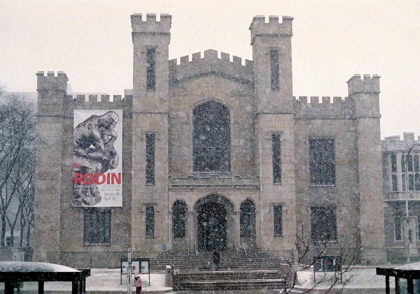
Hartford is home to the nation's oldest public art museum, the Wadsworth Atheneum; the oldest public park, Bushnell Park; the oldest continuously published newspaper, The Hartford Courant; the second-oldest secondary school, Hartford Public, and the Mark Twain House, among other historically significant attractions.
History
- This is a summary. For more information, see: History of Hartford, Connecticut
After Dutch explorer Adriaen Block visited the area in 1614, fur traders from the New Netherland colony set up trade at Fort Goede Hoop (Good Hope) at the confluence of the Connecticut and Park Rivers[10] as early as 1623, but abandoned their post by 1654. Today, the neighborhood near the site is still known as Dutch Point. The first English settlers arrived in 1635 and their settlement was originally called Newtown, but was renamed Hartford in 1637. The name "Hartford" was chosen to honor the English town of Hertford, home of Samuel Stone, one of the settlers.
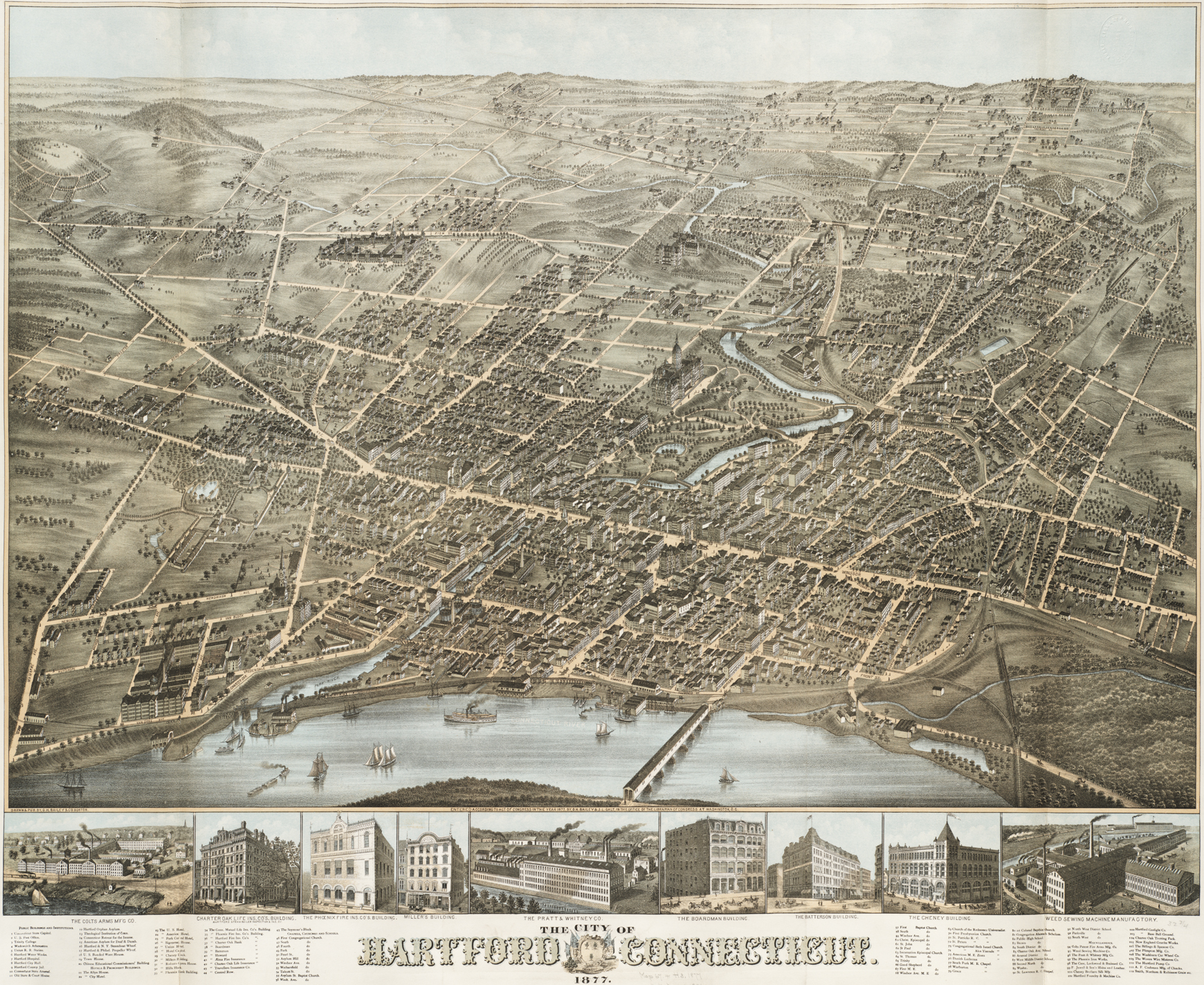
 1877 Map of Hartford
The leader of Hartford's original settlers from what is now Cambridge, Massachusetts, Pastor Thomas Hooker, delivered a sermon which inspired the writing of the Fundamental Orders of Connecticut, a document (ratified January 14, 1639) investing the people with the authority to govern, rather than ceding such authority to a higher power. Hooker's conception of self-rule embodied in the Fundamental Orders went on to inspire the Connecticut Constitution, and ultimately the U.S. Constitution. Today, one of the Connecticut's nicknames is the 'Constitution State'.[11][12]
On December 15, 1814, delegations from throughout New England gathered at the Hartford Convention to discuss possible secession from the United States. Later in the century, Hartford was a center of abolitionist activity. Harriet Beecher Stowe, daughter of Lyman Beecher and author of Uncle Tom's Cabin, lived in Nook Farm, part of the Asylum Hill section of the city.
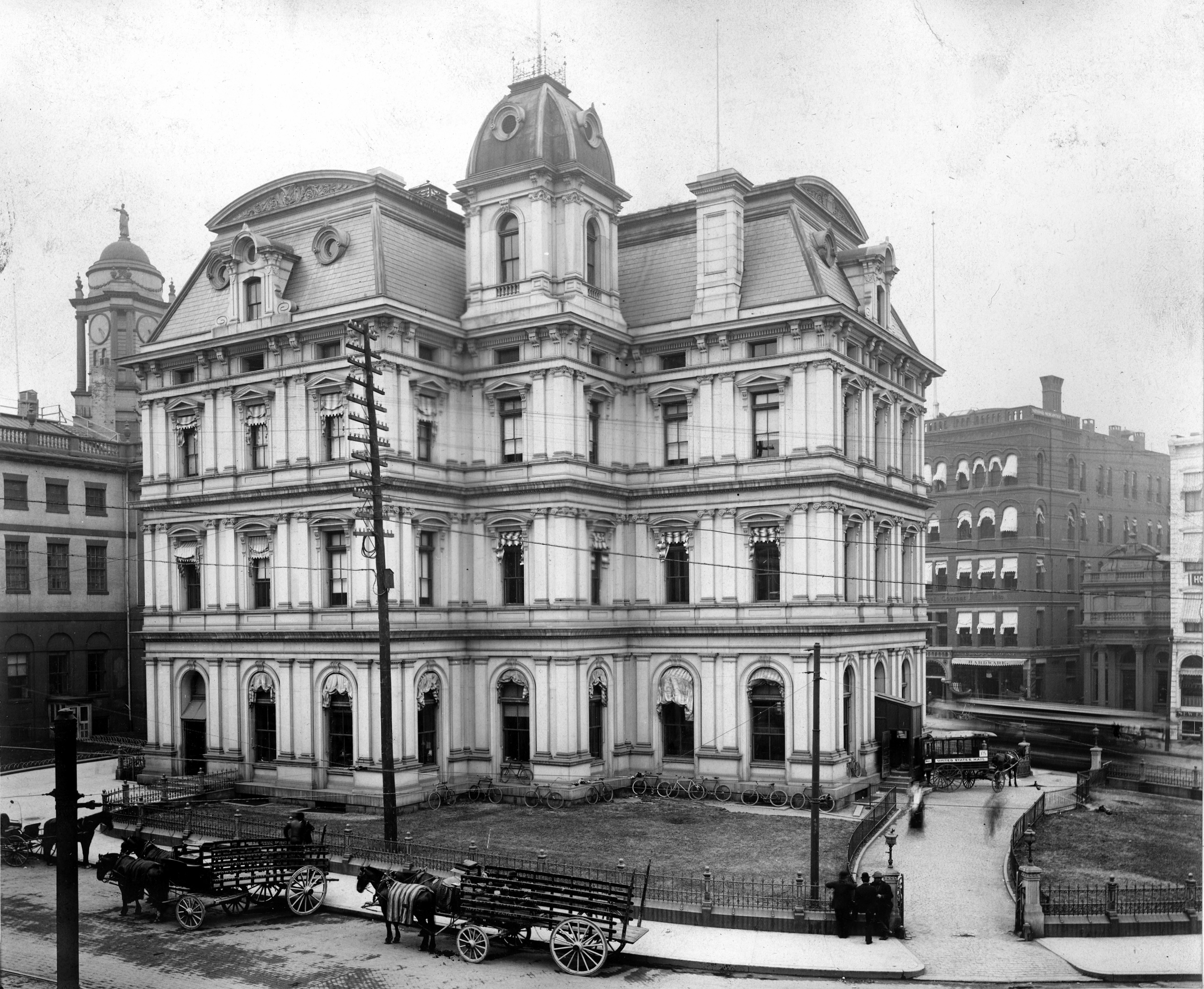
 Old Post Office and Custom House next to the Old State House (left) in 1903. Completed in 1882, the building was demolished in 1934.
On the week of 12 April 1909 the Connecticut River reached a then-record flood stage of 24½ feet above the low water mark flooding the city and doing great damage.[13]
On July 6, 1944, the Hartford Circus Fire destroyed the big top at the Ringling Bros. and Barnum & Bailey Circus, the deadliest circus fire in the history of the United States. In 1987, Carrie Saxon Perry was elected mayor of Hartford, the first female African-American mayor of a major American city.[14] Starting in the late 1950s the suburbs of Hartford grew while the capital city began a long decline. This decline may have been accelerated by construction of highways (including I-84 & I-91 which intersect in downtown Hartford). Many residents moved out of the city and into the suburbs, and this trend continues. During the 1980s, Hartford experienced an economic boom of sorts and by the late 1980s, almost a dozen new skyscrapers were proposed to be built in the city's downtown. For various reasons, including the economic recession that followed in the early 1990s, many of these buildings were never built. By the beginning of the twenty-first century, many workers in Hartford lived more than twenty-minutes drive from the city—though according to the Census Bureau, the city's average commute time of 22 minutes is a full three minutes less than the US average.[15]
Geography
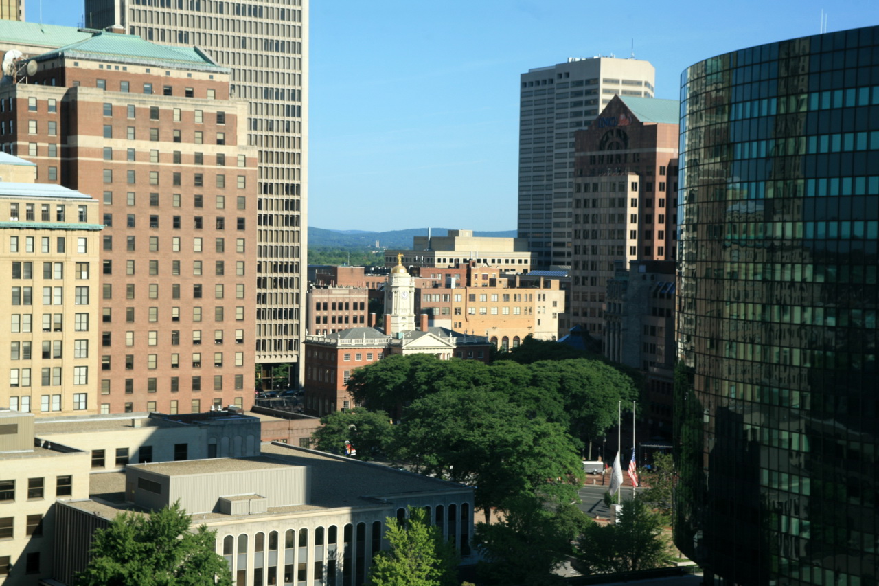
 Downtown Hartford from the air
According to the United States Census Bureau, the city has a total area of 18.0 square miles (47 km2), of which 17.3 square miles (45 km2) is land and 0.7 square miles (1.8 km2) (3.67%) is water.
Hartford is bordered by the towns of West Hartford, Newington, Wethersfield, East Hartford, Bloomfield, South Windsor, and Windsor.
The Connecticut River forms the boundary between Hartford and East Hartford.
The Park River originally divided Hartford into northern and southern sections and was a major part of Bushnell Park, but the river was nearly completely enclosed and buried by flood control projects in the 1940s.[10] The former course of the river can still be seen in some of the roadways that were built in the river's place, such as Jewell Street and the Conlin-Whitehead Highway.[16]

Bloomfield, Connecticut Windsor, Connecticut South Windsor, Connecticut West Hartford, Connecticut 
East Hartford, Connecticut  Hartford, Connecticut

Newington, Connecticut Wethersfield, Connecticut Climate
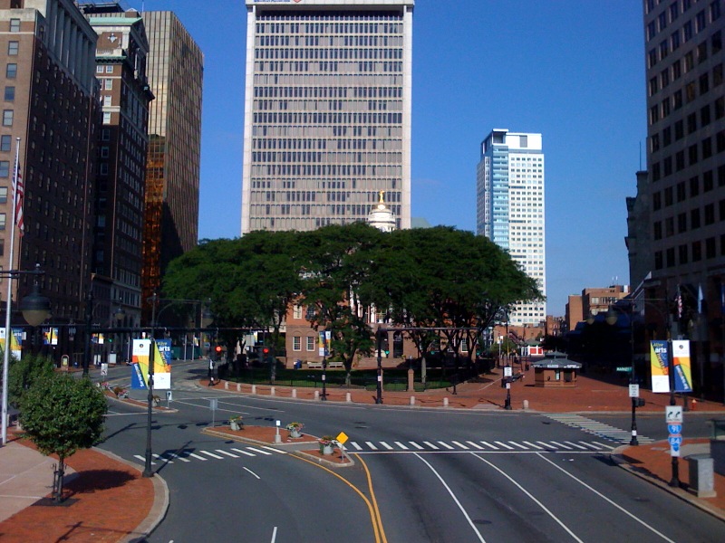
 State House Square in Downtown Hartford
Hartford lies in the Humid continental climate zone (Köppen Dfa). Summers are typically hot and muggy by New England standards, while winters are typically cold with frequent snowfall. The average annual precipitation is approximately 46.2 inches (117 cm),[17] which is distributed fairly evenly throughout the year. Hartford typically receives about 45 inches (114 cm) of snow in an average winter;[17] the record seasonal snowfall was 115.2 inches (293 cm) during the winter of 1995–1996.[18] The first snowfall typically occurs in mid to late November and the last snow of the season usually occurs in late March, although accumulating snow has occurred as early as mid-October and as late as mid-May in extreme events. During the summer, temperatures often exceed 90 °F (32 °C), and do so on an average of 18 days per year.[17] The record for 90 degree days is 38 which occurred in 1983. Conversely, winter temperatures dip to 0 °F (−18 °C) on 5 nights per year.[17] Thunderstorms are common during the summer months since the frontal boundary that separates the tropical air mass from colder air to the north moves back and forth over the city. While these thunderstorms may be severe with damaging winds and hail, tornadoes are rare. Tropical storms and hurricanes have also struck Hartford, although the occurrence of such systems is rare and is usually confined to the remnants of such storms. Hartford saw extensive damage from the 1938 New England Hurricane; as well as with Hurricane Irene in 2011. The highest temperature recorded in Hartford is 103 °F (39 °C) on July 22, 2011 and the lowest is −26 °F (−32 °C) on January 22, 1961.
Climate data for Hartford Month Jan Feb Mar Apr May Jun Jul Aug Sep Oct Nov Dec Year Record high °F (°C) 72
(22)73
(23)89
(32)96
(36)99
(37)100
(38)103
(39)102
(39)101
(38)91
(33)83
(28)76
(24)103
(39)Average high °F (°C) 34.1
(1.2)37.7
(3.2)47.7
(8.7)59.9
(15.5)71.7
(22.1)80.0
(26.7)84.9
(29.4)82.5
(28.1)74.3
(23.5)63.1
(17.3)50.9
(10.5)39.0
(3.9)60.5 Average low °F (°C) 17.2
(−8.2)19.9
(−6.7)28.3
(−2.1)37.9
(3.3)48.1
(8.9)57.0
(13.9)62.4
(16.9)60.7
(15.9)52.1
(11.2)40.6
(4.8)32.6
(0.3)22.6
(−5.2)40.0 Record low °F (°C) −26
(−32)−24
(−31)−6
(−21)9
(−13)28
(−2)37
(3)44
(7)36
(2)30
(−1)17
(−8)1
(−17)−18
(−28)−26
(−32)Precipitation inches (mm) 3.84
(97.5)2.96
(75.2)3.88
(98.6)3.86
(98)4.39
(111.5)3.85
(97.8)3.67
(93.2)3.98
(101.1)4.13
(104.9)3.94
(100.1)4.06
(103.1)3.60
(91.4)46.16
(1,172.5)Snowfall inches (cm) 14.3
(36.3)10.7
(27.2)7.7
(19.6)1.5
(3.8)0.1
(0.3)0
(0)0
(0)0
(0)0
(0)0.1
(0.3)2.5
(6.4)8.4
(21.3)45.3
(115.1)Avg. precipitation days (≥ 0.01 in) 11.4 10.1 11.9 11.3 12.6 11.3 9.9 10.0 9.7 9.0 10.3 11.6 129.1 Avg. snowy days (≥ 0.1 in) 6.7 5.5 4.4 1.1 0 0 0 0 0 0 1.6 5.8 25.1 Sunshine hours 170.5 178.0 213.9 228.0 257.3 273.0 294.5 269.7 225.0 198.4 138.0 139.5 2,585.8 Source: NOAA (normals 1971–2000, records 1954–2001),[17] HKO (sun 1961–1990) [19] Demographics
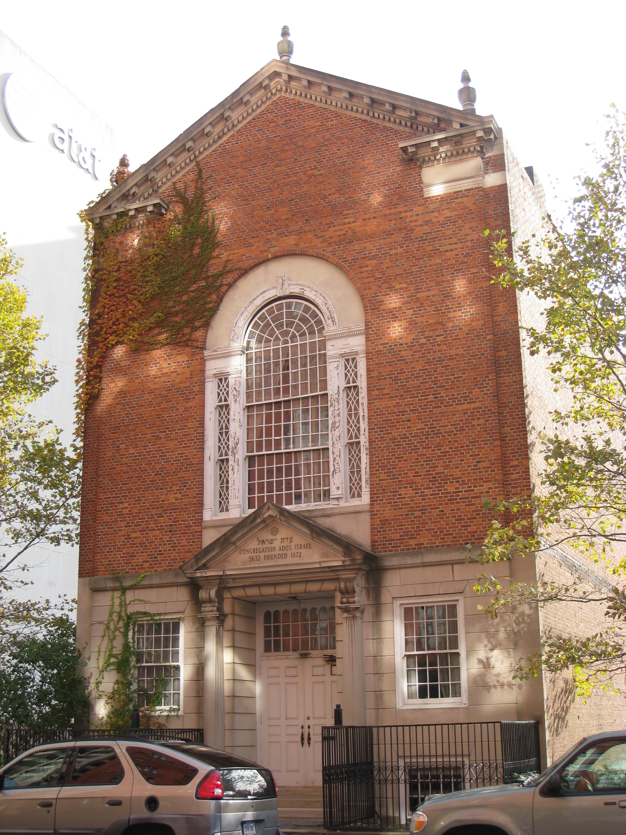
 Founded in 1872, the Ados Israel Synagogue closed in the mid-1980s, as the Jewish community expanded to suburbs such as West Hartford.
Historical populations Census Pop. %± 1790 2,683 — 1800 3,523 31.3% 1810 3,955 12.3% 1820 4,726 19.5% 1830 7,074 49.7% 1840 9,468 33.8% 1850 13,555 43.2% 1860 26,917 98.6% 1870 37,180 38.1% 1880 42,015 13.0% 1890 53,230 26.7% 1900 79,850 50.0% 1910 98,915 23.9% 1920 138,036 39.6% 1930 164,072 18.9% 1940 166,267 1.3% 1950 177,397 6.7% 1960 162,178 −8.6% 1970 158,017 −2.6% 1980 136,392 −13.7% 1990 139,739 2.5% 2000 121,578 −13.0% 2010 124,775 2.6% Population 1800–1990[20] As of the census[21] of 2000, there were 121,578 people, 44,986 households, and 27,171 families residing in the city. The population density was 7,025.5 people per square mile (2,711.8/km²). There were 50,644 housing units at an average density of 2,926.5 per square mile (1,129.6/km²). The racial makeup of the city was 27.72% white, 38.05% African American or black, 0.54% Native American, 1.62% Asian, 0.11% Pacific Islander, 26.51% from other races, and 5.44% from two or more races. 40.52% of the population were Hispanic or Latino, chiefly of Puerto Rican origin. 17.83% of the population classified itself as non-Hispanic White.
There were 44,986 households out of which 34.4% had children under the age of 18 living with them, 25.2% were married couples living together, 29.6% had a female householder with no husband present, and 39.6% were non-families. 33.2% of all households were made up of individuals and 9.6% had someone living alone who was 65 years of age or older. The average household size was 2.58 and the average family size was 3.33.
In the city, the population distribution skews young: 30.1% under the age of 18, 12.6% from 18 to 24, 29.8% from 25 to 44, 18.0% from 45 to 64, and 9.5% who were 65 years of age or older. The median age was 30 years. For every 100 females, there were 91.4 males. For every 100 females age 18 and over, there were 86.0 males.
With 30 percent of the population living below the poverty line, Hartford's rate of poverty is second in the United States only to Brownsville, Texas.[22] About 28.2% of families were below the poverty line, including 41.0% of those under age 18 and 23.2% of those age 65 or over.
The median income for a household in the city was $24,820, and the median income for a family was $27,051. Males had a median income of $28,444 versus $26,131 for females. The per capita income for the city was $13,428. After World War II, and continuing through the latter half of the 20th century, many Puerto Ricans moved to the city. As of 2000, 32.56% of Hartford residents claimed Puerto Rican heritage. This was the second-largest concentration of Puerto Ricans on the US mainland, behind only Holyoke, Massachusetts.[23]
Voter Registration and Party Enrollment as of October 25, 2005[24] Party Active Voters Inactive Voters Total Voters Percentage Democratic 30,332 5,981 36,313 65.81% Republican 2,248 351 2,599 4.71% Unaffiliated 12,880 3,324 16,204 29.37% Minor Parties 48 13 61 0.11% Total 45,508 9,669 55,177 100% Neighborhoods
Main article: Neighborhoods of Hartford, Connecticut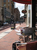 Pratt Street in Downtown Hartford
Hartford's neighborhoods are diverse and historic. The central business district, as well as the State Capitol, Old State House and a number of museums and shops are located Downtown. Parkville, home to Real Art Ways, is named for the confluence of the north and the south branches of the Park River. Frog Hollow, in close proximity to Downtown, is home to Pope Park and Trinity College which is one of the nation's oldest institutions of higher learning. Asylum Hill, a mixed residential and commercial area, houses the headquarters of several insurance companies as well as the historic homes of Mark Twain and Harriet Beecher Stowe. The West End, home to the Governor's residence, Elizabeth Park, and the University of Connecticut School of Law, abuts the Hartford Golf Club. Sheldon Charter Oak is renowned as the location of the Charter Oak and its successor monument as well as the former Colt headquarters including Samuel Colt's family estate – Armsmear. The North East neighborhood is home to Keney Park and a number of the city's oldest and ornate homes. The South End features "Little Italy" and was the home of Hartford's sizeable Italian community. South Green hosts Hartford Hospital. The South Meadows is the site of Hartford-Brainard Airport and Hartford's industrial community. The North Meadows has retail strips, car dealerships, and Comcast Theatre. Blue Hills is home of the University of Hartford and also houses the largest per capita of residents claiming Jamaican-American heritage in the United States. Other neighborhoods in Hartford include Barry Square, Behind the Rocks, Clay Arsenal, South West, and Upper Albany- which is dotted by many Caribbean restaurants and specialty stores.
In 2010, Hartford ranked 19th in the United States' annual national crime rankings, (below the 200.00 rating.) [25] It had the second highest crime rate in Connecticut, behind New Haven. Statistically Hartford's Northern districts (North East, Asylum Hill, Upper Albany) had the highest murder rate, while the South districts (Downtown, Sheldon, South Green) had a slightly lower murder rate, but had the most crime overall. Overall, the South Meadows neighborhood had the lowest crime rate, respectively.[26]
Economy
 Travelers Tower in Downtown Hartford.
Hartford is the historic international center of the insurance industry, with companies such as Travelers, Aetna, The Hartford, The Phoenix Companies, Uniprise and Hartford Steam Boiler based in the city. The area is also home to U.S. Fire Arms and United Technologies.
From the 19th century until the mid-20th century, Hartford was a major manufacturing city. During the Industrial Revolution into the mid-20th century, the Connecticut River Valley cities produced many major precision manufacturing innovations. Among these was Hartford's pioneer bicycle (and later) automobile maker Pope.[27] As in nearly all former Northern manufacturing cities, many factories have been closed, relocated, or reduced operations.
Despite the city's lengthy history with the insurance industry, various insurers have recently left Hartford and moved their operations to other locations, including to some of Hartford's suburbs. Citing the tax structure in the city and parking shortages, MetLife recently vacated several floors in CityPlace, Connecticut's largest office building, and joined CIGNA in a large suburban campus in Bloomfield, Connecticut. Lincoln Financial has recently cut its Hartford workforce, while Travelers elected to construct a sprawling training complex in Windsor, Connecticut, just north of the city. Originating from the acquisition of the travel protection division of Travelers, Travel Insured International operates out of East Hartford, Connecticut. Additionally, the Fortune 100 MassMutual Company recently relocated its Hartford operations 16 miles north to Enfield, Connecticut. The Hartford's life insurance division is primarily located in nearby Simsbury, Connecticut.
At the same time, many companies have moved to or expanded in the central business district and surrounding neighborhoods. Aetna announced mid-decade that by 2010 it would move nearly 3,500 employees from its Middletown, Connecticut offices to its corporate headquarters in the Asylum Hill section of the city. Travelers recently expanded its operations at several downtown locations. In 2008, Sovereign Bank consolidated two bank branches as well as its regional headquarters in a nineteenth century palazzo on Asylum Street. In 2009, Northeast Utilities, a Fortune 500 company and New England's largest energy utility, announced it would establish its corporate headquarters downtown. In the same year, work began at the southeastern corner of Constitution Plaza on the AI Technology Center, the future headquarters of the eponymous engineering firm. AI's chief executive helped finance the building, the first commercially leasable structure in Connecticut to be certified at the platinum level under the US Green Building Council's LEED (Leadership in Energy and Environmental Design) program. Other recent entrants into the downtown market include GlobeOp Financial Services and specialty insurance broker S.H. Smith.
Hartford is a center for medical care, research, and education. Within Hartford itself the city includes Hartford Hospital, Connecticut Children's Medical Center, and Saint Francis Hospital (which merged in 1990 with Mount Sinai Hospital).
Following the housing market decline, Hartford renters are finding cheap and declining rent averages in relation to national trends. “Declining rents are affecting not only Hartford but also other markets in Connecticut and across the country as employers remain restrained about hiring. Connecticut's unemployment now stands at 9.1 percent, below the nation's 9.7 percent.” [28]
Education
Colleges and universities
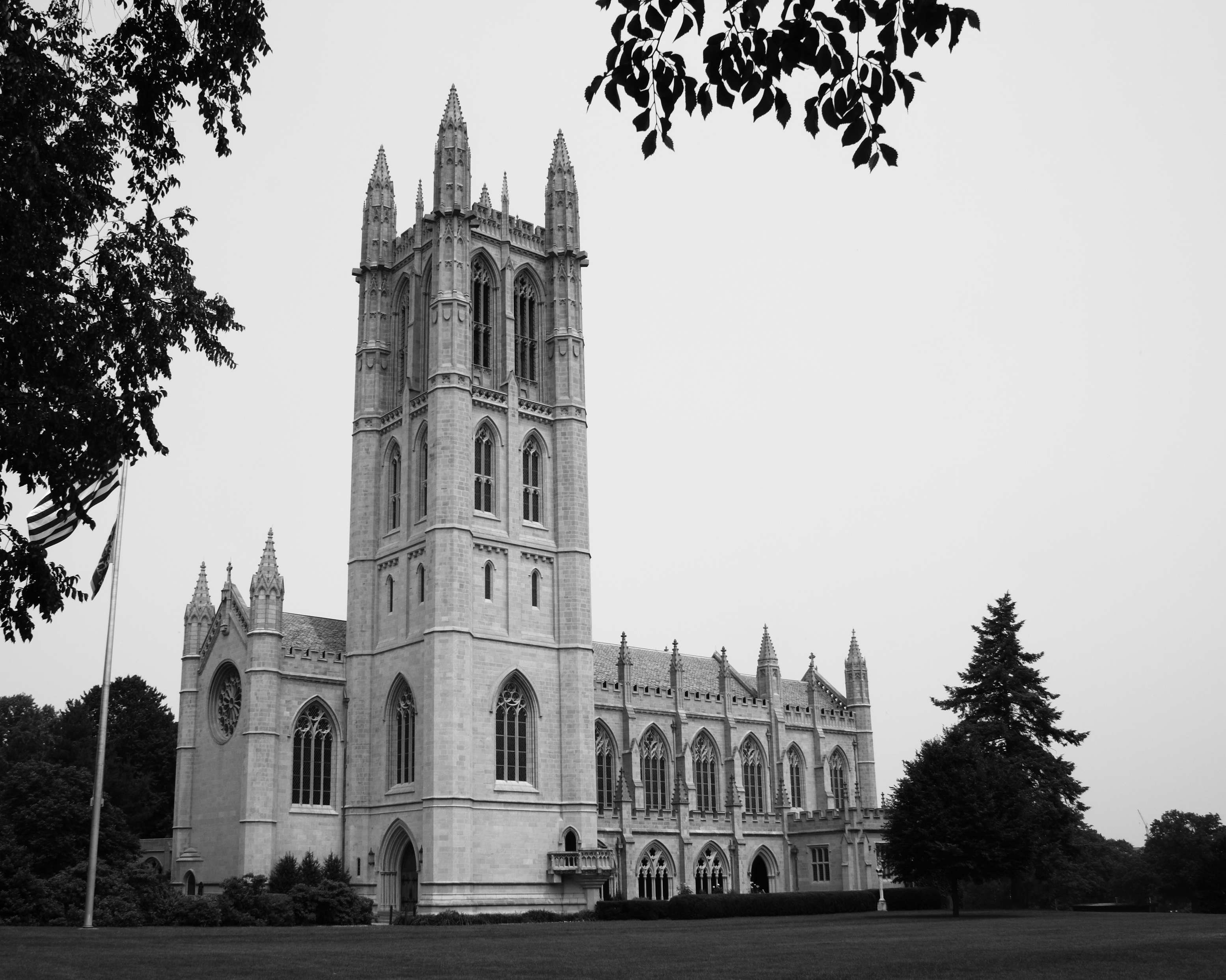
 Trinity College Chapel
Hartford houses several world-class institutions such as Trinity College. Other notable institutions include Capital Community College (located Downtown in the old G. Fox Department Store building on Main Street), the University of Connecticut School of Business (also Downtown), the Hartford Seminary (in the West End), the University of Connecticut School of Law (also in the West End) and Rensselaer at Hartford (a Downtown branch campus of Rensselaer Polytechnic Institute). Saint Joseph College is currently building a school of pharmacy in the downtown area.[29] The official opening is planned for fall of 2011.
The University of Hartford features several cultural institutions: the Joseloff Gallery, the Renee Samuels Center, and the Mort and Irma Handel Performing Arts center. The "U of H" campus is co-located in the city's Blue Hills neighborhood and in neighboring towns West Hartford and Bloomfield.
Primary and secondary education
Hartford is served by the Hartford Public Schools [2]. Hartford Public High School, the nation's second oldest high school, is located in the Asylum Hill neighborhood of Hartford. The city is also home to Bulkeley High School on Wethersfield Avenue, Weaver High School on Granby Street, and Sport Medical and Sciences Academy on Huyshope Avenue. In addition, Hartford contains The Learning Corridor, which is home to the Montessori Magnet School, Hartford Magnet Middle School, Greater Harford Academy of Math and Science, and the Greater Hartford Academy of the Arts. One of the technical high schools in the Connecticut Technical High School System, A.I. Prince Technical High School, also calls the city home.The Classical Magnet School is one of the many Hartford Magnet Schools. Hartford is also home to Watkinson School, a private, coeducational day school.
Emergency services
Fire department
The city of Hartford is protected 24/7, 365 by 325 professional firefighters of the City of Hartford Fire Department – Class 1(HFD). The Hartford Fire Department operates out of 12 Fire Stations, strategically located throughout the city, under the command of 2 District Chiefs in 2 Districts. The HFD maintains a fire apparatus fleet of 11 Engines, 5 Ladders, 1 Tac. Unit(Rescue), and numerous other special, support, and reserve units. The Hartford Fire Department is one of 3 ISO Class 1 fire departments in New England, which includes Milford, Connecticut and Cambridge, Massachusetts. The HFD responds to, on average, approximately 23,000 emergency calls annually. [3] The proposed 2010–2011 budget for the fire department is $32,462,602 which includes 399 sworn positions and 8 civilian posts.[30]
Engine Company Ladder Company Special Unit District Chief Address Neighborhood Engine 1 Ladder 6 197 Main St. South Green Engine 2 Ladder 3 Dist. 2 1515 Main St. Clay Arsenal Tac. 1 Dist. 1(Deputy Chief) 275 Pearl St. Downtown Engine 5 129 Sigourney St. Asylum Hill Engine 7 181 Clark St. Northeast Engine 8 721 Park St. Frog Hollow Engine 9 655 New Britain Ave. Southwest Engine 10 510 Franklin Ave. South End Engine 11 Ladder 5 Rehab. Unit 180 Sisson Ave. West End Engine 14 Ladder 4 25 Blue Hills Ave. Upper Albany Engine 15 Ladder 2 8 Fairfield Ave. Barry Square Engine 16 635 Blue Hills Ave. Blue Hills Police department
The HPD was founded in 1860, though the history of law enforcement in Hartford begins in 1636.[31] The current Hartford Police Chief is Daryl K. Roberts.[32] The department is located at 50 Jennings Road and includes divisions such as Animal Control, Bomb Squad, Detective Bureau, K-9 Unit, Marine Division, Negotiator, Records, S.W.A.T and Vice & Narcotics. To date seven officers have died in the line of duty.[33] The proposed 2010–2011 budget for the police department is $76,110,089 which includes 424 sworn officers.[30]
Culture
Points of interest
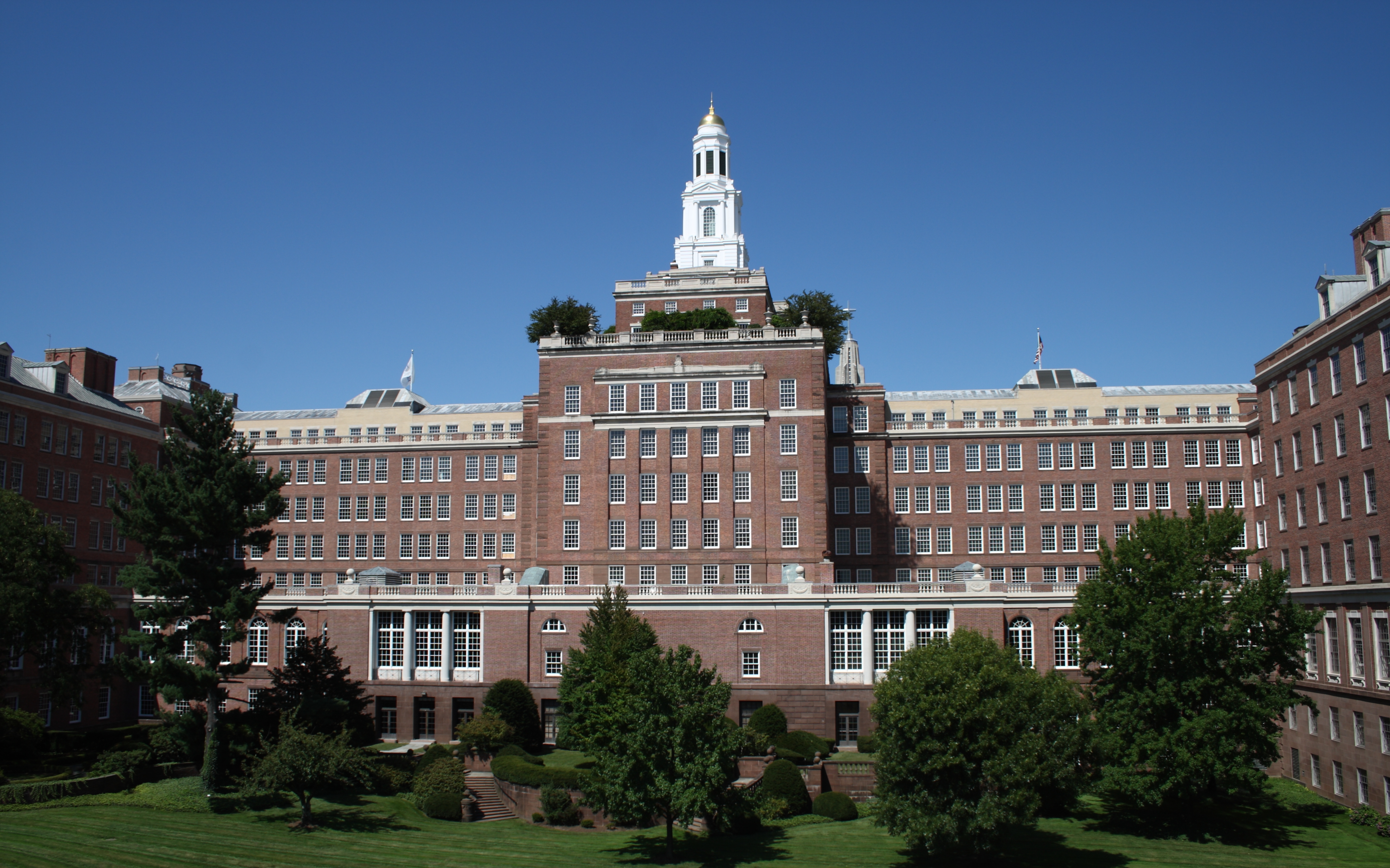
 Aetna Headquarters in the Asylum Hill neighborhood.
- Aetna Headquarters – The world's largest colonial revival building, the Aetna headquarters is crowned by a tall Georgian tower inspired by the Old State House downtown.
- Armsmear – The Colt family estate.
 Armsmear
- Bulkeley Bridge – Spanning the Connecticut River and connecting the city of Hartford with East Hartford, the nine-span structure is a stone-arch bridge.
- Bushnell Center for the Performing Arts – Constructed in the 1930s by the same architects who designed New York City's Radio City Music Hall, the theater features a Georgian Revival exterior and an exquisite Art Deco interior, with a large hand-painted mural suspended from the ceiling that is the largest of its kind in the United States.
- Bushnell Park – Located below the State Capitol and legislative office complex, this park consists of rolling lawn, sculpture, fountains, and a historic carousel. It is the first park in the country purchased by a municipality for public use, and it was designed by Jacob Weidenmann. The Soldiers & Sailors Memorial Arch, a Civil War Memorial which frames the northern entrance to the park, is the first triumphal arch in the United States.
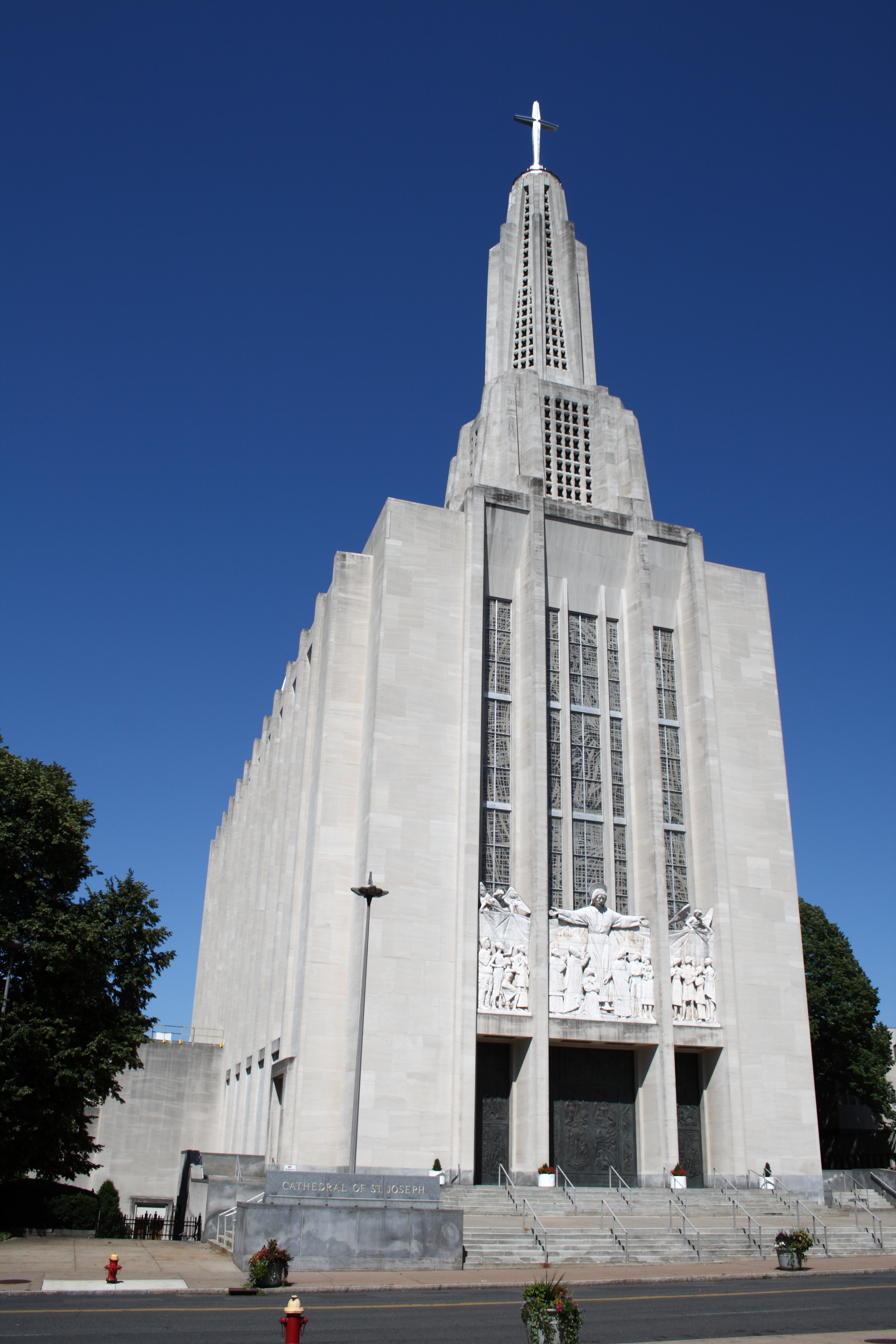
- Cathedral of St. Joseph – Located west of downtown along Farmington Avenue in the Asylum Hill neighborhood, this 281-foot (86 m) limestone Roman Catholic cathedral (built in 1961 to replace its predecessor lost to fire) has large Parisian stained glass windows, an 8,000 pipe organ, and the largest ceramic tile mural of Christ in Glory in the world.
 Cathedral of Saint Joseph
- Charter Oak Cultural Center[34] – Located at 21 Charter Oak Avenue, near the Charter Oak monument, COCC is housed in Connecticut's first synagogue, built in 1876. Today it is a secular non-profit institution bringing together art, drama, music, and other cultural excursions.
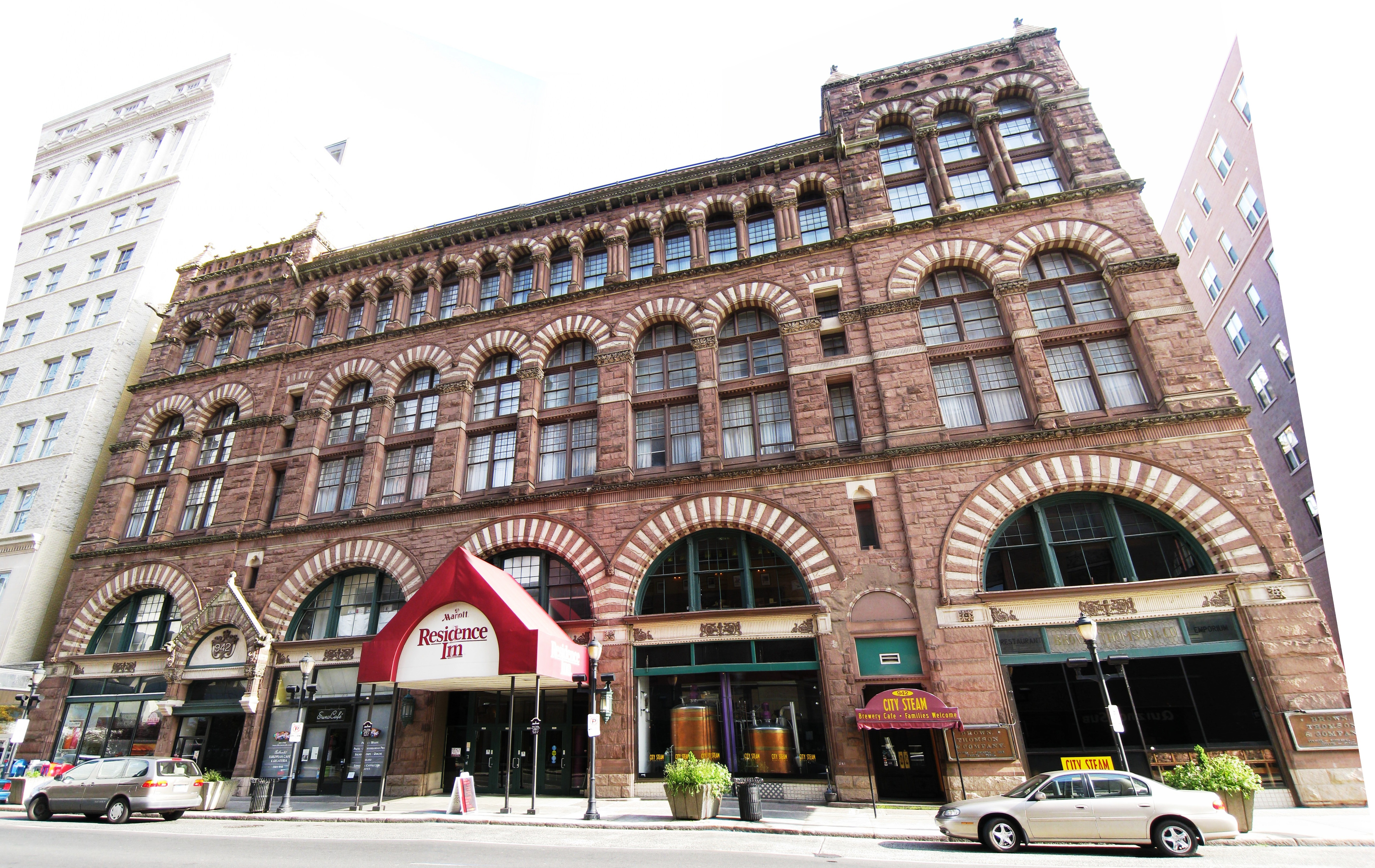
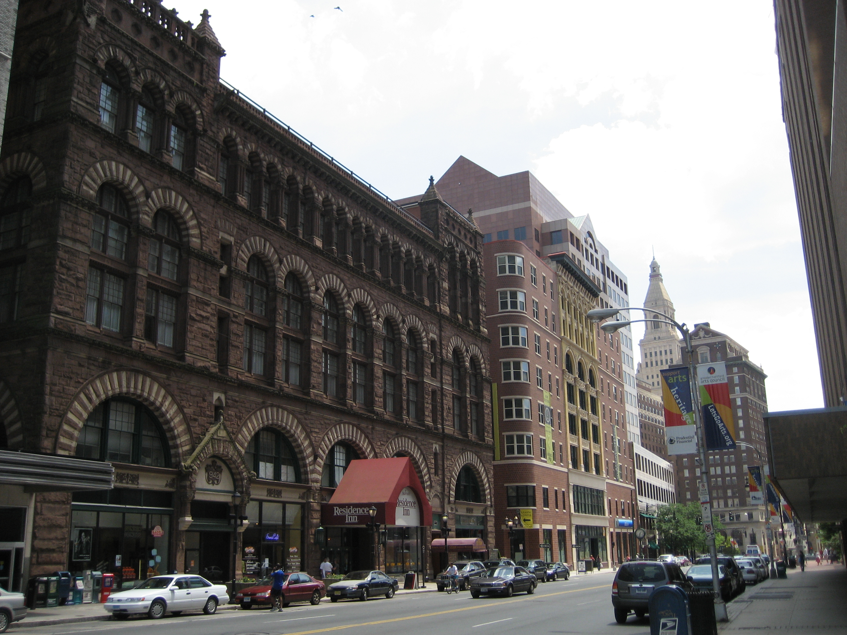
- Cheney Building – Constructed in the late 19th-century, this notable building by famed architect H. H. Richardson is located Downtown on Main Street. It housed the Brown, Thomson & Co. department store.
- City Place I- The tallest building in Hartford at 38 stories and the tallest building in Connecticut. It is located at 185 Asylum St.
- Colt Armory – Topped with a blue and gold dome, the complex was once the main factory building of Colt's Manufacturing Company. It is currently being redeveloped and renovated and will feature apartments, retail and office space.
- Comcast Theater (formerly the Meadows Music Theater) – Located in the North Meadows, it is an indoor/outdoor amphitheater-style performance venue.
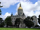 Connecticut State Capitol building
 Connecticut Science Center, Hartford, CT on the Riverfront
- Connecticut Science Center – 154,000 square foot (14,000 m²), nine-story, $165 million museum. Designed by César Pelli, it opened on June 12, 2009.
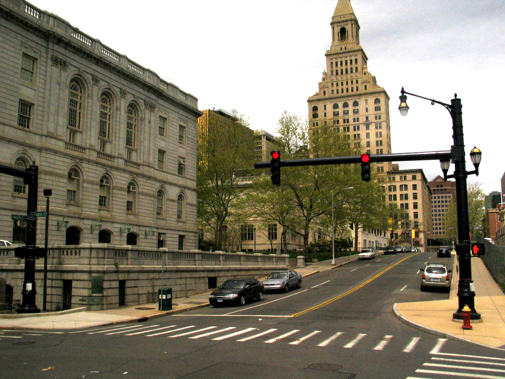
- Connecticut State Library & Supreme Court – Located in the hill district near the State Capitol atop Bushnell Park, the building also contains the Museum of Connecticut History and a number of galleries devoted to Samuel Colt memorabilia.
- Connecticut Convention Center – The 540,000 square foot (42,000 m²) convention center is now open, and overlooks the Connecticut River and the central business district. Attached to the center is a new 409 room, 22-story Marriott Hotel (opened late August 2005).
- Connecticut Governor's Mansion – An imposing Georgian revival mansion situated near the highest point in the City of Hartford on upper Prospect Avenue. Four landscaped acres surround the residence continuing the garden setting of Elizabeth Park, just opposite Asylum Avenue.
- Connecticut Opera – Founded in 1942, is the six-oldest opera company in the United States, performing three fully staged operas per season, primarily at The Bushnell Center for the Performing Arts in Hartford.
- Connecticut State Capitol – Located atop Bushnell Park, this large Gothic-inspired building features many statues and engravings on its exterior. It is topped with a gold leafed dome.
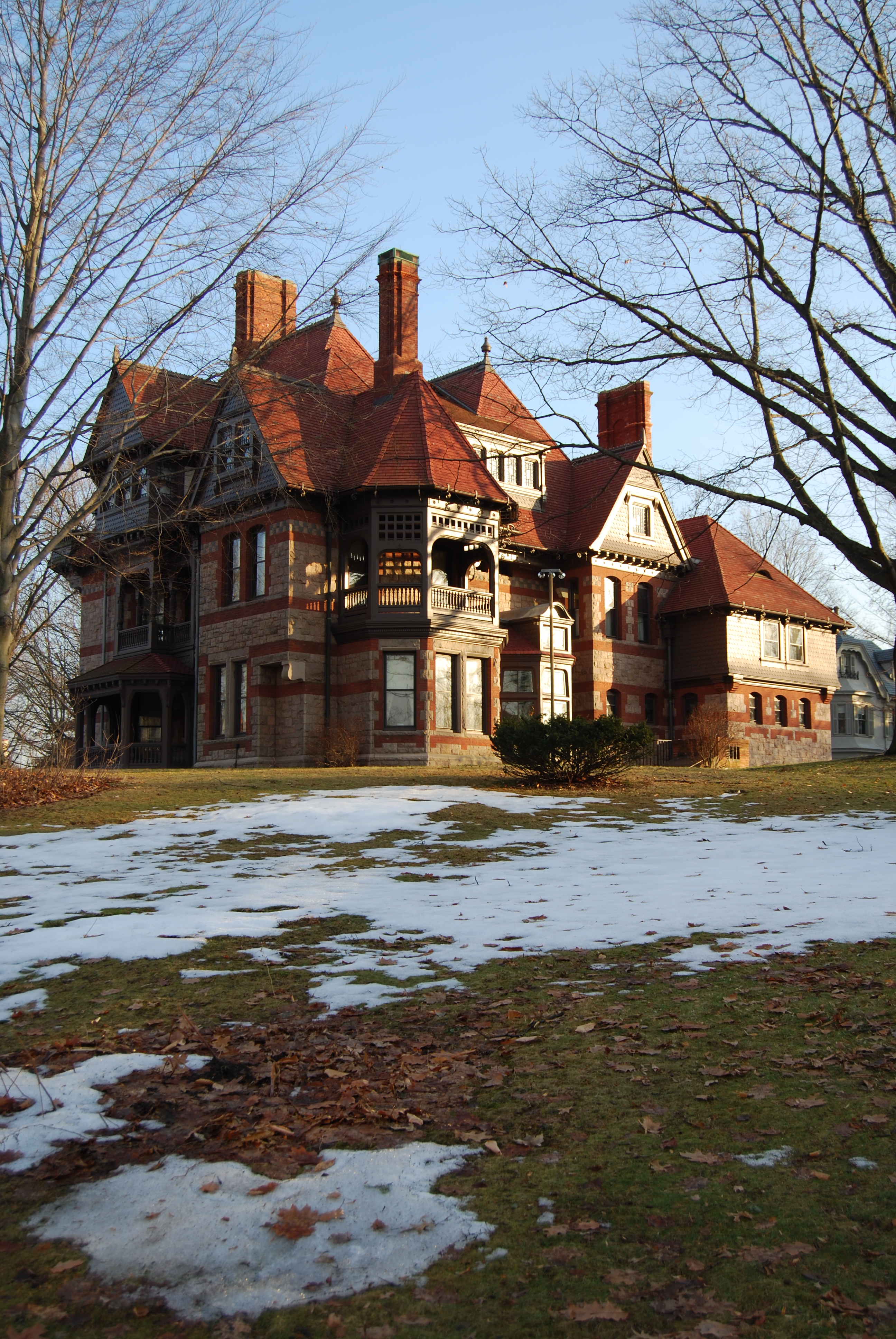
 The house of Katherine Seymour Day (grandniece of Harriet Beecher Stowe). Adjacent to the Stowe house, it now forms part of the research center dedicated to the author and abolitionist.
- Constitution Plaza – Built in the early 1960s, Constitution Plaza is a renowned, and notorious, redevelopment project. To build the plaza, Hartford's historic Front Street neighborhood was razed. The complex is composed of numerous office buildings, underground parking, a restaurant, broadcasting studio and outdoor courtyards and fountains. During the holiday season the area is filled with Christmas lights for the Festival of Light. The Plaza passes over I-91 and connects the city to the Connecticut River by way of Riverfront Plaza.
- Elizabeth Park & Rose Garden[35] – Straddling the Hartford/West Hartford border, both sections of the park administered by the City of Hartford.
- Harriet Beecher Stowe House & Research Center – The former home of Harriet Beecher Stowe, located in the Asylum Hill neighborhood on Farmington Avenue, has become a museum, along with its neighbor – the home of Mark Twain.
- The Hartford Financial Services Group headquarters campus on Asylum Hill occupies the former site of the American School for the Deaf, which has moved to a campus in West Hartford.
- Hartford Public Library – The Library was founded in 1774 and has over 500,000 holdings, an extensive calendar of programs and free public access computers and wifi.
 Hartford Stage Company in Downtown.
- Hartford Stage – Dedicated to the production of classic works and new play development.
- Hartford Symphony Orchestra – Connecticut's regional orchestra.
- The Hartt School at the University of Hartford is recognized as one of the premiere performing arts conservatories in the United States.
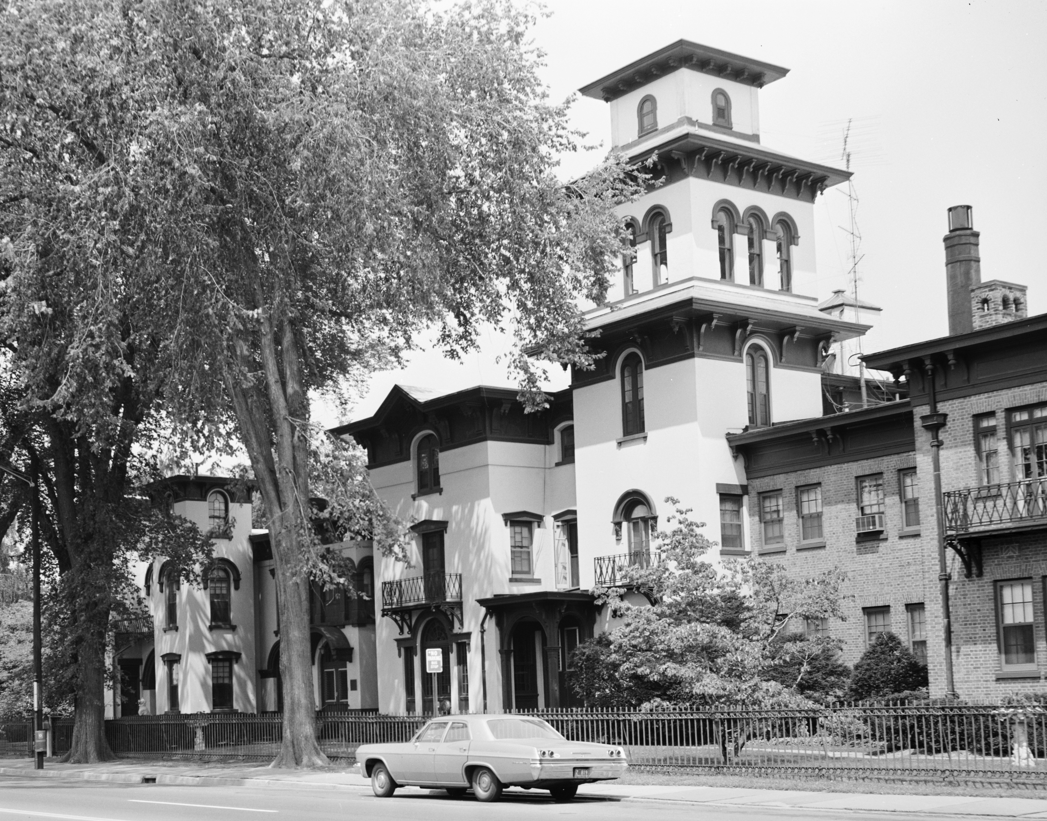
- Isham-Terry House- This Italian Villa was built in 1854 as the residence of a businessman and is one of the city's older homes.
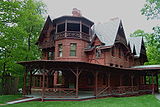 Mark Twain House
- The Mark Twain House and Museum – Once the home of Samuel Clemens, the house is now a museum, located in Nook Farm, now part of the Asylum Hill neighborhood, on Farmington Avenue.
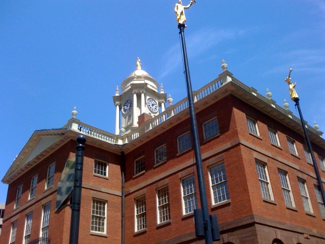
- Old State House – The Old State House, dating back to 1796, makes it one of the nation's oldest. It was designed by Charles Bulfinch, who later went on to design the Massachusetts State House in Boston. Recently restored with a gold-leafed dome rising from its top, the Old State House sits facing the Connecticut River in Downtown. The Old State House was the site of the Amistad trial.
 Old State House
- Phoenix Mutual Life Insurance Building, the first two-sided building in the world, it is located on Constitution Plaza and listed on the National Register of Historic Places.
- Pope Park, Hartford, Connecticut
- Real Art Ways is an alternative art gallery and hosts contemporary art, music, and film productions.
- Riverfront Recapture and Park – The park connects the downtown with the Connecticut River. It contains bike and walking trails, playing fields, and a white triangle-shaped dome covers one of the performing stages. The boat launch for a Connecticut River tour is also located here. A walkway spanning the Connecticut River leads to East Hartford.
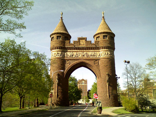
 Soldiers & Sailors Memorial Arch
 Wadsworth Atheneum
- Soldiers and Sailors Memorial Arch – Located in Bushnell Park, the now buried Park River once flowed beneath it. Honoring the 4,000 Hartford citizens who served in the American Civil War, and the 400 whom perished, the brownstone memorial is the first triumphal arch in the United States.
- Stone Field Sculpture – Located at the corner of Gold and Main Streets, this work of public art consisting of 36 boulders was completed by the Minimalist, Carl Andre, in 1977.
- Trinity College – The liberal arts college was founded in 1823 and has more than 2,100 students. It is the second-oldest in Connecticut after Yale University in New Haven.
- University of Connecticut School of Business – A branch of the University of Connecticut Business school operates in downtown Hartford. The building is located on Market Street, north of Constitution Plaza.
- University of Connecticut School of Law – located off Farmington Avenue, the campus features an extensive Gothic-inspired library. * University of Hartford – The University, which was founded in 1877, sits on 340 acres (140 ha) with a 13-acre (5.3 ha) campus on Bloomfield Avenue situated on land divided between Hartford, West Hartford and Bloomfield. Located in the Blue Hills neighborhood, the campus is minutes from Downtown. There are more than 7,200 students and 86 undergraduate majors.
- Wadsworth Atheneum Museum of Art – The oldest art museum in the U.S. is located on Main Street in downtown Hartford opposite the Travelers Tower. The museum features a significant collection of Italian Baroque old masters and post-impressionist modern art. In the plaza located between it and Hartford City Hall, Alexander Calder's 'Stegosaurus' sculpture sits in an open-air plaza.
- XL Center – Built in 1975, the center hosts concerts and shows. Formerly home to the NHL Hartford Whalers, it is currently the home to the Connecticut Whale AHL hockey team and, part-time, to the UConn Huskies basketball team.
Parades
- Greater Hartford St. Patrick's Day Parade - Downtown - March 2011 was the 40th year - Run by The Central Connecticut Celtic Cultural Committee
- Greater Hartford Puerto Rican Day Parade - Downtown, South Green, and Frog Hollow - June 2010 - Run by The Connecticut Institute for Community Development
- Greater Hartford West Indian Parade - Northeast - August - Run by The West Indian Foundation
- Hooker Day Parade - Downtown - October - Run by Hartford Business Improvement District
Hartford Views
-

Hartford seen from Simsbury's Heublein Tower.
-
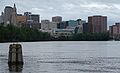
Hartford Skyline from Connecticut River
-

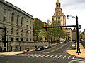
Main Street looking toward State House Square
-

Downtown, looking toward Old State House
-
Downtown, behind City Hall (foreground)
-

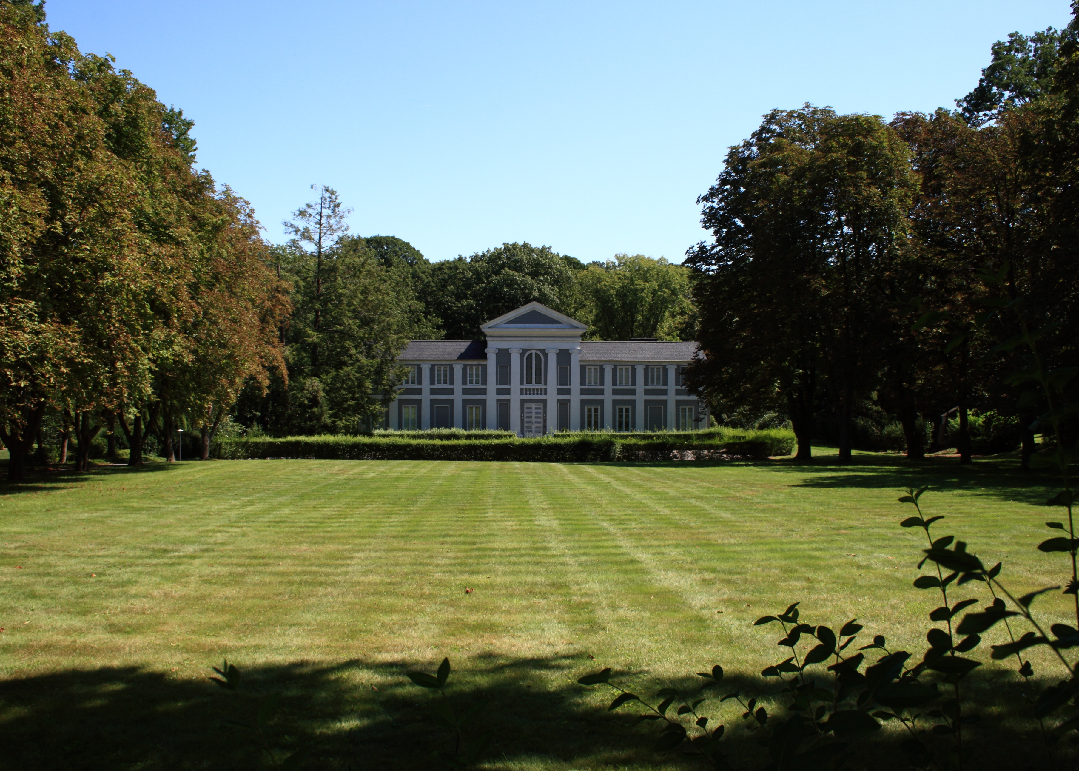
A. Everett Austin House in the historic West End
-

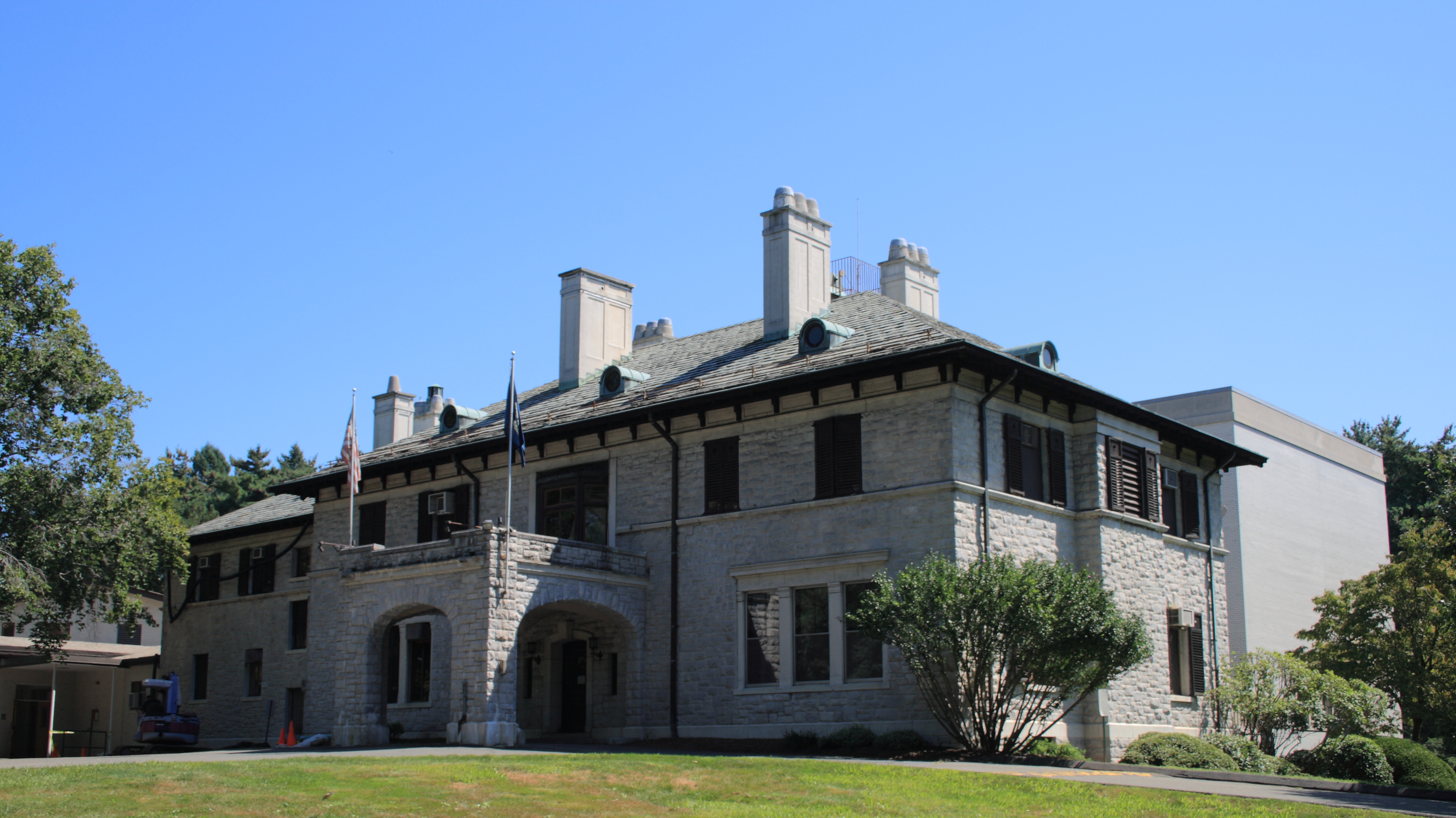
St. Francis Hospital & Medical Center
-

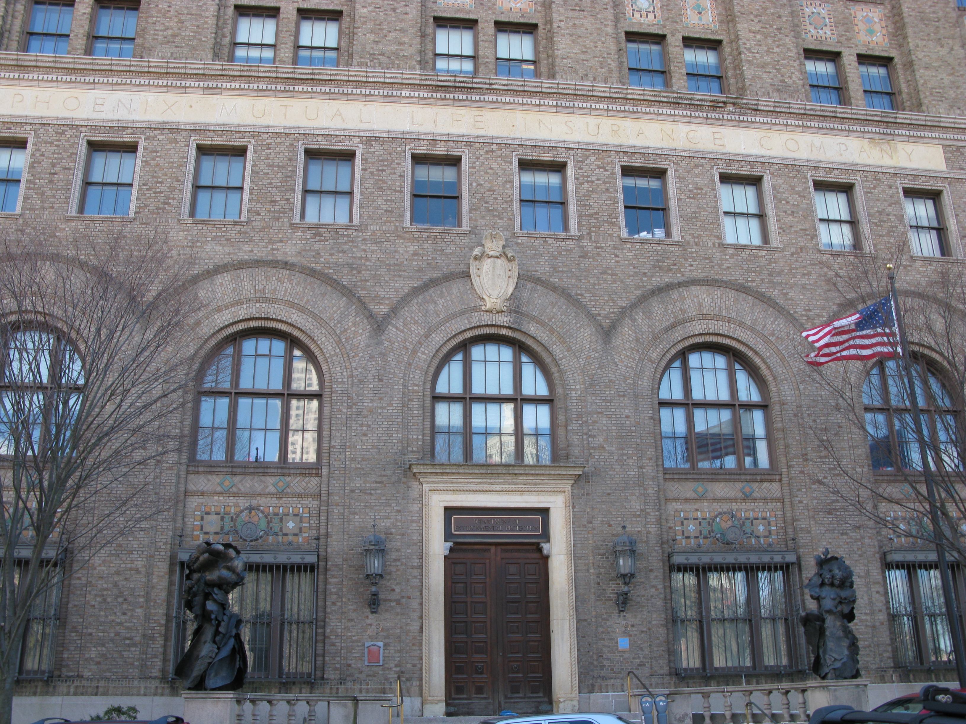
Connecticut Department of Environmental Protection in former Phoenix Mutual Life Insurance Company Building
-

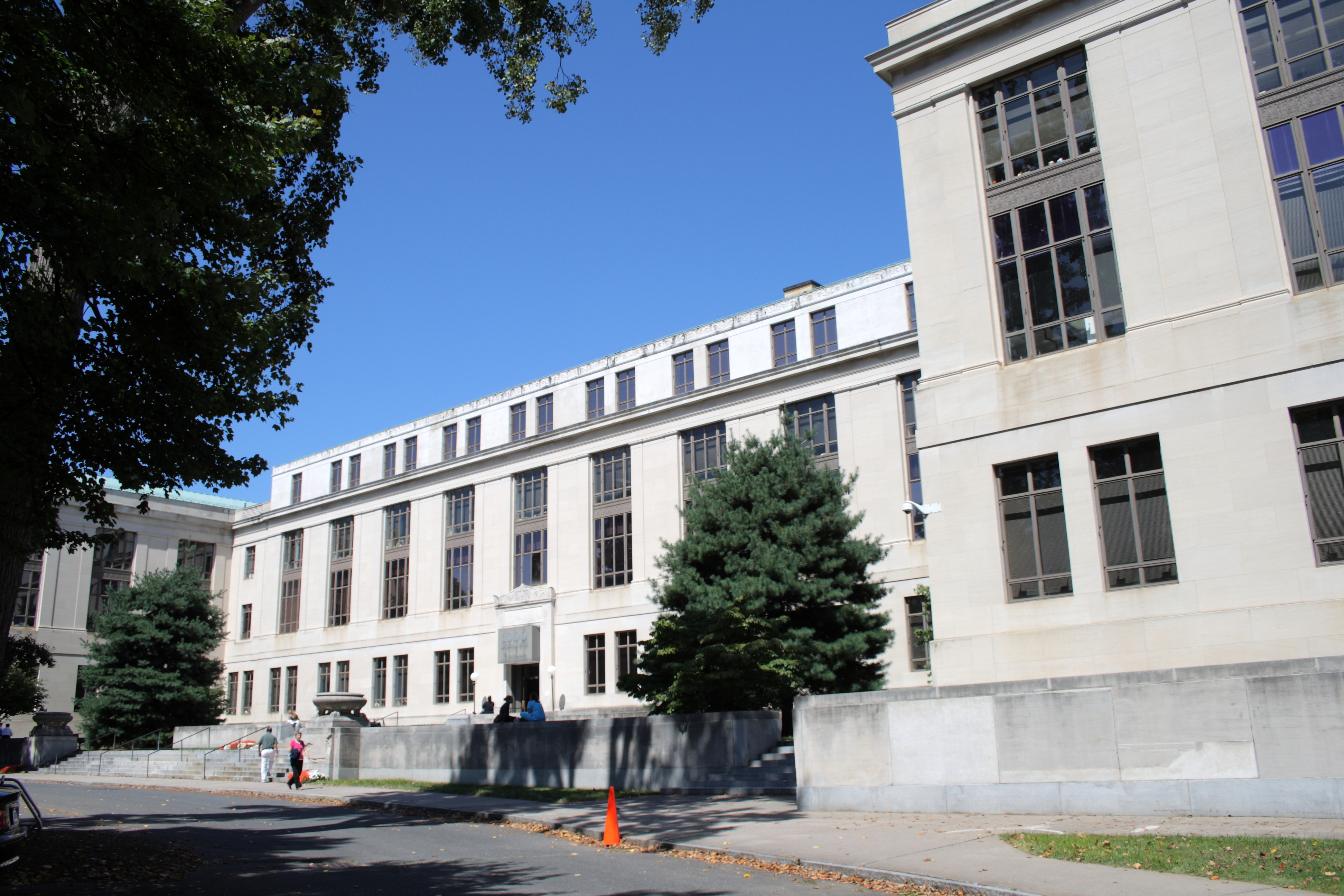
Connecticut Historical Society Museum & Library
-

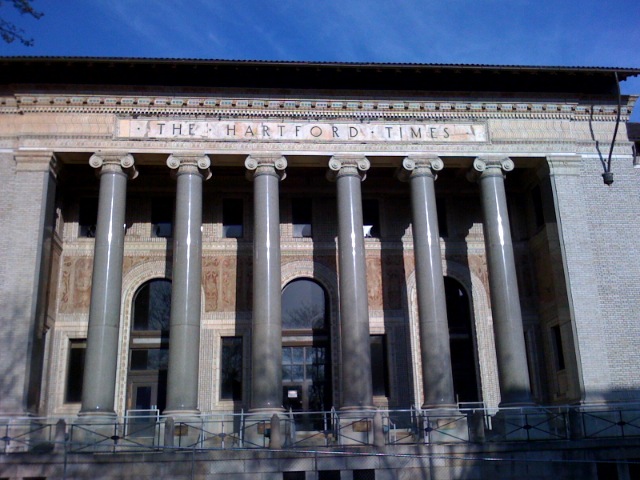
Beaux-Arts former Hartford Times Building
-

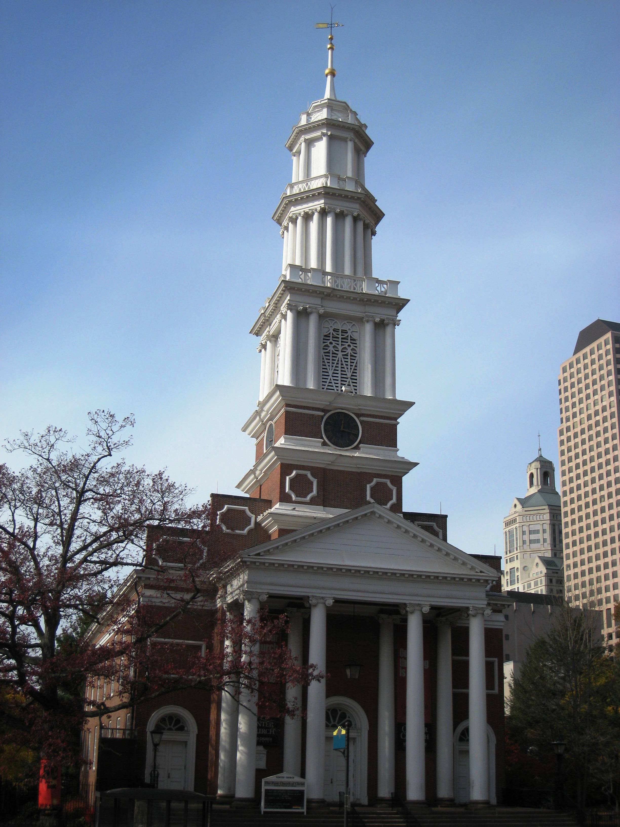
Center Church
-

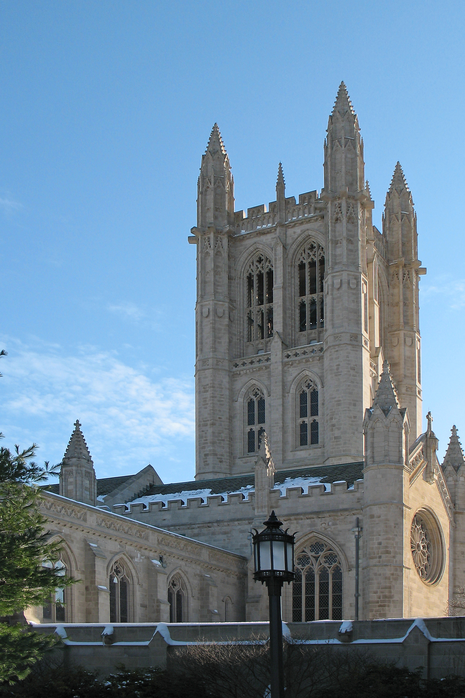
Trinity College Chapel
-

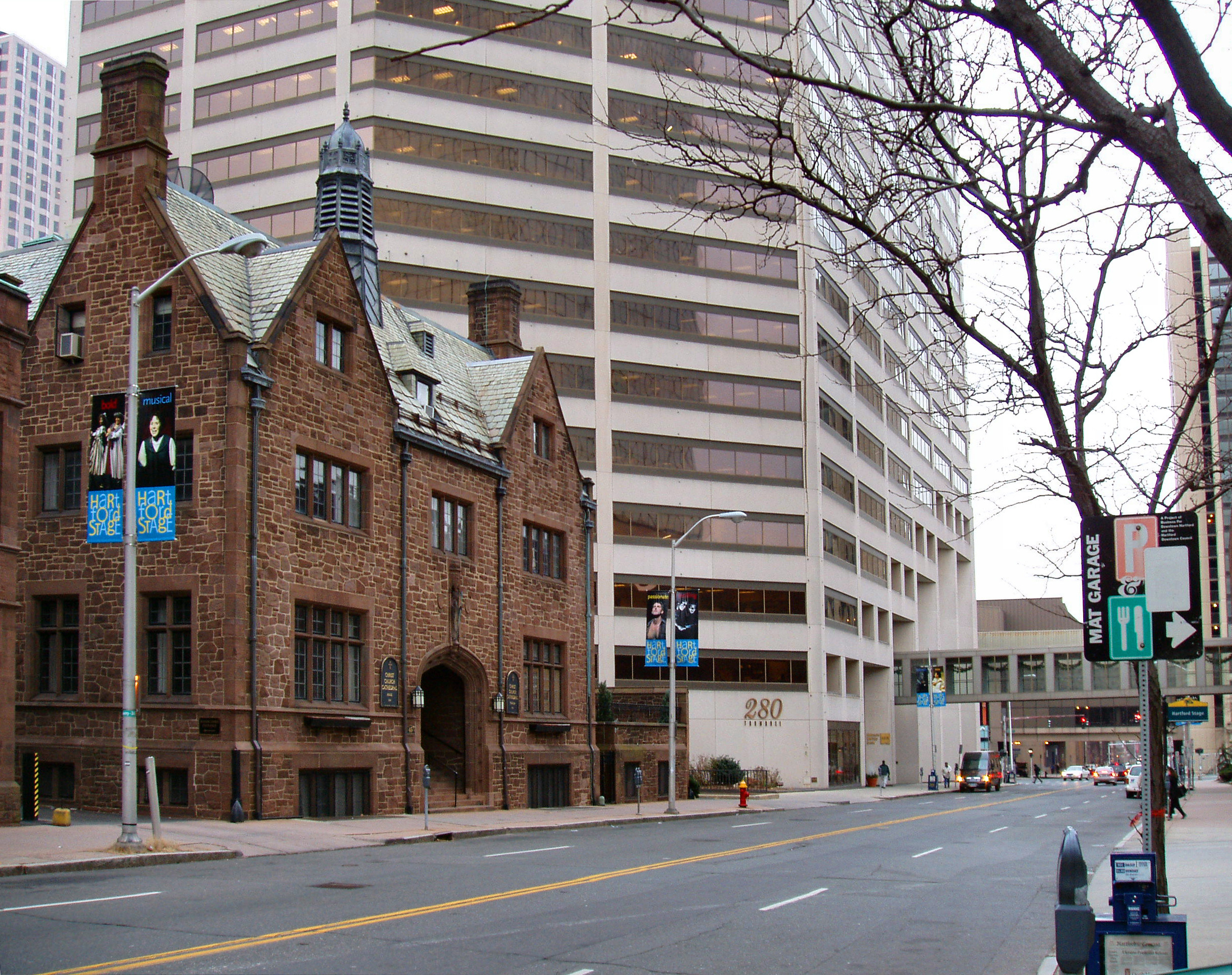
Christ Church Cathedral Chapter House
-
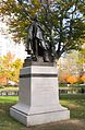
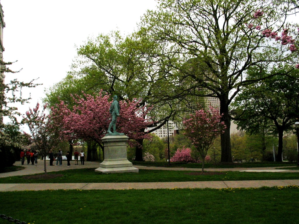
Horace Wells Monument, Bushnell Park
-

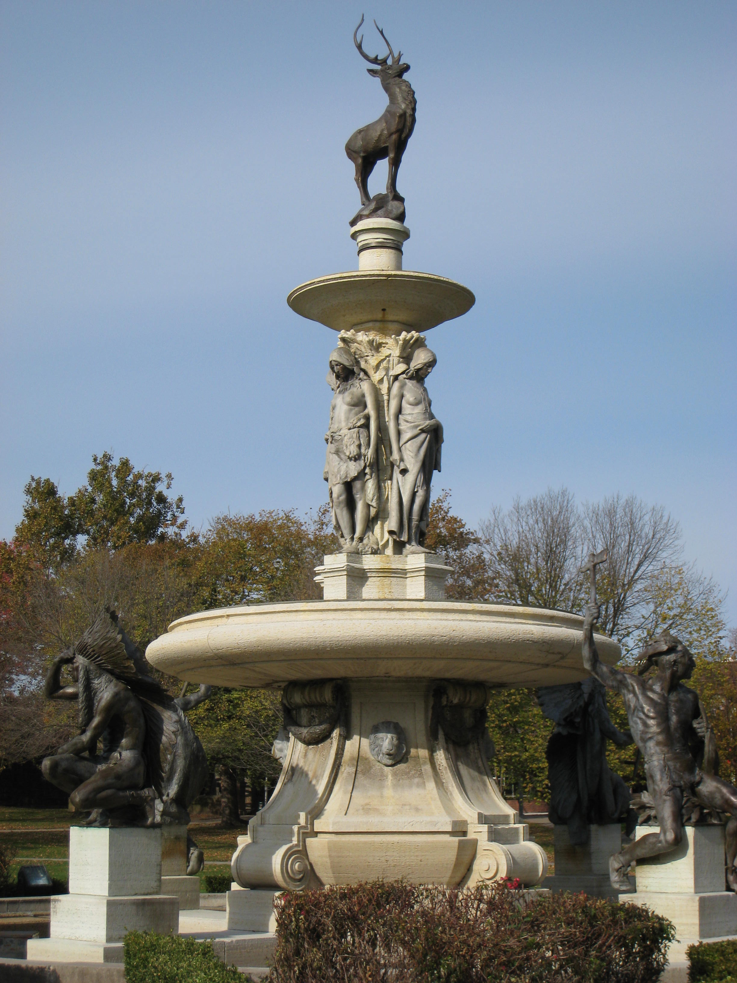
Corning Fountain, Bushnell Park
-

Grounds of Connecticut State Capitol Building
-

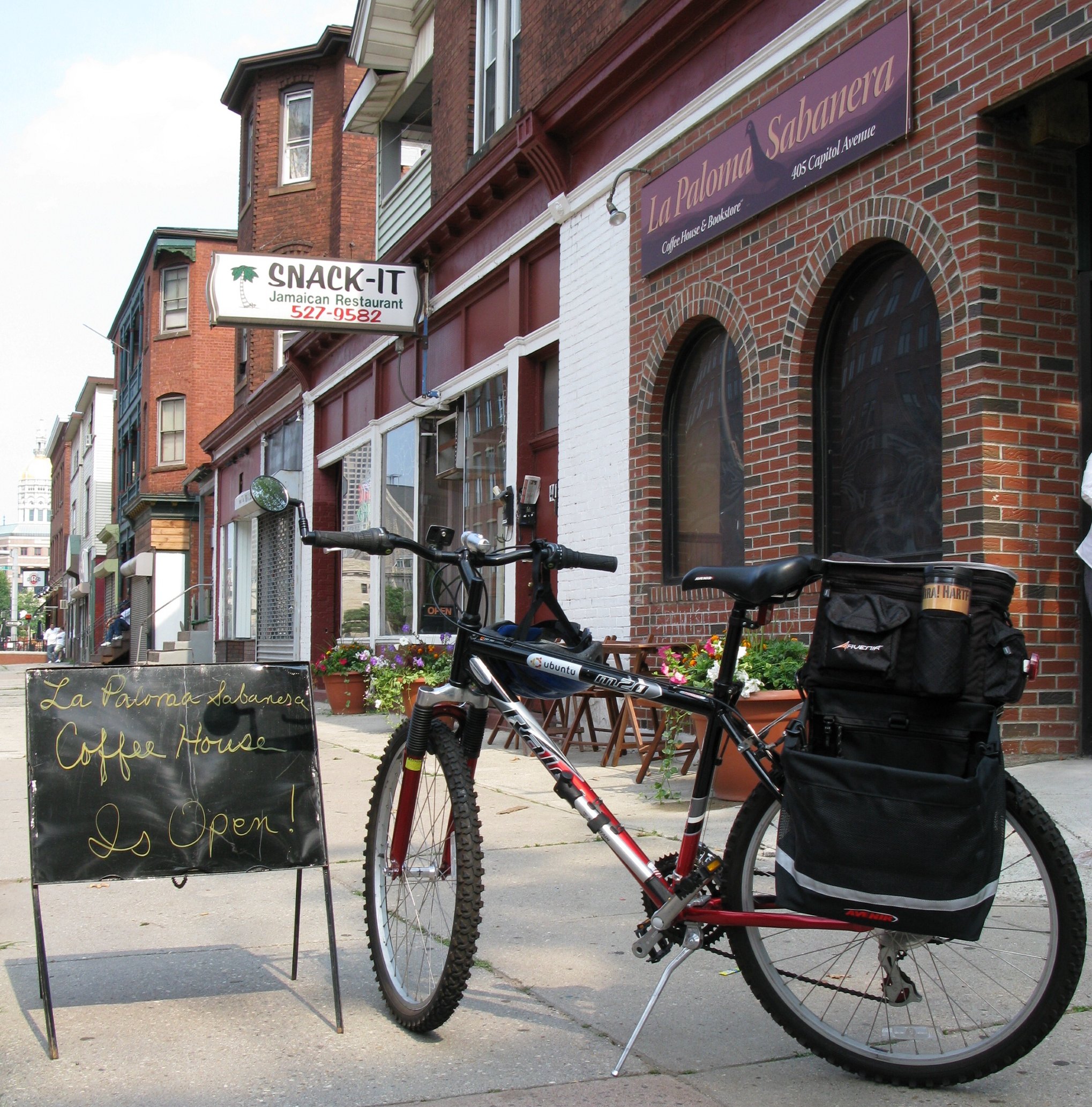
Hispanic and Jamaican Eateries near the Capitol
-
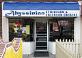
Ethiopian Restaurant in the West End
Sports
Club Sport League Venue Connecticut Whale Ice hockey American Hockey League XL Center Hartford Colonials American Football United Football League Rentschler Field Hartford Wanderers Rugby Union New England Rugby Football Union Colt Park Hartford was home to the NHL's Hartford Whalers from 1979 to 1997, before the team relocated to Raleigh, North Carolina and became the Carolina Hurricanes.
The Boston Celtics played various home games per year in Hartford from 1975–1995.
The University of Connecticut men's and women's basketball team – the UConn Huskies – also play a number of their home games at the XL Center downtown. Other home games are played at Gampel Pavilion located on the university's campus in Storrs.
Hartford also used to have a National League baseball team, the Hartford Dark Blues, back in the 1870s, and a NFL team, the Hartford Blues, for one season in 1926.
New development
 Connecticut Convention Center
Promoted as "New England's Rising Star",[36] the City of Hartford has generated renewed interest with both local and national developers who are investing in the city and the Knowledge Corridor region.
In 2000, at The Big E in West Springfield, Massachusetts, Hartford and Springfield, Massachusetts - the two major New England, Connecticut River Valley cities with centers only 24 miles apart - jointly announced the Knowledge Corridor Partnership. The Knowledge Corridor Partnership aims to unite the bi-state Hartford and Springfield metropolitan areas economically, culturally, and geographically. The region is nicknamed the "Knowledge Corridor" because the metropolitan region features numerous well-regarded universities and research hospitals. The Knowledge Corridor is the second most populous metropolitan region in New England with 1.9 million people, and features over 32 universities and liberal arts colleges, including several of the United States' most prestigious. Increasingly, Hartford and Springfield are considered twin cities - they are considerably closer geographically than other U.S. twin cities like Dallas-Fort Worth, Texas. As of the 10th anniversary of the Knowledge Corridor, it was announced that the Knowledge Corridor is beginning to receive federal funds, as opposed to either state or city.[37]
In 1997, Hartford lost its NHL franchise, the Hartford Whalers, but it has since gained an AHL franchise, the Connecticut Whale.
Some of the major new development projects include:
Adriaen's Landing: The state- and privately funded project is situated on the banks of the Connecticut River along Columbus Boulevard, and connects to Constitution Plaza. Constitution Plaza forced hundreds of households to relocate when it was built a few decades ago. The latest project includes the 540,000-square-foot (50,000 m2) Connecticut Convention Center, which opened in June 2005 and is the largest meeting space between New York City and Boston. Attached to the Convention Center is the 22-story, 409 room Marriott Hartford Hotel-Downtown which opened in August 2005. Being constructed next to the convention center and hotel is the 140,000-square-foot (13,000 m2) Connecticut Science Center. The final component of the project, 'Front Street', sits across from the Convention Center and covers the land between Columbus Boulevard and the Hartford Times Building. The Front Street development combines retail, entertainment and residential components. Publicly funded parts of the project will include transportation improvements. There have been significant delays in the Front Street project – the first developer was removed from the project because of lack of progress. The city has chosen a new developer, but work is yet to begin on the retail and residential component of Front Street. The city and state may soon take action to increase the speed with which the project enters implementation phases. There has been talk of bringing an ESPN Zone to the Front Street (ESPN is headquartered in nearby Bristol).[38] On the back side of Front Street, the historic Beaux-Arts Hartford Times Building is being converted for administrative offices for the Wadsworth Atheneum. In 2004, Underground Coalition, a Connecticut hip hop promotion company, produced The First Annual Hartford Hip Hop festival, which also took place at Adriaen's Landing. The event drew over 5,000 fans. A significant number of cultural events and performances take place every year at Mortensen Plaza (Riverfront Recapture Organization) by the banks of the CT River. These events are held outdoors and include live music, festivals, dance, arts and crafts and they are very diverse in ethnicity. Hartford also has a vibrant theater scene with major Broadway productions at the Bushnell Theater as well as performances at the Hartford Stage and Theaterworks (City Arts).
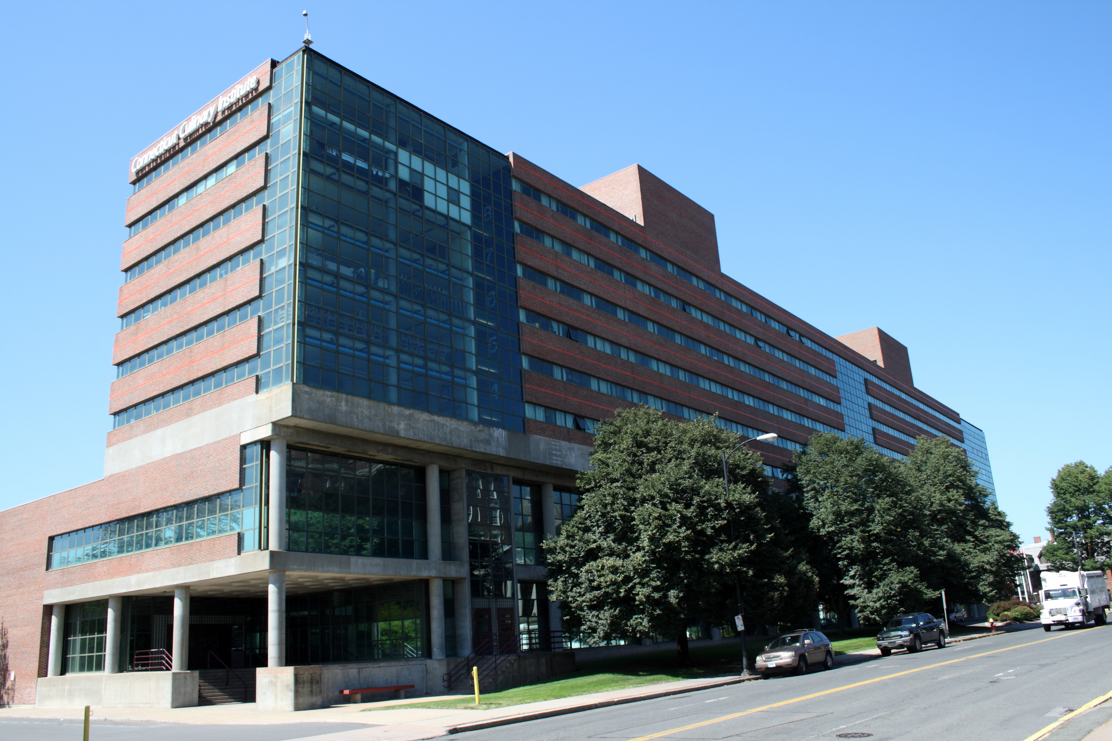
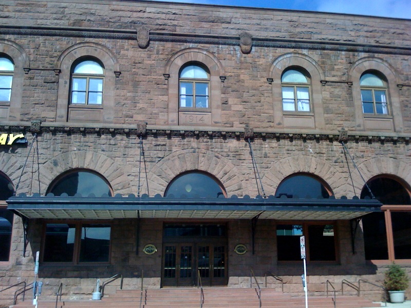
 Connecticut Culinary Institute
The New Haven – Hartford – Springfield commuter rail line (officially named The Knowledge Corridor Intercity Rail Line) [39] is expected to be operational during 2015. According to Connecticut Governor Malloy, the Knowledge Corridor line will reach speeds up to 110 mph (177 km/h).[40] The rail line is intended to unite the densely populated, 61 mile region between Hartford, Springfield, and New Haven; ease the frequently congested Interstate 91 automobile highway; and increase mobility in a region that is now almost entirely dependent upon automobile ownership. As of May 2011, Connecticut's portion of the commuter line has been 3/4 funded. Currently, the state is seeking the $227 million necessary to complete the northern portion of the line from the $2.4 billion in Federal funds that Florida rejected to fund its own high-speed rail project.[40]
Hartford 21: Recently completed on the site of the former Hartford Civic Center Mall (now known as the XL Center), the project includes a 36 story residential tower—the tallest residential tower between New York City and Boston. Attached to the tower is 90,000 square feet (8,000 m2) of office space and 45,000 square feet (4,200 m2) of retail space, all contained within a connected complex. The Greater Hartford YMCA has opened in the complex and will soon be closing its Jewell Street site which will be knocked down for another project. The XL Center Arena remains open and hosts the AHL Connecticut Whale and the UConn men's and women's basketball teams, as well as shows and concerts.
Capital Community College at the 11-story G. Fox Department Store Building: The 913,000-square-foot (84,800 m2) former home of the G. Fox & Company Department Store on Main Street has been renovated and made the new home of Capital Community College as well as offices for the State of Connecticut and ground level retail space. Capital Community College helps train (mostly) adult students in specific career fields. On Thursdays, vendors sell crafts on the Main Street level. Two music clubs, Mezzanine and Room 960, are housed in the building.
Connecticut Culinary Institute: The school recently relocated its main campus to the former Hastings Hotel and Conference Center, which is next to Aetna headquarters in the city's Asylum Hill neighborhood just west of downtown. The school also has a branch campus in Suffield, Connecticut. The Hastings Hotel and Conference Center, which closed abruptly in 2004, was the hotel where former President Bill Clinton stayed when he was in the city.
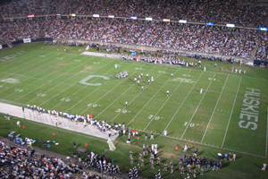
 Rentschler Field
Rentschler Field: In neighboring East Hartford, the stadium for UConn football was part of the revitalization plan for Hartford and was built on some of the lands donated by United Technologies. The bulk of the land donated will be used for technology, entertainment, lodging and retail development. A high-tech research park is also currently being planned for the site.
Transportation and parking changes: The New Britain-Hartford Busway is in the works. Local activists are pushing for more bike lanes, as well as for these lanes to be respected by motorists and kept clear of debris. The local bicycle advocacy organization formed in 2005, Central Connecticut Bicycle Alliance, has been making surprising inroads in Hartford and the surrounding suburbs.
Some roads were turned into pedestrian walkways to reduce gridlock, while other roads were widened or made one-way. Some intersections were also improved to better handle traffic. A large parking garage was built downtown to ease parking problems. A series of shuttle routes was created, known as the "Star Shuttle" and now run by the Greater Hartford Transit District.
New condos and apartments:
- Hartford 21: Opened adjacent to the XL Center in September 2006, this sleek 36-story apartment tower is the tallest in New England, and is located at the intersection of Trumbull Street and Asylum Street. The building includes 232 luxury one-bedroom and two-bedroom units (including four penthouses), an adjacent parking garage and spacious common areas.
- Trumbull on the Park: Recently opened along Bushnell Park, this apartment community is housed in a new 11-story brick building along with a parking garage and ground-level retail space. Additional units are housed in recently renovated historic buildings on nearby Lewis Street.
- 55 on the Park: Formerly a SNET office building, it has been turned into luxury apartments that sit along Bushnell Park. The building reopened a few years ago and was among the first new residences to open downtown in years.
- Sage Allen Building: On Main Street, the former Sage Allen department store building has been turned into 44 4-bedroom townhouses as well as an upscale apartment building comprising about 70 units that opened in January 2007. The project also includes the renovation of the Richardson Food Court and the reopening of Temple Street, which once again reconnects Main and Market Streets. Many of the townhouses will be occupied by University of Hartford students. It sits directly across Market Street from the University of Connecticut Graduate Business Learning Center.
- The Metropolitan: The former Hartford Electric Light Company Building on Pearl Street is being converted into luxury condominiums.
- American Airlines Building: Located at 915 Main Street across from Capital Community College and the Residence Inn by Marriott, the site was formerly home to an E. J. Korvette department store and later American Airlines. The building has been converted into apartments with renovated ground-level retail space.
Transportation
Airports
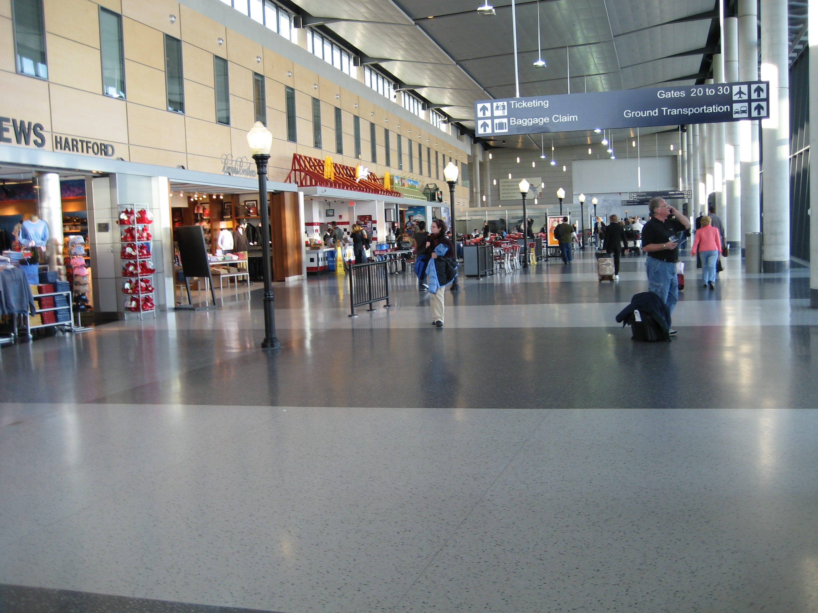
 Bradley International Airport
Bradley International Airport, in Windsor Locks, Connecticut, is twenty minutes north of downtown Hartford. It features over 100 daily departures to 30 destinations on nine airlines. Other airports serving the Hartford area include:[41]
- Hartford-Brainard Airport, located in Hartford off I-91 and close to Wethersfield, serves charter flights and local flights.
- Westover Metropolitan Airport, located in Chicopee, Massachusetts, 27 miles (43 km) north of Hartford, serves commercial, local, charter, and military flights.
- Tweed New Haven Regional Airport, located in New Haven, Connecticut, is served by US Airways Express.
Buses
Hartford city buses run at regular intervals throughout the city. Interstate bus is provided by Peter Pan Bus, Greyhound Bus and to a lesser degree, Bonanza Buses. Chinatown bus lines provides low-cost bus service between Hartford and their New York and Boston hubs. Megabus provides low-cost bus service between New York and Springfield, and Amherst, Massachusetts. Additionally, there are buses for connections to smaller cities in the state. The bus station is located on the ground floor of the transport center at One Union Place in Downtown Hartford. A free people circulator, known as the "Star Shuttle," operates around downtown.
A proposed bus rapid transit line between Hartford and New Britain, the New Britain–Hartford Busway, is being considered as a way to reduce traffic congestion on I-84.[42][43]
Highways
 Bulkeley Bridge over Connecticut River in Hartford
I-84, which runs from Scranton, to its intersection with I-90 in Sturbridge, just over the Massachusetts border, and I-91, which runs from New Haven along the Connecticut River ultimately to Canada, intersect in downtown Hartford. In addition to I-84 and I-91, two other highways service the city: Route 2, an expressway that runs from downtown Hartford to Westerly, passing through Norwich and past Foxwoods Resort Casino; and the Wilbur Cross Highway portion of Route 15 that skirts the southeastern part of the city near Brainard Airport. A short connector known as the Conlin-Whitehead Highway also provides direct access from I-91 to the Capitol Area of downtown Hartford.
Hartford experiences heavy traffic as a result of its substantial suburban population (nearly 10 times that of the actual city). As a result, thousands of people travel on area highways at the start and end of each workday. I-84 experiences traffic from Farmington through Hartford and into East Hartford and Manchester during the rush hour.
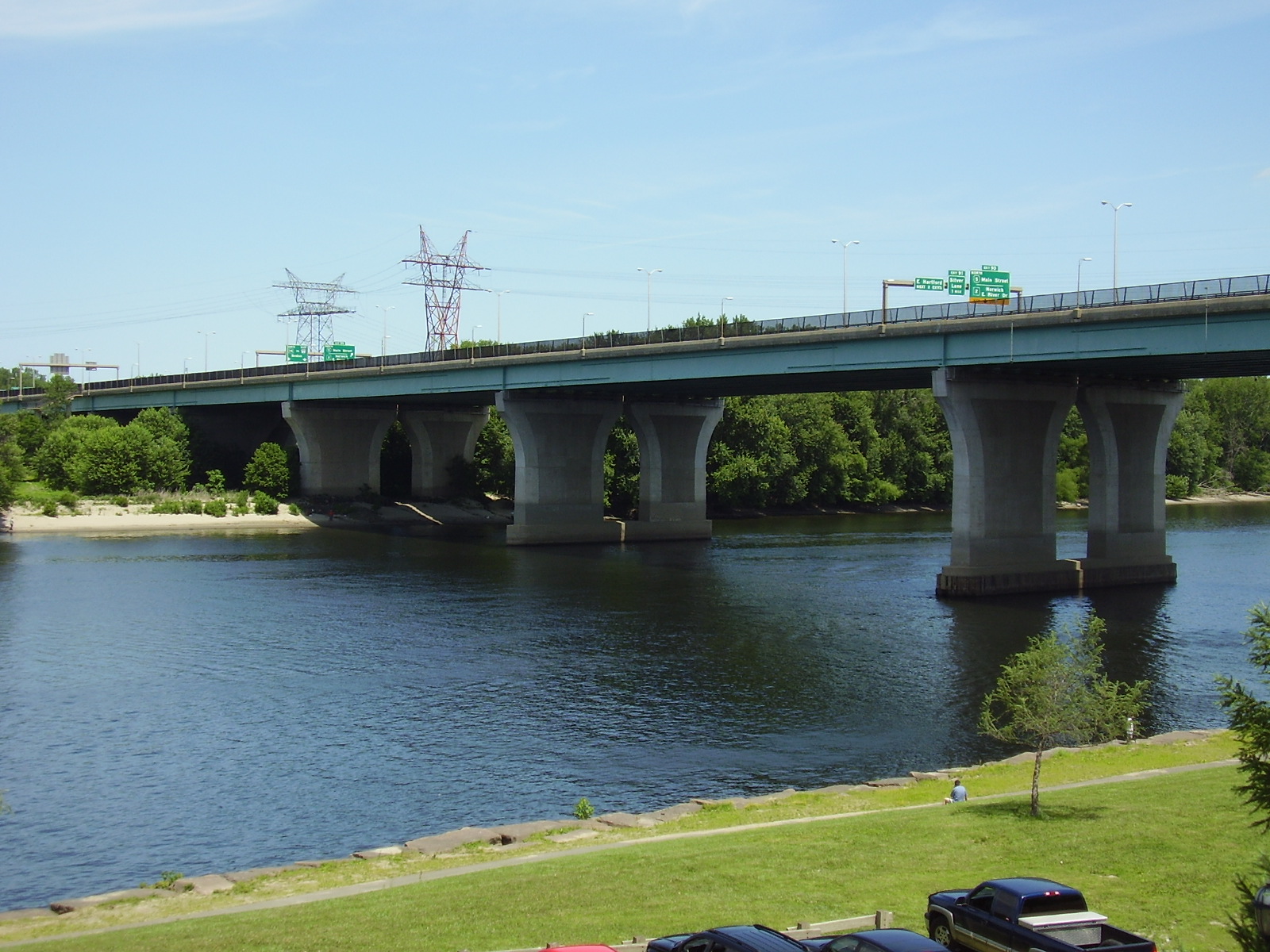
 Charter Oak Bridge over Connecticut River in Hartford
Several major surface arteries also run through the city. Albany Avenue (Route 44) runs westward through the northern part of West Hartford to the hills of northern Litchfield County and into New York, and eastward towards Putnam and into Rhode Island. Main Street (Route 159) heads north through Windsor towards the western suburbs of Springfield, Massachusetts. Wethersfield Avenue (Route 99) heads south through Wethersfield towards Middletown. Farmington Avenue heads west through West Hartford Center and Farmington towards Torrington.
Bicycle
A bicycle route runs through the center of Hartford. This route is a small piece of the large eastern bicycle route – the East Coast Greenway (ECG). The 3,000-mile (4,800 km) ECG runs from Calais, Maine to the Florida Keys. The route is intended to be off road, but some sections are currently on-road. The section through Hartford is right through the middle of Bushnell Park.
There are designated bicycle lanes on several roads including Capitol Avenue, Zion Street, Scarborough Lane, Whitney, and South Whitney.
Railroad
See also: Union Station (Hartford) Hartford's Union Station
The dependence on railroads has decreased since the construction of Interstate 91 and Interstate 84 through the city center. However, Hartford's Union Station at One Union Place still operates a significant schedule. Amtrak provides service from Hartford to Vermont via Springfield, and southward to New Haven, with connections to New York, Boston, Providence, and Washington DC. The station also serves numerous bus companies because of Hartford's mid-way location on the New York to Boston route.
Currently, there are preliminary plans to create a New Haven-Hartford-Springfield Commuter Rail Line with stations in communities close to I-91. It would use rail currently used by Amtrak, which in turn was formerly part of the New York, New Haven and Hartford Railroad system.
Public transport
Connecticut Transit is owned by the Connecticut Department of Transportation. CTTRANSIT operates local and commuter bus service within the city and the surrounding area. Taxi service is available from the train station at 1 Union Place or by calling one to any location in the area. There is a free downtown shuttle, and city buses are equipped with bike racks.
Media
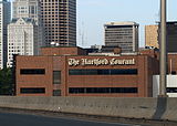 The Hartford Courant Co. building
The daily Hartford Courant newspaper is the country's oldest continuously published newspaper, founded in 1764. A weekly newspaper, owned by the same company that owns the Courant, the Hartford Advocate, also serves Hartford and the surrounding area, as does the Hartford Business Journal ("Greater Hartford's Business Weekly") and the weekly Hartford News.
The Hartford region is also served by several magazines. Among the local publications are: Hartford Magazine, a monthly lifestyle magazine serving Greater Hartford; CT Cottages & Gardens; Connecticut Business, a glossy monthly serving all of Connecticut; and Home Living CT, a home and garden magazine published five times a year and distributed statewide.
Several television and radio stations based in Hartford, including Connecticut Public Television which is headquartered in Hartford. These stations serve the Hartford/New Haven market, which is the 29th largest media market in the U.S.
See also: List of newspapers in Connecticut in the 18th-century: Hartford
Notable Hartford residents
Main article: List of people from Hartford, ConnecticutHartford has been home to many historically significant people: arts innovator "Chick" Austin (1900–57); L. Paul Bremer (b. 1941), ex-Administrator of US-occupied Iraq and foreign service officer; city planner and parks champion Frederick Law Olmsted (1822–1903); dictionary author Noah Webster (1758–1843); inventor Sam Colt (1814–62); and American financier and industrialist J.P. Morgan (1837–1913).
Some of America's most famous authors lived in Hartford, including Mark Twain (1835–1910), who moved to the city in 1874; his next-door neighbor at Nook Farm, Harriet Beecher Stowe (1811–96); and poet Wallace Stevens (1879–1955), an insurance executive in the city. More recently Dominick Dunne (1925–2009) and John Gregory Dunne (1932–2003) resided in Hartford.
Many broadcasters have called Hartford home over the years. King of All Media Howard Stern worked mornings at WCCC-FM in 1979, meeting local resident and sidekick Fred Norris there. Both Bill O'Reilly and Gayle King worked at WFSB. Twisted Sister lead vocalist Dee Snider also did a morning show on WMRQ radio in the mid 2000's. MSNBC "Morning Joe" co-host Mika Brzezinski was a reporter for years on WTIC ch 61 and WFSB. Former NFLer Beasley Reece was Sports Director for WVIT in the late 80's and early 90's, also a one-time home to ESPN's Chris Berman, and ESPN anchor Steve Berthiaume started his broadcasting career there as well. Charley Steiner broadcast for WPOP prior to working for ESPN, and Jason Jackson hosted a local sports radio show on ESPNRadio 1410 in 2003.
Actors and others in the entertainment business from Hartford include Academy Award–winning film icon Katharine Hepburn, actors Ben Cooper, Tony Todd, Linda Evans, Jenna Dewan, comedian Totie Fields, William Gillette, Eriq La Salle, Norman Lear, Jenna Dewan, Charles Nelson Reilly, film executive and academic August Coppola (father of Nicolas Cage), Remote Control host Ken Ober, Brooke Burke, and Sophie Tucker, (1884–1966), "last of the red-hot mamas." Amy Brenneman, who grew up in Glastonbury, adapted the experiences of her mother, a Connecticut Superior Court judge in Hartford, into the television series Judging Amy. Stephanie McMahon, daughter of WWE mogul Vince McMahon was born in Hartford.
In the field of music, residents include Rock and Roll Hall of Fame Members, Gene Pitney, Mike Carabello (original conga drummer in Santana); Mark McGrath; bass guitarist Doug Wimbish (Sugar Hill Records, Living Colour); Cindy Blackman (Drummer for Lenny Kravitz); jazz alto saxophonist Jackie McLean;[44] concert violinist Elmar Oliveira (b.1950); R&B, Reggae, Dancehall and Reggaeton artist Notch; gospel artist Kurt Carr were born in the city; and brothers Jeff Porcaro, Mike Porcaro and Steve Porcaro of the group Toto.
Cleveland Browns head coach Eric Mangini is from Hartford. Former NHL player Craig Janney was born in Hartford. Basketball stars include NBA players Marcus Camby, Rick Mahorn, Johnny Egan, and Michael Adams, as well as NFL kicker John Carney, and former NFLer Eugene Robinson. Jeff Bagwell and Vin Baker attended the University of Hartford.
Sister cities
Hartford features numerous sister cities. They include:[45]
 Bydgoszcz, Poland: A city in north-central Poland. It is part of the metroplex Bydgoszcz-Toruń with Toruń, only 45 km away, and over 850,000 inhabitants.
 Caguas, Puerto Rico: A midsized city in central Puerto Rico. The city of Hartford has the highest percentage of individuals with Puerto Rican ancestry in the continental United States.
 Floridia, Italy: A small suburb of Siracusa located on the southeastern coast of the island of Sicily.
 Freetown, Sierra Leone: Capital City of Sierra Leone.
 Hertford, England: The town has a population of about 24,000 and serves many commuters to London. The town has a country feel while only 20 miles (30 km) north of London.
 Mangualde, Portugal: A small town in Centro Region that is very close to the Serra da Estrela Mountains.
 Morant Bay, Jamaica: A town in southeastern Jamaica. It was the starting point of the only peasant rebellion in Jamaican history.
 New Ross, Ireland: A small town in southeast Ireland, at the confluence of the River Barrow and the River Nore. It is the ancestral home of the Kennedy family.
 Ocotal, Nicaragua: A large town in northern Nicaragua.
 Thessaloniki, Greece This mediterranean port is Greece's second largest city, with a population of just over 1 million people.
Appearances in popular culture
- Hartford was one of the 23 American cities bombed in the CBS drama Jericho.
- Hartford was the site of episode 3.29 of the documentary television series Gangland on the History Channel about its Los Solidos gang.
- The city was the setting for the Amy Brenneman series Judging Amy, which aired on CBS from 1999–2005.
- Many scenes in the WB/CW series Gilmore Girls take place in Hartford.
- Hartford was the setting for the 2002 movie, Far From Heaven.
- In the Simpsons episode They Saved Lisa's Brain, Homer enters a talent competition in which the winner will receive (as advertised on television) "a free trip to Hawaii". When participants show up for the event, the announcer reveals that the trip is actually to Hartford, Connecticut, claiming that "no one said Hawaii".
- In Stephen King's novel The Mist, Hartford is the only word heard on the radio by protagonist David Drayton after he leaves with a group from the supermarket in his home town.
- Hartford is one of the Eastern seaboard cities shown to be targeted with a nuclear weapon by the antagonist of the video game, Call of Duty 4: Modern Warfare.
- In the Kevin Smith written movies Mallrats and Chasing Amy, two different characters played by Jason Lee refer to the Hartford Whalers. In Mallrats, Lee's character Brody says, "Breakfasts come and go, Rene. Now Hartford, the Whale? They only beat Vancouver once or twice in a lifetime." In Chasing Amy, Lee's character Banky says, "What difference does it make if I refer to her as a dyke? Or if I call the Whalers a bunch of faggots in the comfort of my own office, far from the sensitive ears of the rest of the world?"
References
- ^ http://factfinder2.census.gov/faces/tableservices/jsf/pages
- ^ http://2010.census.gov/2010census/popmap/ipmtext.php#.TmEVl9Xzwgk
- ^ a b "Annual Estimates of the Population for All Incorporated Places in Connecticut" (CSV). 2006 Population Estimates. U.S. Census Bureau, Population Division. June 21, 2006. http://www.census.gov/popest/cities/files/SUB-EST2006_9.csv. Retrieved June 28, 2007.
- ^ http://sdplotkin.com/files/WMECO_Review2010.pdf
- ^ City of Hartford History (The State of Connecticut is sometimes known as "the land of steady habits.")Connecticut Nicknames, Connecticut State Library
- ^ Paul Zielbauer, "Poverty in a Land of Plenty: Can Hartford Ever Recover?" New York Times, August 26, 2002.
- ^ Letter from Mark Twain
- ^ http://www.hartford.gov/news/ECONOMIC%20ACTIVITY%20REPORT.pdf
- ^ U.S. Metro Economies: GMP The Engines of America's Growth
- ^ a b http://www.bushnellpark.org/parkriver.html
- ^ http://www.renewamerica.us/columns/voigt/050905
- ^ Leassons from Thomas Hooker about the frailty of humanity and the importance of a worldview by Steven Voigt, September 5, 2005
- ^ "Record-Breaking Flood at Hartford, Conn.". Popular Mechanics. June 1909. http://books.google.com/books?id=h-ADAAAAMBAJ&pg=PA10&dq=%22popular+mechanics%22+1907&lr=&as_brr=1#PPA516,M1. Retrieved 4 February 2009.
- ^ "I Dream a World: Portraits of Black Women Who Changed America" by Brian Lanker, http://www.hartford.gov/news/PR020111_Black%20History%20Month.pdf
- ^ http://factfinder.census.gov/servlet/ADPTable?_bm=y&-geo_id=35200US734500937000&-qr_name=ACS_2007_1YR_G00_DP3&-context=adp&-ds_name=&-tree_id=307&-_lang=en&-redoLog=false&-format=
- ^ Main Street Bridge
- ^ a b c d e "Climatography of the United States No. 20: HARTFORD BRADLEY INTL AP, CT". National Oceanic and Atmospheric Administration. July 2011. http://cdo.ncdc.noaa.gov/climatenormals/clim20/ct/063456.pdf. Retrieved 2010-05-08.
- ^ The Winter of 95–96: A Season of Extremes, National Climatic Data Center
- ^ "Climatological Normals of Hartford". Hong Kong Observatory. http://www.weather.gov.hk/wxinfo/climat/world/eng/n_america/us/Hartford_e.htm. Retrieved 2010-05-24.
- ^ [1], U.S. Census Bureau. Accessed January 23, 2008.
- ^ "American FactFinder". United States Census Bureau. http://factfinder.census.gov. Retrieved 2008-01-31.
- ^ Poverty: 1999
- ^ Puerto Rican ancestry by city – ePodunk
- ^ "Registration and Party Enrollment Statistics as of October 25, 2005" (PDF). Connecticut Secretary of State. Archived from the original on 2006-09-23. http://web.archive.org/web/20060923151511/http://www.sots.ct.gov/ElectionsServices/lists/2005OctRegEnrollStats.pdf. Retrieved 2006-10-02.
- ^ http://os.cqpress.com/citycrime/2010/City_crime_rate_2010-2011_hightolow.pdf
- ^ http://www.hartford.gov/police/Crime_Stats_Folder/2008%20Crime%20Statistics/2008_MonthlyCompstatReports.htm
- ^ Clymer, Floyd. Treasury of Early American Automobiles, 1877–1925 (New York: Bonanza Books, 1950), p.37.
- ^ "Courant.com: Apartment rents keep dropping in Hartford". http://articles.courant.com/2010-04-09/business/hc-apartment-rents-connecticut.artapr09_1_average-rent-rent-increases-apartment-hunters. Retrieved 27 October 2010.
- ^ "Saint Joseph College to Locate New School of Pharmacy in Downtown Hartford". Saint Joseph College. http://www.sjc.edu/news/pharmacy_location.html.
- ^ a b http://www.hartford.gov/budget/Budget10_11/Rec_1011_11_PublicSafety.pdf
- ^ http://www.hartford.gov/police/HistoryFolder/2008HistoryPage.htm
- ^ http://www.hartford.gov/police/
- ^ http://www.hartford.gov/police/KilledInLineOfDuty/2009_12_14_KilledInLineofDutyHomepage.htm
- ^ http://www.charteroakcenter.org/
- ^ http://www.epcentury.com/
- ^ "Hartford- New England's Rising Star- Home page". Hartford Image Project. http://www.hartford.com/. Retrieved 2007-06-08.
- ^ http://www.masslive.com/business-news/index.ssf/2010/10/hartford_springfield_economic_partnershi.html
- ^ http://www.frontstreetdistrict.com/index.html
- ^ http://www.whitehouse.gov/the-press-office/fact-sheet-high-speed-intercity-passenger-rail-program-northeast
- ^ a b http://www.nhregister.com/articles/2011/04/07/news/doc4d9cf8b24e8c3339028689.txt
- ^ http://www.bradleyairport.com/Flights/destinations.aspx
- ^ http://www.gobrt.org/HartfordNewBritainFEISExecutiveSummary.pdf
- ^ http://www.newbritainherald.com/articles/2010/07/02/news/doc4c2ea0c0a3970050173464.txt
- ^ Dixon, Ken, "Music Hall of Fame proposed for state", article in Connecticut Post in Bridgeport, Connecticut, April 26, 2007 ("Other famous state residents include the late jazz saxophonist Jackie McLean of Hartford")
- ^ "Hartford Sister Cities International". Hartford Public Library. http://www.hplct.org/tap/cultural_exchange/sister_cities/hartford_sister_cities_internati.shtml. Retrieved 2011-07-03.
External links
- Hartford.gov – Official Hartford website
- Hartford.com – Official tourism website
- Riverfront.org – Riverfront Recapture site
- MetroHartford.com – Chamber of Commerce
- enjoyhartford.com – Greater Hartford Convention & Visitors Bureau
- Hartford, Connecticut: Landmarks ~ History ~ Neighborhoods
- Hartford Advocate
- Hartford Radio and TV History Site
- Hartford travel guide from Wikitravel
Coordinates: 41°45′46″N 72°40′27″W / 41.762736°N 72.674286°W
 State of ConnecticutHartford (capital)
Topics - Index
- Culture
- Constitution
- Delegations
- Elections
- Geography
- Government
- History
- Images
- People
- Visitor Attractions
Regions Counties Cities Places Municipalities and communities of Hartford County, Connecticut Cities Bristol | Hartford | New Britain
Towns Avon | Berlin | Bloomfield | Burlington | Canton | East Granby | East Hartford | East Windsor | Enfield | Farmington | Glastonbury | Granby | Hartland | Manchester | Marlborough | Newington | Plainville | Rocky Hill | Simsbury | South Windsor | Southington | Suffield | West Hartford | Wethersfield | Windsor Locks | Windsor
Unincorporated
communitiesBlue Hills | Broad Brook | Burnside | Collinsville | Hazardville | Hockanum | Kensington | Marion | Milldale | Newington Junction | North Granby | Plantsville | Sherwood Manor | Simsbury Center | Southwood Acres | Tariffville | Terramuggus | Thompsonville | Weatogue | West Simsbury
Counties Cities and towns
100k-250kHartfordCities and towns
25k-99kBristol · East Hartford · Enfield · Glastonbury · Manchester · Middletown · New Britain · Newington · South Windsor · Southington · Vernon · West Hartford · WindsorCities and towns
10k-25kAvon · Berlin · Bloomfield · Clinton · Coventry · Cromwell · East Hampton · Ellington · Farmington · Granby · Killingly · Mansfield · Old Saybrook · Plainfield · Plainville · Rocky Hill · Simsbury · Somers · Stafford · Suffield · Tolland · Wethersfield · Windham · Windsor LocksNew England Topics Flag | Culture | Cuisine | Geography | Economy | Government | History | Population | Sports
States Major cities Boston | Bridgeport | Burlington | Cambridge | Hartford | Lowell | Manchester | New Haven | Portland | Providence | Quincy | Springfield | Stamford | Waterbury | Worcester
State capitals Augusta | Boston | Concord | Hartford | Montpelier | Providence
Transportation Rail MBTA (MA and RI) · Northeast Corridor (CT, MA, and RI) · Acela Express (CT, MA, and RI) · Downeaster (ME, NH, and MA) · Vermonter (CT, MA, and VT) · Shore Line East (CT) · Metro-North Railroad (CT and NY)Air Bradley International Airport (CT) · Portland International Jetport (ME) · Logan International Airport (MA) · Manchester-Boston Regional Airport (NH) · T. F. Green Airport (RI) · Burlington International Airport (VT)Mayors of cities with populations exceeding 100,000 in Connecticut - Bill Finch
(Bridgeport)
- Pedro Segarra (D)
(Hartford)
- Michael Pavia (R)
(Stamford)
 Other states: AL • AK • AZ • AR • CA • CO • CT • DE • FL • GA • HI • ID • IL • IN • IA • KS • KY • LA • ME • MD • MA • MI • MN • MS • MO • MT • NE • NV • NH • NJ • NM • NY • NC • ND • OH • OK • OR • PA • RI • SC • SD • TN • TX • UT • VT • VA • WA • WV • WI • WYCategories:
- Cities in Connecticut
- Populated places in Hartford County, Connecticut
- Hartford, Connecticut
- Populated places on the Connecticut River
- Populated places established in 1637


Wikimedia Foundation. 2010.