- Pierre, South Dakota
Infobox Settlement
official_name = Pierre, South Dakota
other_name =
native_name =
nickname =
settlement_type =City
motto =
imagesize =
image_caption =
flag_size =
image_
seal_size =
image_shield =
shield_size =
image_blank_emblem =
blank_emblem_type =
blank_emblem_size =
seal_size =
image_shield =
shield_size =
image_blank_emblem =
blank_emblem_type =
blank_emblem_size =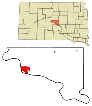
mapsize = 250px
map_caption = Location in Hughes County and the state ofSouth Dakota
mapsize1 =
map_caption1 =
image_dot_
dot_mapsize =
dot_map_caption =
dot_x =
dot_y =
pushpin_
pushpin_label_position =
pushpin_map_caption =
pushpin_mapsize =
subdivision_type = Country
subdivision_name =United States
subdivision_type1 = State
subdivision_name1 =South Dakota
subdivision_type2 = County
subdivision_name2 = Hughes
subdivision_type3 =
subdivision_name3 =
subdivision_type4 =
subdivision_name4 =
government_footnotes =
government_type =
leader_title =Mayor
leader_name =Laurie Gill
leader_title1 =
leader_name1 =
leader_title2 =
leader_name2 =
leader_title3 =
leader_name3 =
leader_title4 =
leader_name4 =
established_title = Founded
established_date =1880
established_title2 =
established_date2 =
established_title3 =
established_date3 =
area_magnitude =
unit_pref = Imperial
area_footnotes =
area_total_km2 = 33.7
area_land_km2 = 33.7
area_water_km2 = 0.0
area_total_sq_mi = 13.0
area_land_sq_mi = 13.0
area_water_sq_mi = 0.0
area_water_percent = 0.08
area_urban_km2 =
area_urban_sq_mi =
area_metro_km2 =
area_metro_sq_mi =
area_blank1_title =
area_blank1_km2 =
area_blank1_sq_mi =
population_as_of =2000
population_footnotes =
population_note =
population_total = 13876
population_density_km2 = 411.5
population_density_sq_mi = 1065.8
population_metro =
population_density_metro_km2 =
population_density_metro_sq_mi =
population_urban =
population_density_urban_km2 =
population_density_urban_sq_mi =
population_blank1_title =
population_blank1 =
population_density_blank1_km2 =
population_density_blank1_sq_mi =
timezone = Central
utc_offset = -6
timezone_DST = Central
utc_offset_DST = -5
latd = 44 |latm = 22 |lats = 5 |latNS = N
longd = 100 |longm = 20 |longs = 11 |longEW = W
elevation_footnotes =
elevation_m = 442
elevation_ft = 1453
postal_code_type =ZIP code
postal_code = 57501
area_code = 605
blank_name = FIPS code
blank_info = 46-49600GR|2
blank1_name = GNIS feature ID
blank1_info = 1266887GR|3
website = [http://ci.pierre.sd.us ci.pierre.sd.us]
footnotes = The city of Pierre (pronEng|ˈpɪər "peer") is thecapital of theU.S. state ofSouth Dakota and thecounty seat of Hughes County.GR|6 The population was 13,876 at the 2000 census, making it the second least populous state capital after Montpelier,Vermont . Founded in 1880 on theMissouri River oppositeFort Pierre , Pierre has been South Dakota's capital since it gained statehood onNovember 11 ,1889 , having been chosen for its location in the geographic center of the state. It is also a major statewide transportation hub and is famous for its memorial hall. The "Capital Journal " is the local newspaper. The city is named after Pierre Chouteau an early fur trader in the area.Pierre is the principal city of the Pierre Micropolitan Statistical Area, which includes all of Hughes and Stanley counties.
Geography
Pierre is located at coor dms|44|22|5|N|100|20|11|W|city (44.367966, −100.336378) GR|1.
According to the
United States Census Bureau , the city has a total area of 13.0square mile s (33.7km² ), of which 13.0 square miles (33.7 km²) is land and 0.08% is water.Pierre lies on rough river bluffs overlooking the Missouri River. Many of these bluffs are strewn with large boulders. It is a few miles away from
Lake Oahe , one of the largest man made lakes in the world and a very popularfishing destination.The climate in Pierre consists of cold, sometimes harsh, winters and very warm to hot summers. The average highs and lows are 28°F/3°F for January and 89°F/62°F in July. The warmest temperature ever recorded in Pierre was 117°F (47.2°C), set on
July 15 ,2006 . The coldest recorded temperature was −35°F (−37.2°C) onFebruary 9 ,1994 .Demographics
As of the
census GR|2 of 2000, there were 13,876 people, 5,567 households, and 3,574 families residing in the city. Thepopulation density was 1,065.8 people per square mile (411.5/km²). There were 5,949 housing units at an average density of 457.0/sq mi (176.4/km²). The racial makeup of the city was 88.91% White, 0.20% African American, 8.56% Native American, 0.46% Asian, 0.02% Pacific Islander, 0.29% from other races, and 1.56% from two or more races. Hispanics or Latinos of any race were 1.25% of the population.There were 5,567 households, out of which 32.9% had children under the age of 18 living with them, 51.6% were married couples living together, 9.5% had a female householder with no husband present, and 35.8% were non-families. 31.5% of all households were made up of individuals, and 10.7% had someone living alone who was 65 years of age or older. The average household size was 2.35, and the average family size was 2.96.
In the city, the population was spread out, with 27.2% under the age of 18, 6.5% from 18 to 24, 28.6% from 25 to 44, 23.6% from 45 to 64, and 14.1% who were 65 years of age or older. The median age was 38 years. For every 100 females, there were 90.5 males. For every 100 females age 18 and over, there were 85.4 males.
The median income for a household in the city was $42,962, and the median income for a family was $52,144. Males had a median income of $32,969 versus $22,865 for females. The
per capita income for the city was $20,462. About 5.5% of families and 7.8% of the population were below thepoverty line , including 7.9% of those under age 18 and 9.2% of those age 65 or over.Transportation
Airlines serving
Pierre Regional Airport provide non-stop flights toDenver, Colorado ,Watertown, South Dakota , andBrookings, South Dakota , with continuing service to Minneapolis-St. Paul from Watertown.The nearest interstate highway is
Interstate 90 , which is about 34 miles south of Pierre via U.S. Highway 83. Pierre is one of only five state capitals not served by an interstate highway.Dover, Delaware ;Jefferson City, Missouri ;Carson City, Nevada ; andJuneau, Alaska , are the other four state capitals with this distinction.Notable natives
*
Floyd Bannister was apitcher inMajor League Baseball .
*Ernest O. Lawrence , physicist and Nobel Laureate
*M. Michael Rounds , Governor of South DakotaTrivia
* Pierre is the only state capital to lie on a timezone demarcation line.
* Pierre is the subject of a joke in the song "Capital," performed by the populara cappella groupRockapella and composed bySean Altman . The song lists every U.S. state capital except for Pierre; during the song's final fade-out, a voice can be heard exclaiming, "Pierre! Pierre! We forgot Pierre!" [ [http://www.seanaltman.com/lyra-d.shtml SeanSongs - Sean Altman Lyrics A to D ] ] A subsequent track on the album features the then-mayor of Pierre, Gary Drewes, chastising Rockapella for the omission (and their mispronunciation of the town's name).
* In the 1990s, Pierre was known as Suicide City/Town for having a large cluster of suicides during that time. [cite web | last =Belluck | first =Pam | authorlink = | coauthors = | title =In Little City Safe From Violence, Rash of Suicides Leaves Scars | work = | publisher =The New York Times | date =April 5 ,1998 | url =http://query.nytimes.com/gst/fullpage.html?res=9907E7D6133AF936A35757C0A96E958260&sec=&spon=&pagewanted=all | format = | doi = | accessdate =2008-01-11 ]References
External links
* [http://www.pierre.org Pierre Chamber of Commerce]
* [http://ci.pierre.sd.us Pierre city government official web site]
* [http://www.capjournal.com/ The Capital Journal - local newspaper]
* [http://rpllib.sdln.net/ Rawlins Municipal Library - public library]{
Wikimedia Foundation. 2010.