- Sturbridge, Massachusetts
Infobox Settlement
official_name = Sturbridge, Massachusetts
nickname =
motto =
imagesize =
image_caption =
image_
mapsize = 250px
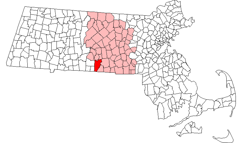
map_caption = Location in Worcester County in Massachusetts
mapsize1 =
map_caption1 =
subdivision_type = Country
subdivision_name =United States
subdivision_type1 = State
subdivision_name1 =Massachusetts
subdivision_type2 = County
subdivision_name2 = Worcester
established_title = Settled
established_date = 1729
established_title2 = Incorporated
established_date2 = 1738
established_title3 =
established_date3 =
government_type =Open town meeting
leader_title = Town
Administrator
leader_name = James J. Malloy
leader_title1 =
leader_name1 = Arnold Wilson
Harold White
William Emrich
Steven Halterman
Edward Goodwin
area_magnitude =
area_total_km2 = 100.9
area_total_sq_mi = 39.0
area_land_km2 = 96.9
area_land_sq_mi = 37.4
area_water_km2 = 4.0
area_water_sq_mi = 1.5
population_as_of = 2000
settlement_type = Town
population_total = 7837
population_density_km2 = 80.9
population_density_sq_mi = 209.5
elevation_m = 189
elevation_ft = 619
timezone = Eastern
utc_offset = -5
timezone_DST = Eastern
utc_offset_DST = -4
latd = 42 |latm = 06 |lats = 30 |latNS = N
longd = 72 |longm = 04 |longs = 45 |longEW = W
website = http://www.town.sturbridge.ma.us/
postal_code_type = ZIP code
postal_code = 01566
area_code = 508 / 774
blank_name = FIPS code
blank_info = 25-68155
blank1_name = GNIS feature ID
blank1_info = 0618384
footnotes =Sturbridge is a town in Worcester County,
Massachusetts ,United States . It is home toOld Sturbridge Village living history museum and other sites of historical interest such asTantiusques and theCrowd Site .The population was 7,837 at the
2000 census . Forgeographic anddemographic information on specific parts of the town of Sturbridge, please see the articles on Fiskdale and Sturbridge (CDP).History
Sturbridge was first settled in 1729, by settlers from Medfield, and was officially incorporated in 1738. New Medfield and Dummer (after Governor William Dummer) were considered as town names, before the town was named after
Stourbridge ,England .Geography
According to the
United States Census Bureau , the town has a total area of 39.0square mile s (100.9km² ), of which, 37.4 square miles (96.9 km²) of it is land and 1.5 square miles (4.0 km²) of it (3.95%) is water. Sturbridge is bordered by Charlton and Southbridge to the east, Union,Connecticut and Woodstock,Connecticut to the south, Brimfield and Holland to the west, and Brookfield and East Brookfield to the north.U.S. Route 20 runs through Sturbridge, and the junction ofInterstate 90 (theMassachusetts Turnpike ) and Interstate 84 is located there. TheWilbur Cross Highway (Connecticut Route 15 ) formerly ended in Sturbridge; locals sometimes call Haynes Street "Old Route 15". Haynes Street ends at Main Street (Massachusetts Route 131 ), which connects Sturbridge Center with Southbridge; on the west side of town,Massachusetts Route 148 connects Fiskdale with Brookfield.Demographics
As of the
census GR|2 of 2000, there were 7,837 people, 3,066 households, and 2,213 families residing in the town. Thepopulation density was 209.5 people per square mile (80.9/km²). There were 3,335 housing units at an average density of 89.1/sq mi (34.4/km²). The racial makeup of the town was 97.14% White, 0.36% Black or African American, 0.27% Native American, 1.14% Asian, 0.09% Pacific Islander, 0.31% from other races, and 0.70% from two or more races. Hispanic or Latino of any race were 1.30% of the population.There were 3,066 households out of which 34.2% had children under the age of 18 living with them, 60.7% were married couples living together, 8.7% had a female householder with no husband present, and 27.8% were non-families. 23.4% of all households were made up of individuals and 9.8% had someone living alone who was 65 years of age or older. The average household size was 2.55 and the average family size was 3.03.
In the town the population was spread out with 25.5% under the age of 18, 5.3% from 18 to 24, 29.5% from 25 to 44, 26.4% from 45 to 64, and 13.4% who were 65 years of age or older. The median age was 39 years. For every 100 females there were 96.9 males. For every 100 females age 18 and over, there were 93.7 males.
The median income for a household in the town was $56,519, and the median income for a family was $64,455. Males had a median income of $50,168 versus $31,940 for females. The
per capita income for the town was $25,559. About 4.5% of families and 6.1% of the population were below thepoverty line , including 11.3% of those under age 18 and 8.3% of those age 65 or over.Government
Infobox Mass Town Govt
county= Worcester
clerk_courts = Dennis P. McManus (D)
cty_treasurer = Position Eliminated
da = Joseph D. Early, Jr. (D)
deeds = Anthony J. Vigliotti (D)
probate = Stephen Abraham (D)
sheriff = Guy W. Glodis (D)
state_rep = Todd M. Smola(R)
state_sen = Stephen M. Brewer (D)
gov_councilors = Thomas J. Foley (D)
fed_rep =Richard E. Neal (D-2nd District),
fed_sen =Edward Kennedy (D)John Kerry (D)Education
Burgess Elementary School, serving grades K-6, is one of three public schools in Sturbridge. It has its own
school committee , part of School Union 61. Sturbridge students also attend Tantasqua Regional Junior High School (grades 7-8) andTantasqua Regional High School , in the Fiskdale section of town. Union 61 and the Tantasqua district share administrators, including the superintendent, and both include Brimfield, Brookfield, Holland, Sturbridge and Wales.Places of interest
Old Sturbridge Village , located on Route 20, is aliving museum that re-creates life in rural New England during the 1830s.Wells State Park, a 1,400-acre (5.7 km²) woodland park and campground, located on Route 49. The park features 10 miles (16 km) of trails and Walker Pond, which offers a setting for fishing, canoeing, and swimming. [cite web |url=http://www.mass.gov/dcr/parks/central/well.htm |title=Wells State Park |publisher=Massachusetts Department of Conservation and Recreation |accessdate=2008-02-16]
References
External links
*
* [http://www.town.sturbridge.ma.us/ Sturbridge official website]
* [http://www.millstone-realty.com/ Sturbridge Real Estate]
* [http://www.visitthelastgreenvalley.info/attractions/pages/wells.htm Wells State Park]
Wikimedia Foundation. 2010.