- Massachusetts Route 15
-
"MA 15" redirects here. MA 15 may also refer to Massachusetts's 15th congressional district.
Route 15 
Route information Length: 0.23 mi[1] (0.37 km) Major junctions West end:  Route 15 in Pawtucket, RI
East end:  Route 152 in Seekonk
Highway system Massachusetts State Highway Routes
←  Route 14
Route 16  →
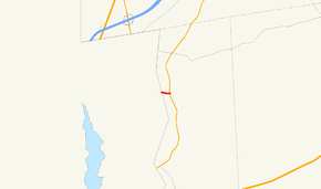
→Route 15 is a short, unsigned route in the U.S. state of Massachusetts, connecting Rhode Island's Route 15 with Route 152 in Seekonk.[1] At a length of just under a quarter mile (0.23 miles), it is the shortest numbered highway in the state.
Contents
Route description
The entire route is contained within the town of Seekonk, and is known as Brook Street.
History
Old Route 15

 Old Route 15 used to be an extension of Connecticut Route 15 (now I-84) before its truncation in 1980.
The number was formerly used for an extension of Connecticut's Route 15, now Interstate 84. It connected the CT-15 from the state line in Holland with U.S. Route 20 and Interstate 90 (Massachusetts Turnpike) in Sturbridge. Sturbridge's Route 15 changed alignments several times over the years, as the Wilbur Cross Highway was upgraded to freeway standards (CT-15 used to run concurrently with I-84 to the state line, but was truncated in 1980 to its current terminus in East Hartford). Local lanes of the former Route 15 in Massachusetts are still in use today as Haynes Street, a road parallel to I-84 that ends at Main Street (Route 131) near Town Hall.
This section of road is still referred to locally as "Route 15" and signed as "Olde Route 15". It is also recognized as Route 15 by Google Maps, Yahoo Maps, and Microsoft Live Maps. It was even shown on the Massachusetts official state map long after the route was decommissioned. [1][2][3]
See also
References
- ^ a b Executive Office of Transportation, Office of Transportation Planning - 2005 Road Inventory
Categories:- Numbered routes in Massachusetts
- Transportation in Bristol County, Massachusetts
Wikimedia Foundation. 2010.

