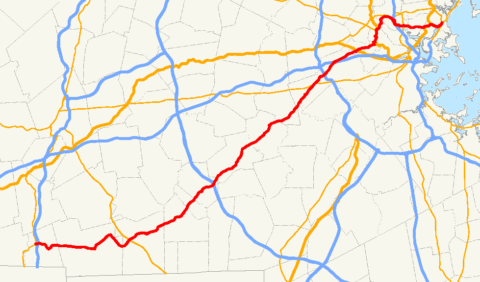
- Massachusetts Route 16
-
Route 16

Route information Length: 59.8646 mi[1] (96.3427 km) Major junctions West end: 
 Route 12 / 193 in Webster
 I-395 in Webster
 Route 146 in Uxbridge
 Route 9 in Wellesley

 I-95 / Route 128 in Newton
 I-90/Mass Pike in Newton

 U.S. Route 3 / Route 2 in Cambridge
 I-93 in Medford
 Route 28 in Medford
 U.S. Route 1 in Chelsea / Revere
East end: 
 Route 1A/Route 60 in Revere
Highway system Massachusetts State Highway Routes
←  Route 15
Route 17  →
→Route 16 is an east–west state highway in Massachusetts. It begins in the west at an intersection with Route 12 and Route 193 in Webster, just north of the Connecticut state border. It runs in a generally southwest-northeast routing through a number of Boston's suburbs and runs to the west and then north of the city before ending in Revere at an intersection with Route 1A and Route 60.
Much of Route 16 east of the Newton-Wellesley town line, and especially from Cambridge eastward, is a multi-lane parkway, although it is not limited access for any significant length of road. Segments of Route 16 are also known as the Mystic Valley Parkway, the Alewife Brook Parkway, and the Revere Beach Parkway, among other names.
From the western end of the Route 135 concurrency in Wellesley to Route 30 (Commonwealth Avenue) in Newton, the route serves as a part of the Boston Marathon, from the halfway point to just before Mile 18 and the hills.
Contents
Route description
From the shore to the Pike
Route 16 runs north and west of the City of Boston, beginning at the Atlantic Ocean at Revere Beach, where it intersects with Route 1A and 60 at Timothy J. Mahoney Circle in Revere.
The route proceeds west by a winding path through several mixed-used industrial, commercial, and residential areas in the cities of Everett and Malden until it intersects Interstate 93 in Medford. It then veers north, traveling beside the Mystic River upstream, and passing near Medford Square, the downtown area of that city. This portion of Route 16 is also part of the Mystic Valley Parkway.
The Mystic Valley Parkway continues west as Route 16 turns south in Somerville on Alewife Brook Parkway. This section of Route 16 soon joins U.S. Highway 3 and then Route 2 at the eastern end of the freeway portion of the Concord Turnpike. From there, Route 16 passes the large parking garage at the MBTA Alewife Station, passes by Fresh Pond, eventually leaving Routes 2 and 3 as they continue along Fresh Pond Parkway. It then continues west through Cambridge, passing by Mount Auburn Cemetery before entering Watertown. Route 16 crosses U.S. Highway 20 in Watertown Square, then crosses the Charles River. It enters Newton near the village of Nonantum, and eventually crosses I-90, the Massachusetts Turnpike, in West Newton; Pike Exit 16 here provides access to and from the east only. Still in Newton, Route 16 then crosses Route 30 and Route 128 (Interstate 95).
From Newton to I-495
This area west of Boston, also called MetroWest, that Route 16 now travels through contains several quintessential New England towns. The route now goes by restored antique, colonial homes and town buildings.[2]
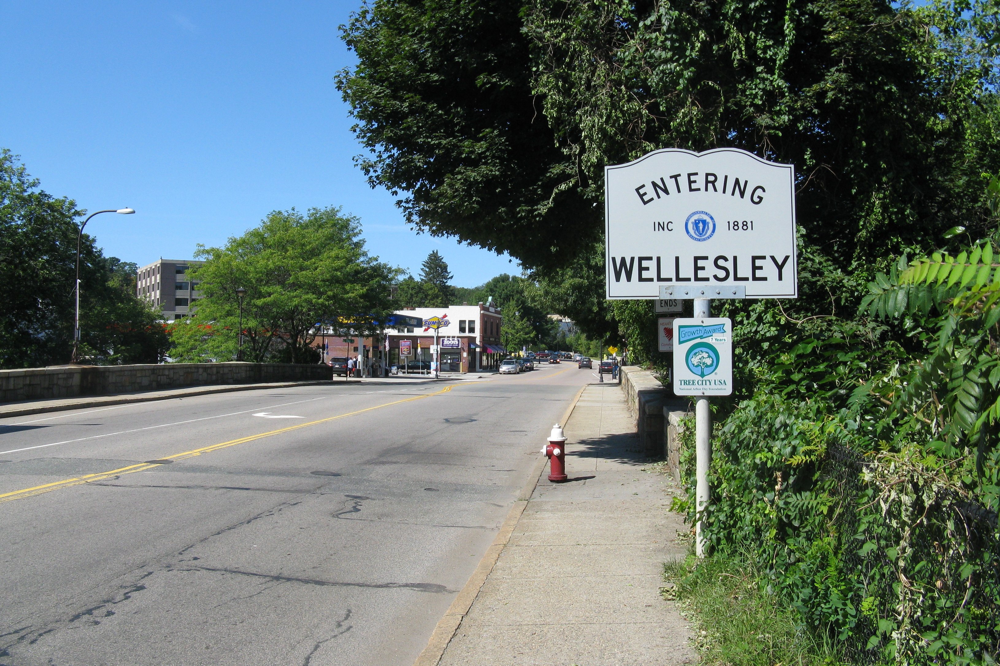
From the Pike, Route 16 goes southwesterly past Lasell College in Newton, and through Wellesley, where Wellesley College and Babson College are located. The road then passes the Elm Bank Reservation in Sherborn, through Holliston, by Weston Pond, and shortly thereafter passes beneath I-495.
From I-495 to Lake Chaubunagungamaug
After passing I-495, the route continues to the southwest, going through Milford, Hopedale, Mendon, Uxbridge, the Blackstone River Valley National Heritage Corridor and Douglas with a trip through the Douglas State Forest in the last town.
Route 16 continues to its intersection with I-395 in Webster, along the shore of Lake Chaubunagungamaug,[3] and not far from the Connecticut border. It ends at Route 12 just to the west.
Junction list
County Location Mile Roads intersected Notes Worcester Webster 0.0 Route 12
Route 193Northern terminus of Route 193. 0.2 Interstate 395I-395 Exit 2. Douglas 6.9  Route 96
Northern terminus of Route 96. Uxbridge 12.2 Route 146Route 146 Exit 3. 14.4  Route 122
Brief concurrency with Route 122.
To Route 146A, via Route 122 south.
Milford 21.4  Route 140
22.9  Route 85
Southern terminus of Route 85.
To Interstate 495.
23.3  Route 109
Western terminus of Route 109.
To Interstate 495. I-495No access between Route 16 and I-495. Middlesex Holliston 27.3 

 Route 126 south
Southern terminus of Route 16/126 concurrency. 29.6 
Route 126 northNorthern terminus of Route 16/126 concurrency. Sherborn 29.6
 Route 27 south
No access to Route 27 south from Route 16 east.
No access to Route 16 west from Route 27 north.
These movements are facilitated via Sawin Street.
Southern terminus of Route 16/27 concurrency.33.3
Route 27 northNorthern terminus of Route 16/27 concurrency. Norfolk Wellesley 39.1 
 Route 135 west
No access to Route 135 west from Route 16 east.
No access to Route 16 west from Route 135 east.
These movements are facilitated via Weston Road.
Western terminus of Route 16/135 concurrency; Boston Marathon joins Rte. 16 here39.3 
Route 135 eastEastern terminus of Route 16/135 concurrency. 40.7 Route 9Partial interchange with signals; under construction. Middlesex Newton 42.2 Interstate 95
Route 128I-95 Exit 21. 43.4  Route 30
Commonwealth Avenue; Boston Marathon leaves Route 16 here 44.0 I-90/Mass PikeMass Pike Exit 16; partial interchange.
Access to I-90 east only from Route 16.
Access to Route 16 from I-90 west only.Watertown 46.8  U.S. Route 20
Main Street (west), North Beacon Street (east) Cambridge 49.4
U.S. Route 3 south
Route 2 eastFresh Pond Parkway
Southern terminus of US-3/Route 2/16 concurrency.50.7
Route 2 westCambridge Turnpike
Northern terminus of US-3/Route 2/16 concurrency.51.1
U.S. Route 3 north
 Route 2A
Massachusetts Avenue
Northern terminus of US-3/Route 16 concurrency.Medford 53.0  Route 38
Brief concurrency with Route 38.
To Route 60, via Route 38 north.53.5 Interstate 93I-93 Exit 31; partial interchange.
Access to I-93 (in both directions) from Route 16 east only.
Access to Route 16 east only from I-93 south.
Access to Route 16 west only from I-93 north.
Access to I-93 from Route 16 west can be facilitated via
Routes 38 north and 60 east to the Exit 32 interchange.55.3 Route 28Fellsway Everett 56.1  Route 99
Broadway; dual rotary intersection. Suffolk Revere 58.5 U.S. Route 1Northeast Expressway; interchange. 58.8  Route 107
Broadway; interchange.
Southern terminus of Route 107.59.6  Route 145
Continuation of Revere Beach Parkway.
Northern terminus of Route 145.
To Route 1A south.59.9 Route 1A
Route 60Eastern terminus of Route 16.
Eastern terminus of Route 60.
Rotary intersection.Street names
Route 16 is known by the following street names
Webster- East Main Street (Route 12/193 to I-395)
- Gore Road
- Douglas Road
Douglas
- Webster Street
- South Street
- Main Street
- Davis Street
Uxbridge
- Douglas Street
- Mendon Street
Mendon
- Uxbridge Road
- Hastings Street
- Milford Street
Milford
- Mendon Street
- Main Street
- East Main Street
Holliston
- Washington Street (partly concurrent with Route 126)
Sherborn
- Washington Street
- North Main Street (concurrency with Route 27)
- Eliot Street
Natick
- Eliot Street
Wellesley
- Washington Street (partly concurrent with Route 135)
Newton
- Washington Street
- Watertown Street
- Galen Street (Charles River crossing)
Watertown
- Mount Auburn Street
- Aberdeen Avenue
- Huron Avenue
Cambridge
- Fresh Pond Parkway (concurrency with US-3 and Route 2)
- Alewife Brook Parkway (partly concurrent with US-3 and Route 2)
- Mystic Valley Parkway
Medford
- Mystic Valley Parkway (partly concurrent with Route 38)
- Revere Beach Parkway
Everett
- Revere Beach Parkway
Chelsea
- Revere Beach Parkway
Revere
- Revere Beach Parkway
History
Parts of Route 16 were historically maintained by the Metropolitan District Commission (MDC), and while the MDC no longer exists, the parkway portions of the route are still patrolled by the Massachusetts State Police and maintained by the Massachusetts Department of Conservation and Recreation as a remnant of the former MDC jurisdiction.[4]
Photos
References
- ^ "Office of Transportation Planning - 2005 Road Inventory". Executive Office of Transportation. 2005. http://www.eot.state.ma.us/default.asp?pgid=content/plan02&sid=about. Retrieved 2008-06-09.
- ^ "Holliston Massachusetts". SmartMoves. 2004. http://www.metrowest-ma.com/holliston.htm. Retrieved 2008-06-09.
- ^ Columbia Gazetteer of North America. "Chaubunagungamaug, Lake, Massachusetts (MA), United States". AllRefer.com. http://reference.allrefer.com/gazetteer/C/C05550-chaubunagungamaug-lake.html. Retrieved 2008-06-09.
- ^ "Parkway Maintenance Matrix". Massachusetts Department of Conservation and Recreation. http://www.mass.gov/dcr/pe/documents/parkwaymaintmatrix.pdf. Retrieved 2008-06-10.
Categories:- Numbered routes in Massachusetts
- Parkways in the United States
- Holliston, Massachusetts


Wikimedia Foundation. 2010.