- Massachusetts Route 135
-
Route 135
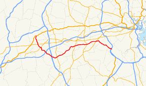
Route information Length: 29.53 mi[1] (47.52 km) Major junctions West end:  U.S. Route 20 in Northborough
 Route 9 in Westborough
 Route 30 in Westborough
 Route 85 in Hopkinton
 Route 126 in Framingham
 Route 27 in Natick
 Route 16 in Wellesley
East end: 
 I-95/Route 128 in Dedham
Highway system Massachusetts State Highway Routes
←  Route 134
Route 136  →
→

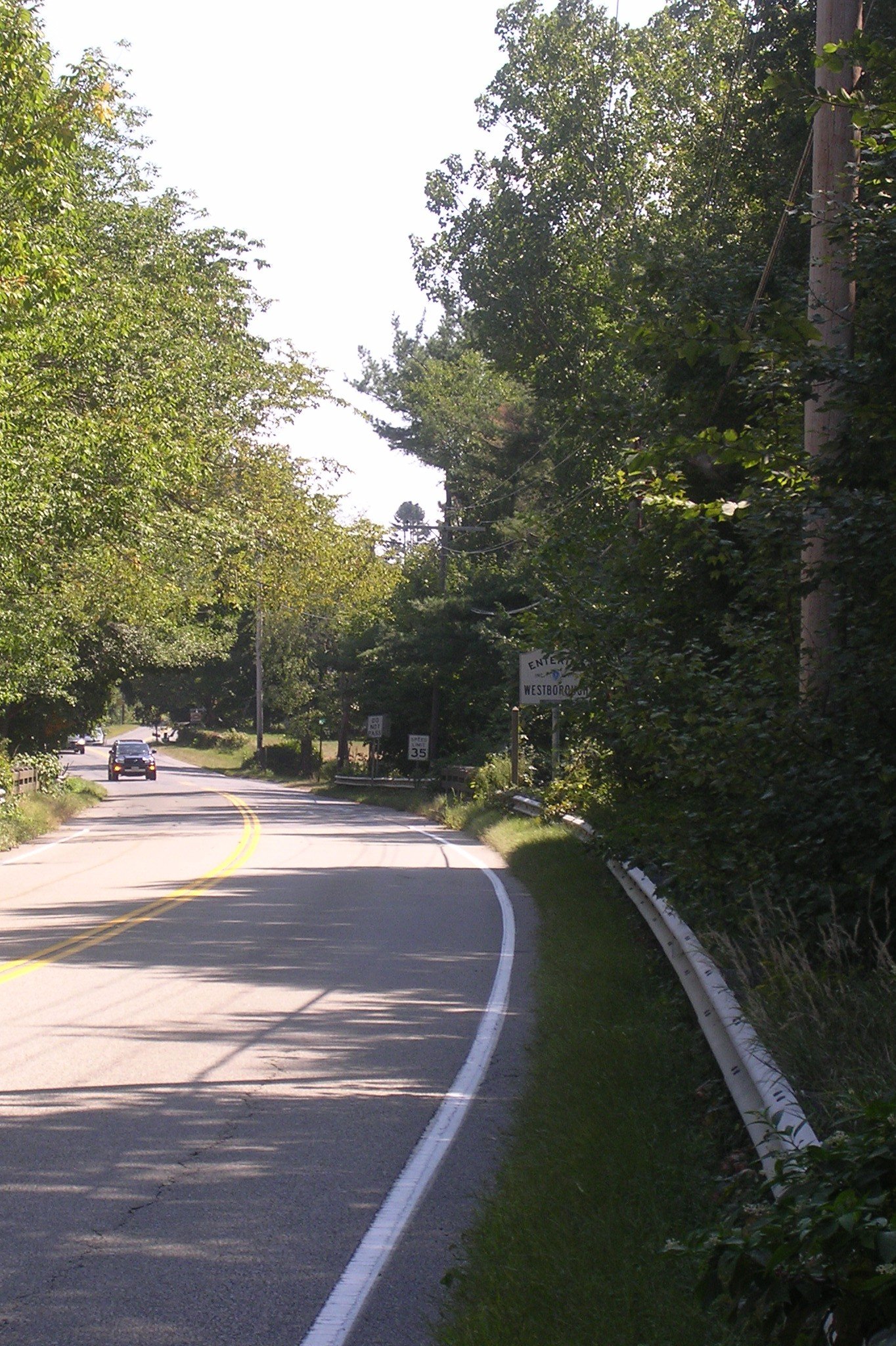
Eastbound entering Westborough Route 135 is a state highway in eastern Massachusetts, running from U.S. Route 20 in Northborough east to Interstate 95 (Route 128) in Dedham. The first 13 miles (21 km) of the Boston Marathon, from Hopkinton to Wellesley, follow Route 135.
Contents
Route description
Route 135 begins at U.S. Route 20 in Northborough. The route follows a generally southeasterly path, interchanging with Route 9 approximately 1-mile (1.6 km) from its beginning. The route continues into Westborough, where it meets Route 30 at a rotary. Route 135 continues southeast, crossing underneath Interstate 90 (the Mass Pike) and Interstate 495, but interchanging with neither. The route enters Hopkinton, and turns northeast at an intersection with West Main Street (access to I-495 is possible using this road). Not far down the road, Route 135 crosses Route 85, continues into Ashland and then into Framingham. In downtown Framingham, Route 135 crosses Route 126 at a rather notorious intersection with railroad crossings, which often cause backups. Route 135 continues into Natick and crosses Route 27 in the center of town. The road continues into Wellesley, passing by the campus of Wellesley College before entering the town center. Route 135 and Route 16 meet at a 5-way intersection and run concurrently for a short distance. Route 135 splits off Route 16 and once again turns southeast onto Great Plain Avenue. The highway enters Needham, and splits off Great Plain Avenue towards Dedham. Upon entering Dedham, Route 135 meets Interstate 95 (Route 128).
Route 135 officially ends at this interchange, although current signage indicates that the route continues eastward (it actually did up to the 1950s). The road that continues after the interchange (West St./Common St.) passes Northeastern University's Dedham campus and meets Route 109 approximately a half mile to the southeast, near Dedham Center.
Junction list
County Location Milepost Roads intersected Notes Worcester Northborough 0.00 U.S. Route 20Western terminus of Route 135. Westborough Route 9 Route 30Rotary intersection. Middlesex Hopkinton  I-90/Mass Pike
No access between I-90 and Route 135  I-495
I-495No access between I-495 and Route 135 Route 85Framingham Route 126Natick Route 27Norfolk Wellesley 
Route 16 WestWestern terminus of Route 16/135 concurrency. 
Route 16 EastEastern terminus of Route 16/135 concurrency. Dedham Interstate 95
Route 128Eastern terminus of Route 135.
I-95 Exit 17.
West Street continues east to Route 109.
Street names
Route 135 is known by the following street names.
Northborough
- South Street
Westborough
- Milk Street
- South Street
- Hopkinton Road
Hopkinton
- Wood Street
- Main Street
- East Main Street
Ashland
- West Union Street
- Union Street
Framingham
- Waverly Street
Natick
- West Central Street
- East Central Street
Wellesley
- Central Street
- Washington Street (concurrent with Route 16)
- Wellesley Ave
- Great Plain Ave
Needham
- Great Plain Ave
- Dedham Ave
Dedham
- West Street
History
Originally, the eastern terminus of Route 135 was in Quincy at the current intersection of Route 3A and Route 53. The route was truncated after completion of the Route 128 freeway in the late 1950s made Route 135's routing redundant.
References
- ^ Executive Office of Transportation, Office of Transportation Planning - 2005 Road Inventory
Categories:- Numbered routes in Massachusetts
- Transportation in Worcester County, Massachusetts
- Transportation in Middlesex County, Massachusetts
- Transportation in Norfolk County, Massachusetts


Wikimedia Foundation. 2010.