- Quincy, Massachusetts
Infobox Settlement
official_name = Quincy, Massachusetts
nickname =
motto =
imagesize =
image_caption =
image_
mapsize = 250px
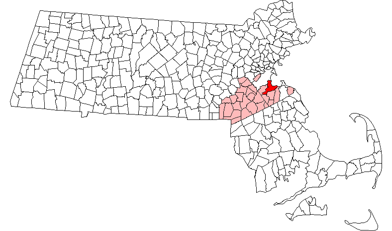
map_caption = Location in Norfolk County in Massachusetts
mapsize1 =
map_caption1 =
subdivision_type = Country
subdivision_name =United States
subdivision_type1 = State
subdivision_name1 =Massachusetts
subdivision_type2 = County
subdivision_name2 = Norfolk
established_title = Settled
established_date = 1625
established_title2 = Incorporated
established_date2 = 1792
established_title3 =
established_date3 =
government_type = Mayor-council city
leader_title =Mayor
leader_name = Thomas P. Koch
leader_title1 =
leader_name1 =
area_magnitude =
area_total_km2 = 69.6
area_total_sq_mi = 26.9
area_land_km2 = 43.5
area_land_sq_mi = 16.8
area_water_km2 = 26.2
area_water_sq_mi = 10.1
population_as_of = 2007
settlement_type =City
population_total = 91,622
population_density_km2 = 2,106.3
population_density_sq_mi = 5,453.7
elevation_m = 6
elevation_ft = 20
elevation_max_ft = 517
elevation_min_ft = 0
timezone = Eastern
utc_offset = -5
timezone_DST = Eastern
utc_offset_DST = -4
latd = 42 |latm = 15 |lats = 10 |latNS = N
longd = 71 |longm = 00 |longs = 10 |longEW = W
website = [http://www.ci.quincy.ma.us/ www.ci.quincy.ma.us]
postal_code_type = ZIP code
postal_code = 02169, 02170, 02171
area_code = 617 / 857
blank_name = FIPS code
blank_info = 25-55745
blank1_name = GNIS feature ID
blank1_info = 0617701
footnotes =Quincy is a city in Norfolk County,
Massachusetts ,United States . Its nicknames are "The City of Presidents", "City of Legends", and "Birthplace of the American Dream". [ [http://www.ci.quincy.ma.us/AboutQuincyPage5.html Quincy About Page] ] As a major part ofMetropolitan Boston , Quincy is a member ofBoston 's Inner Core Committee for the Metropolitan Area Planning Council. [ [http://www.mapc.org/metro_area/innercore.html Inner Core Committee members] ] Its name, which comes from that of Colonel John Quincy, is correctly pronounced IPA|/ˈkwɪnzi/, [ [http://www.ci.quincy.ma.us/AboutQuincyPage5.html City of Quincy, Massachusetts] ] though non-locals often mispronounce it as IPA|/ˈkwɪnsi/. Quincy is the birthplace of former PresidentsJohn Adams andJohn Quincy Adams , as well as statesmanJohn Hancock . The population was 88,025 at the 2000 census.History
The Wollaston neighborhood is the oldest part of Quincy, first settled by English immigrants in 1625 as Mount Wollaston and renamed Merrymount. Quincy itself later became part of Braintree, was officially incorporated as a separate town in 1792, and was made a city in 1888.
Among its several firsts was the
Granite Railway , the first commercialrailroad in theUnited States . It was constructed in 1826 to carrygranite from a Quincy quarry to theNeponset River in Milton so that the stone could then be taken by boat to erect theBunker Hill Monument inCharlestown, Massachusetts . Quincy granite became famous throughout the nation, and stonecutting became the city's principal economic activity.Quincy was also a notableshipbuilding center. Sailing ships were built in Quincy for many years, including the only seven-mastedschooner ever built, "Thomas W. Lawson". The Fore River area became a shipbuilding center in the 1880s—originally owned byThomas A. Watson of telephone fame—and many famous warships were built at theFore River Shipyard , including theaircraft carrier USS Lexington (CV-2) ; thebattleship sUSS Massachusetts (BB-59) , now preserved as amuseum ship atBattleship Cove in Massachusetts, andUSS Nevada (BB-36) ; and theUSS Salem (CA-139) , the world's last all-gun heavy warship, which is still preserved at Fore River as the main exhibit of theUnited States Naval Shipbuilding Museum . John J. Kilroy, the originator of the famousKilroy Was Here graffiti, was awelding inspector at Fore River.Quincy was also an
aviation pioneer. Dennison Field in theSquantum section of town was one of the world's first airports and was partially developed byAmelia Earhart . In 1910, it was the site of theHarvard Aero Meet , the second air show in America. It was later leased to the Navy for an airfield, and served as a reserveSquantum Naval Air Station into the 1950s.Of some note,
Howard Johnson's andDunkin Donuts were founded and started in Quincy, and the celtic punk bandDropkick Murphys got its start in Wollaston. TheQuincy Mine inHancock, Michigan , founded in 1846, was named after Quincy because the mine started with significant investment from Massachusetts.Geography
Quincy shares borders with Boston to the north (separated by the
Neponset River ), Milton to the west, Randolph to the south, and Hull (maritime border), Weymouth, and Braintree to the east.According to the
United States Census Bureau , the city has a total area of convert|26.9|sqmi|km2, of which convert|16.8|sqmi|km2 are land and convert|10.1|sqmi|km2 are water. The total area is 37.60% water.Although Quincy is primarily urban, convert|2485|acre|sqmi km2|1 [ [http://www.mass.gov/mgis MassGIS Protected and Recreational Open Space data, last updated 2008-07-10] ] or fully 23 percent of its land area lies within the uninhabited
Blue Hills Reservation , a state park managed by the Massachusetts Department of Conservation and Recreation. This undeveloped natural area encompasses the southwestern portion of Quincy and includes the city's highest point, convert|517|foot|m Chickatawbut Hill.There are several beaches in Quincy, [ [http://www.ci.quincy.ma.us/AboutBeachesCommPage115.html About Quincy beaches] ] including
Wollaston Beach along Quincy Shore Drive. Located on Quincy Bay, Wollaston Beach is the largest beach inBoston Harbor . [ [http://www.tbha.org/programs_beaches_wollastonbeach.htm Boston Harbor Association] ]Demographics
As of the
census GR|2 of 2000, there were 88,025 people, 38,883 households, and 20,530 families residing in the city, making it the ninth largest city in the state. Thepopulation density was 5,244.3 people per square mile (2,025.4/km²). There were 40,093 housing units at an average density of 2,388.7/sq mi (922.5/km²). The racial makeup of the city was 79.60% White, 2.21% African American, 0.16% Native American, 15.39% Asian, 0.02% Pacific Islander, 0.85% from other races, and 1.76% from two or more races. Hispanic or Latino of any race were 2.08% of the population. 33.5% were of Irish, 12.7% Italian and 5.0% English ancestry according toCensus 2000 . 77.1% spoke English, 8.0% Chinese or Mandarin, 2.6% Cantonese, 1.9% Spanish, 1.5% Vietnamese and 1.3% Italian as their first language.There were 38,883 out of which 20.7% had children under the age of 18 living with them, 38.7% were married couples living together, 10.5% had a female householder with no husband present, and 47.2% were non-families. 37.6% of all households were made up of individuals and 13.4% had someone living alone who was 65 years of age or older. The average household size was 2.22 and the average family size was 3.03.
In the city the population was spread out with 17.5% under the age of 18, 8.1% from 18 to 24, 36.1% from 25 to 44, 22.1% from 45 to 64, and 16.3% who were 65 years of age or older. The median age was 38 years. For every 100 females there were 91.0 males. For every 100 females age 18 and over, there were 88.5 males.
The median income for a household in the city was $47,121, and the median income for a family was $59,735. Males had a median income of $40,720 versus $34,238 for females. The
per capita income for the city was $26,001. About 5.2% of families and 7.3% of the population were below thepoverty line , including 10.1% of those under age 18 and 7.0% of those age 65 or over.Neighborhoods
Quincy is divided into numerous
neighborhoods with histories all their own. [ [http://www.ci.quincy.ma.us/AboutNeighborhoodsPage112.html Quincy Neighborhoods] ]* Adams Shore
* Germantown
*Hough's Neck
* Marina Bay
*Merrymount
* Montclair
* North Quincy
*Quincy Center
*Quincy Point
* South Quincy
* Squantum
* West Quincy
* WollastonEducation
Quincy is home to various educational institutions, including both a public and a private college.
Public
Public education in Quincy includes one
community college , twohigh schools , fivemiddle school s, and 12elementary school s. [ [http://www.quincypublicschools.com/schools/schools_mainpage.shtml Quincy Public Schools official site] ]Higher education
*
Quincy College , a two-year community college and the onlypost-secondary institution owned and operated by amunicipality inMassachusetts .High schools
*
North Quincy High School
* Quincy High SchoolMiddle schools
* Atlantic
* Broad Meadows
* Central
* Point Webster
* SterlingElementary schools
* Amelio Della Chiesa Early Childhood Center
* Atherton Hough
* Beechwood Knoll
* Bernazzani
* Clifford Marshall
* Lincoln-Hancock
* Merrymount
* Montclair
* Parker
* Snug Harbor
* Squantum
* WollastonPrivate
Higher education
*
Eastern Nazarene College , aliberal arts college in Wollaston.Primary and secondary schools
*Montessori School of Quincy, a
Montessori school for children of preschool through elementary school age [ [http://www.msoq.org/live/ Montessori School of Quincy website] ]
*Woodward School for Girls, a non-sectarian, college preparatory day school for girls, grades 6-12 [ [http://thewoodwardschool.org/ Woodward School website] ]Catholic schools
Quincy's three
Catholic school s each offerpre-kindergarten through eighth grade education.
*Sacred Heart School [ [http://www.shsquincy.org/index.htm Sacred Heart School website] ]
*St. Ann School [ [http://www.stannwollaston.com/ St. Ann School website] ]
*St. Mary School [ [http://www.stmaryschoolquincy.com/ St Mary School website] ]Transportation
Because Quincy is part of
Metro Boston , it has easy access to transportation facilities. State highways and the Interstate system connect the Greater Boston area to the airport, port, and intermodal facilities ofBoston . Due to its proximity to Boston proper, Quincy is connected not only by these modes of transportation but Boston's subway system, the T.Rail
Subway service is available on the Red Line of the
Massachusetts Bay Transportation Authority (MBTA) from 4 separate T stations: North Quincy, Wollaston, Quincy Center, and Quincy Adams.Bus
Buses are also available for transportation in Quincy, including the following bus lines provided by the MBTA: MBTABus|201, MBTABus|202, MBTABus|210, MBTABus|211, MBTABus|212, MBTABus|214, MBTABus|215, MBTABus|216, MBTABus|217, MBTABus|220, MBTABus|221, MBTABus|222, MBTABus|225, MBTABus|230, MBTABus|236, MBTABus|238, MBTABus|245. Most of the routes funnel through the Quincy Center T station, which is the principal hub south of Boston for all MBTA buslines; the southern bus garage for the MBTA system is adjacent to the Quincy Armory on Hancock Street.
Major highways
Principal highways are State Routes 3, 3A, 28, 37, and 53, in addition to
Interstate 93 .Airport
Boston's
Logan International Airport is accessible via MBTA Red Line connections at South Station, directly on the MBTA commuter boat (see below) or by motor vehicle usingInterstate 93 or surface roads to theTed Williams Tunnel .Water/ferry
Quincy is a major terminal for the commuter boat system that crosses
Boston Harbor toLong Wharf , Hull,Rowe's Wharf ,Hingham , andLogan Airport . The commuter boats, operated by Harbor Express under license by theMassachusetts Bay Transportation Authority , dock at theFore River Shipyard inQuincy Point . [ [http://www.harborexpress.com Harbor Express website] ]Sports
Active sporting programs include the Red Raiders of
North Quincy High School , the Presidents ofQuincy High School , and the Crusaders ofEastern Nazarene College . Quincy hosted the youth baseballBabe Ruth League World Series in 2003 and 2005, and will do so again in 2008. Both high school and Babe Ruth League games are played at Adams Field.Quincy has had brief flirtations with professional sports. The Quincy Chiefs of the minor league
Eastern Basketball Association (the predecessor to the currentContinental Basketball Association ) played a single season in 1977-78, and was coached and managed by currentBoston Celtics executiveLeo Papile . The Chiefs finished 12-19 in third place, and lost in the playoffs to eventual league championWilkes-Barre .The final season of the
Boston Minutemen of theNorth American Soccer League was played atVeterans Memorial Stadium in Quincy, in 1976, finishing 7-17.Quincy has also briefly had a professional baseball team. The Quincy Shipbuilders competed in the
New England League in 1933, recording a 12-6 record before moving to Nashua midseason.Notable residents
*
John Adams - SecondPresident of theUnited States . FirstVice-President
*Abigail Adams - Wife of John Adams, secondPresident of the United States
*John Quincy Adams - SixthPresident of theUnited States
*Charles Francis Adams III -Secretary of the Navy under Hoover
*John Cheever - novelist
*Dick Dale - musician
*Ruth Gordon - actress
*John Hancock - patriot and president of theContinental Congress
*Howard Deering Johnson - founder of theHoward Johnson's chain
*Josiah Quincy - political leader in theAmerican Revolution
*Lee Remick - actress
*Wilbert Robinson -Baseball Hall of Fame player and manager*
See also
* The
Abigail Adams Cairn
* John Adams birthplace
* John Quincy Adams birthplace
* TheJosiah Quincy House
*Peacefield (Old House)
* TheQuincy Plan
* Thomas Crane Public Library
* United First Parish Church
*Eastern Nazarene College
*Dunkin Donuts
*Southern Artery
*Quincy Mosque
*Squantum Point Park
*Naval Air Station Squantum
*Blue Hills Reservation
*Quincy Quarries Reservation Gallery
References
Further reading
*Browne, Patricia Harrigan, "Quincy - A Past Carved in Stone", Images of America Series, Arcadia Publishing, July 1996, ISBN 0-7524-0299-4
External links
* [http://ci.quincy.ma.us/ Official Webpage]
* [http://www.discoverquincy.com/ Discover Quincy] - Quincy tourism information
* [http://www.qatv.org/ Quincy Access Television] - Channels 8 & 10
Wikimedia Foundation. 2010.