- Massachusetts Route 3A
-
Route 3A
Route information Length: 97 mi[1] (156 km) Existed: 1926 – present Southern section Length: 53.392 mi[1] (85.926 km) South end:  Route 3 in Plymouth
Major
junctions: US 44 in Plymouth
 Route 53 in Kingston Route 53 in Quincy
North end: 

 I-93 / US 1 / Route 3 / Route 203 in Boston
Northern section Length: 22.5043 mi[1] (36.217 km) South end: 

 I-95 / US 3 / Route 128 in Burlington
Major
junctions:Lowell Connector in Lowell
 Route 110 in Lowell
 Route 113 in Tyngsborough
North end:  NH 3A in Hudson, NH
Highway system Massachusetts State Highway Routes
← Route 3Route 4  →
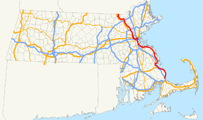
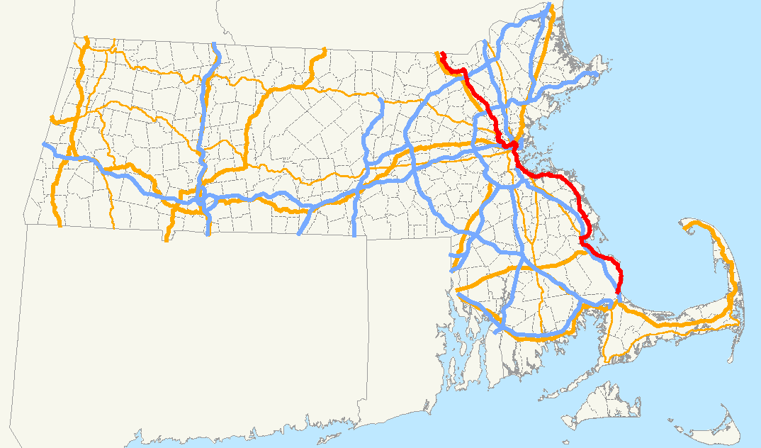
→Route 3A is a state highway in eastern Massachusetts, which parallels Route 3 and U.S. Route 3 from Cedarville in southern Plymouth to Tyngsborough at the New Hampshire state line.
Route 3A has two major posted segments, separated by a lengthy concurrency with Route 3 and US 3. Its southern portion parallels Route 3 from Cedarville in southern Plymouth to Neponset in the Dorchester area of Boston. Towns and cities that Route 3A traverse along its path include Plymouth, Kingston, Duxbury, Marshfield, Scituate, Cohasset, Hingham, Weymouth and Quincy.
North of Neponset, Route 3A runs, unsigned, concurrently with Route 3 and U.S. Route 3 to Burlington, before separating again (MassHighway counts the mileage along MA 3 between the two sections as part of MA 3A mileage).
The northern portion of which parallels U.S. Route 3 in northwestern Middlesex County. It stretches from Interstate 95 (Route 128) in Burlington to the New Hampshire state line, where it continues as Route 3A.
Contents
Route description
Plymouth to Neponset
This segment parallels Route 3 from Cedarville in southern Plymouth to Neponset in the Dorchester area of Boston. Towns and cities that Route 3A traverse along its path include Plymouth, Kingston, Duxbury, Marshfield, Scituate, Cohasset, Hingham, Weymouth and Quincy.
Neponset to Burlington
This segment is concurrent with Route 3 (to Cambridge) and then U.S. Route 3 (from Cambridge to Burlington). As an 'A' route concurrent with its parents, this segment is not posted.
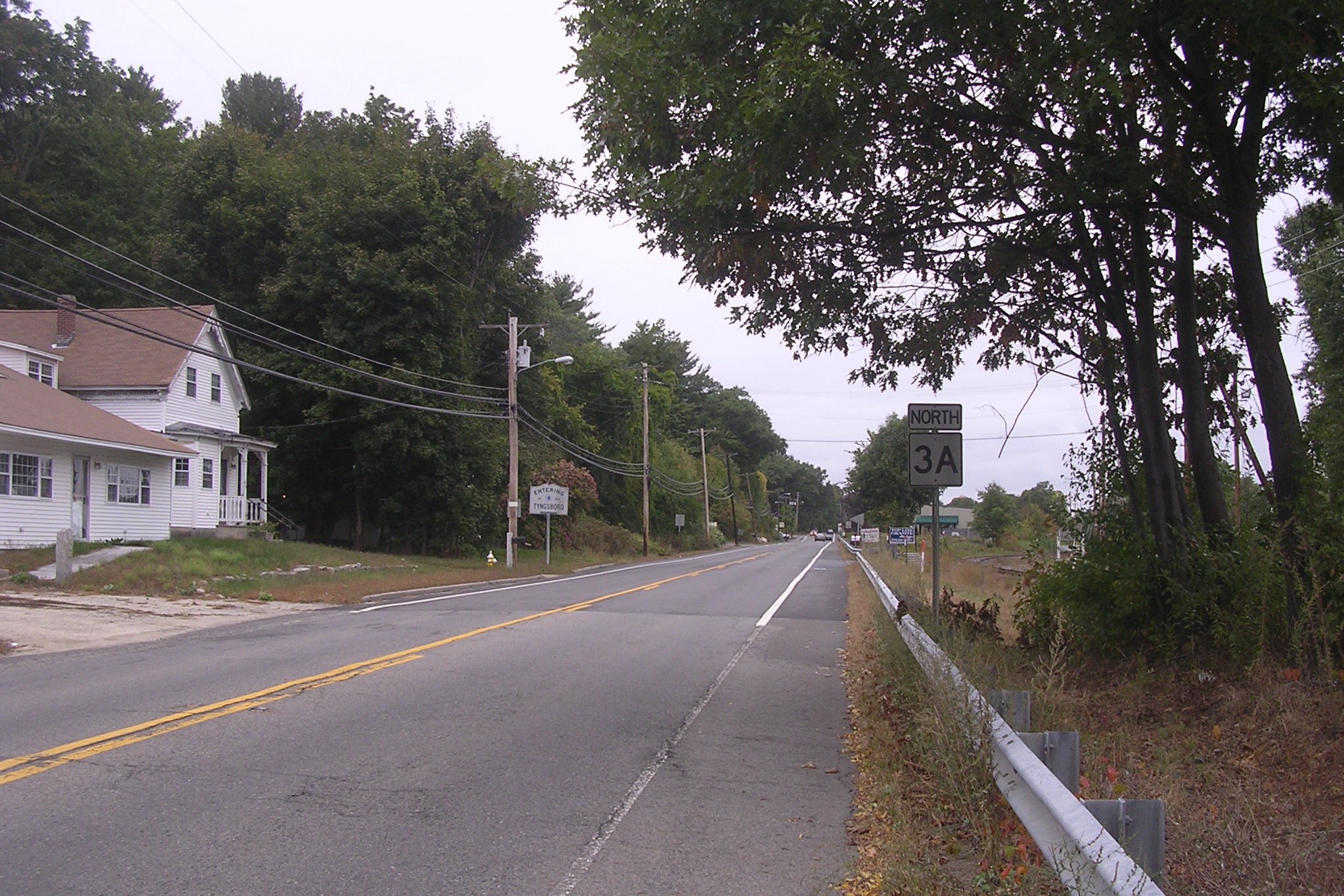
Burlington to Tyngsborough
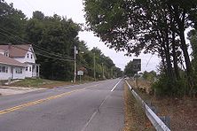 Northbound 3A entering Tyngsborough
This segment parallels US 3 from Interstate 95 (Route 128) in Burlington to the New Hampshire state line, where it continues as New Hampshire Route 3A. The part south of Route 113 in Tyngsborough is former US 3.
The section from Burlington to Billerica is currently being widened from 2 to 4 lanes.
History

From 1922 to 1926, Route 3A between Kingston and Quincy was New England Interstate Route 6A. In 1926, when New England Interstate Route 6 became Route 3, Route 6A became Route 3A.
In the 1930s Route 3A's route was shifted onto new alignments built to reduce traffic problems in several communities through which the highway traversed. This included a bypass of Hingham Square along Broad Cove Road and Otis Street along Hingham Harbor replacing the original route that took it down Lincoln Street to downtown Hingham then along North Street to Summer Street. Chief Justice Cushing Highway was built around the same time and Route 3A was put on this highway from south of the Hingham Harbor rotary through Cohasset to Scituate. This replaced a routing along long-existing roadways such as Country Way in Scituate, South and North Main Streets in Cohasset and East Street to Summer Street in Hingham. Along East Street from Hull Street to Summer, Route 3A shared the highway with Route 128 in the late 1920s and early 1930s.
In the 1950s and early 1960s Route 3A was extended to take over the original path of Route 3 south of Kingston to Plymouth and north of downtown Quincy to Neponset when Route 3 assumed its current freeway route. In between those locations, old Route 3 was designated Route 53. The section of old Route 3 from Cedarville south to the Sagamore Rotary near the Cape Cod Canal in Bourne is unnumbered.
Much of Route 3A is sometimes referred to as the "Cape Way" due to its history as the only major road to Cape Cod from Boston prior to the opening of Route 3. The "Cape Way" name is reflected in numerous business names along 3A's length.

The section of Route 3A south of the intersection with Route 113 in Tyngsborough (all but the northern few miles of the route) was formerly U.S. Route 3, prior to the construction of the Northwest Expressway, a freeway connection from I-95 in Burlington to the Everett Turnpike in Nashua, NH, which was given the U.S. Route 3 designation.
Junction list
County Location Mile Roads intersected Notes Plymouth Plymouth 0.0 Route 3Southern terminus of southern portion of Route 3A at Route 3 Exit 2 11.4 Plimoth Plantation Highway Access to Route 3 Exit 4 15.0 US 44Access to Route 3 Exit 6 Kingston 18.3 Route 3Route 3 Exit 9 18.7  Route 80
Eastern terminus of Route 80 18.9  Route 106
Eastern terminus of Route 106; to  Route 27
Signed access to Route 27/106 junction from Route 3A south is via Evergreen Street in Kingston Center20.3 Route 53Southern terminus of Route 53 Duxbury 20.6 Route 3Route 3 Exit 10
Southbound ramps straddle Kingston line24.2  Route 14
Eastern terminus of Route 14 25.0  Route 139
Marshfield 27.7 Route 139Southern end of concurrency with Route 139 28.1 Route 139Northern end of concurrency with Route 139 Scituate 34.5  Route 123
Eastern terminus of Route 123 Hingham 42.2  Route 228
Norfolk Quincy 49.0 Route 53Northern terminus of Route 53 Suffolk Boston 53.6 I-93 / US 1 / Route 3Beginning of unsigned concurrency with Route 3 Unsigned concurrency with Route 3 and US 3 Middlesex Burlington 74.8 I-95 / US 3 / Route 128Northern end of unsigned concurrency with US 3
I-95 Exit 3377.2  Route 62
Southern end of concurrency with Route 62 77.8 Route 62Northern end of concurrency with Route 62 Billerica 82.4  Route 129
Southern end of concurrency with Route 129 83.6 Route 129Northern end of concurrency with Route 129 Lowell 87.3 Lowell Connector Access to I-495 Exit 35 A-B-C 87.7 Route 110Southern end of concurrency with Route 110 87.9 Route 110Northern end of concurrency with Route 110 Chelmsford 91.1 Route 4Northern terminus of Route 4 91.8  Route 40
Eastern terminus of Route 40 Tyngsborough 95.1 Route 113Southern end of concurrency with Route 113
Tyngsborough Bridge crosses the Merrimack River95.3 Route 113Northern end of concurrency with Route 113 97.0 NH 3ANorthern terminus of Route 3A
Continues as NH Route 3A into Hudson, New Hampshire1.000 mi = 1.609 km; 1.000 km = 0.621 mi
Concurrency terminus • Closed/Former • Incomplete access • UnopenedReferences
- ^ a b c Executive Office of Transportation, Office of Transportation Planning - 2005 Road Inventory
Road transportation infrastructure of Cape Cod U.S. Routes  State Routes
State Roads Bridges See also: Cape Cod Canal Tunnel · Southside ConnectorCategories:- Numbered routes in Massachusetts
- Plymouth, Massachusetts
- Kingston, Massachusetts
- Duxbury, Massachusetts
- Marshfield, Massachusetts
- Scituate, Massachusetts
- Cohasset, Massachusetts
- Hingham, Massachusetts
- Weymouth, Massachusetts
- Quincy, Massachusetts
- Transportation in Boston, Massachusetts
- Burlington, Massachusetts
- Billerica, Massachusetts
- Chelmsford, Massachusetts
- Lowell, Massachusetts
- Tyngsborough, Massachusetts
- Transportation in Plymouth County, Massachusetts
- Transportation in Norfolk County, Massachusetts
- Transportation in Suffolk County, Massachusetts
- Transportation in Middlesex County, Massachusetts


Wikimedia Foundation. 2010.