- U.S. Route 6 in Massachusetts
-
For the Route 6 that existed in the early 1920s, see Massachusetts Route 3 and U.S. Route 3.This article is about the section of U.S. Route 6 in Massachusetts. For the entire length of the highway, see U.S. Route 6.
U.S. Route 6
Grand Army of the Republic Highway
Mid-Cape Highway
Route information Length: 117.46 mi (189.03 km) Existed: 1926 – present Major junctions West end:  U.S. Route 6 in East Providence, Rhode Island
 I-195 in Swansea
 Route 24 in Fall River
 Route 140 in New Bedford

 Routes 25/28 in Bourne
 Route 3 in Bourne
East end:  Route 6A in Provincetown
Highway system United States Numbered Highways
List • Bannered • Divided • ReplacedMassachusetts State Highway Routes
←  US 5
US 5Route 6A →←  Route 5
N.E. Route 6A  →
→Route 6 is the portion of the cross-country U.S. Route 6 in the state of Massachusetts. Route 6 runs 117.46 miles (189.03 km) in the state connecting Providence, Rhode Island to Fall River, New Bedford, and Cape Cod. In the Fall River and New Bedford areas, Route 6 is a secondary highway paralleling Interstate 195. Within Cape Cod, Route 6 is the primary highway interconnecting the towns of the area.
Contents
Route description
Route 6 is a 4-lane arterial road for approximately its first 54 miles (87 km) from the Rhode Island line (crossing into Massachusetts from East Providence to Seekonk) to the Cape Cod Canal, except for sections in New Bedford (where it runs along Mill and Kempton Streets, two one-way city streets) and Fall River (where it runs along a two-lane President Avenue).
After crossing the canal via the Sagamore Bridge, it becomes a freeway, known as the Mid-Cape Highway. From Bourne to Dennis at the Exit 9A/B cloverleaf, the freeway is 4 lanes. The bridges from the Cape Cod Canal, to Oak Street in Barnstable Village (a half-mile west of Route 132), are unique in their construction since they are made out of concrete and granite. The road then reduces to a two-lane freeway with plastic stanchions posted on a small asphalt median. The two-lane freeway section has a secondary, less-formal name of "Suicide Alley", due to the high number of fatalities from head-on collisions before the median improvements were constructed. (When the two-lane freeway stretch was first built, it was marked with passing zones like any other two-lane highway. The small asphalt/stanchion median was built in stages beginning in 1989 and finishing in 1992.) The Mid-Cape Highway carries a speed limit of 55 on the standard freeway and 50 on the two-lane freeway. It remains like this until Orleans, where the freeway ends at a large rotary (Mile 90.6).
Through Eastham and North Truro, U.S. 6 is a 4-lane surface street. Through Wellfleet and southern Truro, U.S. 6 is a former 3-lane road converted to 2 lanes with shoulders. In Provincetown, U.S. 6 ends as it started in the state, as a surface expressway once again until it comes to an end at Route 6A at the Cape Cod National Seashore. For the last several miles of its existence near Provincetown Route 6 east is actually heading west-southwest.
History
New England Interstate Route 3

Before the U.S. Highway system, the route from Rhode Island to Bourne, and from Orleans to Provincetown, was part of New England Interstate Route 3 (NE-3). Within the Upper Cape, however, NE-3 went along what is now Route 28 between Bourne and Orleans. The U.S. 6 designation was instead applied to the route on the north shore of Cape Cod, which was known as New England Interstate Route 6 before 1926 (now Route 6A).
U.S. Route 6 Bypass
When U.S. 6 was first routed through Provincetown in 1926, the highway was signed along the rather narrow Commercial Street. After the Provincetown U.S. 6 bypass was built, congestion and the increasing size of automobiles forced the town to post most of Commercial Street (all but the easternmost mile that hits the Truro line) as one-way westbound. Route 6A, when signed, was placed along the paralleling Bradford Street instead. There was an alternate plan at the time to make Bradford one-way westbound and Commercial one-way eastbound (which would have made both roads Route 6A), but this was rejected, as the town decided instead to let incoming traffic through the heavy Commercial Street (almost entirely pedestrian) business district.


U.S. 6 was briefly signed on current I-195 between Route 105 and Route 28; however, when I-195 was completed, and the I-195 designation took over that section of freeway, U.S. 6 reverted back to its older route.
Formerly, U.S. 6 took both sides along the Cape Cod canal (and was signed as "BYPASS 6"), but is now routed only on the north side (The south side is now signed "TO 6" from the Sagamore Bridge to the Bourne Bridge). However, a single "BYPASS 6" sign still exists just north of the Bourne Bridge rotary.
Junction list
Seekonk to Bourne
County Location Milepost Roads Intersected Notes Bristol Seekonk 0.00 U.S. Route 6U.S. Route 6 continues westbound into East Providence, RI. 0.8  Route 114
To Interstate 195 (Exit 1).
To RI Route 114.
Swansea 4.7  Route 136
To I-195 (Exit 2).7.4 Interstate 195I-195 Exit 3. 7.8  Route 118
Southern terminus of Route 118. Somerset 11.1  Route 103
 Route 138
Eastern terminus of Route 103.
Western terminus of US-6/Route 138 concurrency.Fall River 11.4  Route 79
Route 138Eastern terminus of US-6/Route 138 concurrency. 13.5 Route 24
(Amvets Highway)Route 24 Exit 5. Westport 17.7  Route 88
To Interstate 195 (Exit 10).20.9  Route 177
Eastern terminus of Route 177. New Bedford 25.6 Route 140
(Taunton-New Bedford Expy.)Southern terminus of Route 140.
To Interstate 195 (Exit 13).27.5  Route 18
Southern terminus of Route 18.
To Interstate 195 (Exit 15).Fairhaven 29.8  Route 240
Southern terminus of Route 240.
To Interstate 195 (Exit 18).Plymouth Marion 39.2  Route 105
Southern terminus of Route 105.
To Interstate 195 (Exit 20).Wareham 45.7 Route 28Western terminus of US-6/Route 28 concurrency.
To Route 25 (Exit 2).Barnstable Bourne 50.4 Route 25
Route 28Eastern terminus of US-6/Route 28 concurrency.
Route 25 Exit 3.54.0 Route 3
(Pilgrims Highway)Southern terminus of Route 3.
Routes 3/6 Exits 1A-B.Mid-Cape Highway begins at the interchange with in Bourne.
Refer to the Exit List below for interchanges.Exit list (Bourne to Orleans freeway)
The westbound exit numbers in Sagamore are out of order: First is Exit 1C, then Exit 1A, then Exit 1B. On the eastbound side, Exits 1A-B are combined into one exit, with three exit only lanes and US-6 shrinking down to one lane. US-6 shrinks to one lane westbound too, after Exit 1B, before gaining three lanes again.
County Location Exit # Mile[1] Route and destinations Notes Barnstable Bourne 1B 54 JCT
Route 3 — Quincy, Boston
Sagamore Beach1A 54 Scusset Beach Road — Sagamore Beach Sagamore Bridge (Cape Cod Canal crossing) 1C 54.8 Route 6A — SagamoreWestbound ramps feed into old
Sagamore Bridge approach
(old US-6)Sandwich 2 58.3  Route 130 — Sandwich, Mashpee
3 60.2 Quaker Meetinghouse Road — East Sandwich 4 62.4 Chase Road — East Sandwich, West Barnstable Barnstable 5 64.8  Route 149 — Marstons Mills, West Barnstable
6 67.6  Route 132 — West Barnstable, Hyannis
6B 70.9 Mary Dunn Road — Hyannis, Barnstable Proposed as 6½ to relieve congestion on exits 6 and 7 Yarmouth 7 71.7 Willow Street — Yarmouth Port, West Yarmouth 8 74.0 Union Street — Yarmouth, Dennis Dennis 9 77.2  Route 134 — Dennis Port, West Harwich, Dennis
Split into 9A and 9B Harwich 10 81.3  Route 124 — Harwich, Brewster
11 83.8  Route 137 — Brewster, Chatham
Orleans 12 88.3 Route 6A — Orleans, East BrewsterOrleans/Eastham line (13) 90.3 JCT at Orleans Rotary
U.S. Route 6 (west) — Barnstable, Bourne
U.S. Route 6 (east) — Provincetown
Route 28 — Chatham
Route 6A — BrewsterOrleans to Provincetown
County Location Mile Roads intersected Notes Mid-Cape Highway ends at the Orleans Rotary intersection with on the Orleans/Eastham line.Barnstable Orleans 90.6 Route 6ASouthern terminus of (unsigned) US-6/Route 6A concurrency.
To Route 28.Truro 109.4 Route 6ANorthern terminus of (unsigned) US-6/Route 6A concurrency. Provincetown 118.0 Route 6ANorthern terminus of Route 6A.
Eastern terminus of U.S. Route 6.The Orleans Rotary was once officially Exit 13. A sign labeling the turnoff to Routes 6A/28 once marked it as "Exit 13S", however the signage was removed in 1985.
There are also two freeway-style interchanges on the surface arterial portion in Truro. The first is near Mile 106 for the Pamet Roads, and the second is near Mile 110 for Highland Road. These exits are not numbered.
Photos
-

Westbound entering
New Bedford -

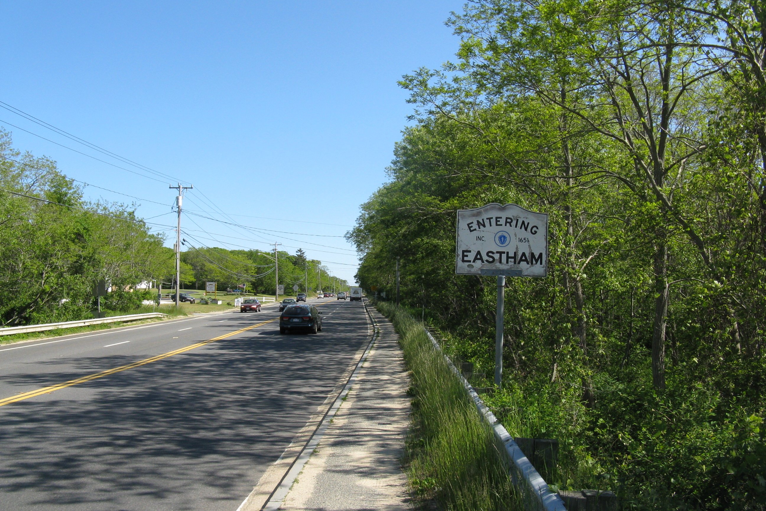
Southbound entering Eastham
-

Westbound start at Provincetown. This sign was erected in August or September 2010.
References
- ^ Massachusetts Executive Office of Transportation. 2007. Interchange Lists (US 6). Downloaded from http://www.eot.state.ma.us/default.asp?pgid=planning/disc/interchanges&sid=dtable , August 7, 2011.
See also
Suffixed routes
 Massachusetts Route 6A, alignment in Cape Cod of Route 6 prior to the construction of the freeway segment
Related routes
 Massachusetts Route 28, the original alignment of New England Route 3 in Cape Cod
 New England Interstate Route 3, the designation of US-6 (excluding the stretch from Bourne to Orleans) prior to 1926
 New England Interstate Route 6, the designation of US-6 between Bourne and Orleans, as well as of U.S. Route 3/Route 3 prior to 1926
U.S. Route 6Previous state:
Rhode IslandMassachusetts Next state:
TerminusRoad transportation infrastructure of Cape Cod U.S. Routes US 6 State Routes
State Roads Bridges See also: Cape Cod Canal Tunnel · Southside ConnectorCategories:- U.S. Route 6
- U.S. Highways in Massachusetts
- Two-lane freeways in the United States
- Transportation in Bristol County, Massachusetts
- Transportation in Plymouth County, Massachusetts
- Transportation in Barnstable County, Massachusetts
-


Wikimedia Foundation. 2010.