- East Providence, Rhode Island
Infobox Settlement
official_name = City of East Providence
established_title2 = Incorporated (city)
established_date2 = 1958
established_title = Incorporated (town)
established_date = 1812
subdivision_type2 = County
subdivision_name2 = Providence
government_type =Council-manager
settlement_type =City
imagesize =
image_caption =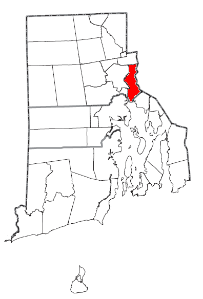
mapsize = 250px
map_caption = Location of East Providence in Rhode Island
mapsize1 =
map_caption1 =
subdivision_type = Country
subdivision_name =United States
subdivision_type1 = State
subdivision_name1 =Rhode Island
leader_title1 = City manager
leader_name1 = Richard M. Brown
leader_title = City council
leader_name = Isadore S. Ramos Ph.D, Mayor
Robert E. Cusack
Bryan P. Silva
Valerie A. Perry
Bruce DiTraglia
area_magnitude =
area_total_km2 = 43.02
area_land_km2 = 34.7
area_water_km2 = 8.3
area_total_sq_mi = 16.61
population_as_of = 2005
population_total = 49515
population_density_km2 = 1426
population_density_sq_mi = 3692
timezone = Eastern
utc_offset = -5
timezone_DST = Eastern
utc_offset_DST = -4
area_land_sq_mi = 13.4
area_water_sq_mi = 3.2
elevation_m = 19
elevation_ft = 62
latd = 41 |latm = 48 |lats = 49 |latNS = N
longd = 71 |longm = 22 |longs = 12 |longEW = W
region =
postal_code_type = ZIP code
postal_code = 02914, 02915, 02916
website = http://www.eastprovidenceri.net/
area_code = 401
blank_name = FIPS code
blank_info = 44-22960GR|2
blank1_name = GNIS feature ID
blank1_info = 1219590GR|3
footnotes =East Providence is a city in Providence County,
Rhode Island ,United States . The population was 48,688 at the 2000 census, making it the fifth largest city in the state.It is a suburb of Providence.
Geography
East Providence is located at coor dms|41|48|5|N|71|21|39|W|city (41.801500, -71.360824)GR|1.
According to the
United States Census Bureau , the city has a total area of 16.6square mile s (43.0km² ), of which, 13.4 square miles (34.7 km²) of it is land and 3.2 square miles (8.3 km²) of it (19.33%) is water.The following
village s are located in East Providence:
*East Providence Center
*Riverside
*RumfordThe Mayor is Dr. Isadore Ramos. The city is home to the
Rhode Island Stingrays soccer club.History
In 1641, the Plymouth Colony purchased from the Indians a large tract of land which today includes the northern half of East Providence (from Watchemoket to Rumford), Rehoboth, Seekonk, and part of Pawtucket. Four years later, John Brown of Plymouth bought a considerably smaller piece of land from the Indians, which today comprises the southern part of East Providence (Riverside), Barrington, and a small part of Swansea. Finally, in 1661, Plymouth completed the "North Purchase" from which Attleboro, North Attleboro, and Cumberland were later formed. Over the whole the authorities gave the name 'Rehoboth'. The center of this large settlement, which is sometimes referred to as 'Old Rehoboth', is within the borders of modern East Providence. In 1812, the western half of Old Rehoboth was set off as a separate township called Seekonk, Massachusetts. Old Rehoboth's town center now became the heart of Old Seekonk. Finally, in 1862, the western part of Old Seekonk was ceded to Rhode Island and incorporated as East Providence.
Watchemoket
In decades preceding the Civil War, Watchemoket Point was little more than a farming and fishing area with perhaps a few hundred residents. Watchemoket was situated directly across from the thriving city of Providence and thus benefited from the expansion of that community. More importantly, two bridges across the Seekonk River gave easy access to Watchmemoket. By the 1860s, tolls were no longer being charged to cross the Washington and Central Bridges, giving further stimulus to the growth of Watchemoket and the transformation of the village from a sleepy fishing area to the vital core of East Providence in 1862. Perhaps the first businesses to come to Watchemoket were inns built to service the large numbers of people coming through. The residents of Watchemoket also had their own library by the early 1870s. At first the organizers named it Ladies Library Association, but in 1885 they changed the named to Watchemoket Free Public Library. Already the commercial and population center of East Providence, by the mid-1880s, Watchemoket next became the political center as well. The town hall was moved from Rumford to the heart of the community, so it was more accessible. They purchased a lot on Taunton Avenue for $11,500 and erected a two-story brick building which opened in 1889. That same year the East Providence Police Department opened its headquarters in the town hall. Beginning around 1900 and continuing until the onset of the Depression in 1930, large numbers of Portuguese from Providence, Fall River, New Bedford, and Portugal settled in East Providence. By 1905, there were over 400 Portuguese in the town, the third highest in the state. The Portuguese, like other ethnic groups, were drawn to East Providence primarily by the lure of jobs. Many employment opportunities were available in the Watchemoket area, where numerous immigrants settled.
Rumford
For some time after the incorporation of the town in 1862, the area around the old "Ring of the Green" was referred to as East Providence Center. The official town hall was located here until 1889, as were several churches. Moreover, the village was the population center of East Providence, containing many farms and mills along the Ten Mile River. The 165-foot Rumford Chemical Works water tower, in the shape of a red and white baking powder can, was built on Wilson Avenue near North Broadway, where the Newman Congregational Church had stood. Many people migrated from East Providence Center to the new center at Watchemoket.
Riverside
From the time of the Wannamoisett purchase in 1645 to the Civil War, the shore land from Watchemoket to Bullocks Point had remained a sparsely settled fishing and farming area. When East Providence was incorporated, no more than a few hundred of its residents made the coastal village their home. The white settlers had first learned of the plentiful supply of shellfish in the area from the Wampanoag Indians. More than two centuries later, the waters of Narragansett Bay, which washed the shores of Wannamoisett, still contained an abundant supply of edible sea treasures. Clams, quahogs, and oysters were harvested by Wannamoisett residents and sold in Providence. Arnold Medberry, for instance, brought his plow to the shoreline and began picking up clams by the handful. He loaded the shellfish on a cart and easily sold his entire day's catch in Providence. At that time, Medberry and his neighbors were referred to as "clamdiggers", a derogatory term comparable to the pejorative hayseed. Already, by the early nineteenth century, individuals had begun to build summer homes, causing the population to double to about 500-600. During that time period, Cedar Grove, Lewis Station, Chimney Corners, Peck's Corner, Pleasant Bluffs, Sabin's Point, Sherman's Station, and Pomham were developed. New resort facilities were built, such as the Pomham House. Numbers of roads were lined with trees and houses, Christian Churches were formed, a library was built, and the Narragansett Engine Company was formed in 1878. By that time, the residents were no longer dismissed as "clamdiggers", but regarded as townspeople. While many transactions were taking place,
Charles I. D. Looff came to Riverside. He was a wood carver for a furniture business in New York, and spent spare time in his basement carveing wooden horses as a hobby. After long years of hard work, he produced the first steam powered carousel and sold it to Crescent Park. He operated the carousel and designed a summer recreation area. By the early 1900s, New Englanders recognized Crescent Park as the leading amusement park in the region. Looff accomplished fantastic achievements and, after his death, his family continued to operate Crescent Park.Recent development
The city has recently created a commission charged with facilitating the redevelopment of old industrial sites and brownfields along most of East Providence's 14-mile coastline on the
Seekonk River as mixed use residential, commercial, and light industrial zones. [ [http://www.projo.com/ri/eastprovidence/content/projo_20060510_epdev10.17bca881.html East Providence | Rhode Island news | projo.com | The Providence Journal ] ] [ [http://www.eastprovidencewaterfront.com/?id=26 East Providence Waterfront Commission ] ]Demographics
As of the
census GR|2 of 2000, there were 48,688 people, 20,530 households, and 12,851 families residing in the city. Thepopulation density was 3,632.1 people per square mile (1,401.8/km²). There were 21,309 housing units at an average density of 1,589.6/sq mi (613.5/km²). The racial makeup of the city was 86.49% White, 5.02% African American, 0.46% Native American, 1.15% Asian, 0.05% Pacific Islander, 2.80% from other races, and 4.03% from two or more races. Hispanic or Latino of any race were 1.89% of the population.There were 20,530 households out of which 27.1% had children under the age of 18 living with them, 46.3% were married couples living together, 12.7% had a female householder with no husband present, and 37.4% were non-families. 32.4% of all households were made up of individuals and 14.6% had someone living alone who was 65 years of age or older. The average household size was 2.33 and the average family size was 2.99.
In the city the population was spread out with 21.7% under the age of 18, 7.4% from 18 to 24, 29.4% from 25 to 44, 22.6% from 45 to 64, and 18.9% who were 65 years of age or older. The median age was 40 years. For every 100 females there were 86.8 males. For every 100 females age 18 and over, there were 82.6 males.
The median income for a household in the city was $39,108, and the median income for a family was $48,463. Males had a median income of $34,342 versus $26,423 for females. The
per capita income for the city was $19,527. About 6.3% of families and 8.6% of the population were below thepoverty line , including 10.7% of those under age 18 and 11.0% of those aged 65 or over.The population has large immigrant communities from
Portugal andCape Verde .Education
East Providence has both public and non-public schools. Public Elementary schools are the following: Agnes B. Hennessey, Alice M. Waddington, Emma Whiteknact, James R.D. Oldham, Kent Heights, Myron J. Francis, Orlo Avenue, and Silver Spring School. Public Middle Schools are Edward R. Martin Middle School and Riverside Middle School. Public High Schools consist of Grove Ave. Educational Development Center, East Providence Area Career & Technical Center, and East Providence Senior High School. Non-public Elementary and Junior-High Schools are St. Mary Academy (Bayview), Sacred Heart School, St. Brendan School, St. Margaret School, The Gordon School & Providence Country Day (P.C.D.).
Registered National Historic Places in East Providence
*
Bicknell-Armington Lightning Splitter House
*Boston and Providence Railroad Bridge
*Bridgham Farm
*Carpenter, Lakeside, and Springvale Cemeteries
*Crescent Park Looff Carousel , (National Historic Landmark )
*Nathaniel Daggett House
*James Dennis House
*District 6 Schoolhouse
*Little Neck Cemetery
*Newman Cemetery
*Newman Congregational Church
*Oddfellow's Hall
*Pomham Rocks Light Station
*Richmond Paper Company Mill Complex
*Rumford Chemical Works and Mill House Historic District
*Rumford Historic District
*Squantum Association
*St. Mary's Episcopal Church
*Phillip Walker House
*Whitcomb Farm
*World War I Memorial Notable Residents and Former Residents
*
Claudia Jordan
*Rebecca DiPietro - "2006 WWE Diva Search Contestant"
*Meredith Vieira , co-host of "Today"
*Davey Lopes , formerMajor League Baseball player
*Arunah Shepherdson Abell , (1806-1888), born in East Providence, apprentice on the "Providence Patriot", later publisher of the "Philadelphia Public Ledger " and the "Baltimore Sun "cite book | title = Who Was Who in America, Historical Volume, 1607-1896 | publisher = Marquis Who's Who | location = Chicago | date = 1963]References
Further reading
*"Our Heritage: A History of East Providence", Joseph Conforti
External links
* [http://www.eastprovidenceri.net City of East Providence]
* [http://www.eastprovidencepd.com/ East Providence Police Department]
* [http://www.eastprovidencefiredepartment.com East Providence Fire Department]
* [http://www.eptheatre.org East Providence Community Theatre]
* [http://ep.k12.ri.us East Providence School Department]
* [http://www.eastprovidencelibrary.org East Providence Public Library]
Wikimedia Foundation. 2010.