- Olneyville, Providence, Rhode Island
-
 Providence neighborhoods with Olneyville in red
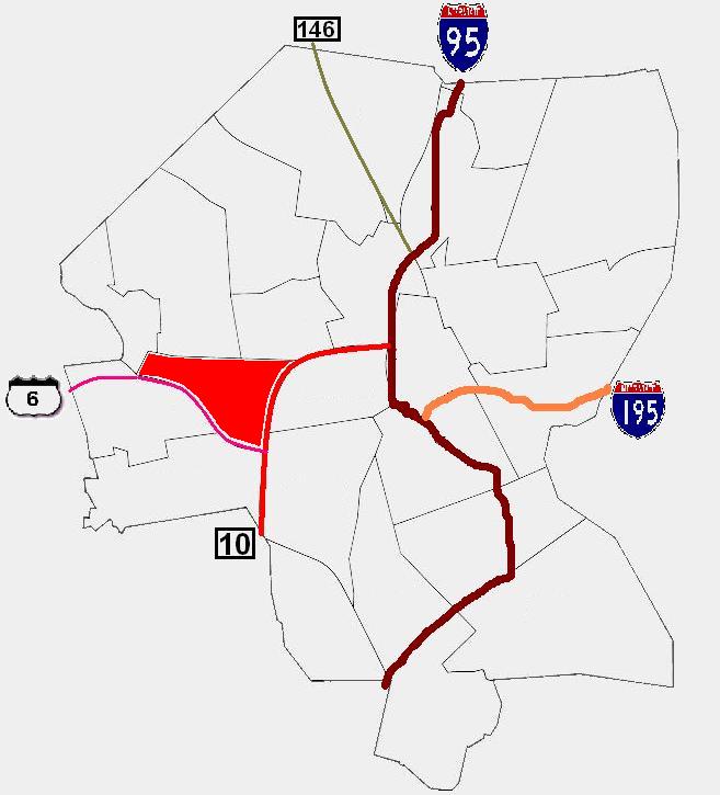
Olneyville is a neighborhood in Providence, Rhode Island bordered by Atwells Avenue to the north, U.S. Route 6 to the south and Rhode Island Route 10 to the east. The Woonasquatucket River runs through the southern portion of the neighborhood. The area is roughly triangular.
Olneyville Square is a major traffic intersection in Olneyville, defined by the intersection of Westminster Street, Broadway, Plainfield Street, and Manton Avenue.
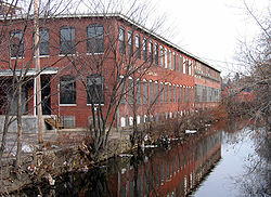 The Woonasquatucket River in the Olneyville neighborhood of Providence, Rhode Island
Contents
History
Settlement in Olneyville began at Olneyville Square in the early 18th century. The area began as a center of trade with a nearby Narragansett village. Larger settlement began in 1785 after Christopher Olney, for whom Olneyville is named, founded a grist mill and a paper mill on a wide part of the Woonasquatucket River. Olney was a captain during the Revolutionary War and owned a 95 acre farm in the area. By the end of the American Revolutionary War, a forge and foundry and other small industries operated in Olneyville.[1]
Through the mid-19th century, Olneyville developed as a railroad junction and mill district. This attracted many Polish immigrants. However, the mill industries declined after World War II causing economic decline. The construction of the Route 6 connector in the 1950s exacerbated these problems. In the two decades that followed Olneyville witnessed a substantial drop in its population.[1]
On May 15, 1900, Olneyville was the site of one of the few occasions of "raining fish", when a late afternoon thunderstorm brought perch and bullspouts falling from the skies.[2]
Development
Former warehouses and mill buildings in Olneyville were home to a number of artist collectives including Fort Thunder in the 1990s. Since 2000, many of these buildings have been purchased by developers who plan to convert them into luxury condominiums.
However, proposals to develop the Olneyville area have met some local opposition, caused by fears of gentrification. In March 2007, the Olneyville Neighborhood Association (ONA) declared its opposition to plans from the United Way to move their headquarters from the East Side to Calender Mills in Olneyville.[3] In July 2007, during a meeting of the Providence City Council, the ONA declared a "tax strike" to protest a proposed property tax increase. Residents of Olneyville and Silver Lake expressed concerns that the proposed tax increase would force poorer residents from their homes and declared that they would not pay the amount of any property tax increase.[4]
Demographics
The 1990 census reported that Hispanics comprised 34.9% of the population, African-American 12.3%, and Asians 7.2%.[1]
Today, according to the Providence Plan, a local nonprofit aimed at improving city life, 57.4% of residents are Hispanic, 22% white, 13.6% African-American, 7.4% Asian, and 1.6% Native-American. 63% of public school children speak a language other than English as their primary language.[5]
The median family income is $19,046, well below the city-wide average of $32,058. 41.1% of families live in poverty while nearly one in four families receives some form of public assistance. One in five children has been exposed to high levels of lead.[5]
Government
Olneyville is divided west to east between Ward 6 and Ward 15. They are represented in the Providence City Council by Democrats Joseph DeLuca and Josephine DiRuzzo, the Council President Pro Tempore.[6]
Food and Culture
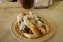 Hot wieners "all the way" by Olneyville New York System are a Rhode Island specialty food
The Hot wiener is a Rhode Island specialty food that purportedly originated in Olneyville and the Olneyville New York System, in Olneyville, is often cited as the "definitive"[7] or "quintessential"[8] vendor and dates to its opening by Greek immigrant Anthony Stevens in 1946.
Parks
Olneyville has three parks: John Donigian Memorial Park and Riverside Mills Park along the Woonasquatucket River, and Joslin Recreation area, on Florence Street.[9]
Sports
Messer Street Grounds was home to the Providence Grays baseball team of the National League from 1878-1885.
See also
References
- ^ a b c Providence Neighborhoods: Olneyville
- ^ "Rained Fish"AP report in the Lowell (Mass.) Sun, May 16, 1900, p4
- ^ Rhode Island news | Rhode Island news | projo.com | The Providence Journal
- ^ Residents revolt over tax hike | Providence | Rhode Island news | projo.com | The Providence Journal
- ^ a b Olneyville
- ^ http://local.provplan.org/profiles/oln_main.html
- ^ Lukas, Paul. "The Big Flavors Of Little Rhode Island." The New York Times. November 13, 2002.
- ^ Ellis, Jonathan. "Top Hot Wiener." Brown Daily Herald. November 27, 2005.
- ^ Citywide Green
External links
Official neighborhoods Blackstone · Charles · College Hill · Downtown · Elmhurst · Elmwood · Federal Hill · Fox Point · Hartford · Hope · Lower South Providence · Manton · Mount Hope · Mount Pleasant · Olneyville · Reservoir · Silver Lake · Smith Hill · South Elmwood · Upper South Providence · Valley · Wanskuck · Washington Park · Wayland · West EndAgglomerations Categories:


Wikimedia Foundation. 2010.