- College Hill, Providence, Rhode Island
-
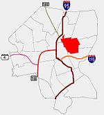 Providence neighborhoods with College Hill in red
College Hill is a neighborhood in Providence, Rhode Island, and one of six neighborhoods comprising the East Side of Providence and part of College Hill Historic District. It is roughly bounded by North Main Street to the west, Power Street to the south, Governor Street and Arlington Avenue to the east and Olney Street to the north. The name refers to the two major educational institutions established in the neighborhood: Brown University and Rhode Island School of Design. Prior to their development, the area was known as Prospect Hill. College Hill is also home to Thayer Street, a shopping strip frequented by students in the Providence area.
College Hill is the most affluent neighborhood in Providence, with a median family income of nearly three times that of the city as a whole.
Contents
History
Around the time of the founding of the colony of Providence Plantations the farm of Rev. Chad Brown occupied the hill. Settled around North Main Street in 1636, nearly all of Providence was originally on College Hill. By the time of the American Revolution, the foot of the hill was densely populated with wharves, warehouses, shops, public buildings, and residential houses. In 1770, the college that became Brown University was moved to the old Brown farm and over the next century would gradually expand. In the nineteenth century, precious metals and jewellery trading drove much business on North Main Street, and RISD was established in 1877. By the 1900s, Brown had begun expanding more aggressively, demolishing nearly 100 houses in the 1950s for a residential quadrangle area.
In the post-war years, Providence went into a decline. Many of the neighborhood's more historic centers were in disrepair and were slated for demolition as part of urban renewal projects. The Providence Preservation Society[1] intervened and the area is now home to one of the country's largest restored collections of 18th and 19th century Victorians and colonials.
Government
College Hill is divided along Angell Street between Ward One to the south and Ward Two to the north.[2][3]
As of the 2006 elections, Ward One is represented in the Providence City Council by Seth Yurdin and Ward Two by Cliff Wood. Both are Democrats (USA).
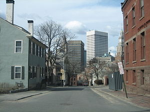 The Providence skyline from College Hill
Major public buildings include the Providence County Courthouse and the Rhode Island Office of the Attorney General. Both are located on North Main Street, at the bottom of College Hill. The Rhode Island Supreme Court is located along Benefit Street.
Demographics
75.6% of College Hill residents are white while 13.6 % are Asian, both well-above the city-wide averages of 54.5% and 6.2% respectively. African-Americans and Hispanics each comprise about 5% of the population.[4]
Median family income on College Hill is $121,521, well above the city-wide average. About 5% of households live below the poverty line. Fewer than 1% of households receive any public assistance.[4]
Universities and Schools
The College Hill contains nearly all of Brown University's academic and residential facilities, including the Main Green, the Rockefeller Library, the Pembroke Campus, and the School of Medicine. Most of Rhode Island School of Design's buildings are along the slope of College Hill.
The Moses Brown School, on Lloyd Avenue and the Wheeler School, on Hope Street, are notable private schools on College Hill.
Hope High School is located at the corner of Hope and Olney Streets, is one of Providence's major public high schools.[5]
Shopping and Restaurants
Numerous cafes, restaurants, and shops are located along Thayer Street, adjoining Brown University at Soldier's Arch. Both streets are home to numerous small and independent shops, though Thayer Street has a few chain stores. Brown University's bookstore is located on Thayer.[6] Thayer Street's Avon Cinema, dating back to the early twentieth century, is a noted College Hill landmark.[7]
Parks
- Prospect Terrace Park is a park located on top of College Hill that allows for a scenic view of downtown Providence and the city and county beyond.
- Riverwalk, located along the Providence River, is where part of Waterfire is held.
- Roger Williams National Memorial on North Main Street.
- Veterans' Memorial Park and Market Square between South Main Street and Canal Street.
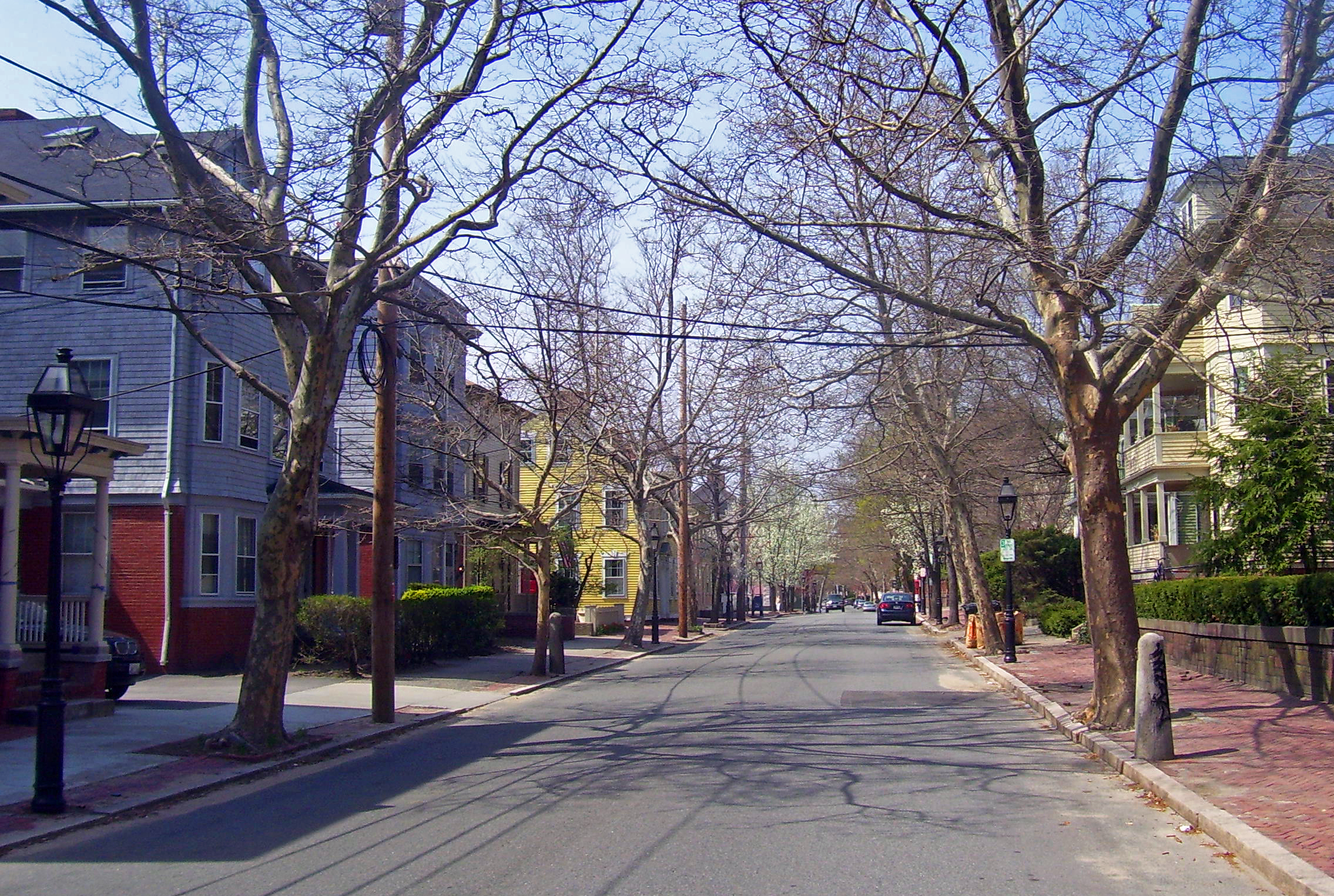
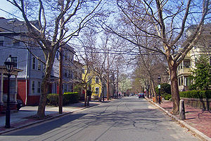 Benefit Street, the heart of College Hill
Landmarks
The base of College Hill is the oldest area of the city. The College Hill Historic District includes much of the area and has been recognized as a National Historic Landmark District by the Department of the Interior. The Providence Preservation Society[8] and the Rhode Island Historical Society have preserved numerous historic buildings in the College Hill area. Landmarks include:
- The Old State House
- The First Baptist Church in America[9]
- The First Christian Science Church on Meeting Street[10] - A domed church on Meeting Street.
- The Providence Athenaeum - The fourth oldest library in America, located on Benefit Street.[11]
- The Marine Armory - An armory in service during the American Civil War and the original headquarters of the Rhode Island State Police[12]
References
- ^ Providence Preservation Society
- ^ ward1.jpg
- ^ ward2.jpg
- ^ a b College Hill
- ^ Hope High School Arts Community
- ^ Brown University Bookstore
- ^ Avon Cinema
- ^ Providence Preservation Society
- ^ First Baptist Church in America
- ^ Welcome to College Hill, the historic heart of Providence
- ^ Benefit Street, an enduring elegance | Providence | Rhode Island news | projo.com | The Providence Journal
- ^ Rhode Island State Police: History
Official neighborhoods Blackstone · Charles · College Hill · Downtown · Elmhurst · Elmwood · Federal Hill · Fox Point · Hartford · Hope · Lower South Providence · Manton · Mount Hope · Mount Pleasant · Olneyville · Reservoir · Silver Lake · Smith Hill · South Elmwood · Upper South Providence · Valley · Wanskuck · Washington Park · Wayland · West EndAgglomerations Categories:- Neighborhoods in Providence, Rhode Island
- Populated places in Providence County, Rhode Island

Wikimedia Foundation. 2010.