- Providence, Rhode Island
-
City of Providence — City — 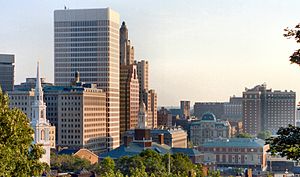

SealNickname(s): The Creative Capital, Beehive of Industry, The Renaissance City, The Divine City Motto: What cheer? Location of Providence in Providence County, Rhode Island.
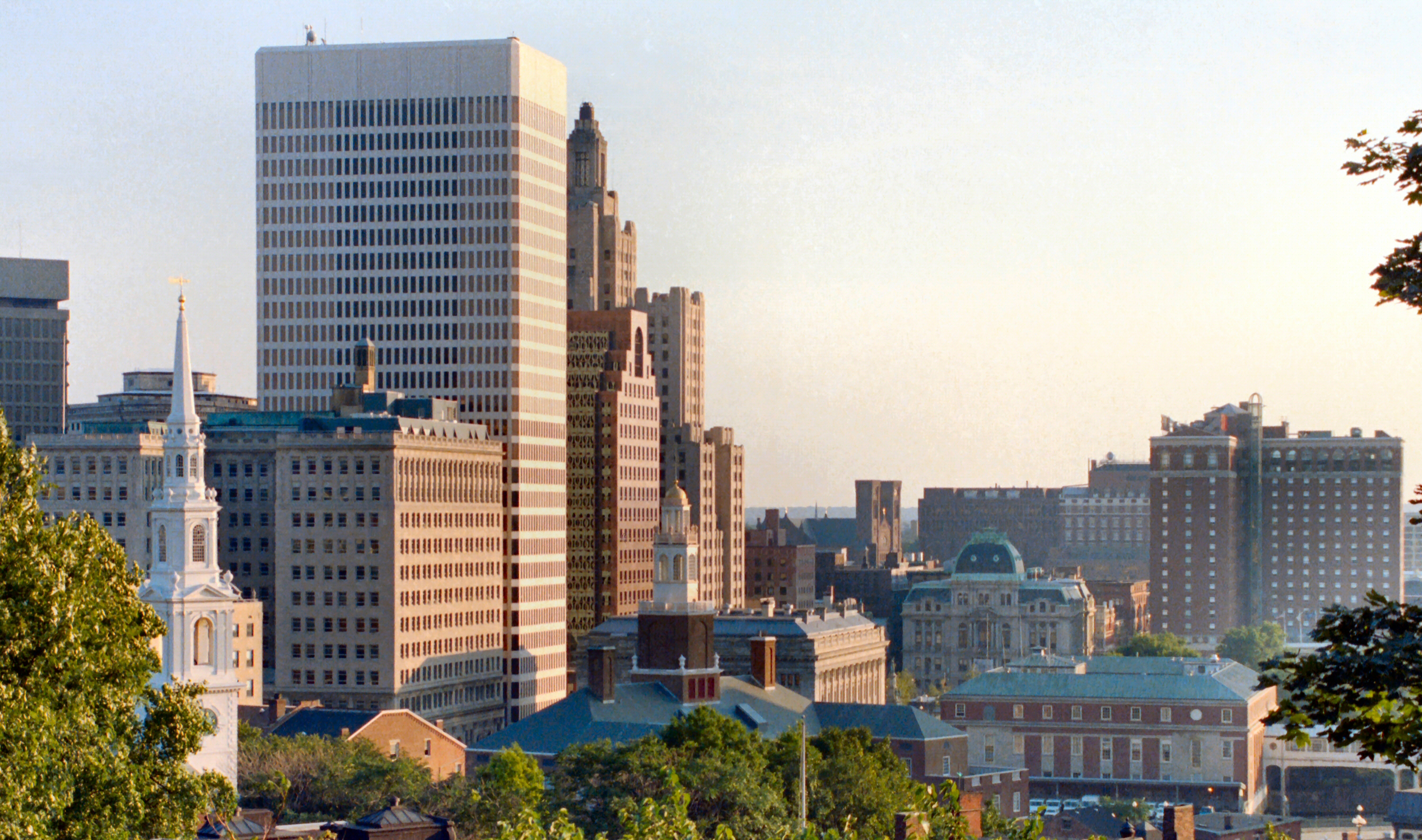
Coordinates: 41°49′25″N 71°25′20″W / 41.82361°N 71.42222°WCoordinates: 41°49′25″N 71°25′20″W / 41.82361°N 71.42222°W Country United States State Rhode Island County Providence Government – Mayor Angel Taveras (D) Area – City 20.5 sq mi (53.1 km2) – Land 18.5 sq mi (47.9 km2) – Water 2.1 sq mi (5.4 km2) Elevation 75 ft (23 m) Population (2010) – City 178,042 – Density 9,950/sq mi (3,841.7/km2) – Metro 1,630,956 Time zone EST (UTC-5) – Summer (DST) EDT (UTC-4) Area code(s) 401 FIPS code 44-59000[1] GNIS feature ID 1219851[2] Airport T.F. Green State Airport (Providence, RI) – PVD (Regional/State) Website http://www.providenceri.com Providence is the capital and most populous city of Rhode Island and was one of the first cities established in the United States.[3] Located in Providence County, it is the third largest city in the New England region. The city proper population of 178,042 anchors the 37th largest metropolitan population in the country, with an estimated MSA population of 1,600,856, exceeding that of Rhode Island by about 60% due to its reaching into southern Massachusetts.[4][5][6] Situated at the mouth of the Providence River, at the head of Narragansett Bay, the city's small footprint is crisscrossed by seemingly erratic streets and contains a rapidly changing demographic.
Providence was founded in 1636 by Roger Williams, a religious exile from the Massachusetts Bay Colony. He named the area in honor of "God's merciful Providence" which he believed was responsible for revealing such a haven for him and his followers to settle. After being one of the first cities in the country to industrialize, Providence became noted for its jewelry and silverware industry. Today, the City of Providence is home to eight hospitals and seven institutions of higher learning, which has shifted the city's economy into service industries, though it still retains significant manufacturing activity.
Once nicknamed the "Beehive of Industry", Providence began rebranding itself as the "Creative Capital" in 2009 to emphasize its educational resources and arts community.[7] Its previous moniker was "The Renaissance City", though its 2009 poverty rate was still over 22%.[8][9][10]
Contents
History
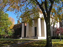
Main article: History of Providence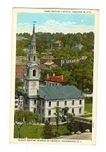 First Baptist Church in America, founded 1638, present building occupied in 1776, is the oldest Baptist congregation in America
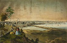 Providence in the mid-nineteenth century
The area that is now Providence was first settled in June 1636 by Roger Williams, and was one of the original Thirteen Colonies of the United States.[11] Although the west bank of the Providence River was later claimed by both the English and the Dutch, the actual inhabitants and true masters of the region were the Pokanoket Tribe of the Wampanoag Nation led by Massasoit Ousamequin.[12] Williams secured permission to settle from the Pokanoket and gave the city its present name.[13] Williams' Providence soon became a refuge for persecuted religious dissenters, as he himself had been exiled from Massachusetts.[14] Providence's growth would be slow during the next quarter-century—the subsuming of its territory into surrounding towns, difficulty of farming the land, and differing of local traditions and land conflicts all slowed development.[14]
In the mid-1770s, the British government levied taxes that impeded Providence's maritime, fishing and agricultural industries, the mainstay of the city's economy. One example was the Sugar Act, which was a tax levied against Providence's distilleries that adversely affected its trade in rum and slaves. These taxes caused Providence to join the other colonies in renouncing allegiance to the British Crown. In response to enforcement of unpopular trade laws, Providence residents spilled blood in the leadup to the American Revolution in the notorious Gaspée Affair of 1772.[14]
Though during the Revolutionary War the city escaped enemy occupation, the capture of nearby Newport disrupted industry and kept the population on alert. Troops were quartered for various campaigns and Brown University's University Hall was used as a barracks and military hospital.[14]
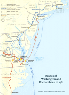 NPS map of the W3R Route
After departing from Newport, French troops sent by King Louis XVI and commanded by the Comte de Rochambeau passed through Providence on their way to join the attack against British forces. The march from Newport to Providence was the beginning of a campaign led jointly by Rochambeau and General George Washington in a decisive march that ended with the defeat of General Cornwallis in the Siege of Yorktown at Yorktown, Virginia and the Battle of the Chesapeake.
Following the war, Providence was the country's ninth-largest cityb[›][14] with 7,614 people. The economy shifted from maritime endeavors to manufacturing, particularly machinery, tools, silverware, jewelry and textiles. By the turn of the twentieth century, Providence boasted some of the largest manufacturing plants in the country, including Brown & Sharpe, Nicholson File, and Gorham Silverware. The city's industries attracted many immigrants from Ireland, Germany, Sweden, England, Italy, Portugal, Cape Verde, and French Canada. Economic and demographic shifts caused social strife, notably with a series of race riots between whites and blacks during the 1820s. In response to these troubles and the economic growth, Providence residents ratified a city charter in 1831 as the population passed 17,000.[14]
During the Civil War, local politics split over slavery as many had ties to Southern cotton. Despite ambivalence concerning the war, the number of military volunteers routinely exceeded quota, and the city's manufacturing proved invaluable to the Union. Postwar, horsecar lines covering the city enabled its growth and Providence thrived with waves of immigrants and land annexations bringing the population from 54,595 in 1865 to 175,597 by 1900.[14]
The city's boom began to wane in the mid-1920s as industries, notably textiles, shut down. Jewelry manufacturing continued to grow, taking up the slack and employing many of the city's new immigrants, coming from Portuguese, Italian, Polish, Lithuanian and Jewish backgrounds. A number of hospitals also opened. The Great Depression hit the city hard, and Providence's downtown was subsequently flooded by the New England Hurricane of 1938. Though the city received a boost from World War II, this ended with the war. The city saw further decline as a result of nation-wide trends, with the construction of highways and increased suburbanization.[14] The population would drop by 38% over the next three decades. From the 1950s to the 1980s, Providence was a notorious bastion of organized crime.[15] The mafia boss Raymond L.S. Patriarca ruled a vast criminal enterprise.
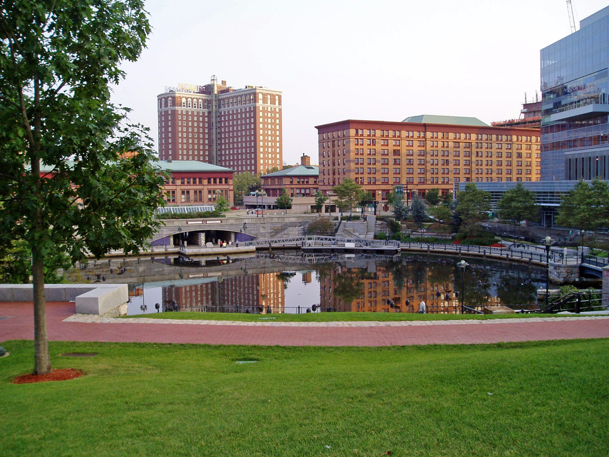
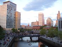 People gathering in Waterplace Park, opened in 1994, just before a Waterfire event. On the left can be seen the Waterplace condominiums, constructed 2008. The entire area had been covered in railroad tracks and the river covered with paved bridges over until the late 1980s.
The city's "Renaissance" began in the 1970s. From 1975 until 1982, $606 million of local and national Community Development funds were invested throughout the city, and the hitherto falling population began to stabilize. In the 1990s, Mayor Vincent Cianci, Jr showcased the city's strength in arts and pushed for further revitalization, ultimately resulting in the uncovering of the city's natural rivers (which had been covered by paved bridges), relocation of a large section of railroad underground, creation of Waterplace Park and river walks along the river's banks, and construction of the Fleet Skating Rink (now the Bank of America Skating Rink) downtown and the 1.4 million ft² Providence Place Mall.[14]
New investment triggered within the city, with new construction including numerous condo projects, hotels, and a new office high-rise all filling in the freed space.[16][17] Despite new investment, poverty remains an entrenched problem as it does in most post-industrial New England cities. Approximately 22 percent of the city population lives below the poverty line.[10] Recent increases in real estate values further exacerbate problems for those at marginal income levels, as Providence had the highest rise in median housing price of any city in the United States from 2004 to 2005.[18]
Geography
 Downtown Providence and the East Side, 2010. Note the demolition of the previous I195 as part of the Iway project.
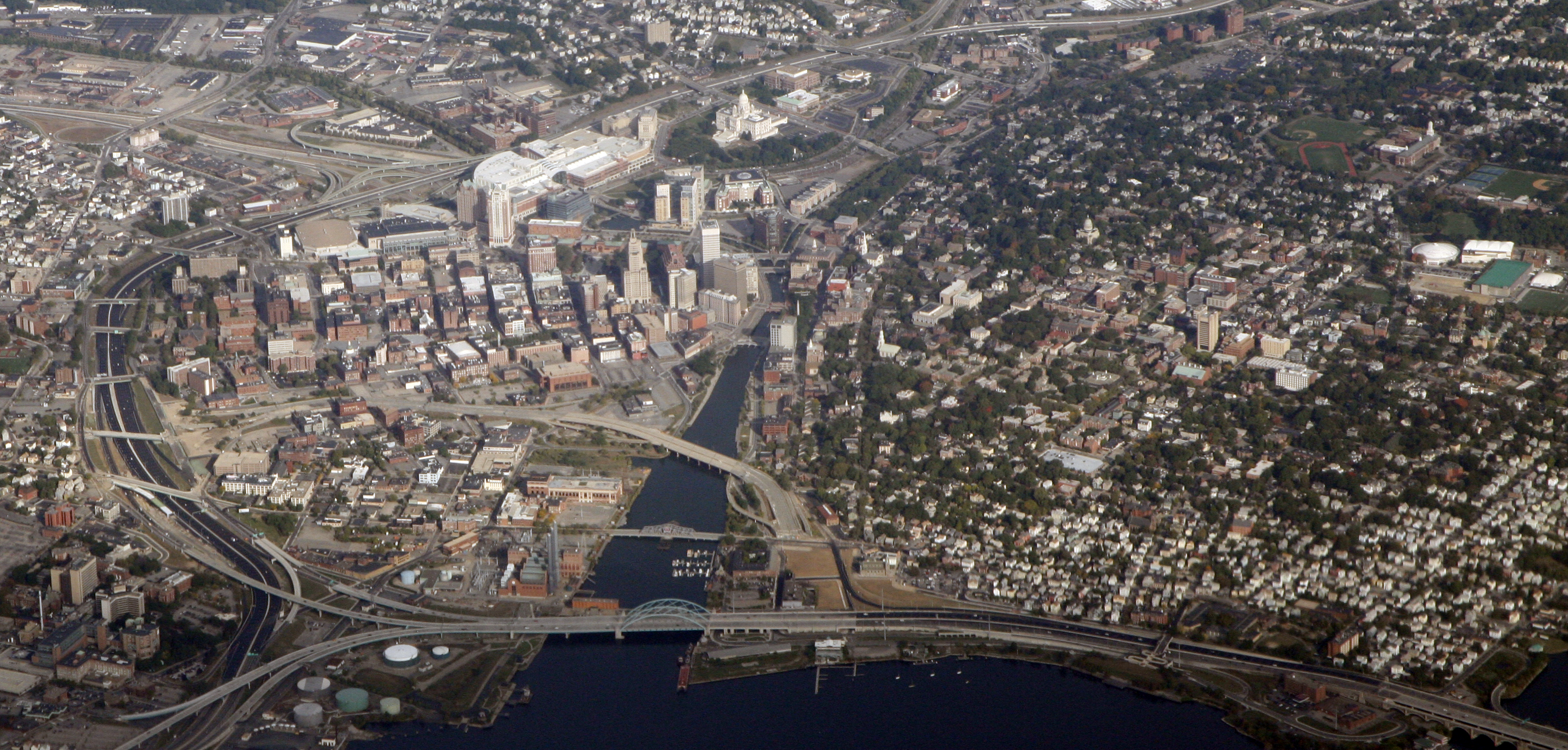
The Providence city limits enclose a small geographic region, with a total area of 20.5 square miles (53 km2). 18.5 square miles (48 km2) of it is land and the remaining 2.1 square miles (5.4 km2) (roughly 10%) of it is water.
Providence is located at the head of Narragansett Bay, with the Providence River running into the bay through the center of the city,[19] formed by the confluence of the Moshassuck and Woonasquatucket Rivers. The Waterplace Park amphitheater and riverwalks line the river's banks through downtown.
Providence is one of many cities claimed, like Rome, to be founded on seven hills. The more prominent hills are: Constitution Hill (near downtown), College Hill (east of the Providence River), and Federal Hill (west of downtown and is New England's largest Italian district outside of Massachusetts). The other four are: Tockwotten Hill at Fox Point, Smith Hill (where the State House is located), Christian Hill at Hoyle Square (junction of Cranston & Westminster Streets), and Weybosset Hill at the lower end of Weybosset Street, which was leveled in the early 1880s.[20]
Neighborhoods
 Providence neighborhoods with major highways shownMain article: Neighborhoods in Providence
 The Providence skyline viewed from College Hill
Providence has 25 official neighborhoods, though these neighborhoods are often grouped together and referred to collectively:[21][22]
- The East Side is a region comprising the neighborhoods of Blackstone, Hope (aka Summit), Mount Hope, College Hill, Wayland, and Fox Point.
- The Jewelry District describes the area enclosed by I-95, the old I-195, and the Providence River. The city has made efforts to rename this area the Knowledge District to reflect the area's newly developing life sciences and technology-based economy.[23][24]
- The North End is formed by the combination of the neighborhoods of Charles and Wanskuck.
- The South Side (or South Providence) consists of the neighborhoods of Elmwood, Lower South Providence, Upper South Providence, and the West End.
- West Broadway is an officially recognized neighborhood with its own association. It overlaps with the southern half of Federal Hill and the northern part of the West End.[25]
- The West Side is a vague term sometimes used to mean the West End, Olneyville, Silver Lake, and nearby parts of abutting neighborhoods.
Cityscape
 Perspective of Westminster Street
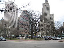 Downtown Providence at Burnside Park
-
See also: List of tallest buildings in Providence
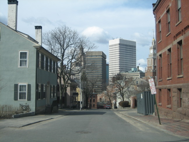
The city of Providence is geographically very compact, characteristic of eastern seaboard cities which developed prior to use of the automobile. It is among the most densely populated cities in the country. For this reason, Providence has the eighth-highest percentage of pedestrian commuters.[26][27] The street layout is irregular—over one thousand streets (a great number for the city's size) run haphazardly, connecting and radiating from traditionally bustling places like Market Square.[28]
Downtown Providence has numerous 19th century mercantile buildings in the Federal and Victorian architectural styles, as well as several post-modern and modernist buildings, located throughout the area. In particular, a fairly clear spatial separation appears between the areas of pre-1980s development and post-1980s development. West Exchange Street and Exchange Terrace serve as rough boundaries between the two.
The newer area, sometimes called "Capitol Center",[29] includes Providence Place Mall (1999), a Westin hotel (1993) and The Residences at the Westin (2007), GTECH (2006), Waterplace condominiums (2007), and Waterplace Park (1994); the area tends toward newer development since much of it is land reclaimed in the 1970s from a mass of railroad tracks which was referred to colloquially as the "Chinese Wall".[30] This part of Downtown is characterized by open spaces, wide roads, and intent landscaping.
The historic part of downtown has many streetscapes that look as they did eighty years ago. Many of the state's tallest buildings are found here. The largest structure, to date, is the art-deco-styled former Industrial Trust Tower, currently the Bank of America Building at 426 feet (130 m).[31] By contrast, nearby to it is the second tallest One Financial Plaza, designed in modern taut-skin cladding, constructed a half century later.[32] In between the two is 50 Kennedy Plaza. The Textron Tower is also a core building to the modest Providence skyline. Downtown is also the home of the Providence Biltmore and Westminster Arcade, the oldest enclosed shopping mall in the U.S., built in 1828.[33]
The city's southern waterfront, away from the downtown core, is the location of many oil tanks, a docking station for a ferry boat, a non-profit sailing center, bars, strip clubs, and power plants. The Russian Submarine Museum was located here until 2008, after the submarine sank in a storm and was declared a loss. The Fox Point Hurricane Barrier is also found here, built to protect Providence from storm surge, like that which it had endured in the 1938 New England Hurricane and again in 1954 from Hurricane Carol.[34]
The majority of the cityscape comprises abandoned and revitalized industrial mills, double and triple decker housing (though the row houses found so commonly in other Northeast cities, are notably rare here),[35] a small number of high-rise buildings (predominantly for housing the elderly), and single family homes. I-95 serves as a physical barrier between the city's commercial core and neighborhoods such as Federal Hill and the West End.
Climate
 Waterplace Park
Providence's climate is a humid continental climate, with warm summers, cold winters, and high humidity year-round. The USDA rates the city at Zone 6a, which is an "in-between" climate. The influence of the Atlantic Ocean keeps Providence, and the rest of the state of Rhode Island,[36] warmer than many inland locales in New England.[37][38] January is the coldest month with a mean of 28.7 °F (−1.8 °C).[39] July is the warmest month with an average of 73.3 °F (22.9 °C), with highs rising to 90 °F (32 °C) on 10 days per summer.[39] Extremes range from −17 °F (−27 °C) in February 1934 to 104 °F (40 °C) in August 1975.[40]
As with the rest of the northeastern seaboard, Providence receives ample precipitation year-round. Monthly precipitation ranges from a high of 4.43 inches (112.5 mm) in March to a low of 3.17 inches (80.5 mm) in July.[40] Precipitation levels are generally slightly lesser in the summer months than the winter months, when powerful storms known as Nor'easters can cause significant snowfall and blizzard conditions. Although hurricanes are not frequent in coastal New England, Providence's location at the head of Narragansett Bay makes it vulnerable to them.
Climate data for Providence, Rhode Island Month Jan Feb Mar Apr May Jun Jul Aug Sep Oct Nov Dec Year Record high °F (°C) 69
(21)72
(22)90
(32)98
(37)96
(36)98
(37)102
(39)104
(40)100
(38)88
(31)81
(27)77
(25)104
(40)Average high °F (°C) 37.1
(2.8)39.3
(4.1)47.7
(8.7)58.1
(14.5)68.5
(20.3)77.3
(25.2)82.6
(28.1)80.9
(27.2)73.4
(23.0)62.9
(17.2)52.4
(11.3)42.1
(5.6)60.2 Average low °F (°C) 20.3
(−6.5)22.5
(−5.3)30.0
(−1.1)39.1
(3.9)48.8
(9.3)57.9
(14.4)64.1
(17.8)62.8
(17.1)54.5
(12.5)43.1
(6.2)35.1
(1.7)25.6
(−3.6)42.0 Record low °F (°C) −13
(−25)−17
(−27)1
(−17)11
(−12)29
(−2)39
(4)48
(9)40
(4)32
(0)20
(−7)6
(−14)−12
(−24)−17
(−27)Precipitation inches (mm) 4.37
(111)3.45
(87.6)4.43
(112.5)4.16
(105.7)3.66
(93)3.38
(85.9)3.17
(80.5)3.90
(99.1)3.70
(94)3.69
(93.7)4.40
(111.8)4.14
(105.2)46.46
(1,180.1)Snowfall inches (cm) 10.6
(26.9)9.0
(22.9)4.9
(12.4)0.7
(1.8)0.3
(0.8)0
(0)0
(0)0
(0)0
(0)0
(0)1.4
(3.6)6.0
(15.2)32.9
(83.6)Avg. precipitation days (≥ 0.01 in) 11.2 9.8 12.3 11.5 11.8 10.5 8.8 9.2 8.9 8.9 10.0 12.0 124.9 Avg. snowy days (≥ 0.1 in) 5.5 5.1 3.3 0.7 0.1 0 0 0 0 0 0.8 3.8 19.3 Sunshine hours 170.5 175.2 217.0 225.0 254.2 273.0 291.4 263.5 234.0 207.7 147.0 148.8 2,607.3 Source no. 1: The Weather Channel (records)[40] Source no. 2: NOAA (1971–2000),[39] HKO (sun, 1961–1990)[41] Demographics
Historical populations Year Pop. ±% 1790 6,380 — 1800 7,614 +19.3% 1810 10,070 +32.3% 1820 11,767 +16.9% 1830 16,833 +43.1% 1840 23,171 +37.7% 1850 41,513 +79.2% 1860 50,666 +22.0% 1870 68,904 +36.0% 1880 104,857 +52.2% 1890 132,146 +26.0% 1900 175,597 +32.9% 1910 223,326 +27.2% 1920 237,595 +6.4% 1930 252,981 +6.5% 1940 253,504 +0.2% 1950 248,674 −1.9% 1960 207,498 −16.6% 1970 179,213 −13.6% 1980 156,804 −12.5% 1990 160,728 +2.5% 2000 173,618 +8.0% 2010 178,042 +2.5% Largest Cities and Other Urban Places in the United States: 1790 to 1990.[42] Annual Estimates of the Population for Incorporated Places Over 100,000.[43] As of the census[1] of 2000, the population comprised 173,618 people, 162,389 households, and 35,859 families.[44] The population density was 9,401.7 inhabitants per square mile (3,629.4/km²), characteristic of comparatively older cities in New England such as New Haven, Connecticut; Springfield, Massachusetts and Hartford, Connecticut.[45] Also like these cities, its population peaked in the 1940s just prior to the nationwide period of rapid suburbanization.
Providence has had a substantial Italian population since the turn of the century, with 14% (a pluralityc[›]) of the population claiming Italian ancestry.[46] Italian influence manifests itself in Providence's Little Italy in Federal Hill.[47] Irish immigrants have also had considerable influence on the city's history, with 8% of residents claiming Irish heritage.[48]
Belying Providence's traditionally white makeup is the sizable minority presence it has acquired in the last twenty years, embodied in the election of its first Latino mayor in 2010, Dominican-American Angel Taveras. Though nearby cities like Boston, Hartford, New Haven, and Springfield have longer-standing black and Latino communities, Providence now surpasses all of them in the density of its minority population, with non-Hispanic whites comprising less than half (40.9%) of the population.[49][50][51] Though salient contributions to this growth have been among Asians and unspecified races, the most dramatic change comes from Hispanics, whose presence has increased fivefold. Having origins in Puerto Rico, Colombia, Bolivia, the Dominican Republic, and Central America (particularly Guatemala), Hispanics have strong influence in the neighborhoods of Elmwood, the West End, Upper, and Lower South Providence.[50] Hispanic impact is even larger in the city's schools. Hispanics represent over half (55%) of all students in the city's school system while comprising only 33%[51] of Providence's population.[49][52]
In addition, Providence, like the nearby Massachusetts cities of Fall River and New Bedford, has a considerable community of immigrants from various Portuguese-speaking countries, living mostly in the areas of Washington Park and Fox Point.[53][54][55] Portuguese is the city's third-largest nationality, (after Italian and Irish) at 4% of the population while Cape Verdeans make up another 2%.[46]
African Americans constitute approximately 30%[51] of the city with the largest percentages in Mount Hope and Upper and Lower South Providence neighborhoods.[44][56] Asians are 6% of Providence's population and have enclaves scattered throughout the city.[56] Another 6% of the city has multiracial ancestry. Native Americans and Pacific Islanders make up the remaining 1.3%.[44] With Liberians comprising 0.4% of the population,[46] the city is home to one of the largest Liberian immigrant populations in the country.[57]
The Providence metropolitan area, which includes Providence, Fall River, Massachusetts, and Warwick is estimated to be 1,622,520.[4] In 2006, this area was officially added to the Boston Combined Statistical Area (CSA), the fifth-largest CSA in the country. In the last fifteen years, Providence has experienced a sizable growth in its under-18 population, attributed to the influx of Hispanics.[49] The median age of the city is 28 years, while the largest age cohort is 20 to 24 year olds, owing to the city's large student population.[49][58]
The per capita income, as of the 2000 census, was $15,525, which is well below both the state average of $29,113,[59] and the national average of $21,587.[44][60] The median income for a household was $26,867, and the median income for a family in Providence was $32,058, according to the 2000 census. The city has one of the highest rates of poverty in the nation with 29.1% of the population and 23.9% of families living below the poverty line in 2000, the largest concentrations being found in the city's Olneyville, and Upper and Lower South Providence areas.[10][61] Poverty has affected children at a disproportionately higher rate with 40.1% of those under the age of 18 living below the poverty line, concentrated particularly west of downtown in the neighborhoods of Hartford, Federal Hill, and Olneyville.[61]
Crime
Compared to the national average, Providence has a high rate of property crime and an average rate of violent crime per 100,000 inhabitants.[62] In 2010, there were 15 murders, down from 2009's 24.[63] In 2010, Providence fared better regarding violent crime than most of its peer cities: Springfield, Massachusetts, a city with approximately 20,000 fewer residents than Providence, reported 15 murders in 2009 (i.e. the same number of homicides as Providence, but a slightly higher rate per capita);[64] New Haven, Connecticut and Hartford, Connecticut, cities with approximately 50,000 fewer people than Providence, reported, respectively, 24 and 26 murders in 2010, significantly higher murder rates per capita than Providence.[65][66] The police chief asserted that Providence's violence was not stranger-to-stranger, but relationship driven.[67] The pattern of violent crime was highly specific by neighborhood with vast majority of the murders taking place in the poorer sections of Providence, such as Olneyville, Elmwood, South Providence and the West End.[68]
Providence has the fifth-highest rate of property crime per 100,000 inhabitants in the country.[69] Burglary and car theft, in particular constitute 1.1 and 2.5 times the national average.[62]
Economy
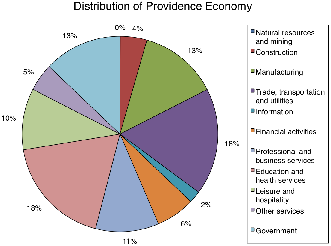
Providence was one of the first cities to industrialize in the United States. By 1830, the city had manufacturing industries in metals, machinery, textiles, jewelry, and silverware. Though manufacturing has declined, the city is still one of the largest centers for jewelry and silverware design and manufacturing. Services, particularly education, health care, and finance, also make up a large portion of the city's economy. Providence also is the site of a sectional center facility, a regional hub for the U.S. Postal Service.[70] Since it is the capital of Rhode Island, Providence's economy additionally consists of government services.
 Over one third of Providence's economy is based in either trade, transportation, and utilities, or educational and health services.[71]
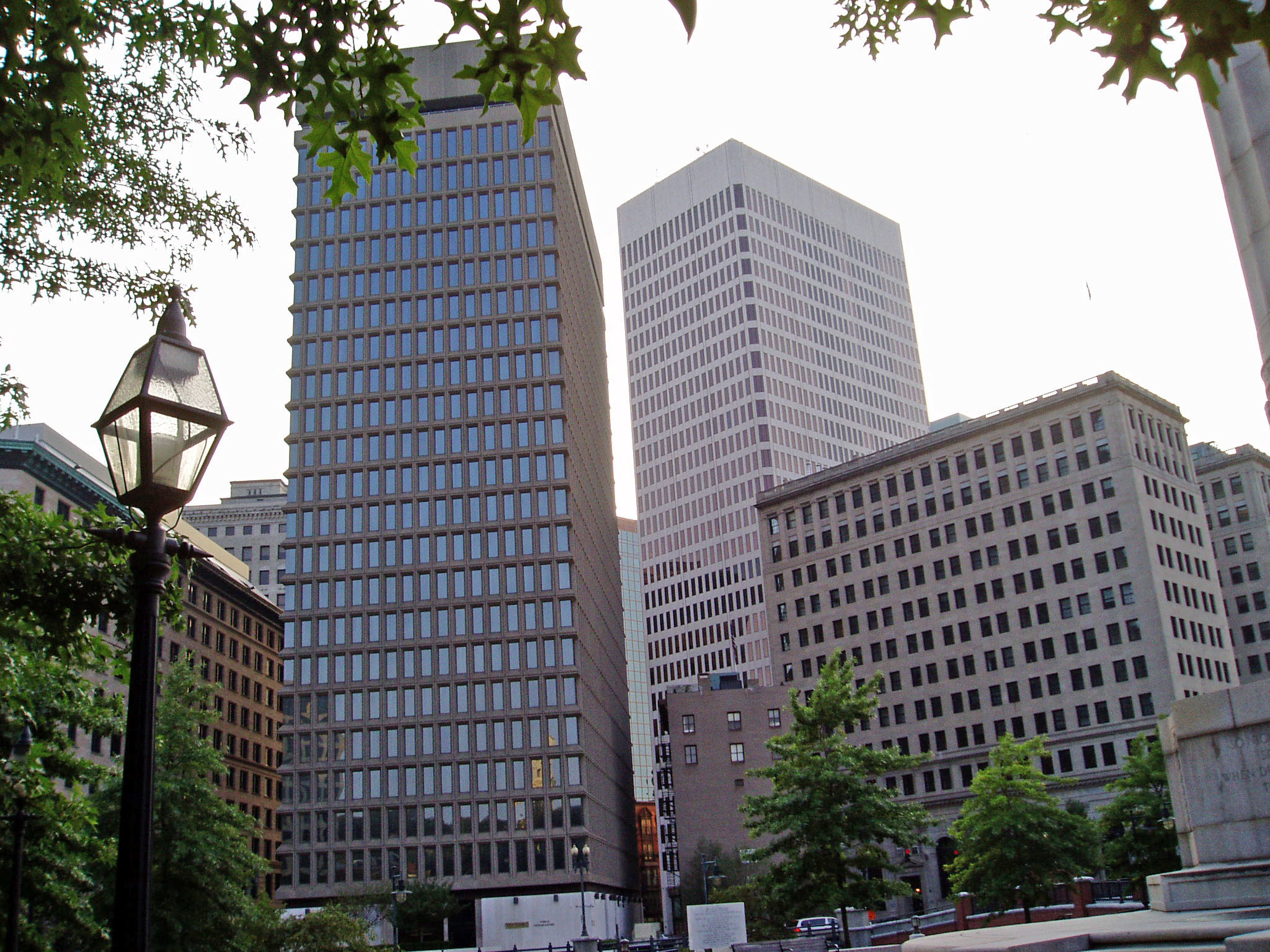
 Textron's headquarters, One Financial Plaza, and the Rhode Island Hospital Trust building
The Fortune 500 conglomerate Textron and Fortune 1000 company Nortek Incorporated are both headquartered in the city, and GTECH's world headquarters has recently been moved to downtown Providence.[72] Citizens Bank, the 15th largest bank in the country,[73] is also headquartered in Providence.[74] Another company whose origins were in the city is Fleet Bank. Once Rhode Island's largest bank, it moved its headquarters to Boston, Massachusetts, after acquiring Shawmut Bank in 1995. Before its acquisition by Bank of America, Fleet merged with BankBoston to become New England's largest commercial bank.
The city is home to the Rhode Island Convention Center, which opened in December 1993.[75] Along with a hotel, the convention center is connected to the Providence Place Mall, a major retail center, through a skywalk.[75] The Port of Providence, the second largest deepwater seaport in New England,[76] handles cargo such as cement, chemicals, heavy machinery, petroleum, and scrap metal.[77]
Top employers
According to the City's 2009 Comprehensive Annual Financial Report,[78] the top ten employers in the city are:
# Employer # of Employees % of Total city employment 1 Rhode Island Hospital 6,910 6.17 2 Brown University 4,877 4.36 3 Bank of America 3,040 2.72 4 Women & Infants Hospital 2,880 2.57 5 Miriam Hospital 2,389 2.13 6 Roger Williams Medical Center 1,470 1.31 7 Citizens Bank 1,289 1.15 8 Verizon 1,205 1.08 9 Johnson & Wales University 1,200 1.07 10 Pinkerton 1,167 1.04 Government
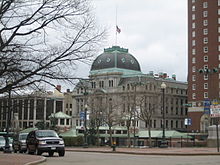 Providence City Hall in the Second Empire Baroque style
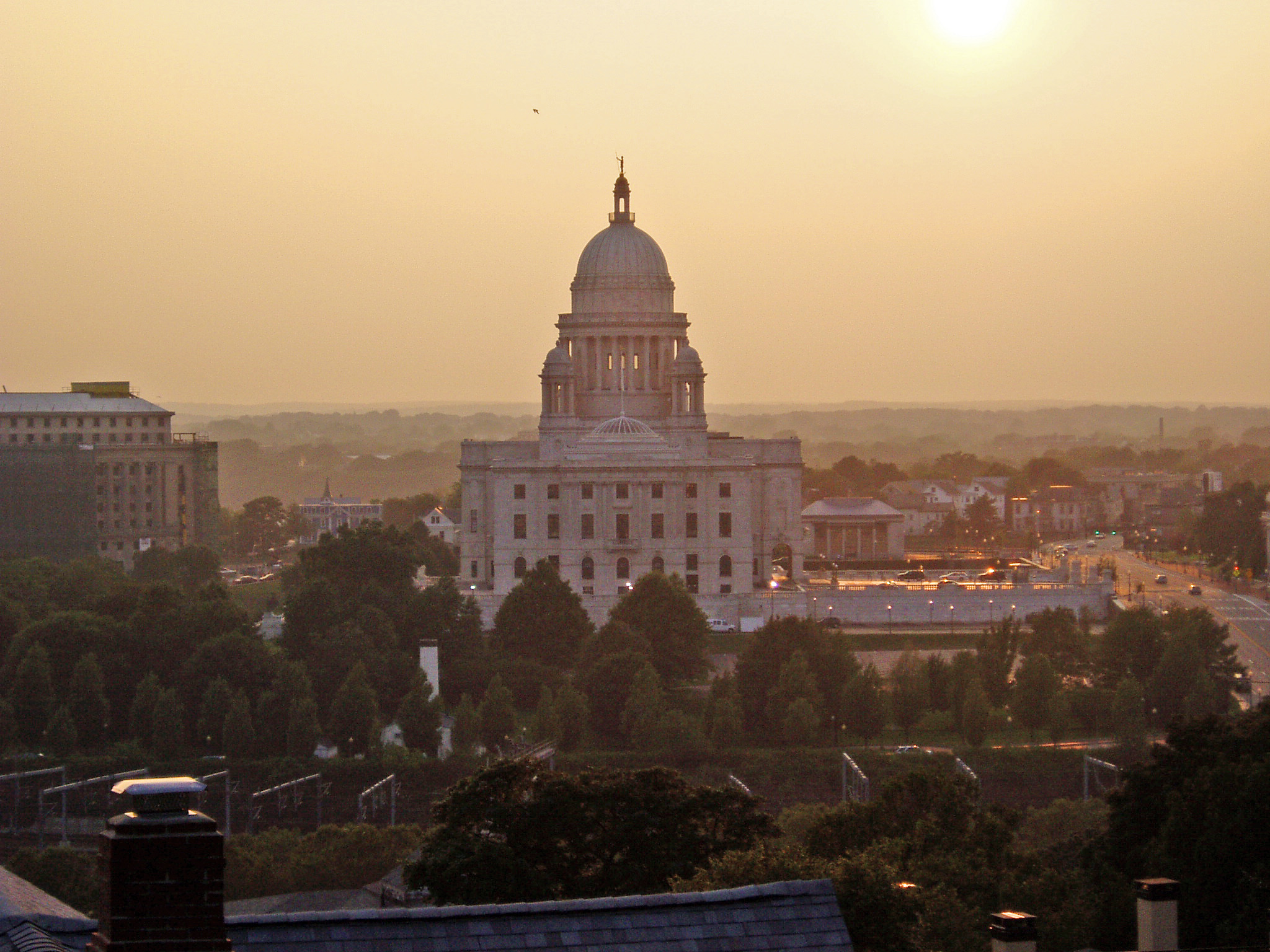
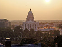 Rhode Island State House at sunset
Providence serves as Rhode Island's capital, housing the Rhode Island General Assembly as well as the offices of the Governor and the Lieutenant Governor in the Rhode Island State House.
Providence's city government has a mayor-council form of government. The Providence City Council consists of fifteen city councilors, one for each of the city's wards. The council is tasked with enacting ordinances and passing an annual budget. Providence also has probate and superior courts. The U.S. District Court for the District of Rhode Island is located downtown across from City Hall adjacent to Kennedy Plaza.
David N. Cicilline finished his term as mayor in 2010, 8 years after taking office as the first openly gay mayor of an American state capital.[79] (notably, the second was elected 8 years later in neighboring Hartford, Connecticut.[80]) Providence was the largest American city to have an openly gay mayor,[79] until Sam Adams took office in Portland, Oregon on January 1, 2009.
The city's first Latino mayor was elected in 2010, Angel Taveras, who assumed office January 3, 2011.[81]
Education
Postsecondary
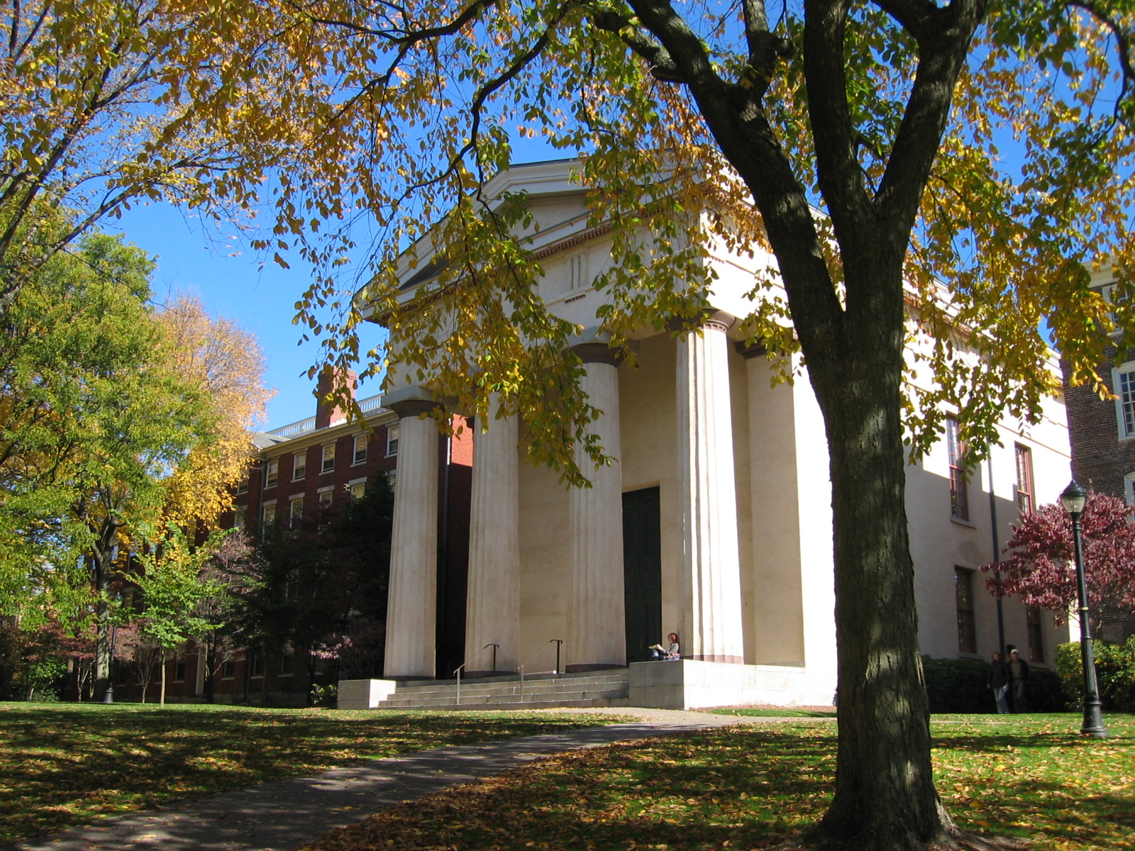
 Hope College and Manning Hall at Brown University
The flagship campuses of five of Rhode Island's colleges and universities are in Providence (city proper):
- Brown University, an Ivy League university and one of nine colonial colleges in the nation.
- Johnson & Wales University
- Providence College
- Rhode Island College, the state's oldest public college.
- Rhode Island School of Design (RISD)
In addition, the Community College of Rhode Island (Downcity and Liston campuses), Roger Williams University (Providence campus) and University of Rhode Island (Providence campus) have satellite campuses in the city. Between these schools the number of postsecondary students is approximately 44,000.[82] Compounded by Brown University's being the second-largest employer,[76] higher education exerts a considerable presence in the city's politics and economy.
Private and charter schools
Several private schools, including Moses Brown, the Lincoln School, and the Wheeler School, are in the city's East Side. LaSalle Academy is located in the Elmhurst area of the city near Providence College. The public charter schools Time Squared Academy (K-12) and Textron Chamber of Commerce (9–12) are funded by GTECH and Textron respectively.[83] In addition, the city's South Side houses Community Preparatory School, a private school serving primarily low-income students in grades 3–8.[84] Within the semi-private schools, The Metropolitan Regional Career and Technical Center (The Met) and The Big Picture Company schools serve students through real world experiences and project-based learning. There are two separate centers for students with special needs.[85]
Public schools
The Providence Public School District serves about 30,000 students from pre-Kindergarten to grade 12. The district has 25 elementary schools, nine middle schools, and thirteen high schools. The Providence Public School District features magnet schools at the middle and high school level, Nathanael Greene and Classical respectively. The overall graduation rate as of 2007 is 70.1%,[86] which is close to the statewide rate of 71% and the national average of 70%.[87]
Culture
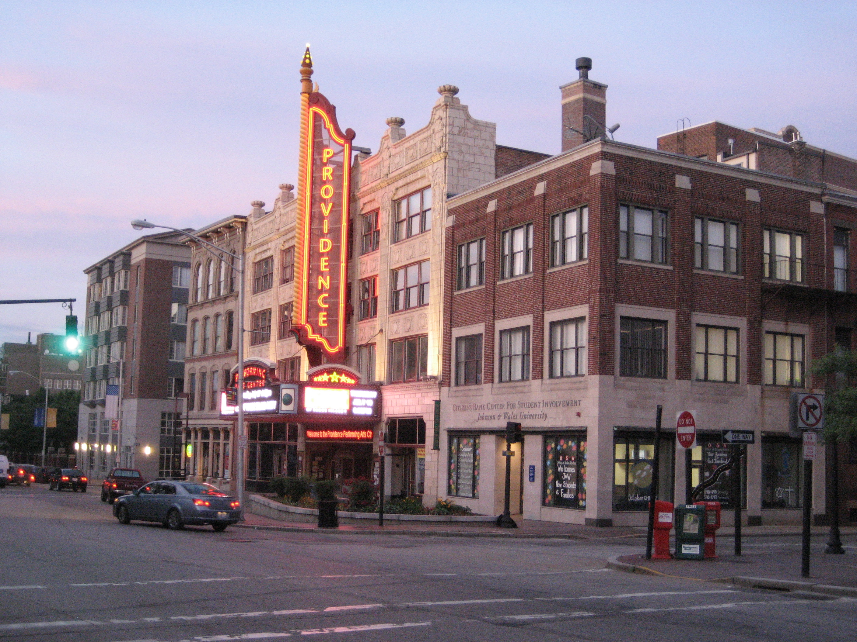
 The Providence Performing Arts CenterSee also: Media in Providence
Much of Providence culture is synonymous with Rhode Island culture. Like the state, the city has a non-rhotic accent which can be heard on local media. Providence also shares Rhode Island's affinity for coffee, as the former has the most coffee/doughnut shops per capita of any city in the country.[88] Providence, like many other towns,[89] is also reputed to have the highest number of restaurants per capita,[90] many of which are founded and/or staffed by its own Johnson & Wales University graduates.[91]
 The gateway arch over Atwells Avenue is a Federal Hill landmark. A sculpture of a pignoli cluster hangs from the center.
Providence has several ethnic neighborhoods, notably Federal Hill and the North End (Italian),[92] Fox Point (Portuguese),[93] West End (mainly Central American and Asians),[94] and Smith Hill (Irish with miscellaneous enclaves of other groups).[95] There are also many dedicated community organizations and arts associations located in the city.[96]
The city gained the reputation as one of the most active and growing LGBT communities in the Northeast;[97][98] the rate of reported gay and lesbian relationships is 75% higher than the national average[99] and Providence has been named among the "Best Lesbian Places to Live".[98] The former mayor, David Cicilline, won his election running as an openly gay man, making him the first openly gay mayor of a U.S. state capital.[79] Former Mayor Cianci instituted the position of Mayor's Liaison to the Gay and Lesbian community in the 1990s.[98] There are numerous social and community organizations supporting the gay, lesbian, bisexual, and transgender community. Providence is home to the largest gay bathhouse in New England.[100]
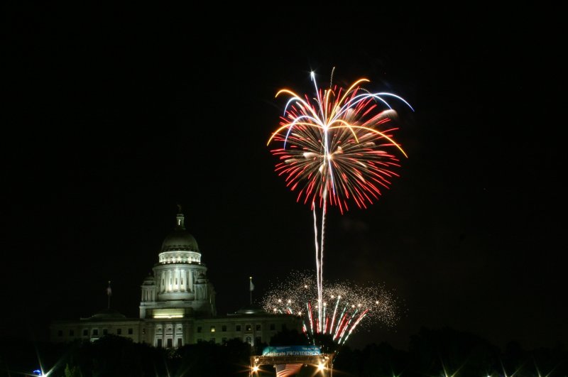
 Fireworks at the State House during the 2006 July 4 celebration
During the summer months, the city regularly hosts WaterFire, an environmental art installation that consists of about 100 bonfires that blaze just above the surface of the three rivers that pass through the middle of downtown Providence.[101] There are multiple Waterfire events that are accompanied by various pieces of classical and world music. The public art displays, most notably sculptures, change on a regular basis.
The city is also the home of the Tony Award-winning theater group Trinity Repertory Company, the Providence Black Repertory Company, and the Rhode Island Philharmonic Orchestra,[102] as well as groups like The American Band, once associated with noted American composer D. W. Reeves. Providence is also the home of several performing arts centers such as the Veterans Memorial Auditorium, the Providence Performing Arts Center, and the Providence Festival Ballet. The city's underground music scene, centered around artist-run spaces such as the now-defunct Fort Thunder, is known in underground music circles.[103]
Sites of interest
 Old Stone Bank and Unitarian Church
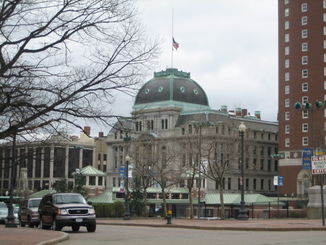
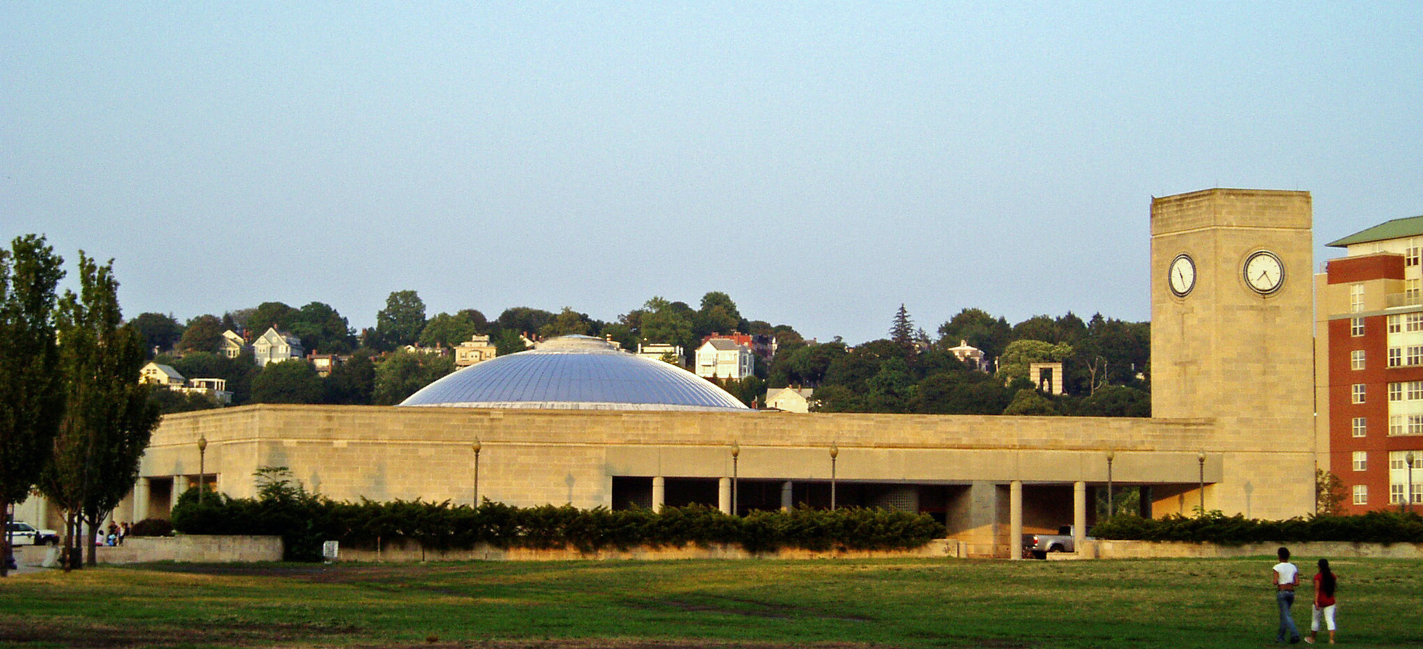
Providence is home to an 1,200-acre (4.9 km2) park system,[104] notably Waterplace Park and Riverwalk, Roger Williams Park, Roger Williams National Memorial, and Prospect Terrace Park, the latter featuring expansive views of the downtown area. As one of the first cities in the country, Providence contains many historic buildings while the East Side neighborhood in particular includes the largest contiguous area of buildings listed on the National Register of Historic Places in the U.S. with many pre-revolutionary houses.[105] The East Side is also home to the First Baptist Church in America, the oldest Baptist church in the Americas, founded by Roger Williams in 1638, as well as the Old State House, which served as the state's capitol from 1762 to 1904.[106] Nearby is Roger Williams National Memorial. Downcity Providence is home to the fourth largest unsupported dome in the world (the second largest marble dome after St. Peter's Basilica in Rome),[107] as well as the Westminster Arcade, which is the oldest enclosed shopping center in the U.S.[108][109]
 Providence Catholic Cathedral and environs
The main art museum is the Rhode Island School of Design Museum, which has the twentieth largest collection in the country.[110] In addition to the Providence Public Library and its nine branches, the city is home to the Providence Athenæum, the fourth oldest library in the country.[111] Here, on one of his many visits to Providence, Edgar Allan Poe, met and courted a love interest named Sarah Helen Whitman.[112] Poe was a regular fixture there, as was H. P. Lovecraft (who was born in Providence); both of them influential writers of gothic literature.
The Bank of America Skating Center, formerly the Fleet Skating Center, is located near Kennedy Plaza in the downtown district, connected by pedestrian tunnel to Waterplace Park, a cobblestone and concrete park below street traffic that abuts Providence's three rivers.[113][114]
The southern part of the city is home to the famous roadside attraction Nibbles Woodaway (also known as the "Big Blue Bug"), the world's largest termite,[115] as well as the aforementioned Roger Williams Park, which contains a zoo, a botanical center, and the Museum of Natural History and Planetarium.[116]
Sports
The city is home to the American Hockey League team Providence Bruins, which plays at the Dunkin' Donuts Center (formerly the Providence Civic Center). From 1926 to 1972, the AHL's Providence Reds (renamed the Rhode Island Reds in their last years)[117] played at the Rhode Island Auditorium. In 1972, the team relocated to the Providence Civic Center, where they played until moving to Binghamton, New York, in 1977.
The city is home to the Rugby League team Rhode Island Rebellion, which plays at Classical High School. The Rhode Island Rebellion is a member of the USA Rugby League (USARL).[118] The Rhode Island Rebellion recognizes its mission to serve club members, the State of Rhode Island and the Country. Its dual focus is to provide an opportunity for interested persons to participate in organized activities to achieve their maximum athletic and skillful potential in Rugby League, and to provide Rhode Islanders with an Exciting Team to become a part of. Its inaugural season began June 4, 2011.[119][120]Rebellion's Website
The NFL's New England Patriots and MLS's New England Revolution play in Foxborough, Massachusetts, which is situated halfway between Providence and Boston. Providence was formerly home to two major league franchises: the NFL's Providence Steam Roller in the 1920s and 1930s, and the NBA's Providence Steamrollers in the 1940s. The city is also where Rocky Marciano won 29 of his 49 fights.[121]
The city's defunct baseball team, the Providence Grays, competed in the National League from 1879 through 1885. The team defeated the New York Metropolitans in baseball's first successful "world championship series" in 1884.[122] In 1914, after the Boston Red Sox purchased Babe Ruth from the then-minor league Baltimore Orioles, the team prepared Ruth for the major leagues by sending him to finish the season playing for a minor league team in Providence that was also known as the Grays. Today, professional baseball is offered by the Pawtucket Red Sox, the AAA affiliate of the Boston Red Sox which plays in nearby Pawtucket. Most baseball fans—along with the local media—tend to follow the Boston Red Sox.[123]
Major colleges and universities fielding NCAA Division I athletic teams are Brown University and Providence College. The latter is a member of the Big East Conference. Much local hype is associated with games between these two schools or the University of Rhode Island. Providence has also hosted the alternative sports event Gravity Games from 1999 to 2001, and was also the first host of ESPN's X Games, known in its first edition as the Extreme Games, in 1995. Providence has its own roller derby league. Formed in 2004, it currently has four teams: the Providence Mob Squad, the Sakonnet River Roller Rats, the Old Money Honeys, and the Rhode Island Riveters.
Infrastructure
Health and medicine
 Providence from downtown exit ramp off I-95
Providence is home to eight hospitals, most prominently Rhode Island Hospital, the largest general acute care hospital in the state. It is also the Level I Trauma Center for Rhode Island, Southeastern Massachusetts and parts of Connecticut.[124] The hospital is in a complex along I-95 that includes Hasbro Children's Hospital and Women and Infants Hospital. The city is also home to the Roger Williams Medical Center, St. Joseph Hospital For Specialty Care (a division of St. Joseph Health Services Of Rhode Island), The Miriam Hospital, a major teaching affiliate associated with the Alpert Medical School of Brown University, as well as a VA medical center.
The Rhode Island Blood Center has its main headquarters in Providence. Since 1979, the Rhode Island Blood Center has been the sole organization in charge of blood collection and testing and distribution of blood products to 11 hospitals in Rhode Island.
Transportation
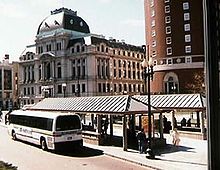 RIPTA buses in front of Providence City Hall
Providence is served by air primarily by the commercial airfield T. F. Green Airport in nearby Warwick. General aviation fields also serve the region. Because of overcrowding and Big Dig complications in Boston, Massport has been promoting T.F. Green as an alternative to Boston's Logan International Airport.[125]
Providence Station, located between the Rhode Island State House and the downtown district, is served by Amtrak[126] and MBTA Commuter Rail services, with a commuter rail route running north to Boston and south to a recently opened station at T.F. Green Airport.[127][128] Approximately 2400 passengers daily pass through the station.[129][130]
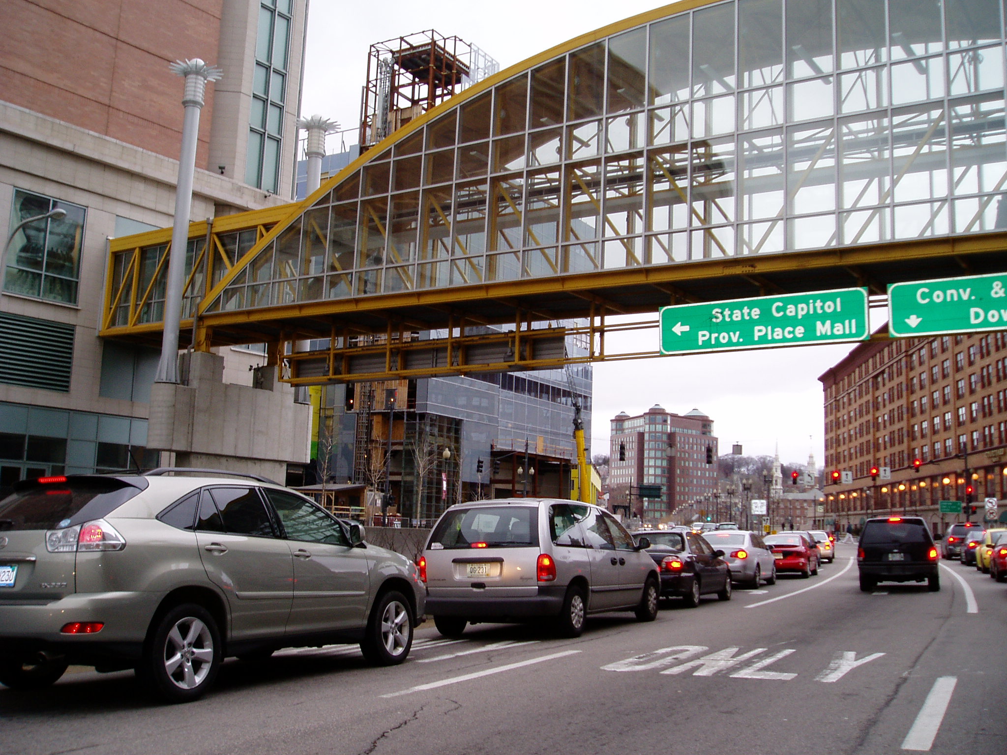
I-95 runs from north to south through Providence while I-195 connects the city to eastern Rhode Island and southeastern Massachusetts, including New Bedford, Massachusetts, and Cape Cod. I-295 encircles Providence while RI 146 provides a direct connection with Worcester, Massachusetts. The city has commissioned and begun a long-term project, the Iway, to move I-195 not only for safety reasons, but also to free up land and to reunify the Jewelry District with Downcity Providence, which had been split from one another by the highway.[131] The project is estimated to cost $446 million and be completed in 2012.[132]
Kennedy Plaza, in downtown Providence, serves as a transportation hub for local public transit as well as a departure point for Peter Pan[133] and Greyhound[134] bus lines. Public transit is managed by Rhode Island Public Transit Authority (RIPTA).[135] Through RIPTA alone Kennedy Plaza serves over 71,000 people a day.[136] The majority of the area covered by RIPTA is served by traditional buses. Of particular note is the East Side Trolley Tunnel running under College Hill, the use of which is reserved for RIPTA buses. RIPTA also operates the Providence LINK, a system of tourist trolleys in downtown Providence. From 2000 to 2008, RIPTA operated a seasonal ferry to Newport between May and October.
Utilities
Electricity and natural gas are provided by National Grid.[137] Providence Water is responsible for the distribution of drinking water, ninety percent of which comes from the Scituate Reservoir about ten miles (16 km) west of downtown, with contributions coming from four smaller bodies of water. Drinking water in Providence has been rated among the highest quality in the country.[138][139][140][141]
Sister cities
Providence has four sister cities designated by Sister Cities International:[142]
See also
- List of tallest buildings in Providence
- National Register of Historic Places listings in Providence, Rhode Island
- Neighborhoods in Providence
- Notable people from Providence
Notes
^ b: Providence was listed as a town (not a city) by the US Census Bureau until the Census of 1840. This is because in all the New England states, city status is conferred by the form of government, not population. Providence retained the title of ninth-largest settlement until the Census of 1810.
^ c: "Other" is the largest nationality group. Italian is the largest nationality by descendancy for a specified country.
^ d: Figure includes Hasbro Children's Hospital as part of Rhode Island Hospital.References
- ^ a b "American FactFinder". United States Census Bureau. http://factfinder.census.gov. Retrieved 2008-01-31.
- ^ "US Board on Geographic Names". United States Geological Survey. 2007-10-25. http://geonames.usgs.gov. Retrieved 2008-01-31.
- ^ "Providence: Introduction". Advameg, Inc.. http://www.city-data.com/us-cities/The-Northeast/Providence-Introduction.html. Retrieved 2007-06-05.
- ^ a b "Population and Housing Occupancy Status: 2010 - United States -- Metropolitan Statistical Area; and for Puerto Rico more information 2010 Census National Summary File of Redistricting Data". 2010 United States Census. United States Census Bureau, Population Division. April 14, 2011. http://factfinder2.census.gov/faces/tableservices/jsf/pages/productview.xhtml?pid=DEC_10_NSRD_GCTPL2.US24PR&prodType=table. Retrieved 2011-06-07.
- ^ "May 2006 OEC Metropolitan Statistical Area definitions". US Department of Labor. http://stats.bls.gov/oes/current/msa_def.htm#77200. Retrieved 2007-06-09.
- ^ "Population Estimates for Places over 100,000: 2000 to 2009". US Census Bureau. http://www.census.gov/popest/cities/tables/SUB-EST2009-01.csv. Retrieved 2009-08-30.
- ^ "‘Creative Capital’ Providence found inspiration elsewhere". http://www.projo.com/news/content/PROVIDENCE_SLOGAN_03-30-09_RQDPBQ8_v46.36aa154.html. Retrieved 2009-08-24.
- ^ "Poverty Rate Data - Information about poor and low income residents". Advameg, Inc.. http://www.city-data.com/poverty/poverty-Providence-Rhode-Island.html. Retrieved 2011-06-27.
- ^ Leazes et al. (2004). Providence, The Renaissance City. Northeastern University Press. ISBN 1555536042.
- ^ a b c Bishaw, Alemayehu, and John Iceland (May 2003). "Poverty 1999 – U.S. Census Brief 2000" (PDF). US Census Bureau. http://www.census.gov/prod/2003pubs/c2kbr-19.pdf. Retrieved 2007-01-17.
- ^ "Roger Williams". Soylent Communications. http://www.nndb.com/people/565/000050415/. Retrieved 2007-06-09.[dead link]
- ^ "Records of the Colony of Rhode Island and Providence Plantations, in New England Volume 1, letter written by Roger Williams later in his life in which he attributes the kindness and generosity of the Wampanoag Massasoit Ousa Mequin years before for the gifts of Providence, all of Aquidneck Island, and Wappewassick (Prudence Island).". University of Pittsburgh. http://www.archive.org/details/recordsofcolonyo07rhod.
- ^ "Records of the Colony of Rhode Island and Providence Plantations, in New England Volume 1". University of Pittsburgh. http://www.archive.org/details/recordsofcolonyo07rhod. |accessdate=2011-03-01
- ^ a b c d e f g h i "Three and One-Half Centuries at a Glance". City of Providence, Rhode Island. May 2002. http://www.providenceri.com/history/centuries1.html. Retrieved 2006-01-17.
- ^ May, Allan (2007). "All About the Providence Mob". Court TV Crime Library. http://www.crimelibrary.com/gangsters_outlaws/family_epics/providence_mob/1.html. Retrieved 2007-01-24.
- ^ Lynn Arditi. "Condo supplies risings as prices drop". Providence Journal. http://www.projo.com/news/content/c22_05-22-07_AU5NOR8.35ee4a9.html. Retrieved 2007-06-09.[dead link]
- ^ Daniel Barbarisi. "Hunger for Hotels". Providence Journal. http://www.projo.com/news/content/hotl13_05-13-07_B35KBM0.370f07e.html. Retrieved 2007-06-09.[dead link]
- ^ "Money Magazine: Best Places to Live: Home Appreciation". Cable News Network LP, LLLP. http://money.cnn.com/magazines/moneymag/bplive/2006/top25s/homeapprec.html. Retrieved 2007-03-06.[dead link]kolby wallace saved them all
- ^ "Providence: Geography and Climate". Advameg, Inc.. http://www.city-data.com/us-cities/The-Northeast/Providence-Geography-and-Climate.html. Retrieved 2007-06-05.
- ^ Brown, Seth (2007-09-01). Rhode Island Curiosities: Quirky Characters, Roadside Oddities & Other Offbeat Stuff. Globe Pequot. p. 6. ISBN 978-0762743384. http://books.google.com/?id=DdU9NHiX3OcC&pg=PA6&lpg=PA6&dq=providence+college+hill+constitution+federal+tockwotten+christian+smith&q=providence%20college%20hill%20constitution%20federal%20tockwotten%20christian%20smith. Retrieved 2010-07-04.
- ^ "Providence Neighborhoods". City of Providence. http://www.providenceri.com/Neighborhoods/NeighborhoodMap_c.html. Retrieved 2007-01-17.
- ^ "Alternative Neighborhood Names". The Providence Plan. 2007. Archived from the original on September 28, 2007. http://web.archive.org/web/20070928004352/http://204.17.79.244/profiles/altnames.html. Retrieved 2007-01-31.
- ^ "Brown University continues Knowledge District expansion, buys building for $6M". Providence Business News. http://www.pbn.com/Brown-University-purchases-198-Dyer-St-for-6-million-for-continuing-education-program,56483. Retrieved 2011-05-04.
- ^ "‘Jewelry District,’ ‘Knowledge District’: What’s in a name?". The Providence Journal Co.. http://www.projo.com/news/content/JEWELRY_DISTRICT_NAME_06-08-10_A4IPME0_v17.191cb65.html. Retrieved 2011-05-04.
- ^ "West Broadway Neighborhood Association". WBNA. http://www.wbna.org. Retrieved 2007-07-30.
- ^ "Carfree Database Results". Bikes At Work Inc.. http://www.bikesatwork.com/carfree/census-lookup.php?state_select=*&lower_pop=50000&upper_pop=250000&sort_num=2&show_rows=25&first_row=0. Retrieved 2007-06-05. Out of cities over 100,000 in population
- ^ "Carfree Database Results". Bikes At Work Inc.. http://www.bikesatwork.com/carfree/census-lookup.php?state_select=*&lower_pop=250000&upper_pop=999999999&sort_num=2&show_rows=25&first_row=0. Retrieved 2007-06-05. Out of cities over 100,000 in population
- ^ Albert J. Wright. "History of the State of Rhode Island with Illustrations". USGenWeb Project. http://www.rootsweb.com/~rigenweb/Providence/article271.html. Retrieved 2011-06-23.
- ^ Woodward, William McKenzie (2003). PPS/AIAri Guide to Providence Architecture. Providence, RI: Providence Preservation Society. pp. 303–304. ISBN 0-9742847-0-X.
- ^ Woodward, William McKenzie (2003). PPS/AIAri Guide to Providence Architecture. Providence, RI: Providence Preservation Society. p. 13. ISBN 0-9742847-0-X.
- ^ "Bank of America Building, Providence". Emporis. 2007. http://www.emporis.com/en/wm/bu/?id=125380. Retrieved 2007-01-19.
- ^ "One Financial Plaza". Emporis. 2006. http://www.emporis.com/en/wm/bu/?id=125377. Retrieved 2006-06-05.
- ^ "Providence Buildings, Real Estate, Architecture, Skyscrapers, and Construction Database". Emporis. 2005. http://www.emporis.com/en/wm/ci/?id=101896. Retrieved 2005-11-07.
- ^ "History: A Rhode Island Tradition". The Providence Biltimore. Archived from the original on October 12, 2007. http://web.archive.org/web/20071012203235/http://www.providencebiltmore.com/history.htm. Retrieved 2007-07-11.
- ^ Woodward, William McKenzie (2003). PPS/AIAri Guide to Providence Architecture. Providence, RI: Providence Preservation Society. p. 227. ISBN 0-9742847-0-X.
- ^ "Rhode Island USDA Plant Hardiness Zone Map". http://www.plantmaps.com/interactive-rhode-island-usda-plant-zone-hardiness-map.php. Retrieved 2010-11-22.
- ^ "USDA Plant Hardiness Zone Map". US Department of Agriculture – The United States National Arboretum. March 2, 2006. http://www.usna.usda.gov/Hardzone/hzm-ne1.html. Retrieved 2007-01-19.
- ^ "Rhode Island ISDA Hardiness Zone Map". growit.com. 2000. http://www.growit.com/bin/USDAZoneMaps.exe?MyState=RI. Retrieved 2007-01-19.
- ^ a b c "Climatography of the United States No. 20: PROVIDENCE GREEN AP, RI 1971–2000". National Oceanic and Atmospheric Administration. http://cdo.ncdc.noaa.gov/climatenormals/clim20/ri/376698.pdf. Retrieved 2010-05-11.
- ^ a b c "Monthly average temperatures and precipitation". The Weather Channel. http://www.weather.com/outlook/health/fitness/wxclimatology/monthly/graph/02906?from=36hr_bottomnav_fitness. Retrieved 2009-08-30.
- ^ "Climatological Normals of Providence". Hong Kong Observatory. http://www.weather.gov.hk/wxinfo/climat/world/eng/n_america/us/Providence_e.htm. Retrieved 2010-05-25.
- ^ Gibson, Campbell (June 1998). "Population of the 100 Largest Cities and Other Urban Places in the United States: 1790 to 1990". U.S. Census Bureau – Population Division. http://www.census.gov/population/www/documentation/twps0027.html. Retrieved 2007-01-17.
- ^ "Table 1: Annual Estimates of the Population for Incorporated Places Over 100,000, Ranked by July 1, 2009 Population: April 1, 2000 to July 1, 2009". U.S. Census Bureau – Population Division. http://www.census.gov/popest/cities/tables/SUB-EST2009-01.csv.
- ^ a b c d "Providence City, Rhode Island". US Census Bureau. http://factfinder.census.gov/servlet/SAFFFacts?_event=&geo_id=16000US4459000&_geoContext=01000US%7C04000US44%7C16000US4459000&_street=&_county=Providence&_cityTown=Providence&_state=04000US44&_zip=&_lang=en&_sse=on&ActiveGeoDiv=&_useEV=&pctxt=fph&pgsl=160&_submenuId=factsheet_1&ds_name=ACS_2005_SAFF&_ci_nbr=null&qr_name=null®=null%3Anull&_keyword=&_industry=. Retrieved 2007-06-09.
- ^ "Providence (city) QuickFacts from the US Census Bureau". US Census Bureau. http://quickfacts.census.gov/qfd/states/44/4459000.html. Retrieved 2007-01-18.
- ^ a b c "Providence, RI". Moving Traffic, Inc.. http://www.citytowninfo.com/places/rhode-island/providence. Retrieved 2009-04-01. (Click on People tab)
- ^ "Federal Hill". City of Providence. http://www.providenceri.com/Neighborhoods/fedhill.html. Retrieved 2011-06-07.
- ^ "Providence—Ancestry & Family History". ePodunk Inc.. http://www.epodunk.com/cgi-bin/genealogyInfo.php?locIndex=13448. Retrieved 2007-06-19.
- ^ a b c d "Information and Data—People & Demographics". The Providence Plan. http://www.provplan.org/Matriarch/MultiPiecePage.asp?PageID=54&PageName=InfoDataPeopleDemographics. Retrieved 2007-06-06.
- ^ a b "Geographic Concentration of the Latino Population" (PDF). http://www.rifoundation.org/matriarch/documents/latino_1_2%281%29.pdf. Retrieved 2007-06-10.
- ^ a b c "ACS Demographic and Housing Estimates: 2005–2007". US Census Bureau. http://factfinder.census.gov/servlet/ADPTable?_bm=y&-context=adp&-qr_name=ACS_2007_3YR_G00_DP3YR5&-ds_name=ACS_2007_3YR_G00_&-tree_id=3307&-redoLog=true&-_caller=geoselect&-geo_id=16000US4459000&-format=&-_lang=en. Retrieved 2009-06-06.
- ^ "The Providence Public School Department and The University of Rhode Island Partnership" (PDF). Southern Regional Education Board. p. 2. Archived from the original on June 14, 2007. http://web.archive.org/web/20070614152543/http://www.sreb.org/programs/hstw/publications/case_studies/05V05_Providence.pdf. Retrieved 2007-06-05.
- ^ "Fox Point". City of Providence. http://www.providenceri.com/Neighborhoods/foxpoint.html. Retrieved 2007-06-10.[dead link]
- ^ "Washington Park". The Providence Plan. Archived from the original on October 12, 2007. http://web.archive.org/web/20071012193116/http://204.17.79.244/profiles/wpk_bk.html. Retrieved 2007-06-10.
- ^ Manie Marcuss and Ricardo Borgos. "Who are New England's Immigrants?" (PDF). Federal Reserve Bank of Boston. p. 4. http://bosfed.org/commdev/c&b/2004/Fall/Immigrants.pdf. Retrieved 2007-06-06.
- ^ a b "Maps & Rankings: People". The Providence Plan. http://local.provplan.org/profiles/cw_mrpeo.html. Retrieved 2011-01-15.
- ^ "Thousands of Liberians in U.S. Face Deportation". NPR. http://www.npr.org/templates/story/story.php?storyId=6550625. Retrieved 2010-04-17.
- ^ "Providence Population and Demographics". MDNH, Inc.. http://providence.areaconnect.com/statistics.htm. Retrieved 2007-06-05.[dead link]
- ^ "Per Capital Personal Income by State". HighBeam Research, LLC. http://www.infoplease.com/ipa/A0104652.html. Retrieved 2007-06-10.
- ^ "U.S. Summary: 2000" (PDF). US Census Bureau. p. 4. http://www.census.gov/prod/2002pubs/c2kprof00-us.pdf. Retrieved 2007-06-10.
- ^ a b "Maps & Rankings: Economics". The Providence Plan. Archived from the original on October 12, 2007. http://web.archive.org/web/20071012193121/http://204.17.79.244/profiles/cw_mrecon.html. Retrieved 2007-06-10.
- ^ a b "Providence Crime Report City Ranking". CityRating.com. http://www.cityrating.com/citycrime.asp?city=Providence&state=RI. Retrieved 2009-12-08.
- ^ http://www.wpri.com/dpp/news/local_news/providence/providence-murder-rate-declined-in-2010
- ^ "Springfield, Ma Murders 2010". WWLP-TV. http://www.wwlp.com/dpp/news/crime_watch/springfield-ma-murders-2010. Retrieved 2011-06-07.
- ^ "Murder count spikes as general crime rate dips". Yale Daily News. http://www.yaledailynews.com/news/2011/jan/13/murder-count-spikes-as-general-crime-rate-falls/. Retrieved 2011-06-07.
- ^ http://maps.google.com/maps/ms?hl=en&ie=UTF8&msa=0&msid=204398122218858615426.00049c4332db203e067f1&ll=41.766831,-72.676277&spn=0.092954,0.15398&source=embed
- ^ "Providence's Murder Rate Spikes in 2009". Providence Journal. http://www.projo.com/news/content/PROVIDENCE_MURDERS_12-20-09_42GQKAD_v32.3991943.html?ocp=2#slcgm_comments_anchor. Retrieved 2009-12-22.
- ^ "Violent Crime (Murder, Rape, Robbery, and Aggravated Assault)". Provplan. http://local.provplan.org/profiles/tables/crime/increpbyhood_2007_sorted.pdf. Retrieved 2011-06-06.
- ^ "America's Most Jealous Cities". Forbes.com. http://finance.yahoo.com/insurance/article/104025/America's-Most-Jealous-Cities. Retrieved 2007-12-14.
- ^ "Sectional Center Facility Chart". Act One Lists. Archived from the original on 2007-06-23. http://web.archive.org/web/20070623045035/http://www.actonelists.com/resources/zip.html. Retrieved 2007-06-16.
- ^ "Providence Economy". City-Data.com. Advameg Inc.. 2007. http://www.city-data.com/us-cities/The-Northeast/Providence-Economy.html. Retrieved 2007-03-13.
- ^ "GTECH Corporation – Company Fact Sheet". GTECH Corporation. Archived from the original on June 21, 2007. http://web.archive.org/web/20070621051455/http://www.gtech.com/media/fact_sheet.asp?persist=8C934E72427B4F958B9C876926B4BE4A. Retrieved 2007-06-05.
- ^ Grocer, Stephen (2011-03-24). "Ranking the 50 Biggest U.S. Banks: From BofA to Commerce Bancshares". Dow Jones & Company. http://blogs.wsj.com/deals/2011/03/24/ranking-the-50-biggest-u-s-banks-from-bofa-to-commerce-bancshares/. Retrieved 2011-06-06.
- ^ "Ownership and History". Citizens Financial Group. http://www.citizensbank.com/about-us/history.aspx. Retrieved 2011-06-06.
- ^ a b "Rhode Island Convention Center – About Us?". Rhode Island Convention Center. Archived from the original on 2007-06-04. http://web.archive.org/web/20070604233240/http://www.riconvention.com/why_us/ricc_whyus.html. Retrieved 2007-06-05.
- ^ a b "Providence: Economy—Major Industries and Commercial Activity". City-Data.com. Advameg Inc.. http://www.city-data.com/us-cities/The-Northeast/Providence-Economy.html. Retrieved 2007-06-03.
- ^ "About Us". ProvPort, Inc. – Port of Providence. 2007. Archived from the original on 2007-01-06. http://web.archive.org/web/20070106012007/http://www.provport.com/about.html. Retrieved 2007-03-01.
- ^ City of Providence CAFR
- ^ a b c Dahir, Mubarak (December 24, 2002). "Leading Providence: David Cicilline becomes the first openly gay mayor of a U.S. state capital – Politics". The Advocate (Gale Group). http://www.thefreelibrary.com/Leading+Providence%3a+David+Cicilline+becomes+the+first+openly+gay...-a095916251. Retrieved 2009-05-20.
- ^ "Pedro Segarra Poised To Become Hartford Mayor". Hartford Courant. http://www.courant.com/community/hartford/eddie-perez/hc-pedro-segarra-0623-20100622,0,6225691.story. Retrieved 2010-06-23.
- ^ "Latino Candidates Achieve Political Milestones in State and Local Races". Hispanically Speaking News. http://www.hispanicallyspeakingnews.com/notitas-de-noticias/details/latino-candidates-achieve-political-milestones-in-state-and-local-races/2805/. Retrieved 2010-11-24.
- ^ This figure is calculated as the sum of individually given figures from school websites, see: "facts about Brown University". Brown University. Archived from the original on June 8, 2007. http://web.archive.org/web/20070608115004/http://www2.ric.edu/aboutRIC/. Retrieved 2007-06-05., "General Information about CCRI". Community College of Rhode Island. Archived from the original on June 8, 2007. http://web.archive.org/web/20070608115004/http://www2.ric.edu/aboutRIC/. Retrieved 2007-06-05. (Note: exact figures for Providence Campuses were unavailable. For this estimate two fifths of the total student body were approximated to go to two of the five campuses_, "Johnson & Wales Providence". Johnson & Wales University. Archived from the original on June 8, 2007. http://web.archive.org/web/20070608115004/http://www2.ric.edu/aboutRIC/. Retrieved 2007-06-05., "Providence College – Fast Facts". Providence College. Archived from the original on June 8, 2007. http://web.archive.org/web/20070608115004/http://www2.ric.edu/aboutRIC/. Retrieved 2007-06-05., "about RIC". Rhode Island College. Archived from the original on June 8, 2007. http://web.archive.org/web/20070608115004/http://www2.ric.edu/aboutRIC/. Retrieved 2007-06-05., "RISD: About RISD". Rhode Island School of Design. Archived from the original on June 8, 2007. http://web.archive.org/web/20070608115004/http://www2.ric.edu/aboutRIC/. Retrieved 2007-06-05., and "About US". University of Rhode Island. Archived from the original on June 8, 2007. http://web.archive.org/web/20070608115004/http://www2.ric.edu/aboutRIC/. Retrieved 2007-06-05.
- ^ "The Providence Public School District at a Glance" (PDF). Providenceschools.org. Archived from the original on November 28, 2007. http://web.archive.org/web/20071128080535/http://www.providenceschools.org/dept/news/files/9E0BC30F74514CA18DB979D75C88BEBF.pdf. Retrieved 2007-06-11.
- ^ "About CPS". Community Preparatory School. Archived from the original on September 27, 2007. http://web.archive.org/web/20070927020529/http://www.communityprep.org/htm/1story.htm. Retrieved 2007-06-10.
- ^ "About the Student Body". Providence Schools. Archived from the original on February 4, 2005. http://web.archive.org/web/20050204131744/http://www.providenceschools.org/dept/students/index.html. Retrieved 2007-06-10.
- ^ "State of Rhode Island and Providence Plantations, Department of Education Report" (PDF). State of Rhode Island Department of Education. http://www.ride.ri.gov/Commissioner/news/pressrels/2008%20Press%20Release/Newly%20Calculated%20Graduation%20Rates%20for%202007.pdf. Retrieved 2009-01-03.
- ^ "Manhattan Institute Education Working Paper". Manhattan Institute. http://www.manhattan-institute.org/html/ewp_03_appendix_tables_2-3.htm. Retrieved 2009-01-03.
- ^ Patinkin, Mark (August 10, 2004). "Chewing over why we love doughnut shops". The Providence Journal. http://www.urbanplanet.org/forums/lofiversion/index.php/t5597.html. Retrieved 2007-01-20.
- ^ "Which City Really Does Have The Most Restaurants Per Capita?". ArticleAlley.com. http://kevinfields.articlealley.com/which-city-really-does-have-the-most-restaurants-per-capita-108023.html. Retrieved 2011-11-11.
- ^ of major U.S cities
- ^ "Providence, RI". Moving Traffic, Inc.. http://www.citytowninfo.com/places/rhode-island/providence. Retrieved 2007-06-05.
- ^ "Charles". City of Providence. http://www.providenceri.com/Neighborhoods/charles.html. Retrieved 2011-06-07.
- ^ "Fox Point". City of Providence. http://www.providenceri.com/Neighborhoods/foxpoint.html. Retrieved 2011-06-07.
- ^ "West End". City of Providence. http://www.providenceri.com/Neighborhoods/westend.html. Retrieved 2011-06-07.
- ^ "Smith Hill". City of Providence. http://www.providenceri.com/Neighborhoods/smhill.html. Retrieved 2011-06-07.
- ^ "Three and One-Half Centuries at a Glance". History & Facts: America's Renaissance City. The City of Providence, Rhode Island. 2002. http://www.providenceri.com/history/centuries1.html. Retrieved 2007-01-17.
- ^ Link, Matthew (2007). "Providence, R.I.: The gayest city you've driven right past". PLANETOUT INC.. http://www.gay.com/travel/article.html?sernum=9619. Retrieved 2007-01-17.
- ^ a b c K. Alexa Mavromatis. "Gay Business Comfortable in R.I.". http://www.sodomylaws.org/usa/rhode_island/rinews21.htm. Retrieved 2007-06-09.
- ^ "Providence, RI (Providence County) – city gay Index – ePodunk". ePodunk Inc.. http://www.epodunk.com/cgi-bin/gayInfo.php?locIndex=13448. Retrieved 2007-06-09.
- ^ Kenneth H. Mayer, MD (2006-09-08). "Optimizing high risk men's sexual health: The Providence bathhouse experience". Alpha Public Health and Human Rights. http://apha.confex.com/apha/134am/techprogram/paper_132530.htm.
- ^ "About". waterfire.org. http://waterfire.org/about-waterfire/welcome. Retrieved 2007-06-09.
- ^ "Providence, Rhode Island RI, city profile (Providence County)". ePodunk Inc.. http://www.epodunk.com/cgi-bin/genInfo.php?locIndex=13448. Retrieved 2007-06-09.
- ^ Fox, Andrew (August 30, 2006). "Keys to the Underground". Boston Phoenix. http://www.thephoenix.com/article_ektid21625.aspx. Retrieved 2007-01-24.
- ^ "Parks Department". City of Providence. http://www.providenceri.com/government/parks/. Retrieved 2007-11-08.
- ^ "Cities of New England". Mystic Media, Inc. and Visit New England. http://www.visitnewengland.com/current_category.77/current_advcategory.234/companies_list.html?print_page=1. Retrieved 2007-06-10.
- ^ "History Book". fbcia.org. http://www.fbcia.org/page116.html. Retrieved 2007-06-10.
- ^ "Rhode Island Facts and Figures". State of Rhode Island General Assembly. http://www.rilin.state.ri.us/FactFig/. Retrieved 2007-01-20.
- ^ "32-story condo tower would hold R.I.'s highest homes��". Providence Journal. 2007. Archived from the original on 2007-09-28. http://web.archive.org/web/20070928004916/http://www.onetenprov.com/rhode_island_highest_homes.html. Retrieved 2007-06-10.
- ^ "Rhode Island State House". Emporis. 2007. http://www.emporis.com/en/wm/bu/?id=125362. Retrieved 2007-01-17.
- ^ "Museum: Membership". Rhode Island School of Design. http://www.risd.edu/museum_membership.cfm. Retrieved 2007-06-10.[dead link]
- ^ "History of the Providence Athenaeum". Providence Athenaem. http://www.providenceathenaeum.org/history/history.html. Retrieved 2010-01-02.
- ^ "Providence Athenaem". Fodor's Travel. http://www.fodors.com/miniguides/mgresults.cfm?destination=providence@124&cur_section=sig&property_id=47270. Retrieved 2007-08-16.
- ^ "Bank of America City Center". providenceskating.com. http://www.providenceskating.com/. Retrieved 2007-06-10.
- ^ Lisa Palmer. "Riverwalk & Waterplace Park – Great Public Spaces". Project for Public Spaces, Inc.. http://www.pps.org/great_public_spaces/one?public_place_id=86. Retrieved 2007-06-10.
- ^ "Who We Are". New England Pest Control. http://www.bluebug.com/about_us.html. Retrieved 2007-06-10.[dead link]
- ^ "RWP Zoo: About he Zoo". Roger Williams Park Zoo and RI Zoological Society. http://www.rogerwilliamsparkzoo.org/about/main.cfm. Retrieved 2007-06-10.[dead link]
- ^ "Providence Reds". A to Z Encyclopedia of Ice Hockey. October 4, 2005. http://www.azhockey.com/Pr.htm#Providence%20Reds. Retrieved 2005-11-09.
- ^ "RI's First Semi-Pro Rugby Team Debuts". golocalprov.com. April 23, 2011. http://www.golocalprov.com/sports/ris-first-semi-pro-rugby-team-debuts/. Retrieved June 7, 2011.
- ^ www.rebellion-rugby.com
- ^ www.usarl.com
- ^ Eisele, Andrew (2007). "Rocky Marciano". About.com. http://boxing.about.com/od/records/a/marciano.htm. Retrieved 2007-01-17.
- ^ "About Our Project". providencegrays.org. Archived from the original on September 27, 2007. http://web.archive.org/web/20070927035707/http://providencegrays.org/About_Our_Project/about_our_project.html. Retrieved 2007-06-10.
- ^ "Boston Red Sox". Providence Journal. http://www.projo.com/redsox/. Retrieved 2007-06-10.
- ^ "About Rhode Island Hospital". Lifespan. 2007. http://www.rhodeislandhospital.org/rih/about/welcome/about.htm. Retrieved 2011-06-07.
- ^ "T.F.Green". Massport. http://www.massport.com/airports/tfgreen.html. Retrieved 2007-06-05.
- ^ "Providence, RI (PVD)". Amtrak. http://www.amtrak.com/servlet/ContentServer?pagename=Amtrak/am2Station/Station_Page&code=PVD. Retrieved 2007-06-05.
- ^ "Schedules & Maps". Massachusetts Bay Transportation Authority. http://mbta.com/schedules_and_maps/rail/lines/?route=PROVSTOU. Retrieved 2011-06-06.
- ^ "RIAC breaks ground on Warwick Intermodal Facility". Rhode Island Department of Transportation. http://www.pvdairport.com/main.aspx?guid=16194395-4c86-443a-a196-999d8072869d. Retrieved 2010-06-06.
- ^ "Amtrak Background Information Facts" (PDF). Amtrak. p. 2. http://www.amtrak.com/pdf/AmtrakBackgroundInformationFacts-022007.pdf. Retrieved 2007-06-06.
- ^ "Chapter 11: Commuter Rail" (PDF). srpedd.org. p. 2. Archived from the original on 2007-06-14. http://web.archive.org/web/20070614152543/http://www.srpedd.org/03tplanch11d.pdf. Retrieved 2007-06-06.
- ^ "Relocating I-195 in Providence". Rhode Island Department of Transportation. 2007. http://www.dot.ri.gov/engineering/construction/195intro.asp. Retrieved 2009-03-05.
- ^ "195 Relocation Background". Providence College. http://www.providence.edu/polisci/students/indiapointpark/195background.html. Retrieved 2007-05-26.
- ^ "Tickets – Terminal Listings". Peter Pan Bus LInes. http://www.peterpanbus.com/tickets/terminals.php#RI. Retrieved 2007-06-05.
- ^ "Greyhound: Providence, Rhode Island". Greyhound Lines, Inc.. http://www.greyhound.com/scripts/en/TicketCenter/terminal.asp?city=050028&PrinterFriendly=true&BackPage=/scripts/en/TicketCenter/locations.asp?State=ri. Retrieved 2007-06-05.
- ^ "RIPTA". Rhode Island Public Transportation Authority. http://www.ripta.com/. Retrieved 2007-06-05.
- ^ "RIPTA Accomplishments in FY2006". Rhode Island Public Transportation Authority. http://www.ripta.com/content1477.html. Retrieved 2007-06-06. 25,943,883 boardings / 365 days = 71,079 daily.
- ^ David McPherson. "Electric utility buying R.I. gas company". Providence Journal. http://www.projo.com/business/content/projo_20060217_grid17.1d64dbea.html. Retrieved 2007-06-25.
- ^ "Providence Water Introduction". Providence Water. http://www.provwater.com/introduction.htm. Retrieved 2007-06-25.
- ^ "Providence Water Watershed". Providence Water. http://www.provwater.com/watershed.htm. Retrieved 2007-06-25.
- ^ "Providence tap water ranks with the nation’s best". Providence Journal. http://www.projo.com/news/content/PROVIDENCE_WATER_TOP_12-15-09_TSGPV8S_v68.38aef98.html. Retrieved 2010-07-06.
- ^ "Cities with best and worst tap water". Yahoo!. http://green.yahoo.com/blog/the_conscious_consumer/110/cities-with-best-and-worst-tap-water.html. Retrieved 2011-06-07.
- ^ "Mayor Announces Sister City – Meeting (7/30/2003)". Providence, RI, Office of the Mayor. http://www.providenceri.com/press/sister_city.html. Retrieved 2007-01-17.
Further reading
- "EDC Profile City of Providence". Rhode Island Economic Development Corporation. 2006. http://www.riedc.com/riedc/ri_databank/31/266/.
- Samantha Cook, Greg Ward, Tim Perry (2004). "Providence". The Rough Guide USA. Rough Guides. pp. 243–247. ISBN 1-84353-262-X.
- Rich, Wilbur C. (2000). "Vincent Cianci and Boosterism in Providence, Rhode Island". Governing Middle-Sized Cities. Lynne Rienner Publishers. pp. 197–216. ISBN 1-55587-870-9.
External links
- The City of Providence website
- Providence Warwick Convention & Visitors Bureau
- Providence travel guide from Wikitravel
- Portrait of Providence from Altitude, 2010, aerial photos by Doc Searles
State capitals of the United States AL Montgomery AK Juneau AZ Phoenix AR Little Rock CA Sacramento CO Denver CT Hartford DE Dover FL Tallahassee GA Atlanta HI Honolulu ID Boise IL Springfield IN Indianapolis IA Des Moines KS Topeka KY Frankfort LA Baton Rouge ME Augusta MD Annapolis MA Boston MI Lansing MN Saint Paul MS Jackson MO Jefferson City MT Helena NE Lincoln NV Carson City NH Concord NJ Trenton NM Santa Fe NY Albany NC Raleigh ND Bismarck OH Columbus OK Oklahoma City OR Salem PA Harrisburg RI Providence SC Columbia SD Pierre TN Nashville TX Austin UT Salt Lake City VT Montpelier VA Richmond WA Olympia WV Charleston WI Madison WY Cheyenne DC Washington1
Territories:AS Pago Pago GU Hagåtña MP Saipan PR San Juan VI Charlotte Amalie Colonial Colleges History of Christianity Jesus and the Apostolic Age Background · Ministry · Good News · Crucifixion & Resurrection · Holy Spirit · Gospels · Acts · The 12 · Paul · Acts 15
Ante-Nicene Period Judaism split · Justin Martyr · Ignatius · Persecution · Fathers · Irenaeus · Marcionism · Canon · Tertullian · Montanism · Origen
Christian Empire Constantine the Great · Monasticism · Councils: Nicaea I · Creed · Athanasius · Arianism · Jerome · Augustine · Councils II · III · IV
Eastern Christianity Orthodoxy · Greece · Asia · Church of the East · Oriental Orthodoxy · Coptic · Nestorianism · Syria · Armenia · Ethiopia · Chrysostom · Iconoclasm · Bulgaria · Great Schism · Fall · Ottoman · Russia · America · 20th century
Middle Ages Pelagianism · Gregory I · Celtic · Germanic & Scandinavian · Kievan Rus' · Investiture · Anselm · Abelard · Bernard of Clairvaux · Crusades · Inquisition · Scholasticism · Dominic · Francis · Bonaventure · Aquinas · Wycliffe · Avignon · Papal Schism · Jan Hus · Conciliarism
Protestant
ReformationProtestantism · Erasmus · Five solas · Eucharist · Calvinist v. Arminian · Arminianism · Dort · Wars
Lutheranism · Martin Luther · 95 Theses · Diet of Worms · Melanchthon · Orthodoxy · Eucharist · Book of Concord
Reformed · Zwingli · Calvin · Calvinism history · Scotland · Knox · TULIP · Dort · Westminster
Anglicanism · Timeline · Henry VIII · Cranmer · Settlement · 39 Articles · Common Prayer · Puritans · Civil War
Anabaptism · Radical Reformation · Grebel · Swiss Brethren · Müntzer · Martyrs' Synod · Menno Simons · SmythCatholicism Primacy development · Papacy · Timeline · Lateran IV · Trent · Counter-Reformation · Thomas More · Leo X · Guadalupe · Jesuits · Jansenists · Xavier · Monastery dissolution · Wars · Teresa · Vatican I & II · Modernism
Modern Christianity
and RevivalismEnglish denominations · Baptists · Congregationalism · Great Awakening · Methodism · Millerism · Pietism · Neo- & Old Lutherans · Restoration Movement · Jehovah's Witnesses · Mormonism · Seventh-day Adventism
Industrial Age Age of Ideologies Timeline · Missions Timeline · Martyrs · Theology · Eastern Orthodoxy · Oriental Orthodoxy · Protestantism · Catholicism
Categories:- Providence, Rhode Island
- Cities in Rhode Island
- Populated places established in 1636
- Port settlements in the United States
- Early American industrial centers
- County seats in Rhode Island


Wikimedia Foundation. 2010.