- Tiverton, Rhode Island
Infobox Settlement
official_name = Tiverton, Rhode Island
settlement_type = Town
nickname =
motto =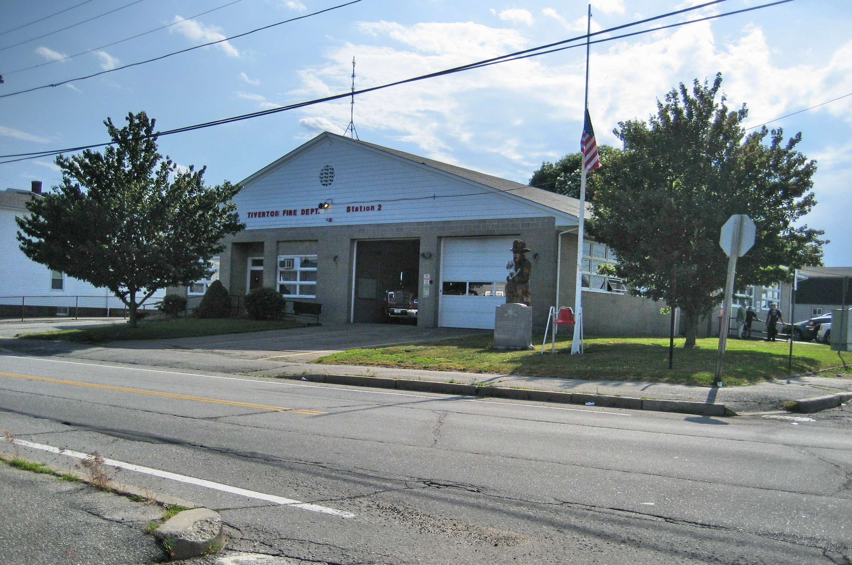
imagesize =
image_caption = North Tiverton Fire Station
image_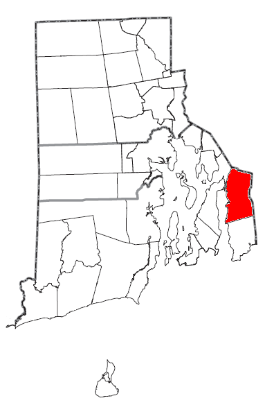
mapsize = 250px
map_caption = Location of Tiverton in Rhode Island
mapsize1 =
map_caption1 =subdivision_type = Country
subdivision_name =United States
subdivision_type1 = State
subdivision_name1 =Rhode Island
subdivision_type2 = County
subdivision_name2 = Newportgovernment_footnotes =
government_type =
leader_title =
leader_name =
leader_title1 =
leader_name1 =
established_title =
established_date =unit_pref = Imperial
area_footnotes =
area_magnitude =
area_total_km2 = 94.1
area_land_km2 = 76.0
area_water_km2 = 18.0
area_total_sq_mi = 36.3
area_land_sq_mi = 29.4
area_water_sq_mi = 7.0population_as_of = 2000
population_footnotes =
population_total = 15260
population_density_km2 = 200.7
population_density_sq_mi = 519.8timezone = Eastern (EST)
utc_offset = -5
timezone_DST = EDT
utc_offset_DST = -4
elevation_footnotes =
elevation_m = 44
elevation_ft = 144
latd = 41 |latm = 37 |lats = 46 |latNS = N
longd = 71 |longm = 11 |longs = 14 |longEW = Wpostal_code_type =
ZIP code
postal_code = 02878
area_code = 401
blank_name = FIPS code
blank_info = 44-70880GR|2
blank1_name = GNIS feature ID
blank1_info = 1220066GR|3
website =
footnotes =Tiverton is a town in Newport County,
Rhode Island ,United States . The population was 15,260 at the 2000 census.Geography
Tiverton is located on the eastern shore of
Narragansett Bay , across theSakonnet River fromAquidneck Island (also known as the Island of Rhode Island). Together with the adjacent town of Little Compton, the area is disconnected from the rest of the state of Rhode Island. The northern portion of the town is located onMount Hope Bay .Tiverton is located west of the town of Westport and south of the city of
Fall River located inMassachusetts . Much of the town is located along a granite ridge which runs in a north-south direction, rising approximately 170 feet in elevation from the bay. A large section of exposed granite can be observed at the highway cut for Route 24, near the Main Road interchange.According to the
United States Census Bureau , Tiverton has a total area of 36.3 square miles (94.1 km²), of which 29.4 square miles (76.0 km²) is land and 18.0 km² (7.0 sq mi; 19.16%) is water.The northern portion of greater Tiverton is North Tiverton,
Rhode Island .Demographics
As of the
census GR|2 of 2000, there were 15,260 people, 6,077 households, and 4,405 families residing in the town. Thepopulation density was 519.8 people per square mile (200.7/km²). There were 6,474 housing units at an average density of 220.5/sq mi (85.1/km²). The racial makeup of the town was 97.98% White, 0.43% Black or African American, 0.17% Native American, 0.39% Asian, 0.03% Pacific Islander, 0.22% from other races, and 0.79% from two or more races. Hispanic or Latino of any race were 0.68% of the population.There were 6,077 households out of which 29.6% had children under the age of 18 living with them, 60.2% were married couples living together, 8.8% had a female householder with no husband present, and 27.5% were non-families. 23.1% of all households were made up of individuals and 11.7% had someone living alone who was 65 years of age or older. The average household size was 2.51 and the average family size was 2.95.
The age distribution of the population of Tiverton was 22.1% under the age of 18, 5.9% from 18–24, 29.0% from 25–44, 26.6% from 45-64, and 16.5% 65 years older. The median age was 41 years. For every 100 females there were 94.9 males. For every 100 females age 18 and over, there were 92.6 males aged 18 or more.
The median income for a household in the town was $49,977, and the median income for a family was $58,917. Males had a median income of $41,042 versus $29,217 for females. The
per capita income for the town was $22,866. About 2.9% of families and 4.5% of the population were below thepoverty line , including 2.7% of those under age 18 and 9.1% of those age 65 or over.History
Early
Tiverton was originally incorporated in 1694, as part of the
Massachusetts Bay Colony . In 1746, in the final settlement of a long colonial boundary dispute betweenRhode Island andMassachusetts , Tiverton was annexed to Rhode Island byRoyal Decree (together with its fellow towns along the eastern shore of Narragansett Bay, Barrington, Bristol and Little Compton, and the town of Cumberland, to the north of Providence). Tiverton was then incorporated as a town of Rhode Island, in 1747. Until that same year, Tiverton controlled the area of East Freetown,Massachusetts , as an outpost. The boundary settlement of 1746 had put East Freetown in Massachusetts, and in 1747 it was purchased by Freetown,Massachusetts .Men from the Tiverton outpost took part in the
Battle of Freetown , onMay 25 ,1778 , during the Revolutionary War. For about three years of that war, December 1776 – late1779 , Rhode Island proper (also known as Aquidneck Island, historically) was occupied by the British. During this time, Tiverton was a refuge for Americans fleeing this occupation, and a mustering place for Colonial forces, gathering to drive away the British. (The occupying forces eventually were withdrawn strategically, as General Clinton marshalled his forces for the 1780 British invasion ofSouth Carolina .McEvedy, p.62] )In its early days, Tiverton was chiefly a farming community with some fishing and boat construction. Until 1900 the manufacture of menhaden oil, a fish derivative, was one of the primary industrial pursuits. Cotton and woolen mills were established as early as 1811, when Colonel Joseph Durfee established a spinning mill at Cook Pond, in what it now the city of
Fall River, Massachusetts .In 1856, the northern part of the town was set apart from Tiverton, and re-named Fall River, Rhode Island [ [http://homepage.mac.com/joepowers/mill/rhode.html Fall River, Rhode Island] ] , by the Rhode Island General Assembly. Then, on March 1, 1862, in a decision made by the United States Supreme Court, both Fall Rivers were made part of Massachusetts and the state boundary was placed in its current location near State Avenue. [ [http://www.citizensunionbank.com/inner/history.asp History of Citizens-Union Bank] ]
Mark's Stadium is a former soccerstadium located inNorth Tiverton, Rhode Island . During the 1920s and early 1930s it was the home ofFall River Marksmen , one of the era’s most successful soccer teams. It is one of the earliest examples of asoccer-specific stadium in theUnited States . ["Soccer in a Football World - The Story of America’s Forgotten Game" (2006) : David Wangerin [http://www.amazon.com/dp/0954013476] ] After the demise of the Marksmen, the stadium was used as a home ground by other local teams, most notablyFall River F.C. andPonta Delgada S.C. .Recent
As of 2006, trade establishments are the major employers in the town. Since the mid-20th century, Tiverton has grown as a summer resort and residential area, and as a suburb of the
Fall River, Massachusetts area. During the 1960s, Route 24 was constructed through the northern part of the town, connectingBoston withNewport, Rhode Island via the Sakonnet Bridge, which is currently scheduled to be replaced by the Rhode Island Department of Transportation. [ [http://www.haleyaldrich.com/nodes/48.aspx?path=/capabilities/infrastructure_development/sakonnet/ Sakonnet Bridge Replacement] ]In 2002, contaminated soil (including some soil that was blue) was discovered in the Bay Street neighborhood of Tiverton. In 2003, private property testing began. Contaminants including arsenic, lead, cyanide, and more were found at levels above residential exposure guidelines. Residents have been prohibited from digging in the soil. ENACT (Environmental Neighborhood Awareness Committee of Tiverton) advocates on behalf of the community. [ENACT, www.enactri.org] Property values in the neighborhood have plummeted due to the contamination and moratorium on digging soil, which meant that residents of this working class neighborhood have lost their home equity. One of ENACT's successes has been the passage of the legislation in the Rhode Island statehouse to create the Environmentally Contaminated Home Ownership (ECHO) loan program, which provides loans for people whose home equity is almost zero due to contamination. [Schwartzapfel, Beth. "Civil Actions." Brown Alumni Magazine. Nov/Dec 2007. http://www.brownalumnimagazine.com/under_the_elms/civil_actions.html.] The Rhode Island Department of Environmental Management (RIDEM) has been involved in developing work plans. [Oct. 4, 2005 ENACT presentation to Tiverton residents.]
National Historic Places in Tiverton
*
Benjamin Barker House
*Bourne Mill
*Cook-Bateman Farm
*Fort Barton Site
*Joseph Hicks House
*Osborn-Bennett Historic District
*Tiverton Four Corners Historic District Notable residents
*Robert Gray, merchant sea-captain and explorer
*Russell Warren (architect)
*Paul Di Filippo science fiction author
*Mika Seeger ceramic artistEducation
Tiverton has 5 public schools: Poccasset Elementary School, Fort Barton Elementary School, Ranger Elementary School, (the newest school in the district) Tiverton Middle School, and Tiverton High School. [ [http://www.tivertonschools.org/ School Website] ] The town is its own district and a part of the Newport County district.
See also
* [http://www.tiverton.ri.gov/ Official website of Tiverton]
* [http://www.enactri.org/ The Environmental Neighborhood Awareness Committee of Tiverton]Further reading
*
McEvedy, Colin (1988). "The Penguin Atlas of North American History to 1870". London:Penguin Books . ISBN 0-14-051128-8.References
Wikimedia Foundation. 2010.