- Newport County, Rhode Island
-
Newport County, Rhode Island 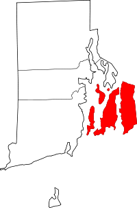
Location in the state of Rhode Island
Rhode Island's location in the U.S.Founded 1703 Seat N/A Largest city Newport Area
- Total
- Land
- Water
314 sq mi (812 km²)
104 sq mi (269 km²)
210 sq mi (543 km²), 66,83%Population
- (2010)
- Density
82,888
797/sq mi (308/km²)Congressional district 1st Newport County is one of five counties located in the state of Rhode Island. As of 2010, the population of Newport County was 82,888. It is also one of the seven regions of Rhode Island.
Like all of the counties in Rhode Island, Newport County is a county that no longer has any governmental functions {other than as court administrative and sheriff corrections boundaries). All of those functions in Rhode Island are now carried out either by the state government, or by the cities and towns of Rhode Island.
Contents
Geography
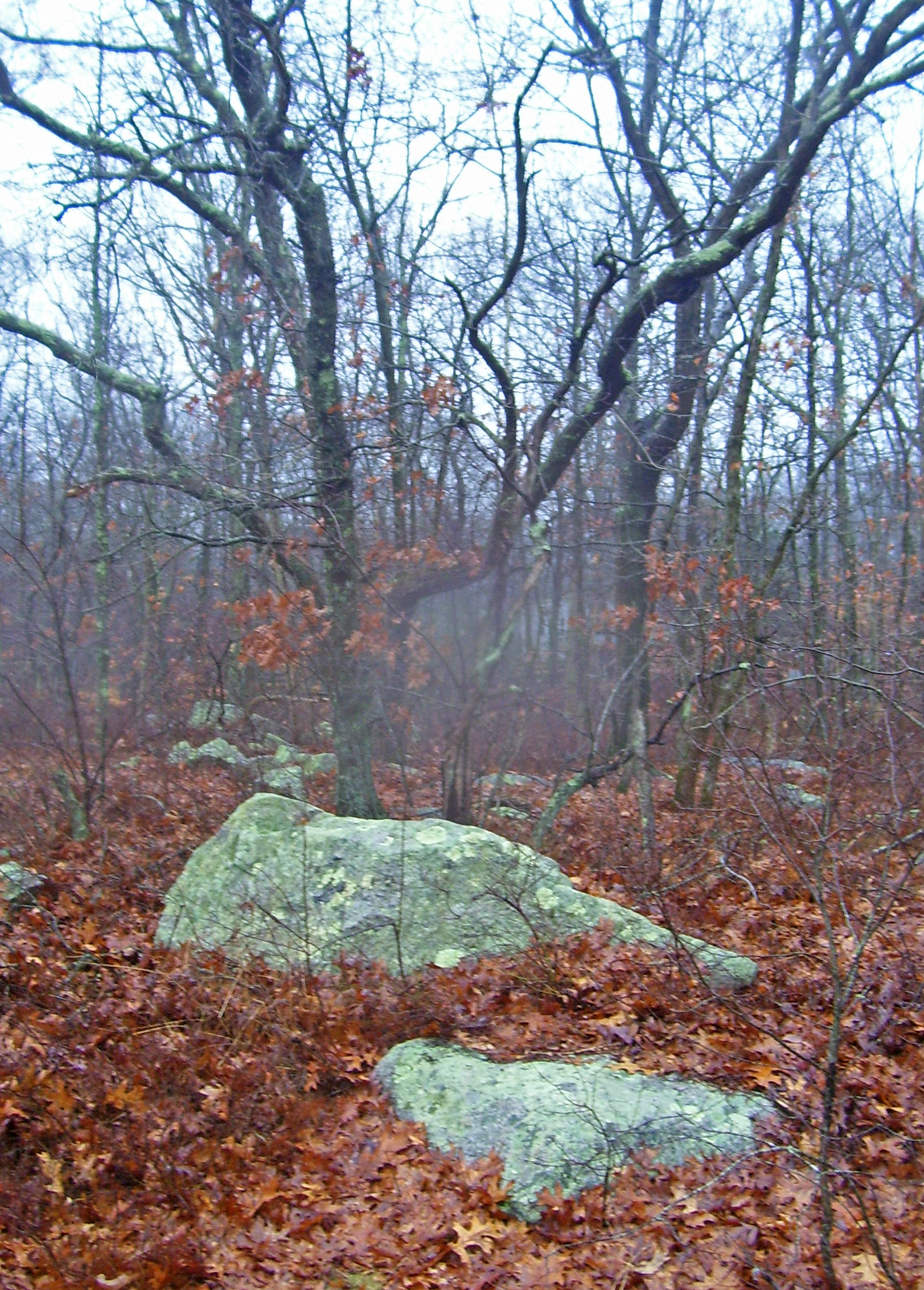
 Summit of Pocasset Hill, highest point in the county
.
According to the U.S. Census Bureau, the county has a total area of 314 square miles (810 km2), of which 104 square miles (270 km2) is land and 210 square miles (540 km2) (66.83%) is water.
The county consists of Aquidneck Island, Conanicut Island, Prudence Island, and the easternmost portion of the state on the mainland. The highest point in the county is Pocasset Hill, 320 feet (98 m) above sea level, located in Tiverton. The lowest elevation is at sea level.
Adjacent counties
- Bristol County, Rhode Island - north
- Bristol County, Massachusetts - east
- Washington County, Rhode Island - west

Bristol County Washington County 
Bristol County, Massachusetts  Newport County, Rhode Island

Atlantic Ocean National protected areas
- Sachuest Point National Wildlife Refuge
- Touro Synagogue National Historic Site
History
Newport County was constituted on June 22, 1703, as one of the two original counties of the Colony of Rhode Island and Providence Plantations. As originally established, Newport County consisted of four towns: Portsmouth, Newport, Jamestown, and New Shoreham. In 1746-47, two towns, Little Compton and Tiverton, were acquired from Massachusetts. In 1856, the town of Fall River was split off from Tiverton but was ceded to Massachusetts six years later in 1862 as part of the settlement of the boundary dispute between Rhode Island and Massachusetts. In 1963, the town of New Shoreham was transferred to Washington County. County government was abolished in Rhode Island in 1842 and today remains only for the purpose of delineating judicial administrative boundaries.
Demographics
Historical populations Census Pop. %± 1790 14,351 — 1800 14,845 3.4% 1810 16,294 9.8% 1820 15,771 −3.2% 1830 16,535 4.8% 1840 16,874 2.1% 1850 20,007 18.6% 1860 21,896 9.4% 1870 20,050 −8.4% 1880 24,180 20.6% 1890 28,552 18.1% 1900 32,599 14.2% 1910 39,335 20.7% 1920 42,893 9.0% 1930 41,668 −2.9% 1940 46,696 12.1% 1950 61,539 31.8% 1960 81,891 33.1% 1970 94,559 15.5% 1980 81,383 −13.9% 1990 87,194 7.1% 2000 85,433 −2.0% 2010 82,888 −3.0% [1][2][3] As of the census[4] of 2000, there were 85,433 people, 35,228 households, and 22,228 families residing in the county. The population density was 821 people per square mile (317/km²). There were 39,561 housing units at an average density of 380 per square mile (147/km²). The racial makeup of the county was 91.46% White, 3.73% Black or African American, 0.43% Native American, 1.23% Asian, 0.07% Pacific Islander, 1.09% from other races, and 1.99% from two or more races. 2.82% of the population were Hispanic or Latino of any race. 19.6% were of Irish, 13.2% Portuguese, 11.8% English, 9.2% Italian, 6.3% German and 5.2% French ancestry according to Census 2000. 92.0% spoke English, 2.3% Spanish, 2.1% Portuguese and 1.3% French as their first language.
There were 35,228 households out of which 28.60% had children under the age of 18 living with them, 49.90% were married couples living together, 10.30% had a female householder with no husband present, and 36.90% were non-families. 29.90% of all households were made up of individuals and 10.80% had someone living alone who was 65 years of age or older. The average household size was 2.35 and the average family size was 2.95.
In the county, the population was spread out with 22.50% under the age of 18, 8.40% from 18 to 24, 29.90% from 25 to 44, 24.80% from 45 to 64, and 14.40% who were 65 years of age or older. The median age was 39 years. For every 100 females there were 94.60 males. For every 100 females age 18 and over, there were 91.40 males.
The median income for a household in the county was $50,448, and the median income for a family was $60,610. Males had a median income of $41,630 versus $29,241 for females. The per capita income for the county was $26,779. About 5.40% of families and 7.10% of the population were below the poverty line, including 9.00% of those under age 18 and 6.70% of those age 65 or over.
Cities, towns, and villages*
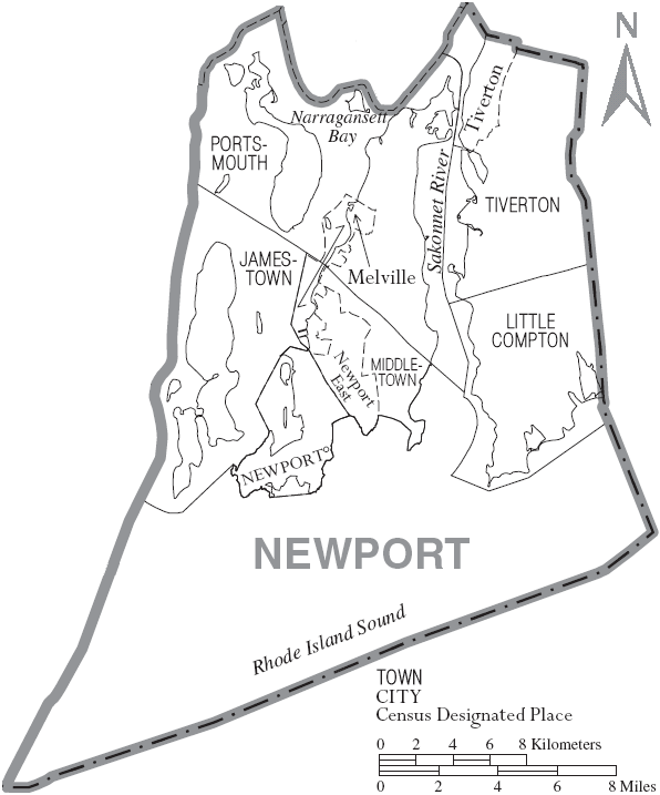
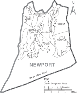 Map of Newport County, Rhode Island showing cities, towns, and CDPs
- Jamestown
- Beavertail (a village of Jamestown)
- Cedar Point (a village of Jamestown)
- Conanicut (a village of Jamestown)
- Dutch Island (a village of Jamestown)
- Freebody Hill (a village of Jamestown)
- Little Compton
- Adamsville (a village of Little Compton)
- Briggs Point (a village of Little Compton)
- Sakonnet (a village of Little Compton)
- Tunipus (a village of Little Compton)
- Middletown
- Easton Point (a village of Middletown)
- Sachuest (a village of Middletown)
- Newport East (a village of Middletown)
- Newport
- Castle Hill (a village of Newport)
- Coasters Harbor (a village of Newport)
- Coddington Point (a village of Newport)
- Fort Adams (a village of Newport)
- Forty Steps (a village of Newport)
- Goat Island (a village of Newport)
- Ochre Point (a village of Newport)
- Rose Island (a village of Newport)
- Tonomy Hill (a village of Newport)
- Portsmouth
- Bristol Ferry (a village of Portsmouth)
- Cedar Island (a village of Portsmouth)
- Common Fence Point (a village of Portsmouth)
- Corey Lane (a village of Portsmouth)
- Despair Island (a village of Portsmouth)
- Dyer Island (a village of Portsmouth)
- Gould Island (a village of Portsmouth)
- Hog Island (a village of Portsmouth)
- Homestead (a village of Portsmouth)
- Hope Island (a village of Portsmouth)
- Hummocks (a village of Portsmouth)
- Island Park (a village of Portsmouth)
- Melville (a village of Portsmouth)
- Patience (a village of Portsmouth)
- Prudence (a village of Portsmouth)
- Quaker Hill (a village of Portsmouth)
- Tiverton
- Bridgeport (a village of Tiverton)
- Eagleville (a village of Tiverton)
- Fogland Point (a village of Tiverton)
- Grayville (a village of Tiverton)
- Nannaquaket (a village of Tiverton)
- North Tiverton (a village of Tiverton)
- Tiverton Four Corners (a village of Tiverton)
* Villages have no separate corporate existence from the towns they are in.
See also
References
- ^ http://www.census.gov/population/www/censusdata/cencounts/files/ri190090.txt
- ^ http://factfinder2.census.gov/faces/tableservices/jsf/pages/productview.xhtml?pid=DEC_10_PL_QTPL&prodType=table
- ^ http://mapserver.lib.virginia.edu/
- ^ "American FactFinder". United States Census Bureau. http://factfinder.census.gov. Retrieved 2008-01-31.
External links
- Newport County Chamber of Commerce
- National Register of Historic Places listing for Newport Co., Rhode Island
Municipalities and communities of Newport County, Rhode Island City 
Towns CDPs  State of Rhode Island and Providence Plantations
Topics Culture | Delegations | Geography | Government | History | Thirteen Colonies | Colonial Colleges | Images | Narragansett Indian Tribe | People | Visitor attractions | State symbols
Regions Counties: Bristol | Kent | Newport | Providence | Washington | Geographic: Blackstone Valley | Block Island
Cities Central Falls | Cranston | East Providence | Newport | Pawtucket | Providence | Warwick | Woonsocket
Towns Barrington | Bristol | Burrillville | Charlestown | Coventry | Cumberland | East Greenwich | Exeter | Foster | Glocester | Hopkinton | Jamestown | Johnston | Lincoln | Little Compton | Middletown | Narragansett | New Shoreham (Block Island) | North Kingstown | North Providence | North Smithfield | Portsmouth | Richmond | Scituate | Smithfield | South Kingstown | Tiverton | Warren | Westerly | West Greenwich | West Warwick
Categories:- Rhode Island counties
- Newport County, Rhode Island
- 1703 establishments in the Thirteen Colonies
- Populated places established in 1703


Wikimedia Foundation. 2010.