- Bristol, Rhode Island
Infobox Settlement
official_name = Town of Bristol, Rhode Island
settlement_type = Town
imagesize =
image_caption = Bristol Harbor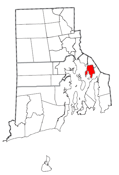
mapsize = 250px
map_caption = Location of Bristol in Rhode Island
mapsize1 =
map_caption1 =
subdivision_type = Country
subdivision_type1 = State
subdivision_type2 = County
subdivision_name =United States
subdivision_name1 =Rhode Island
subdivision_name2 = Bristol
government_type =Elected Town Council (5) Members
leader_title =Town Administrator
leader_name = Diane C. Mederos (D) RI
established_date =
area_magnitude = 1 E8
area_total_km2 = 53.4
area_land_km2 = 26.2
area_water_km2 = 27.2
area_total_sq_mi = 20.6
area_land_sq_mi = 10.1
area_water_sq_mi = 10.5
elevation_m = 40
elevation_ft = 131
latd = 41 |latm = 41 |lats = 3 |latNS = N
longd = 71 |longm = 16 |longs = 7 |longEW = W
population_as_of = 2000
population_total = 22469
population_density_km2 = 858.1
timezone = EST
utc_offset = -5
timezone_DST = EDT
utc_offset_DST = -4
latitude = 41.684° N
longitude = 71.268669° W
website = http://www.bristolri.us
postal_code_type =ZIP code
postal_code = 02809
area_code = 401
blank_name = FIPS code
blank_info = 44-09280GR|2
blank1_name = GNIS feature ID
blank1_info = 1220083GR|3
footnotes =Bristol is a town in and the historic
county seat of Bristol County,Rhode Island ,United States .GR|6 The population was 22,469 at the 2000 census. Bristol, a deep waterseaport , is named afterBristol ,England .Bristol gained national fame despite its small size as a result of having the oldest, continuous Independence Day celebrations in the United States, earning Bristol its nickname, "America's most patriotic town".
Bristol's diverse heritage is influenced by a strong Portuguese-American presence, mostly
Azorean , andItalian-American . Major industries includeboat building (and related marine industries),manufacturing andtourism [http://www.destinationbristol.com/] . The town's school system is united with neighboringWarren, Rhode Island .History
The first battle of
King Philip's War took place here in 1675; although Philip was eventually defeated, a variant of his Indian name, "Metacomet", is now the name of a main road in Bristol, Metacom Avenue RI Route 136.King Philip also made nearby Mount Hope (
Montaup ) his base of operations. "King Philip's Chair," a rocky ledge on the mountain, was a lookout site for enemy ships on Mount Hope Bay. After that war concluded, the town was settled in 1680 as part of thePlymouth Colony . It was sold for £1100 to four Boston investors by the names of Byfield, Walley, Oliver, and Burton. It remained a part ofMassachusetts until the Crown transferred it to the Rhode Island Colony in 1747.The DeWolf family was among the earliest settlers of Bristol. Bristol and Rhode Island became a center of slavery trading. James DeWolf mentioned among notable people below, had been a leading slave trader, later becoming a United States Senator from Rhode Island. Quakers from Rhode Island were involved early in the slavery abolition movement.
During the
American Revolutionary War , the British Navy bombarded Bristol twice. OnOctober 7 ,1775 , a group of ships led byCaptain Wallace and the "HMS Rose" sailed into town and demanded provisions. When refused, Wallace shelled the town, causing some damage. The attack was stopped when Lt. Gov. William Bradford rowed out to the "Rose" to negotiate a cease-fire, but then a second attack took place onMay 25 ,1778 . This time, 500 British and Hessian troops marched through the main street (now called Hope Street RI Route 114) and burnt 30 barracks and houses, taking some prisoners to Newport.Bristol also is noted for having the oldest, continuous Independence Day celebrations in the
United States . The first mention of this comes from July 1777, when a British officer noted sounds coming from acrossNarragansett Bay ::"This being the first anniversary of the
Declaration of Independence of the Rebel Colonies, they ushered in the morning by firing 13 cannons, one for each colony, we suppose. At sunset, the rebelfrigate s fired another round of 13 guns, each one after the other. As the evening was very still and fine the echo of the guns down the Bay had a grand effect."The annual celebrations were established in 1785 and continue today, organized by the Bristol
Fourth of July Committee [http://www.july4thbristolri.com/] . The festivities officially start on June 14th, Flag Day, beginning a period of outdoor concerts, soap-box races and a Firefighters muster at Independence Park. The Celebration climaxes on July 4th with the Military, Civic and Firemen's Parade, an event that draws over 200,000 people from Rhode Island and around the world. These elaborate celebrations give Bristol its nickname, "America's most patriotic town."Until 1854, Bristol was one of the five state capitals of Rhode Island.
Bristol is home to
Roger Williams University , named for Rhode Island founder Roger Williams.The southerly terminus of the East Bay Bike Path [http://www.riparks.com/eastbay.htm] is located at Independence Park on Bristol Harbor. The Bike path continues North to East Providence, R.I. Constructed on an old abandoned railway, some of the best views of Narragansett Bay can be seen along this magnificent corridor. This path is a valued commodity to Bristol, it allows bikers, roller skaters and walkers to enjoy the area. The construction of the East Bay Bike Path was highly contested by Bristolians before construction because of the potential of crime, the Bike Path has become a welcome asset to the community.
A Bristol boat company, (Herreshoff), made the yacht which returned the America's cup to the United States from the UK in the early 20th Century. The Colt Estate is a well known site and was home to Samuel P. Colt, nephew of the man famous for the arms company.
Bristol is the site of one
National Historic Landmark , theJoseph Reynolds House built in 1700. TheMarquis de Lafayette and his staff in 1778 used the building as headquarters during theBattle of Rhode Island . [http://www.eastbaychamberri.org/East_Bay_Life/index.cfm/Pages/Town_Descriptions/]"Notable Inhabitants:"
*Benjamin Bourne , lawyer, jurist, and politician
*John Saffin , best known for his "A Brief and Candid Answer" toSamuel Sewall 's "The Selling of Joseph" (1700), over the issue of slavery.
*William Bradford (1729-1808) , physician, lawyer, and United States Senator
*Ambrose Burnside , railroad executive, industrialist, politician, and Union general
*James De Wolf ,slave trade r and United States senator
*Nathanael Herreshoff , yacht designer & builder
*Ira Magaziner , chief Internet policy advisor to Clinton Administration
* Ethel Barrymore Colt, actor and lyricist
*Samuel P. Colt , entrepreneur, politician, lawyer, gentleman farmer & philanthropist
*Anthony Quinn , actor
* William Thomas "Billy" Andrade PGA Tour Professional Golfer"Museums:"
* [http://www.herreshoff.org/ Herreshoff Marine Museum]
* [http://www.brown.edu/Facilities/Haffenreffer/ Haffenreffer Museum of Anthroplogy]
* [http://www.lindenplace.org/ Linden Place] (1810)
* [http://www.blithewold.org/ Blithewold Mansion, Gardens & Arboretum] (1907)
* [http://www.coggeshallfarm.org/ Coggeshall Farm Museum] (c. 1790)
* [http://www.mounthopefarm.com/ Mount Hope Farm] (1745)Geography
Bristol is situated on convert|10.1|sqmi|km2 of a
peninsula (the smaller sub-peninsula on the west is called Poppasquash), withNarragansett Bay on its west and Mount Hope Bay on its east. According to theUnited States Census Bureau , the town has a total area of 20.6square mile s (53.4km² ), of which, 10.1 square miles (26.2 km²) of it is land and 10.5 square miles (27.2 km²) of it (50.99%) is water. Bristol's harbor is home to over 800 boat moorings in seven mooring fields.Demographics
As of the
census GR|2 of 2000, there were 22,469 people, 8,314 households, and 5,653 families residing in the town. Thepopulation density was 2,222.2 people per square mile (858.1/km²). There were 8,705 housing units at an average density of 860.9/sq mi (332.4/km²). The ethnic group makeup of the town was 97.14% European, 1.29% Hispanic or Latino (of any race), 0.67% Asian, 0.62% African, 0.16% Native American, 0.04% Pacific Islander, 0.33% other ethnic group, and 1.03% from two or more races.There were 8,314 households out of which 28.2% had children under the age of 18 living with them, 54.8% were married couples living together, 10.1% had a female householder with no husband present, and 32.0% were non-families. 26.3% of all households were made up of individuals and 11.9% had someone living alone who was 65 years of age or older. The average household size was 2.45 and the average family size was 2.99.
In the town the population was spread out with 19.6% under the age of 18, 13.8% from 18 to 24, 27.0% from 25 to 44, 22.0% from 45 to 64, and 17.7% who were 65 years of age or older. The median age was 38 years. For every 100 females there were 93.1 males. For every 100 females age 18 and over, there were 90.4 males.
The median income for a household in the town was $43,689, and the median income for a family was $54,656. Males had a median income of $37,587 versus $26,413 for females. The
per capita income for the town was $21,532. About 5.2% of families and 8.1% of the population were below thepoverty line , including 9.2% of those under age 18 and 10.8% of those age 65 or over.Points of interest and Registered Historic Places
*
America's Cup Hall of Fame
*Blithewold Mansion, Gardens and Arboretum
*Bristol County Courthouse
*Bristol County Jail
*Bristol Customshouse and Post Office
*Bristol Ferry Lighthouse
*Bristol Waterfront Historic District
*Benjamin Church House
*Colt State Park
*Gillary's Host of Punk Rock Wednesday
*Juniper Hill Cemetery
*Haffenreffer Museum of Anthropology
*Herreshoff Marine Museum
*Linden Place , Home of the DeWolfs
*Longfield
*Mount Hope Bridge
*Mount Hope Farm
*Poppasquash Farms Historic District
*Joseph Reynolds House
*Roger Williams University
*Roger Williams University School of Law References
External links
* [http://www.bristolri.us/ Official Town Website]
* [http://www.onlinebristol.com/ Unofficial Home Page]
* [http://www.bristolri.com/ Bristol Phoenix, weekly community newspaper]
* [http://www.destinationbristol.com/ Destination Bristol, official tourism site]
* [http://www.july4thbristolri.com/ Bristol Fourth of July Committee, official site]
* [http://www.riparks.com/colt.htm Colt State Park]
* [http://www.bristolyouthsoccer.com/ Bristol Youth Soccer Association]
* [http://www.bristolblues.net/ Bristol Blues Vintage Base Ball Club]
* [http://www.bfdladder1.com/ Bristol Volunteer Fire Department Ladder 1, Special Hazards & Marine 1]
Wikimedia Foundation. 2010.