- Exeter, Rhode Island
Infobox Settlement
official_name = Exeter, Rhode Island
settlement_type = Town
nickname =
motto =
image_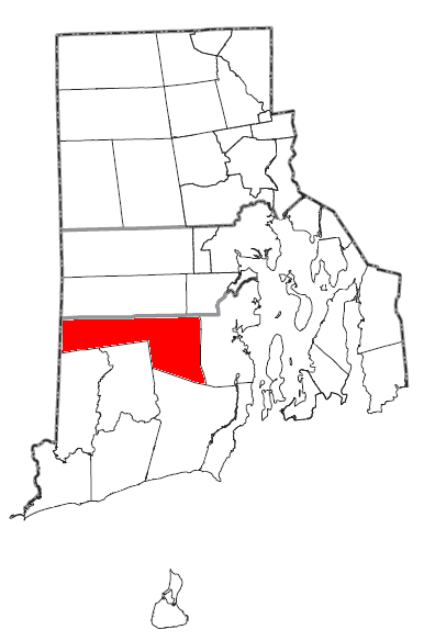
mapsize = 250px
map_caption = Location of Exeter in Rhode Island
mapsize1 =
map_caption1 =
subdivision_type = Country
subdivision_name =United States
subdivision_type1 = State
subdivision_name1 =Rhode Island
subdivision_type2 = County
subdivision_name2 = Washington
government_footnotes =
government_type =
leader_title =
leader_name =
leader_title1 =
leader_name1 =
established_title =
established_date =
unit_pref = Imperial
area_footnotes =
area_magnitude =
area_total_km2 = 151.2
area_land_km2 = 149.5
area_water_km2 = 1.7
area_total_sq_mi = 58.4
area_land_sq_mi = 57.7
area_water_sq_mi = 0.7
population_as_of = 2000
population_footnotes =
population_total = 6045
population_density_km2 = 40.4
population_density_sq_mi = 104.7
timezone = Eastern (EST)
utc_offset = -5
timezone_DST = EDT
utc_offset_DST = -4
elevation_footnotes =
elevation_m = 58
elevation_ft = 190
latd = 41 |latm = 33 |lats = 50 |latNS = N
longd = 71 |longm = 36 |longs = 20 |longEW = W
postal_code_type =ZIP code
postal_code = 02822
area_code = 401
blank_name = FIPS code
blank_info = 44-25300GR|2
blank1_name = GNIS feature ID
blank1_info = 1220087GR|3Exeter is a town in Washington County,
Rhode Island ,United States . Exeter extends east from theConnecticut border to the town of North Kingstown. It is bordered to the north by West Greenwich and East Greenwich, and to the south by Hopkinton, Richmond and South Kingstown. Exeter'spostal code is 02822. The population was 6,045 at the 2000 census.Exeter was named for the Earl of Exeter.
Geography
Exeter is located at coor dms|41|34|39|N|71|32|17|W|city.
According to the
United States Census Bureau , the town has a total area of 58.4square mile s (151.2km² ), of which, 57.7 square miles (149.5 km²) of it is land and 0.7 square miles (1.7 km²) of it (1.15%) is water.Exeter shares a public school system with its neighbor to the north, West Greenwich.
Demographics
As of the
census GR|2 of 2000, there were 6,045 people, 2,085 households, and 1,592 families residing in the town. Thepopulation density was 104.7 people per square mile (40.4/km²). There were 2,196 housing units at an average density of 38.0/sq mi (14.7/km²). The racial makeup of the town was 96.36% White, 0.66% African American, 0.60% Native American, 0.74% Asian, 0.02% Pacific Islander, 0.33% from other races, and 1.29% from two or more races. Hispanic or Latino of any race were 1.27% of the population.There were 2,085 households out of which 38.0% had children under the age of 18 living with them, 64.4% were married couples living together, 8.7% had a female householder with no husband present, and 23.6% were non-families. 16.8% of all households were made up of individuals and 4.6% had someone living alone who was 65 years of age or older. The average household size was 2.77 and the average family size was 3.15.
In the town the population was spread out with 26.3% under the age of 18, 6.4% from 18 to 24, 31.6% from 25 to 44, 26.0% from 45 to 64, and 9.7% who were 65 years of age or older. The median age was 38 years. For every 100 females there were 96.7 males. For every 100 females age 18 and over, there were 96.0 males.
The median income for a household in the town was $64,452, and the median income for a family was $74,157. Males had a median income of $47,083 versus $36,928 for females. The
per capita income for the town was $25,530. About 4.5% of families and 5.5% of the population were below thepoverty line , including 7.5% of those under age 18 and 10.2% of those age 65 or over.History
Exeter is noted by folklorists as the site of one of the best documented examples of
vampire exhumation: theMercy Brown Vampire Incident of 1892.The name Exeter derives from the town of
Exeter inDevon ,England . Numerous other places have also been given the name Exeter.Proposed Town of Westconnaug
In February 2008 Rhode Island State Representative Nicholas Gorham proposed legislation tocreate a super town of rural communities including Scituate. Other towns that would be included in his proposed town of "Westconnaug" are West Greenwich, Exeter, Foster, Glocester, and the western part of Coventry. [ Providence Journal 2008-02-09, [http://www.projo.com/news/content/NEW_TOWN_02-09-08_858UTT6_v15.355f1a5.html Lawmaker proposes a super town made up of 5 towns and part of Coventry] , by Lisa Vernon-Sparks ]
Attractions and National Historic Places in Exeter
*
Yawgoo Valley is the only ski resort in Rhode Island.
*Austin Farm Road Agricultural Area
*Baptist Church in Exeter
*Fisherville Historic and Archeological District
*Hallville Historic and Archeological District
*Lawton's Mill
*Simon Lillibridge Farm
*Parris Brook Historic and Archeological District
*Queen's Fort
*Sodom Mill Historic and Archeological District
*Foreverland Ranch, home of The Ghost of Otis References
External links
* [http://www.riedc.com/riedc/ri_databank/31/282/ EDC Profile of Exeter]
* [http://www.ri.gov/towns/view/exeter/ RI.GOV - Town of Exeter]
* [http://www.town.exeter.ri.us/ Town of Exeter, Rhode Island website]
* [http://www.exeterpubliclibrary.org Exeter Town Library]
* [http://ewg.k12.ri.us/default.asp Exeter-West Greenwich Regional School District]
* [http://search.atomz.com/search/?sp-a=sp10031b98&sp-p=all&sp-f=ISO-8859-1&sp-q=%22exeter%22 Visit RI - Exeter]
* [http://www.state.ri.us/govtracker/index.php?page=DetailMuni&eid=3768 Exeter Town Hall]
* [http://ri.gov/ Rhode Island Government]
* [http://www.southcountyri.com/ Welcome to South County Rhode Island]
* [http://www.exeter1fire.com/ Exeter #1 Fire Department]
Wikimedia Foundation. 2010.