- North Smithfield, Rhode Island
-
North Smithfield, Rhode Island — Town — Forestdale school house from the nineteenth century Location of North Smithfield in Providence County, Rhode Island
Coordinates: 41°59′17″N 71°33′7″W / 41.98806°N 71.55194°W Country United States State Rhode Island County Providence Area – Total 24.7 sq mi (64.1 km2) – Land 24.0 sq mi (62.3 km2) – Water 0.7 sq mi (1.8 km2) Elevation 361 ft (110 m) Population (2010) – Total 11,967 – Density 498.6/sq mi (192.1/km2) Time zone Eastern (EST) (UTC-5) – Summer (DST) EDT (UTC-4) ZIP codes 02824, 02896 Area code(s) 401 FIPS code 44-52480[1] GNIS feature ID 1219815[2] Website http://www.nsmithfieldri.org/ North Smithfield is a town in Providence County, Rhode Island, United States, settled as a farming community in 1666 and incorporated into its present form in 1871. North Smithfield includes the historic villages of Forestdale, Primrose, Waterford, Branch Village, Union Village, Park Square, and Slatersville. The population was 11,967 at the 2010 census.
Contents
Geography
According to the United States Census Bureau, the town has a total area of 24.7 square miles (64 km2), of which, 24.0 square miles (62 km2) of it is land and 0.7 square miles (1.8 km2) of it (2.83%) is water. North Smithfield is in a New England upland region. The Branch River and Blackstone Rivers provided much of the power for the early mills in the town.
History
In the 17th century British colonists settled in North Smithfield developing a farming community that they named after Smithfield, London in England.[3] The town was part of Smithfield, Rhode Island until it was incorporated as North Smithfield in 1871.[3] The first colonization occurred after a Native American, "William Minnian, (or Quashawannamut) "of Punkkupage" of Massachusetts Bay on May 14, 1666, deeded approximately 2,000 acres" to John Mowry and Edward Inman who partnered with Nathaniel Mowry, John Steere, and Thomas Walling in dividing up the purchased tract.[3] In the early 18th century, a Quaker colony developed in what is now North Smithfield (then Smithfield), which extended into south Uxbridge, Massachusetts.
The Buxton Family settled in the border area of Smithfield circa 1740 from Essex County, MA. Captain James Buxton fought in the American Revolution in three of the Massachusetts Militias under the Continental Army at Valley Forge, the Battle of Saratoga, and the Hudson River Chain at West Point before returning to Smithfield where he died in 1817. [4] His commission as a Captain was signed by Gov. John Hancock. Perhaps he is lost to the service records of Rhode Islanders and their roles in the American Revolution and Colonial history because of his border location and his service in Massachusetts. The Congregational Church on the Green at Slatersville, was "long said to be a Buxton church".
Today North Smithfield is part of the John H. Chaffee Blackstone River Valley National Heritage Corridor. The Blackstone Valley is the oldest industrialized region in the U.S.
 A rare "stone-ender" known as the John Mowry, Jr. or Sayles House on Wesquadomeset (Sayles) Hill near Iron Mine Hill and Sayles Hill Roads in North Smithfield, demolished in the 20th century
The village of Slatersville was largely built by Samuel Slater and his brother John Slater beginning in 1803.[5] It is a well preserved original New England mill village with worker housing and commercial buildings. This village is in fact America's first planned industrial mill village.[6] Samuel and John's family owned this mill and the village until the turn of the 19th to the 20th century.[5]
Union Village, along Rhode Island Route 146A achieved local prominence as an important stagecoach stop on the route along Great Road.[6] Union Village was also home to a hat shop, taverns, an academy and the Union Bank from which it gets its name.[6]
Demographics
As of the census[1] of 2000, there were 10,618 people, 3,954 households, and 2,957 families residing in the town. The population density was 441.7 people per square mile (170.5/km²). There were 4,070 housing units at an average density of 169.3 per square mile (65.4/km²). The racial makeup of the town was 98.32% White, 0.42% African American, 0.21% Native American, 0.52% Asian, 0.08% from other races, and 0.45% from two or more races. Hispanic or Latino of any race were 0.47% of the population. 41% reported either French or French Canadian ancestry, 12% Irish, 12% Italian, and 8% English.[7]
There were 3,954 households out of which 31.0% had children under the age of 18 living with them, 64.0% were married couples living together, 7.8% had a female householder with no husband present, and 25.2% were non-families. 21.3% of all households were made up of individuals and 12.4% had someone living alone who was 65 years of age or older. The average household size was 2.61 and the average family size was 3.05.
In the town the population was spread out with 22.4% under the age of 18, 5.7% from 18 to 24, 27.2% from 25 to 44, 26.8% from 45 to 64, and 18.0% who were 65 years of age or older. The median age was 42 years. For every 100 females there were 90.4 males. For every 100 females age 18 and over, there were 86.8 males.
The median income for a household in the town was $58,602, and the median income for a family was $67,331. Males had a median income of $43,133 versus $30,748 for females. The per capita income for the town was $25,031. About 1.9% of families and 3.5% of the population were below the poverty line, including 2.8% of those under age 18 and 9.9% of those age 65 or over.
Historic Places in North Smithfield

- Slatersville, America's first industrial mill village, established by John Slater and Samuel Slater in 1807
- Smithfield Friends Meeting House, Parsonage & Cemetery 18th-19th century Quaker community
- Peleg Arnold Tavern (1690)
- Blackstone Valley National Heritage Corridor
- Forestdale Mill Village Historic District
- Tyler Mowry House (1825)
- William Mowry House (1804)
- Smithfield Road Historic District
- Three Dog Site, RI-151
- Todd Farm (1740)
- Union Village Historic District
Notable people
- Peleg Arnold - delegate to the Continental Congress and Chief Justice of the Rhode Island Supreme Court[8]
- Jeff Jillson - National Hockey League player
- David Rawlings - Guitarist with wife Gillian Welch[9]
Education
- North Smithfield High School, the only public high school in the town, was ranked 9th out of 52 public high schools in Rhode Island in 2006.[10]
Adjacent Communities
- Woonsocket, Rhode Island
- Blackstone, Massachusetts
- Millville, Massachusetts
- Uxbridge, Massachusetts
- Burrillville, Rhode Island
- Lincoln, Rhode Island
- Cumberland, Rhode Island
- Smithfield, Rhode Island
Houses of Worship
- Lighthouse Christian Church
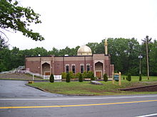
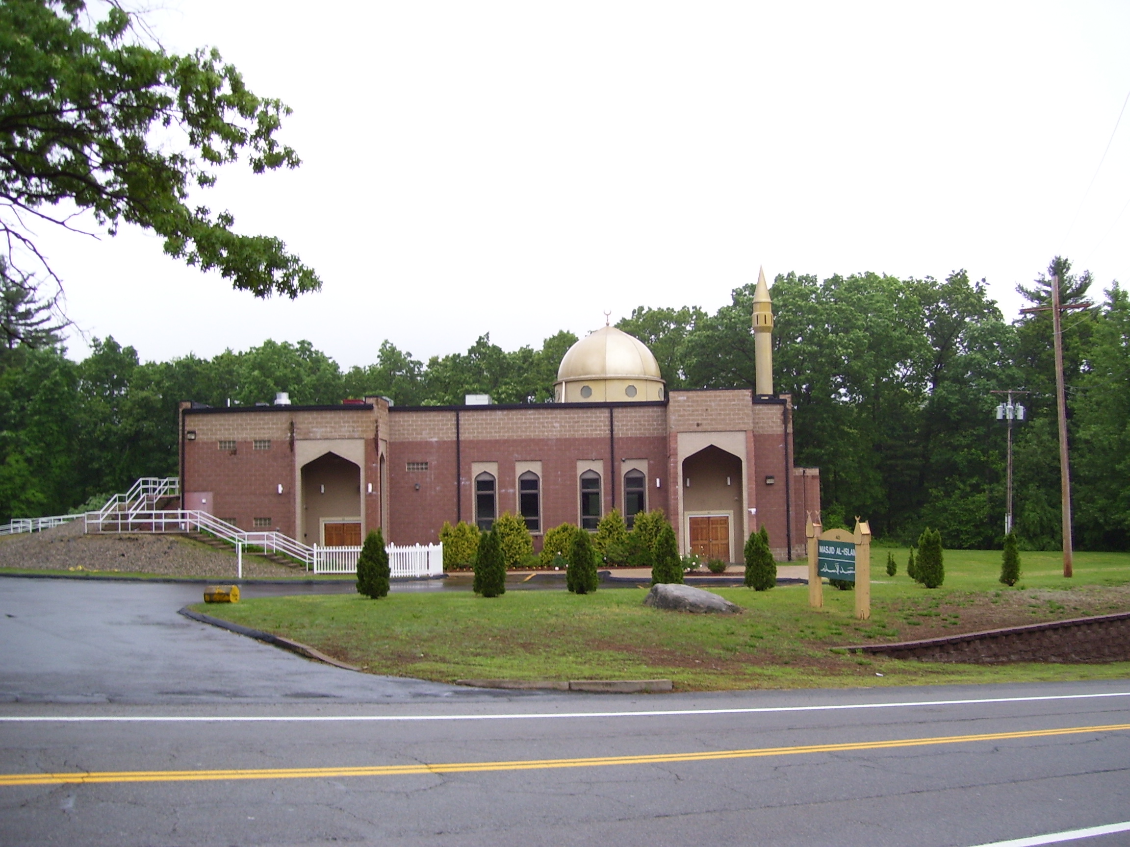
- Masjid Al-Islam mosque
- Slatersville Congegational Church
- St. John the Evangelist Church
References
- ^ a b "American FactFinder". United States Census Bureau. http://factfinder.census.gov. Retrieved 2008-01-31.
- ^ "US Board on Geographic Names". United States Geological Survey. 2007-10-25. http://geonames.usgs.gov. Retrieved 2008-01-31.
- ^ a b c Nebiker, Walter (1976). the History of North Smithfield. Somersworth, NH: New England History Press.
- ^ [*The National Society of the Daughters of the American Revolution Volume, 15 page 7 Mrs. Ella S. Anderson Freeman. DAR ID Number: 149020> 4 James Buxton (1745-1817) commanded a company in Col. Benjamin Tupper's regiment, Massachusetts troops. He was born and died in Smithfield, R. I. Also No. 127831. View full context ]
- ^ a b "Samuel Slater/The Mill Village, Slatersville/Woonsocket". Woonsocket.org. http://images.google.com/imgres?imgurl=http://www.woonsocket.org/sville1.gif&imgrefurl=http://www.woonsocket.org/slatersville.htm&h=100&w=104&sz=9&hl=en&start=13&um=1&tbnid=bpTdo7xIydTHqM:&tbnh=81&tbnw=84&prev=/images%3Fq%3DPhotos%2Bof%2BSlatersville%26svnum%3D10%26um%3D1%26hl%3Den%26rlz%3D1T4SUNA_en___US247. Retrieved 2007-12-26.
- ^ a b c "Plan your visit/Valley sites/Cumberland, North Smithfield, Smithfield". National Park Service. http://www.nps.gov/blac/planyourvisit/valley-sites-cumberland-smithfield-north-smithfield.htm. Retrieved 2007-12-25.
- ^ http://www.epodunk.com/cgi-bin/genealogyInfo.php?locIndex=13444
- ^ Who Was Who in America, Historical Volume, 1607-1896. Chicago: Marquis Who's Who. 1963.
- ^ Wilkinson, Alec (2004-09-20). "The Ghostly Ones". The New Yorker. pp. 78. http://www.newyorker.com/archive/2004/09/20/040920fa_fact_wilkinson. Retrieved 2009-05-03.
- ^ [1]
External links
*The Church on the Green at Slatersville, long a Buxton Church
Image gallery
-

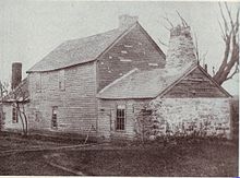
Mowry House ca. 1690, on Providence Pike in North Smithfield
-
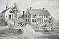
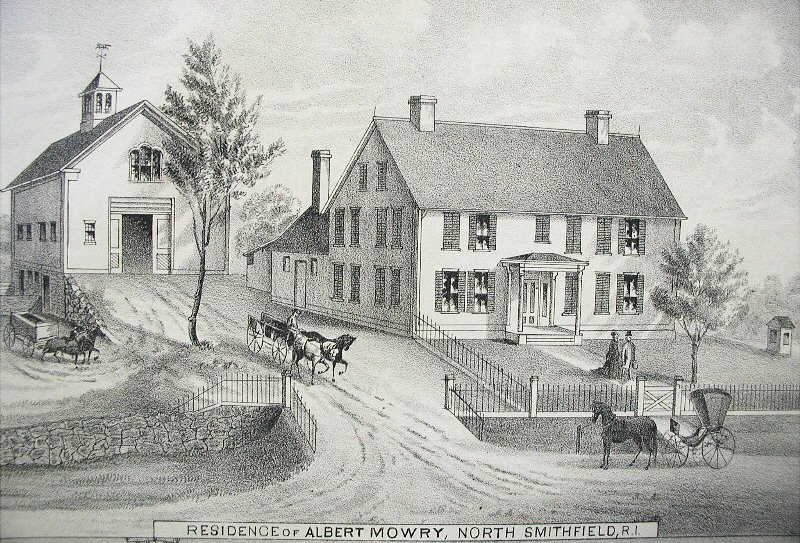
Albert Mowry farmhouse in North Smithfield in the 19th century
North Smithfield in the 19th century
Municipalities and communities of Providence County, Rhode Island Cities 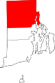
Towns Burrillville | Cumberland | Foster | Glocester | Johnston | Lincoln | North Providence | North Smithfield | Scituate | Smithfield
CDPs Other
villagesAlbion | Chepachet | Esmond | Forestdale | Georgiaville | Glendale | Hanton City | Harmony | Lime Rock | Manville | Oakland | Primrose | Quinnville | Saylesville | Smithville-North Scituate | Slatersville
 State of Rhode Island and Providence Plantations
Topics Culture | Delegations | Geography | Government | History | Thirteen Colonies | Colonial Colleges | Images | Narragansett Indian Tribe | People | Visitor attractions | State symbols
Regions Counties: Bristol | Kent | Newport | Providence | Washington | Geographic: Blackstone Valley | Block Island
Cities Central Falls | Cranston | East Providence | Newport | Pawtucket | Providence | Warwick | Woonsocket
Towns Barrington | Bristol | Burrillville | Charlestown | Coventry | Cumberland | East Greenwich | Exeter | Foster | Glocester | Hopkinton | Jamestown | Johnston | Lincoln | Little Compton | Middletown | Narragansett | New Shoreham (Block Island) | North Kingstown | North Providence | North Smithfield | Portsmouth | Richmond | Scituate | Smithfield | South Kingstown | Tiverton | Warren | Westerly | West Greenwich | West Warwick
Coordinates: 41°58′00″N 71°32′58″W / 41.9666667°N 71.54944°WCategories:- Populated places in Providence County, Rhode Island
- Towns in Rhode Island
- North Smithfield, Rhode Island


Wikimedia Foundation. 2010.