Forestdale, Rhode Island

Forestdale, Rhode Island

Infobox nrhp
name = Forestdale Mill Village Historic District
nrhp_type = hd
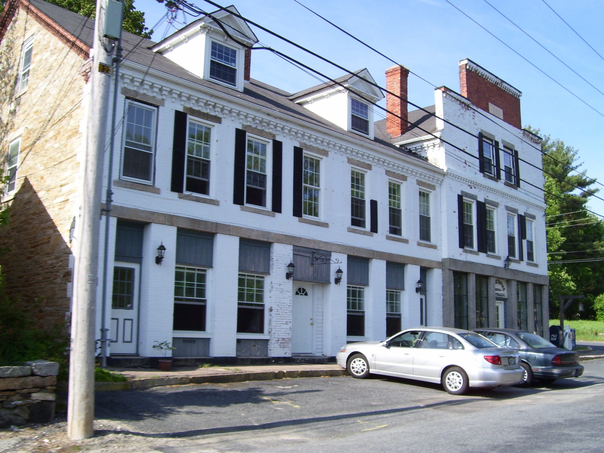


caption = Forestdale's main factory block from the nineteenth century, currently has a post office
location =North Smithfield, Rhode Island
nearest_city =
lat_degrees =
lat_minutes =
lat_seconds =
lat_direction =
long_degrees =
long_minutes =
long_seconds =
long_direction =
area = 500 acres, 50 buildings
built =
architect =
architecture =Federal, Victorian
added = June 5, 1972
visitation_num =
visitation_year =
refnum = #72000041
mpsub =
governing_body =

Forestdale is a village and historic district in North Smithfield, Providence County, Rhode Island, United States, one-half mile from Slatersville, Rhode Island. The historic district runs east and west along Main Street and north on Maple Avenue. School Street is the primary road through the village, and the Branch River runs adjacent to the road in the valley. The Village Haven Restaurant and local VFW chapter are also located in the village.

History

The village was originally owned by the Forestdale Manufacturing Company, a textile mill, later purchased by John Slater & Co. The Mansfield & Lamb scythe-shop manufactured sycthes and later tools in Forestdale starting in 1824, and during the American Civil War manufactured swords and sabres for Union Forces. The mills used water power from the Branch River to power their equipment.

Further reading

*Walter Nebiker, "The History of North Smithfield" (Somersworth, NH: New England History Press, 1976).

External links

* [http://www.rootsweb.com/~rigenweb/article243.html Forestdale History]

See also

* List of Registered Historic Places in Rhode Island


Wikimedia Foundation. 2010.

Игры ⚽ Нужна курсовая?

Look at other dictionaries:

  • Providence, Rhode Island — City of Providence   City   …   Wikipedia

  • Cranston, Rhode Island —   City   Seal …   Wikipedia

  • Cumberland, Rhode Island —   Town   Cumberland Town Hall Motto: Great History. Bright Future …   Wikipedia

  • Pawtucket, Rhode Island — City of Pawtucket   City   Downtown across the Blackstone River …   Wikipedia

  • Chepachet, Rhode Island — Chepachet Village Historic District U.S. National Register of Historic Places U.S. Historic District …   Wikipedia

  • Oakland, Rhode Island — Oakland Historic District U.S. National Register of Historic Places U.S. Historic district …   Wikipedia

  • Greenville, Rhode Island —   CDP   Coordinates …   Wikipedia

  • Mountaindale, Rhode Island — Mountaindale (also known as Mountain Dale) is a locale in the town of Smithfield, Providence County, Rhode Island, United States. The area is currently included in the Greenville, Rhode Island census designated place and is sometimes referred to… …   Wikipedia

  • Manville, Rhode Island — Manville is a village in the town of Lincoln in Providence County, Rhode Island, United States. It is located at latitude 41.9616° North, longitude 71.4744° West. It has been assigned the ZIP Code 02838. It is a mill village that lies along the… …   Wikipedia

  • Mapleville, Rhode Island — Mapleville is a village in Burrillville, Providence County, Rhode Island, United States formerly home to various manufacturers in the 19th century. The village is home to a post office, fire station, churches, library, and various businesses.… …   Wikipedia

Share the article and excerpts

Direct link
Do a right-click on the link above
and select “Copy Link”