- Chepachet, Rhode Island
-
Chepachet Village Historic District
 Chepachet depicted in a 1905 postcard
Location: Glocester, Rhode Island Built: 1799 Architect: Unknown Architectural style: No Style Listed Governing body: Local NRHP Reference#: 71000031
[1]Added to NRHP: March 31, 1971 Chepachet is a village and census-designated place[2] in the town of Glocester in the northwestern part of the U.S. state of Rhode Island. It is centered at the intersection of U.S. Route 44 (aka Putnam Pike) and RI Route 102 (also known as Victory Highway and Chopmist Hill Road). Chepachet's ZIP code is 02814.
Contents
Schools
The area is part of the Foster-Glocester Regional School District, meaning Ponaganset High School, located on Glocester's border with neighboring community North Scituate, is the only secondary school for residents of Chepachet. West Glocester Elementary, an elementary school in Chepachet, is part of the Glocester Elementary School District.
History
"Chepachet" was originally a habitat of the Pequot and Nipmuc natives, the name means "where rivers meet." During the American Revolution, Loyalists from Newport were exiled near Chepachet, including Thomas Vernon, a Tory from Newport, who recorded election celebrations in Chepachet in 1776:
This being the day for the choice of Deputies (members of the General Assembly). We are told that there is a very great resort of people of all kinds at Chepasseh, and that it is a day of great frolicking. Our landlord and his three sons are gone, having rigged themselves out in the best manner. [A] man on horseback passed by (together with many others) with a very large bag full of cakes made by Granne West (mother to the General [ William West ]) which are to be sold to the people.[3]
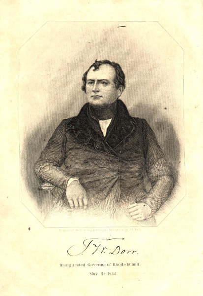
. In 1842, Chepachet was the setting of the endgame of the Dorr Rebellion, which helped to win voting rights for non-landowners in a new state Constitution.
Since 1926, the town has hosted the Ancients and Horribles parade, an annual Fourth of July event, notable for its political statements and ribald humor.
In the 1940s, a US Navy auxiliary ship, USS Chepachet, was named after the village. The ship's bell resides at the seat of town government, and the ship's surviving crew had a 50th anniversary reunion in the town in 1998.
In the 1990s Chepachet gained brief national attention in episodes of television's The X-Files as the location of the youth summer home of main character Fox Mulder. In one episode set in Providence he mentions Chepachet is "20 miles up Route 5." This is only marginally correct, as the local Route 5 does not enter Providence's boundaries, but passes through Smithfield, and is accessible to Chepachet only by crossing Burrillville; actually, from Providence, US 44 (which crosses RI 5 in Greenville) is the most direct route to Chepachet, and from points north and south, it's RI 102.
External links
Images
-
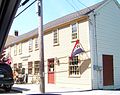
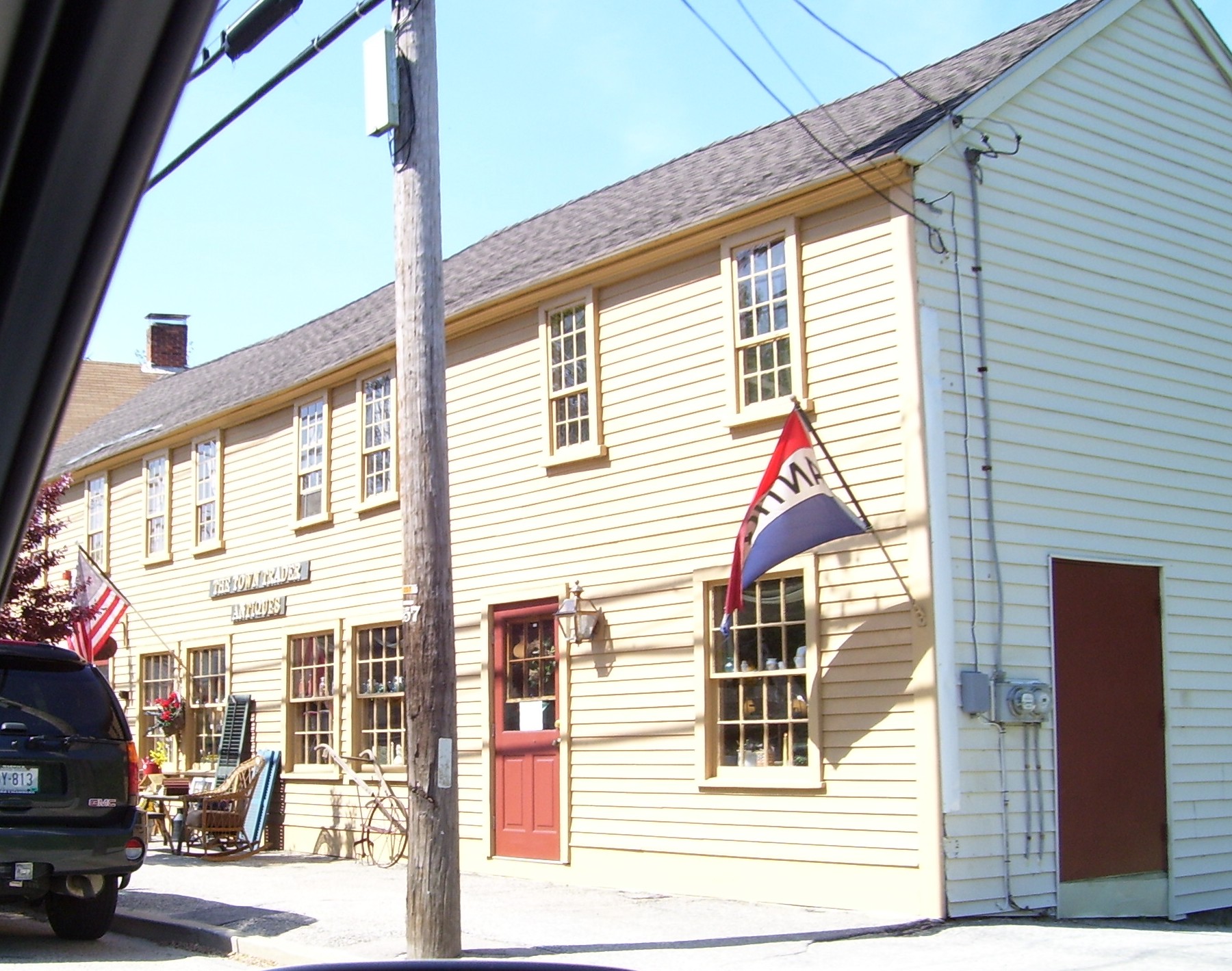
Chepachet antique store
-
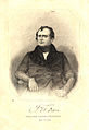
Thomas W. Dorr, leader of the 1842 rebellion, as pictured in an 1844 book frontispiece.
-
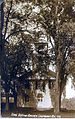
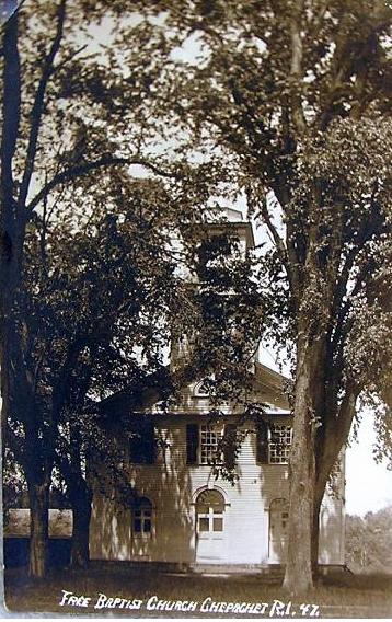
Chepachet Free Baptist Church, in ca. 1905. The meeting house was built in 1821
See also
- National Register of Historic Places listings in Providence County, Rhode Island
- Ancient and Horribles Parade
- Dorr Rebellion
- Ponaganset High School
- The Horror at Red Hook
References
- ^ "National Register Information System". National Register of Historic Places. National Park Service. 2007-01-23. http://nrhp.focus.nps.gov/natreg/docs/All_Data.html.
- ^ U.S. Geological Survey Geographic Names Information System: Chepachet, Rhode Island
- ^ Thomas Vernon Diary, pg. 76-78
Municipalities and communities of Providence County, Rhode Island Cities 
Towns Burrillville | Cumberland | Foster | Glocester | Johnston | Lincoln | North Providence | North Smithfield | Scituate | Smithfield
CDPs Other
villagesAlbion | Chepachet | Esmond | Forestdale | Georgiaville | Glendale | Hanton City | Harmony | Lime Rock | Manville | Oakland | Primrose | Quinnville | Saylesville | Smithville-North Scituate | Slatersville
U.S. National Register of Historic Places Topics Lists by states Alabama • Alaska • Arizona • Arkansas • California • Colorado • Connecticut • Delaware • Florida • Georgia • Hawaii • Idaho • Illinois • Indiana • Iowa • Kansas • Kentucky • Louisiana • Maine • Maryland • Massachusetts • Michigan • Minnesota • Mississippi • Missouri • Montana • Nebraska • Nevada • New Hampshire • New Jersey • New Mexico • New York • North Carolina • North Dakota • Ohio • Oklahoma • Oregon • Pennsylvania • Rhode Island • South Carolina • South Dakota • Tennessee • Texas • Utah • Vermont • Virginia • Washington • West Virginia • Wisconsin • WyomingLists by territories Lists by associated states Other  Category:National Register of Historic Places •
  Portal:National Register of Historic PlacesCategories:
- Historic districts in Rhode Island
- Historic districts in Providence County, Rhode Island
- Villages in Providence County, Rhode Island
- Glocester, Rhode Island
- Census-designated places in Providence County, Rhode Island
-


Wikimedia Foundation. 2010.