- National Register of Historic Places listings in Washington, D.C.
-
This is a list of properties and districts in the District of Columbia on the National Register of Historic Places. There are more than 500 listings, including 74 National Historic Landmarks of the United States and another 13 places otherwise designated as historic sites of national importance by Congress or the President.[1]
Contents
The locations of National Register properties and districts (at least for all showing latitude and longitude coordinates below), may be seen in a Google map by clicking on "Map of all coordinates".[2]
The list is generally grouped by quadrant. The Northwest Quadrant has almost 400 listings, so is further divided into three parts. The part of the NW Quadrant nearest the National Mall is grouped with the Southwest quadrant and called "central Washington" for the purposes of this list. The following are approximate tallies of current listings by area.[3]
Note that the White House, the Capitol building, and the United States Supreme Court Building are recorded in the National Register's NRIS database as a National Historic Landmarks, but these a matter of law three buildings and associated buildings and grounds are legally exempted from listing in the National Register of Historic Places, according to the Historic Preservation Act of 1966, Section 107 (16 U.S.C. 470g).
-
- This National Park Service list is complete through NPS recent listings posted November 10, 2011.[4]
Current listings by area
 Titanic Memorial, Southwest quadrant
Area # of Sites 1 Central 186 2 Western NW Quadrant 105 3 Upper NW Quadrant 161 4 Northeast 48 5 Southeast 35 7 Duplicates (11) Total: 524  Christ Church, Washington Parish, in Southeast quadrant
Current listings
Central Washington
includes the SW Quadrant and areas in the NW Quadrant east of Rock Creek and south of M Street.
NW quadrant
includes areas west of Rock Creek
includes areas east of Rock Creek and north of M Street.
NE quadrant
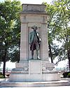
Landmark name Image Date listed Location Neighborhood Summary 1 American Revolution Statuary July 14, 1978 Public buildings and various parks within DC
38°53′37″N 76°59′59″W / 38.89361°N 76.99972°WStanton Park 14 statues including 11 in central DC, and the General Nathanael Greene statue in Stanton Park 2 Atlas Theater and Shops 
November 10, 2010 1313-33 H Street, NE
38°53′59″N 76°59′15″W / 38.89972°N 76.9875°WNE 3 Mountjoy Bayly House 
July 20, 1973 122 Maryland Ave., NE
38°53′29″N 77°0′18″W / 38.89139°N 77.005°WNE 4 Brooks Mansion 
July 17, 1975 901 Newton St., NE.
38°55′58″N 76°59′37″W / 38.93278°N 76.99361°WNE 5 Ralph Bunche House 
September 30, 1993 1510 Jackson St., NE.
38°55′47″N 76°59′2″W / 38.92972°N 76.98389°WNE 6 Capitol Hill Historic District 
August 27, 1976 Roughly bounded by Virginia Ave., SE., S. Capitol St., F St. NE., and 14th Sts. SE & NE.
38°53′13″N 76°59′51″W / 38.88694°N 76.9975°WNE, SE and NW Boundary increase (listed July 3, 2003): Roughly bounded by 7th St. NE, I-295, M St. SE and 11th St. SE 7 Chesapeake and Potomac Telephone Company Warehouse and Repair Facility 
May 14, 2007 1111 N. Capitol St. NE
38°54′15.48″N 77°0′32.4″W / 38.9043°N 77.009°WNE 8 Children's Country Home 
December 9, 2003 1731 Bunker Hill Rd. NE
38°56′29″N 76°58′39″W / 38.94139°N 76.9775°WNE 9 Civil War Monuments in Washington, DC 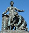
September 20, 1978 Various parks within the original boundaries of city
38°53′23″N 76°59′25″W / 38.88972°N 76.99028°WVarious 18 statues about people and topics related to the Civil War, including 1 in Lincoln Park (NE & SE quadrants), 6 in the upper NW quadrant, and 11 in central Washington. 10 Alexander Crummell School 
July 25, 2003 Kendall and Gallaudet Sts, NE
38°54′48″N 76°59′7″W / 38.91333°N 76.98528°WNE 11 Dahlgreen Courts 
November 10, 2010 2504-2520 10th St., NE
38°55′22″N 76°59′34″W / 38.92278°N 76.99278°WBrookland Apartment Buildings in Washington, DC, MPS 12 East Capitol Street Carbarn 
February 5, 1974 1400 E. Capitol St., NE.
38°53′23″N 76°59′6″W / 38.88972°N 76.985°WNE 13 East Corner Boundary Marker of the Original District of Columbia 
November 1, 1996 100 ft. E of jct. of Eastern and Southern Aves.
38°53′35″N 76°54′34″W / 38.89306°N 76.90944°WNE and SE See List of Boundary Markers of the Original District of Columbia 14 Engine Company 17 
June 6, 2007 1227 Monroe St. NE[5]
38°56′3″N 76°59′23″W / 38.93417°N 76.98972°WNE 15 Engine Company 26 
May 18, 2011 1340 Rhode Island Ave., NE
38°55′29″N 76°59′12″W / 38.92472°N 76.98667°WNE Firehouses in Washington DC MPS 16 Engine Company 26, (Old) 
August 8, 2007 2715 22nd St. NE
38°55′30″N 76°58′27″W / 38.925°N 76.97417°WNE 17 Engine Company 27 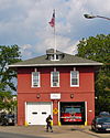
May 18, 2011 4201 Minnesota Ave., NE
38°54′4″N 76°56′36″W / 38.90111°N 76.94333°WNE Firehouses in Washington DC MPS 18 Engine House No. 10 
November 19, 2008 1341 Maryland Ave., NE
38°53′53.99″N 76°59′12.63″W / 38.8983306°N 76.9868417°WNE 19 First Baptist Church of Deanwood 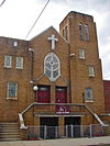
July 24, 2008 1008 45th St. NE
38°54′11.23″N 76°56′16.8″W / 38.9031194°N 76.938°WNE 20 Franciscan Monastery and Memorial Church of the Holy Land 
January 17, 1992 1400 Quincy St., NE.
38°56′13″N 76°59′0″W / 38.93694°N 76.983333°WNE 21 Gallaudet College Historic District 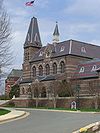
October 15, 1966 and September 10, 1974 Florida Ave. and 7th St., NE.
38°54′22″N 76°59′45″W / 38.90611°N 76.99583°WNE 22 Glenwood Cemetery Mortuary Chapel 
January 9, 1989 2219 Lincoln Rd., NE
38°55′19″N 77°0′22″W / 38.92194°N 77.00611°WNE 23 Hecht Company Warehouse 
May 25, 1994 1401 New York Ave., NE.
38°54′52″N 76°59′6″W / 38.91444°N 76.985°WNE 24 Kenilworth Aquatic Gardens 
August 25, 1978 Kenilworth Ave. and Douglas St. NE
38°54′46″N 76°56′37″W / 38.91278°N 76.94361°WNE 25 Langston Golf Course Historic District 
October 15, 1991 Roughly, Anacostia Park N of Benning Rd. NE
38°54′8″N 76°57′54″W / 38.90222°N 76.965°WNE 26 Langston Terrace Dwellings 
November 12, 1987 N from Benning Rd. to H St., NE
38°53′58″N 76°58′26″W / 38.89944°N 76.97389°WKingman Park 27 Mayfair Mansions Apartments 
November 1, 1989 3819 Jay St., NE
38°54′11″N 76°56′55″W / 38.90306°N 76.94861°WMayfair 28 Newton Theater 
June 27, 2007 3601-3611 12th St. NE
38°56′8″N 76°59′27″W / 38.93556°N 76.99083°WNE 29 Northeast No. 3 Boundary Marker of the Original District of Columbia 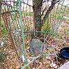
November 1, 1996 144 ft. NW of jct. of Eastern Ave. and Chillum Rd.
38°57′17″N 76°59′17″W / 38.95472°N 76.98806°WNE 30 Northeast No. 4 Boundary Marker of the Original District of Columbia 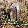
November 1, 1996 5400 Sargent Rd.
38°57′17″N 76°59′17″W / 38.95472°N 76.98806°WNE 31 Northeast No. 5 Boundary Marker of the Original District of Columbia 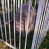
November 1, 1996 4609 Eastern Ave.
38°56′39″N 76°58′28″W / 38.94417°N 76.97444°WNE 32 Northeast No. 6 Boundary Marker of the Original District of Columbia 
November 1, 1996 3601 Eastern Ave.
38°56′1″N 76°57′41″W / 38.93361°N 76.96139°WNE 33 Northeast No. 7 Boundary Marker of the Original District of Columbia 
November 1, 1996 Ft. Lincoln Cemetery
38°55′26″N 76°56′56″W / 38.92389°N 76.94889°WNE 34 Northeast No. 8 Boundary Marker of the Original District of Columbia 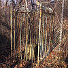
November 1, 1996 Kenilworth Aquatics Gardens, NW of jct. of Eastern and Kenilworth Aves.
38°54′50″N 76°56′10″W / 38.91389°N 76.93611°WNE 35 Northeast No. 9 Boundary Marker of the Original District of Columbia 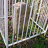
November 1, 1996 919 Eastern Ave.
38°54′12″N 76°55′21″W / 38.90333°N 76.9225°WNE 36 Plymouth Theater 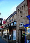
March 3, 2004 1365 H St., NE
38°54′7″N 76°59′11″W / 38.90194°N 76.98639°WNE 37 President's House, Gallaudet College 
February 15, 1974 7th St. and Florida Ave., NE.
38°54′19″N 76°59′46″W / 38.90528°N 76.99611°WNE 38 Roosevelt Apartment Building 
September 7, 1994 1116-1118 F St., NE.
38°53′50″N 76°59′27″W / 38.89722°N 76.99083°WNE 39 Sewall-Belmont House National Historic Site June 16, 1972 144 Constitution Ave., NE.
38°53′31″N 77°0′15″W / 38.89194°N 77.00417°WNE 40 Strand Theater 
November 25, 2008 5129-5131 Nannie Helen Burroughs Ave., NE
38°53′53.99″N 76°55′33.95″W / 38.8983306°N 76.9260972°WNE 41 Trades Hall of National Training School for Women and Girls July 17, 1991 601 50th St., NE.
38°53′46″N 76°55′48″W / 38.89611°N 76.93°WNE 42 Truck House No. 13 
June 6, 2007 1342 Florida Ave. NE
38°54′5″N 76°59′13″W / 38.90139°N 76.98694°WNE 43 U.S. National Arboretum 
April 11, 1973 24th and R Sts., NE.
38°54′42″N 76°57′58″W / 38.91167°N 76.96611°WNE 44 Uline Ice Company Plant and Arena Complex 
May 17, 2007 1132, 1140, and 1146 3rd St. NE
38°54′18″N 77°0′11″W / 38.905°N 77.00306°WNE 45 Union Station 
March 24, 1969 Intersection of Massachusetts and Louisiana Aves. and 1st St., NE.
38°53′51″N 77°0′23″W / 38.8975°N 77.00639°WNE 46 Union Station Plaza and Columbus Fountain 
April 9, 1980 1st St., Massachusetts and Louisiana Aves., NE
38°53′47″N 77°0′23″W / 38.89639°N 77.00639°WNE 47 United Brick Corporation Brick Complex 
October 3, 1978 2801 New York Ave., NE.
38°54′58″N 76°58′6″W / 38.91611°N 76.96833°WNE 48 Woodward & Lothrop Service Warehouse 
February 15, 2005 131 M St. NE
38°54′25″N 77°0′17″W / 38.90694°N 77.00472°WNE SE quadrant
Landmark name Image Date listed Location Neighborhood Summary 1 Anacostia Historic District 
October 11, 1978 Roughly bounded by Martin Luther King, Jr. Avenue; Good Hope Road; 16th Street; Fendall Street; V Street; 15th Street and the Frederick Douglass National Historic Site; Maple View Place
38°51′53″N 76°59′8″W / 38.86472°N 76.98556°WSE Comprises approximately 20 squares and about 550 buildings built between 1854 and 1930 2 Capitol Hill Historic District 
August 27, 1976 Roughly bounded by Virginia Ave., SE., S. Capitol St., F St. NE., and 14th Sts. SE & NE.
38°53′13″N 76°59′51″W / 38.88694°N 76.9975°WNE, SE and NW Boundary increase (listed July 3, 2003): Roughly bounded by 7th St. NE, I-295, M St. SE and 11th St. SE 3 Christ Church 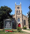
May 25, 1969 620 G St., SE.
38°52′53″N 76°59′52″W / 38.88139°N 76.99778°WSE 4 Civil War Monuments in Washington, DC 
September 20, 1978 Various parks within the original boundaries of city
38°53′23″N 76°59′25″W / 38.88972°N 76.99028°WVarious 18 statues about people and topics related to the Civil War, including 1 in Lincoln Park (NE & SE quadrants), 6 in the upper NW quadrant, and 11 in central Washington. 5 Commandant's Office, Washington Navy Yard 
August 14, 1973 Montgomery Sq. and Dahlgren Ave., SE.
38°52′23″N 76°59′43″W / 38.87306°N 76.99528°WSE See Washington Navy Yard
Small building at bottom of photo6 Congressional Cemetery 
June 23, 1969 1801 E St., SE.
38°52′52″N 76°58′38″W / 38.88111°N 76.97722°WSE Designated a National Historic Landmark June 14, 2011[6] 7 Frederick Douglass National Historic Site 
October 15, 1966 1411 W St., SE.
38°51′45″N 76°59′4″W / 38.8625°N 76.98444°WSE 8 Eastern Market May 27, 1971 7th and C Sts., SE.
38°53′11″N 76°59′48″W / 38.88639°N 76.99667°WSE Badly damaged by an early-morning fire on April 30, 2007; reopened on June 26, 2009 9 East Corner Boundary Marker of the Original District of Columbia 
November 1, 1996 100 ft. E of jct. of Eastern and Southern Aves.
38°53′35″N 76°54′34″W / 38.89306°N 76.90944°WNE and SE See List of Boundary Markers of the Original District of Columbia 10 Engine Company No. 19 
May 10, 2010 2813 Pennsylvania Ave., SE
38°52′24″N 76°58′1″W / 38.87333°N 76.96694°WSE 11 Engine Company No. 25 
June 27, 2007 3203 Martin Luther King Jr., Ave SE
38°50′35″N 77°0′3″W / 38.84306°N 77.00083°WSE 12 Folger Shakespeare Library June 23, 1969 201 E. Capitol St., SE.
38°53′22″N 77°0′11″W / 38.88944°N 77.00306°WSE 13 Friendship House 
January 18, 1973 619 D St., SE., or 630 South Carolina Ave., SE.
38°53′2″N 76°59′53″W / 38.88389°N 76.99806°WSE 14 Gallinger Municipal Hospital Psychopathic Ward February 27, 1989 Reservation 13, 19th St. and Massachusetts Ave., SE
38°53′4″N 76°58′37″W / 38.88444°N 76.97694°WSE 15 Main Gate, Washington Navy Yard 
August 14, 1973 8th and M Sts., SE.
38°52′35″N 76°59′43″W / 38.87639°N 76.99528°WSE More commonly known as the Latrobe Gate. 16 Old Naval Hospital 
May 3, 1974 921 Pennsylvania Ave., SE.
38°52′58″N 76°59′36″W / 38.88278°N 76.99333°WSE 17 Quarters A, Washington Navy Yard 
August 14, 1973 E of Main Gate and S of M St., SE., in the Navy Yard
38°52′34″N 76°59′41″W / 38.87611°N 76.99472°WSE 18 Quarters B, Washington Navy Yard 
August 14, 1973 Charles Morris Ave., SE.
38°52′32″N 76°59′39″W / 38.87556°N 76.99417°WSE 19 St. Elizabeths Hospital 
April 26, 1979 1100 Alabama Avenue SE.[7]
38°51′1″N 76°59′40″W / 38.85028°N 76.99444°WSE 20 St. Mark's Church 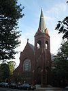
May 8, 1973 3rd and A Sts., SE.
38°53′18″N 77°0′6″W / 38.88833°N 77.00167°WSE 21 Saint Paul African Union Methodist Church 
July 28, 2011 401 I St., SE.
38°52′45″N 77°0′2″W / 38.87917°N 77.00056°WSE 22 John Philip Sousa Junior High School August 7, 2001 3650 Ely Place, SE
38°53′0.59″N 76°57′7.98″W / 38.8834972°N 76.9522167°WSE In 1950, eleven African American students were denied admission to the newly constructed all-white Sousa school. This action was eventually overturned in the landmark 1954 Supreme Court decision in Bolling v. Sharpe, which made segregated public schools illegal in the District of Columbia. This defeat of the principle of "separate but equal" was a significant landmark in the modern Civil Rights Movement. 23 Southeast No. 1 Boundary Marker of the Original District of Columbia 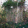
November 1, 1996 30 ft. south of the junction of Southern Ave. and D St., SE
38°52′58.03″N 76°55′20.29″W / 38.8827861°N 76.9223028°WSE 24 Southeast No. 2 Boundary Marker of the Original District of Columbia 
November 1, 1996 4345 Southern Ave.
38°52′20″N 76°56′9″W / 38.87222°N 76.93583°WSE 25 Southeast No. 3 Boundary Marker of the Original District of Columbia 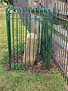
November 1, 1996 3908 Southern Ave.
38°51′43″N 76°56′55″W / 38.86194°N 76.94861°WSE 26 Southeast No. 5 Boundary Marker of the Original District of Columbia 
November 1, 1996 280 ft. NE of jct. of Southern Ave. and Valley Terrace
38°50′31″N 76°58′29″W / 38.84194°N 76.97472°WSE 27 Southeast No. 6 Boundary Marker of the Original District of Columbia 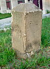
November 1, 1996 901 Southern Ave.
38°49′54″N 76°59′17″W / 38.83167°N 76.98806°WSE 28 Southeast No. 7 Boundary Marker of the Original District of Columbia 
November 1, 1996 25 ft. NE of jct. of Southern Ave. and Indian Head Rd.
38°49′17″N 77°0′5″W / 38.82139°N 77.00139°WSE 29 Southeast No. 9 Boundary Marker of the Original District of Columbia November 1, 1996 .225 mi. S of Oxon Cove Br. and 420 ft. E of Shepherd Pkwy.
38°48′14″N 77°1′27″W / 38.80389°N 77.02417°WSE 30 U.S. Marine Corps Barracks and Commandant's House 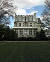
December 27, 1972 8th and I Sts., SE
38°52′48″N 76°59′41″W / 38.88°N 76.99472°WSE 31 Suitland Parkway 
June 2, 1995 From the Anacostia R. in the District of Columbia to Pennsylvania Ave. in Prince George's County, Maryland
38°50′29″N 76°55′17″W / 38.84139°N 76.92139°WSE 32 Washington and Georgetown Railroad Car House 
November 14, 2006 770 M St. SE
38°52′44″N 76°59′45″W / 38.87889°N 76.99583°WSE Commonly known as the Blue Castle 33 Washington Navy Yard 
June 19, 1973 8th and M Sts., SE
38°52′25″N 76°59′47″W / 38.87361°N 76.99639°WSE 34 Watterston House 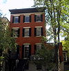
January 17, 1992 224 2nd St., SE.
38°53′11″N 77°0′13″W / 38.88639°N 77.00361°WSE 35 Woodlawn Cemetery 
December 20, 1996 4611 Benning Rd., SE
38°53′6″N 76°56′19″W / 38.885°N 76.93861°WSE See also
References
- ^ See List of National Historic Landmarks in the District of Columbia.
- ^ The latitude and longitude information provided in this table was derived originally from the National Register Information System, which has been found to be fairly accurate for about 99% of listings. For about 1% of NRIS original coordinates, experience has shown that one or both coordinates are typos or otherwise extremely far off; some corrections may have been made. A more subtle problem causes many locations to be off by up to 150 yards, depending on location in the country: most NRIS coordinates were derived from tracing out latitude and longitudes off of USGS topographical quadrant maps created under the North American Datum of 1927, which differs from the current, highly accurate WGS84 GPS system used by Google maps. Chicago is about right, but NRIS longitudes in Washington are higher by about 4.5 seconds, and are lower by about 2.0 seconds in Maine. Latitudes differ by about 1.0 second in Florida. Some locations in this table may have been corrected to current GPS standards.
- ^ These counts are based on entries in the National Register Information Database as of April 24, 2008 and new weekly listings posted since then on the National Register of Historic Places web site. There are frequent additions to the listings and occasional delistings and the counts here are approximate and not official. New entries are added to the official Register on a weekly basis. Also, the counts in this table exclude boundary increase and decrease listings which only modify the area covered by an existing property or district, although carrying a separate National Register reference number.
- ^ "National Register of Historic Places: Weekly List Actions". National Park Service, United States Department of the Interior. Retrieved on November 10, 2011.
- ^ District of Columbia Fire Department. "DC FEMS Fire Station Locations". http://fems.dc.gov/fems/cwp/view,a,3,q,636401.asp. Retrieved 2009-12-23.
- ^ "National Register of Historic Places listings - Weekly list of actions taken on properties: 6/13/11 through 6/19/11". June 24, 2011. http://www.nps.gov/history/nr/listings/20110624.htm. Retrieved July 4, 2011.
- ^ District of Columbia Department of Mental Health. "About St. Elizabeths Hospital". http://dmh.dc.gov/dmh/cwp/view,a,3,q,516064.asp. Retrieved 2009-12-23.
U.S. National Register of Historic Places Topics Lists by states Alabama • Alaska • Arizona • Arkansas • California • Colorado • Connecticut • Delaware • Florida • Georgia • Hawaii • Idaho • Illinois • Indiana • Iowa • Kansas • Kentucky • Louisiana • Maine • Maryland • Massachusetts • Michigan • Minnesota • Mississippi • Missouri • Montana • Nebraska • Nevada • New Hampshire • New Jersey • New Mexico • New York • North Carolina • North Dakota • Ohio • Oklahoma • Oregon • Pennsylvania • Rhode Island • South Carolina • South Dakota • Tennessee • Texas • Utah • Vermont • Virginia • Washington • West Virginia • Wisconsin • WyomingLists by territories American Samoa • District of Columbia • Guam • Minor Outlying Islands • Northern Mariana Islands • Puerto Rico • Virgin IslandsLists by associated states Other  District of Columbia
Topics - Culture
- History
- Geography
- Economy
- Demographics
- Media
- Music
- Sports
- Symbols
- Transportation
- Visitor attractions
- Emancipation Day
Government Categories:- District of Columbia-related lists
- National Register of Historic Places in Washington, D.C.
-
Wikimedia Foundation. 2010.


