- National Register of Historic Places listings in Washington County, Pennsylvania
-
 Location of Washington County in Pennsylvania
This is a list of the National Register of Historic Places listings in Washington County, Pennsylvania.
This is intended to be a complete list of the properties and districts on the National Register of Historic Places in Washington County, Pennsylvania, United States. The locations of National Register properties and districts for which the latitude and longitude coordinates are included below, may be seen in a Google map.[1]
There are 95 properties and districts listed on the National Register in the county. Four sites are further designated as National Historic Landmarks.
-
- This National Park Service list is complete through NPS recent listings posted November 10, 2011.[2]
Current listings
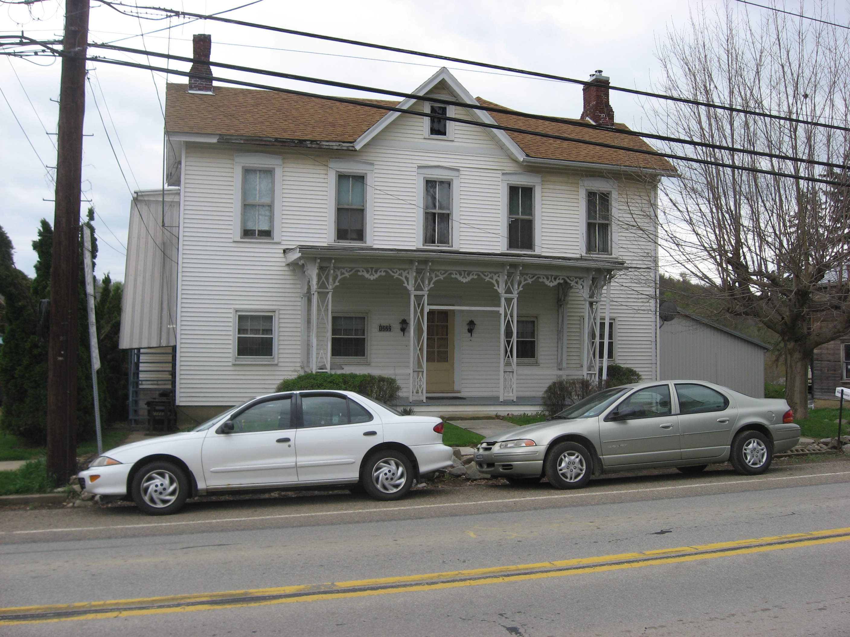
[3] Landmark name[4] Image Date listed Location City or Town Summary 1 Edward G. Acheson House 
May 11, 1976 908 Main Street
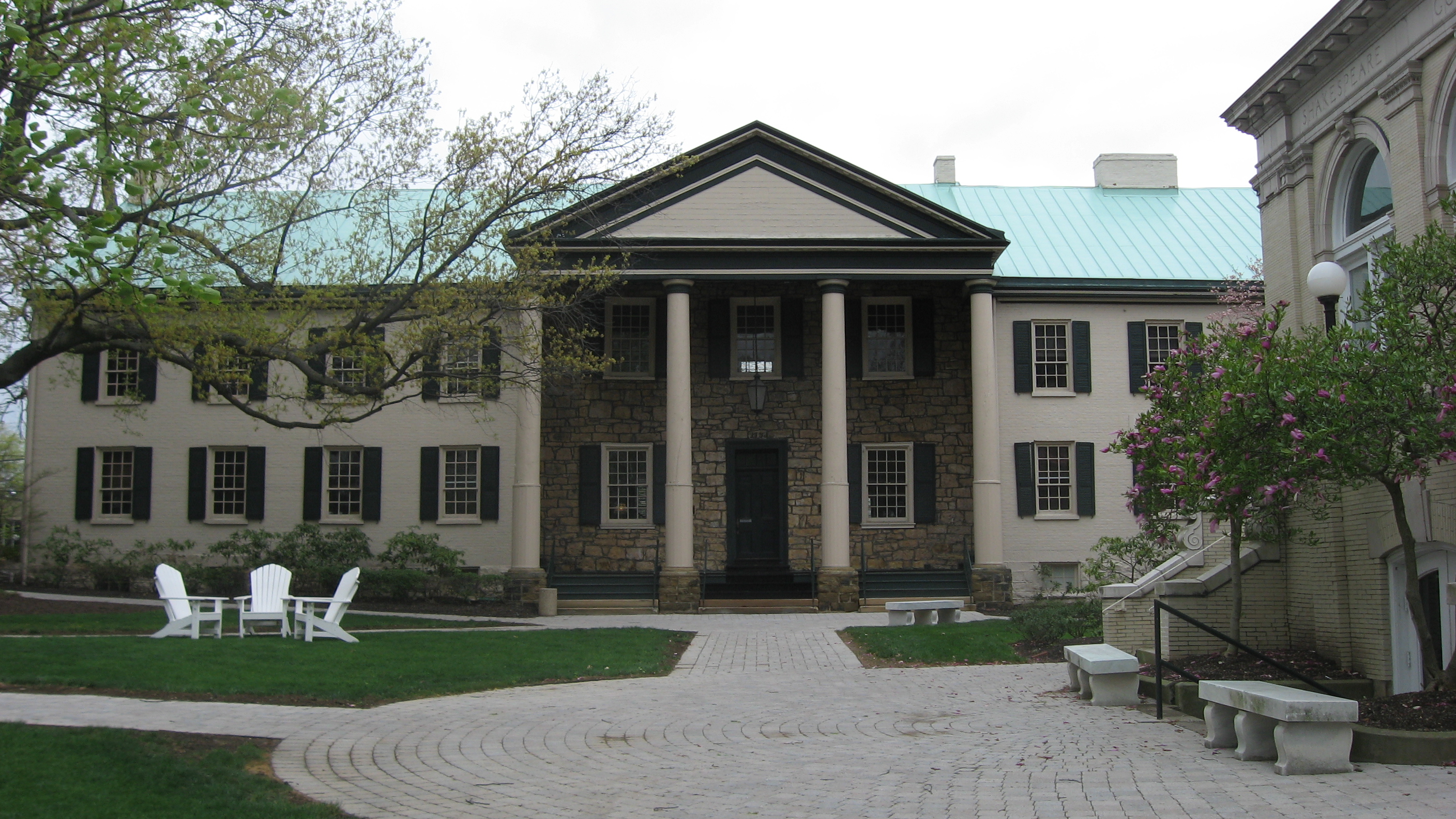
40°12′19″N 79°55′59″W / 40.20528°N 79.93306°WMonongahela 2 Administration Building, Washington and Jefferson College 
August 16, 1977 Washington & Jefferson College campus
40°10′13.3″N 80°14′28″W / 40.170361°N 80.24111°WWashington 3 Bailey Covered Bridge 
June 22, 1979 Bailey Road spanning Ten Mile Creek, southeast of Prosperity
40°1′14″N 80°11′45″W / 40.02056°N 80.19583°WAmwell Township 4 Beallsville Historic District October 24, 1996 Roughly, Main Street, Chestnut Alley, and South Alley between West Alley and Oak Alley
40°3′54″N 80°1′23″W / 40.065°N 80.02306°WBeallsville 5 Bethel African American Episcopal Church of Monongahela City 
November 7, 2002 Junction of 7th and Main Streets
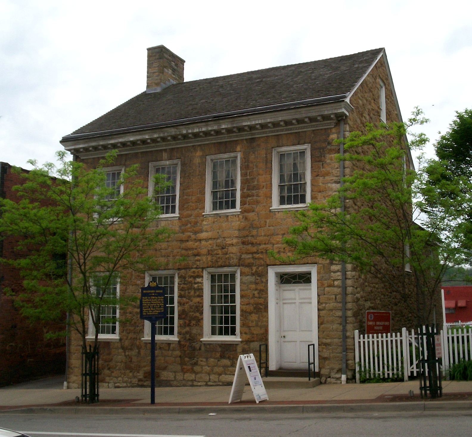
40°12′19″N 79°55′51.6″W / 40.20528°N 79.931°WMonongahela 6 David Bradford House 
July 16, 1973 175 South Main Street
40°10′5″N 80°14′42″W / 40.16806°N 80.245°WWashington 7 Samuel Brownlee House November 7, 1976 North of Eighty-Four on Pennsylvania Route 519
40°12′24″N 80°7′41″W / 40.20667°N 80.12806°WNorth Strabane Township 8 Scott Brownlee Covered Bridge 
June 22, 1979 Off Pennsylvania Route 231
40°2′38″N 80°23′53″W / 40.04389°N 80.39806°WEast Finley Township 9 Brownsville Bridge 
June 22, 1988 State Route 4025 over the Monongahela River
40°1′20″N 79°53′26″W / 40.02222°N 79.89056°WWest Brownsville Extends into Fayette County 10 Caldwell Tavern February 16, 1996 Junction of U.S. Route 40 and Township Route 474, northeast of Claysville
40°8′21″N 80°21′36″W / 40.13917°N 80.36°WBuffalo Township 11 Canonsburg Armory 
December 22, 1989 West College Street and North Central Avenue
40°15′37.27″N 80°11′14.48″W / 40.2603528°N 80.1873556°WCanonsburg 12 Cement City Historic District February 16, 1996 Roughly Chestnut and Walnut Streets from Modisette Avenue to Bertha Avenue and along Ida and Bertha Streets
40°10′15″N 79°51′56″W / 40.17083°N 79.86556°WDonora 13 Centerville Historic District October 24, 1996 Roughly Old National Pike from Linton Road to its junction with Pennsylvania Route 481
40°2′42″N 79°58′35″W / 40.045°N 79.97639°WCenterville 14 Charleroi Historic District 
November 9, 2007 Roughly bounded by 1st and 13th Streets, Oakland Avenue, and the former Pennsylvania Railroad tracks
40°8′24″N 79°54′0″W / 40.14°N 79.9°WCharleroi 15 Charleroi-Monessen Bridge 
June 22, 1988 State Route 2018 over the Monongahela River
40°9′6″N 79°54′15″W / 40.15167°N 79.90417°WNorth Charleroi Extends into Monessen in Westmoreland County 16 Crawford Covered Bridge June 22, 1979 Crawford Road spanning Robinson Fork Wheeling Creek
39°59′56″N 80°28′21″W / 39.99889°N 80.4725°W[5]West Finley Township 17 Dager-Wonsettler Farmstead November 21, 2003 1044 National Park, 0.5 miles (0.80 km) northwest of the junction of Pennsylvania Route 519 and U.S. Route 40
40°7′49″N 80°8′51″W / 40.13028°N 80.1475°WAmwell Township 18 Danley Covered Bridge June 22, 1979 Dogwood Hill Road spanning Robinson Fork Wheeling Creek
40°3′18″N 80°26′22″W / 40.055°N 80.43944°W[5]West Finley Township 19 Horn Davis Overholtzer Bridge June 22, 1979 Spanning Ten Mile Creek southeast of Fairfield
40°0′29″N 80°3′45″W / 40.00806°N 80.0625°WWest Bethlehem Township Extends into Morgan Township in Greene County 20 Day Covered Bridge 
June 22, 1979 Covered Bridge Road spanning Short Creek, south of Prosperity
40°1′46″N 80°17′35″W / 40.02944°N 80.29306°W[5]Morris Township 21 Margaret Derrow House 
November 5, 1974 West Main Street, west of the Claysville borough limits
40°6′56″N 80°24′59″W / 40.11556°N 80.41639°WDonegal Township 22 Devil's Den, McClurg Covered Bridge 
June 22, 1979 Hanover Township park
40°25′28.52″N 80°26′47.51″W / 40.4245889°N 80.4465306°WHanover Township Moved from original location along King's Creek to Hanover Township park in 1987[5] 23 Doak-Little House April 15, 1996 U.S. Route 40 0.5 miles (0.80 km) west of South Strabane
40°8′34″N 80°10′26″W / 40.14278°N 80.17389°WSouth Strabane Township 24 Joseph Dorsey House 
November 19, 1974 113 Cherry Avenue, west of West Brownsville
40°1′14″N 79°55′24″W / 40.02056°N 79.92333°WCenterville 25 Dusmal House February 24, 1975 East of Gastonville off Gilmore Road
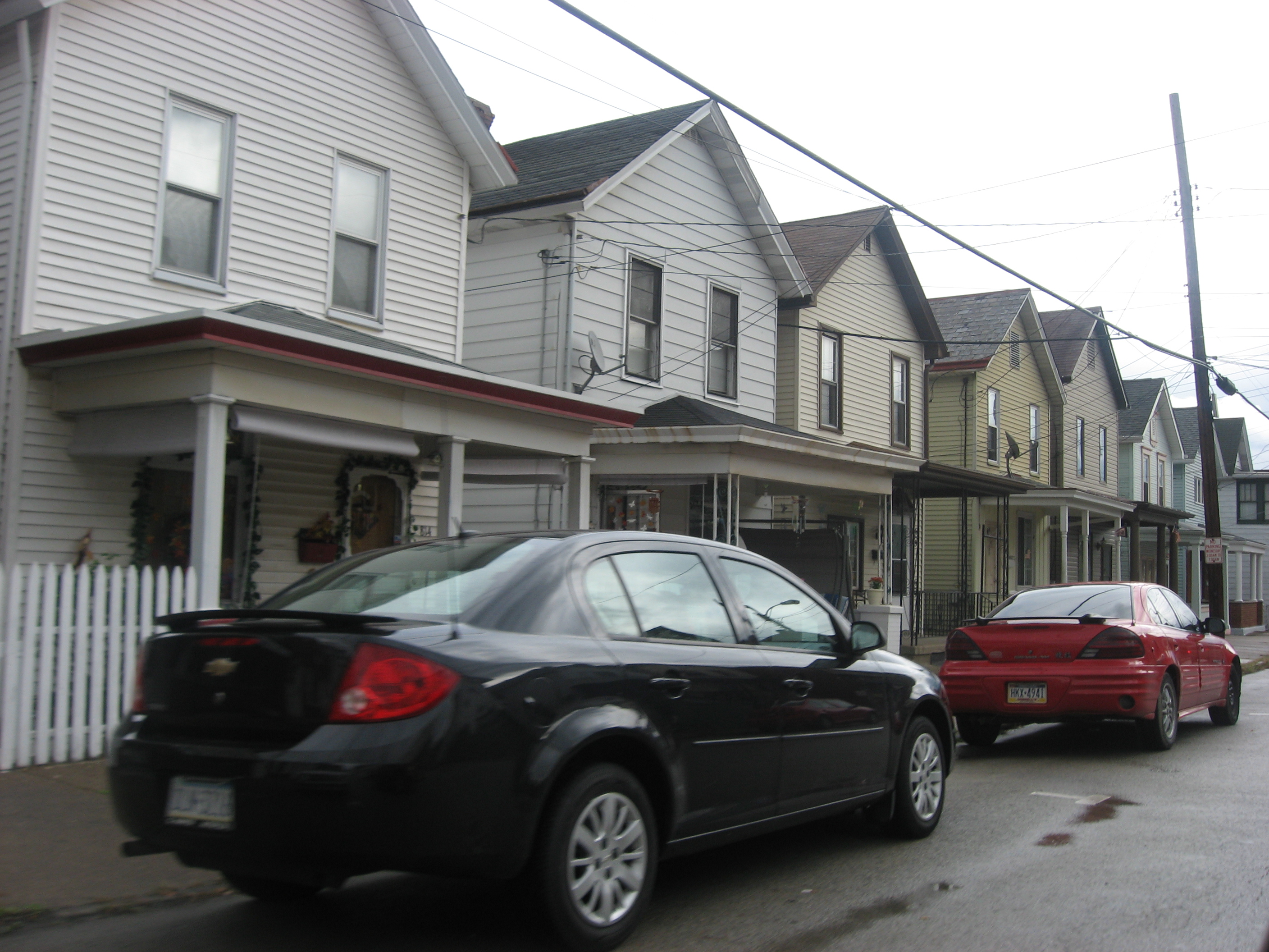
40°15′10″N 79°57′55″W / 40.25278°N 79.96528°WUnion Township 26 East Washington Historic District 
November 15, 1984 Roughly bounded by North, East, and Wade Avenues and Wheeling, Beau, and Chestnut Streets
40°10′18″N 80°14′4″W / 40.17167°N 80.23444°WEast Washington 27 Ebenezer Covered Bridge June 22, 1979 Mingo Creek County Park spanning Mingo Creek
40°11′28″N 80°2′28″W / 40.19111°N 80.04111°W[5]Nottingham Township Moved from original location spanning South Fork Maple Creek at Ginger Hill in 1977[5] 28 Erskine Covered Bridge June 22, 1979 Erskine Road spanning Middle Wheeling Creek, south of West Alexander
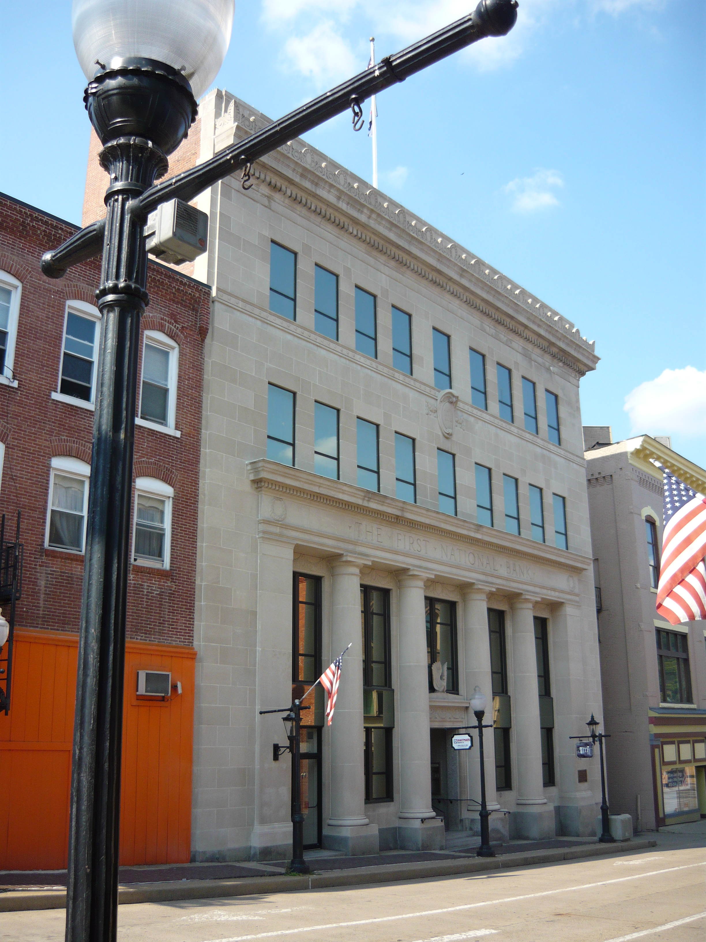
40°3′59″N 80°30′59″W / 40.06639°N 80.51639°W[5]West Finley Township 29 First National Bank of Charleroi 
February 7, 2007 210 Fifth Street
40°8′25″N 79°53′52″W / 40.14028°N 79.89778°WCharleroi 30 Molly Fleming House May 30, 1997 616 Wood Street
40°3′48″N 79°53′27.75″W / 40.06333°N 79.8910417°WCalifornia 31 Philip Friend House November 12, 1998 105 Little Daniels Run Road
40°4′14″N 80°7′31″W / 40.07056°N 80.12528°WNorth Bethlehem Township 32 Harrison House December 30, 1974 Old Route 40
40°2′19″N 79°57′12″W / 40.03861°N 79.95333°WCenterville 33 Hawthorne School 
May 8, 1986 Hawthorne and Bluff Streets
40°15′37.63″N 80°11′47″W / 40.2604528°N 80.19639°WCanonsburg 34 Henry Covered Bridge June 22, 1979 Mansion Hill Road spanning Mingo Creek, west of Monongahela
40°12′8″N 80°1′1″W / 40.20222°N 80.01694°W[5]Nottingham Township 35 Hill's Tavern 
November 19, 1974 U.S. Route 40 in Scenery Hill
40°5′8″N 80°4′11″W / 40.08556°N 80.06972°WNorth Bethlehem Township 36 Huffman Distillery and Chopping Mill November 12, 1992 Caldwell Road, 2 miles (3.2 km) north of the junction with Pennsylvania Route 917, north of Cokeburg
40°7′21″N 80°3′59″W / 40.1225°N 80.06639°WSomerset Township 37 Hughes Covered Bridge June 22, 1979 Spans Ten Mile Creek, southeast of Prosperity
40°1′59″N 80°9′37″W / 40.03306°N 80.16028°WAmwell Township 38 Jackson's Mill Covered Bridge 
June 22, 1979 Kings Creek Road spanning Kings Creek, northwest of Burgettstown
40°25′26.08″N 80°29′21.3″W / 40.4239111°N 80.48925°W[5]Hanover Township 39 Jennings-Gallagher House March 28, 1996 429 Wood Street
40°3′52″N 79°53′26″W / 40.06444°N 79.89056°WCalifornia 40 Kinder's Mill October 16, 1986 State Route 2011 at Piper Road
40°1′51″N 80°3′18″W / 40.03083°N 80.055°WDeemston 41 Krepps Covered Bridge June 22, 1979 Covered Bridge Road, southeast of Cherry Valley and southwest of Midway
40°20′26″N 80°19′53″W / 40.34056°N 80.33139°W[5]Mount Pleasant Township 42 Leatherman Covered Bridge June 22, 1979 Leatherman Bridge Road, north of Cokeburg
40°6′33.25″N 80°4′18″W / 40.1092361°N 80.07167°WNorth Bethlehem Township 43 LeMoyne Crematory 
February 16, 1996 Northwestern corner of the junction of Redstone Road and Elm Street, southeast of Washington
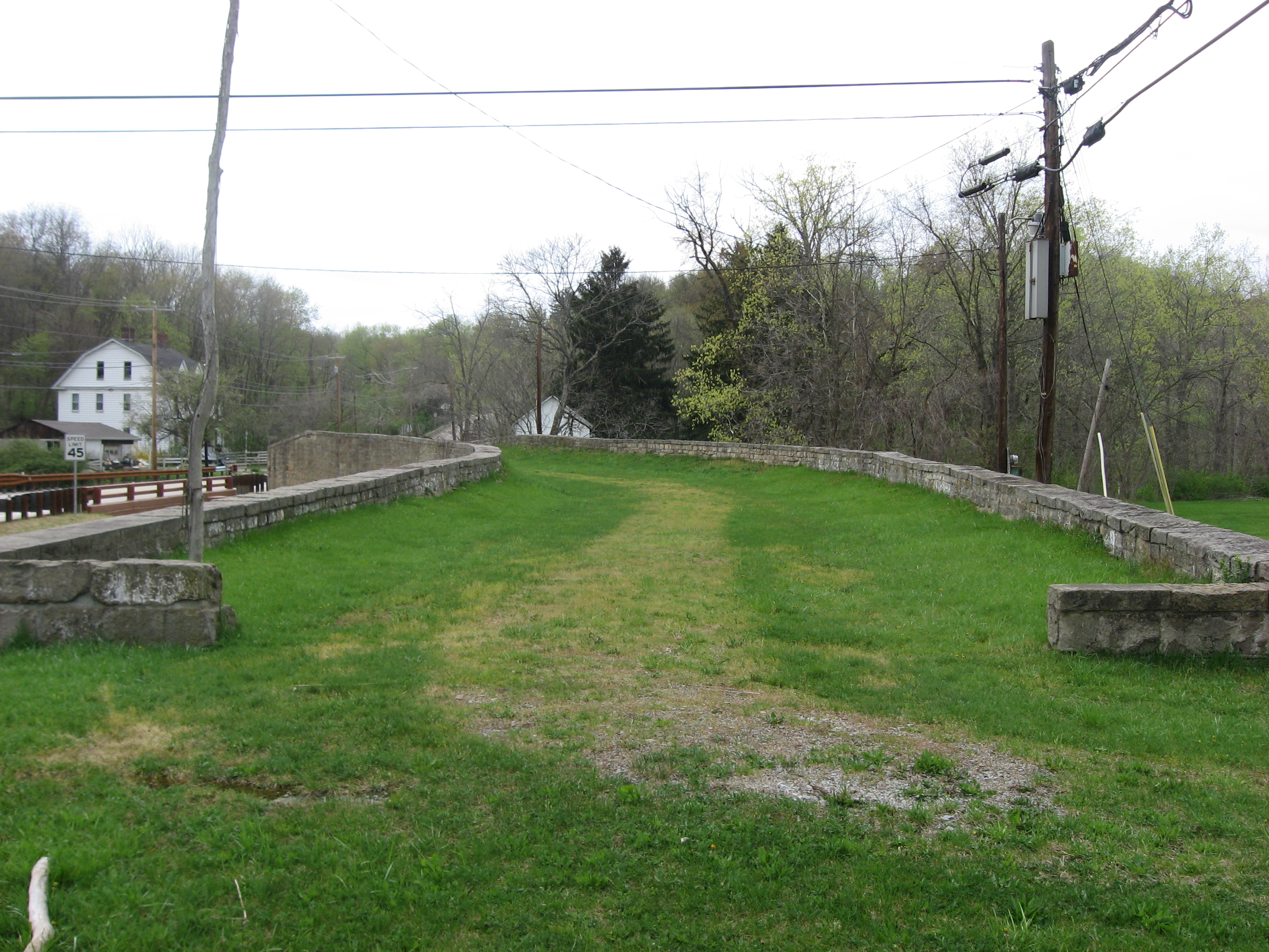
40°9′38″N 80°14′16″W / 40.16056°N 80.23778°WNorth Franklin Township 44 F. Julius LeMoyne House 
September 25, 1997 49 East Maiden Street
40°10′5″N 80°14′36″W / 40.16806°N 80.24333°WWashington 45 Moses Little Tavern February 16, 1996 438 East National Pike, southeast of Laboratory
40°8′58″N 80°11′19″W / 40.14944°N 80.18861°WAmwell Township 46 David Longwell House 
August 2, 1993 711 West Main Street
40°12′19″N 79°55′53″W / 40.20528°N 79.93139°WMonongahela 47 Lyle Covered Bridge 
June 22, 1979 Kramer Road spanning Brush Run, north of Raccoon
40°27′15.26″N 80°22′31.85″W / 40.4542389°N 80.3755139°WHanover Township 48 Malden Inn January 24, 1974 West of Blainsburg on U.S. Route 40
40°2′15″N 79°55′50″W / 40.0375°N 79.93056°WCalifornia 49 Isaac Manchester House June 21, 1975 2 miles (3.2 km) south of Avella on Pennsylvania Route 231
40°15′17″N 80°27′40″W / 40.25472°N 80.46111°WIndependence Township 50 Marianna Historic District November 15, 1984 Roughly bounded by Ten Mile Creek, Beeson Avenue Hill, and 6th and 7th Streets
40°1′21″N 80°5′53″W / 40.0225°N 80.09806°WMarianna 51 Martin Farmstead July 21, 1995 Pennsylvania Route 136, 2 miles (3.2 km) west of Eighty-Four
40°11′1″N 80°10′6″W / 40.18361°N 80.16833°WSouth Strabane Township 52 Martin's Mill Covered Bridge June 22, 1979 West of Marianna crossing Ten Mile Creek
40°0′49″N 80°7′54″W / 40.01361°N 80.13167°WAmwell and West Bethlehem Townships 53 Dr. Joseph Maurer House 
December 30, 1993 97 West Wheeling Street
40°10′8.71″N 80°14′50.86″W / 40.1690861°N 80.2474611°WWashington 54 Blaney Mays Covered Bridge June 22, 1979 Waynesburg Road spanning Middle Wheeling Creek, southwest of Claysville
40°5′17″N 80°29′15″W / 40.08806°N 80.4875°W[5]Donegal Township 55 Meadowcroft Rockshelter 
November 21, 1978 West of Avella
40°17′11″N 80°29′30″W / 40.28639°N 80.49167°WJefferson Township 56 Longdon L. Miller Covered Bridge 
June 22, 1979 Miller Creek Road spanning Templeton Fork Wheeling Creek, west of Enon
39°58′41″N 80°26′47″W / 39.97806°N 80.44639°W[5]West Finley Township 57 Mingo Creek Presbyterian Church and Churchyard November 12, 1992 Junction of Pennsylvania Route 88 and Mingo Church Road, northwest of Courtney
40°13′44″N 79°59′50″W / 40.22889°N 79.99722°WUnion Township 58 Monongahela Cemetery 
October 14, 2001 Cemetery Hill Road at Gregg Street
40°11′39″N 79°55′20″W / 40.19417°N 79.92222°WMonongahela 59 Montgomery House 
October 25, 1974 West Main Street
40°6′57″N 80°24′58″W / 40.11583°N 80.41611°WClaysville 60 Thomas Munce House June 28, 1996 Pennsylvania Route 136, 3 miles (4.8 km) east of Washington
40°11′13″N 80°10′48″W / 40.18694°N 80.18°WSouth Strabane Township 61 John H. Nelson House May 5, 2000 104 Colvin Road
40°8′4″N 79°57′28″W / 40.13444°N 79.95778°WFallowfield Township 62 Old Main, California State College 
May 2, 1974 California State College campus
40°3′57″N 79°53′8″W / 40.06583°N 79.88556°WCalifornia 63 Robert Parkinson Farm July 15, 2002 Pennsylvania Route 18, 0.4 miles (0.64 km) north of Old Concord
40°0′44″N 80°20′0″W / 40.01222°N 80.333333°WMorris Township 64 Pennsylvania Railroad Freight Station 
July 21, 1995 111 Washington Street
40°10′20″N 80°15′15″W / 40.17222°N 80.25417°WWashington 65 Pennsylvania Railroad Passenger Station 
June 19, 1979 100 Wood Street
40°4′5″N 79°53′21″W / 40.06806°N 79.88917°WCalifornia 66 Pine Bank Covered Bridge June 22, 1979 Meadowcroft Rockshelter and Museum of Rural Life, southwest of Studa crossing a ravine
40°17′20″N 80°29′27″W / 40.28889°N 80.49083°W[5]Jefferson Township 67 Plant's Covered Bridge 
June 22, 1979 Skyview Road spanning Templeton Fork Wheeling Creek
40°1′16″N 80°24′58″W / 40.02111°N 80.41611°W[5]East Finley Township 68 Ralston Freeman Covered Bridge 
June 22, 1979 North of Paris crossing Aunt Clara's Fork of King's Creek
40°26′49.19″N 80°30′25.64″W / 40.4469972°N 80.5071222°WHanover Township 69 Regester Log House October 16, 1974 North of Fredericktown off Pennsylvania Route 88
40°0′43″N 79°59′47″W / 40.01194°N 79.99639°WEast Bethlehem Township 70 Ringland Tavern February 16, 1996 U.S. Route 40 in Scenery Hill
40°5′3″N 80°4′6″W / 40.08417°N 80.06833°WNorth Bethlehem Township 71 Roberts House 
April 10, 1975 225 North Central Avenue
40°15′40.1″N 80°11′14.83″W / 40.261139°N 80.1874528°WCanonsburg 72 Frank L. Ross Farm March 20, 2002 Pennsylvania Route 519, 0.3 miles (0.48 km) north of U.S. Route 40
40°7′56″N 80°8′1″W / 40.13222°N 80.13361°WNorth Bethlehem and South Strabane Townships 73 "S" Bridge 
April 4, 1975 U.S. Route 40 at Pennsylvania Route 221, 6 miles (9.7 km) west of Washington
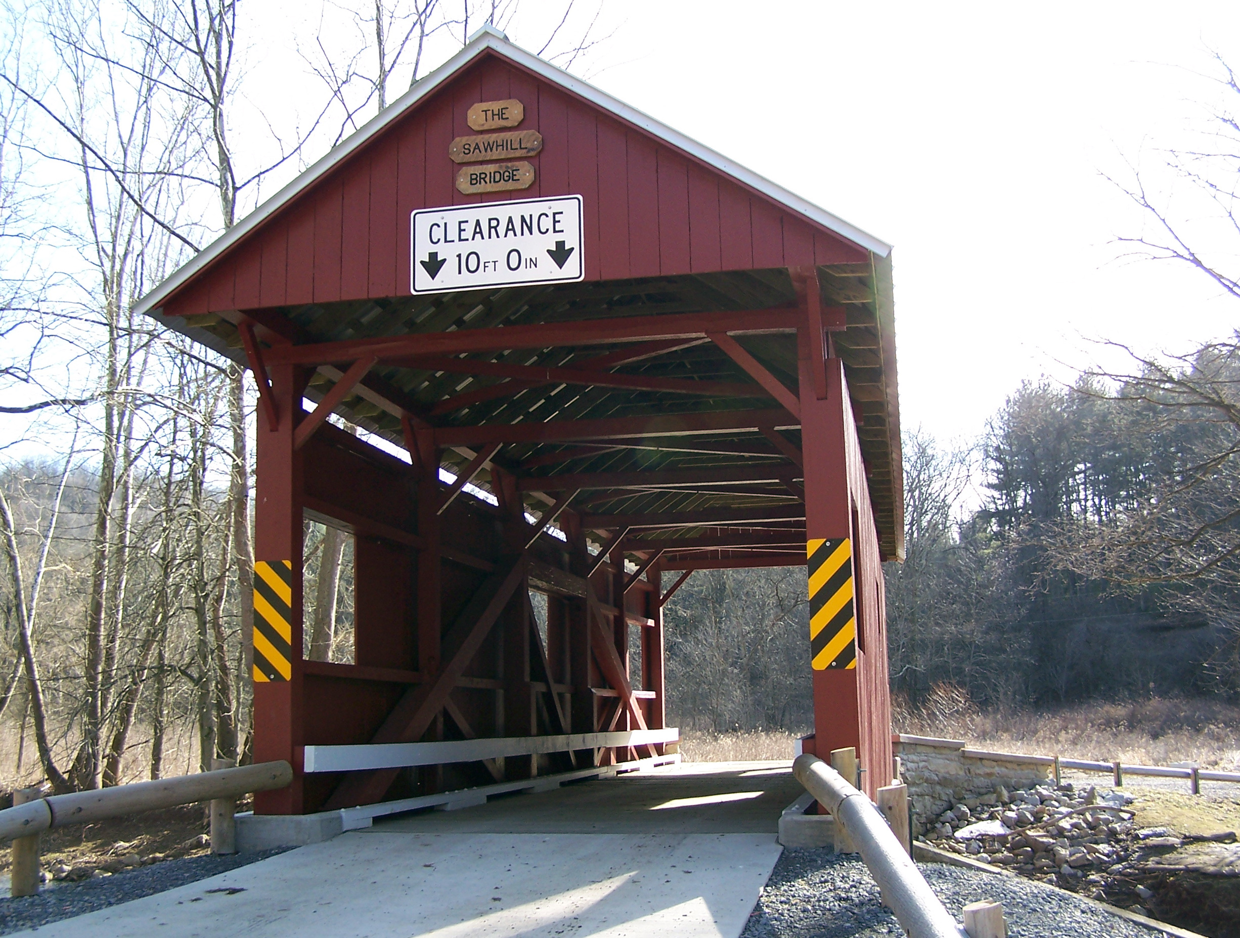
40°8′22″N 80°21′0″W / 40.13944°N 80.35°WBuffalo Township 74 Sawhill Covered Bridge 
June 22, 1979 Off Pennsylvania Route 221, northwest of Taylorstown
40°10′48″N 80°24′59″W / 40.18°N 80.41639°WBlaine Township 75 Scenery Hill Historic District October 24, 1996 Roughly National Pike East/U.S. Route 40 between Scenery Hill Cemetery and Kinder Road in Scenery Hill
40°5′8″N 80°4′17″W / 40.08556°N 80.07139°WNorth Bethlehem Township 76 Sprowl's Covered Bridge 
June 22, 1979 Off Pennsylvania Route 231
40°0′39″N 80°24′25″W / 40.01083°N 80.40694°WEast Finley Township 77 Stephenson-Campbell House August 22, 2002 At the end of Tomahawk Claim Lane, off Reissing Road
40°20′31″N 80°11′43″W / 40.34194°N 80.19528°WCecil Township 78 Taylorstown Historic District September 5, 1985 Main Street in Taylorstown
40°9′35″N 80°22′45″W / 40.15972°N 80.37917°WBlaine Township 79 James Thome Farm April 11, 1997 213 Linnwood Road, northwest of Eighty Four
40°11′53″N 80°9′30″W / 40.19806°N 80.15833°WNorth Strabane Township 80 Trinity Hall 
September 27, 1976 1 mile (1.6 km) south of Washington on Pennsylvania Route 18
40°9′53″N 80°14′56″W / 40.16472°N 80.24889°WNorth Franklin Township 81 Ulery Mill April 20, 1978 Southeast of Marianna
40°0′40″N 80°4′32″W / 40.01111°N 80.07556°WWest Bethlehem Township 82 US Post Office-Charleroi 
January 4, 1990 638 Fallowfield Avenue
40°8′24″N 79°54′2″W / 40.14°N 79.90056°WCharleroi 83 Washington Armory 
May 9, 1991 76 West Maiden Street
40°10′2.23″N 80°14′47.36″W / 40.1672861°N 80.2464889°WWashington 84 Washington County Courthouse 
July 30, 1974 South Main Street
40°10′13.62″N 80°14′44.89″W / 40.17045°N 80.2458028°WWashington 85 Washington County Jail 
July 30, 1974 Cherry Street
40°10′12.85″N 80°14′46.78″W / 40.1702361°N 80.2463278°WWashington 86 Webster Donora Bridge 
June 22, 1988 State Route 1022 over the Monongahela River
40°11′3″N 79°51′8″W / 40.18417°N 79.85222°WDonora Extends into Rostraver Township in Westmoreland County 87 Welsh-Emery House March 7, 1995 114 Emery Road
40°2′58″N 80°0′4″W / 40.04944°N 80.00111°WCenterville 88 West Alexander Historic District March 7, 1985 Roughly bounded by Main, North Liberty, and Mechanic Streets in West Alexander
40°6′15″N 80°30′37″W / 40.10417°N 80.51028°WDonegal Township 89 West Middletown Historic District August 8, 1985 Main Street
40°14′34″N 80°25′34″W / 40.24278°N 80.42611°WWest Middletown 90 John White House November 12, 1998 2151 North Main Street Extension
40°12′28″N 80°15′25″W / 40.20778°N 80.25694°WChartiers Township 91 Wilson's Mill Covered Bridge June 22, 1979 Oakleaf Road spanning Cross Creek, southeast of Avella
40°15′32.4″N 80°22′39.6″W / 40.259°N 80.377667°WCross Creek and Hopewell Townships 92 Levi Wilson Tavern 
April 15, 1996 U.S. Route 40, 1.5 miles (2.4 km) east of the S Bridge
40°9′0″N 80°19′44″W / 40.15°N 80.32889°WBuffalo Township 93 Cerl Wright Covered Bridge June 22, 1979 Ridge Road, northwest of Bentleyville crossing North Fork of Pigeon Creek
40°9′32″N 80°2′56″W / 40.15889°N 80.04889°WSomerset Township 94 Enoch Wright House May 24, 2007 815 Venetia Road
40°14′59″N 80°1′44″W / 40.24972°N 80.02889°WPeters Township 95 Wyit Sprowls Covered Bridge 
June 22, 1979 East Finley Township park spanning Robinson Fork Wheeling Creek
40°2′22″N 80°24′6″W / 40.03944°N 80.40167°W[5]East Finley Township Relocated to current location from West Finley Township approximately 1996[5] Former listing
Landmark name Image Date delisted Location City or Town Summary 1 Sackville House 
August 24, 2010 309 East Wheeling Street
40°10′13″N 80°14′21″W / 40.17028°N 80.23917°WWashington Listed on November 21, 1976 See also
- List of National Historic Landmarks in Pennsylvania
- National Register of Historic Places listings in Pennsylvania
- List of Pennsylvania state historical markers in Washington County
- Washington County History & Landmarks Foundation
References
- ^ The latitude and longitude information provided in this table was derived originally from the National Register Information System, which has been found to be fairly accurate for about 99% of listings. For about 1% of NRIS original coordinates, experience has shown that one or both coordinates are typos or otherwise extremely far off; some corrections may have been made. A more subtle problem causes many locations to be off by up to 150 yards, depending on location in the country: most NRIS coordinates were derived from tracing out latitude and longitudes off of USGS topographical quadrant maps created under North American Datum of 1927, which differs from the current, highly accurate GPS system used by Google maps. Chicago is about right, but NRIS longitudes in Washington are higher by about 4.5 seconds, and are lower by about 2.0 seconds in Maine. Latitudes differ by about 1.0 second in Florida. Some locations in this table may have been corrected to current GPS standards.
- ^ "National Register of Historic Places: Weekly List Actions". National Park Service, United States Department of the Interior. Retrieved on November 10, 2011.
- ^ Numbers represent an ordering by significant words. Various colorings, defined here, differentiate National Historic Landmark sites and National Register of Historic Places Districts from other NRHP buildings, structures, sites or objects.
- ^ "NPS Focus". National Register of Historic Places. National Park Service. http://nrhp.focus.nps.gov. Retrieved November 20, 2009.
- ^ a b c d e f g h i j k l m n o p "Covered Bridges Driving Tour". Washington County Tourism Promotion Agency. http://www.visitwashingtoncountypa.com/pdf/driving_guide.pdf. Retrieved March 23, 2010.
Municipalities and communities of Washington County, Pennsylvania Cities 
Boroughs Allenport | Beallsville | Bentleyville | Burgettstown | California | Canonsburg | Centerville | Charleroi | Claysville | Coal Center | Cokeburg | Deemston | Donora | Dunlevy | East Washington | Elco | Ellsworth | Finleyville | Green Hills | Houston | Long Branch | Marianna | McDonald‡ | Midway | New Eagle | North Charleroi | Roscoe | Speers | Stockdale | Twilight | West Brownsville | West Middletown
Townships Amwell | Blaine | Buffalo | Canton | Carroll | Cecil | Chartiers | Cross Creek | Donegal | East Bethlehem | East Finley | Fallowfield | Hanover | Hopewell | Independence | Jefferson | Morris | Mount Pleasant | North Bethlehem | North Franklin | North Strabane | Nottingham | Peters | Robinson | Smith | Somerset | South Franklin | South Strabane | Union | West Bethlehem | West Finley | West Pike Run
CDPs Unincorporated
communitiesAmity | Avella | Blainsburg | Bulger | Condit Crossing | Eighty Four | Fallowfield | Glyde | Laboratory | Langeloth | North Fredericktown | Paris | Prosperity | Raccoon | Richeyville | Scenery Hill | Studa | Taylorstown | West Alexander
Footnotes ‡This populated place also has portions in an adjacent county or counties
Categories:- National Register of Historic Places in Pennsylvania by county
- Washington County, Pennsylvania
-


Wikimedia Foundation. 2010.