- National Register of Historic Places listings in Northumberland County, Pennsylvania
-
 Location of Northumberland County in Pennsylvania
This is a list of the National Register of Historic Places listings in Northumberland County, Pennsylvania.
This is intended to be a complete list of the properties and districts on National Register of Historic Places in Northumberland County, Pennsylvania. The locations of National Register properties and districts for which the latitude and longitude coordinates are included below, may be seen in a Google map.[1]
There are 28 properties and districts listed on the National Register in the county. One site is further designated as a National Historic Landmark. Another property was once listed but has been removed.
-
- This National Park Service list is complete through NPS recent listings posted November 10, 2011.[2]
Current listings
[3] Landmark name[4] Image Date listed Location City or Town Summary 1 Allenwood River Bridge 
June 22, 1988 Legislative Route 460 over the West Branch of the Susquehanna River
41°6′28″N 76°53′25″W / 41.10778°N 76.89028°WDelaware Township Extends into Gregg Township in Union County 2 Beck House January 11, 1976 62 North Front Street
40°51′50″N 76°47′46″W / 40.86389°N 76.79611°WSunbury 3 Gottlieb Brown Covered Bridge 
August 8, 1979 East of Potts Grove on Township 594
41°0′6″N 76°46′26″W / 41.00167°N 76.77389°WEast Chillisquaque Township Extends into Liberty Township in Montour County 4 Col. James Cameron House May 5, 1989 Pennsylvania Route 405/River Road, southeast of Milton
41°0′8″N 76°51′43″W / 41.00222°N 76.86194°WWest Chillisquaque Township 5 Dauphin County Bridge No. 27 August 2, 1993 Deibler's Dam Road (Mahantango Creek Road) across Mahantango Creek
40°38′5″N 76°51′23″W / 40.63472°N 76.85639°WLower Mahanoy Township Extends into Mifflin Township in Dauphin County 6 Himmel's Church Covered Bridge 
August 8, 1979 Northeast of Rebuck on Township 442
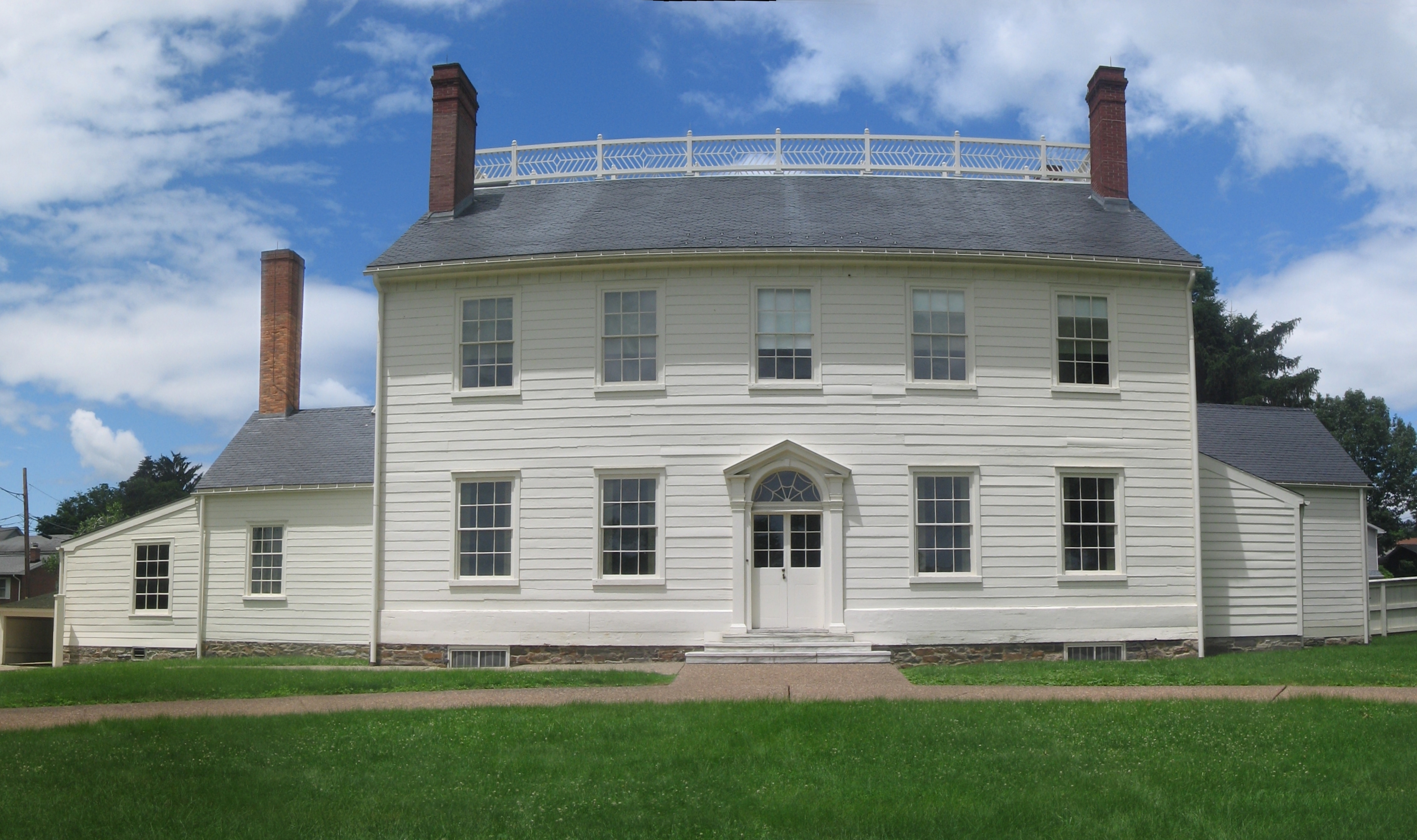
40°43′23″N 76°43′12″W / 40.72306°N 76.72°WWashington Township 7 Hopper-Snyder Homestead July 3, 1979 Northeast of Watsontown off Pennsylvania Route 49061
41°5′39″N 76°51′21″W / 41.09417°N 76.85583°WDelaware Township 8 Hower-Slote House 
August 22, 1979 West of Turbotville
41°6′6″N 76°47′45″W / 41.10167°N 76.79583°WLewis Township 9 Keefer Station Covered Bridge August 8, 1979 East of Sunbury on Township 698
40°52′14″N 76°43′25″W / 40.87056°N 76.72361°WUpper Augusta Township 10 William Kirk House December 2, 1980 West of Turbotville
41°5′56″N 76°48′43″W / 41.09889°N 76.81194°WDelaware Township 11 Lawrence L. Knoebel Covered Bridge August 8, 1979 Knoebel's Grove
40°52′38″N 76°30′21″W / 40.87722°N 76.50583°WRalpho Township Extends into Cleveland Township in Columbia County 12 Kreigbaum Covered Bridge August 8, 1979 East of Elysburg on Township 459
40°50′51″N 76°30′29″W / 40.8475°N 76.50806°WRalpho Township Extends into Cleveland Township in Columbia County 13 Milton Armory July 12, 1991 133 Ridge Avenue
41°1′1″N 76°50′58″W / 41.01694°N 76.84944°WMilton 14 Milton Freight Station 
April 13, 1977 90 Broadway
41°1′10″N 76°51′8″W / 41.01944°N 76.85222°WMilton 15 Milton Historic District July 24, 1986 Roughly bounded by 8th and Upper Market Streets, Spruce Avenue, and Stanton, High and Apple Streets, and the Susquehanna River
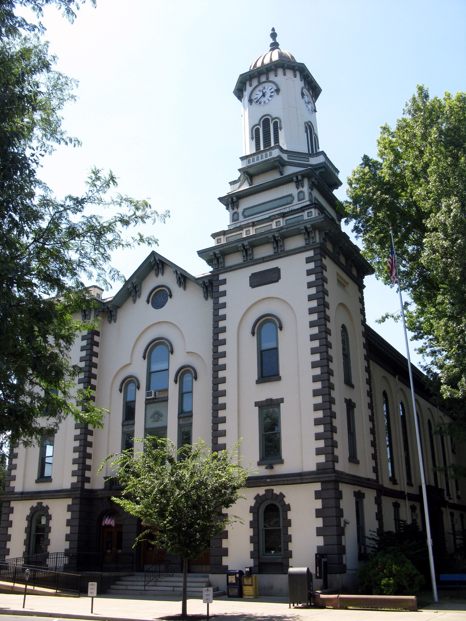
41°1′20″N 76°50′59″W / 41.02222°N 76.84972°WMilton 16 Northumberland County Courthouse 
December 30, 1974 207 Market Street
40°51′42″N 76°47′43″W / 40.86167°N 76.79528°WSunbury 17 Northumberland Historic District 
November 18, 1988 Roughly bounded by Fourth and A Streets, the North Shore Railroad, and Wheatley Avenue
40°53′26″N 76°47′39″W / 40.89056°N 76.79417°WNorthumberland 18 Pennsylvania Canal and Limestone Run Aqueduct December 19, 1978 Bounded by Broadway, Filbert Street, Limestone Run, and Bound Avenue
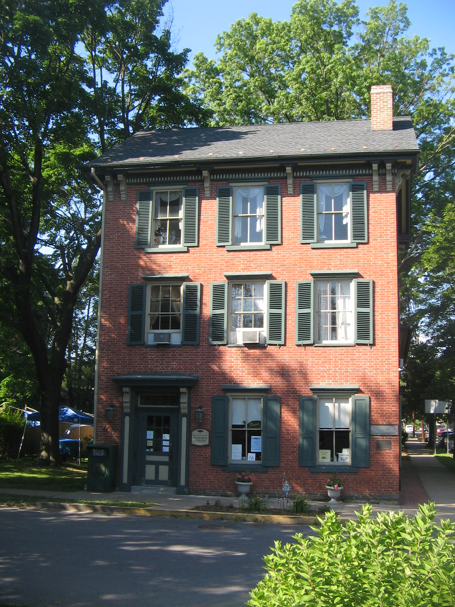
41°1′7″N 76°51′13″W / 41.01861°N 76.85361°WMilton 19 Dr. Joseph Priestley House 
September 11, 1981 100 King Street
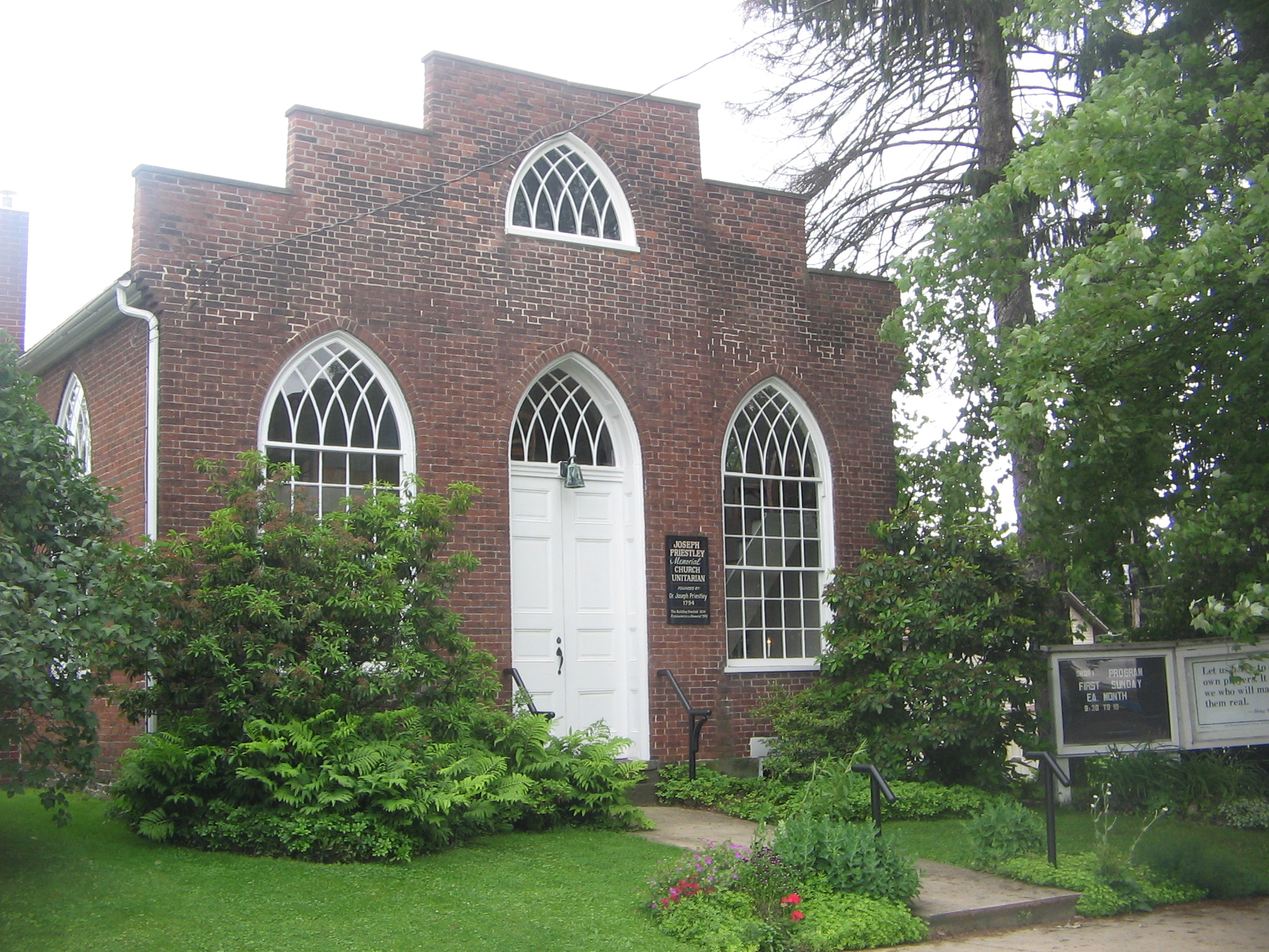
40°53′20″N 76°47′37″W / 40.88889°N 76.79361°WNorthumberland 20 Joseph Priestley House 
October 15, 1966 Priestley Avenue
40°53′24″N 76°47′25″W / 40.89°N 76.79028°WNorthumberland 21 Richards Covered Bridge August 8, 1979 East of Elysburg on Township 804
40°52′2.8″N 76°30′28.8″W / 40.867444°N 76.508°WRalpho Township Extends into Cleveland Township in Columbia County 22 Rishel Covered Bridge 
August 8, 1979 East of Montandon on Township 573
40°57′37″N 76°48′58″W / 40.96028°N 76.81611°WEast and West Chillisquaque Townships 23 Sodom Schoolhouse 
February 12, 1974 East of Montandon on Pennsylvania Route 45
40°57′57″N 76°49′38″W / 40.96583°N 76.82722°WWest Chillisquaque Township 24 Sunbury Armory December 22, 1989 Catawissa Avenue, northeast of Sunbury
40°52′22″N 76°46′40″W / 40.87278°N 76.77778°WUpper Augusta Township 25 Sunbury Historic District November 3, 1983 Roughly bounded by Arch, Chestnut, Front, and 5th Streets
40°51′42″N 76°47′37″W / 40.86167°N 76.79361°WSunbury 26 Warrior Run Presbyterian Church 
April 2, 1973 North of McEwensville on Pennsylvania Route 147
41°5′55″N 76°48′25″W / 41.09861°N 76.80694°WDelaware Township 27 Watsontown River Bridge 
June 22, 1988 Legislative Route 240 spur over the West Branch of the Susquehanna River
41°4′51″N 76°51′55″W / 41.08083°N 76.86528°WWatsontown Extends into White Deer Township in Union County 28 Zion Stone Church November 1, 1984 Tulpehocken Road in Augustaville
40°48′12.1″N 76°44′28.8″W / 40.803361°N 76.741333°WRockefeller Township Former listing
[3] Landmark name[4] Image Date delisted Location City or Town Summary 1 Victoria Theatre May 18, 2004 46 West Independence Street Shamokin See also
- List of National Historic Landmarks in Pennsylvania
- National Register of Historic Places listings in Pennsylvania
- List of Pennsylvania state historical markers in Northumberland County
References
- ^ The latitude and longitude information provided in this table was derived originally from the National Register Information System, which has been found to be fairly accurate for about 99% of listings. For about 1% of NRIS original coordinates, experience has shown that one or both coordinates are typos or otherwise extremely far off; some corrections may have been made. A more subtle problem causes many locations to be off by up to 150 yards, depending on location in the country: most NRIS coordinates were derived from tracing out latitude and longitudes off of USGS topographical quadrant maps created under the North American Datum of 1927, which differs from the current, highly accurate WGS84 GPS system used by Google maps. Chicago is about right, but NRIS longitudes in Washington are higher by about 4.5 seconds, and are lower by about 2.0 seconds in Maine. Latitudes differ by about 1.0 second in Florida. Some locations in this table may have been corrected to current GPS standards.
- ^ "National Register of Historic Places: Weekly List Actions". National Park Service, United States Department of the Interior. Retrieved on November 10, 2011.
- ^ a b Numbers represent an ordering by significant words. Various colorings, defined here, differentiate National Historic Landmark sites and National Register of Historic Places Districts from other NRHP buildings, structures, sites or objects.
- ^ a b "NPS Focus". National Register of Historic Places. National Park Service. http://nrhp.focus.nps.gov. Retrieved November 20, 2009.
Municipalities and communities of Northumberland County, Pennsylvania Cities 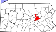
Boroughs Herndon | Kulpmont | Marion Heights | McEwensville | Milton | Mount Carmel | Northumberland | Riverside | Snydertown | Turbotville | Watsontown
Townships Coal | Delaware | East Cameron | East Chillisquaque | Jackson | Jordan | Lewis | Little Mahanoy | Lower Augusta | Lower Mahanoy | Mount Carmel | Point | Ralpho | Rockefeller | Rush | Shamokin | Turbot | Upper Augusta | Upper Mahanoy | Washington | West Cameron | West Chillisquaque | Zerbe
CDPs Unincorporated
communitiesBear Valley | Dalmatia | Locust Gap | Malta | Merrian
Categories:- Northumberland County, Pennsylvania
- National Register of Historic Places in Pennsylvania by county
-


Wikimedia Foundation. 2010.