- Northumberland County, Pennsylvania
-
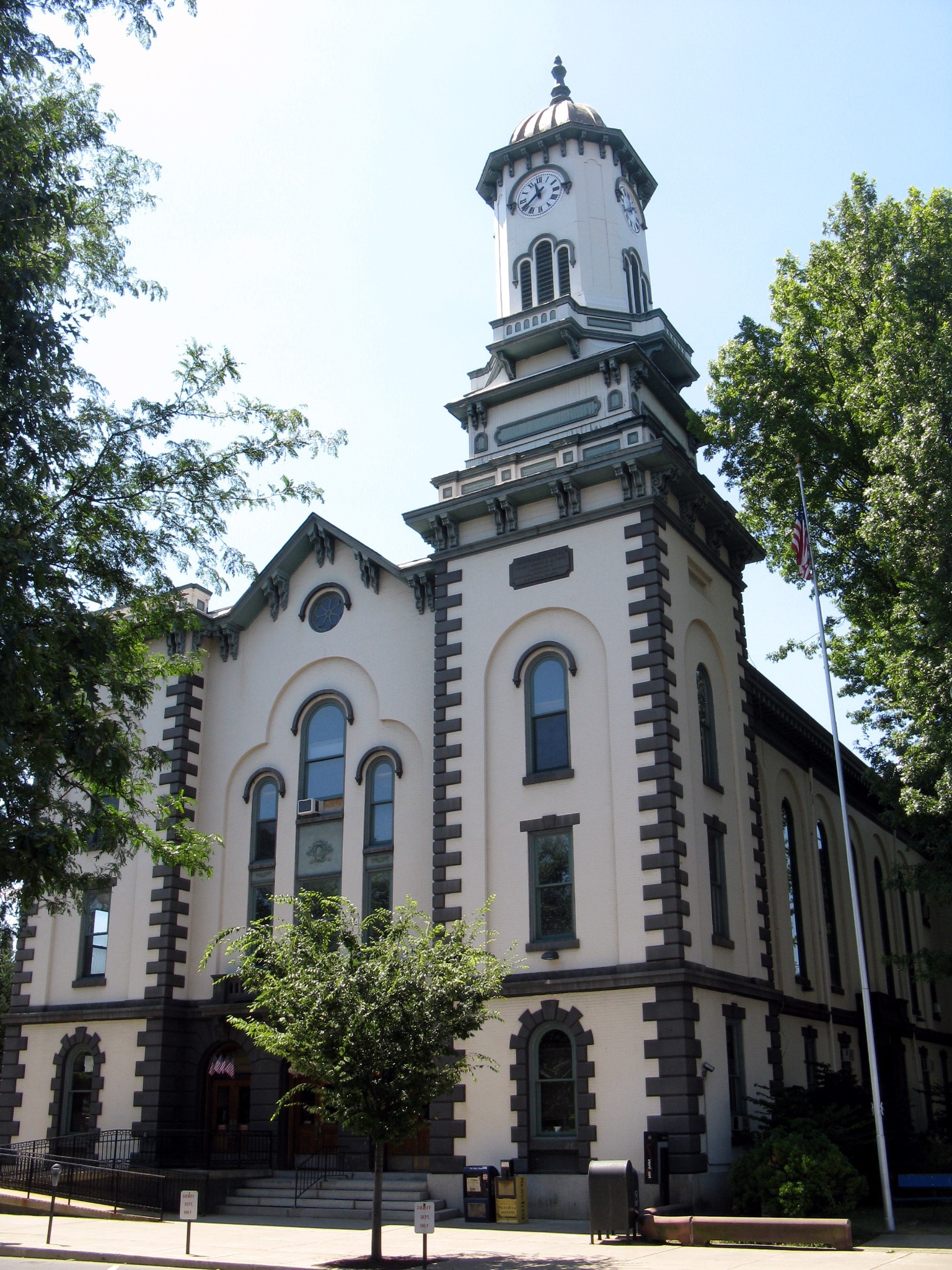
Northumberland County, Pennsylvania  Northumberland County Courthouse
Seal
Location in the state of Pennsylvania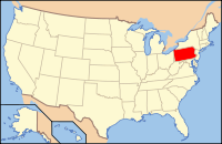
Pennsylvania's location in the U.S.Founded March 21, 1772 Seat Sunbury Largest city Sunbury Area
- Total
- Land
- Water
477 sq mi (1,235 km²)
460 sq mi (1,191 km²)
17 sq mi (44 km²), 3.66%Population
- (2010)
- Density
94,528
205/sq mi (79.3/km²)Website www.northumberlandco.org Northumberland County is a county located in the U.S. state of Pennsylvania. It was formed in 1772 from parts of Lancaster, Berks, Bedford, Cumberland, and Northampton Counties and named for the county of Northumberland in northern England. As of 2010, the population was 94,528. Its county seat is Sunbury[1]. Northumberland County is a sixth class county according to the Pennsylvania's County Code.[2]
Among its famous residents, Joseph Priestley, the enlightenment chemist and theologian, left England in 1796 due to religious persecution and settled on the Susquehanna River. His former house (originally purchased by chemists from Pennsylvania State University after a colloquium that founded the American Chemical Society[1]) is a historical museum [2].
Contents
Geography
According to the U.S. Census Bureau, the county has a total area of 477 square miles (1,236 km²), of which 460 square miles (1,191 km²) is land and 17 square miles (45 km²) (3.66%) is water. By 1813 the area once comprising the sprawling county of Northumberland had been divided over time and allotted to other counties such that lands once occupied by Old Northumberland at its greatest extent are now found in Centre, Columbia, Luzerne, Lycoming, Mifflin, Union, Clearfield, Clinton, Montour, Bradford, Lackawanna, Susquehanna, Wyoming, Tioga, Potter, McKean, Warren, Venango, Snyder, and Schuylkill Counties and the current county is but a fraction of its former size.
Adjacent counties
- Lycoming County (north)
- Montour County (northeast)
- Columbia County (east)
- Schuylkill County (southeast)
- Dauphin County (south)
- Perry County (southwest)
- Juniata County (west)
- Snyder County (west)
- Union County (west)
Demographics
As of the census[3] of 2000, there were 94,556 people, 38,835 households, and 25,592 families residing in the county. The population density was 206 people per square mile (79/km²). There were 43,164 housing units at an average density of 94 per square mile (36/km²). The racial makeup of the county was 97.09% White, 1.52% Black or African American, 0.10% Native American, 0.22% Asian, 0.02% Pacific Islander, 0.47% from other races, and 0.58% from two or more races. 1.10% of the population were Hispanic or Latino of any race. 32.5% were of German, 12.9% Polish, 9.9% American, 8.2% Italian, 8.1% Irish and 5.8% Dutch ancestry according to Census 2000. 95.8% spoke English and 1.5% Spanish as their first language.
Historical populations Census Pop. %± 1790 17,147 — 1800 27,797 62.1% 1810 36,327 30.7% 1820 15,424 −57.5% 1830 18,133 17.6% 1840 20,027 10.4% 1850 23,272 16.2% 1860 28,922 24.3% 1870 41,444 43.3% 1880 53,123 28.2% 1890 74,698 40.6% 1900 90,911 21.7% 1910 111,420 22.6% 1920 122,079 9.6% 1930 128,504 5.3% 1940 126,887 −1.3% 1950 117,115 −7.7% 1960 104,138 −11.1% 1970 99,190 −4.8% 1980 100,381 1.2% 1990 96,771 −3.6% 2000 94,556 −2.3% 2010 94,528 0% [4][5] There were 38,835 households out of which 27.30% had children under the age of 18 living with them, 52.40% were married couples living together, 9.60% had a female householder with no husband present, and 34.10% were non-families. 30.20% of all households were made up of individuals and 15.50% had someone living alone who was 65 years of age or older. The average household size was 2.34 and the average family size was 2.89.
In the county, the population was spread out with 21.90% under the age of 18, 7.00% from 18 to 24, 27.70% from 25 to 44, 24.40% from 45 to 64, and 19.00% who were 65 years of age or older. The median age was 41 years. For every 100 females there were 96.30 males. For every 100 females age 18 and over, there were 92.80 males.
Politics and government
As of November 2008, there are 53,983 registered voters in Northumberland County [3].
- Republican: 24,769 (45.88%)
- Democratic: 24,111 (44.66%)
- Other Parties: 5,103 (9.45%)
While county-level politics tend to be competitive, Northumberland is a Republican county in most statewide elections. The margins of victory in the county for the Republican Presidential candidate in 2000, 2004, and 2008 have been 13, 21, and 14 percentage points, respectively. Governor Ed Rendell narrowly carried it against Lynn Swann while Republican Rick Santorum narrowly carried it against Bob Casey in 2006. The only Democratic statewide candidate to carry the county in 2008 was incumbent Auditor General Jack Wagner. In 2011, the election of Stephen Bridy resulted in a three-way split among the county commissioners.
County commissioners
- Stephen Bridy, Independant
- Vinny Clausi, Democrat
- Rick Shoch, Republican
Other county offices
- Clerk of Courts and Prothonotary, Mary Kathleen Strausser, Republican
- Controller, Tony Phillips, Republican
- District Attorney, Anthony Rosini, Democrat
- Recorder of Deeds and Register of Wills, Suzanne Vastine-Smith, Republican
- Sheriff, Chad A. Reiner, Democrat
- Treasurer, Kevin P. Gilroy, Republican
State Representatives
- Kurt Masser, Republican, 107th district
- Lynda Schlegel-Culver, Republican, 108th district
State Senator
- John Gordner, Republican, 27th district
U.S. Representative
- Tom Marino, Republican, 10th district
Municipalities
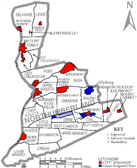
 Map of Northumberland County, Pennsylvania with Municipal Labels showing Cities and Boroughs (red), Townships (white), and Census-designated places (blue).
Under Pennsylvania law, there are four types of incorporated municipalities: cities, boroughs, townships, and, in one case, a town. The following cities, boroughs, and townships are located in Northumberland County:
Cities
Boroughs
Townships
- Coal Township
- Delaware Township
- East Cameron Township
- East Chillisquaque Township
- Jackson Township
- Jordan Township
- Lewis Township
- Little Mahanoy Township
- Lower Augusta Township
- Lower Mahanoy Township
- Mount Carmel Township
- Point Township
- Ralpho Township
- Rockefeller Township
- Rush Township
- Shamokin Township
- Turbot Township
- Upper Augusta Township
- Upper Mahanoy Township
- Washington Township
- West Cameron Township
- West Chillisquaque Township
- Zerbe Township
Census-designated places
Census-designated places are geographical areas designated by the U.S. Census Bureau for the purposes of compiling demographic data. They are not actual jurisdictions under Pennsylvania law. Other unincorporated communities, such as villages, may be listed here as well.
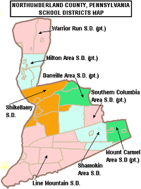 Map of Northumberland County, Pennsylvania Public School Districts
Education
Early Child Education
According to the Office of Child Development and Early Learning of the Pennsylvania Department of Education June 2007 report, Northumberland County is rated at a high risk level for children who are “at risk” and therefore might benefit from more taxpayer funded services. Northumberland County was rated 3.14 ARL, in the highest 25% of counties for average risk level.[6]
Public School Districts
- Danville Area School District (also in Montour County)
- Line Mountain School District
- Milton Area School District (also in Union County)
- Mount Carmel Area School District (also in Columbia County)
- Shamokin Area School District
- Shikellamy School District
- Southern Columbia Area School District (also in Columbia County)
- Warrior Run School District (also in Montour and Union Counties)
Charter School
SusQ-Cyber Charter School - provided by Intermediate Unit 16 Grades 9-12th
Intermediate Unit
Central Susquehanna Intermediate Unit 16 - The primary service area consists of: Columbia, Montour, Northumberland, Snyder and Union counties in central Pennsylvania. Provides a wide variety of education related services to school districts, private and parochial schools and hame schooled students. Funded by: state and federal grants; state contracts and service contracts. Intermediate units do not have the power to levy taxes. The IU's board is made up of representatives from the schools districts it serves.
Independent Schools
- Bethesda Alternative School 7-12th grade
- Keefertown Parochial School 1-8th grade
- Maranatha Mennonite Christian School K-12th grade
- Meadowbrook Christian Academy PreK-12th grade
- Meadowview Christian Academy PreK-10th grade
- Northumberland Christian School PreK-12th grade
- Northwestern Academy 5-12th grade
- Our Lady of Lourdes Regional High School 9-12th grade
- Schwaben Creek School 1-8th grade
- Spring View Parochial School 1-9th grade
- St Louis De Monfort Academy 7-12 grade
- St Monica School PreK-8th grade
- Sunbury Christian Academy K-12th grade
- Sunny Slope Amish Parochial School 1-8th grade
- Transfiguration Elementary School PreK-8th grade
- Watsontown Christian Academy PreK-12th grade
data from ies - National Center For Education Statistics - PSS Private School Universe Survey data for the 2007-2008 school year, U.S. Department of Education Institute of Education Sciences [4]
Additionally there are nearly 1000 children attending Mennonite and Amish schools per the Central Susquehanna Intermediate Unit 16.[7]
See also
- List of municipal authorities in Northumberland County, Pennsylvania
- National Register of Historic Places listings in Northumberland County, Pennsylvania
References
- ^ "Find a County". National Association of Counties. http://www.naco.org/Counties/Pages/FindACounty.aspx. Retrieved 2011-06-07.
- ^ "PA County Code Newspaper Handbook". Pennsylvania Newspaper Association. http://www.pa-newspaper.org/web/2005/10/county_code_newspaper_handbook.aspx. Retrieved April 2011.
- ^ "American FactFinder". United States Census Bureau. http://factfinder.census.gov. Retrieved 2008-01-31.
- ^ http://factfinder2.census.gov
- ^ http://mapserver.lib.virginia.edu/
- ^ http://www.pde.state.pa.us/early_childhood/site/default.asp?g=0 Early Child Education Program Reach Analysis 2007
- ^ School Choice Topic of Meeting tonight, Joseph Deinlein, The Daily Item, April 5, 2011
External links
Municipalities and communities of Northumberland County, Pennsylvania Cities 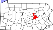
Boroughs Herndon | Kulpmont | Marion Heights | McEwensville | Milton | Mount Carmel | Northumberland | Riverside | Snydertown | Turbotville | Watsontown
Townships Coal | Delaware | East Cameron | East Chillisquaque | Jackson | Jordan | Lewis | Little Mahanoy | Lower Augusta | Lower Mahanoy | Mount Carmel | Point | Ralpho | Rockefeller | Rush | Shamokin | Turbot | Upper Augusta | Upper Mahanoy | Washington | West Cameron | West Chillisquaque | Zerbe
CDPs Unincorporated
communitiesBear Valley | Dalmatia | Locust Gap | Malta | Merrian
Categories:- Pennsylvania counties
- Anthracite Coal Region of Pennsylvania
- Northumberland County, Pennsylvania
- 1772 establishments


Wikimedia Foundation. 2010.